
Col Tsasèche hike
View Photos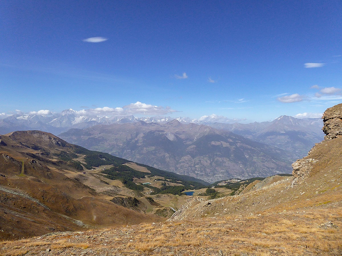
Col Tsasèche hike
Difficulty Rating:
The Col Tsasèche Hike is a strenuous trail in Gran Paradiso National Park that takes you to the Tsasèche (sometimes called Tsa Sèche or Tsa Sètze) Pass. It starts in Gimillan, taking you through the mountain slopes, passing a beautiful pine forest and a local farm. It offers amazing panoramic views of Mont Blanc and surrounding peaks at the end.
Getting there
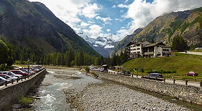
Use the SR47 road to drive to Cogne, then take the Village de Cogne road to ascend to Gimillan.

About
| When to do | June - October |
| Backcountry Campsites | No |
| Pets allowed | Yes |
| Family friendly | No |
| Route Signage | Average |
| Crowd Levels | Moderate |
| Route Type | Out and back |
Col Tsasèche
Elevation Graph
Weather
Route Description for Col Tsasèche
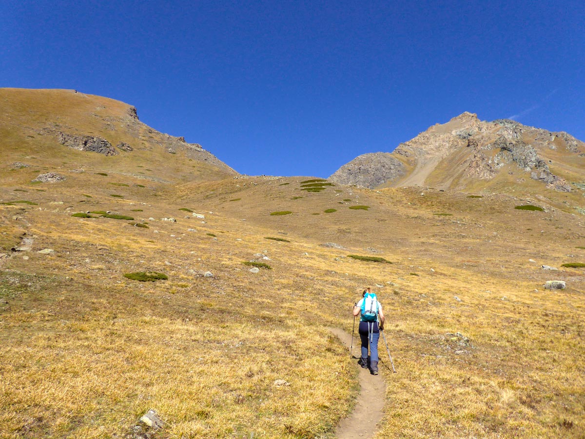
The Col Tsasèche hike starts from Gimillan. Park your car and walk northwest of the town. You should see a sign leading to 3A Epinel, turn right at the fork. There will soon be another sign going to Col Tsasèche (also called Col Tsa Seche). Follow this route.
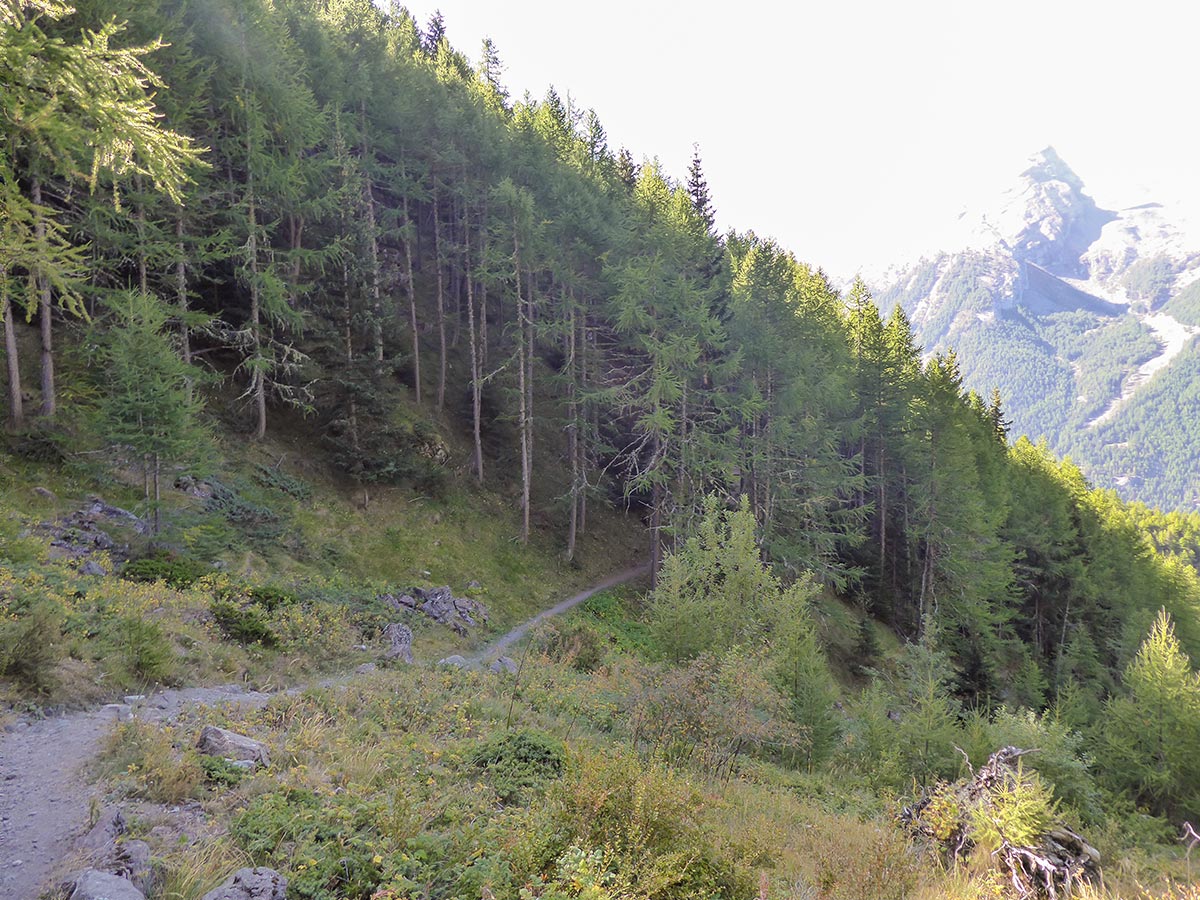
The first section is the same as on Tsaplana trail, where you ascend a steep paved road all the way up to a forest.
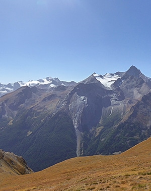
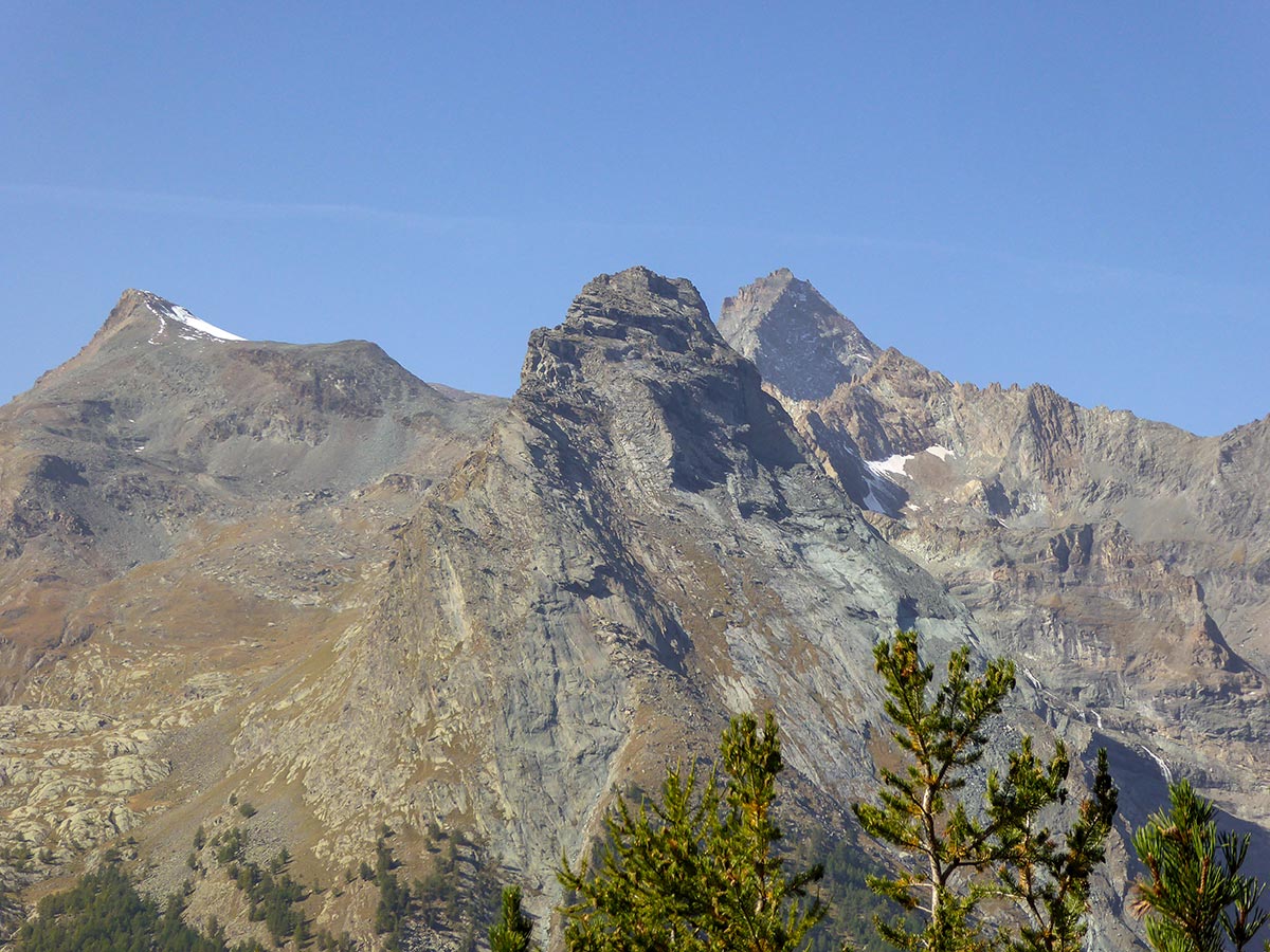
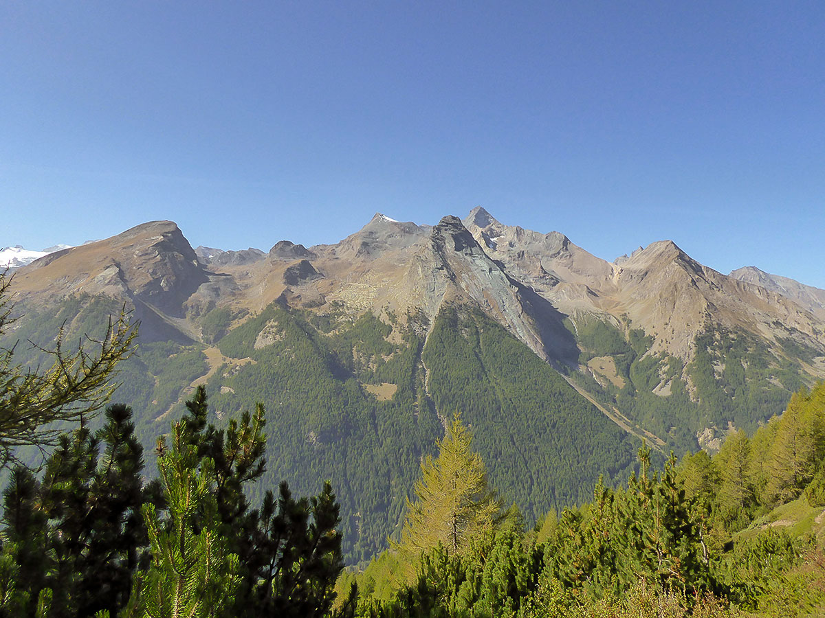
After you reach the forest, follow route 3, ascending left onto the slope. You will walk through a nice pine forest with some stunning views of the snow-capped Gran Paradiso mountain range.
After the forest walk, you will start ascending again, above the treeline. Make sure to use sunscreen as it gets hot on a clear day.
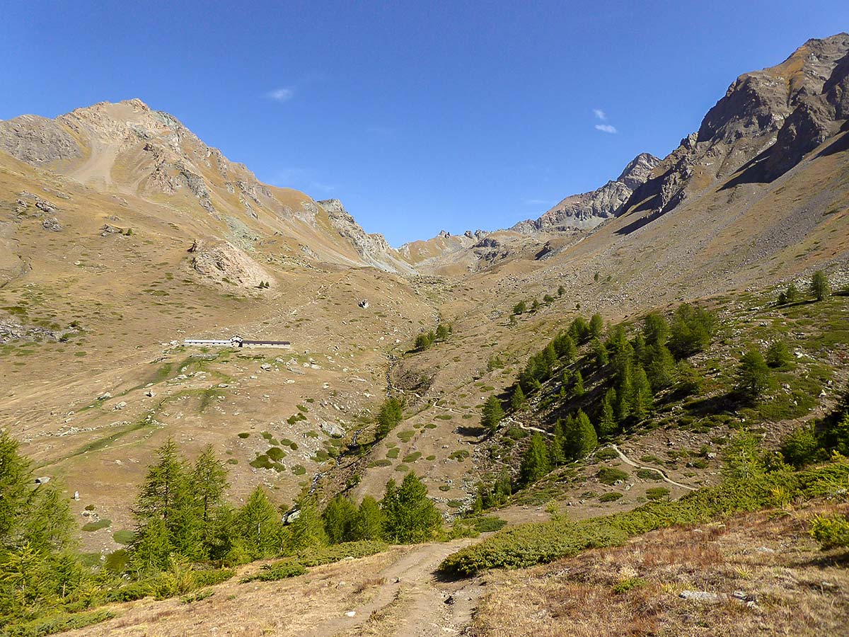
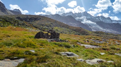
Switchback up the mountain slope. At around 3.5km into the hike, you will walk into a meadow. You will see the stone farmhouse of Arpisson on the other side of the mountain. Descend to the stream and cross it via the bridge. You can take a break at the Arpisson. From here it is around 1.5h to Col Tsasèche. Continue the ascent by following route 2 behind the farmhouse.
There are numerous marmots in the area. If you sit quietly, you should see some of these cute animals running around the mountains. It’s also a great place to try to spot golden eagles, hunting the marmots.
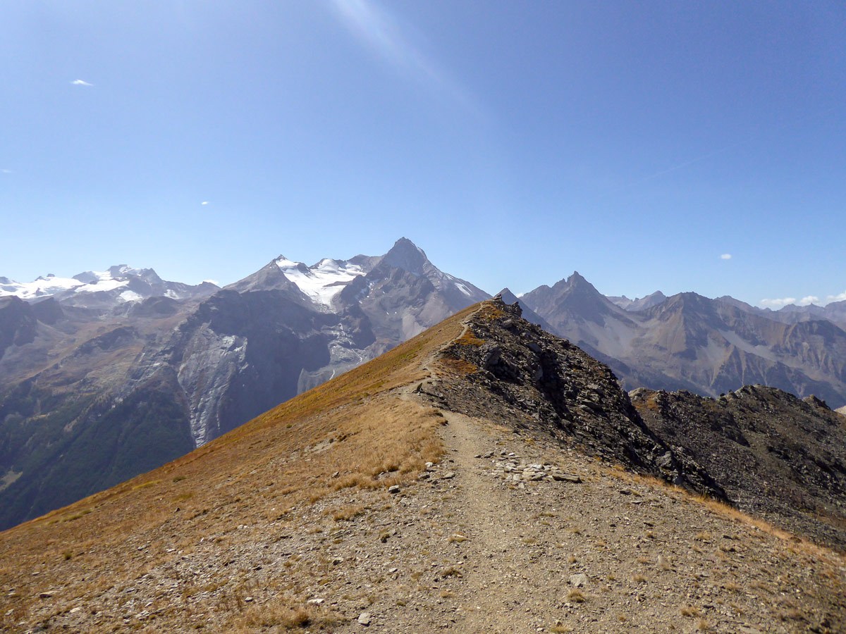
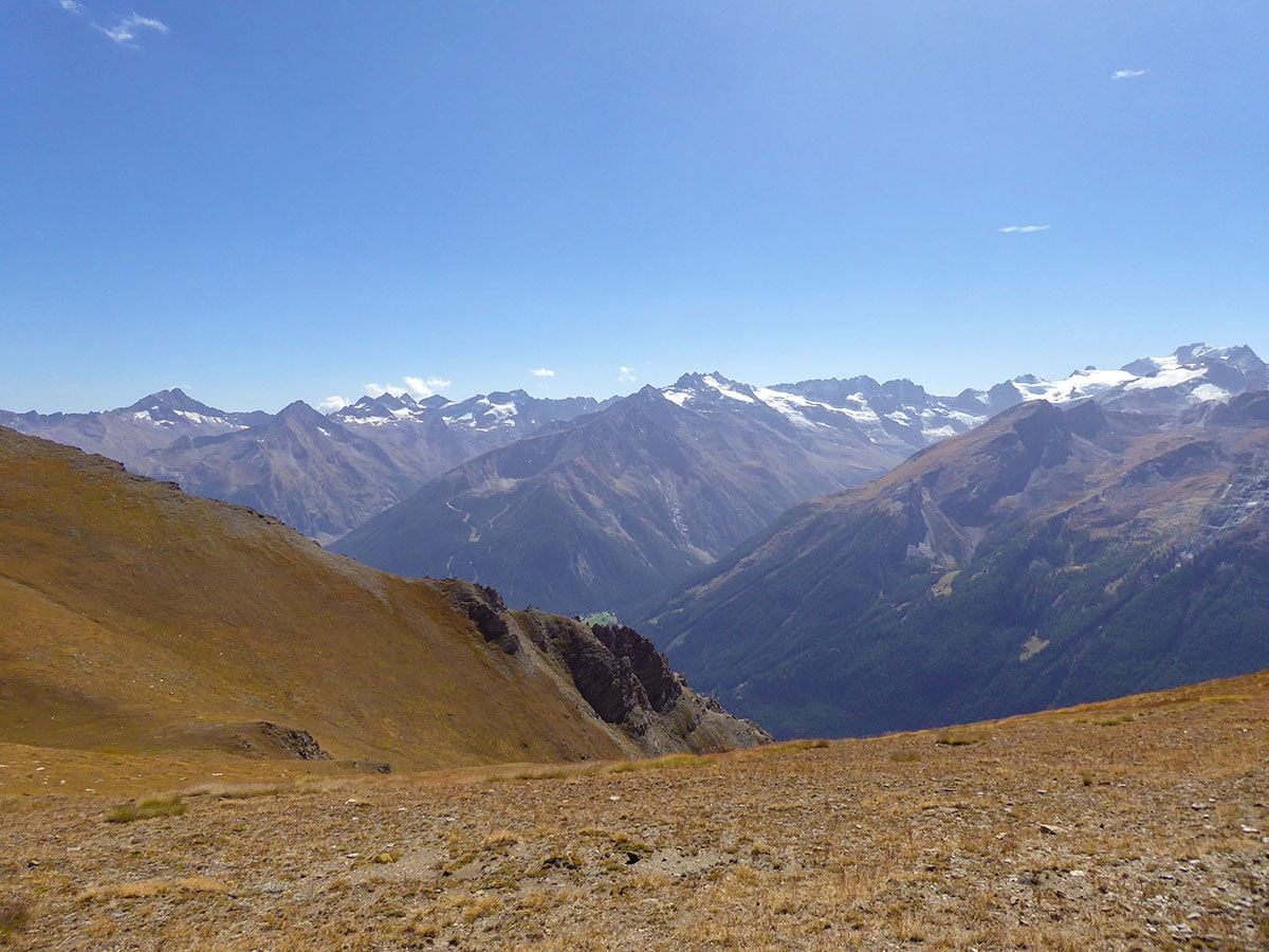
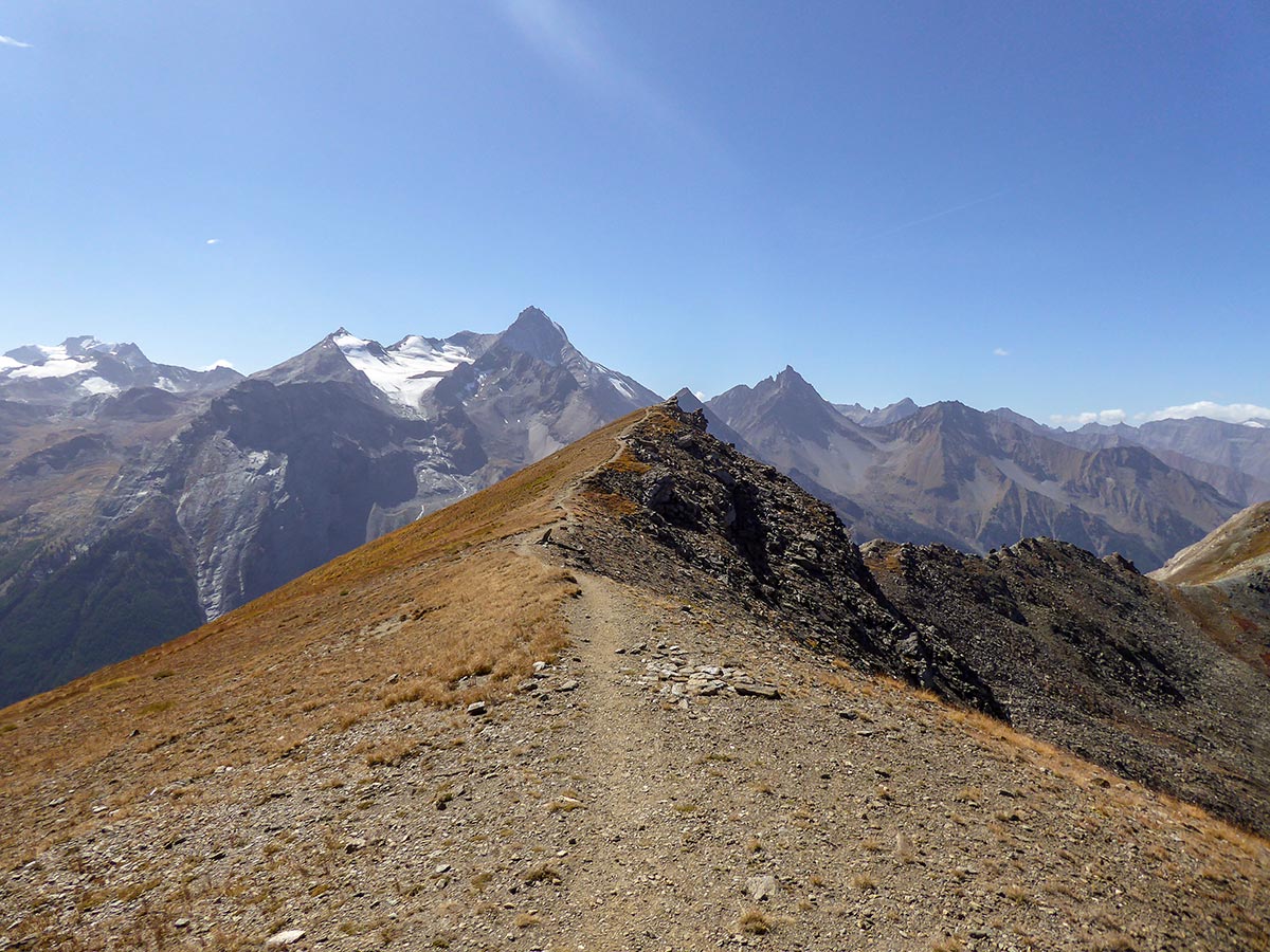
Soon you will reach another signpost. Here, turn left and follow route 2A. After a long ascent, you will come to a mountain wall; climb the left slope. It looks like the pass you are heading to; however, the pass will be visible after you climb higher. When you climb on top of the ridge, you will see that the trail continues to the right and you will be able to see your goal – Col Tsasèche.
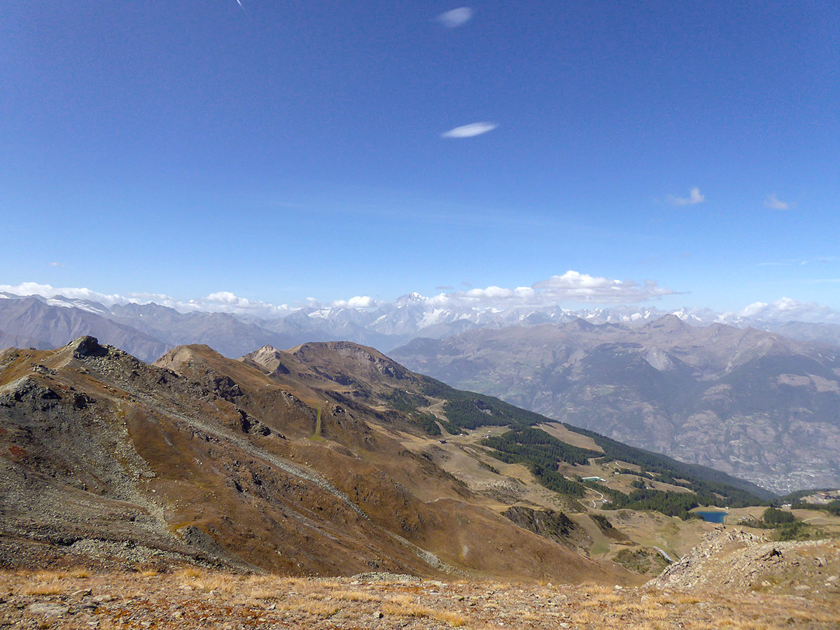
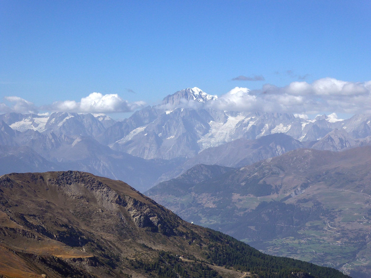
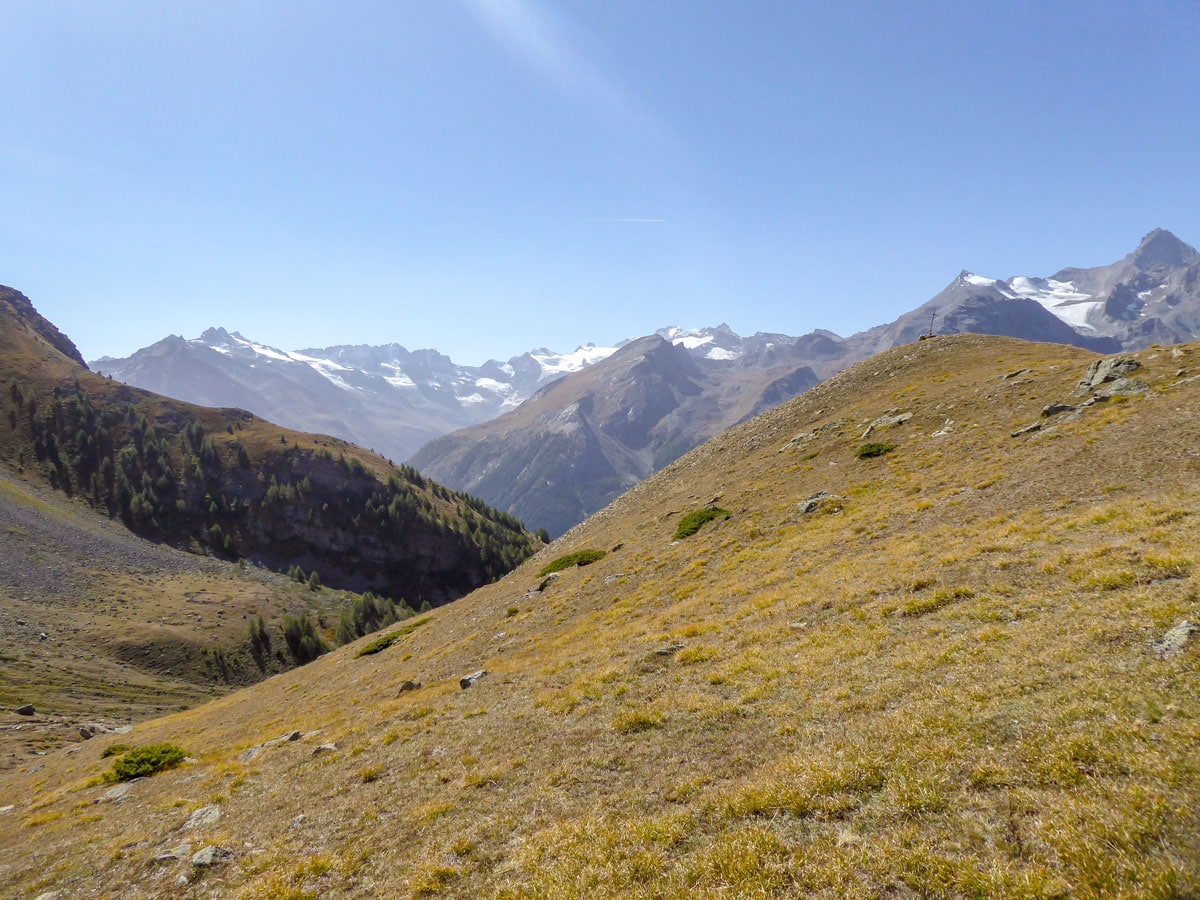
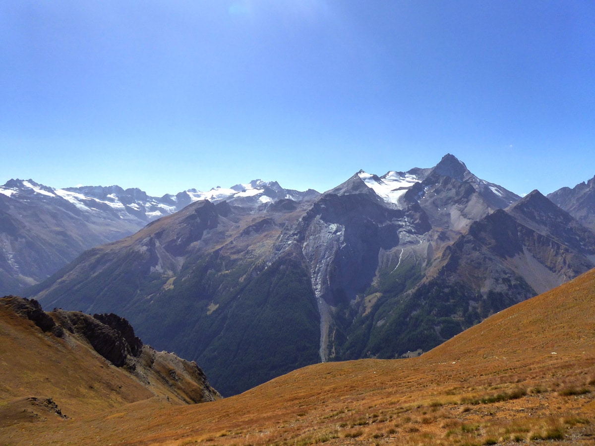
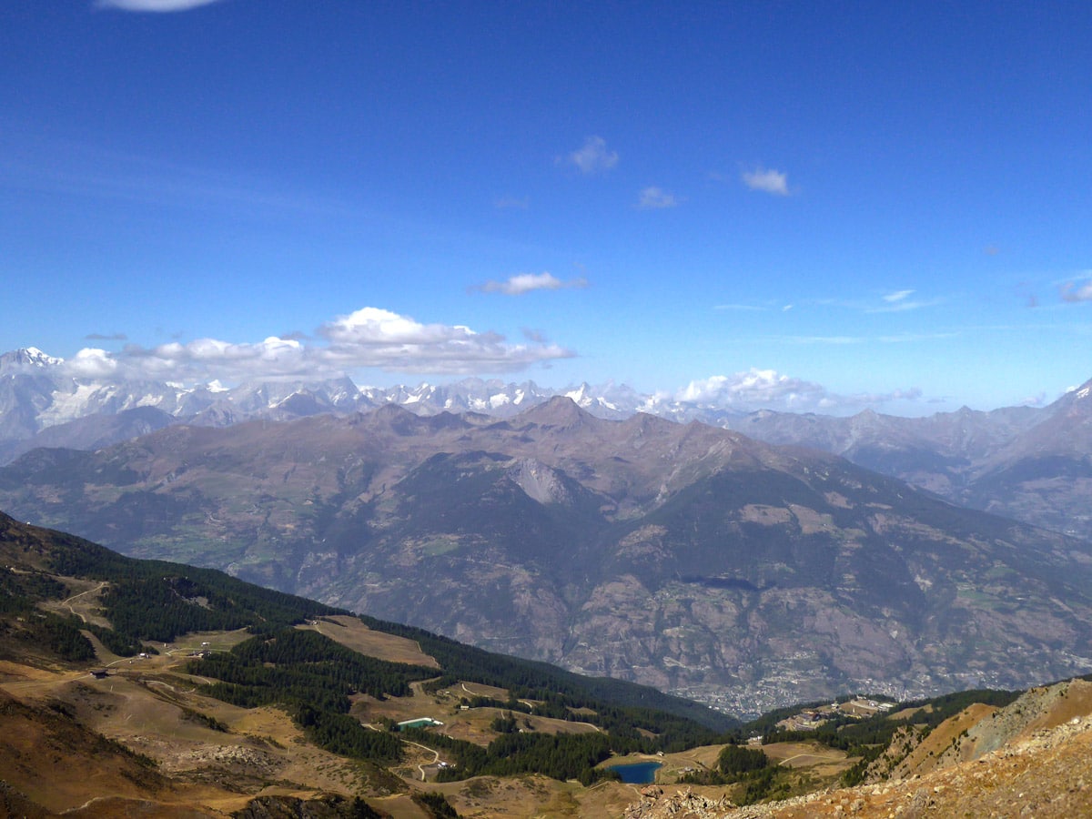
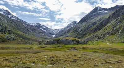
After you finally reach the Tsasèche Pass, you will get to see some of the most magnificent views Gran Paradiso National Park has to offer. In the southwest, you will see the double-square peak of Mt Gran Paradiso and the beautiful peak of Mt Grivola. Looking north, you will see the Pila Ski Resort and Aosta Valley below you. And behind Aosta, you will be rewarded with stunning views of the highest mountains in the Alps: Mont Blanc, Grandes Jorasses and Grand Combin de Grafeneire.
From here you can also easily climb Punta Monpers (2793m). After that, return the same way you came.
Insider Hints
Park your car by the kindergarten north of Gimillan to skip the ascent in the village and make the hike shorter.
We really recommend planning this hike on a clear day, as the best views are at the end and you might not be able to see it if it’s cloudy.

Similar hikes to the Col Tsasèche hike
Alpe Money
The Alpe Money Hike is a beautiful trail in Gran Paradiso National Park. It takes you right up to the…
Rifugio Vittorio Sella
Rifugio Vittorio Sella is one of the most scenic hikes in Gran Paradiso National Park. The trail rewards you with…
Lago di Loie
The Lago di Loie hike takes you on a circular route to the peaceful and crystal-clear Lake Loie. It offers…
Matilda86 4 years ago
We did a wonderful walking trail with great views
Johnny C. 4 years ago
I'm so glad the weather was perfect when we visited. We were able to enjoy the magnificent views of Gran Paradiso mountain range and more.
claritam 4 years ago
With its elevation you'll see enormous mountain slopes and beautiful views of the valley.
Gilberto Fattore 4 years ago
Amazing and fantastic nature
Danny V. 6 years ago
Magnificent view awaits at the top of the summit. Highly recommended.
Julie France 6 years ago
I was genuinely happy to visit this place. Spotted a couple of eagles flying freely. They look amazing.