Col de Saint-Marcel hike
View Photos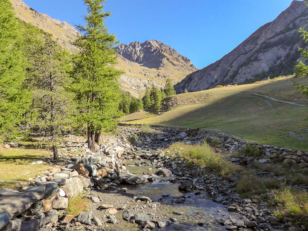
Col de Saint-Marcel hike
Difficulty Rating:
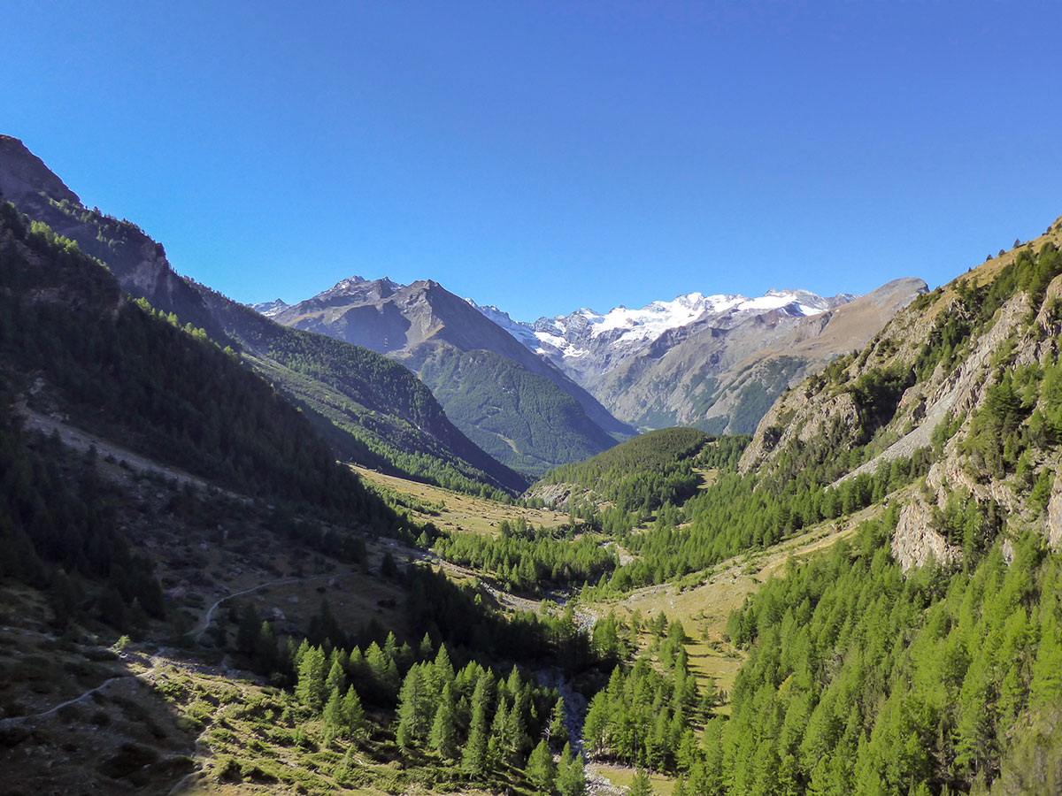
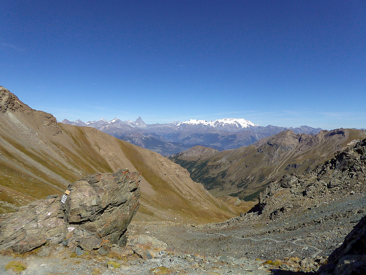
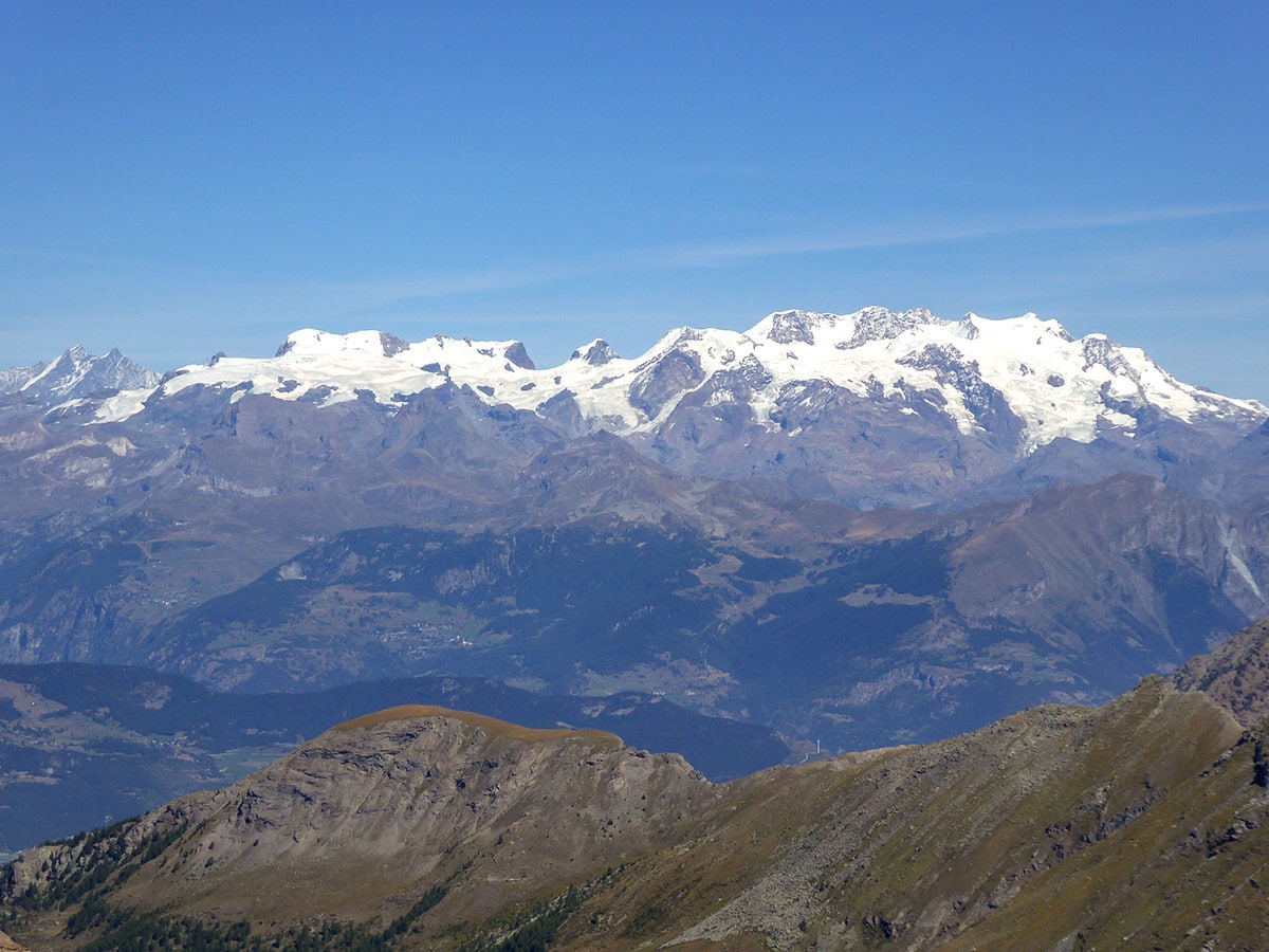
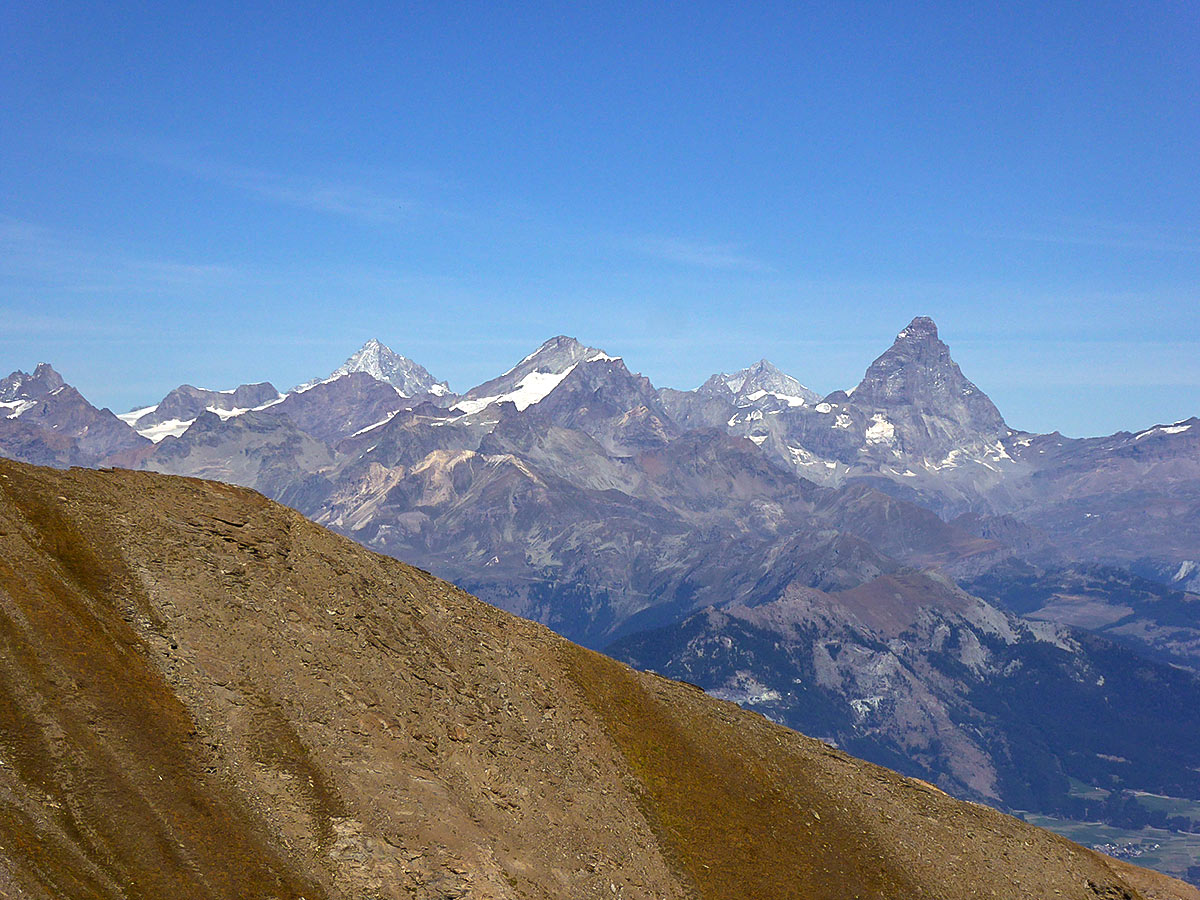
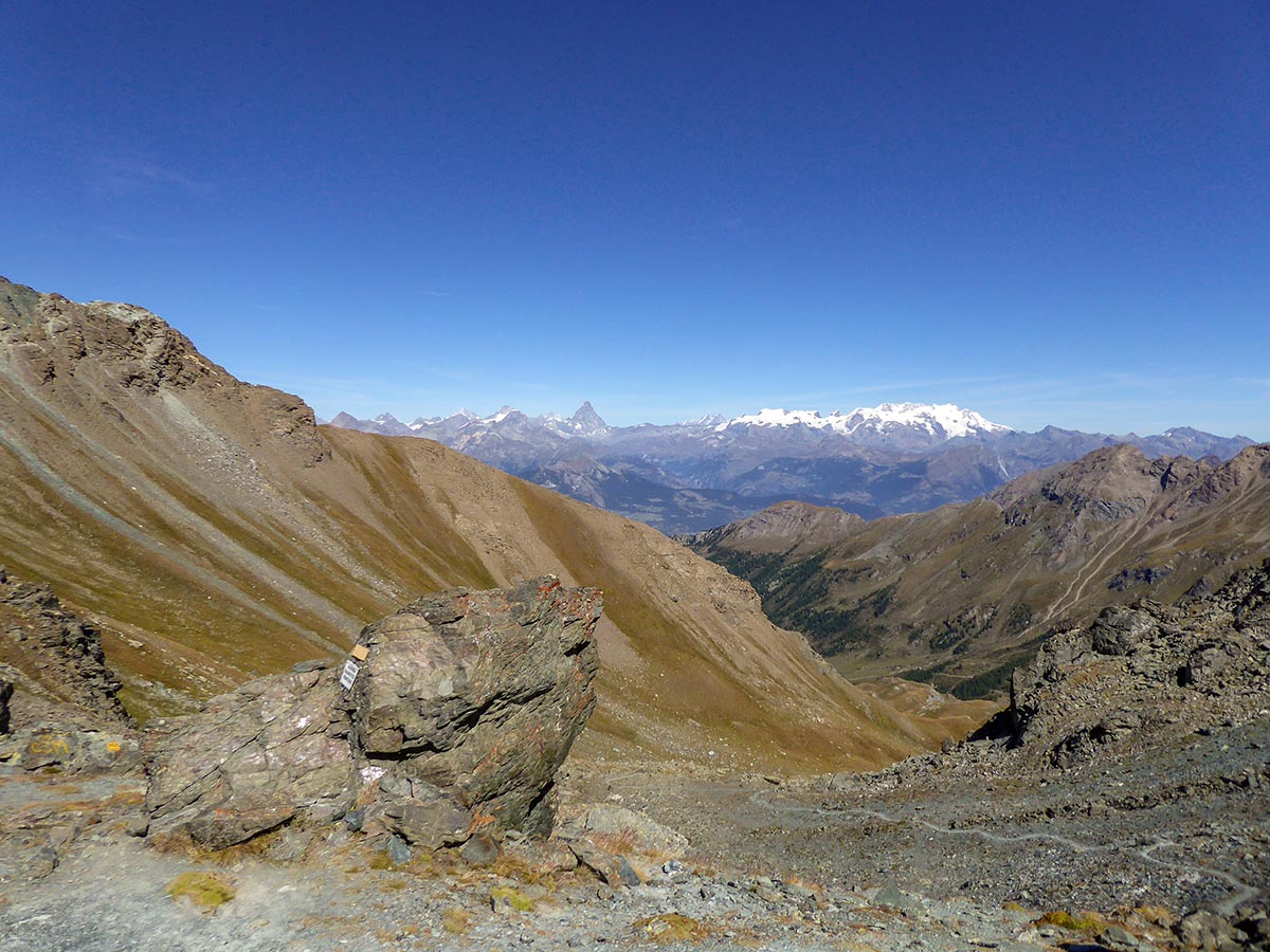
The Col de Saint-Marcel hike in Gran Paradiso National Park takes you through the beautiful valley of Grauson to Saint-Marcel Pass. It offers great views of the Gran Paradiso mountain range along the way and rewards you with the breathtaking scene of the Matterhorn and the snow-capped Swiss Alps next to it including the beautiful Monte Rosa massif.
Getting there
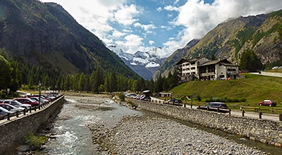
Use the SR47 road to drive to Cogne, then take the Village de Cogne road to ascend to Gimillan.

About
| When to do | June - October |
| Backcountry Campsites | No |
| Pets allowed | Yes |
| Family friendly | No |
| Route Signage | Average |
| Crowd Levels | Moderate |
| Route Type | Out and back |
Col de Saint-Marcel
Elevation Graph
Weather
Route Description for Col de Saint-Marcel
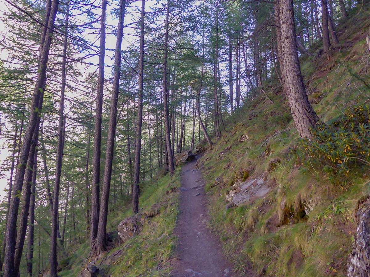
Although this hike is long and has lots of elevation gain, you shouldn’t be too scared by the stats. The trail ascends slowly, bit by bit, with the exception of the last stretch gaining 200m of elevation in a rather short time. The path is not technical and quite easy to walk on.
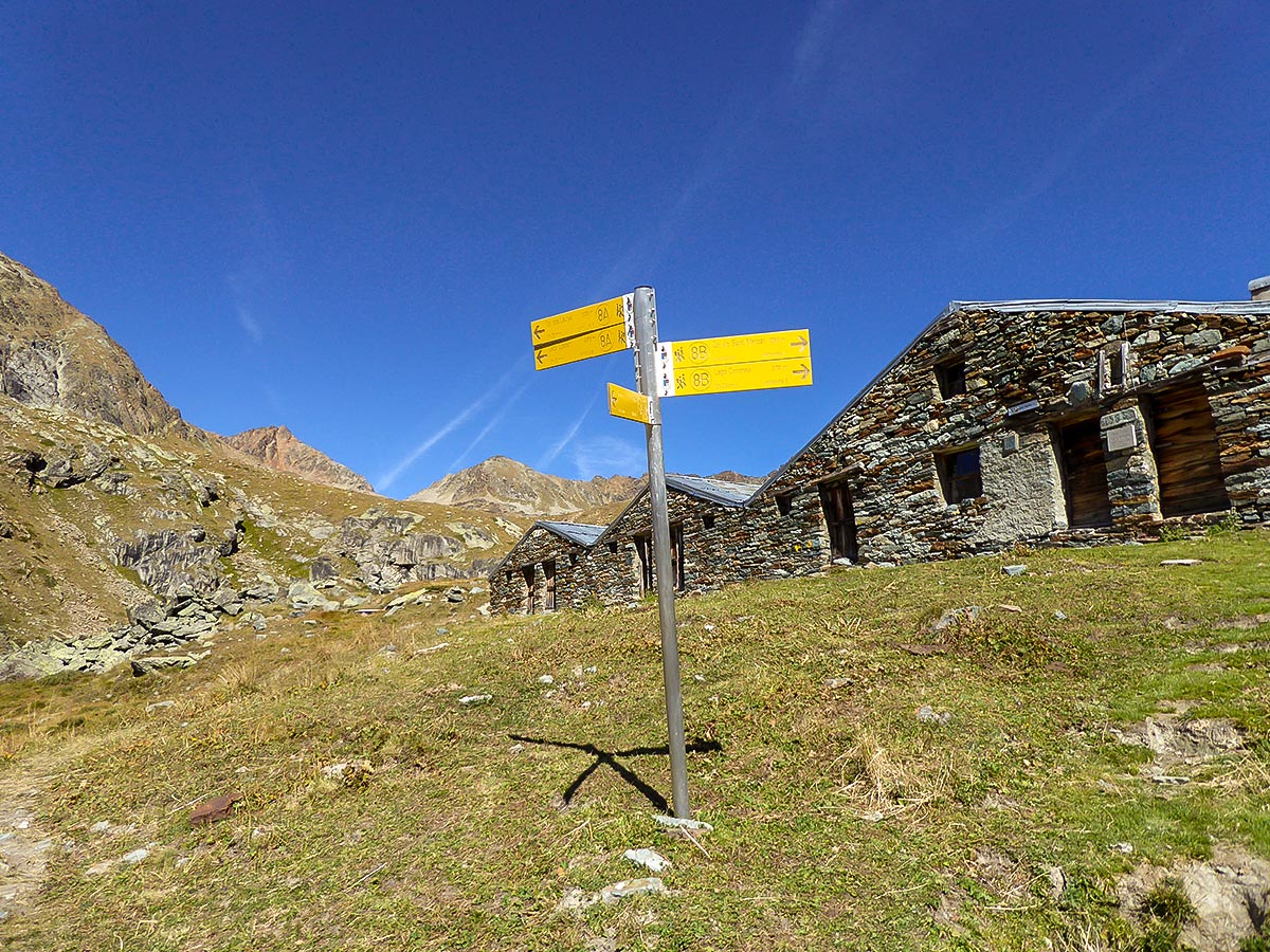
The Col de Saint-Marcel hike starts from Gimillan. Park your car in one of the free car parks in the village. There is one car park right next to the trailhead, but it fills up very quickly. Walk east through Gimillan village, until you reach a river crossing. Cross the bridge and start following route 8.
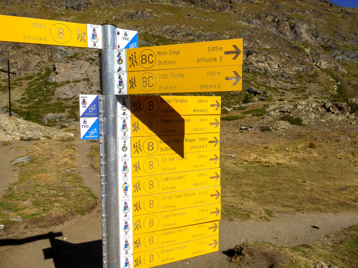
Ascend until you reach a fork and turn right. You should see sign number 8 on a rock with a yellow arrow nearby. You will walk to another signpost near a white monument chapel, continue straight from here.
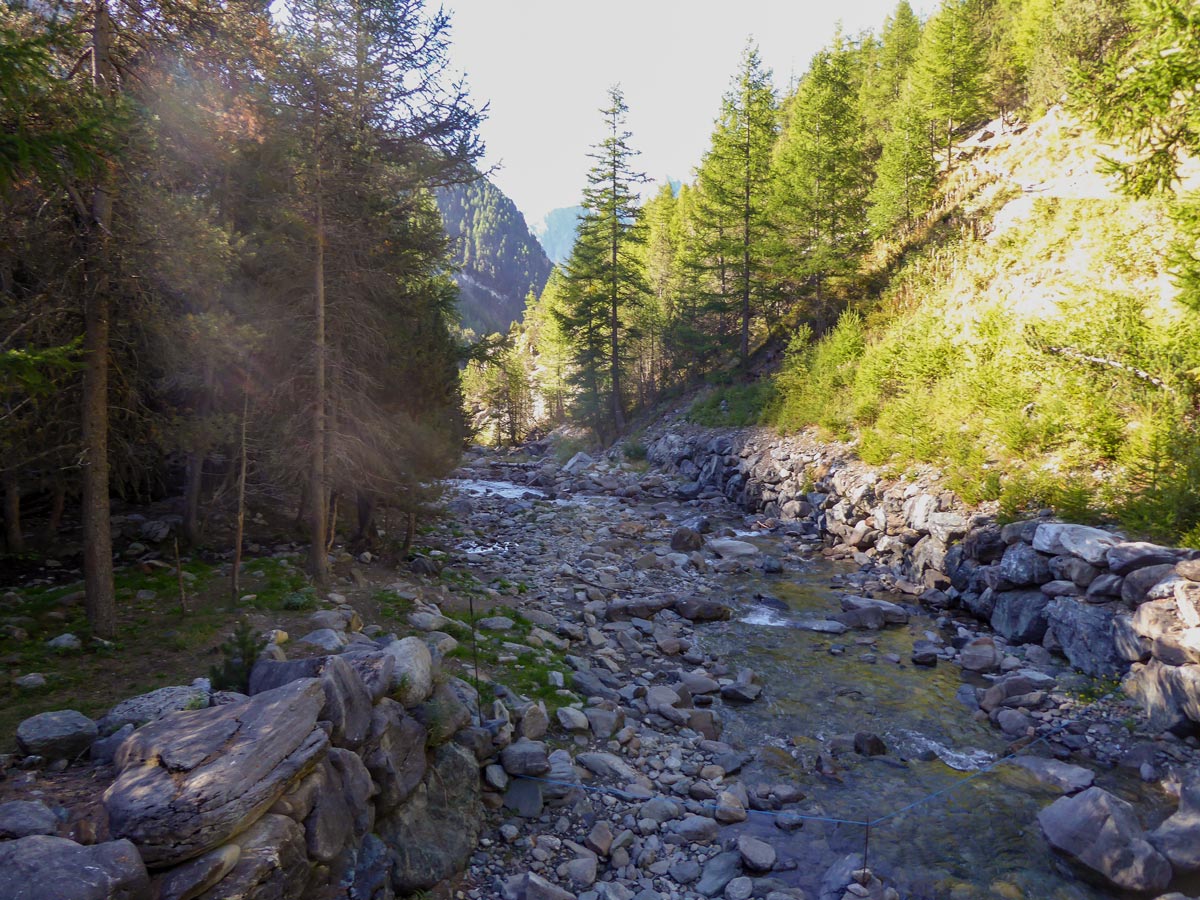
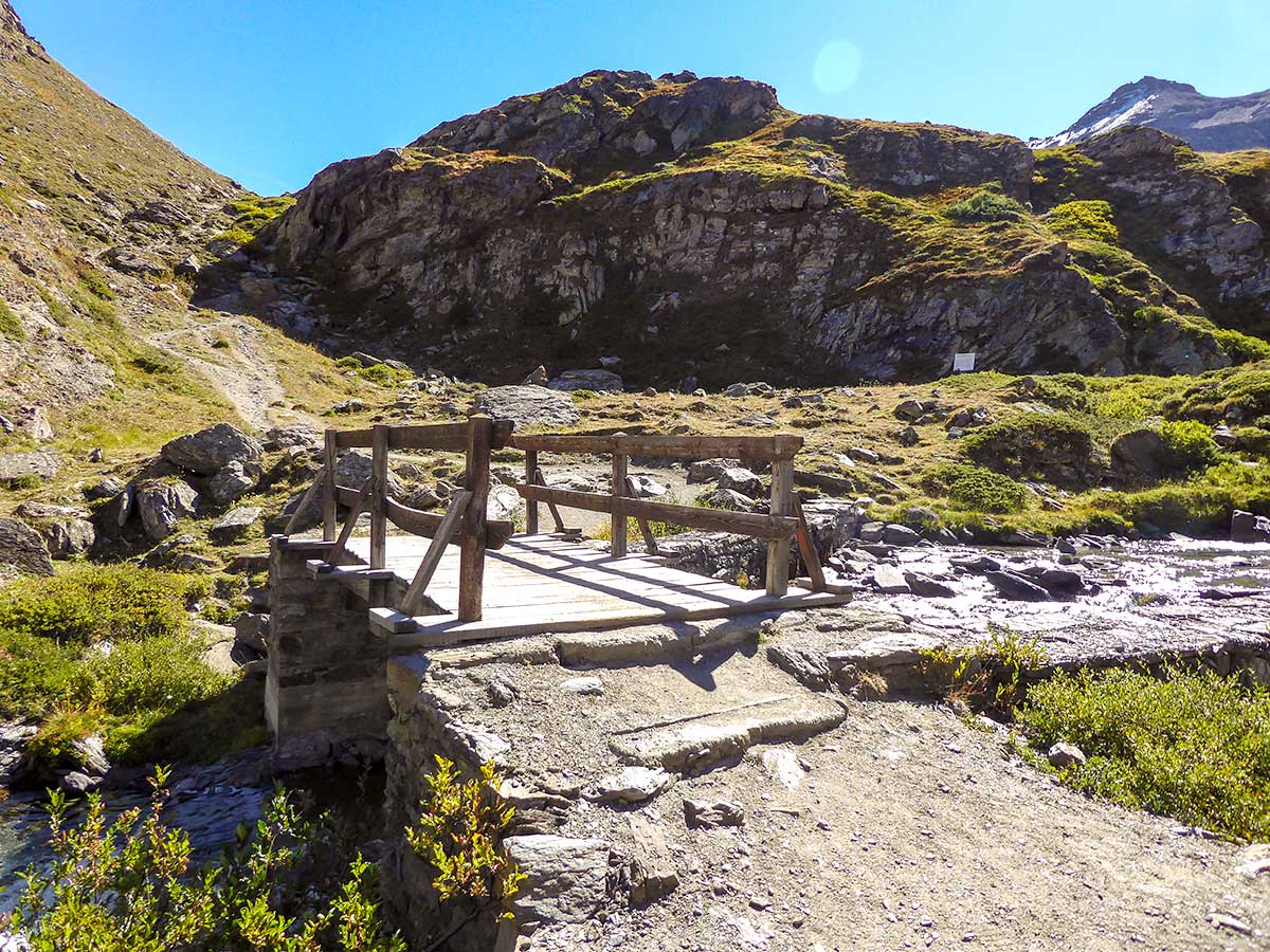
At another signpost go right at the fork, still following route 8. Descend to the Grauson River (Torrente Grauson) and use the wooden bridge to cross to the other side. Ascend onto the right slope, walking against the stream.
There will be another signpost at a fork. Go left, following route 8. After a little bit more walking along the river, you will see one more signpost, take the route 8 that is ascending. Continue hiking along the valley on route 8 following the signs to Grauson Désot.
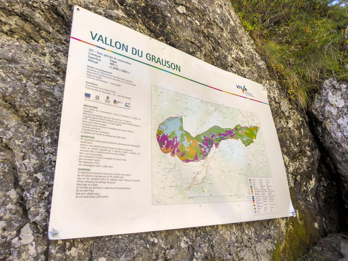
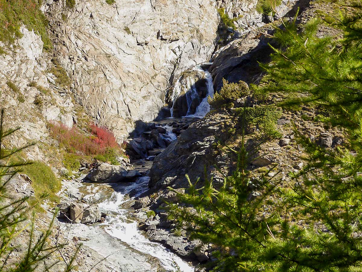
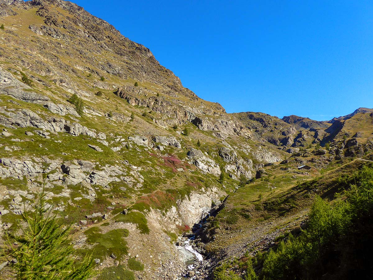
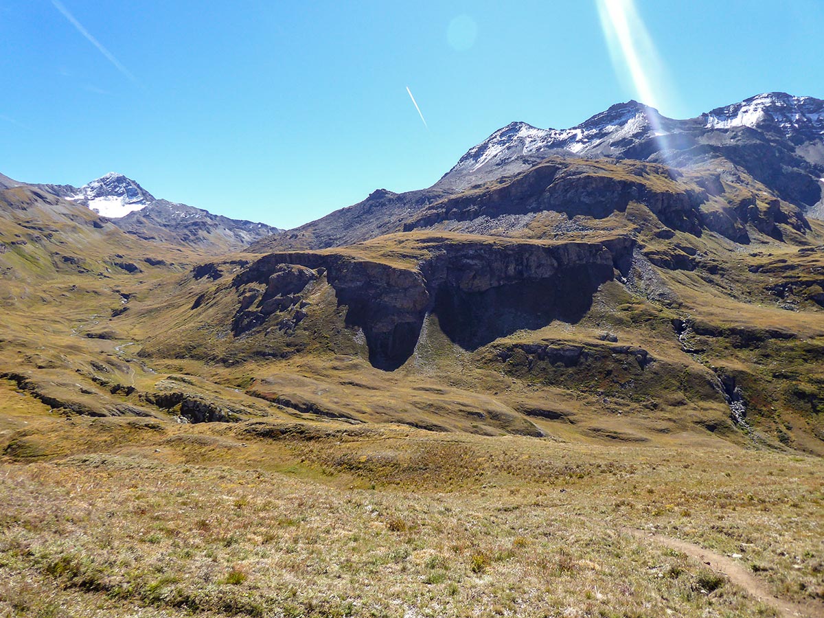
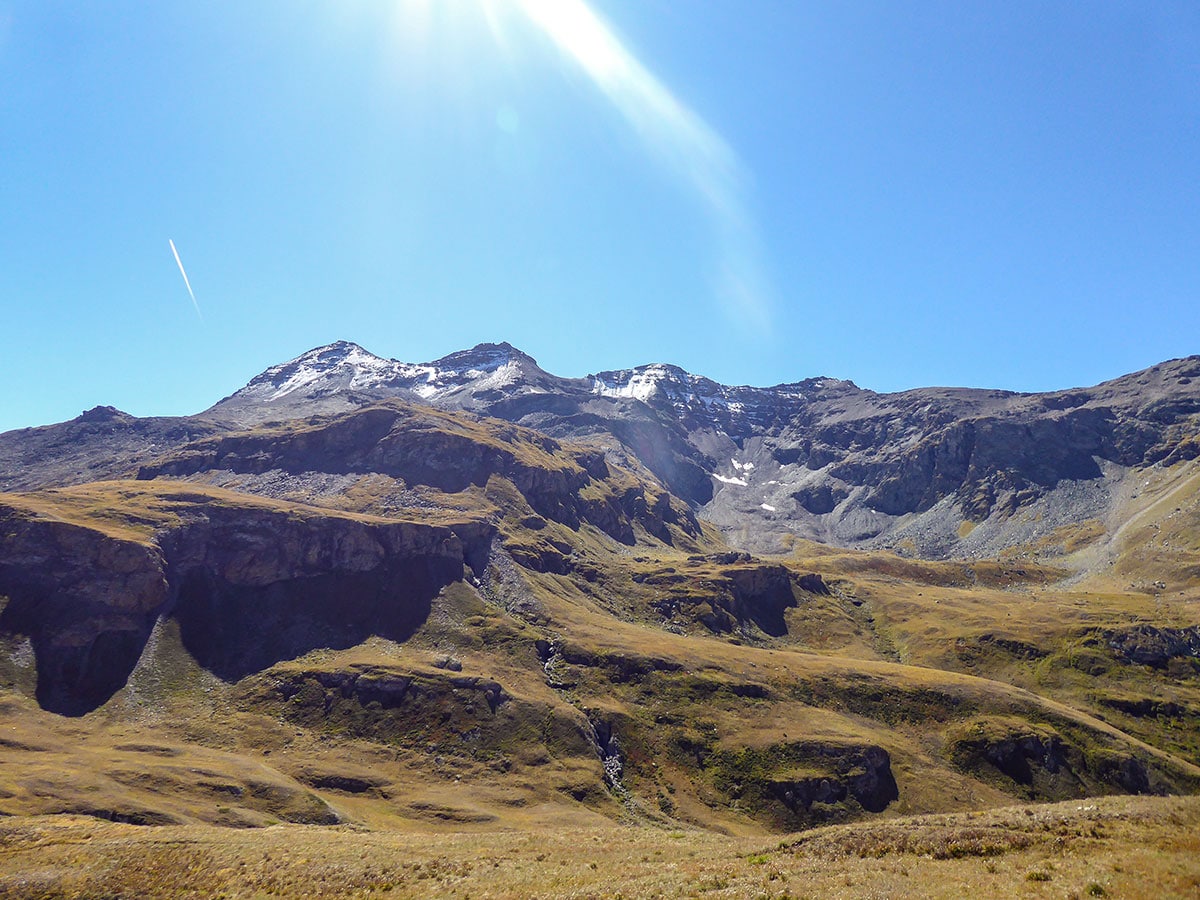
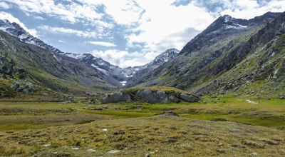
Enjoy the views of stunning cliffs and streams rushing down the mountain slopes that fall into the Grauson River, which has formed the beautiful Grauson Valley (Vallon du Grauson).
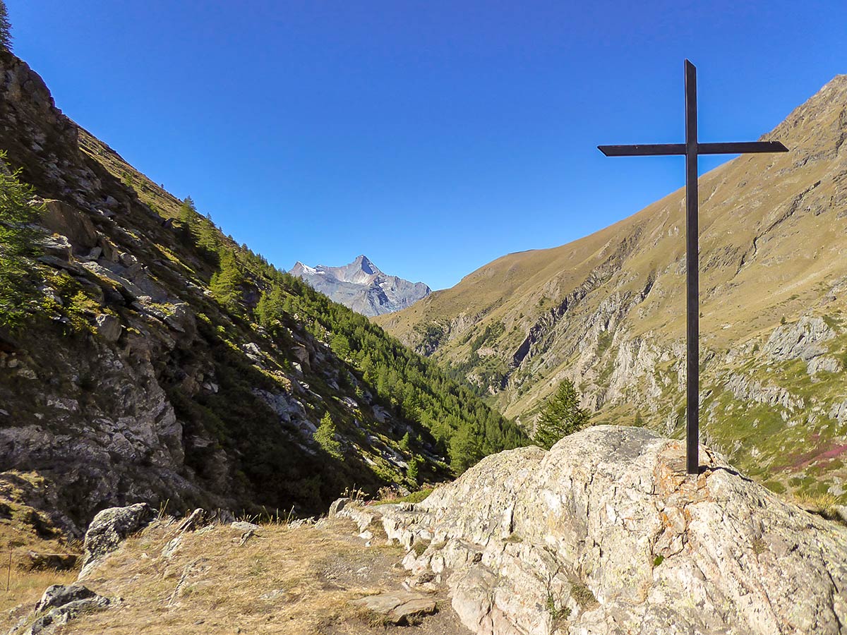
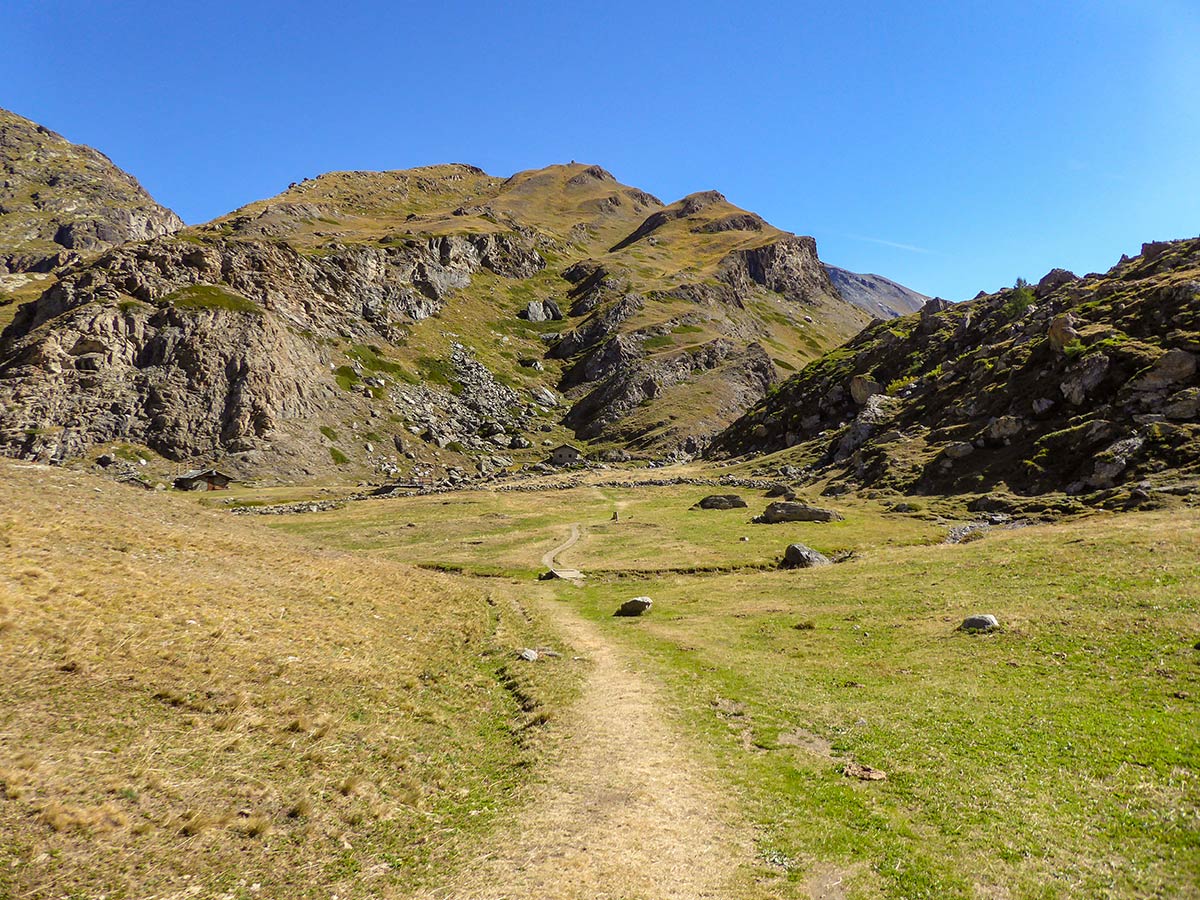
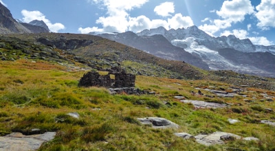
After walking 4.4km you should reach a signpost next to a cross. This is a beautiful place to take a break. After that, continue along route 8 towards Col de Saint-Marcel. Soon you’ll pass Grauson Inferiore (Lower Grauson) – several old houses near the river on your left.
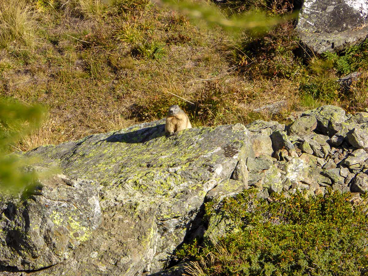
Continue along a beautiful meadow and walk past rushing water streams. Keep an eye out for marmots here.
After walking 5.6km you reach a signpost at the fork in the path. Go left and follow route 8A. You will see a new refuge being built here. In the future, you will have a chance to get some refreshments or even spend the night at this location.
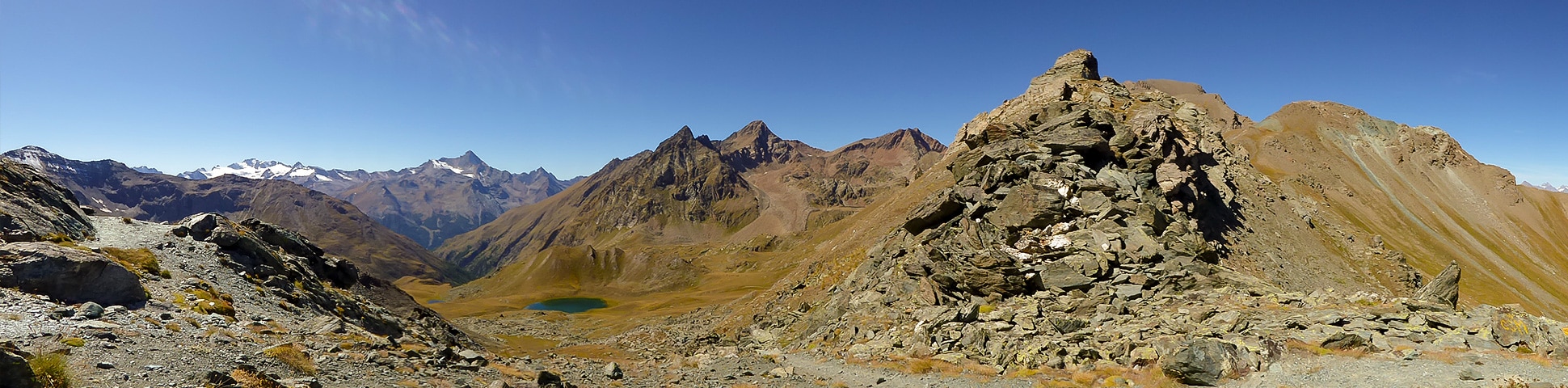
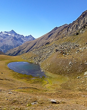
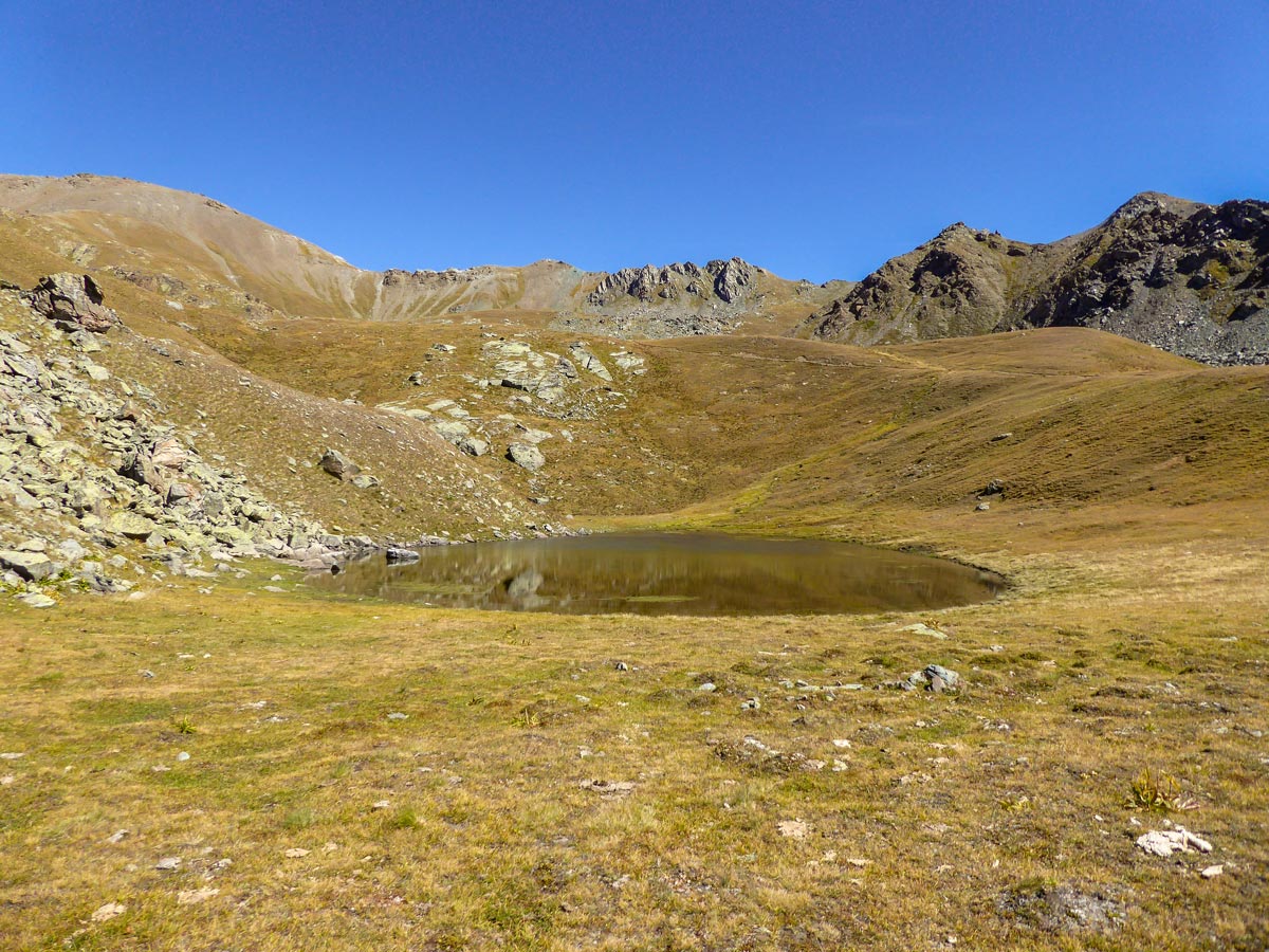
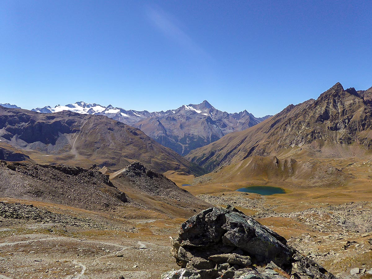
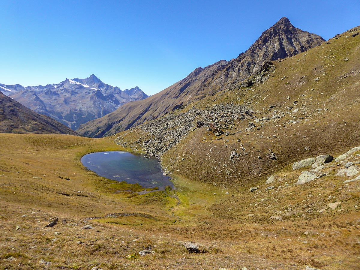
At 6.5km into the hike, you will reach three stone houses and a signpost – Grauson Superiore (Upper Grauson). From here, go right following route 3B. After ascending for another 90m you will see a small lake. Pass it to your left. After you climb on the slope one path will go left. It leads to Lago Corona, which is a beautiful mountain lake. However, at the fork your trail goes right so go back after checking out the lake and continue towards the mountain pass, leaving Lago Corona to your left.
After the last 200 m of switchbacking up, you will finally reach Col de Saint-Marcel. The final and most stunning reward awaits you here – the Matterhorn and the beautiful Monte Rosa Massif next to it. The snowy peaks create a wonderful panoramic view and the Matterhorn, although lacking snow looking from this side, beautifully conquers every other mountain in sight.
After taking a break at Col de Saint-Marcel, go back the same route you came.
Insider Hints
Take sunscreen, the hike has little shade and can be very sunny.
There are two trails from both sides along the river leading to Grauson Désot, but we prefer leaving the river on our left as this trail does have some shade.
There is a Rifugio being built, so in the future, you will be able to enjoy some refreshments and even a roof above your head here.
This route can get quite muddy after rain, it’s best to have trekking poles.

Similar hikes to the Col de Saint-Marcel hike
Alpe Money
The Alpe Money Hike is a beautiful trail in Gran Paradiso National Park. It takes you right up to the…
Rifugio Vittorio Sella
Rifugio Vittorio Sella is one of the most scenic hikes in Gran Paradiso National Park. The trail rewards you with…
Lago di Loie
The Lago di Loie hike takes you on a circular route to the peaceful and crystal-clear Lake Loie. It offers…
Burokai 4 years ago
I loved this route! Even though it's long, but the ascend is rather slow and the quality of the trail is very good (apart of few muddy parts near refuge construction, but I believe on dry days it should be fine). I'd even call it 'children-friendly' if not for the length! Only a small slightly steeper path when getting close to the pass, but nothing too strenuous and no exposure at all. Loved the views of Matternhorn!
Slavka Pochodi 4 years ago
Not too difficult to access the top - a bit of a climb but well worth it for the views and atmosphere
Johnny C. 4 years ago
It was well worth it! From here you'll get to to see the amazing views of majestic Swiss Alps!
Antonin Sand 4 years ago
Lots of elevation, rocky terrain and ruggged trails. Still worth it!
Manny D. 5 years ago
Amazing surroundings. We walked for quite a long time, but we did not encounter many people.
Chloe P. 5 years ago
This is definitely long and exhausting. I'm not in the best condition to do it. I almost threw up because of altitude sickness.
Bridget Mcbride 5 years ago
Great hike. The trail was in perfect condition. It was an arduous climb, and it takes a lot of stamina to get to the top. Best to prepare before doing it.
Laura K. 5 years ago
Full of thrill and excitement! Breathaking views.
Danny V. 6 years ago
There are hiidden wonders to discover around the area. It was a great pleasure to be there and take in all the beauty.