Black Rock Mountain
View Photos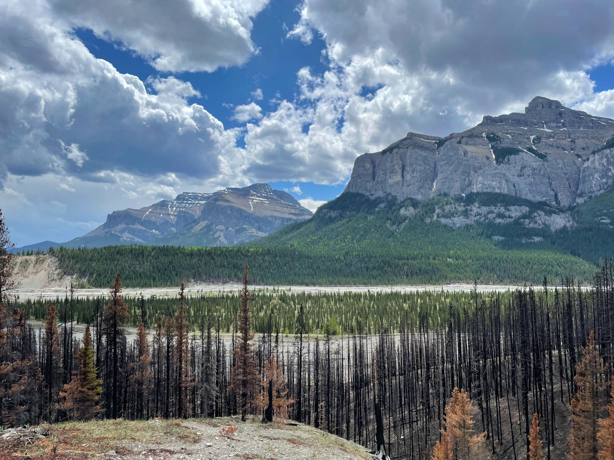
Black Rock Mountain
Difficulty Rating:
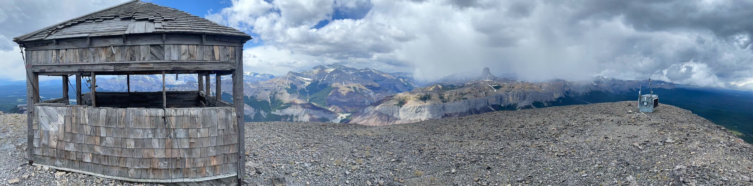
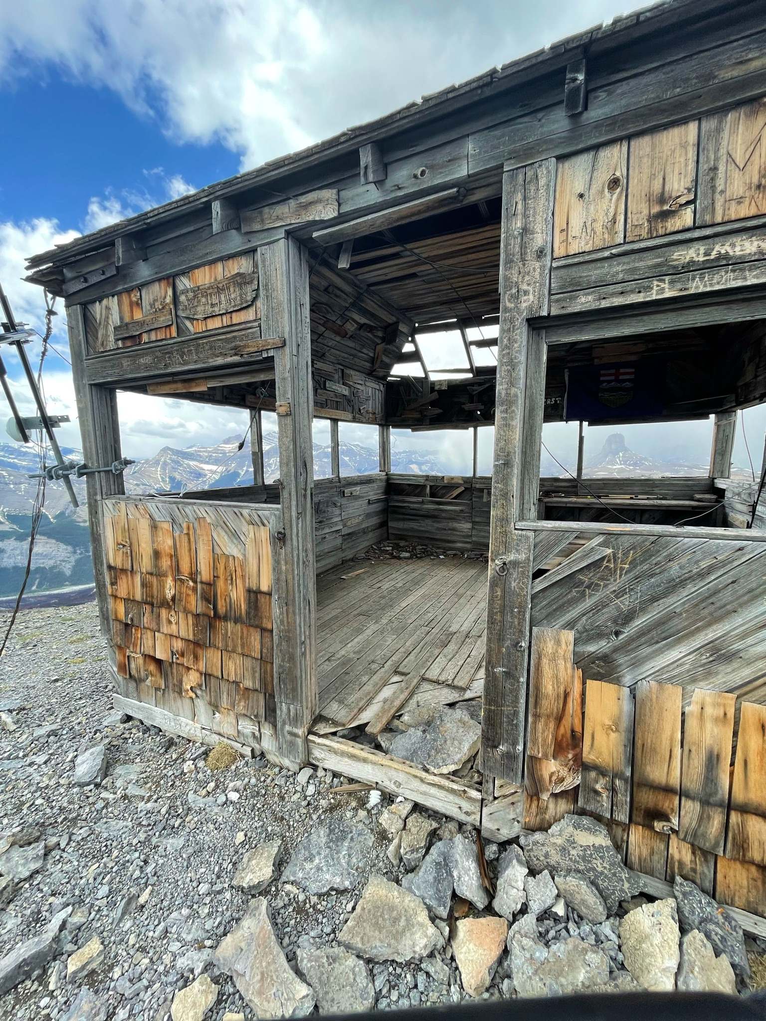
While Black Rock Mountain offers gratifying views, reaching the summit comes with its fair share of challenges, such as finding the trailhead and rockfall in some sections as you ascend. But, after your heart rate settles at the top, peaks stretching into the horizon and cradling the valley emulating a quintessential image of the wild below will force you to forget about any of the challenges along this route. The abandoned fire hall at the top adds a cool look to the already-epic scenery!
Getting there
Take highway 40 north through Waiparous and then go north as it turns into Richards Road. Look for a sign for Trappers Hill Campground and go left, following the gravel Township Road 265A. Go past Trappers Hill and continue as the road gets worse, eventually down a steep hill and onto the Ghost River floodplain. Expect to cross some small streams as you follow faint tracks. Look for a marker with the number 37, and go right. You can park near there and walk to the trailhead or drive a few hundred meters to the trailhead.

About
| When to do | May-October |
| Backcountry Campsites | Random camping |
| Pets allowed | Yes - On Leash |
| Family friendly | No |
| Route Signage | Poor |
| Crowd Levels | Low |
| Route Type | Out and back |
Black Rock Mountain
Elevation Graph
Weather
Black Rock Mountain Description
Black Rock Mountain in Alberta’s Ghost region is a spectacular walk, but it also has a few challenges, resulting in its 5/5 rating. It’s not a super-challenging trail physically; however, the challenge is getting to the trailhead, and there is a serious risk of rockfall. There is a slight bit of exposure that may unsettle those particularly impacted by exposure. More detail on each of these challenges is below:
1. Getting to this hike is hard, and you need a high-clearance vehicle. Currently, Google maps is giving incorrect directions, taking you on a non-existent bridge near the Ghost Airstrip Campground. Also, once you leave Highway 40, you can expect a heavily rutted, gravel road. This is completely passable in a high clearance vehicle, but those in minivans have complained about grounding out their vehicle.
2. This route has the possibility of rockfall that is unavoidable, and you should wear a helmet while you are under the crumbling rock walls. This is especially the case during spring and autumn where water may get into cracks and freeze overnight, and then as it melts in the sun release rocks.
3. Just before the summit of Black Rock, you have about 20 seconds of walking on a 7ft wide sidewalk, with drop-offs on both sides. This trip has been made with hikers that don’t like exposure, and they found it okay.
To hike Black Rock Mountain, first of all, we recommend driving up to the half-demolished Black Rock Mountain Trailhead sign. There is parking for about 10-15 vehicles here, though many park near the “37” marker and walk to the trailhead. Either way, this is a stunning trailhead with mountains all around.
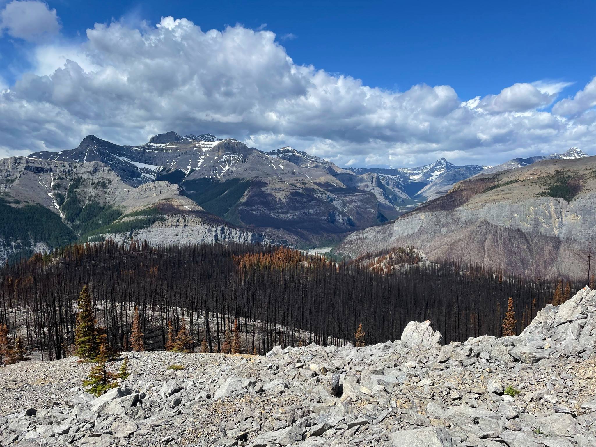
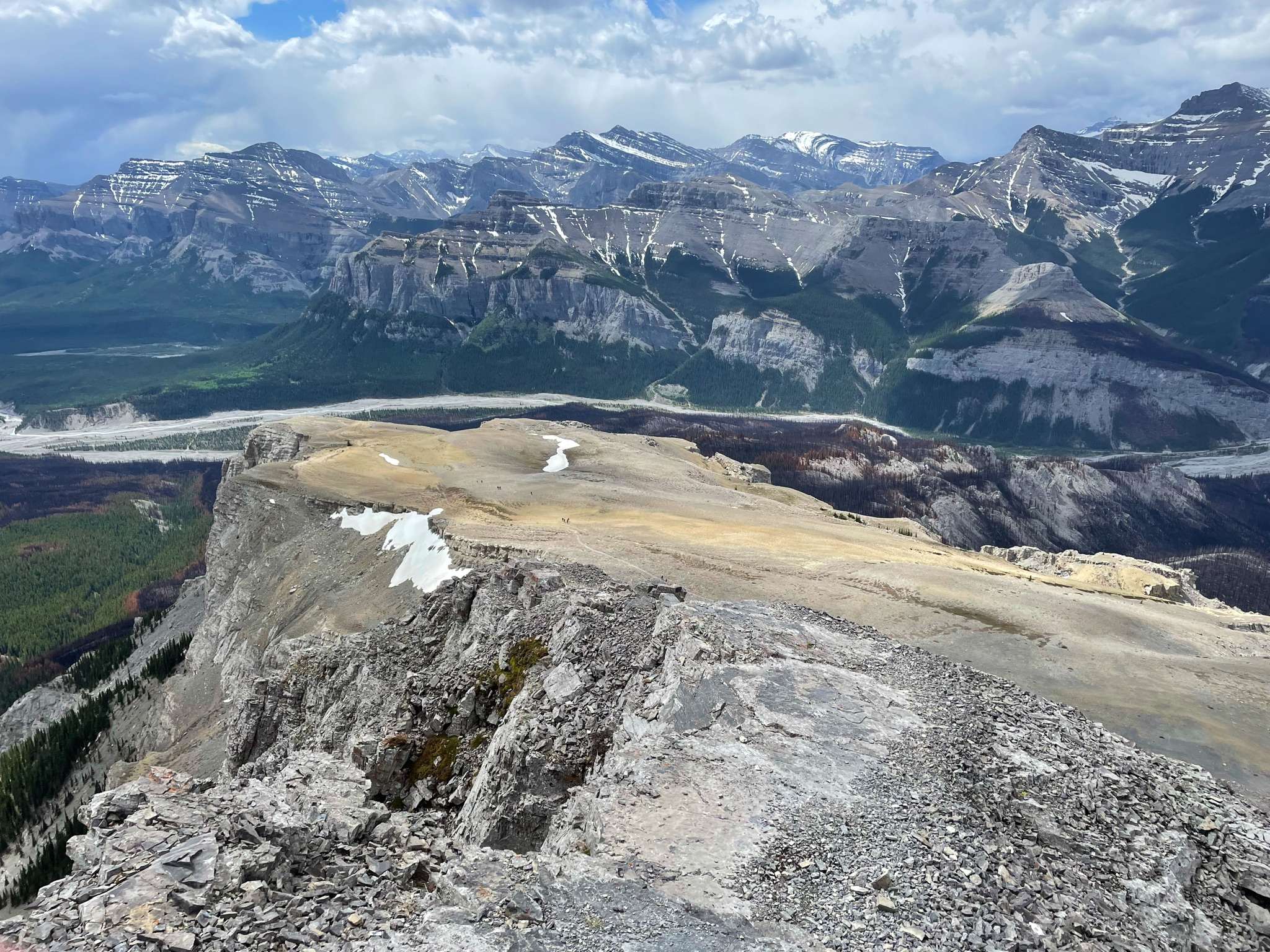
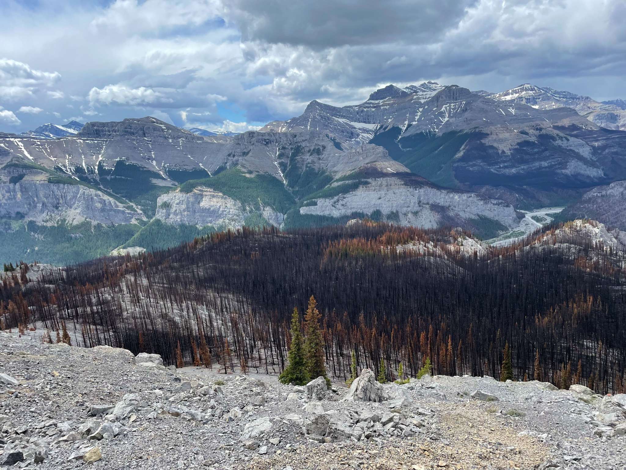
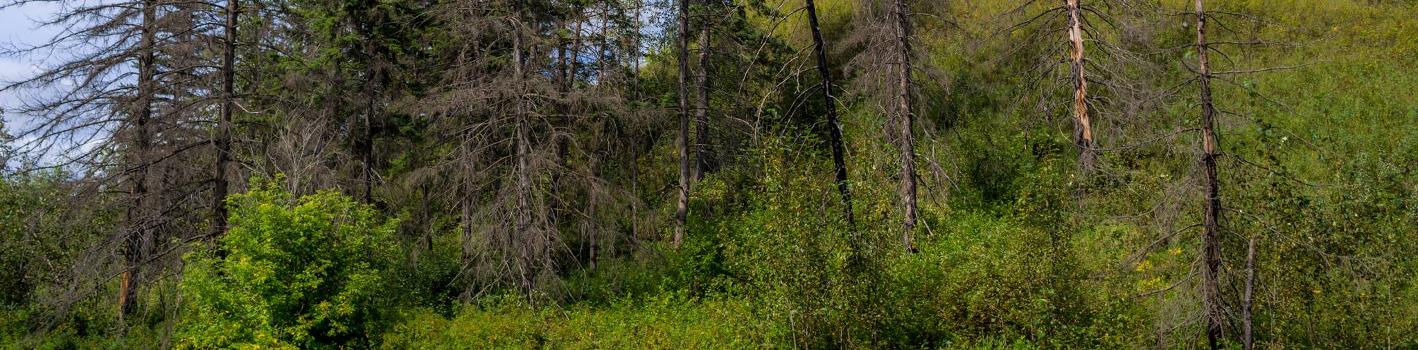
The route leads immediately up and through a recent forest fire burn. This is a pretty area, with nice views through the burned trees, allowing you to savour the mountains all around.
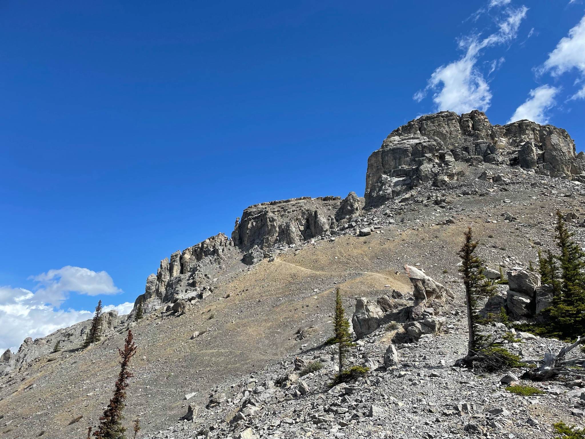
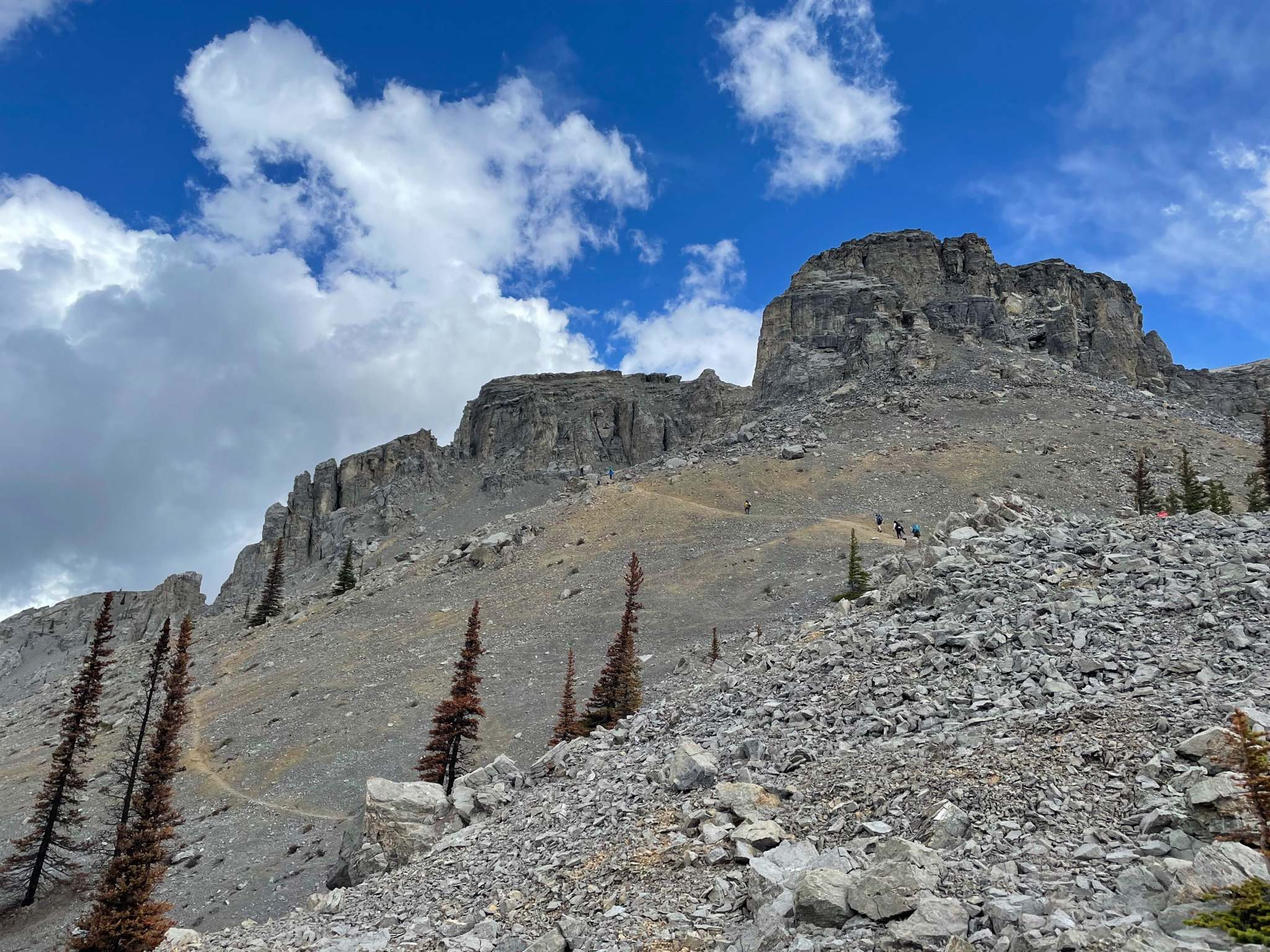
The Black Rock Mountain trail has a nice grade, so you’re constantly gaining elevation while in the trees without any serious inclines. This changes as you come out of the trees and get into the alpine portion of this walk. You come beneath a large crumbling rock face roughly 2.2mi from the start, and you should have your helmet on for the next little while. The path appears to split here, with one part going left on some loose scree and the right path not obvious. The right path is better, though, in our track, you can see we ascended on the left-hand path as we didn’t see the right hand path, but took that on the way back.
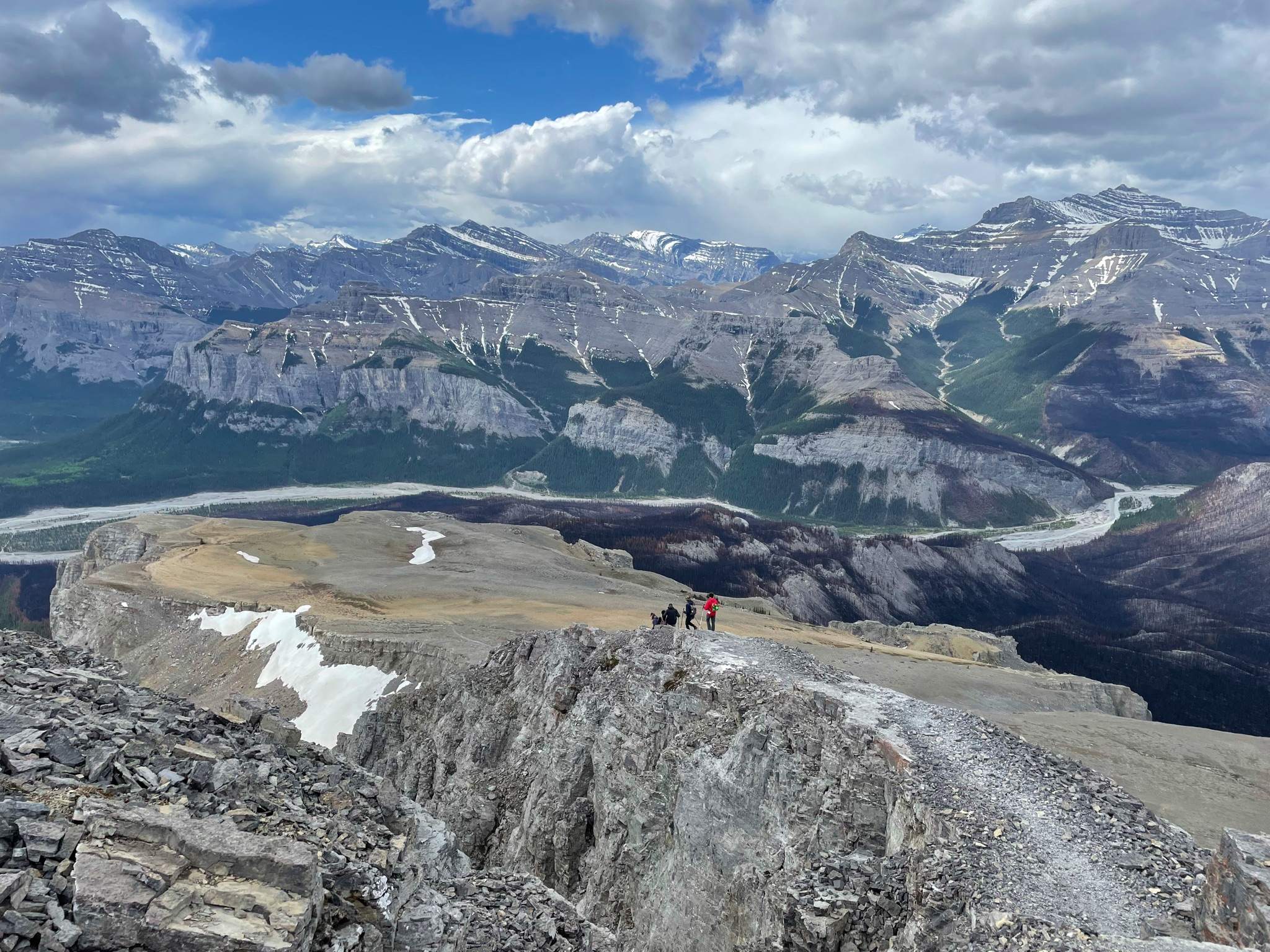
There is the worry of rockfall for the next few hundred meters, so be aware and move quickly. Soon you come up and have a lovely alpine meadow, and as you look ahead, you see the summit push of Black Rock Mountain, with a pretty fire lookout on top. The walk across this meadow is very lovely, and the route up the final stretch looks very steep.
Once on the final stretch, a nice switchbacking trail gets your lungs burning but is otherwise fine. The last 66ft or so of the route does take you on a roughly 2m wide ‘sidewalk’, with drop-offs on both sides. This feeling of exposure is fine for most people but could be an issue if you are particularly uncomfortable with exposure.
Once at the top of Black Rock Mountain, you have incredible views in all directions, as well as a very cool abandoned fire lookout. Black Rock Mountain fire lookout was constructed in 1928 and was used until 1950.
The way back has you retracing your steps on the same path, which can be a bit tricky as the small scree on hard slabs beneath can be a bit slippery. Poles definitely help on the way down.
Once back in the car, look back up at your route up Black Rock Mountain; chances are you’ll want to bring others here yourself.
Insider Hints
Don’t even consider getting to the trailhead of Black Rock Mountain without a high-clearance vehicle!
There are lots of random campers along the road, with people just choosing a spot and setting up camp. This can be a fun activity, though weekends can get a bit wild for some campers, with large parties and lots of noise.
Similar hikes to the Black Rock Mountain hike
Kennedale Ravine Trail
Kennedale Ravine is an out-and-back trail surrounded by development; however, it often doesn’t feel that way. It is a secluded…
Hasse Lake Trail
Hiking the Hasse Lake Trail is a fun way to get outside near Spring Lake. It is an easy trail…
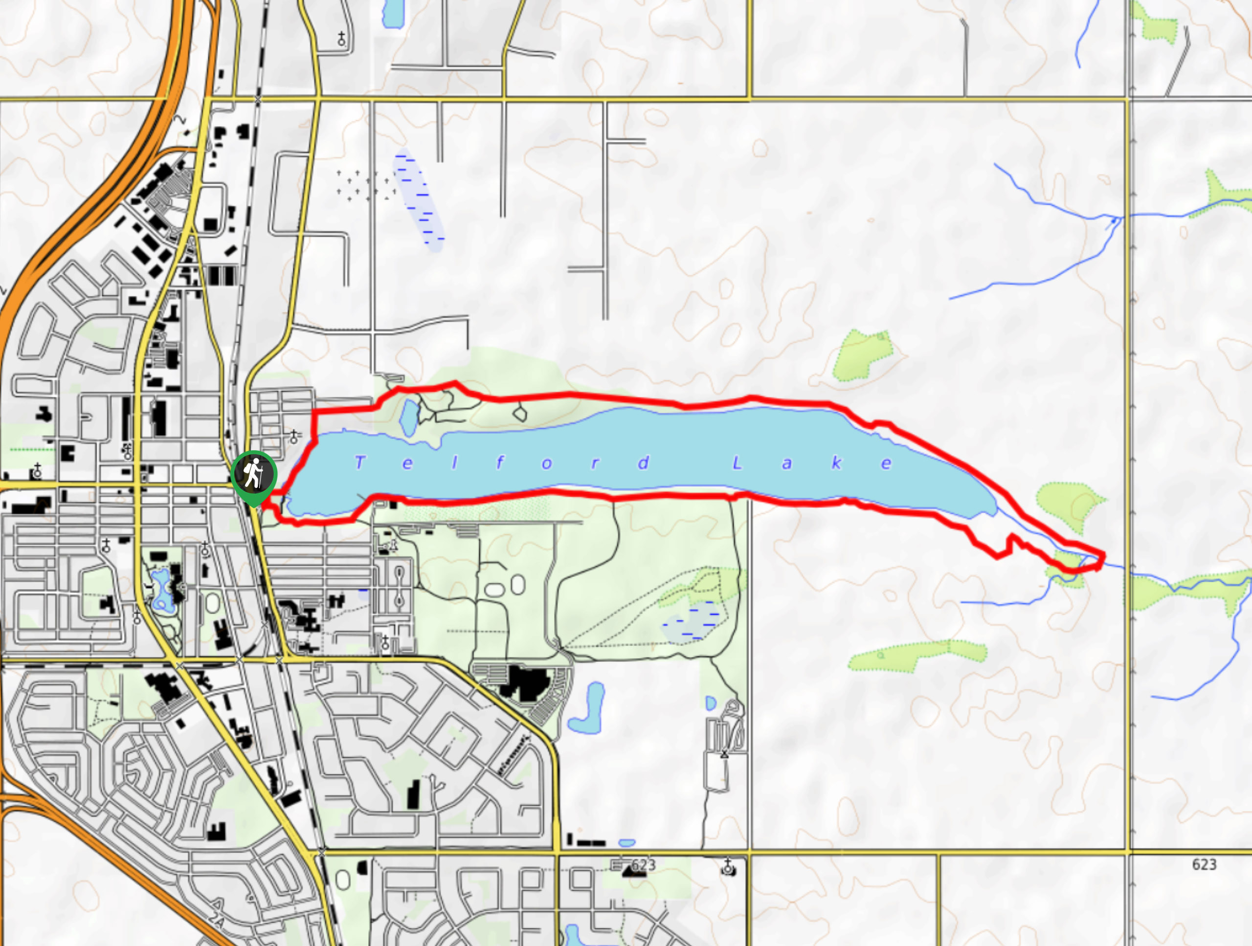
Telford Lake Multiway Trail
The Telford Lake Multiway trail is a 2-3 hour route in Leduc, Alberta. This trail is close to the Edmonton…
Comments