Hasse Lake Trail
View Photos
Hasse Lake Trail
Difficulty Rating:
Hiking the Hasse Lake Trail is a fun way to get outside near Spring Lake. It is an easy trail with almost no elevation gain, making it great for families. If you find yourself travelling along the Yellowhead Highway looking for a place to get some fresh air, this is a great option!
Getting there
To get to the Hasse Lake Trail, travel westbound on Highway 16 from Edmonton. After roughly 24.9mi from downtown Edmonton, take the exit for Range Road 15 on the left. Continue south on this road until you reach Hasse Road, and turn right. Stay on Hasse Road and follow signs for Hasse Lake, where you will find a large parking area and trailhead.

About
| When to do | Year Round |
| Backcountry Campsites | No |
| Pets allowed | Yes |
| Family friendly | Yes |
| Route Signage | Average |
| Crowd Levels | Moderate |
| Route Type | Circuit |
Hasse Lake Trail
Elevation Graph
Weather
Hasse Lake Trail Description
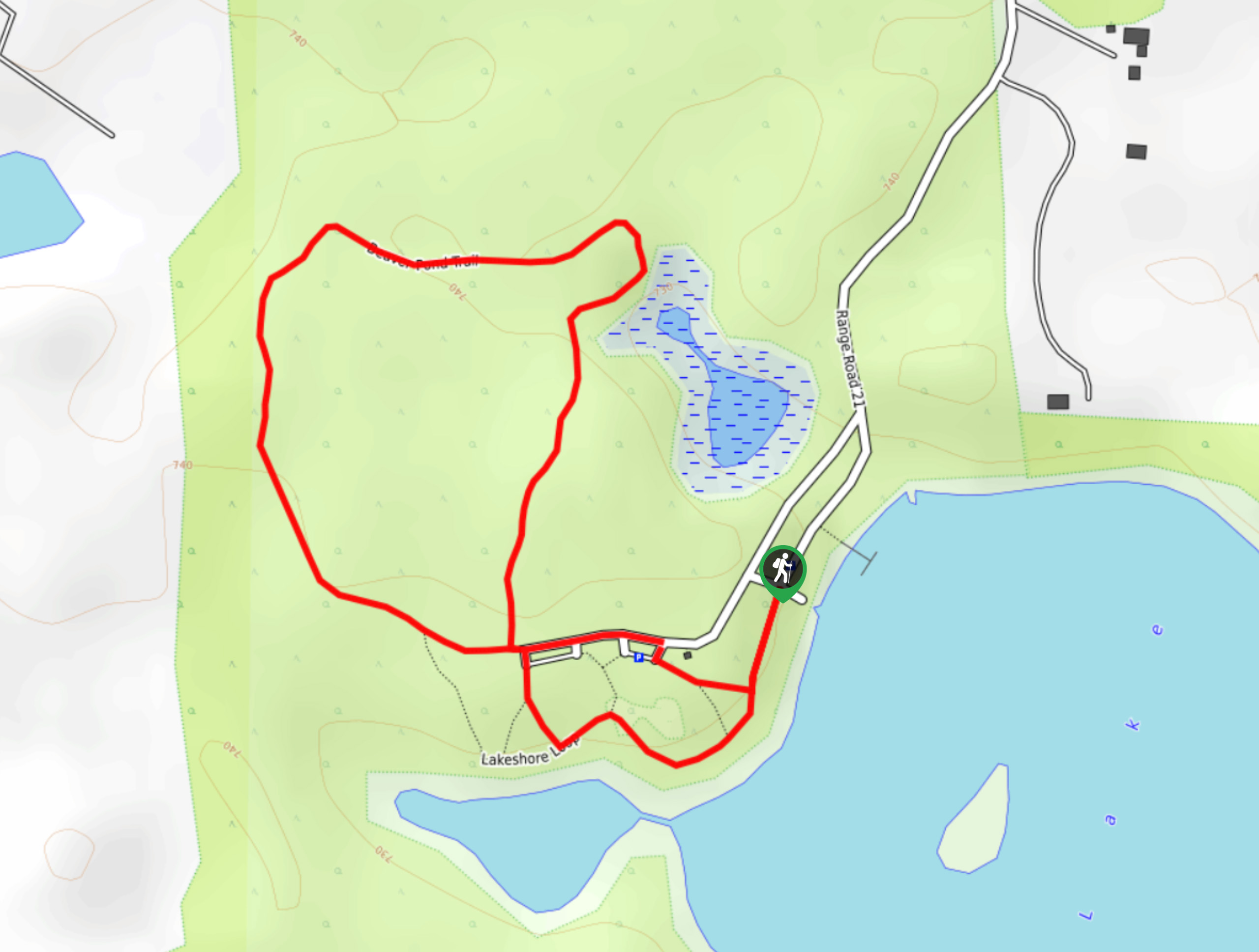
If you find yourself near Spring Lake, the detour to Hasse Lake trail is a nice way to get outside and enjoy the local region. Starting from the northwest corner of the parking area, make your way onto the Beaver Pond Trail to the left. This route creates a figure eight style circuit, so by starting on the Beaver Pond Trail, you will create a full loop of 1.0mi before returning to this junction again. From here, continue straight rather than heading back to the parking area. You will head south to the lake and walk towards the left, creating the second loop of the figure eight, back to the parking lot.
Similar hikes to the Hasse Lake Trail hike
Kennedale Ravine Trail
Kennedale Ravine is an out-and-back trail surrounded by development; however, it often doesn’t feel that way. It is a secluded…
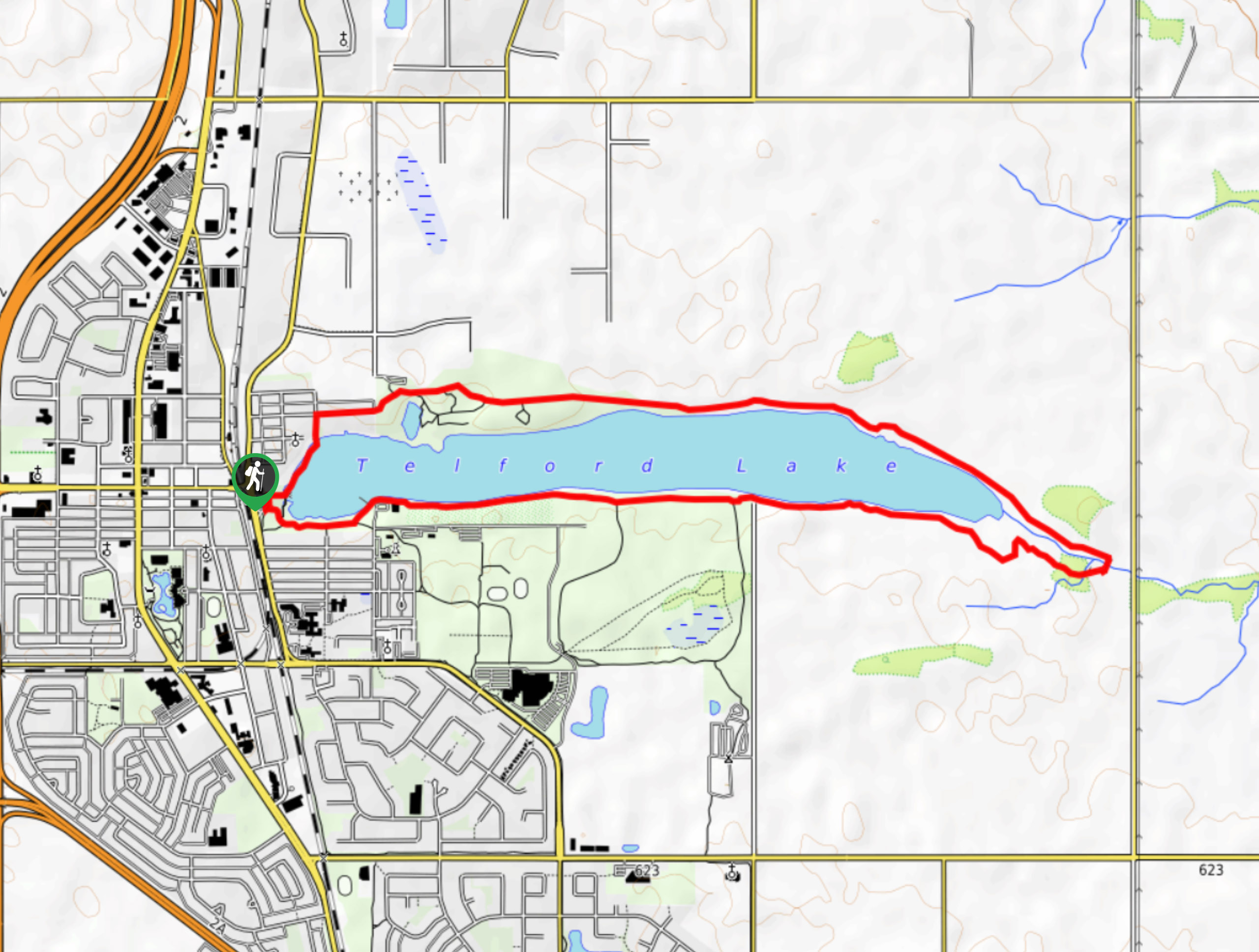
Telford Lake Multiway Trail
The Telford Lake Multiway trail is a 2-3 hour route in Leduc, Alberta. This trail is close to the Edmonton…
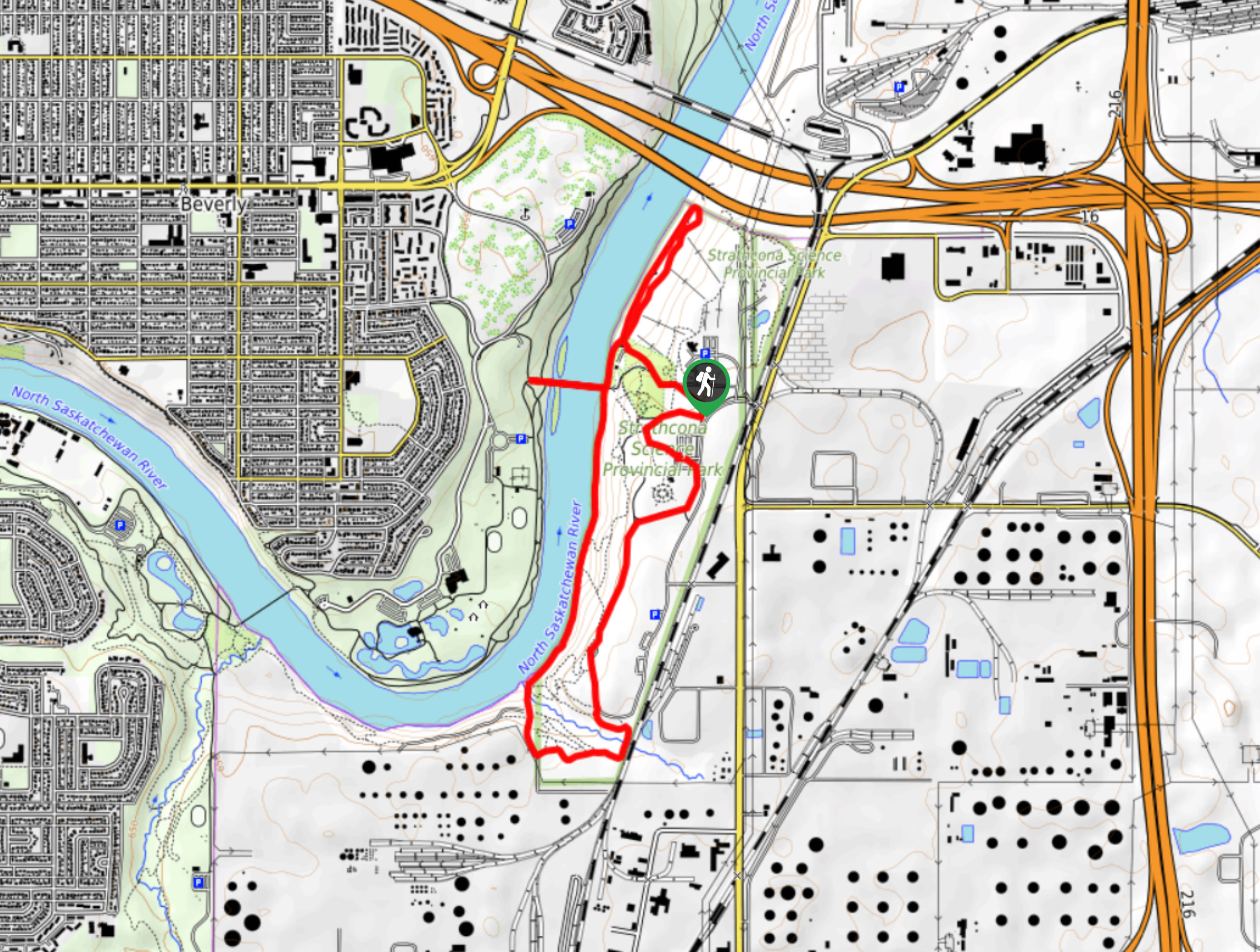
Strathcona Science Park Trail
The Strathcona Science Park trail is located in the North Saskatchewan River Valley next to the Sunridge Ski Area. It…
Comments