The Copper Creek Trail to Copper Lake
View Photos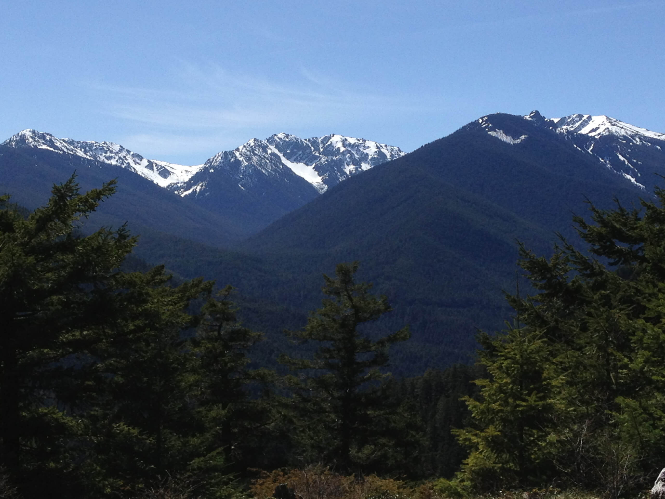
The Copper Creek Trail to Copper Lake
Difficulty Rating:
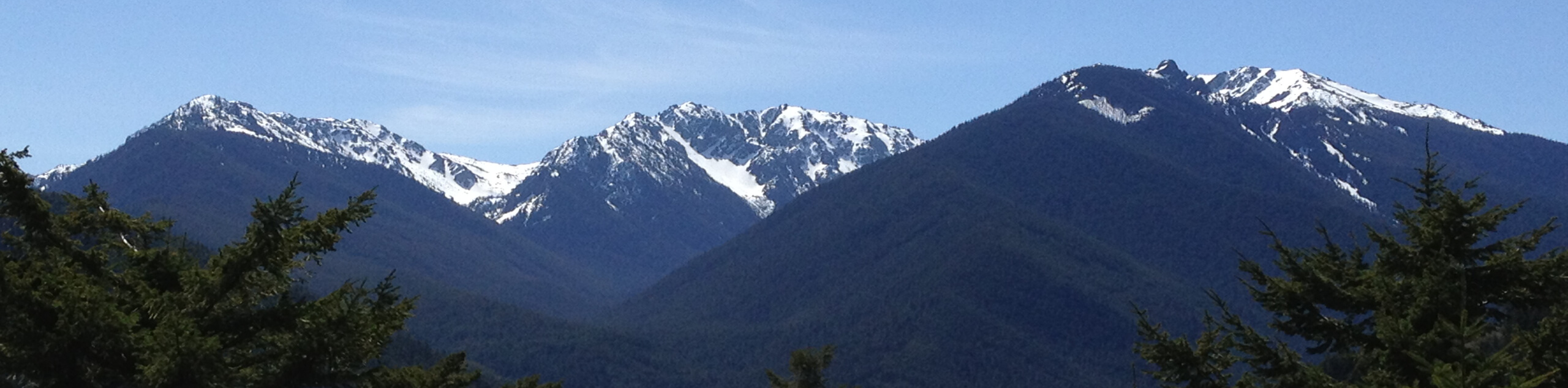
The Copper Creek Trail to Copper Lake is a lengthy hiking route near Gothic, Colorado that will take you along a creek to visit a charming mountain lake. While out hiking the trail, you will take in the cascading waters of Judd Falls, before following along Copper Creek as it gradually climbs through the mountains to reach Copper Lake. Hikers should take note that this route is inaccessible during the winter, as the area is blanketed in snow and conditions are dangerous.
Getting there
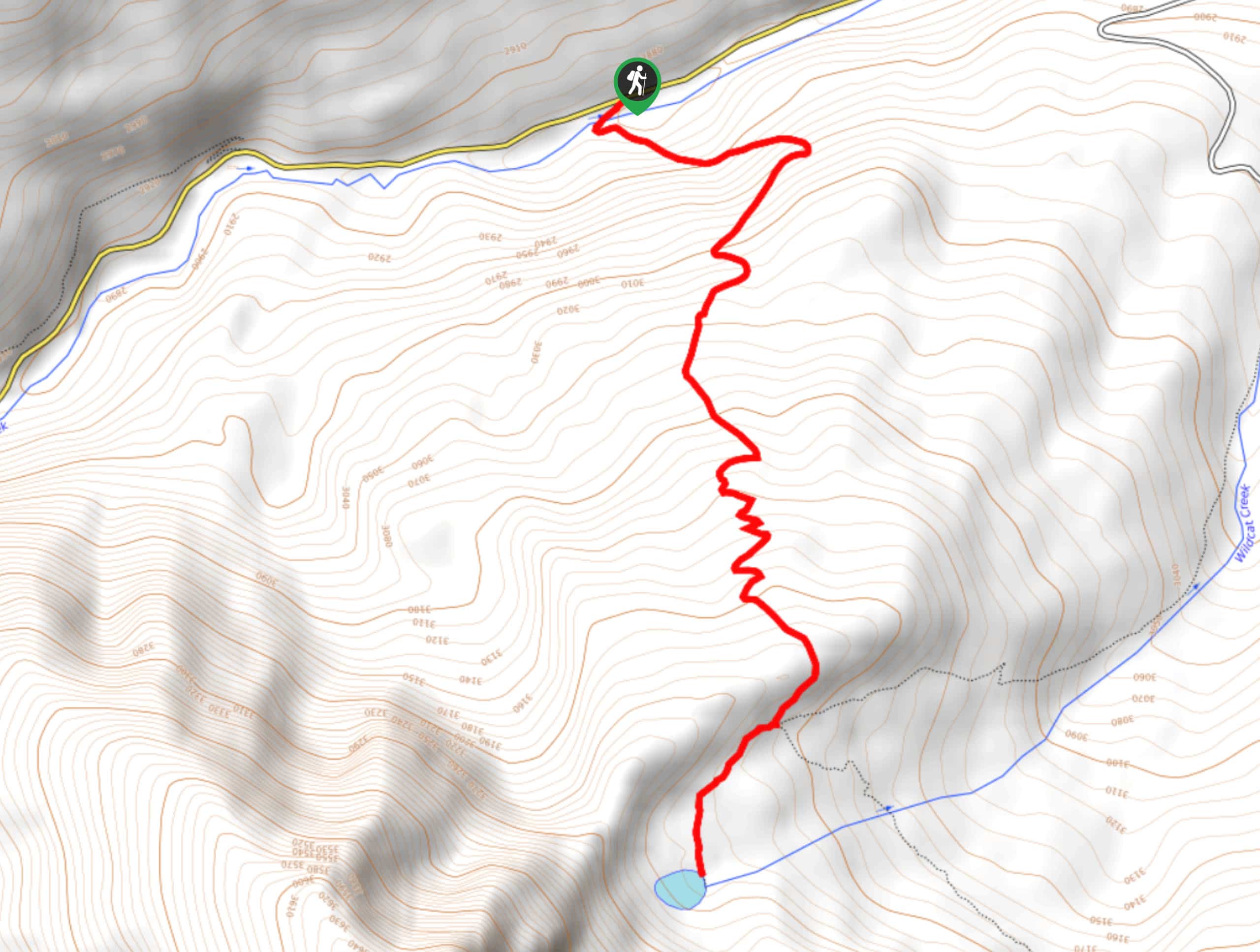
The trailhead for the Copper Creek Trail to Copper Lake can be found at the Judd Falls Trailhead on Gothic Road/FS-317.

About
| Backcountry Campground | Copper Lake Campsite |
| When to do | June-October |
| Pets allowed | Yes - On Leash |
| Family friendly | No |
| Route Signage | Average |
| Crowd Levels | Moderate |
| Route Type | Out and back |
The Copper Creek Trail to Copper Lake
Elevation Graph
Weather
The Copper Creek Trail to Copper Lake Description
While it is a long route, the Copper Creek Trail to Copper Lake is actually a fairly laidback journey thanks to its gradually ascending terrain. Only that last few hundred yards leading up to Copper Lake and beyond are steep, making this a great long-distance hiking route for casual outdoor enthusiasts looking to try their hand at a longer route.
Setting out from the parking lot, you will make your way to the southeast through the light tree cover, where you will soon arrive at the cascading waters of Judd Falls. From here, you will follow the banks of Copper Creek to the northeast, as you pass between the rugged slopes of Avery Peak and White Rock Mountain.
Take some time to appreciate the natural beauty of the surrounding mountains and valley landscape, as you gradually work your way along the water’s edge. Eventually, the route will begin to steepen and you will soon arrive at the beautiful shores of Copper Lake. Here, you will continue on to the north to explore the terrain of the Copper Basin and East Maroon Pass that are situated above the lake. Reaching the northernmost point of the route, you will turn back and retrace your steps to the trailhead where you began your adventure.
Similar hikes to the The Copper Creek Trail to Copper Lake hike
Prospector Trail
The Prospector Trail is a fun hiking adventure near Crested Butte, Colorado that will take you uphill for beautiful views…
Lily Lake Trail #639
The Lily Lake Trail #639 is an easy-going hiking route in the Elk Mountains of Colorado that will lead you…
Green Lake via Carbon Trail
The Green Lake via Carbon Trail is an amazing experience in Crested Butte, Colorado that will take you to a…
Comments