
County Line Trail
View Photos
County Line Trail
Difficulty Rating:
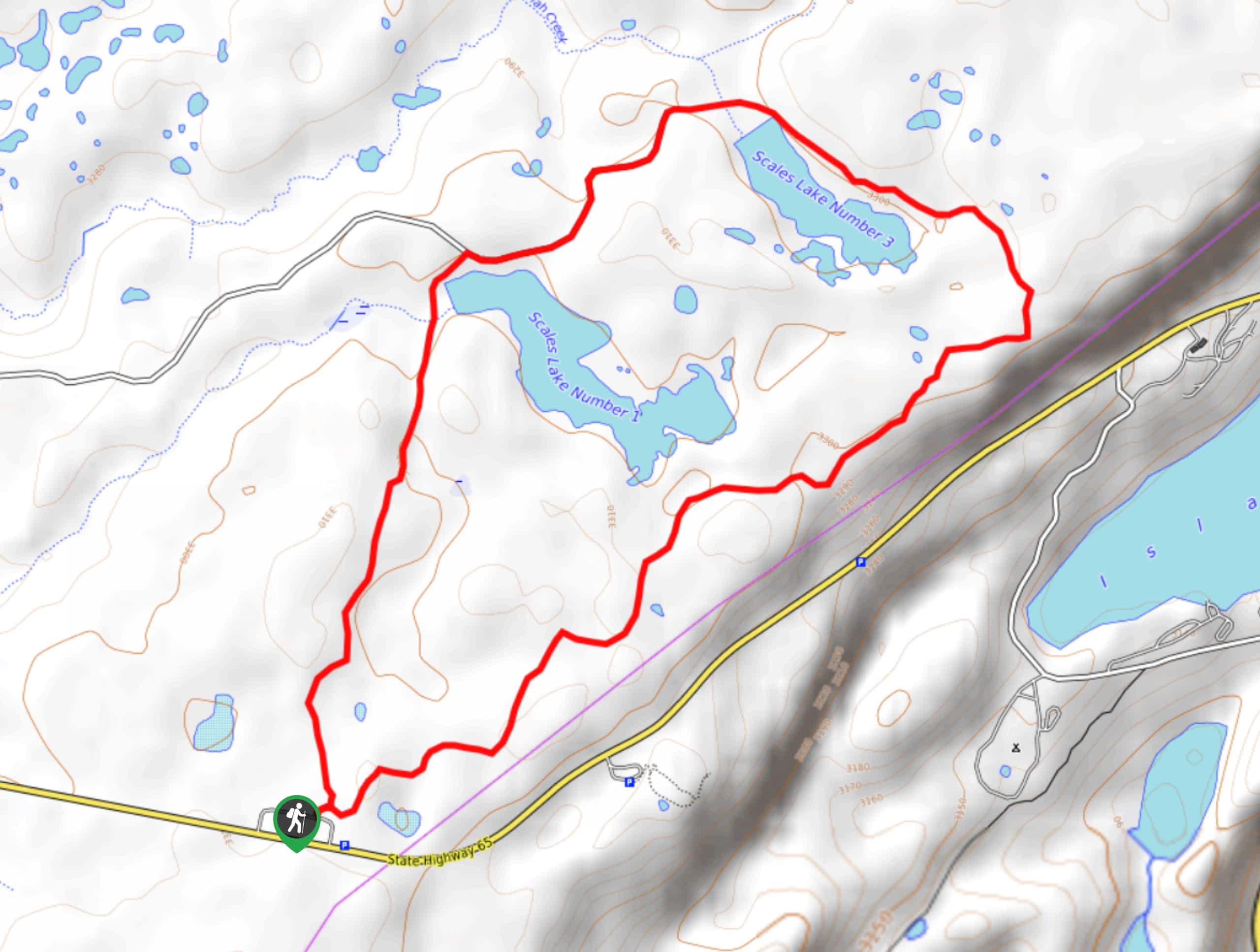
The County Line Trail is a relaxing woodland adventure near Grand Mesa, Colorado that will provide beautiful views overlooking several bodies of water. While out hiking the trail, you will meander through open meadows and serene forests, before arriving at the edge of the Scales Reservoirs. This laidback trail is perfectly suited for a fun family adventure, particularly during the summer months when the wildflowers are in full bloom.
Getting there
The starting point for the County Line Trail can be found west of Grand Mesa along CR65 at the County Line Ski Trailhead.

About
| Backcountry Campground | No |
| When to do | April-October |
| Pets allowed | Yes - On Leash |
| Family friendly | Yes |
| Route Signage | Average |
| Crowd Levels | Low |
| Route Type | Circuit |
County Line Trail
Elevation Graph
Weather
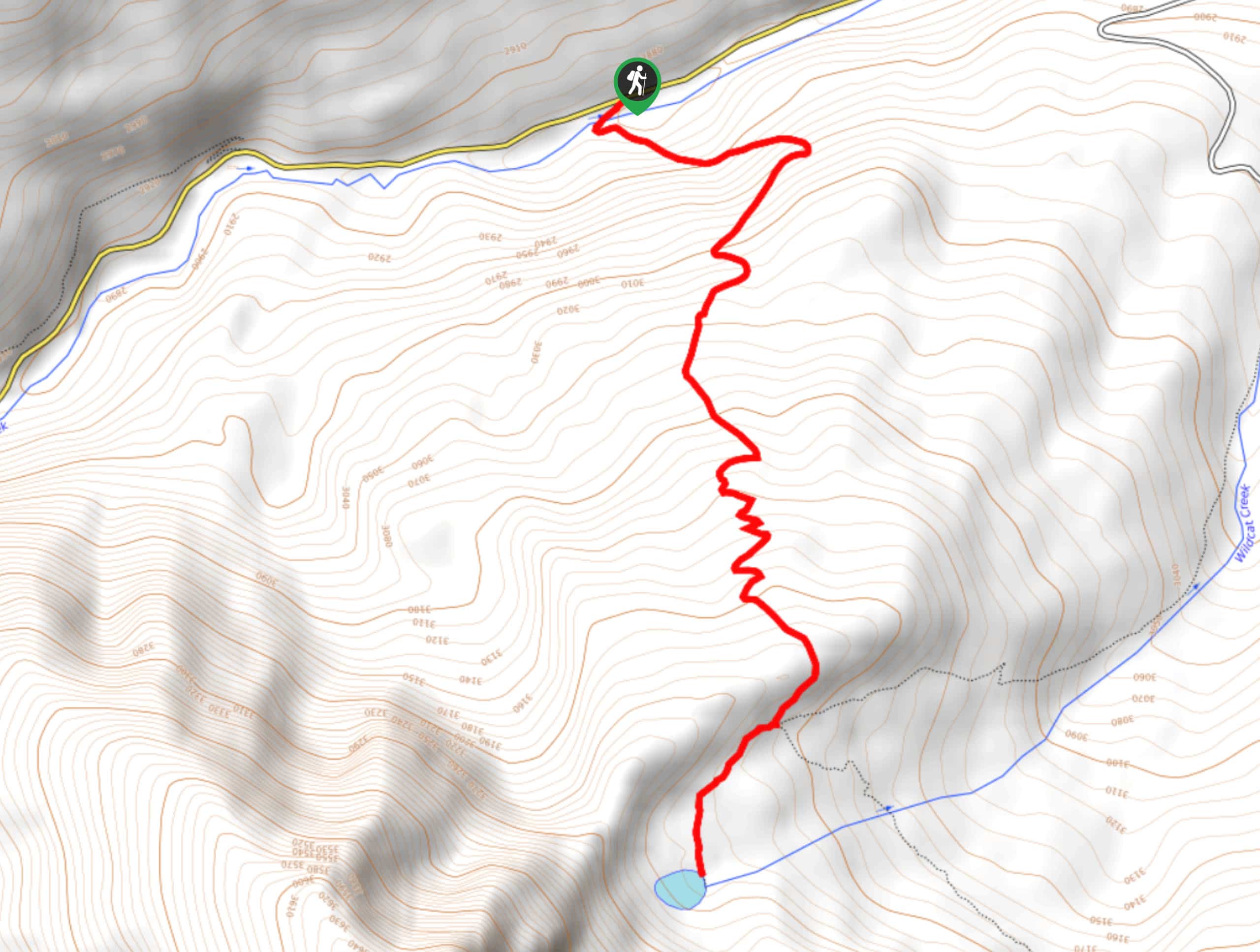
County Line Trail Description
If you are looking to get the family out on the trails and want to do so along a laidback and easy to manage route, then the County Line Trail will be a great option near Grand Mesa that will allow you to explore the natural beauty of the region.
Setting out from the trailhead alongside CR65, you will make your way to the northeast and keep right at the fork in the path to make your way through some light tree cover. Here, you will continue on to the northeast, enjoying the tranquil woodland setting as you stroll through intermittent meadows and make your way past the shores of Scales Reservoir 1.
After passing by the water’s edge, you will keep on to the northeast to loop around Scales Reservoir 3, eventually turning to the southwest in order to meet up with Forest Service Road 118. Here, you will make your way along the road to the southwest and it passes by the two reservoirs. Shortly after passing by Scales Reservoir 1, you will pick up a footpath branching off to the left and follow it back through the forest to the southwest on the return to the trailhead.
Similar hikes to the County Line Trail hike
Prospector Trail
The Prospector Trail is a fun hiking adventure near Crested Butte, Colorado that will take you uphill for beautiful views…
Lily Lake Trail #639
The Lily Lake Trail #639 is an easy-going hiking route in the Elk Mountains of Colorado that will lead you…
Green Lake via Carbon Trail
The Green Lake via Carbon Trail is an amazing experience in Crested Butte, Colorado that will take you to a…
Comments