Castle and Conundrum Peaks Hike
View Photos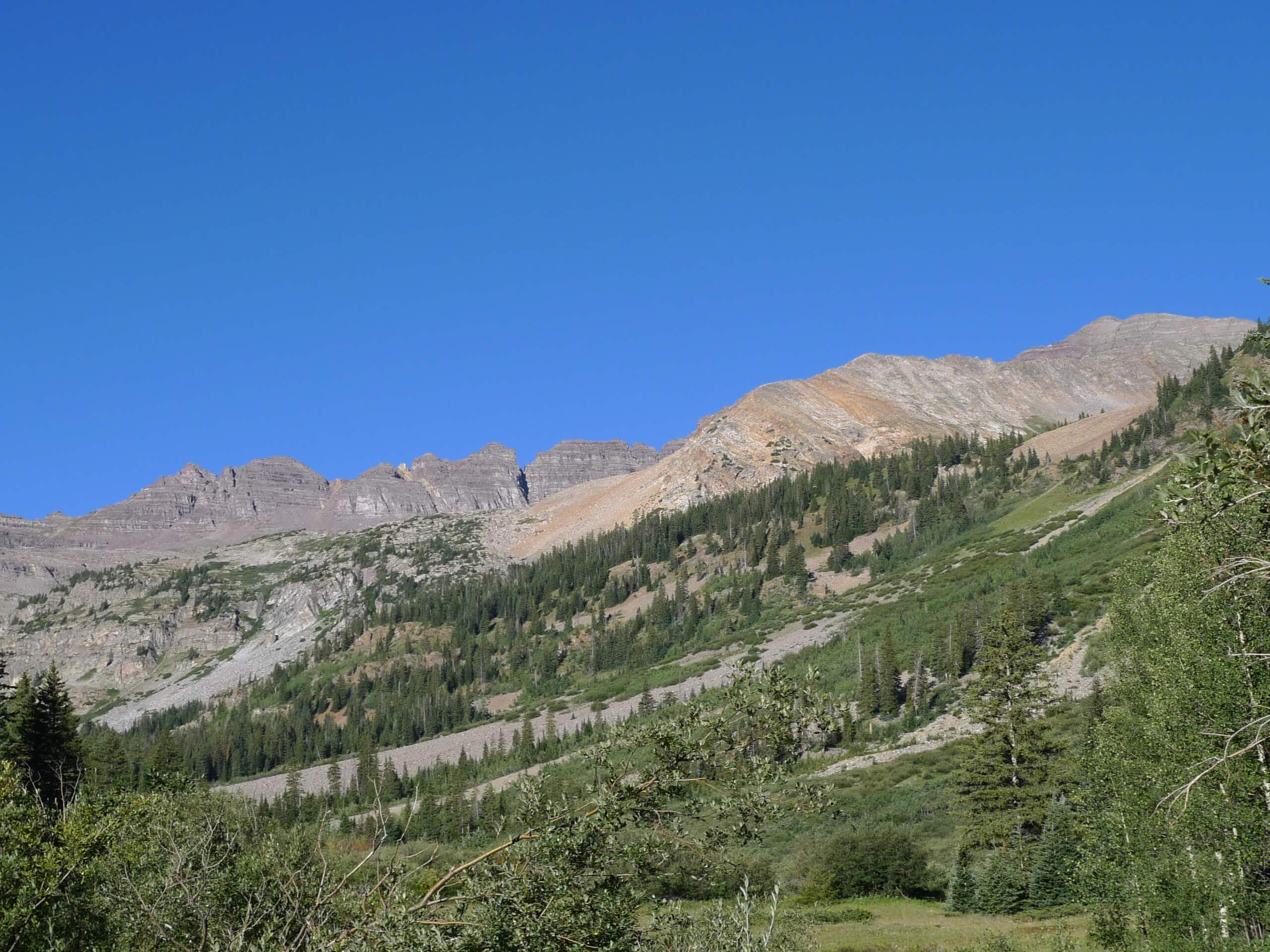
Castle and Conundrum Peaks Hike
Difficulty Rating:
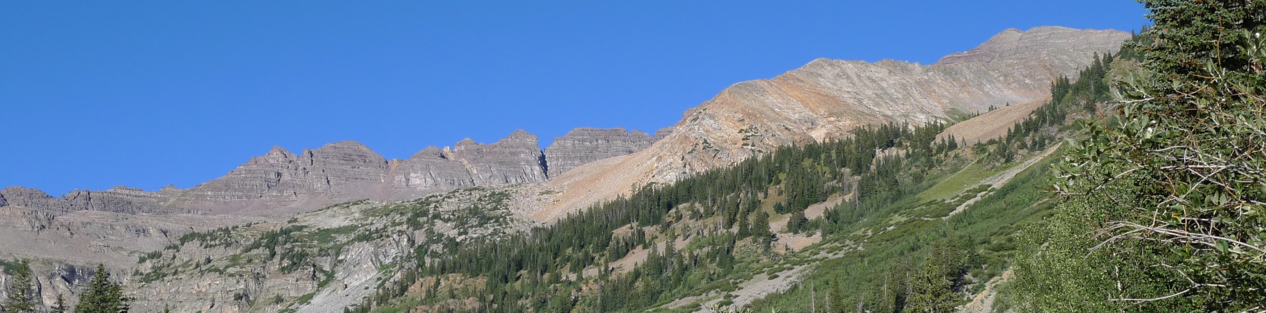
The Castle and Conundrum Peaks Hike is an exceptional hiking route in Colorado that will lead you to the tallest summit in the entire Elk Mountains Range. While out on the trail, you will hike alongside Castle Creek and traverse permanent snowfields on the way to the basin, where you will then climb to the top of a rugged ridge that will lead you to the summit. This is a beautifully scenic trail; however, the dramatic terrain and permanent snow fields along the route mean that it is suitable only for very experienced hikers.
Getting there
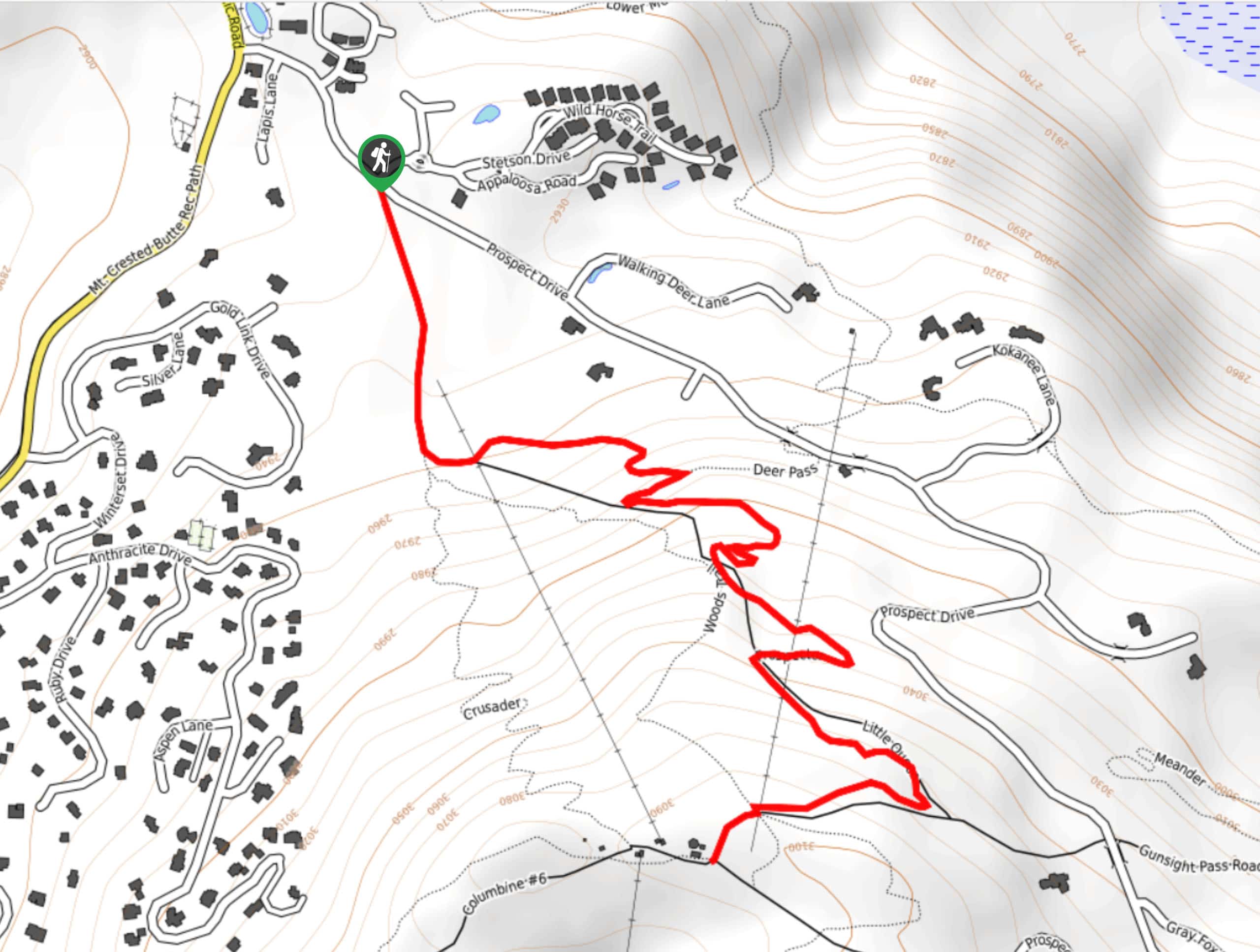
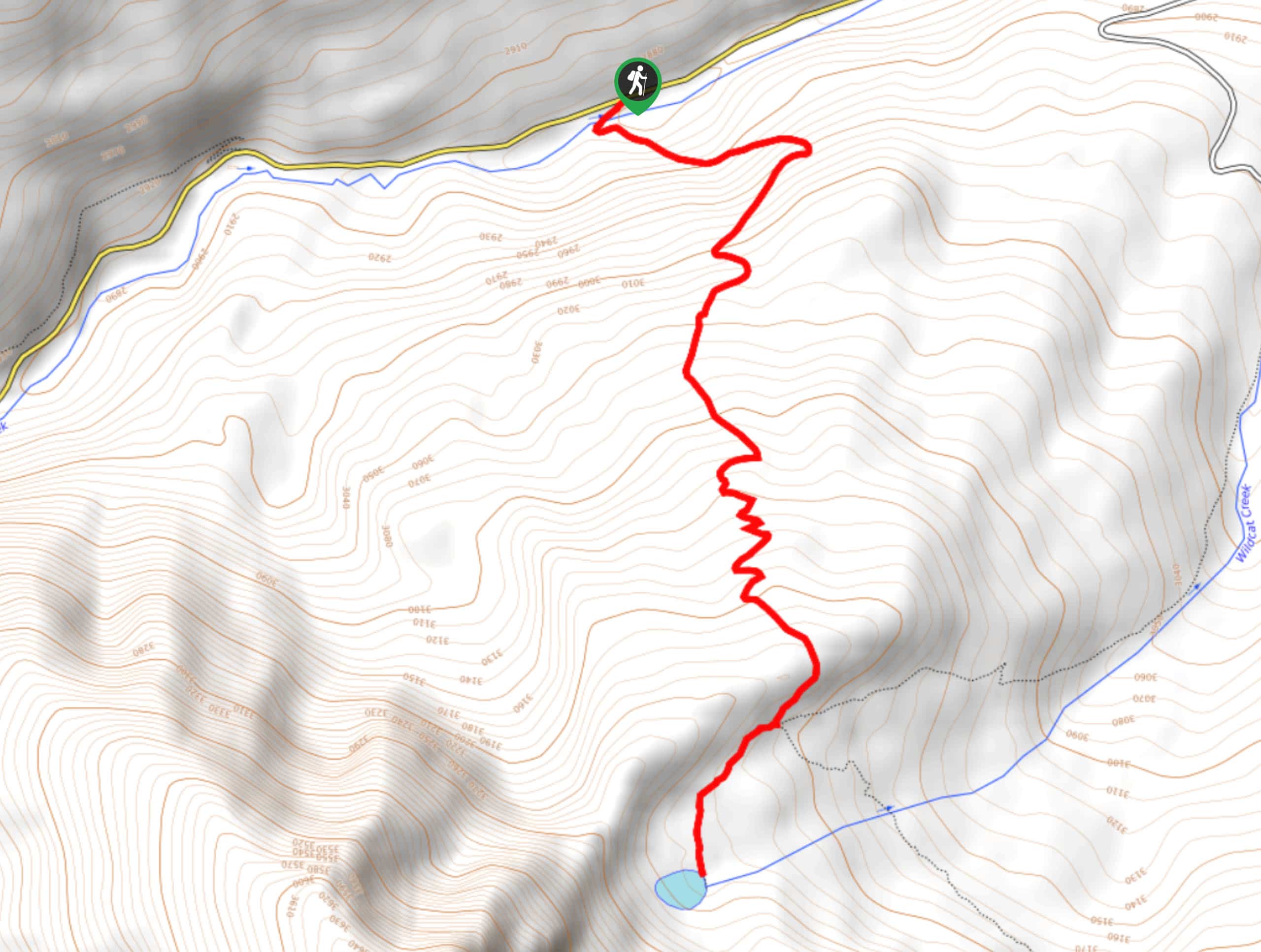
The starting point for the Castle and Conundrum Peaks Hike can be found at the Castle Creek Trailhead along CR15/Castle Creek Road.

About
| Backcountry Campground | Tagert Hut, Green-Wilson Hut |
| When to do | March-November |
| Pets allowed | Yes - On Leash |
| Family friendly | No |
| Route Signage | Average |
| Crowd Levels | Moderate |
| Route Type | Out and back |
Castle and Conundrum Peaks Hike
Elevation Graph
Weather
Castle and Conundrum Peaks Hike Description
For those intrepid adventurers looking for a thrill in the Elk Mountains of Colorado, why not try the Castle and Conundrum Peaks Hike, where you can work your way across permanent snowfields to reach the tallest peak in the area.
Setting out from the trailhead, you will hike uphill to the southwest alongside the rushing waters of Castle Creek, before arriving at a junction near the Tagert and Green-Wilson huts. From here, you will make your way to the northwest and begin climbing more sharply uphill towards the snowfields and basin below Castle Peak.
Here, you will need to traverse the snowfields to continue working your way uphill. The easiest way to do this is to work your way along the left side of the basin and make an ascending traverse of the snowfields, where you will eventually find a clear trail on the left leading up to the top of the ridge. Continuing straight along the top of the ridge, you will eventually reach the summit of Castle Peak, where you will enjoy breathtaking views from the tallest peak in the Elk Mountains. Following the trail to the northwest will lead you to the slightly lower, but no less scenic summit of Conundrum Peak.
After experiencing both of these spectacular peaks, you will head back along the ridgeline and descend into the snowfields, working your way through the basin and along Castle Creek for the return to the trailhead where you began.
Similar hikes to the Castle and Conundrum Peaks Hike hike
Prospector Trail
The Prospector Trail is a fun hiking adventure near Crested Butte, Colorado that will take you uphill for beautiful views…
Lily Lake Trail #639
The Lily Lake Trail #639 is an easy-going hiking route in the Elk Mountains of Colorado that will lead you…
Green Lake via Carbon Trail
The Green Lake via Carbon Trail is an amazing experience in Crested Butte, Colorado that will take you to a…
Comments