South West Coast Path: Woolacombe to Barnstaple
View Photos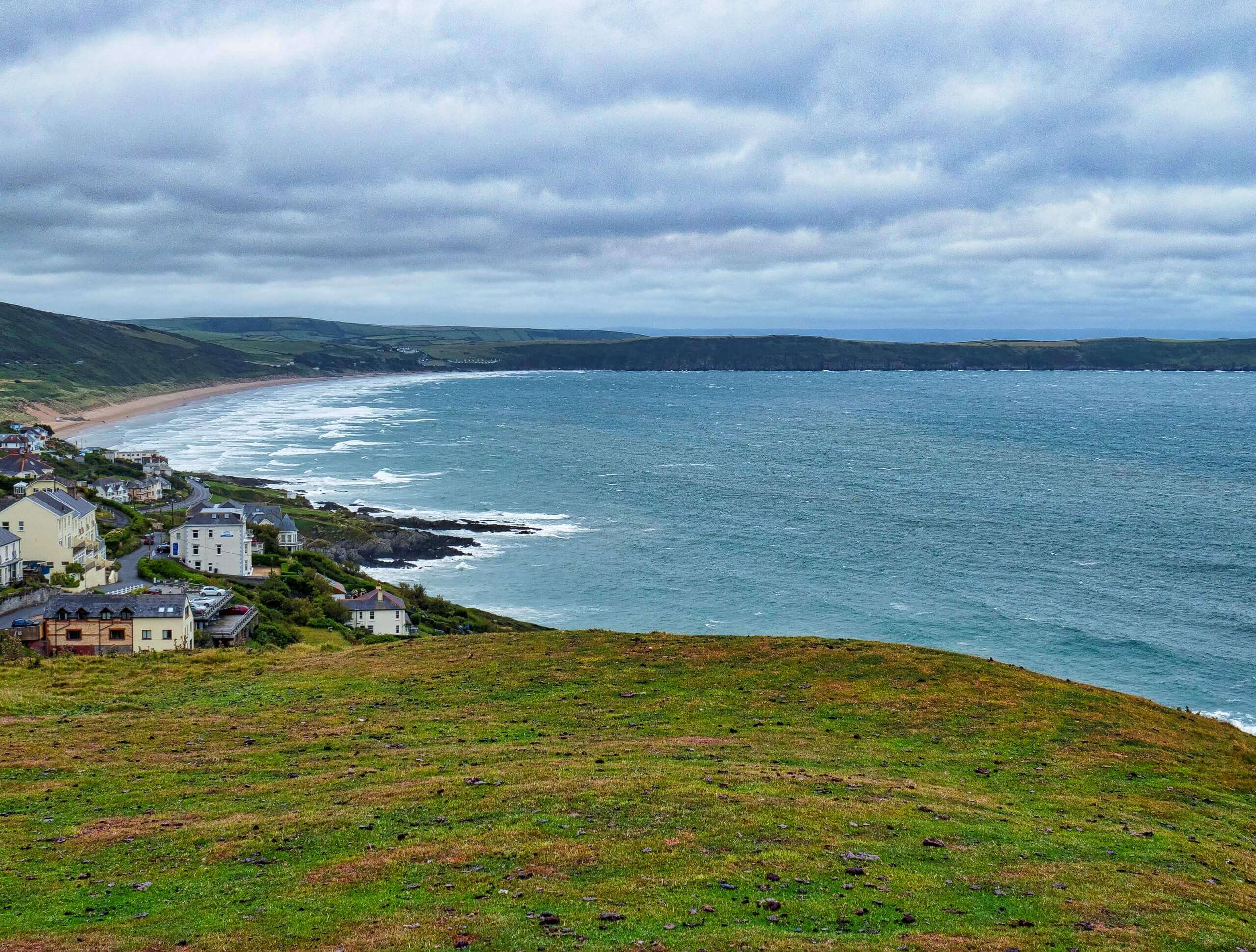
South West Coast Path: Woolacombe to Barnstaple
Difficulty Rating:
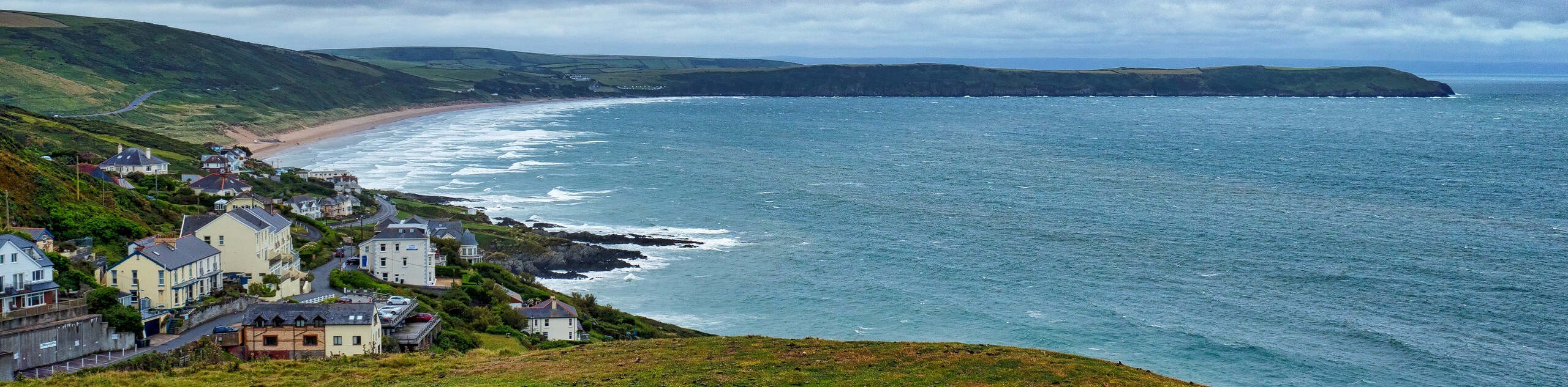
The South West Coast Path: Woolacombe to Barnstaple is a long but beautifully scenic walk that will expose you to views along the Devon Coast. Travelling between Wollacombe and Barnstaple, this route will take you along the water’s edge and provide some nice views not only of the Bristol Channel, but also of the Taw and Torridge estuaries. This is a one-way walk, so make sure to pre-arrange your travel plans for the return back to the starting point of the walk.
Getting there
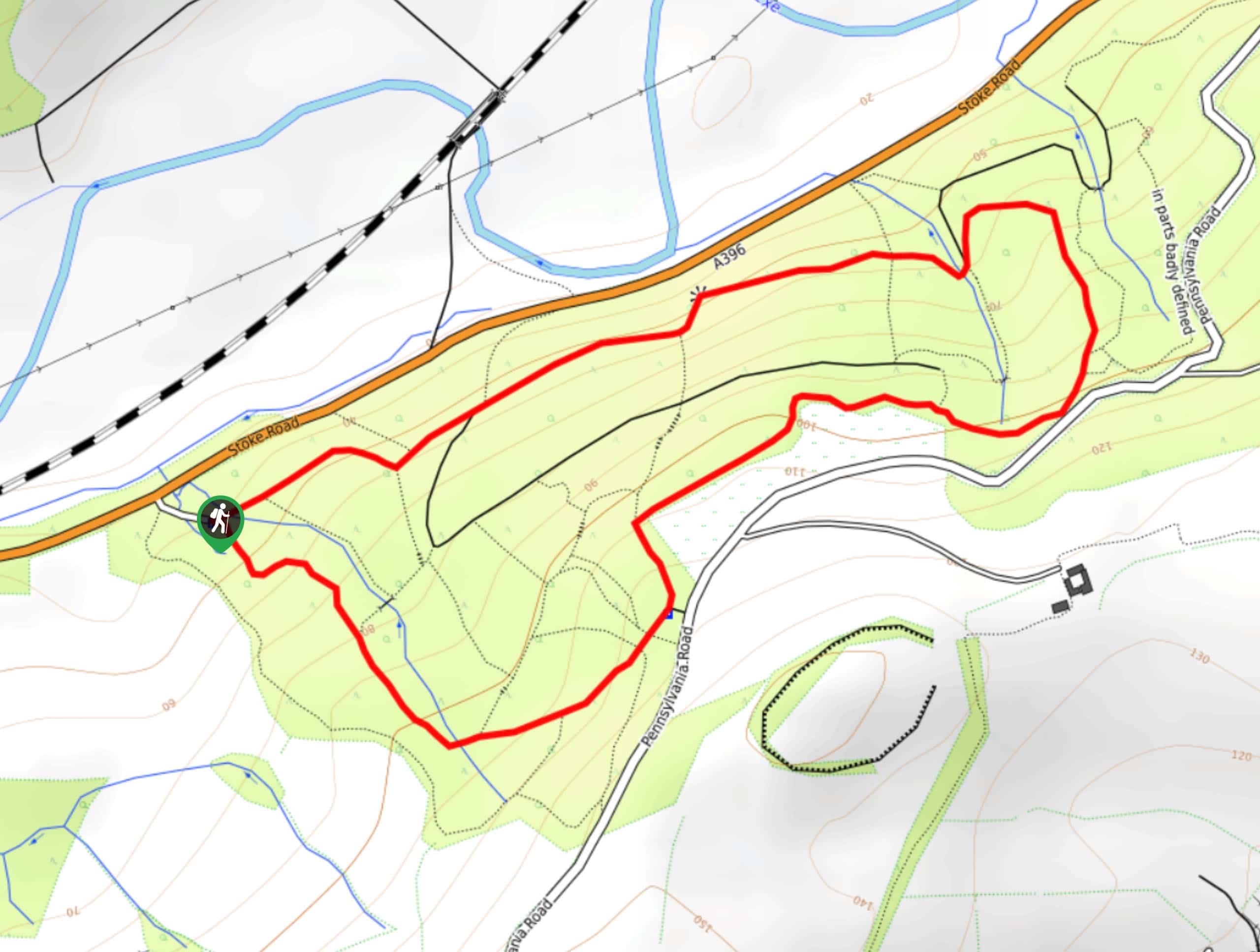
To get to the South West Coast Path: Woolacombe to Barnstaple trailhead from Ilfracombe, head south on Church Street/A361 for 2.0mi and take the third exit at the roundabout onto B3343. Follow this for 3.8mi and the road will turn into Challacombe Hill Road. Continue on for 235ft and turn right to enter the car park.

About
| Backcountry Campground | Mitchum’s Campsite, Ruda Holiday Park |
| When to do | Year-Round |
| Pets allowed | Yes - On Leash |
| Family friendly | No |
| Route Signage | Average |
| Crowd Levels | Moderate |
| Route Type | One Way |
South West Coast Path: Woolacombe to Barnstaple
Elevation Graph
Weather
South West Coast Path: Woolacombe to Barnstaple Trail Description
Walking the South West Coast Path: Woolacombe to Barnstaple differs from many of the other segments of this lengthy walk, in that a good portion of this trail travels further inland along the Taw and Torridge estuaries, providing a nice change of scenery from the view of open water that characterize the rest of the route. Setting out from the car park in Woolacombe, you will make your way south along Woolacombe Sands Beach and Baggy Point, following the rugged terrain of the coastline before turning slightly inland. From here, you will make your way east towards Barnstaple, enjoying the beautiful views of the Torridge and Taw estuaries. Eventually, you will arrive at the end point of the walk in Barnstaple along the banks of the River Taw.
Similar hikes to the South West Coast Path: Woolacombe to Barnstaple hike
Exmouth and Dawlish Warren Walk
Walking the Exmouth and Dawlish Warren Trail is a beautifully scenic but physically demanding excursion in Devon that will see…
Stoke Woods Circular Walk
The Stoke Woods Circular Walk is a quick and fairly easy adventure near Exeter that will expose you to some…
Ottery Saint Mary Woodland Walk
The Ottery Saint Mary Woodland Walk is a great excursion in Devon that features some relatively easy to manage terrain…
Comments