Hartland Point Walk
View Photos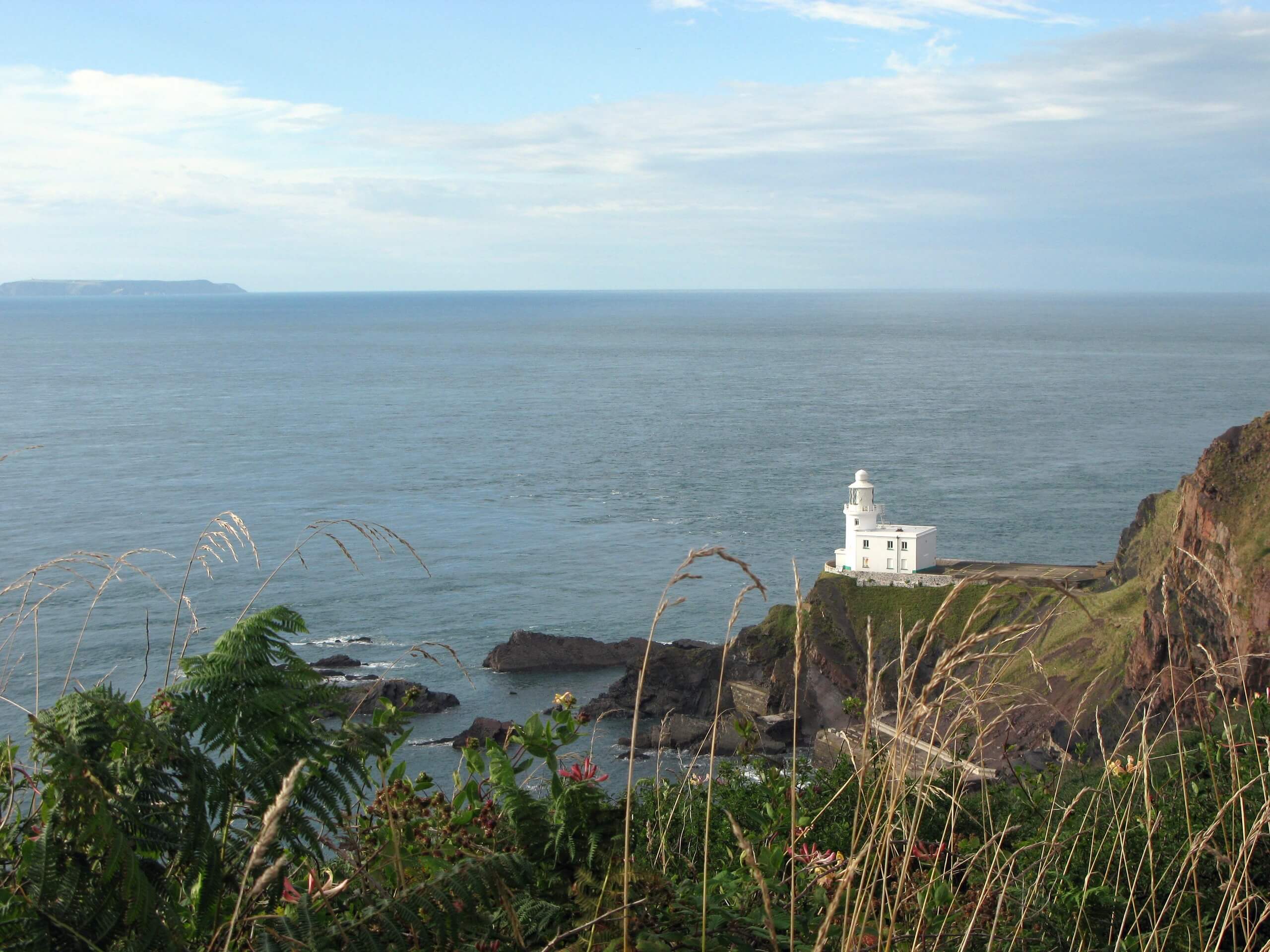
Hartland Point Walk
Difficulty Rating:
Walking along Hartland Point is a wonderful way to experience the scenic coastal areas that can be found in Devon. While out on the trail, you will meander along the rugged coastline and pass by a radar station, lighthouse, and war memorial, all while taking in some spectacular views across the Bristol Channel. What a fantastic way to spend a lazy weekend afternoon on the trails.
Getting there
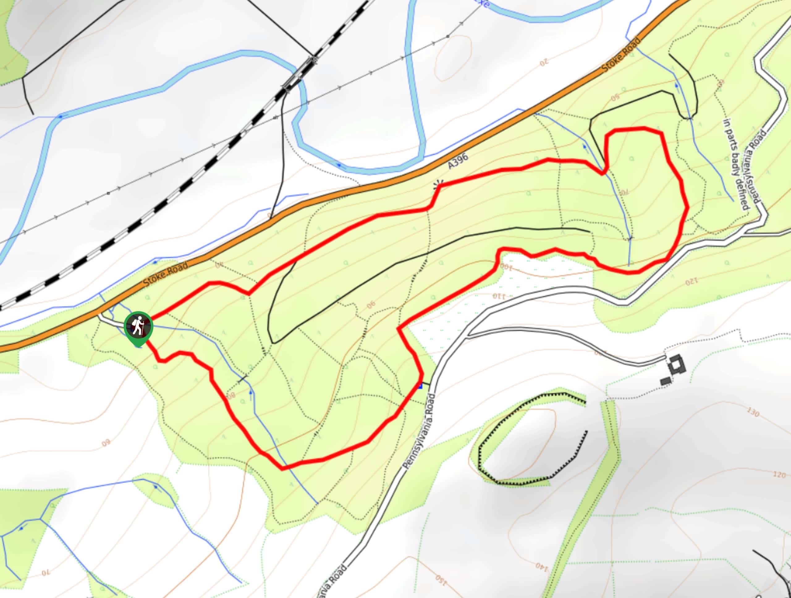
To reach the trailhead for the Hartland Point Walk from Hartland, drive north on E Ball Hill for 1.6mi and make a slight left to continue on for 0.6mi. Make another left here and follow the road for 0.7mi before turning right. You will arrive at the car park in 470ft.

About
| When to do | Year-Round |
| Backcountry Campsites | No |
| Pets allowed | Yes - On Leash |
| Family friendly | Yes |
| Route Signage | Average |
| Crowd Levels | High |
| Route Type | Out and back |
Hartland Point Walk
Elevation Graph
Weather
Hartland Point Walk Description
There is no doubt that the Hartland Point Walk is a wonderful excursion along the coast of Devon; however, the terrain surrounding this route is fairly rugged and features some rocky dropoffs. Make sure to wear good walking shoes and keep an eye on any children if you are walking near the edge of the trail. Additionally, parking can become a bit limited during peak season, so be sure to arrive early in order to secure a space and enjoy some peace and quiet while you gaze out across the water.
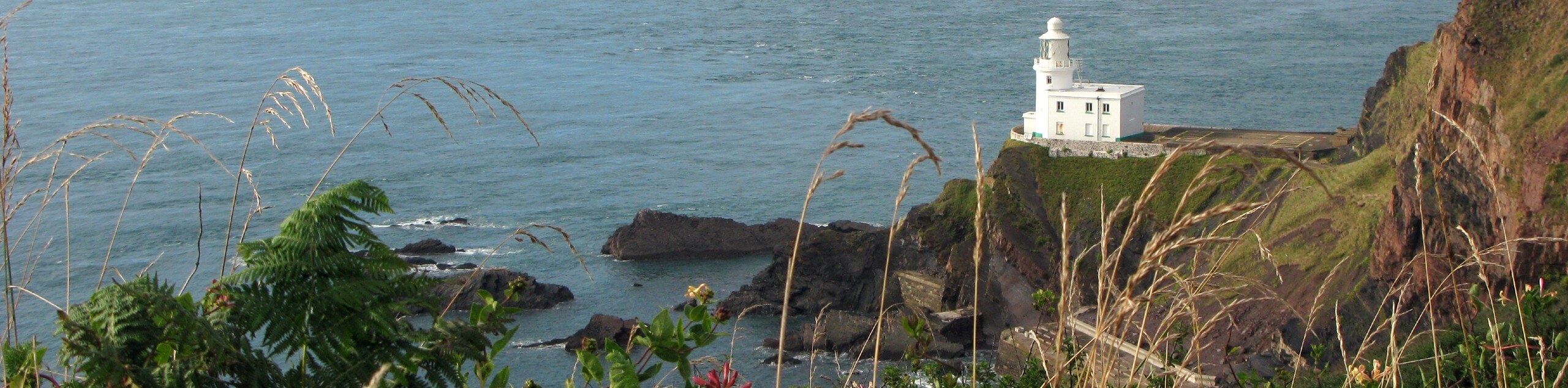
Even with the rocky terrain surrounding the trail, this is a fantastic route that can be enjoyed by walkers of nearly every skill level. The stunning views across the Bristol Channel and the charming coastal landscape are truly beautiful to behold, and make for the perfect backdrop to your walk, no matter the weather. With points of interest like the radar station, lighthouse, and memorial to the HMHS Glenart Castle that was sunk by a German U-boat in 1918, this route will appeal to more than just nature lovers, making it an ideal for a fun weekend walk with friends and family.
Setting out from the car park, you will pass by a little place where you can grab some pre/post-walk refreshments known as The Point. From here, continue on to the northwest corner of the parking lot and pick up the footpath, following it to the east. This initial 0.3mi stretch of trail will take you along the coast towards a radar station, where you will enjoy some lovely views across the Bristol Channel that stretch out to South Wales and Lundy Island on a clear day. From here, turn around and retrace your steps to return back to the trailhead.
At the junction next to the car park, head straight through and make your way to the west along the rugged coastal terrain to arrive at the Coast Guard station. 0.2mi further to the southwest, you will arrive at a memorial for the HMHS Glenart Castle, a converted hospital ship that was sunk in 1918 near the end of the First World War. Continue south along the coastal trail for another 0.5mi, taking some time to appreciate the beautiful views along the rugged shoreline, before arriving at the end of the route along a cliffside that overlooks a rocky beach. After taking in the views, head back along the same trail to return to the car park having completed the Hartland Point Walk.
Trail Highlights
HMHS Glenart Castle Memorial
This First World War monument was erected along the coast at Hartland Point as a memorial to the sinking of the HMHS Glenart Castle, a steam ship that was converted for use as a hospital ship and was sunk in 1918 by a German U-boat. Of the crew, medical personnel, and patients on board, 162 people died, (including Captain Bernard Burt) while only 32 people survived.
Frequently Asked Questions
Can you see Wales from Hartland Point?
Yes. From the lighthouse on Hartland Point, you will have an amazing sightline across the Bristol Channel to South Wales and Lundy Island.
Insider Hints
Make sure to wear proper walking footwear for this journey.
Bring binoculars for some amazing views of local bird species and the terrain along the coast.
Similar hikes to the Hartland Point Walk hike
Stoke Woods Circular Walk
The Stoke Woods Circular Walk is a quick and fairly easy adventure near Exeter that will expose you to some…
Ottery Saint Mary Woodland Walk
The Ottery Saint Mary Woodland Walk is a great excursion in Devon that features some relatively easy to manage terrain…

Exe Valley Way
The Exe Valley Way is a long distance walking route in Devon that will expose you to the picturesque countryside.…
Comments