Travois Trail
View Photos
Travois Trail
Difficulty Rating:
Travel through meadowlands, beneath the shade of towering pines, and scramble up rocky ridges on the Travois Trail. This scenic adventure packs a punch and is reserved for intrepid explorers who don’t mind getting their hands dirty. The incredible scenery and sights of wildlife attract outdoor enthusiasts of all sorts—it may be one of our favorite day hikes near Denver, and we think it could be yours too.
Getting there
The Travois Trail departs from the trailhead and parking lot at the end of the Camino Perdido.

About
| Backcountry Campground | No |
| When to do | Year-round |
| Pets allowed | Yes - On Leash |
| Family friendly | No |
| Route Signage | Poor |
| Crowd Levels | High |
| Route Type | Circuit |
Travois Trail
Elevation Graph
Weather
Travois Trail Description
Wildlife, wilderness, and wicked terrain, the Travois Trail is a crowd favorite. Due to the trail’s popularity, there are allocated days for foot traffic and bikers. On the weekends, you can only bike on even-numbered days, but on weekdays the route is multi-use so you can hike or bike. If you are seeking a more secluded excursion, make sure to arrive nice and early. It is also worth noting that sections of this hike are subject to wildlife and hunting closures, so be sure to check the bulletin at the trailhead for updates. This hike weaves between grassy exposed sections and shaded woodlands, so be sure to pack plenty of water as there are only a few streams along the route.
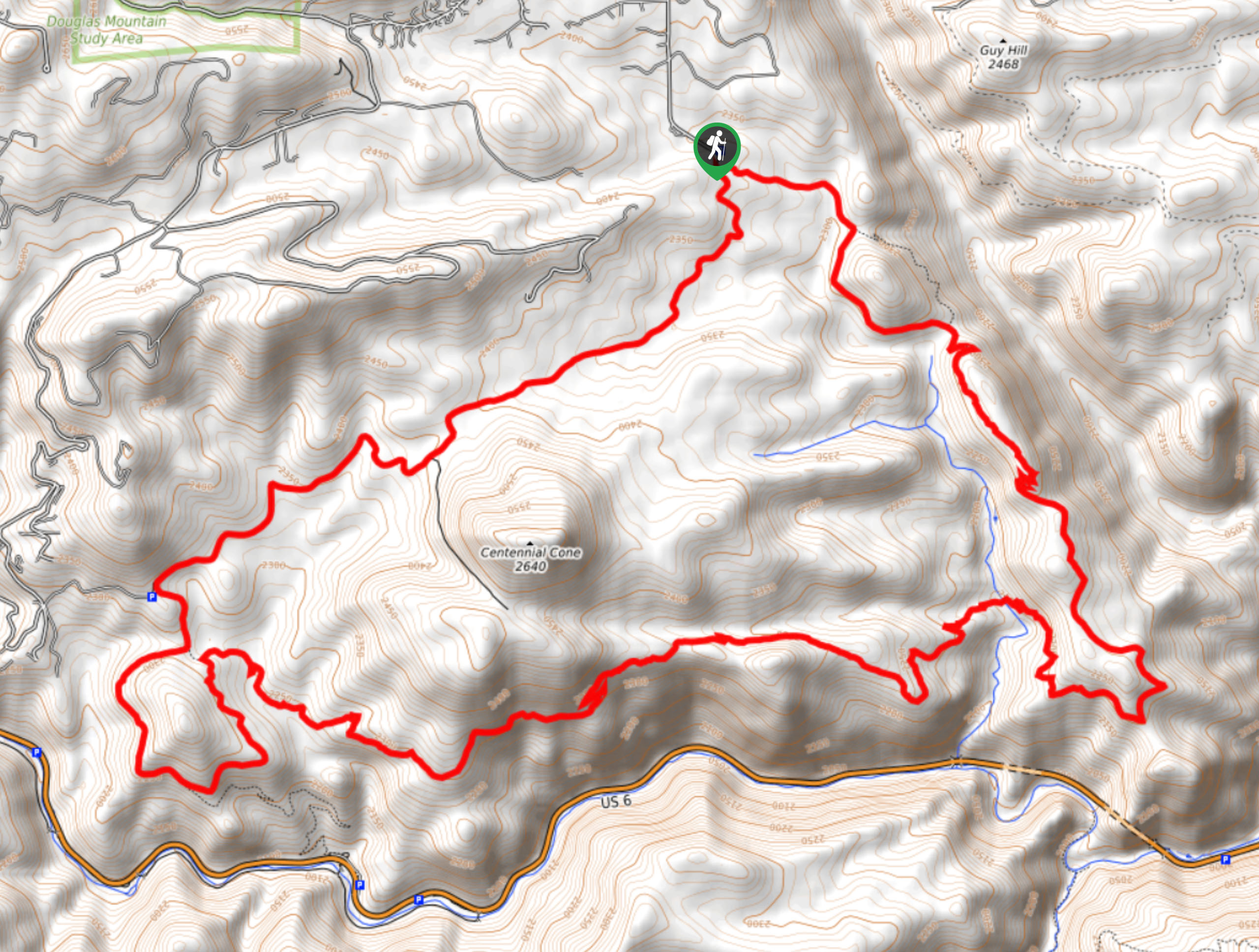
The Travois Hike can be completed in either direction, but we suggest trekking clockwise. Begin your hike from the trailhead and track southeast on the Travois Trail. Shortly after your departure, you will confront an intersection, keep right here and you will be diverted onto the Evening Sun Loop. You will hike briefly along this route before merging back onto the Travois Trail. Trek along the undulating path through the diverse terrain, crossing a bridge over a babbling brook which reveals sights of Clear Creek Canyon below. Eventually, you will meet another intersection, turn left onto the Mayhem Gulch Trail then right onto the Juniper Trail. This loop will quickly reconnect with the Travois Trail.
Continue north along the Travois Trail, merging onto the Elk Range Trail at the next junction. Hike northeast along this route, keeping an eye out for grazing elk as you travel through the luxuriant meadows. Follow this path all the way back to the trailhead and parking lot, marking the end of your adventure.
Similar hikes to the Travois Trail hike

Singletree and Mayhoffer Trail
The Singletree and Mayhoffer Trail is a scenic adventure that will guide adventurers through the lush meadowlands that reveal sights…

Mount Galbraith via Cedar Gulch Trail
The Mount Galbraith via Cedar Gulch Trail is a charming adventure near Golden, Colorado that reveals the beauty and diversity…
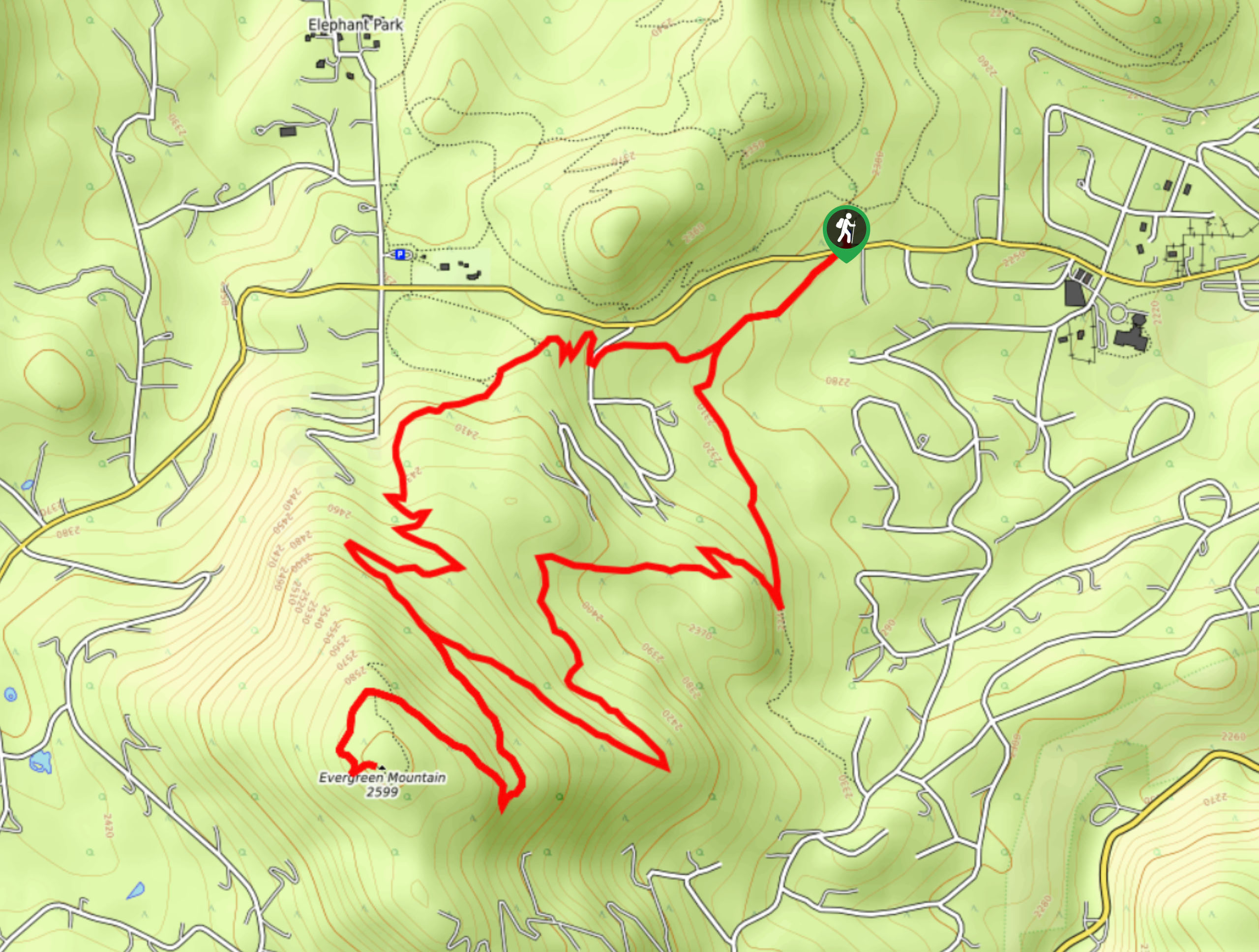
Evergreen Mountain Summit Hike
The Evergreen Mountain Summit Hike is a charming adventure near Denver, CO. As you travel the enchanted woodland path, you…
Comments