Mount Morrison Trail
View Photos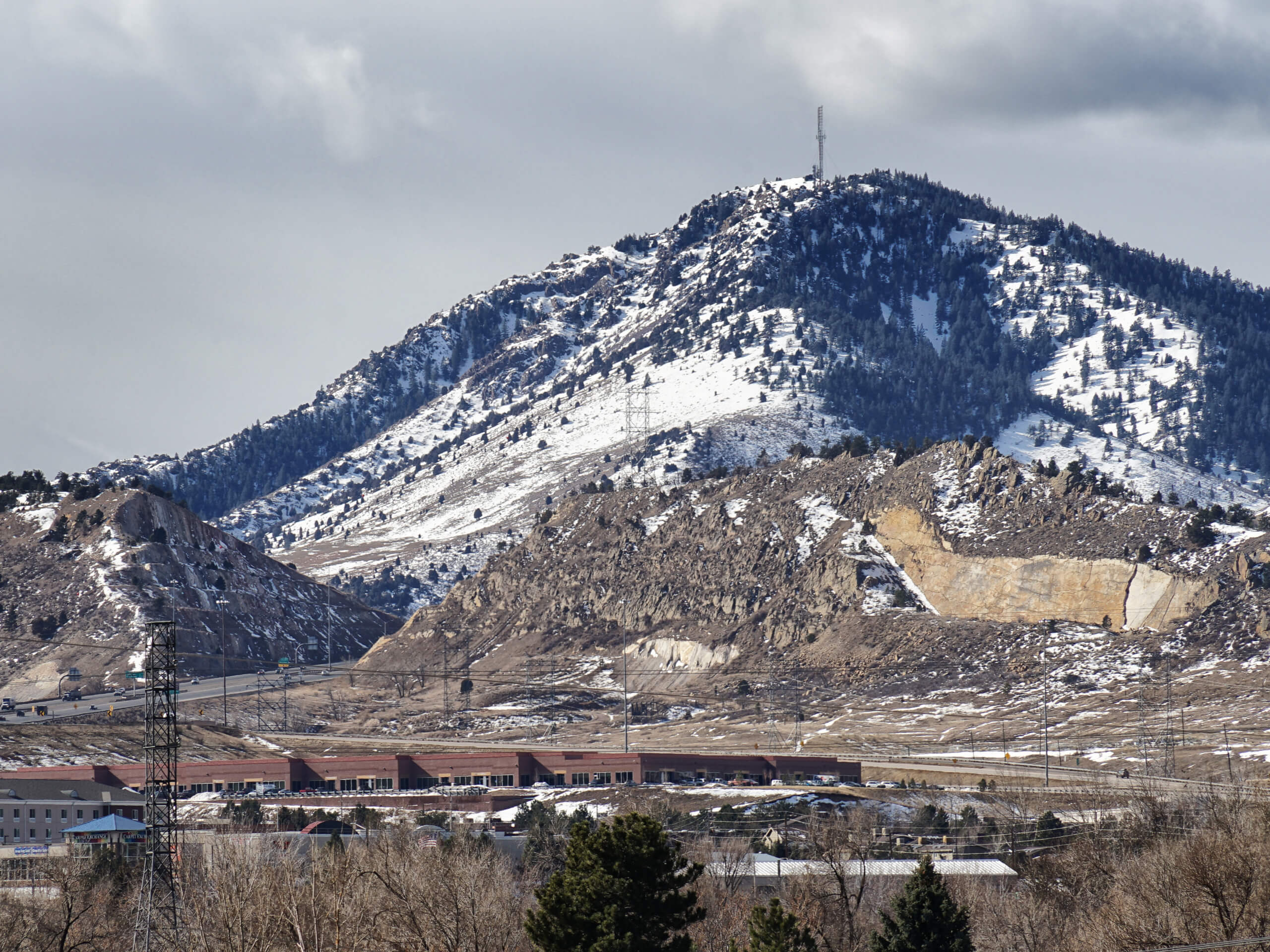
Mount Morrison Trail
Difficulty Rating:
The Mount Morrison Trail is an awesome hike reserved for intrepid adventurers. Short but steep, this trail packs a punch! Hike up the exposed terrain and scramble up the rocky path to the summit, which provides insanely beautiful vistas of the mountain range and cityscape.
Getting there
The Mount Morrison Hike departs from the trailhead off Titans Road.

About
| Backcountry Campground | No |
| When to do | June-October |
| Pets allowed | Yes - On Leash |
| Family friendly | No |
| Route Signage | Poor |
| Crowd Levels | High |
| Route Type | Out and back |
Mount Morrison Trail
Elevation Graph
Weather
Mount Morrison Trail Description
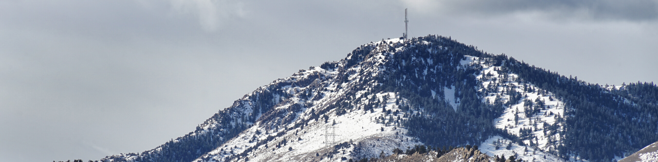
The Mount Morrison Hike is a demanding excursion up to the summit of Mount Morrison, which reveals 360-degree, panoramic views of the surrounding Colorado wilderness. Challenge yourself as you venture up to the summit. This leg-burner of a hike will get your heart pumping as you scramble up the rocky terrain. Wear sturdy footwear to avoid a rolled ankle and consider trekking poles to help navigate the vertiginous trail. Keep an eye out for rattlesnakes bathing along the exposed path, be mindful of your footing and keep your dog on a short leash. Note this path is subject to seasonal closures, ensure to check the bulletin for updates.
We love a challenge, and the Mount Morrison Hike provides just that. This route exhibits the diversity of the Colorado wilderness as you hike along the ridge that reveals awe-inspiring views of the city, plains, red rock, Front Range snow-capped peaks, and foothills. Leave the city in the rear-view mirror and reconnect with nature along this journey. Enjoy sights of the Red Rock Amphitheatres from the summit, and if you are lucky, you may even be able to hear a concert from the path. This is a great day hike near Denver, and if you don’t mind a bit of a push, then we know you will love it too.
Embark on your adventure from the trailhead off Titans Road. This route is not an official trail, so there is no trail name or an explicit trailhead, but the path is easy to navigate. Immediately from the trailhead, you will have to begin your ascent. This path follows an incline all the way to the summit, so you will surely break a sweat. Hike northwest up the path, noticing South Dinosaur Park and Red Rock Park. Soon the path will curve west, revealing sights of Mount Falcon in the East.
Continue along the exposed route and it will guide you north, exposing vistas of the Front Range Foothills. As you near the summit the route will become increasingly steep and warrant a scramble. Climb up the steep terrain up to Mount Morrison’s peak. Revel in the impressive views of the snow-dusted Front Range peaks, Green Mountain, and even Pikes Peak on a clear day. Take a break, admire the scenery, and when you are ready, retrace your footing along the path back to the trailhead.
Trail Highlights
Mount Morrison
Mount Morrison is a part of the Front Range Foothills that sits on the eastern boundary in Morrison, Colorado. Sitting at an elevation of 7881ft, Mount Morrison is an uninspiring peak that ranks 4,388th in Colorado summits. Though not the most impressive peak in the Range, it provides an epic adventure and rewards scenic Front Range vistas.
Insider Hints
Wear sturdy shoes to avoid rolled ankles
If you have joint issues, consider trekking poles to help navigate the steep terrain
Pack plenty of water as this path will surely tire you
Keep an eye and ear out for rattlesnakes
Similar hikes to the Mount Morrison Trail hike

Singletree and Mayhoffer Trail
The Singletree and Mayhoffer Trail is a scenic adventure that will guide adventurers through the lush meadowlands that reveal sights…

Mount Galbraith via Cedar Gulch Trail
The Mount Galbraith via Cedar Gulch Trail is a charming adventure near Golden, Colorado that reveals the beauty and diversity…
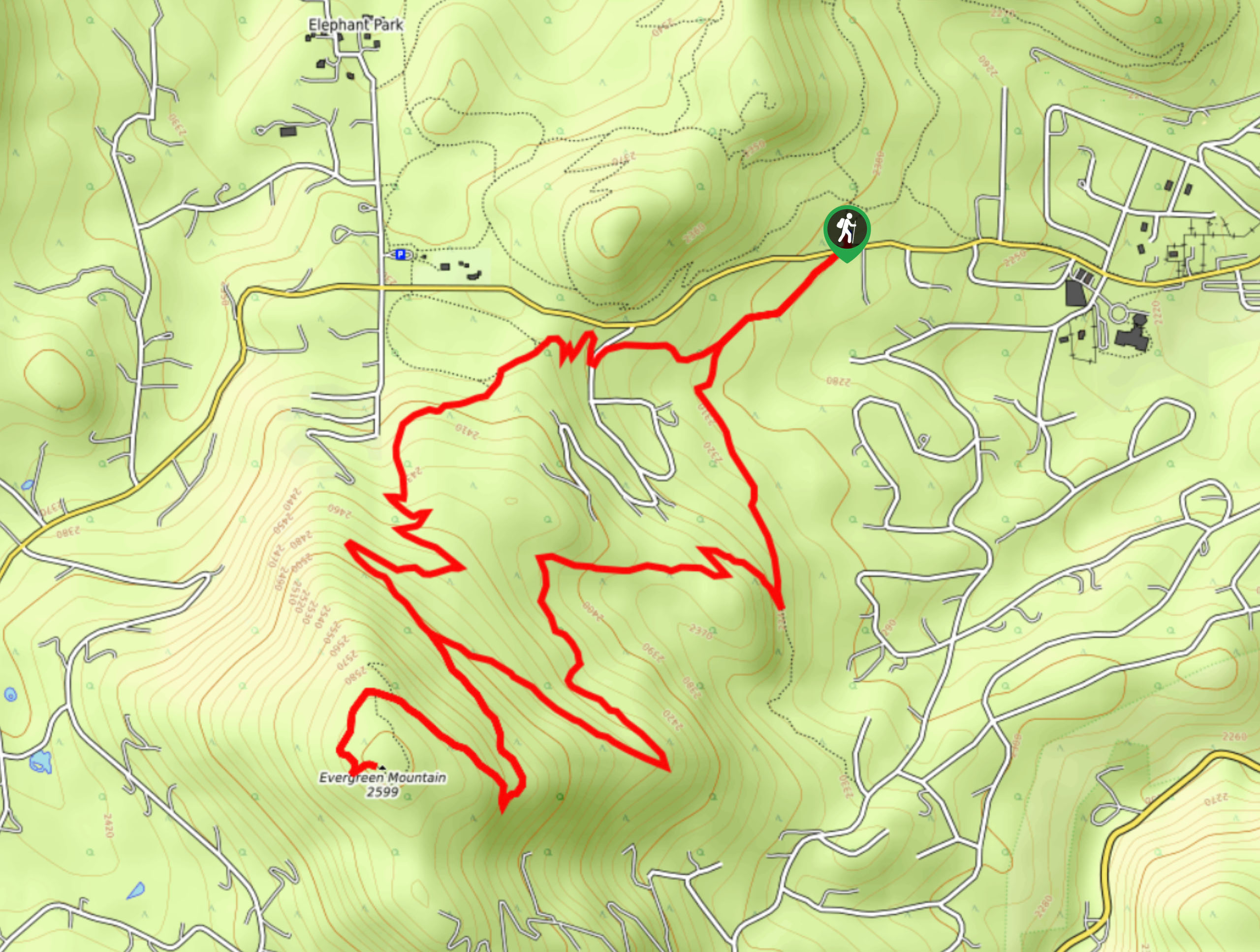
Evergreen Mountain Summit Hike
The Evergreen Mountain Summit Hike is a charming adventure near Denver, CO. As you travel the enchanted woodland path, you…
Comments