Coyote Trail
View Photos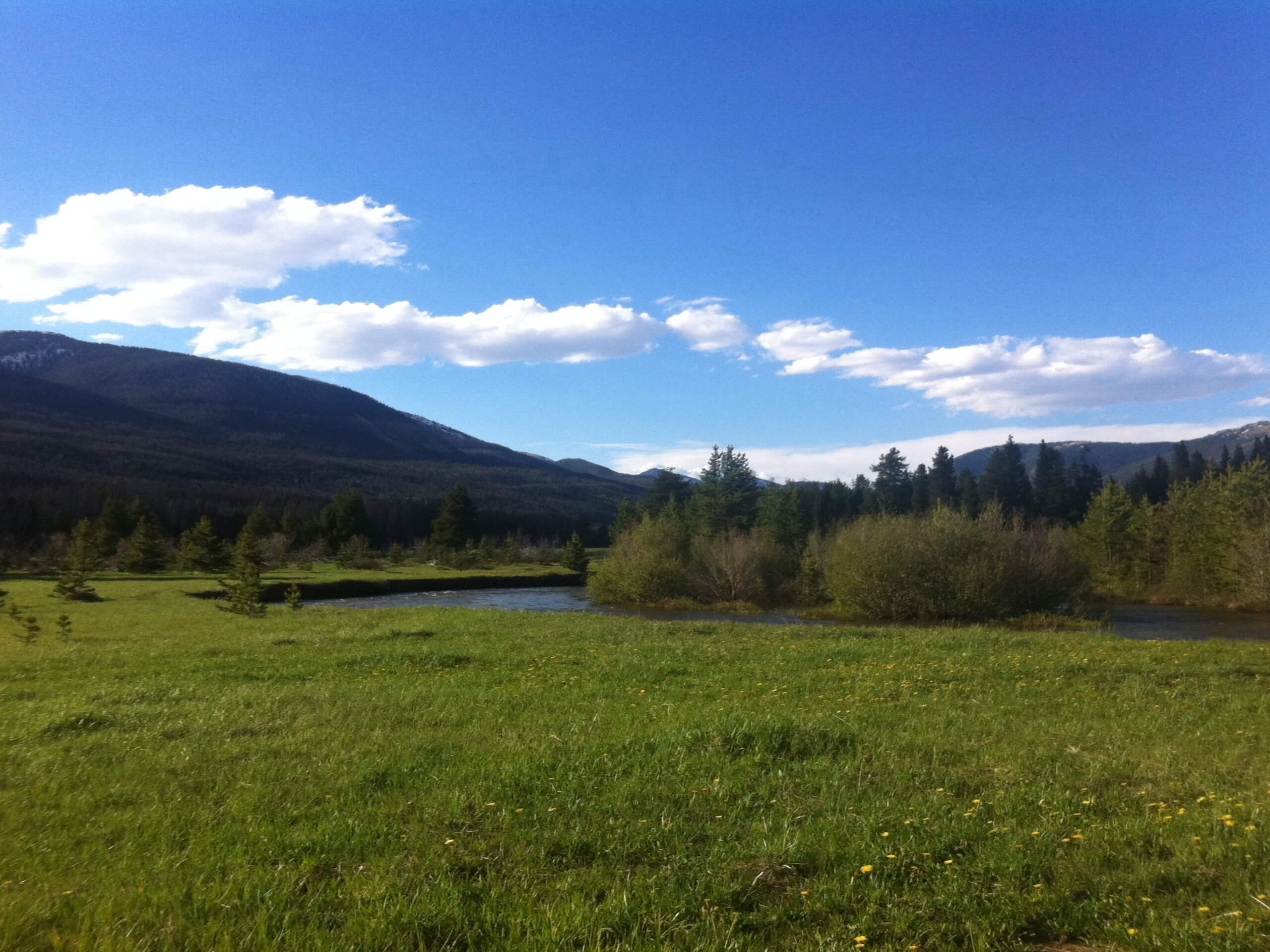
Coyote Trail
Difficulty Rating:
Contrary to the hike’s name, the Coyote Trail will likely exhibit sights of moose and deer rather than coyotes! Located in the Golden Gate Canyon State Park, the well-maintained Coyote Trail demonstrates the beauty of the Colorado wilderness as you trek through vibrant aspens, lush pines, and grassy meadowlands. This scenic, but steep excursion is a must add to your Denver day hikes adventure list.
Getting there
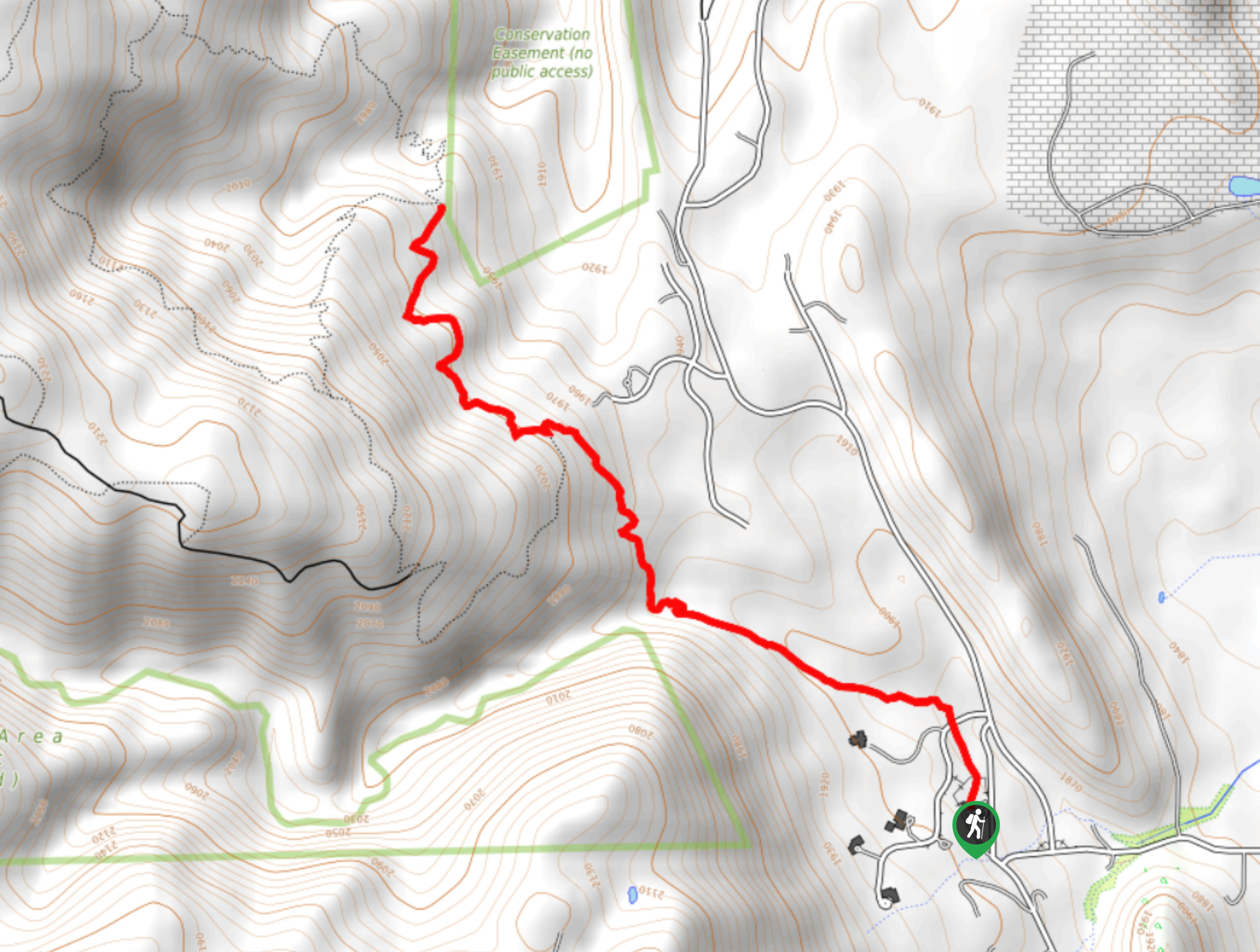
The Coyote Trail departs from the trailhead off Mountain Base Road in the Golden Gate Canyon State Park.

About
| Backcountry Campground | Frazer Mountain Campground |
| When to do | May-October |
| Pets allowed | Yes - On Leash |
| Family friendly | Older Children only |
| Route Signage | Average |
| Crowd Levels | High |
| Route Type | Out and back |
Coyote Trail
Elevation Graph
Weather
Coyote Trail Description
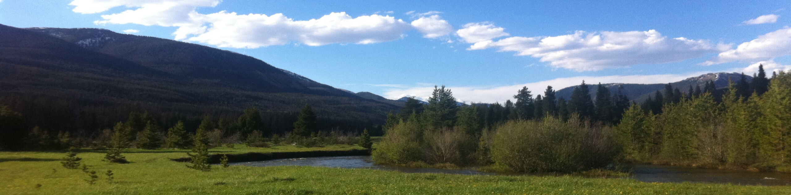
Contrary to popular belief, your chances of spotting a coyote on the Coyote Trail are small compared to the possibility of seeing moose and deer! We are suckers for wilderness hikes that reveal sights of the wildlife, and the Coyote Trail checks that box. Additionally, this path travels through golden aspen groves interspersed with towering pine trees—how could it get any better? Well, the trail also treks through a meadow, which reveals expansive vistas of the Front Range peaks that line the horizon! This hike really has it all, including a historic cabin that housed bootleggers who delivered skunk whiskey during the probation. Note that visitors are required to purchase a day pass to access the network of trails within the State Park; these passes typically cost about $6USD.
Embark on your adventure from the trailhead off Mountain Base Road. Climbing steeply from the trailhead, ascend the rocky terrain along the Coyote Trail. Hike through the vibrant aspens, past an abandoned steamroller, and up several wide switchbacks. Don’t let the initial ascent discourage you, the trail will level out in the meadow. As you scramble up the rocky route, mind your footing and keep an eye out for moose in the woods. After the switchbacks, the trail will plateau and lead you down into the grassy meadow. Enjoy the level terrain and keep your eyes peeled for grazing deer! Soon, you will meet the trail’s end at the dispersed campsites and the John Frazer Cabin.
Explore the cabin, reading the interpretive sign that depicts the story of the bootlegger’s cabin. Take a break and explore the luxuriant meadow before commencing your return. When you are ready, simply retrace your footing along the path back to the trailhead.
Similar hikes to the Coyote Trail hike

Singletree and Mayhoffer Trail
The Singletree and Mayhoffer Trail is a scenic adventure that will guide adventurers through the lush meadowlands that reveal sights…

Mount Galbraith via Cedar Gulch Trail
The Mount Galbraith via Cedar Gulch Trail is a charming adventure near Golden, Colorado that reveals the beauty and diversity…
Belcher Hill and Whippletree Trail
The Belcher Hill and Whippletree Trail is an exciting adventure—how could it not be with a name like that? The…
Comments