Buffalo Bill and Beaver Brook Trail
View Photos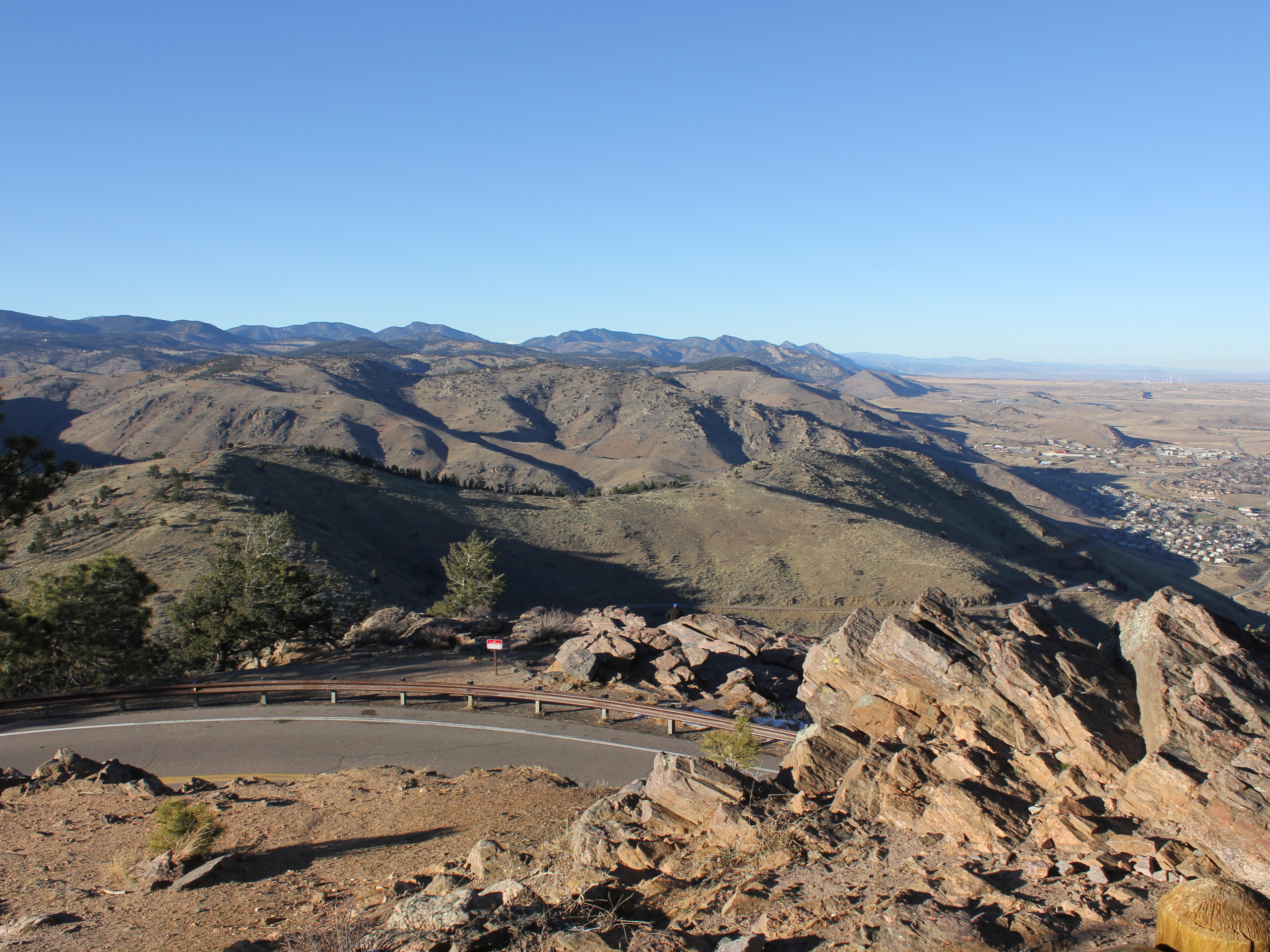
Buffalo Bill and Beaver Brook Trail
Difficulty Rating:
The Buffalo Bill and Beaver Brook Trail is a demanding adventure near Denver. Reserved for intrepid spirits, this hike is not for the faint of heart. If you are seeking a lengthy expedition that reveals the diversity of the Colorado wilderness, then the Buffalo Bill and Beaver Brook Trail will be right up your alley.
Getting there
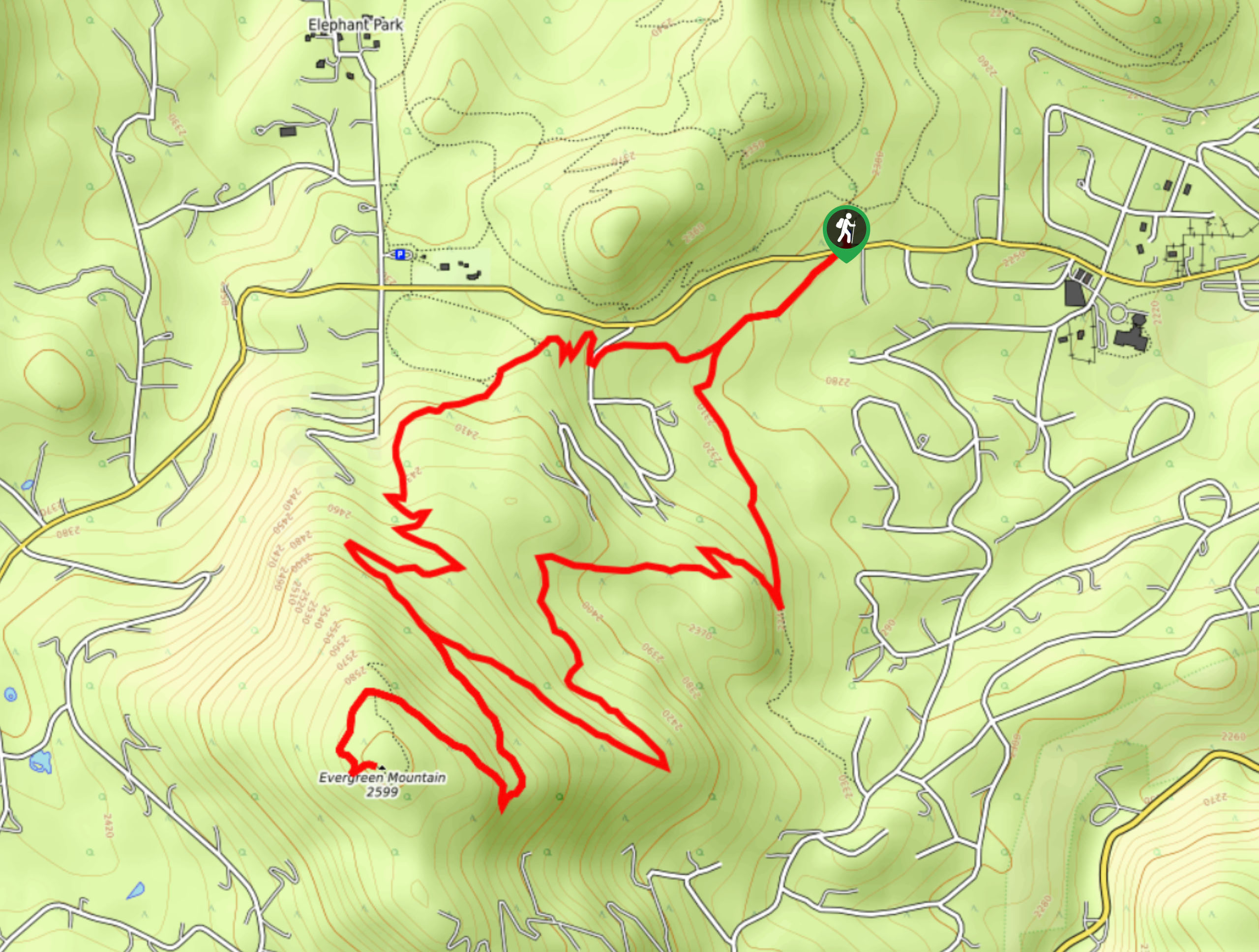
The Buffalo Bill and Beaver Brook Trail begins from the Buffalo Bill Trailhead off Lookout Mountain Road.

About
| Backcountry Campground | No |
| When to do | May-October |
| Pets allowed | Yes - On Leash |
| Family friendly | No |
| Route Signage | Average |
| Crowd Levels | Moderate |
| Route Type | Lollipop |
Buffalo Bill and Beaver Brook Trail
Elevation Graph
Weather
Buffalo Bill and Beaver Brook Trail Description
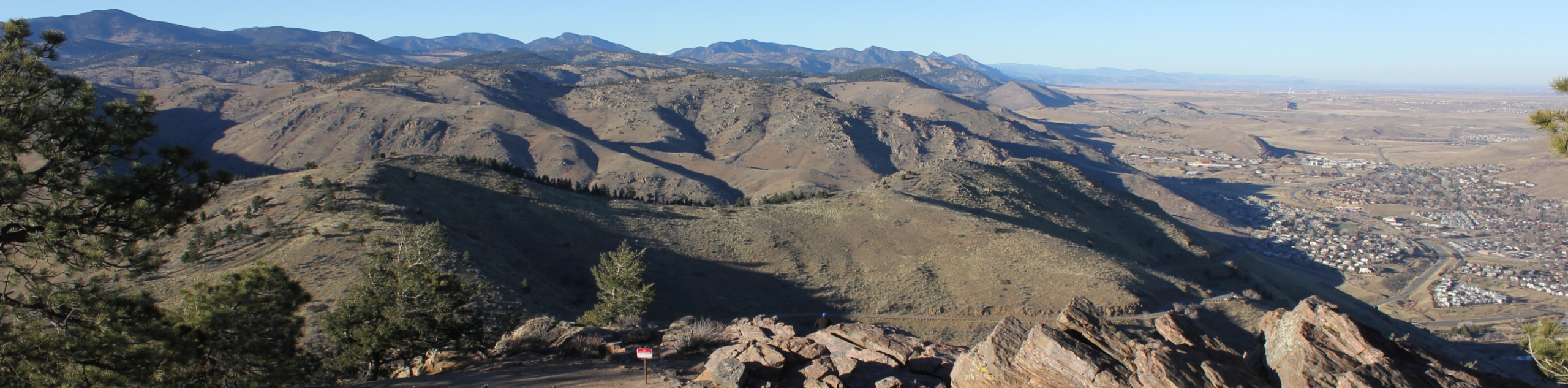
The Buffalo Bill and Beaver Brook Trail is one of a kind. Enjoy unparalleled views of the Front Range foothills, the Clear Creek Canyon, and the lush wilderness, this path is epic. This trail checks all our boxes: strenuous, stimulating, scenic, and diverse. One thing you don’t often experience on day-hikes near Denver is waterfalls, and this path delivers just that. Note that this path travels through arid terrain, so be mindful of rattlesnakes. Get excited and lace up those hiking shoes because we are going on an adventure.
Embark on your excursion along the Buffalo Bill and Beaver Brook Trail from the trailhead. Here there will likely be crowds, but as you travel further into the wilderness the crowds will thin, so don’t let that discourage you! Track the Buffalo Bill Trail south and at the first intersection, take the rightmost Lookout Mountain Trail. This path will guide you below the treeline and at the next junction turn left, and you will be diverted onto the Beaver Brook Trail. This route will intersect with multiple streams and pass a cascading waterfall. The route will weave you between meadowlands and forestlands before delivering you to another intersection.
At this point, keep left before merging right onto the Gudy Gaskill Trail. This route will loop you through the plains which expose views of the Clear Creek Canyon. Soon the circuit will guide you back to the junction with the Beaver Brook Trail. From here, simply retrace your footing back along the path all the way back to the trailhead.
Similar hikes to the Buffalo Bill and Beaver Brook Trail hike

Singletree and Mayhoffer Trail
The Singletree and Mayhoffer Trail is a scenic adventure that will guide adventurers through the lush meadowlands that reveal sights…

Mount Galbraith via Cedar Gulch Trail
The Mount Galbraith via Cedar Gulch Trail is a charming adventure near Golden, Colorado that reveals the beauty and diversity…
Evergreen Mountain Summit Hike
The Evergreen Mountain Summit Hike is a charming adventure near Denver, CO. As you travel the enchanted woodland path, you…
Comments