Nymph Falls Trail
View Photos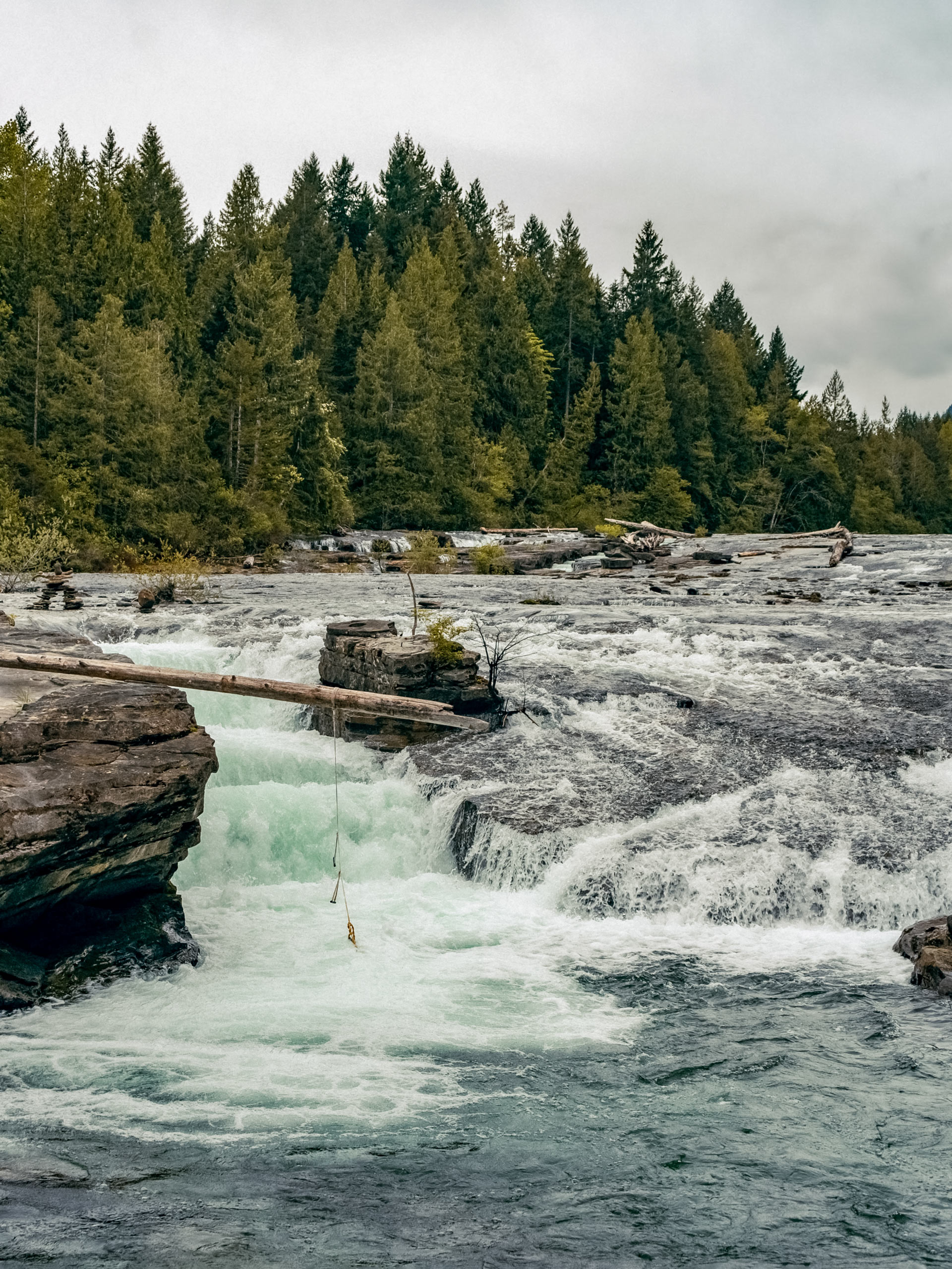
Nymph Falls Trail
Difficulty Rating:
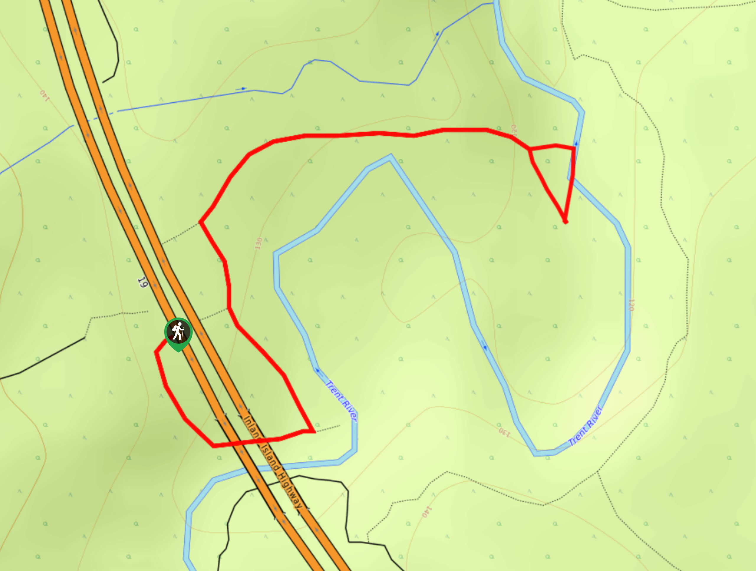
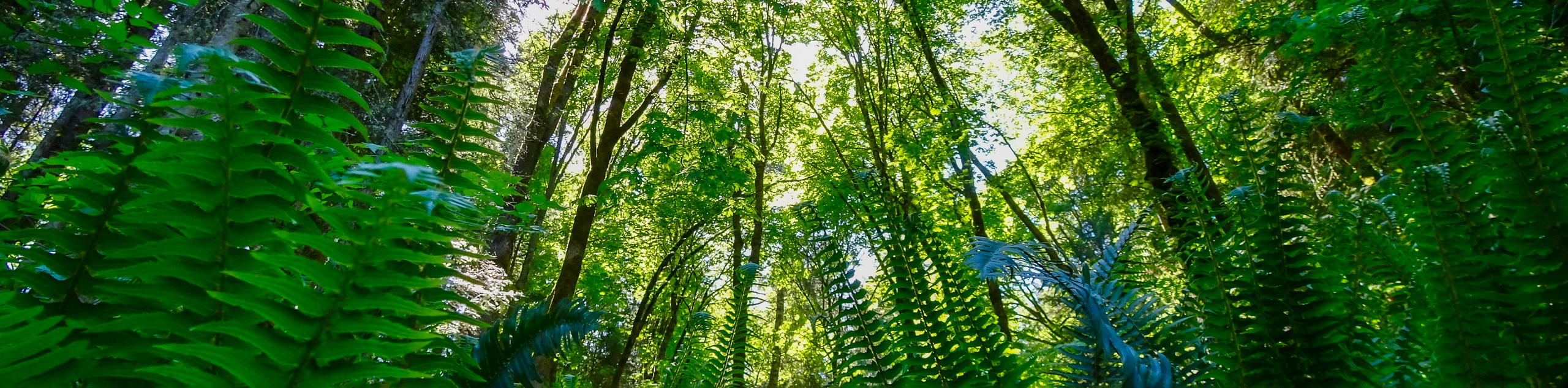
The Nymph Falls Trail is a 1.6mi lollipop hiking route just west of Courtenay, BC that will take you through an amazing example of West Coast temperate rainforest to eventually reach a viewpoint overlooking a cascading waterfall. In addition to the scenic views of the falls, along the trail you will meander past a variety of plant life, including large moss-covered trees, different species of wild mushroom, and copious vibrant green ferns scattered across the forest floor. With easy to navigate trails and spectacular views, this is the perfect trail for a day trip with the entire family.
Getting there
To reach the parking area for the Nymph Falls Trail from Courtenay, head southwest on Lake Trail Road for 1.1mi and turn right onto Comox Lake Road. After 0.8mi, turn right onto Duncan Bay Main Line Road and follow it for 2.1mi. Turn left onto Forbidden Plateau Road and continue along it for 1.4mi to find the parking area on the left.

About
| When to do | May-September |
| Backcountry Campsites | No |
| Pets allowed | Yes |
| Family friendly | Yes |
| Route Signage | Average |
| Crowd Levels | Moderate |
| Route Type | Lollipop |
Nymph Falls Trail
Elevation Graph
Weather
Nymph Falls Trail Description
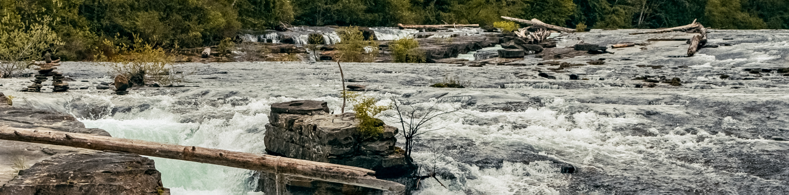
While the Nymph Falls Trail is a great option for some fun family adventuring, hikers should keep in mind that not all of the trails in this network of hiking routes are accessible by wheelchair or strollers, which could make travel a bit difficult for some. Additionally, the Puntledge River is significantly stronger during the spring and autumn seasons, which will make for some spectacular scenery but also hazardous conditions. Pay attention to any posted signage and stay clear of the edge of the river when water levels are high.
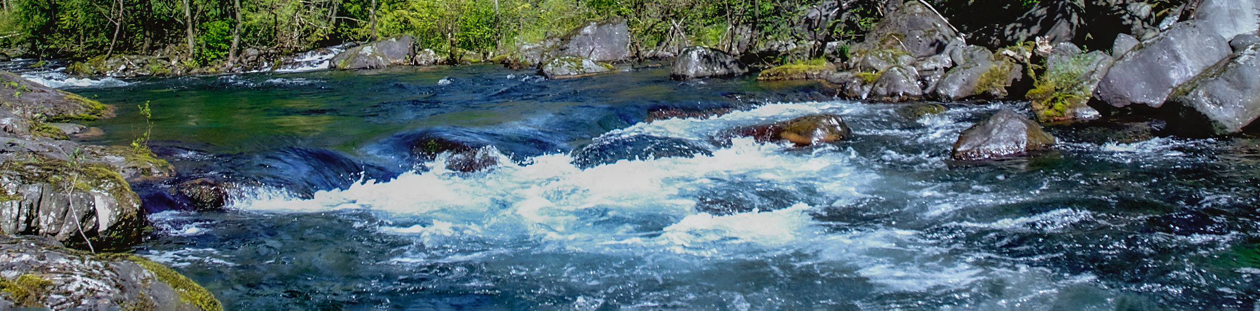
This hike is a perfect half-day hike if you are looking to take in some majestic sights without too much effort. The trail initially meanders through the breathtaking rainforest atmosphere and eventually arrives at a viewpoint where you can gaze out at the rushing water of the river as it cascades over the falls. After taking in the views, follow the trail around the loop as it hugs tightly alongside the edge of the river and allows you to appreciate its power and beauty before arriving back at the trailhead where you began your hike.
Similar hikes to the Nymph Falls Trail hike
Campbell River Canyon View Trail
The Campbell River Canyon View Trail is a 3.0mi lollipop hiking route in Elk Falls Provincial Park that…
Trent Falls
The hike to Trent Falls makes use of a 1.3mi out-and-back trail that follows closely alongside the Trent…
Seal Bay Horse and Bike Loop
The Seal Bay Horse & Bike Loop is an 5.4mi hiking circuit near Courtenay, BC that passes through…
Comments