
Cheyenne Mountain via Talon and Dixon Trails
View Photos
Cheyenne Mountain via Talon and Dixon Trails
Difficulty Rating:
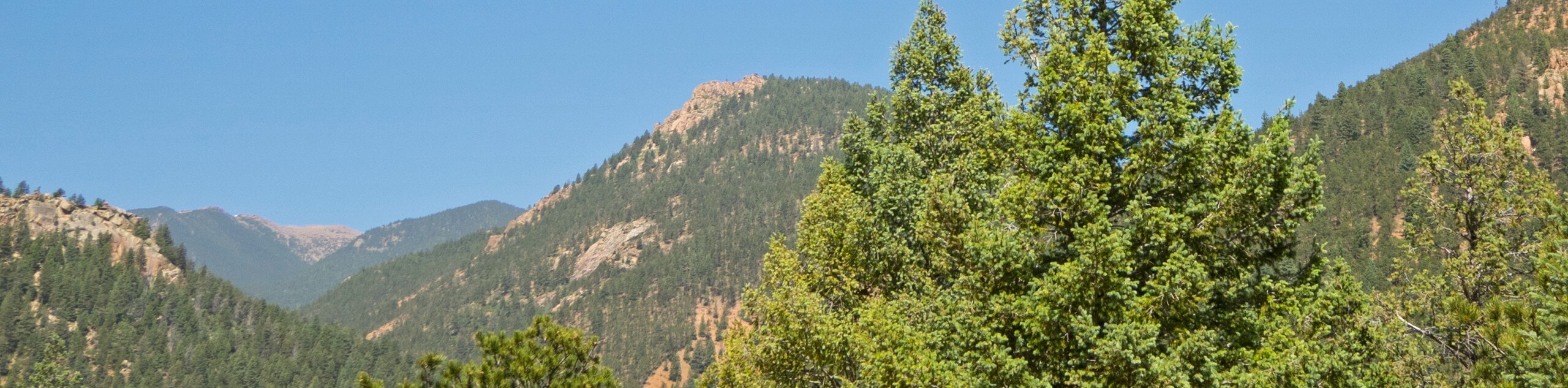
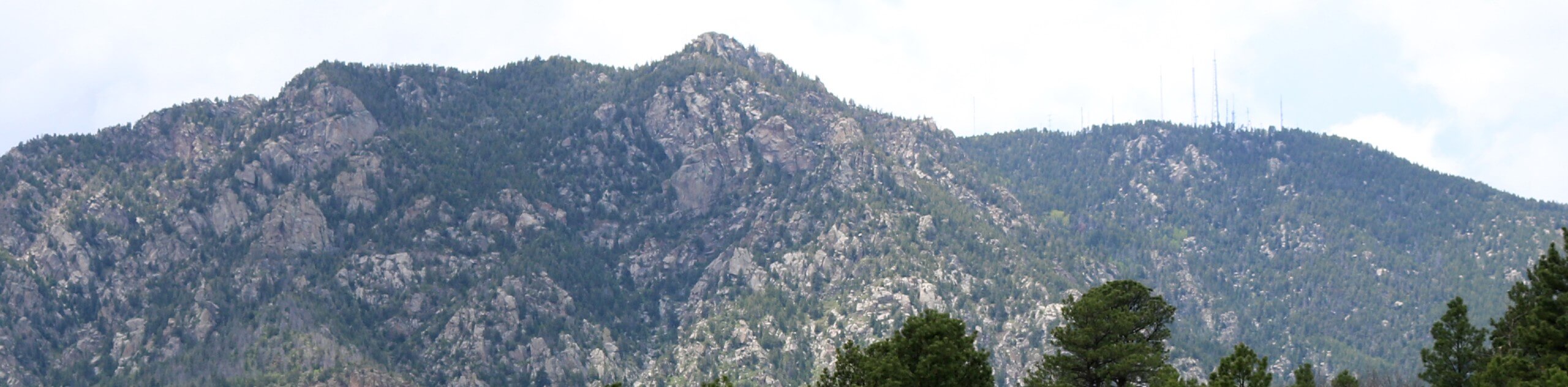
The Cheyenne Mountain via Talon and Dixon Trails is a long but scenic adventure through the Colorado wilderness. Hike through dense woodlands and exposed terrain up to the summit of Robbers Roost, which exposes dumbfounding views of Cheyenne Mountain and the garden of antennas that decorate the peak.
Getting there
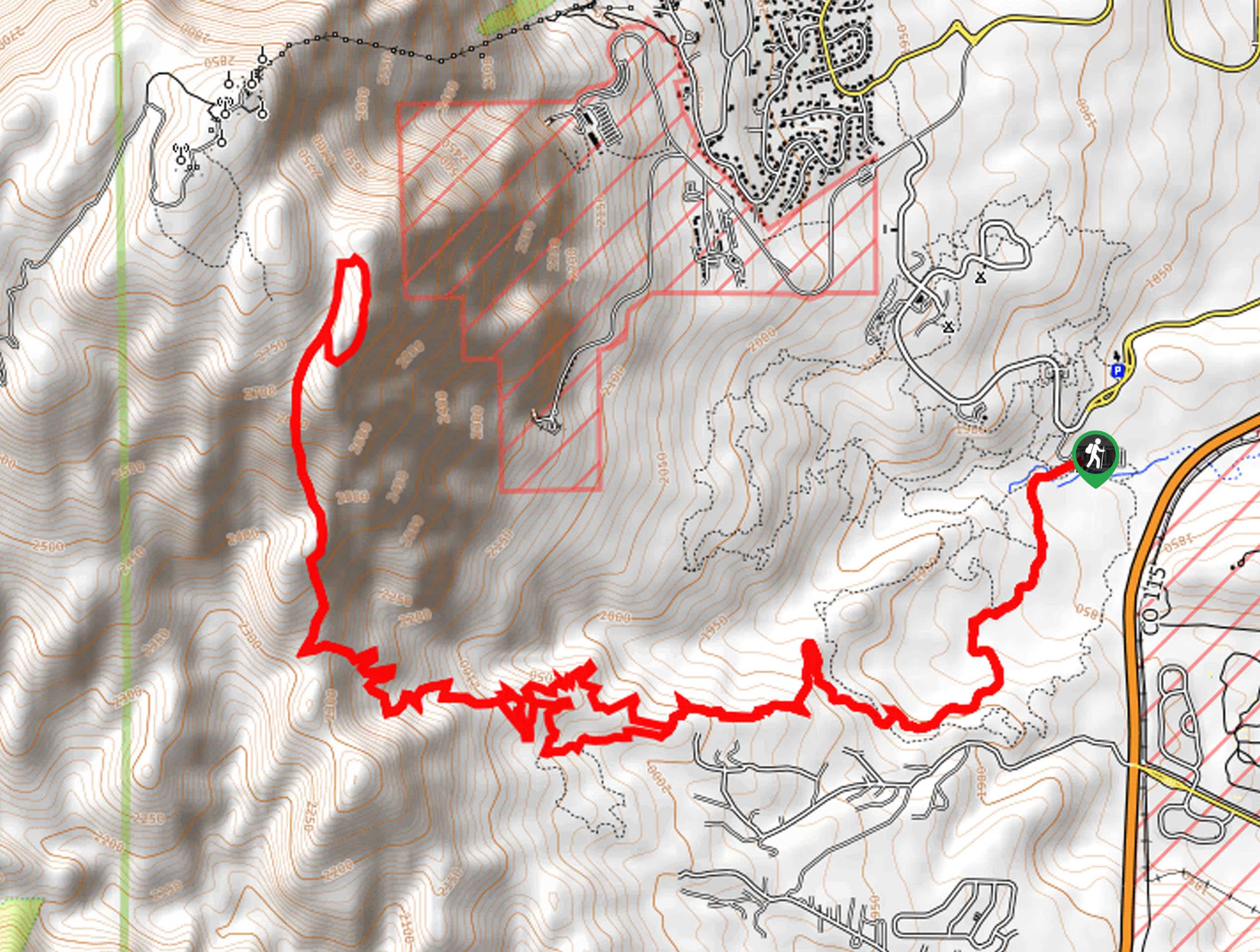
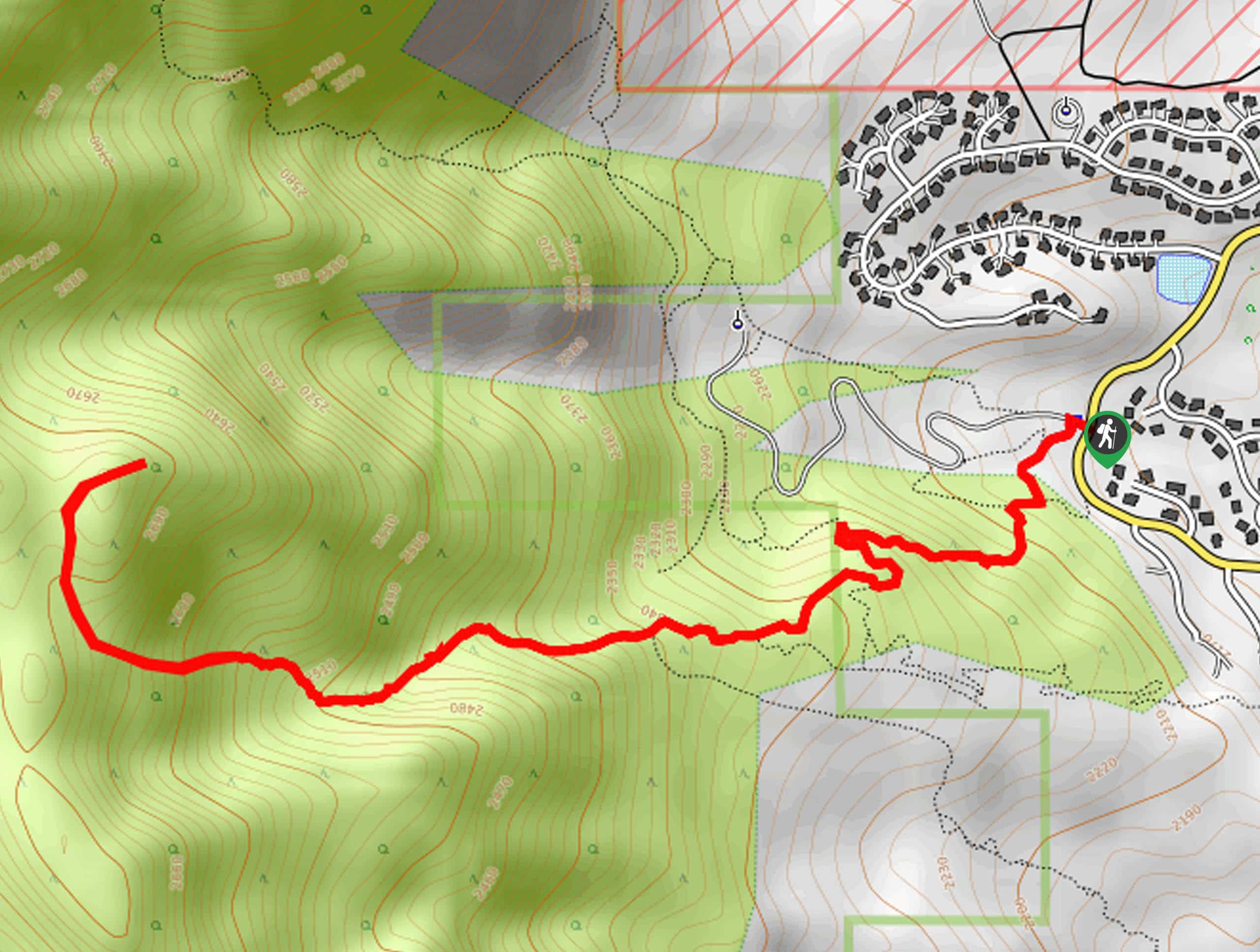
The Cheyenne Mountain via Talon and Dixon Trails is accessed via the Limekiln Trailhead off JL Ranch Heights Road.

About
| Backcountry Campground | No |
| When to do | May-October |
| Pets allowed | No |
| Family friendly | No |
| Route Signage | Average |
| Crowd Levels | High |
| Route Type | Lollipop |
Cheyenne Mountain via Talon and Dixon Trails
Elevation Graph
Weather
Cheyenne Mountain via Talon and Dixon Trails Description
The Cheyenne Mountain via Talon and Dixon Trails is an epic backcountry adventure located just outside Colorado Springs. This extensive but scenic trail reveals the diversity of the area’s flora and fauna as it guides hikers over 15.5mi through the wilderness. Traveling deep into the woodlands, it is important to note that mountain lions and bears frequent the area—so keep an eye out and be mindful of them as you wander. Additionally, this trek is long and travels to high, exposed elevations, so make sure to head out before dawn to summit the peak before noon—mitigating the chances of getting caught in an afternoon storm. Lastly, the creeks may dry up in the late summer, so pack plenty of water! Note that the Cheyenne Mountain State Park charges an entrance fee which typically costs around $9USD per vehicle.
Embark on your adventure along the Cheyenne Mountain via Talon and Dixon Trails from the Limekiln Trailhead. From here, track the Talon Trail, eventually merging onto the North Talon Trail. At the end of the North Talon Trail, you will merge onto the Dixon Trail. This section of the hike will guide you up a seemingly never-ending set of switchbacks through the woodlands. After ascending the vertiginous terrain, you will confront another junction, keep right here, and you will be diverted onto the Dragon’s Backbone Trail.
Now atop the summit of the Robbers Roost, you will be granted sights of the cityscape and the plains in the east. Continue hiking, heading south along the Mountain Loop Trail. This path will deliver epic vistas of Cheyenne Mountain and the antenna garden that decorates its summit. To get back to the trailhead, retrace your steps down the Dixon Trail, then follow the Talon Trail back to the trailhead.
Similar hikes to the Cheyenne Mountain via Talon and Dixon Trails hike
Three Peaks Loop
Seeking an exciting adventure near Colorado Springs? If so, then we have the perfect hike for you—the Three Peaks Loop.…
Talon and Sundance Loop Trail
At the base of Cheyenne Mountain, you will find incredible hiking routes, including the Talon and Sundance Loop. This amazing…
Red Squirrel to Douglas Fir Trail
The Red Squirrel to Douglas Fir Trail is an awesome adventure located just a short drive north of the city.…
Comments