
Trail of Seven Bridges
View Photos
Trail of Seven Bridges
Difficulty Rating:
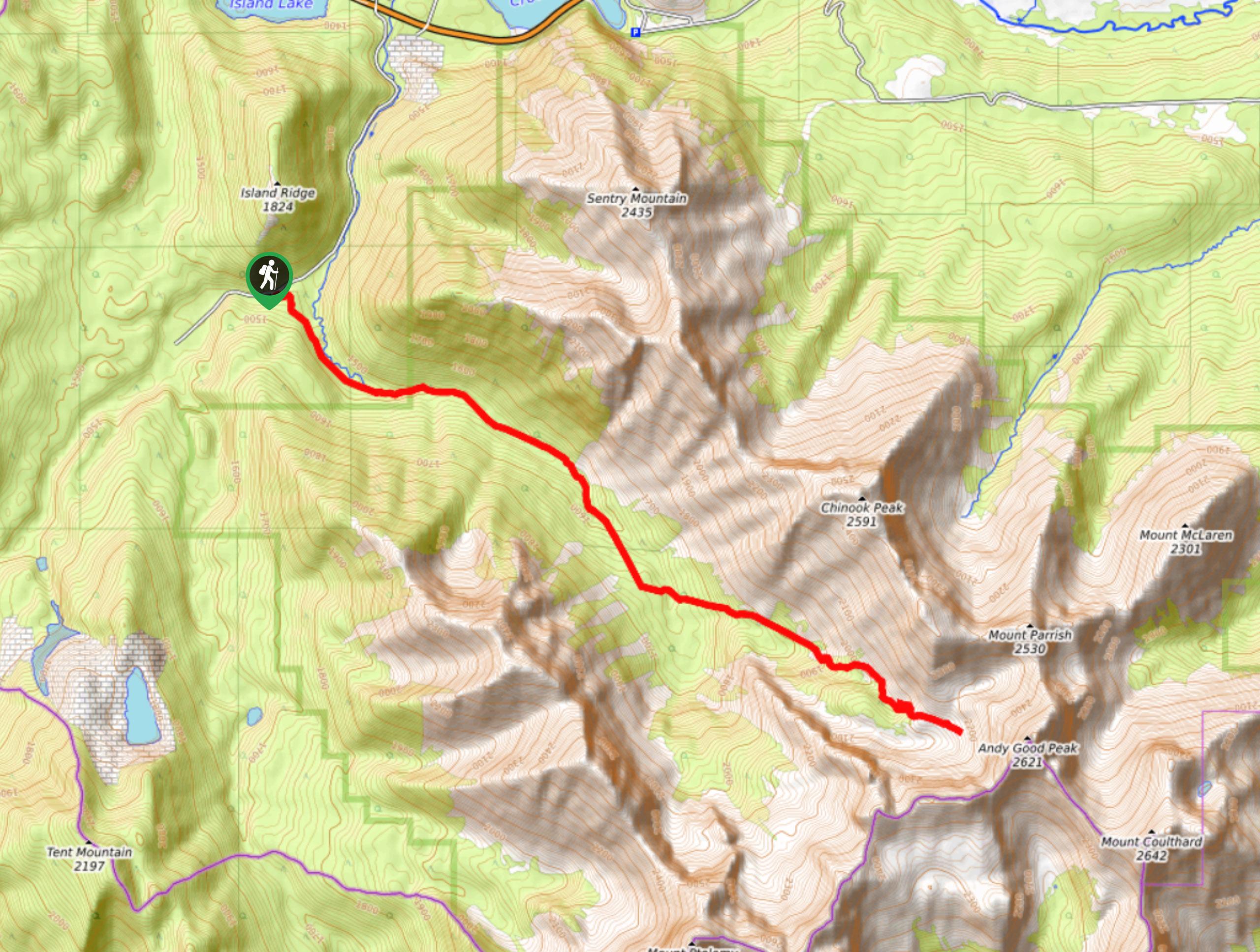
The Trail of Seven Bridges is more popular with OHV users as it is a multi-use trail. You will run into cyclists, dirtbikes, and quads on this trail. It follows an OHV route through the forest crossing several streams. Views open up as you gain elevation to the viewpoint at the end where you turn around. This is quite a long hike that despite the lack of visitors may be noisy with motorized vehicles.
Getting there
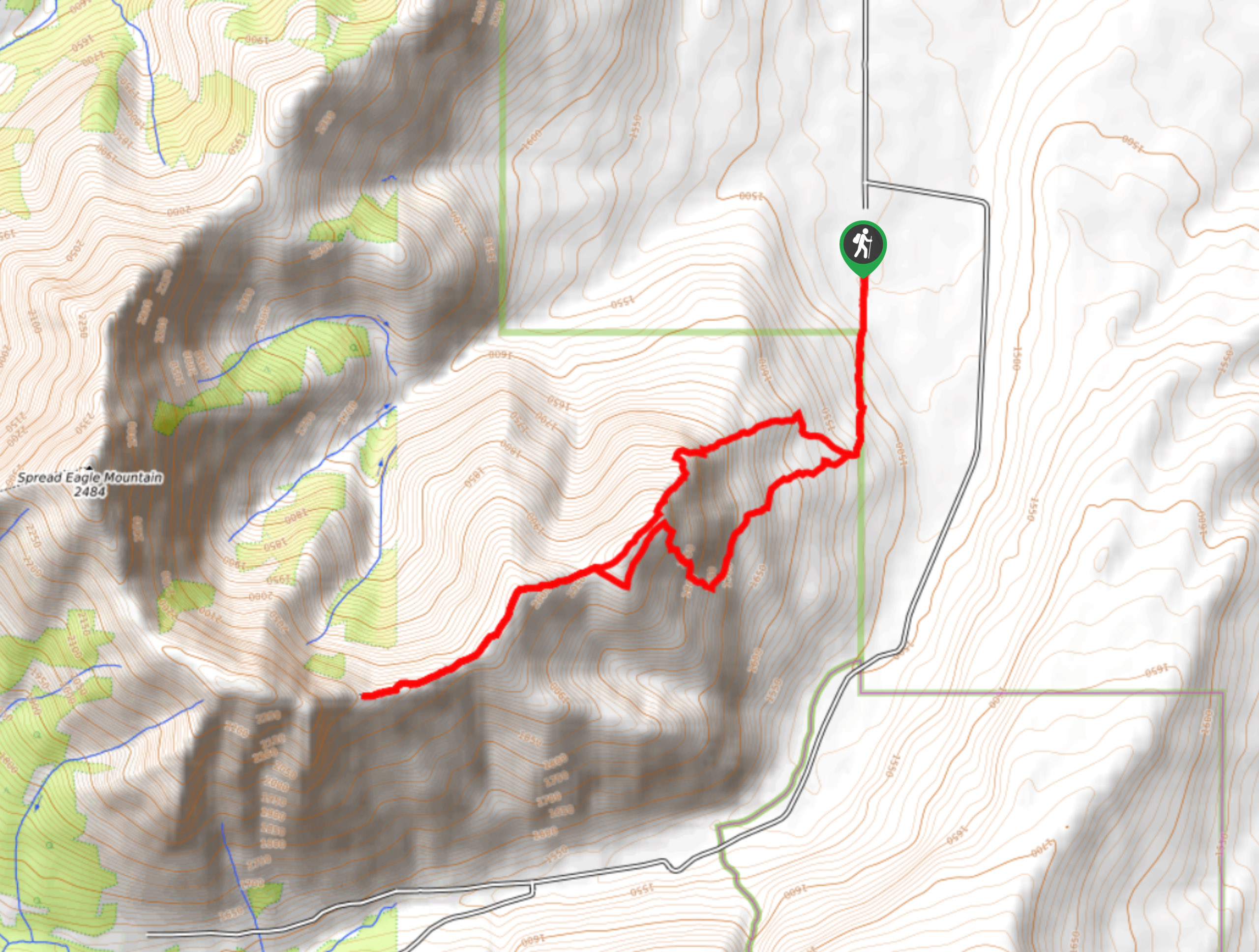
To reach the Trail of Seven Bridges hike from Crowsnest, Alberta, travel eastbound on Highway 3 and take your first right after passing the Welcome To Alberta sign. Stay on this road for 1.9mi and turn left into a pullout for the Trail of Seven Bridges. You will be opposite Island Ridge.

About
| When to do | May-September |
| Backcountry Campsites | No |
| Pets allowed | Yes - Off leash |
| Family friendly | No |
| Route Signage | Poor |
| Crowd Levels | Low |
| Route Type | Out and back |
Trail of Seven Bridges
Elevation Graph
Weather
Trail of Seven Bridges Description
Despite its name, many of the bridges on this trail have long disappeared. The trail is a multi-use route that follows an OHV trail up to a viewpoint and back. The scenery is great in the clearings, however you will encounter mountain bikes and motorized vehicles throughout your journey. This full day effort is the type of hike that is perfect for people who prefer a steady grade, no technical terrain, and an easy to follow trail. You will gain elevation steadily at gradual grade along this route. Enjoy the views of nearby Andy Good Peak and Mount Ptolemy before returning the way you came.
Similar hikes to the Trail of Seven Bridges hike
Piney Point Trail
The Piney Point Loop trail is a moderately trafficked trail from the Beauvais Lake day use area. There are many…
Coal Miners Lake
Coal Miners Lake is a great half day hike close to Crowsnest, Alberta. The moderate route is excellent for families.…
Yarrow Ridge
Yarrow Ridge is a stunning double lollipop loop that leads up a cutline to a ride. The ridge features various…
Comments