
Cranston Ridge hike
View Photos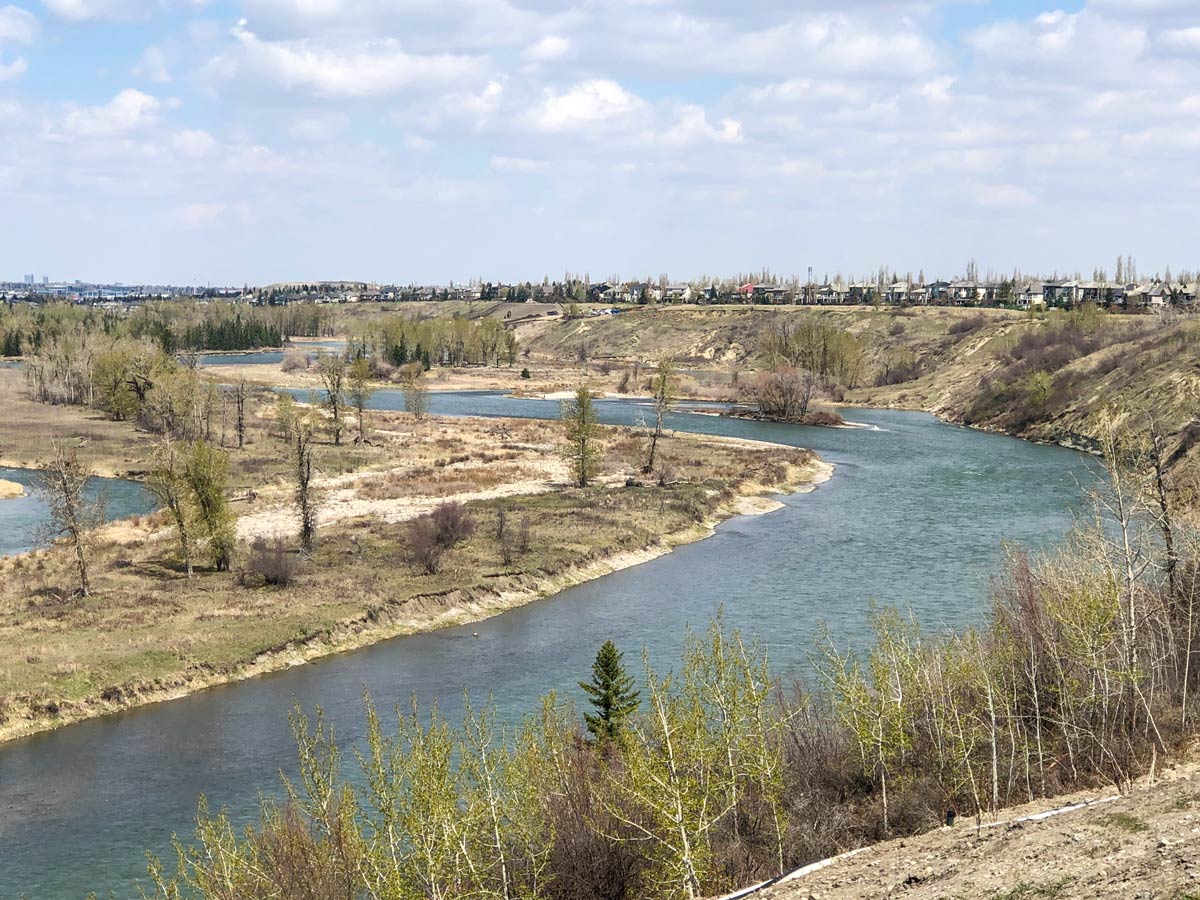
Cranston Ridge hike
Difficulty Rating:
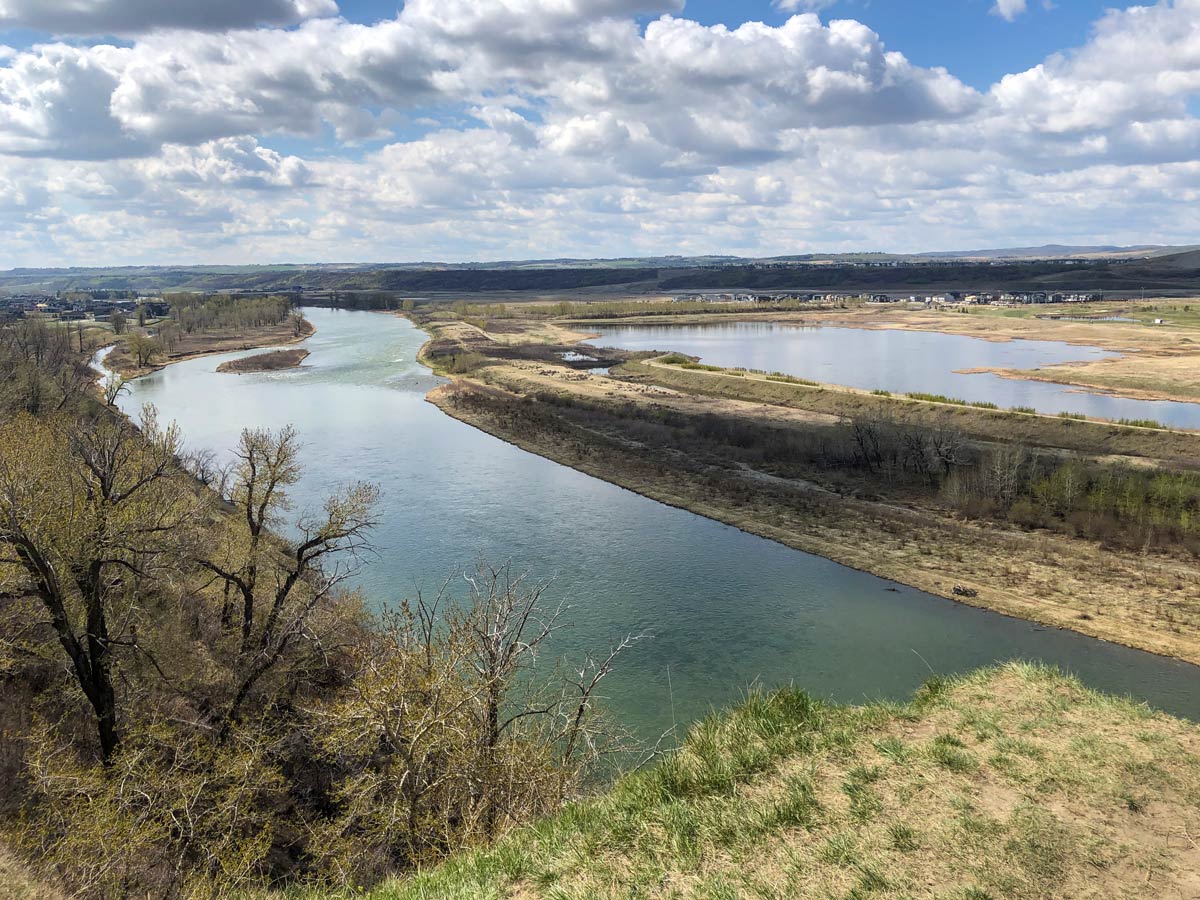
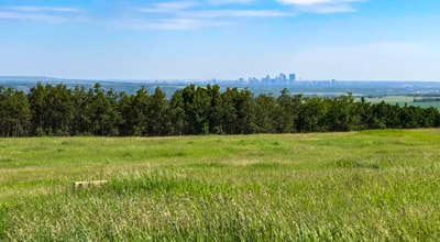
Kick off the Cranston Ridge hike in the bottom of the valley with a tranquil walk along the Bow River. Then, climb to Cranston Ridge with great views of the Rocky Mountains.
Getting there
Find the Rotary Park – Fish Creek Parking lot, just past the parking lot for McKenzie Meadows Golf Club off of 24 St SE just after it passes under Stoney Trail.

About
| When to do | Year-round |
| Family friendly | Older Children only |
| Route Signage | Average |
| Crowd Levels | Moderate |
| Route Type | Circuit |
Cranston Ridge
Elevation Graph
Weather
Route Description for Cranston Ridge
Begin the Cranston Ridge hike from the Rotary Park-Fisk Creek Provincial Park parking lot.
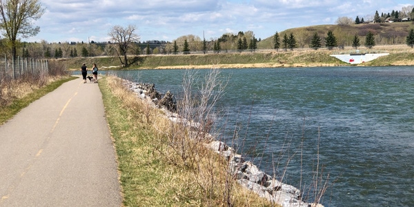
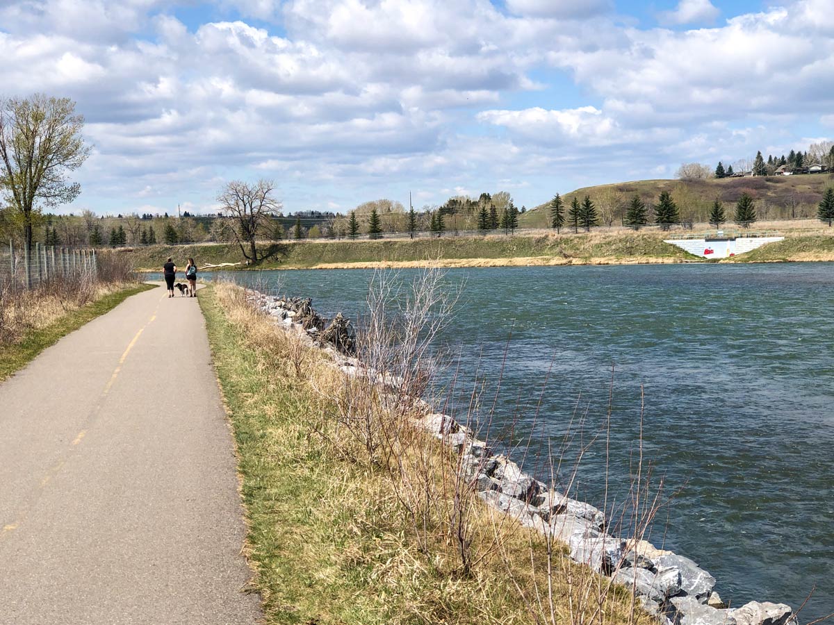
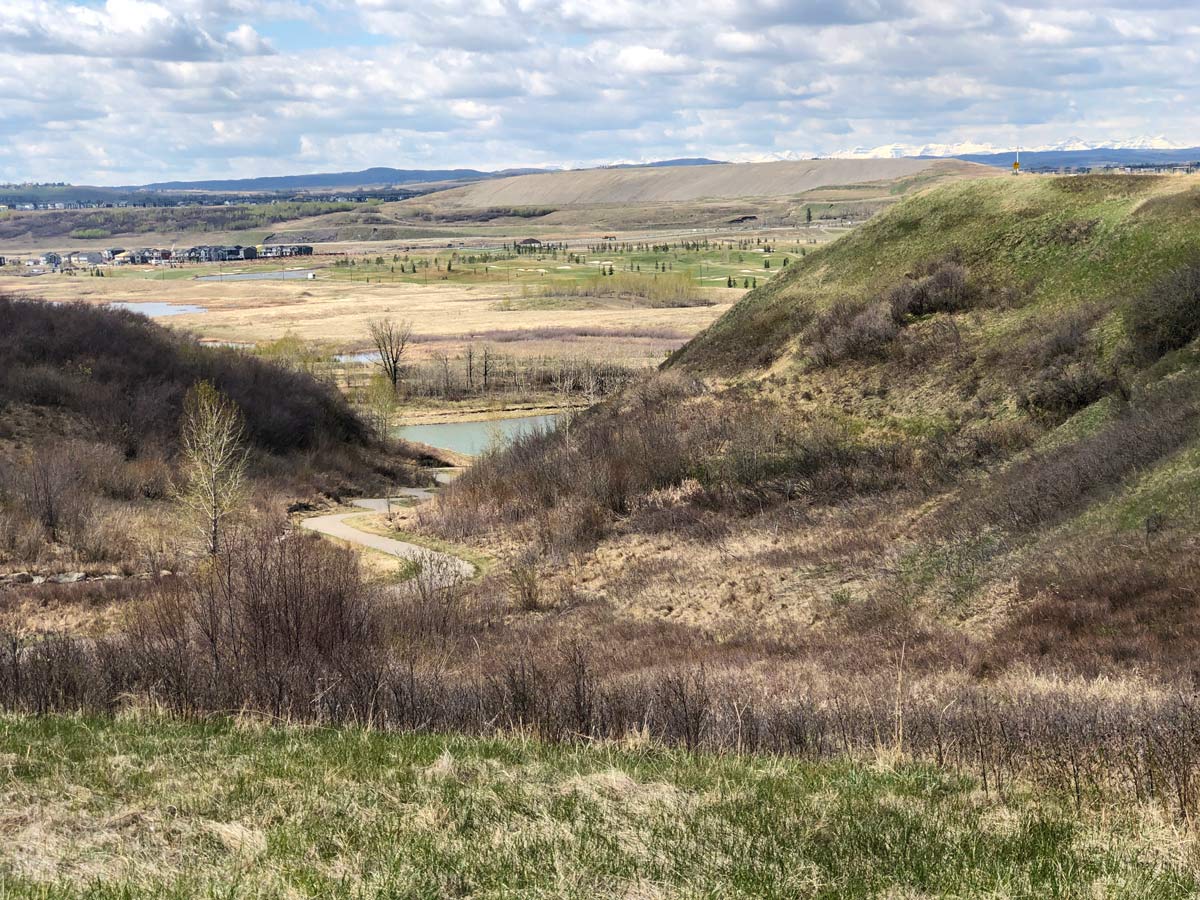
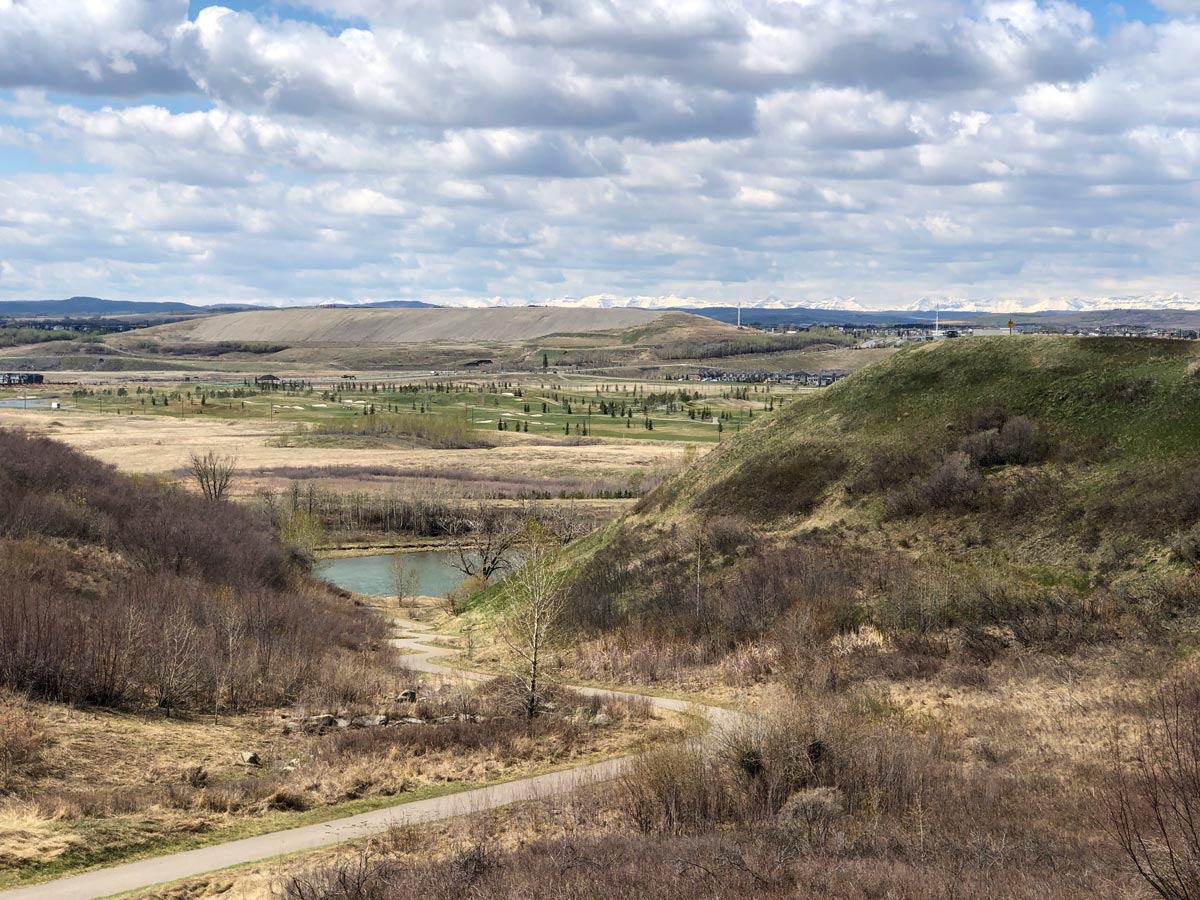
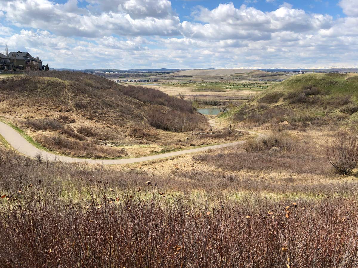
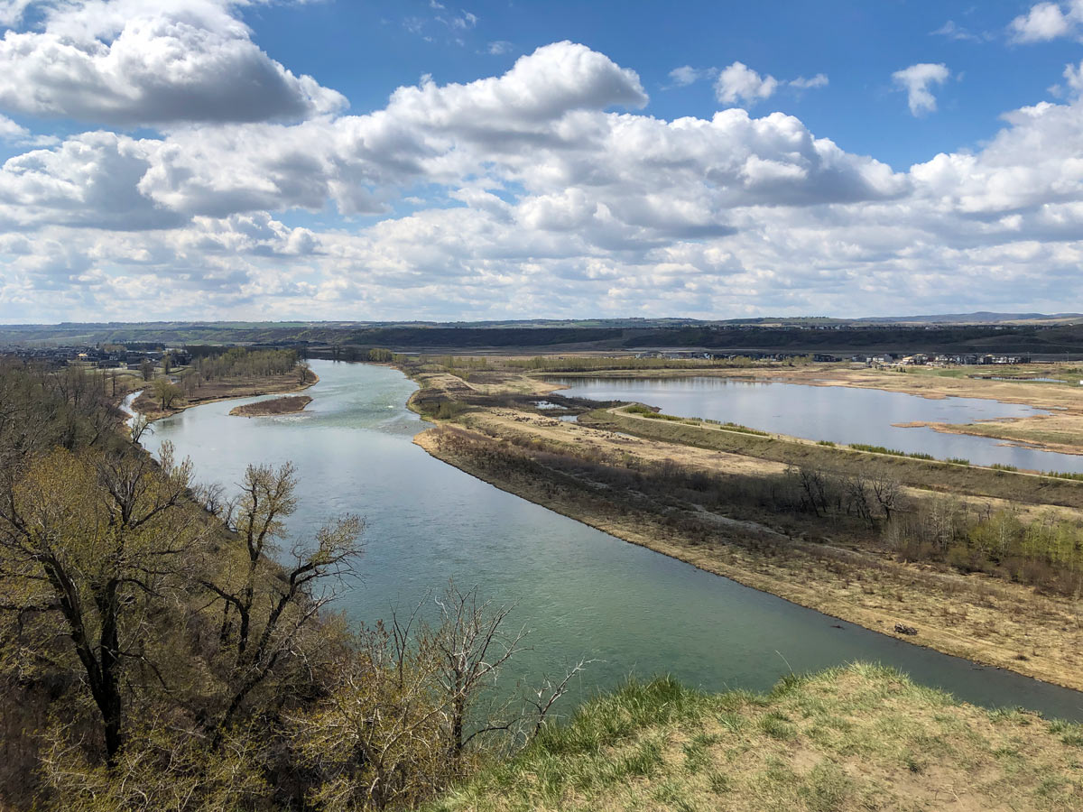
Head south from parking lot and go straight along a paved pathway, with a pond on your left and Bow River on your right. When you get to the end of the path, it goes left up a ravine onto the start of Cranston Ridge.
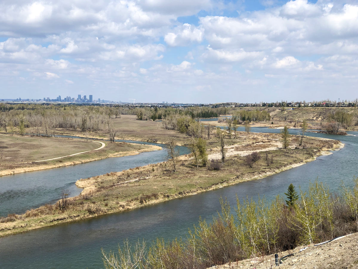
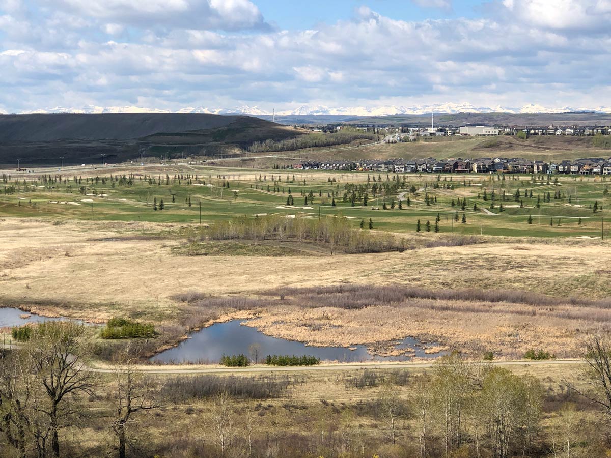
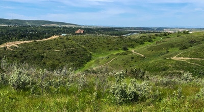
Once on the ridge, follow this walking and cycling path as it weaves in and out with great views down into the Bow River Valley, and in the distance, you’ll see the front ranges of the Canadian Rockies. This is a wide, paved path, however it can be crowded on weekends with a mixture of walkers, cyclists and strollers, so pay attention.
When you come to Cranston Avenue, go right and follow the walkway down into Riverstone Estates, passing Owl Park on the way down. Once at the bottom, you’ll walk on a new path that weaves in and out along the Bow River. Follow the path as it goes away from the river, connecting with Cranston Avenue, where you go right and head east.
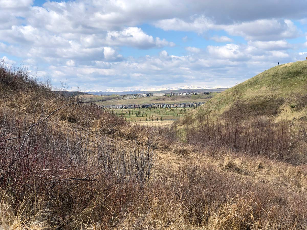
Follow the bend in Cranston Avenue as it curves back north and heads up a hill. It can be pretty steep, especially if you’re pushing a stroller. Look for a paved path going off to your left and follow it, quickly coming to the Cranston Escarpment viewpoint.
Continue to follow the paved path as it goes roughly north back along Cranston Ridge, and enjoy the views as the path goes off to the right around a coulee.
Once you get back to Cranston Avenue, you’ll need to go right for a couple minutes to get to a crosswalk to cross Cranston Avenue. Note that our map doesn’t show the trip to the crosswalk, instead just going over Cranston Avenue.
From here you’re back on the route you took, so you can walk back towards the coulee you came up at the start.
After going down the coulee into the Bow River Valley, you can either take the paved path back to your car or you can take a right and go around a couple of ponds on a gravel path.
Insider Hints
This is a great hike in spring with the snow-clad Rockies in the distance.
Bring your own snacks as there is no place to stop.
To shorten this hike, skip the journey down into Riverstone Estates, as it’s a big hill for relatively limited walking along the river.

Similar hikes to the Cranston Ridge hike
Glenmore Reservoir Trail
Hiking the Glenmore Reservoir trail is a great half day trip, or just head out on a portion of the…
Ann & Sandy Cross Conservation
Embark on a hike at Ann & Sandy Cross Conservation to take in the rolling foothills of the Rocky Mountains.…
Bow River Pathway North
Embark on a stunning urban hike in the city of Calgary from Dale Hodges Park, following the popular Bow River…
Coll A. 5 years ago
This is one of a kind hiking experience. It offers amazing views of the mountains. Also, it's not that hard to climb.
wenzelhd 5 years ago
This hike is magical during spring! You'll find snow-clad Rockies and the weather is fantastic too!
Coll A. 5 years ago
Nice views of the Bow River Valley. A great hike with the snow-clad Rockies in the distance. Be sure to bring some snacks.
Fanah L. 5 years ago
A moderate and tranquil hike along the Bow River. Cranston Ridge gives you great views of the Rocky Mountains. Definitely worth the climb.