

Glenmore Reservoir Trail
View PhotosGlenmore Reservoir Trail
Difficulty Rating:
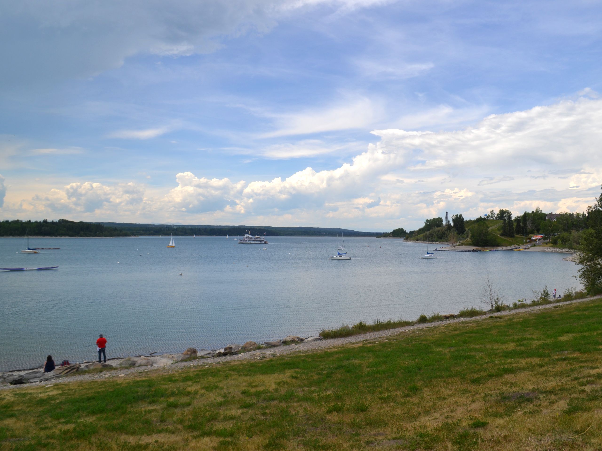
Hiking the Glenmore Reservoir trail is a great half day trip, or just head out on a portion of the path for an hour or two! It is perfect for all abilities and explores the entire reservoir, staying close to the water and wetlands that the reservoir is famous for. This is a heavily populated area in the summer months, but many visitors choose short routes within the area rather than committing to the full loop.
Getting there
To get to the Glenmore Reservoir Trail, you will need to find your way to South Glenmore Park. Take Glenmore Trail SW and exit onto 14 St SW. Head south on 14 St SW and turn right onto 90 Ave SW. Turn right onto 24 St SW and park at the Glenmore Reservoir parking area.
About
| When to do | April-October |
| Backcountry Campsites | No |
| Pets allowed | Yes |
| Family friendly | Yes |
| Route Signage | Average |
| Crowd Levels | High |
| Route Type | Circuit |
Glenmore Reservoir Trail
Elevation Graph
Weather
Glenmore Reservoir Trail Description
The Glenmore Reservoir is a multi-use trail that sees all types of activities on its path. There can be a lot of traffic travelling in both directions, but the traffic is always well controlled. Follow basic right of way practices and you’ll be able to integrate well with cyclists, dogs, runners, and other hikers.
This trail is a great way to escape the city without ever actually leaving. We love visiting the Glenmore Reservoir and travelling along this well-maintained path. You’ll cross bridges, marshes, and paved paths on this route. There is plenty of opportunity to watch for birds and other small wildlife.
You can start the route from anywhere around the reservoir and travel in either direction. You can shorten the route if needed as well, making your day as long or short as you’d like. Our route starts at the south side of the park and travels in a counter-clockwise direction around the reservoir and park. The trail features rolling elevation throughout and passes by many small picnic areas, lookout points, and parks.
As you walk eastbound before looping around the north side of the park, you’ll pass Heritage Park and the Railway Cafe, which is a great place to grab a refreshment by the water. Follow the trail out of Heritage Park and onto Eagle Ridge Drive SW before finding the trail again on the left towards the water. There will be some public parking here as you rejoin the main trail.
Continue north to a bridge over the Elbow River. Take the trail to the left at the end of the bridge, heading slightly south passing by the Earl Grey Golf Club on your right. Follow the trail over some fun bridges as you continue to hug the water. Pass more parking areas, washrooms, and the Kingfisher Picnic Area along the water on the north side.
Find yourself at the North Glenmore Reservoir parking area just before entering the Weaselhead Park area. This section of the trail is more forested and lush than the rest of the route and feels like a true escape. Cross the Elbow River again here on a nice bridge, staying in Weaselhead Park. Signs will read Weaselhead Regional Pathway here until joining the main Glenmore Reservoir trail. Enjoy Weaselhead Flats as you make your way back to the east, eventually finding your way back to the South Glenmore Park.
There are tonnes of great stopping points along this trail making it perfect for the family. There are playgrounds, waterfront docks, washrooms, and other facilities along the route, making this trip a great way to spend a day.
Trail Highlights
Glenmore Reservoir
Glenmore Reservoir is a reservoir created by a dam in the Elbow River in Calgary. The dam and reservoir were built to provide safe water, reduce high water levels in the river, and create recreational opportunities for Calgarians. The reservoir is home to many parks, clubs, and public facilities for locals and tourists to enjoy.
Frequently Asked Questions
How long does it take to walk around the reservoir?
It takes roughly 3 hours to walk around the reservoir and 4 hours to complete the full trail.
How long does it take to bike the Glenmore Reservoir?
It takes roughly 1 hour to complete this trail, check our route guide for more information.
Insider Hints
If you are ambitious, ride your bikes to the park on the city’s many integrated bike trails.
Stop at the Railway Cafe in Heritage Park for some refreshments!
Plan for a full day adventure and pack a picnic to enjoy at one of the many parks and picnic areas along the trail.
Similar hikes to the Glenmore Reservoir Trail hike

Nose Creek Park Loop
The short and easy Nose Creek Park Loop Trail is a good trail for families looking for fresh air. This…

Griffith Woods Perimeter Loop
Griffith Woods Park is located at the southwest edge of the city, making it feel like you have completely escaped.…

Eagle Lake Trail
The hike to Eagle Lake is a great flat and easy trail to a remote lake. Eagle Lake is just…


Comments