Mount Keen from Glen Esk Walk
View Photos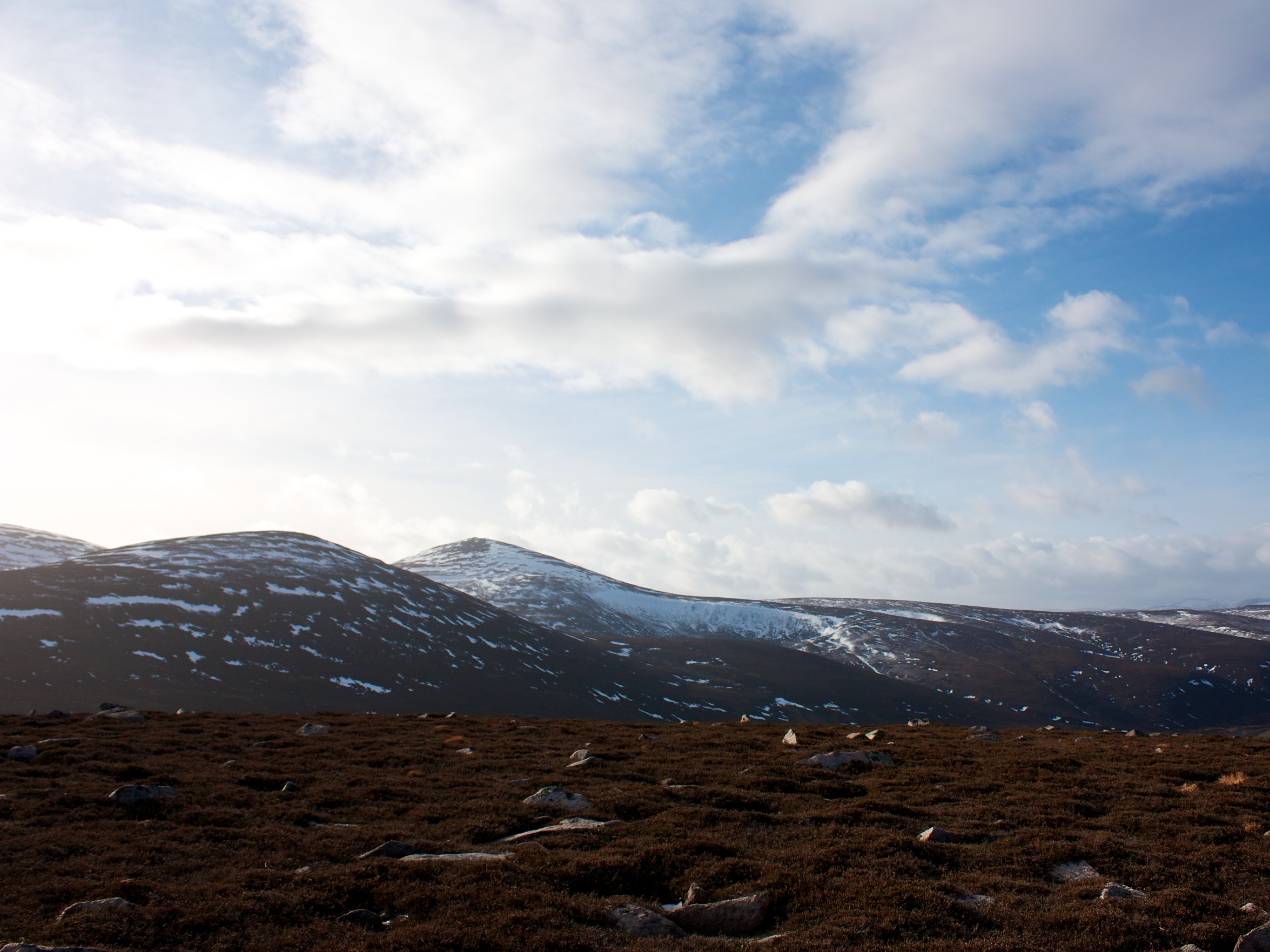
Mount Keen from Glen Esk Walk
Difficulty Rating:
The Mount Keen (3081ft) From Glen Esk Walk invites you to tackle the most easterly Munro with a thrilling ascent from Glen Esk. The 10.9mi walk unfolds on tracks and a well-worn hill path leading to the trig point at the summit, where you’ll uncover atypical views of sprawling moorlands instead of peaks. The route features some steep sections, a few river crossings, and a dose of history with a look at the Queen’s Well, where Queen Victoria stopped during one of her treks in the Angus glens by pony.
Getting there
To get to the Glen Esk Walk from Dundee, take A929/ Dura St and A929 to Forfar Rd/Kingsway E/A972 and continue 1.6mi before following A90 to B966 in Angus Council. Take the exit for B966 from A90 and continue 26.4mi. Continue on B966 for 19.2mi until you reach the Invermark car park, where the walk begins.

About
| When to do | Year-round access |
| Backcountry Campsites | Wild Camping |
| Pets allowed | Yes |
| Family friendly | No |
| Route Signage | Average |
| Crowd Levels | Moderate |
| Route Type | Out and back |
Mount Keen from Glen Esk Walk
Elevation Graph
Weather
Mount Keen from Glen Esk Walk Description
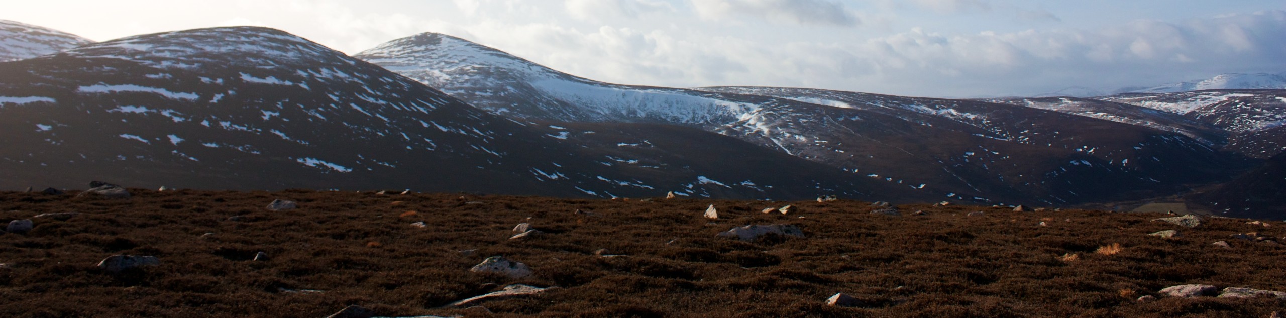
Mighty Mount Keen (3081ft) is most well-known for being the most easterly Munro peak in Scotland. Setting it apart from other hillwalks in Cairngorms National Park is the unique moorland scenery from its summit, differing from the usual peak-filled panoramas in the park more commonly found throughout the park. The route unfolds on tracks and a hillpath, which during good weather is a pleasant walk. That being said, when weather conditions are bad, the peak is highly exposed and views limited, so try to plan your hike accordingly. If tackling this walk in the winter, ensure you’ve got an ice-axe and crampons as well as a good working knowledge of winter hillwalking.
It’s always nice to change things up a little in life, and the same goes for walking! The Mount Keen from Glen Esk Walk offers a unique opportunity to take in some contrasting scenery to the usual peak-lined views from summits in the park. A vast expanse of sweeping moorland surrounds Mount Keen, and when the weather is good, views from atop the summit are seemingly endless across the horizon. This is a superb walk for those looking to tackle an impressive Munro and challenge themselves with a thrilling climb.
To begin the Mount Keen Walk, follow the road from the car park that leads over a bridge, taking you past a church on your right. Follow signs for Mount Keen (also signs for Queen’s Well), and as you approach a house, veer left to pass through a gate and join a track. You’ll find yourself welcomed into an open glen and can spot the Invermark Castle through the trees to your left from here.
Once you reach the metal gate, continue through it and venture up into the glen. Keep your eyes peeled for red deer, which are known to frequent the area. Continue the track as it moves closer to the river and maintain it until you reach Queen’s Well. Queen Victoria stopped at the site, now marked by a structure consisting of granite arches and a cross, to rest at the stream beneath it during one of her pony treks through the Angus Glens. After branching off on the path to get a closer look at the well, rejoin the track by turning left, then right, soon passing the cozy Invermark Cottage.
Up next, you’ll cross the Easter Burn, followed by a crossing of the Ladder burn using an iron grid. Press on up the Ladder Glen, zig-zagging your way towards the moorlands up above. Revel in the views of Glen Esk as they open up at your back and continue on the track that leads north up the moors. When you reach a junction, make a right and continue on the well-worn path and set out to take on a few rocky sections that mark your final push to the summit. At 3081ft, you’ll spot the trig point announcing your arrival at the summit, from where you can take in the vast wasteland of moorland that stretches as far as the eye can see.
Retrace your steps for the descent, following the same route that led to the summit and return to the car park at Invermark, where the walk began.
Trail Highlights
Mount Keen
Mount Keen is a cone-shaped peak that stands 3081ft high in Scotland’s Cairngorms National Park. The peak is located in Aberdeenshire, Scotland, and is part of the Grampian Mountain Range. Mount Keen is the most easterly of the Scottish Munros and has several routes to its summit.
Queen’s Well
The Queen’s Well is an impressive-looking, crown-shaped monument built in Queen Victoria’s honour in 1861. During a pony trek in the Angus Glens, Queen Victoria once stopped for refreshment from the stream beneath the now monument. Lord Dalhousie built the site to honour her stopping at the well and her meeting with him there.
Invermark Castle
The Invermark Castle dates to the 16th-century and is found east of Loch Lee in Angus, Scotland, near Glen Esk’s head. The castle once belonged to the Lindsays of Crawford and was built with the intent to control Highland marauders. In 1803, the castle was completely abandoned, and it remains closed to the public today.
Other Great Walks in Cairngorms National Park
Check out our trail guides to Ben Magdui, Loch Muick, Ben Vrackie, and the Loch an Eilein Walk. Or see all of our Cairngorms walks.
Insider Hints
The Mount Keen from Glen Esk Walk is the fastest available route to reach Mount Keen’s summit.
In bad weather, the hill is highly exposed, so plan accordingly.
If you don’t have your own transport, you can check out buses from Brechin, which are limited but do run.
Similar hikes to the Mount Keen from Glen Esk Walk hike

Glen Banvie Trail and Blair Castle Walk
The Glen Banvie Trail and Blair Castle Walk is a great adventure in Cairngorms National Park that takes in the…

Beinn Udlamain Munro and Sgairneach Mhòr Walk
The Beinn Udlamain Munro and Sgairneach Mhòr Walk is a rugged and exciting journey in Cairngorms National Park that will…

Loch an Eilein, Loch Gamhna, Old Logging Way Loop
The Loch an Eilein, Loch Gamhna, Old Logging Way Loop is a wonderful walking trail in Cairngorms National Park that…
Comments