Glen Quoich Walk
View Photos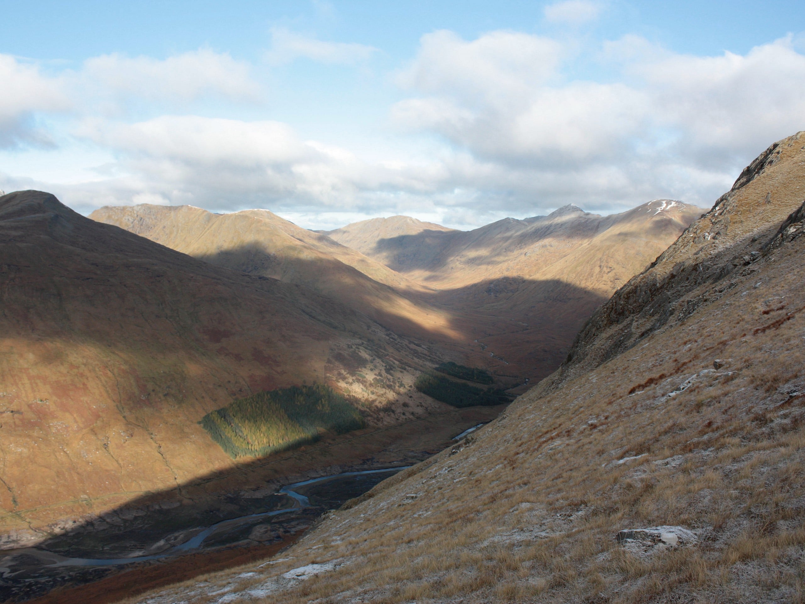
Glen Quoich Walk
Difficulty Rating:
The Glen Quoich Walk is a laidback adventure in Cairngorms National Park that features a beautiful riverside setting, rushing falls, and sweeping views across the glen. While out walking the trail, you will follow along the banks of Quoich Water to view The Punch Bowl falls, before climbing uphill for some amazing views across the valley. While this is an intermediate length route, the terrain here is easy to navigate and traverse, making this a perfect route for beginner walkers.
Getting there
The trailhead for the Glen Quoich Walk can be found 10.2mi southwest of Braemar at the car park along the River Quoich.

About
| Backcountry Campground | No |
| When to do | Year-Round |
| Pets allowed | Yes - On Leash |
| Family friendly | Yes |
| Route Signage | Average |
| Crowd Levels | Moderate |
| Route Type | Lollipop |
Glen Quoich Walk
Elevation Graph
Weather
Glen Quoich Walk Description
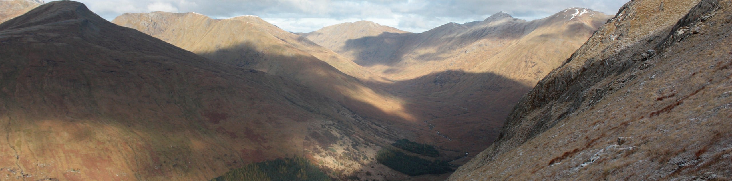
Featuring a winding river and beautiful views from an elevated position above the glen, the Glen Quoich Walk is a wonderfully scenic adventure that is perfect for a wide variety of outdoor enthusiasts, including families and casual adventurers.
Setting out from the car park, you will make your way to the northeast and cross over the Quoich Water, passing by Quoich Cottage as the trail bends to the northwest through the forest. Here, you will take in some pleasant views of The Punch Bowl falls, before heading right at a fork in the path that will lead you away from the riverbank and up the hillside.
Continuing on to the northwest, you will traverse this elevated position and enjoy views looking down onto the glen below, eventually descending to the west in order to cross over the water. Once you are on the opposite bank, you will follow Quoich Water to the southeast along the valley floor, passing through intermittent stretches of woodland terrain on the return to the car park.
Similar hikes to the Glen Quoich Walk hike

Loch an Eilein, Loch Gamhna, Old Logging Way Loop
The Loch an Eilein, Loch Gamhna, Old Logging Way Loop is a wonderful walking trail in Cairngorms National Park that…
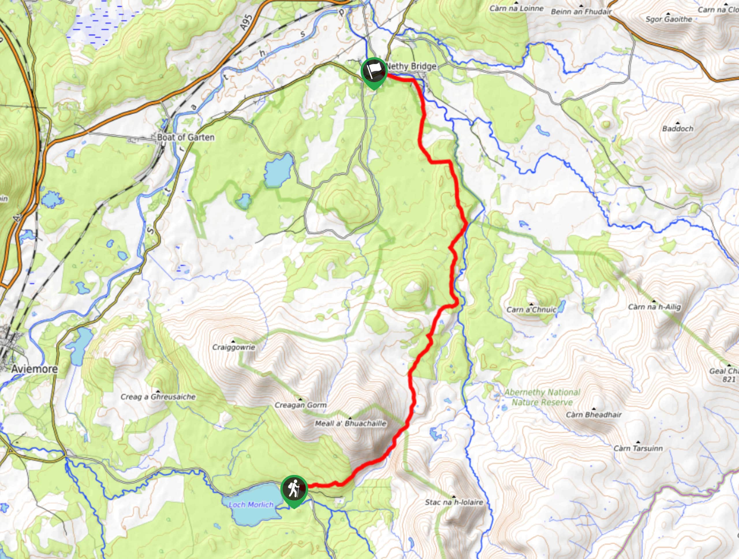
Loch Morlich to Nethy Bridge Walk
The Loch Morlich to Nethy Bridge Walk is a fun one-way trail in Cairngorms National Park that will lead you…
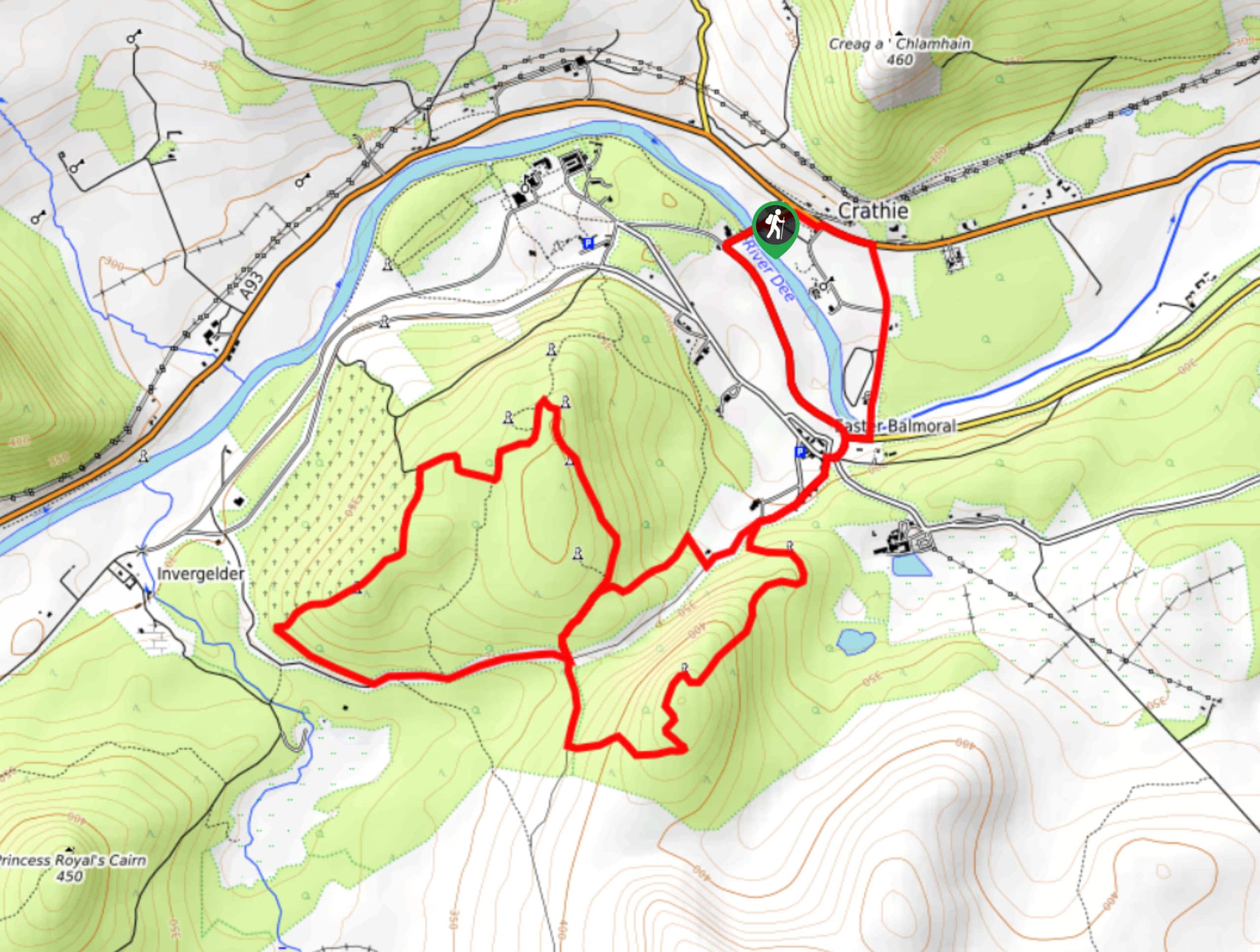
Crathie, Easter Balmoral and Cairns Circular Walk
The Crathie, Easter Balmoral, and Cairns Circular is a wonderful adventure in Cairngorms National Park that will see you explore…
Comments