Creag Mhòr and Loch Avon Walk
View Photos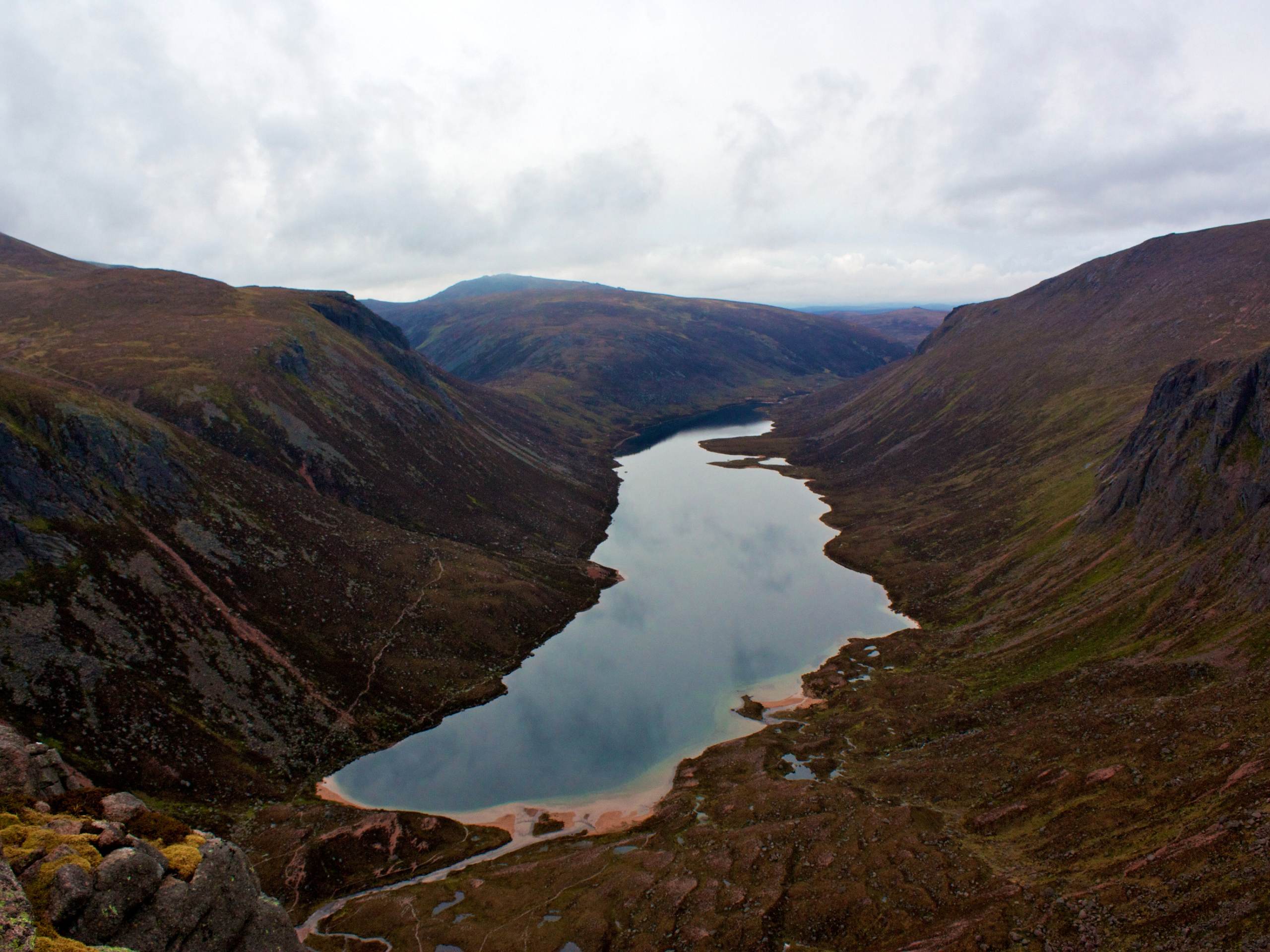
Creag Mhòr and Loch Avon Walk
Difficulty Rating:
The Creag Mhòr and Loch Avon Walk is a full-day adventure from Glenmore covering 18.6mi and climbing an impressive 2848ft to reach the summit of Creag Mhòr (3435ft). The challenging route unfolds on good paths and invites you to experience a remote part of the Cairngorms, where you’ll find yourself entirely enveloped in the beauty and mystique of this marvellous land.
Getting there
To get to the Creag Mhòr and Loch Avon Walk from Aviemore, take Craggan More Rd and Dalfaber Dr for 1.0mi to Grampian Rd/B9152. Then follow Grampian Rd/B9152 and B970 for 3.0mi. Continue on the minor road that leads to Glenmore Lodge and park by the end of the road to begin the walk.

About
| Backcountry Campground | Wild Camping |
| When to do | Year-round access |
| Pets allowed | Yes |
| Family friendly | No |
| Route Signage | Average |
| Crowd Levels | Low |
| Route Type | Lollipop |
Creag Mhòr and Loch Avon Walk
Elevation Graph
Weather
Creag Mhòr and Loch Avon Walk Description
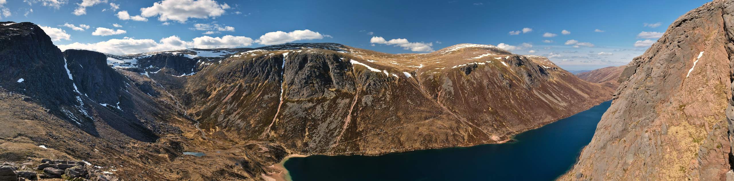
The Creag Mhòr and Loch Avon Walk is a fabulous day out in the Cairngorms National Park for several reasons. Not only are you invited to test your endurance by reaching the summit of Creag Mhòr (3435ft) but also to take in the beauty of Loch Avon and perhaps even brave a dip to cool off following the formidable summit climb. Good paths unfold for much of this route, although the going is rougher on Creag Mhòr, with some pathless stretches. Excellent views of the surrounding mammoth cairngorms await you on this walk, as well as an optional ascent of Creag Mhòr’s trademark granite tor.
To begin the walk, set out along the track from the parking area near Glenmore and pass the barrier. As dense Scots Pine flank each side of the track, you’ll soon pass on the left of Lochan Uaine, with an optional jaunt down to its turquoise shores made possible by some steps.
Continuing on the track, pass through the Ryvoan Pass and then take a right, following signs for Braemar at the fork. As the landscape opens before you, enjoy the breathtaking views of Abernethy Forest on your left as you head towards the River Nethy, crossing on a footbridge. Up ahead at another fork (where the constructed path ends), you’ll keep left.
Creag Mhòr will soon be within your line of sight with Beinn a’Bhuird lording behind it. The path soon rises before a subsequent descent that leads you across Glasath in the below glen. After the burn crossing, press on for 984ft and then take the convenient path up the heath slopes found on your left and leading towards Creag Mhòr. Don’t be fooled by the rocky outcrop at 2871ft, and instead continue up to the real summit made distinct by its granite armour. Once at the summit, opt to ascend the tor and soak up the views of the mighty Cairngorm giants that surround you.
To descend from the summit, aim to the rocks right at the 2871ft point and continue down this way to pick up the Lairig an Laoigh path. Heading southwards on this path, you’ll pass the shelter found at the Fords of Avon. From the shelter, depart the path and turn right onto a more rugged path that leads up gorgeous Glen Avon. Beware of boggy sections here and continue towards Loch Avon, one of the most remote lochs in all of Scotland. Walk the north side of the loch and take the higher branching path at the fork that climbs towards The Saddle across a slope. Take care as you make your way through the boulders and continue northbound down Strath Nethy.
Enjoy the clear path down the glen and follow it to rejoin the path from the initial stage of the walk. Then, cross the footbridge once again and retrace your steps back to the parking area near Glenmore Lodge where the walk began.
Similar hikes to the Creag Mhòr and Loch Avon Walk hike

Glen Banvie Trail and Blair Castle Walk
The Glen Banvie Trail and Blair Castle Walk is a great adventure in Cairngorms National Park that takes in the…

Beinn Udlamain Munro and Sgairneach Mhòr Walk
The Beinn Udlamain Munro and Sgairneach Mhòr Walk is a rugged and exciting journey in Cairngorms National Park that will…
Cairn of Gowal Loop
The Cairn of Gowal Loop is a rough and rugged excursion in Cairngorms National Park that will take you over…
Comments