Craigendarroch Walk
View Photos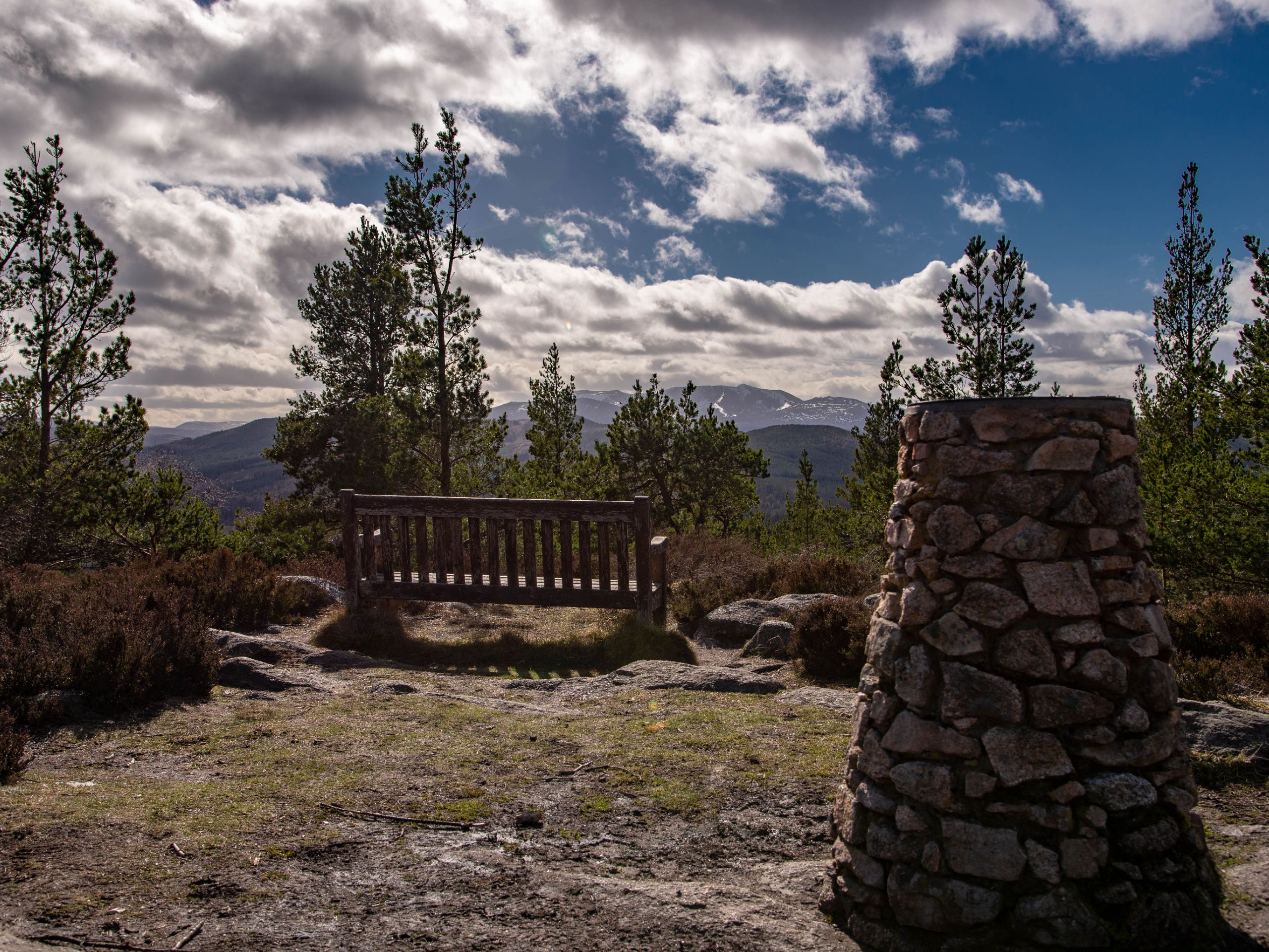
Craigendarroch Walk
Difficulty Rating:
The 4km Craigendarroch Walk in Ballater Scotland is a popular, small hillwalk that features fantastic views of the surrounding hills, most notably Lochnagar, whose corrie and cliffs are guaranteed to steal the show on a clear day! At 1319ft high, Craigendarroch may not be one of the tallest hills in the Cairngorms National Park, but it’s a challenging little hillwalk nonetheless, with some steep sections that are bound to get your heart rate going. This walk is an excellent choice for those looking to work towards tackling some of the park’s higher peaks and also for those walking with older children who are ready to take on a summit climb.
Getting there
To get to the Craigendarroch Walk from Ballater Caravan Park, head northeast on Anderson Rd toward Braichlie Road, then turn left onto Braichlie Road. Continue for 0.1mi, then turn right at the 3rd cross street onto Victoria Road. Drive for 0.1mi, then turn left onto Bridge Street/A93. After a short distance, turn right onto Station Square to enter the car park found in front of the old railway station where the walk begins.

About
| When to do | Year-Round |
| Backcountry Campsites | Ballater Caravan Park |
| Pets allowed | Yes |
| Family friendly | Older Children only |
| Route Signage | Average |
| Crowd Levels | Moderate |
| Route Type | Lollipop |
Craigendarroch Walk
Elevation Graph
Weather
Craigendarroch Walk Description
The Craigendarroch Walk is well summed up in the phrase: short and sweet with a dash of steep! The walk invites you to experience some incredible scenery of the surrounding hills and reach a summit in the Cairngorms National Park in under two hours. Walking Craigendarroch is a pleasant experience due to its clear, well-trodden path and the hills’ oakwood-covered flanks. There are some steep drops to navigate on this route, and the going is very steep at times, so don’t let your guard down due to its relatively small size, as this hill still brings the heat! If walking with older children, ensure they’re able to manage the steep sections and are also able to take care when walking nearby steep drops.
Set out from the car park found in front of the railway line (since restored) right in the centre of Ballater. Make a right to turn onto the main road, heading in the direction of Braemar. Continue past the old church, since converted into a hotel, then turn right to join a footpath with signs for the Craigendarroch Walk. Continue the path until reaching a second sign, marking the path that heads left into the pretty oakwoods. Take the path bound for the woods, then turn left when you spot the red marker post.
The steep ascent soon commences as you find yourself enveloped in age-old oak trees, weaving your way along the path. Keep an eye out for a sign marked with “The Top” and once you’ve reached it, turn right to continue up towards the summit.
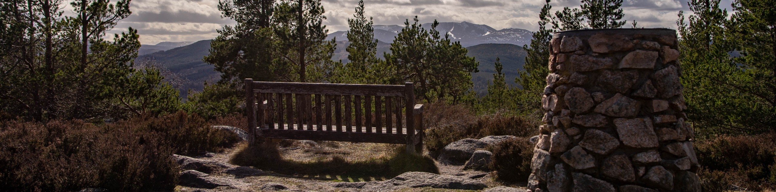
As you continue to climb, you’ll note the oak trees gradually fade as Scots pines and birches soon become more prevalent in this section. As the trail becomes rockier and more rugged, you’ll want to take care with your footing as you near the top. You’ll soon spot the enormous cairn atop Craigendarroch, marking your arrival at the first summit. Views down to Ballater and the meandering Dee are superb from here, so feel free to spend some time enjoying this while catching your breath before continuing to the true summit. When you’re ready, continue a short distance further to reach the summit at 1319ft, where you’ll find a welcoming bench and a handy viewpoint indicator, great for identifying the surrounding hills. On a clear day, you’ll likely be drawn to views of Lochnagar, with its northern corrie and cliffs looking nothing short of majestic from this viewpoint.
When you’ve had your fill of the views, set out to complete the walk by descending via the far path on the side of the hill, marked with a red waymarker. This next section is quite steep, so take your time and as you continue on the path that soon joins another path that rounds the hill. Turn left as the crags of the Ballater Pass appear before you and continue to zig-zag your way down the path, which soon levels. The Ballater Pass, formed along the line of a natural fault, was etched out by a glacier during the ice age. Beware of the drop on your right during this section, as it’s quite extreme!
As the pine trees fade and the towering oaks return, continue the path past a few benches until you reach a junction. Continue straight through the junction and retrace your steps on this same section from the beginning of the walk to return to the car park where the walk began.
Other Great Walks in Cairngorms National Park
Check out our trail guides to Ben Magdui, Loch Muick, Ben Vrackie, Loch an Eilein, and the Mount Keen Walk. Or see all of our Cairngorms walks.
Insider Hints
Today, Craigendarroch is a protected National Nature Reserve, however, the hill’s oaks were once coppiced and used in the production of cartwheels up until the 18th-century.
The railway station where the walk began also features Ballater Tourist Information, a great place to pop in if you plan on checking out Ballater either before or after the walk.
The lovely Victorian village of Ballater features excellent restaurants, cozy cafes and a wide range of accommodations. Check out The Balmoral Bar for great drinks and pub fare.
Similar hikes to the Craigendarroch Walk hike

Loch an Eilein, Loch Gamhna, Old Logging Way Loop
The Loch an Eilein, Loch Gamhna, Old Logging Way Loop is a wonderful walking trail in Cairngorms National Park that…
Loch Morlich to Nethy Bridge Walk
The Loch Morlich to Nethy Bridge Walk is a fun one-way trail in Cairngorms National Park that will lead you…
Crathie, Easter Balmoral and Cairns Circular Walk
The Crathie, Easter Balmoral, and Cairns Circular is a wonderful adventure in Cairngorms National Park that will see you explore…
Comments