Cairn Gorm and the Northern Corries Walk
View Photos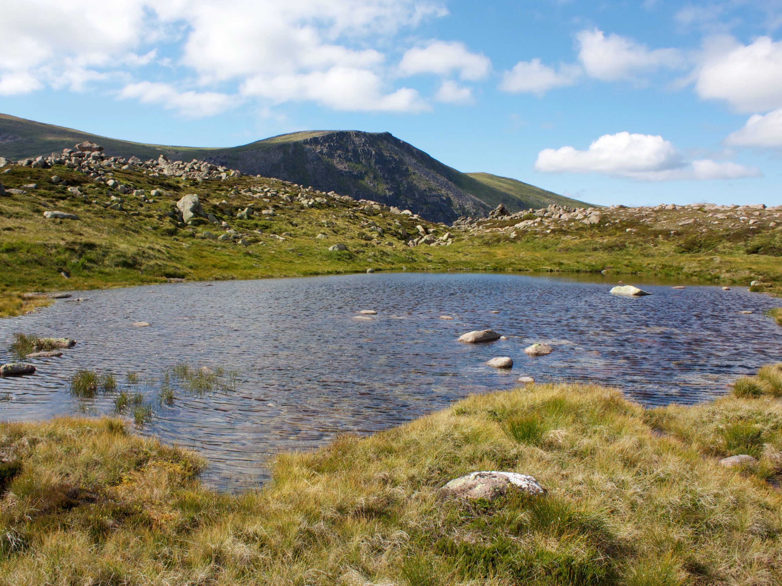
Cairn Gorm and the Northern Corries Walk
Difficulty Rating:
The Cairn Gorm and the Northern Corries Walk is a thrilling 6.8mi hillwalk, beginning at the Cairngorm Ski Centre in the heart of the Cairngorms National Park near Aviemore, Scotland. With an elevation of 4081ft (4084ft), Cairn Gorm is a classified Scottish Munro and is the most popular and most often-walked mountain in the Cairngorms range. Climbing Cairn Gorm is no small feat, and this walk is best reserved for experienced hillwalkers with a good set of navigational skills due to a significant pathless section.
Getting there
To get to the Cairn Gorms and Northern Corries Walk from Aviemore, take Craggan More Road and Dalfaber Drive to Grampian Road/B9152, then continue for 1.0mi. Follow Grampian Road/B19152 and B970 for 3.0mi, then continue straight on a limited-access road for 8.1mi (don’t turn left where the B970 forks.) When you spot signs for the Cairngorm Mountain Lower Car Park, make a right, then continue 1.1mi and keep right to reach the Cairngorm Mountain Upper Car Park, where the trail begins.

About
| When to do | Year-round access |
| Backcountry Campsites | Glenmore Campsite |
| Pets allowed | Yes |
| Family friendly | No |
| Route Signage | Average |
| Crowd Levels | High |
| Route Type | Circuit |
Cairn Gorm and the Northern Corries Walk
Elevation Graph
Weather
Cairn Gorm and the Northern Corries Walk Description
The Cairn Gorm and Northern Corries Walk is a superb hillwalk and one that those looking for a true challenge will find their match in! During the summer months, on a clear day, the trail is relatively straightforward; that being said, beware of pathless sections and high exposure if you’re walking in non-ideal conditions. The trail runs close to cliff edges at times, so caution and care should always be taken on this walk. If tackling this hill during the winter months, exceptional navigational skills are recommended and adequate equipment, such as crampons and an ice-axe.
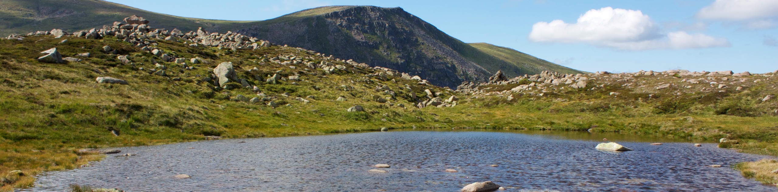
Cairn Gorm (4081ft) is a hillwalk you’ll find on most must-do lists for experienced hillwalkers in Scotland. The formidable hill is undoubtedly the most famous mountain in the Cairngorms range, and its unique rock architecture and fine views from atop the summit make it a challenge well-worth taking on.
To begin the Cairn Gorm and Northern Corries Walk, you’ll bypass the most common route of ascent, which follows The Windy Ridge Path, and instead, head west via the steps to cross the bridge. Spot the path on the far side, which leads up some further steps before bending across the moor to join another path. When you reach a fork, stick to the lower path on your right hand side, which leads across the Allt Coire an t-Sneachda.
After crossing a stream, continue on the path, which soon leads to the expansive ridge of Miadan Creag an Leth-Choin. Enjoy the views as you continue to rise, with the gulf of Coire an Lochain soon coming into view on your left. Press on towards the col found between Lurcher’s Crag and mighty Ben Macdui. From the Col, you’ll capture the incredible scenes over Sròn an Lairige and out across Lairig Ghru. Continue as if heading for Ben Madcui, but depart from this path to join the fainter path that leads up towards sizeable stepping stones, guiding you across a boggy section. The going gets steeper and tougher as you continue to climb, headed for the Coire an Lochain’s eastern cliffs, which you’ll no doubt find breathtaking. Gain the plateau, soaking up the incredible views out towards Sgor an Lochain Uaine and Cairn Toul.
Minding the edge (which features a significant drop), continue on the path that leads towards Coire an Lochain’s rim. Two cairns mark the summit, and both are found close to the plateau edge with a significant fully separating them. If walking during winter months when snow is present, extreme caution must be exercised during this section, as fatal accidents have occurred under bad winter conditions. Follow the plateau edge all the way to the northeast, where you’ll unlock sensational views of the corrie below.
With the adrenaline flowing, continue the path 1312ft as it leaves the edge and heads down across the steep slopes, veering slightly south of east. The route draws close to the cliffs again as you continue up the opposite slopes, with superb views of the corrie accompanying you the whole way. Press on to reach the top of Stob Coire an t-Sneachda and stick to the path that rounds the rim of the cliffs to the left.
As the summit of Cairngorm nears, continue eastwards up the rocky slopes with your sights set on reaching the fine cairn that sits atop the summit. Arrive at the summit, where you’ll also find an old weather station, and revel in the marvellous views as you celebrate your arrival at 4081ft.
To descend, join the path that leads northwards, heading towards the Ptarmigan station building of the funicular railway. Please note that the station is currently closed due to technical issues, so you won’t find any life around here at the moment. Continue downhill, passing on the right hand side of the Ptarmigan building to pick up the wide path with signs for the “Windy Ridge Path.” At a fork, keep right and continue to walk across a ski-run, then veer left next to the second snow fence. With views of Loch Morlich opening up ahead, enjoy the final stretch of the walk on the apparent path that leads down the expansive ridge of Sron an Aonaich. The path soon bears left and continues downhill at a steeper angle until you reach the funicular located just above the lower station. Make a right onto the path to bypass the construction work going on, then head down the steps above the ski centre to return to the car park where the walk began.
Other Great Walks in Cairngorms National Park
Check out our trail guides to Ben Magdui, Loch Muick, Ben Vrackie, Loch an Eilein, and the Mount Keen Walk. Or see all of our Cairngorms walks.
Insider Hints
The car park at Cairngorm Ski Centre charges £2 per vehicle, seasonally from June to October.
For toilet access before or after the walk, you can use the Cairngorm Ski Centre.
The Cairngorm Ski Centre boasts a gift shop and Cafe (open 7 days a week).
This route is easily accessible without your own transport. You can take the bus directly from Aviemore to the Cairngorm Ski Centre where the walk begins.
Nearby Aviemore is a tourist resort and is home to a plethora of great restaurants and accommodations.
Similar hikes to the Cairn Gorm and the Northern Corries Walk hike

Glen Banvie Trail and Blair Castle Walk
The Glen Banvie Trail and Blair Castle Walk is a great adventure in Cairngorms National Park that takes in the…

Beinn Udlamain Munro and Sgairneach Mhòr Walk
The Beinn Udlamain Munro and Sgairneach Mhòr Walk is a rugged and exciting journey in Cairngorms National Park that will…

Loch an Eilein, Loch Gamhna, Old Logging Way Loop
The Loch an Eilein, Loch Gamhna, Old Logging Way Loop is a wonderful walking trail in Cairngorms National Park that…
Comments