
Capel Mounth and Loch Muick Circular Walk
View Photos
Capel Mounth and Loch Muick Circular Walk
Difficulty Rating:
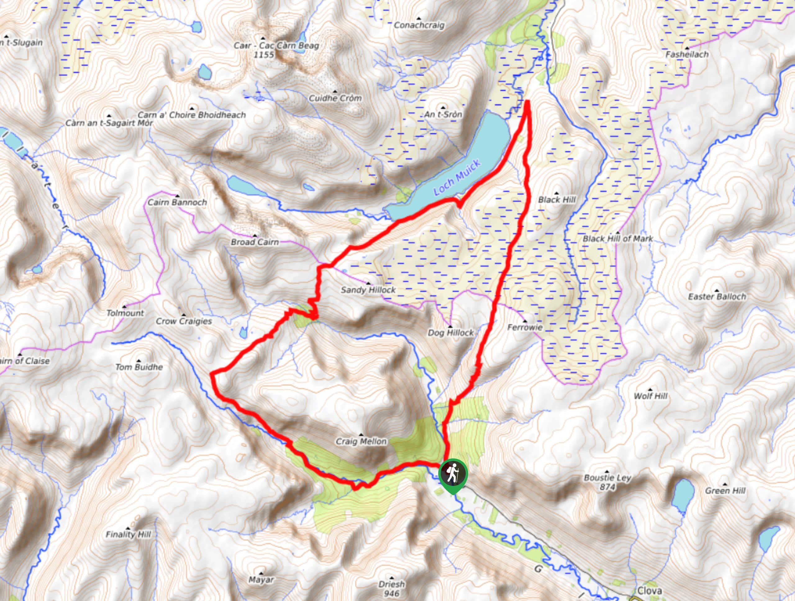
The Capel Mounth and Loch Muick Circular Walk is a very long and very challenging excursion in Cairngorms National Park that is geared towards well-seasoned walkers. While out on the trail, you will pass through a glen and traverse several mountain peaks on the way to the shores of Loch Muich, before returning along the boggy landscape of the moor. While very fit adventurers will be able to complete this walk in a single day, it is often done as a multi-day excursion.
Getting there
The trailhead for the Capel Mopunth and Loch Muick Circular Walk can be found at the Glendoll car park, just 3.4mi northwest of Clova.

About
| Backcountry Campground | No |
| When to do | April-September |
| Pets allowed | Yes - On Leash |
| Family friendly | No |
| Route Signage | Poor |
| Crowd Levels | Low |
| Route Type | Circuit |
Capel Mounth and Loch Muick Circular Walk
Elevation Graph
Weather
Capel Mounth and Loch Muick Circular Walk Description
Featuring beautiful glens, winding rivers, scenic mountaintops, and charming lochs, the Capel Mounth and Loch Muick Circular Walk is an excellent trail if you are looking to experience the rugged beauty of Cairngorms National Park.
Setting out from the car park, you will make your way to the northwest through Glendoll Forest, following closely alongside the banks of White Water as you pass through a scenic glen. Eventually, you will turn to the northeast to traverse the summits of Cairn Lunkard and Craigs of Loch Esk, before traversing the rugged terrain on the way to Loch Muick.
Here, you will enjoy sweeping views across the water that include nearby mountains as a scenic backdrop, as you walk along the shores of the picturesque loch. After reaching the northeast corner of the route, the trail will turn sharply to the southwest and climb back uphill. Making your way across a vast stretch of moor, you will eventually descend into a glen and follow the River South Esk to arrive back at the car park where you began.
Similar hikes to the Capel Mounth and Loch Muick Circular Walk hike

Glen Banvie Trail and Blair Castle Walk
The Glen Banvie Trail and Blair Castle Walk is a great adventure in Cairngorms National Park that takes in the…

Beinn Udlamain Munro and Sgairneach Mhòr Walk
The Beinn Udlamain Munro and Sgairneach Mhòr Walk is a rugged and exciting journey in Cairngorms National Park that will…

Loch an Eilein, Loch Gamhna, Old Logging Way Loop
The Loch an Eilein, Loch Gamhna, Old Logging Way Loop is a wonderful walking trail in Cairngorms National Park that…
Comments