Cassidy Trail hike
View Photos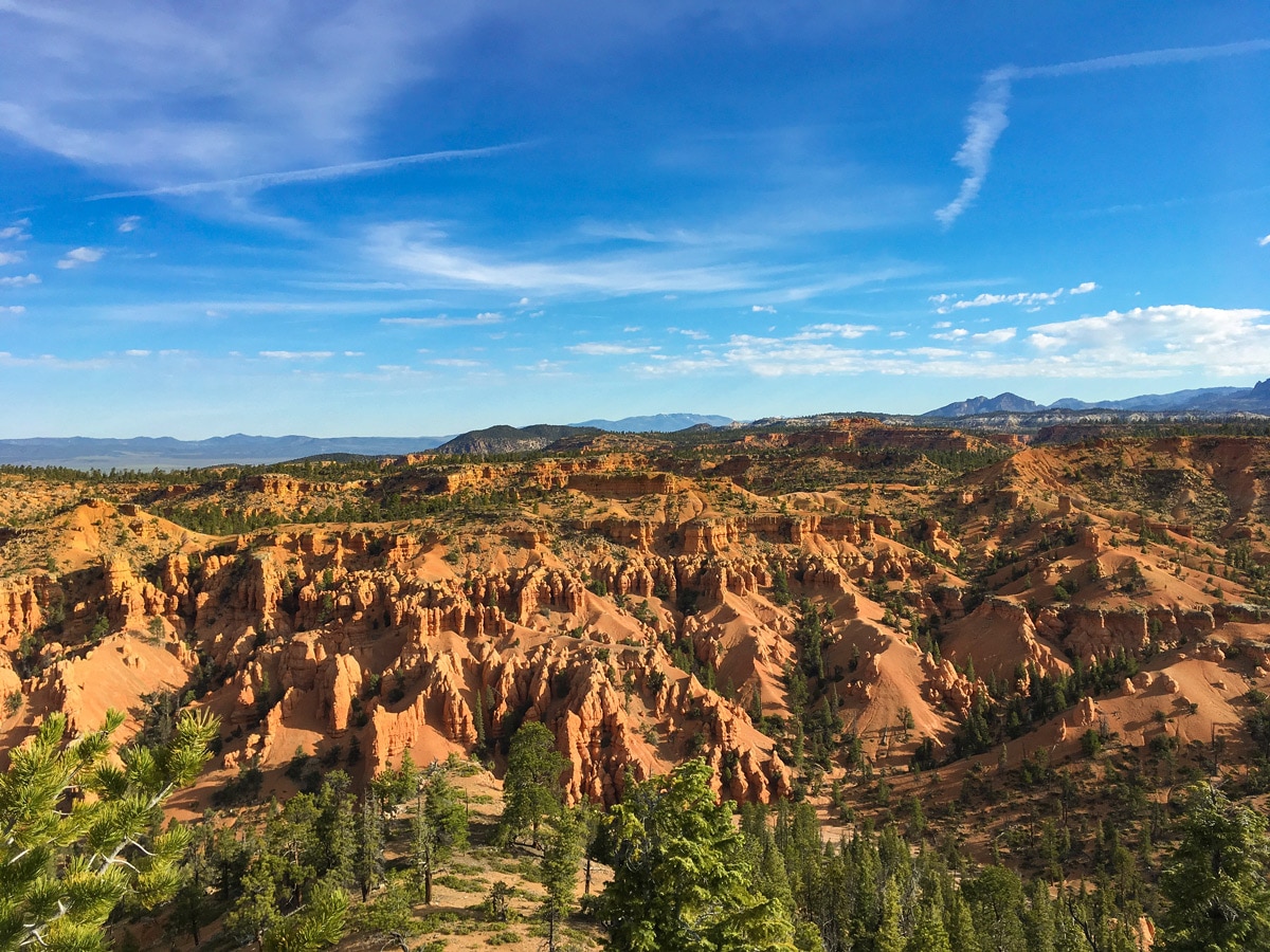
Cassidy Trail hike
Difficulty Rating:
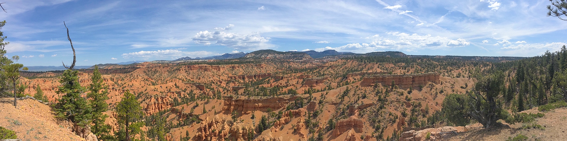
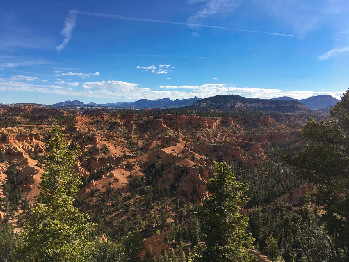
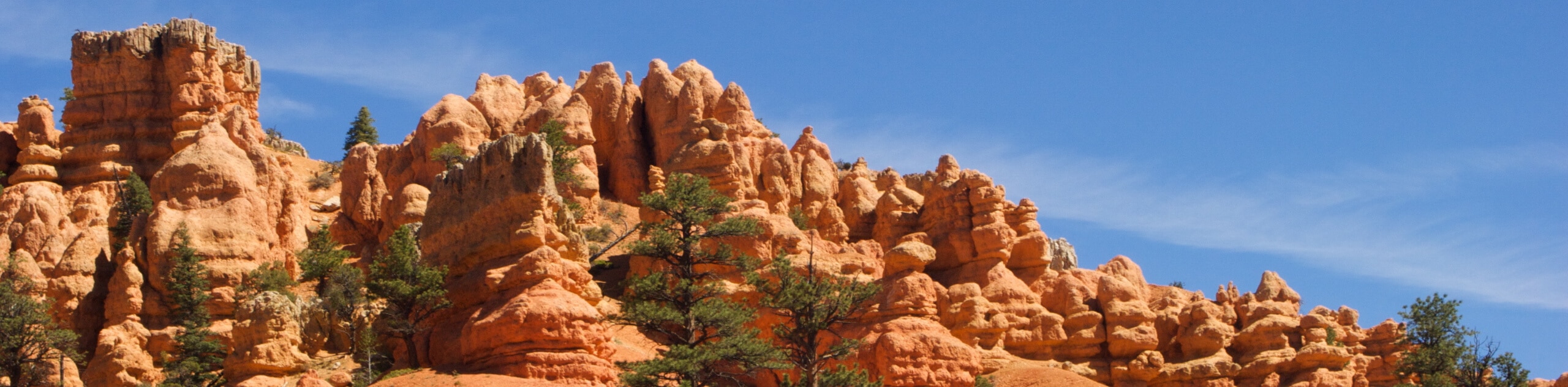
Located in the "Little Bryce Canyon", otherwise known as Red Canyon, the Cassidy Trail is an overwhelmingly beautiful hike. Slowly gaining then traversing along an exposed ridge, the route has nearly continuous views for its entire duration towards Mexican Hat Peak.
Getting there
From the town of Bryce, head north towards the junction with Highway 12. Turn left and hop onto Highway 12, soon entering the Dixie National Forest. Shortly before the Red Canyon Visitor Centre, pull off for the Red Canyon Trailhead on your right. This turnoff is shortly after you pass through two famous arches. The turnoff is poorly signed, so watch out and be ready to hit the brakes!

About
| When to do | Spring, early summer and fall, avoid summer heat and winter snow |
| Backcountry Campsites | Yes, ask at Red Canyon Visitors Centre |
| Toilets | At trailhead, and two along trail |
| Family friendly | No |
| Route Signage | Average |
| Crowd Levels | Low |
| Route Type | Out and back |
Cassidy Trail
Elevation Graph
Weather
Route Description for Cassidy Trail
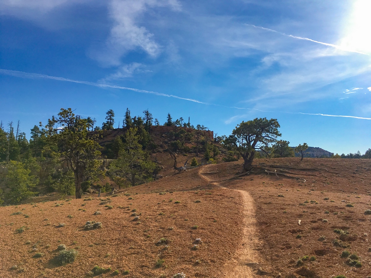
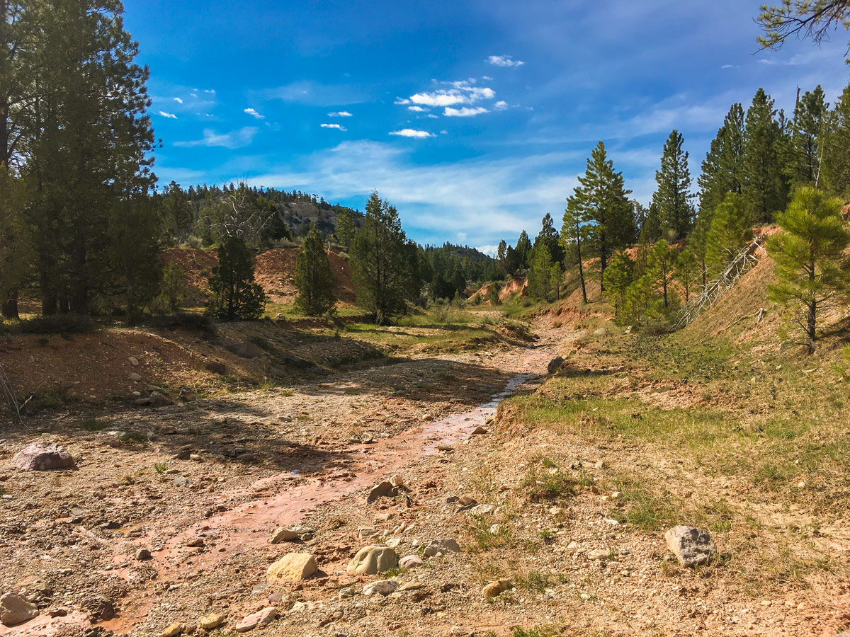
The trail begins at the far end of the large parking lot, initially running beside a wash (dried out riverbed), which slowly gains elevation. After a 1.0mi or so you will reach the turnoff for the Rich Trail. You will cross this trail several times, however at each intersection the way is well marked. Follow signs for the Cassidy Trail and continue straight.
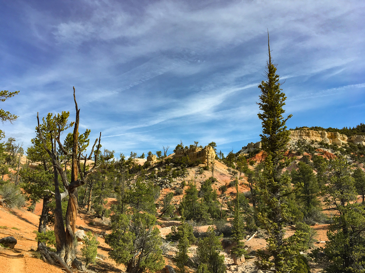
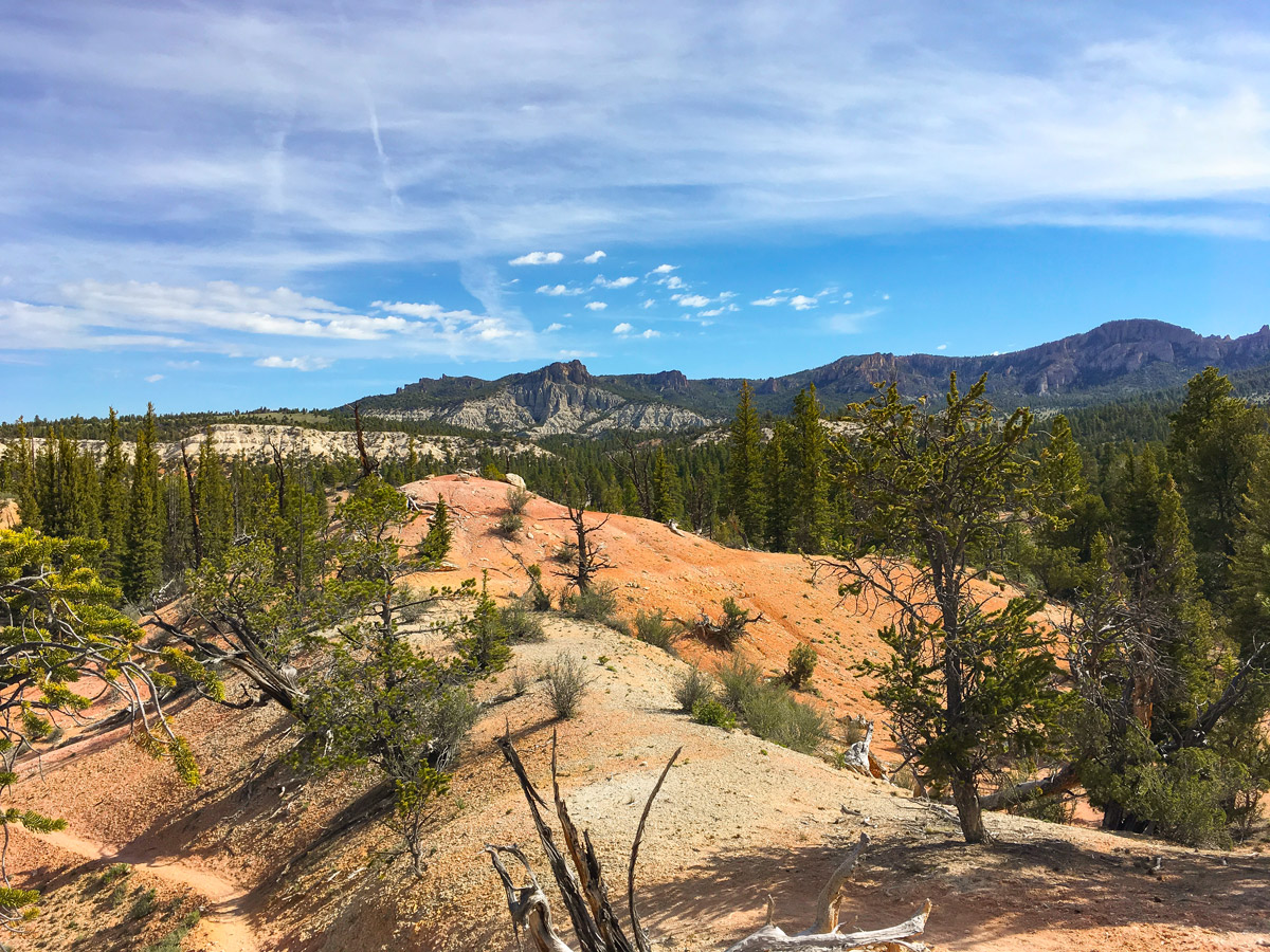
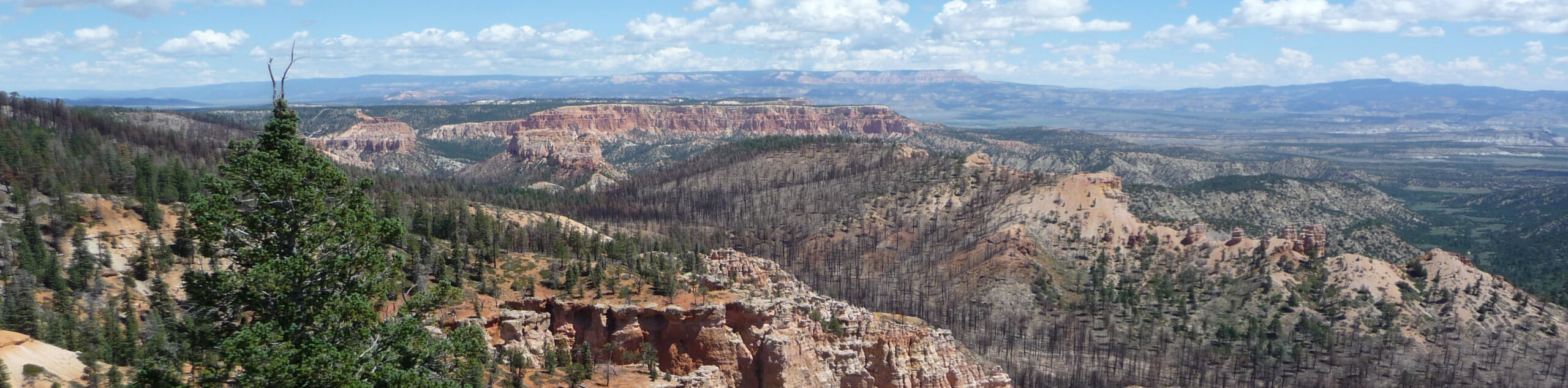
The route will now switchback a few times. Looking back you will be able to see the impressive red rock formations over the main Red Canyon, interspersed with small ponderosa pines. After passing another intersection with the Rich Trail and continuing along a short climb veering left you will come to the stunning Brayton Point. From this view the valley drops out beneath you, and the incredible red limestone lining the cliff wraps around almost 360 degrees!
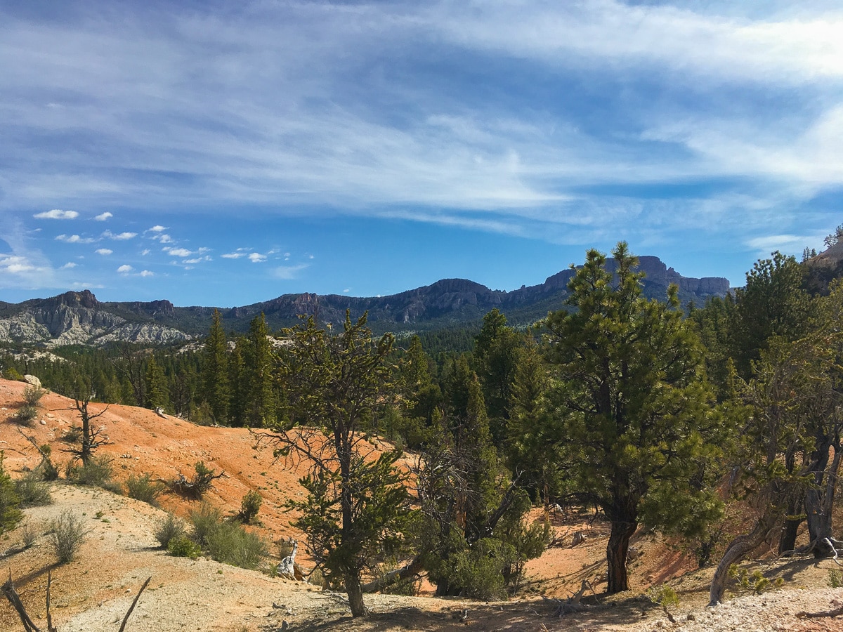
The path then continues to the right along the ridgeline. Since this trail is shared with mountain bikes, the path winds around trees, though all in all it’s quite nice. The views continue as you descend from this plateau and veer north. Coming up at the 5.0mi mark, you’ll approach the Losee Canyon, where you’ll find a horse corral and a washroom. This canyon, though without a majestic view, is deeply entrenched in the stunning red rock and has a beautiful atmosphere.
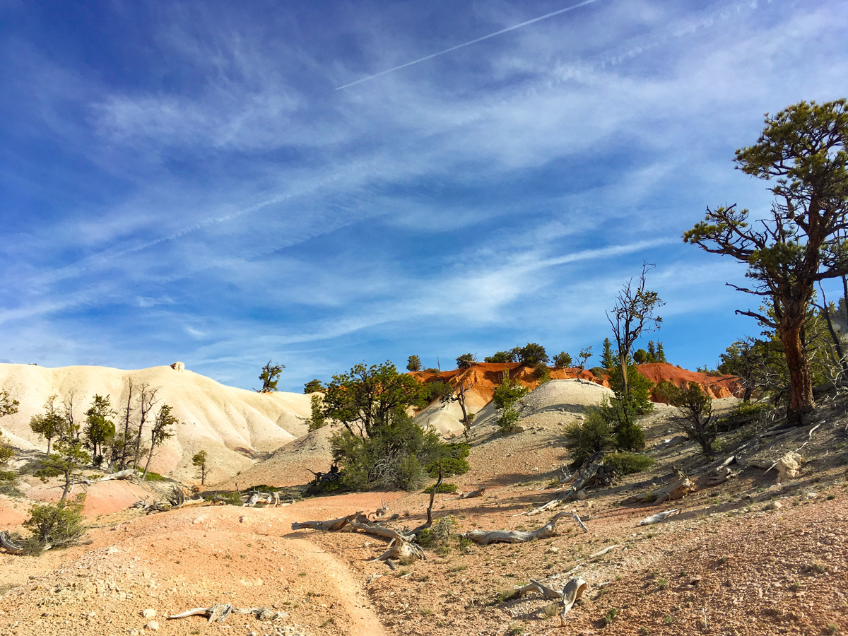
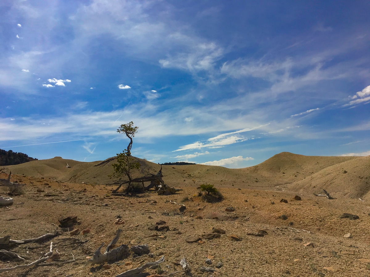
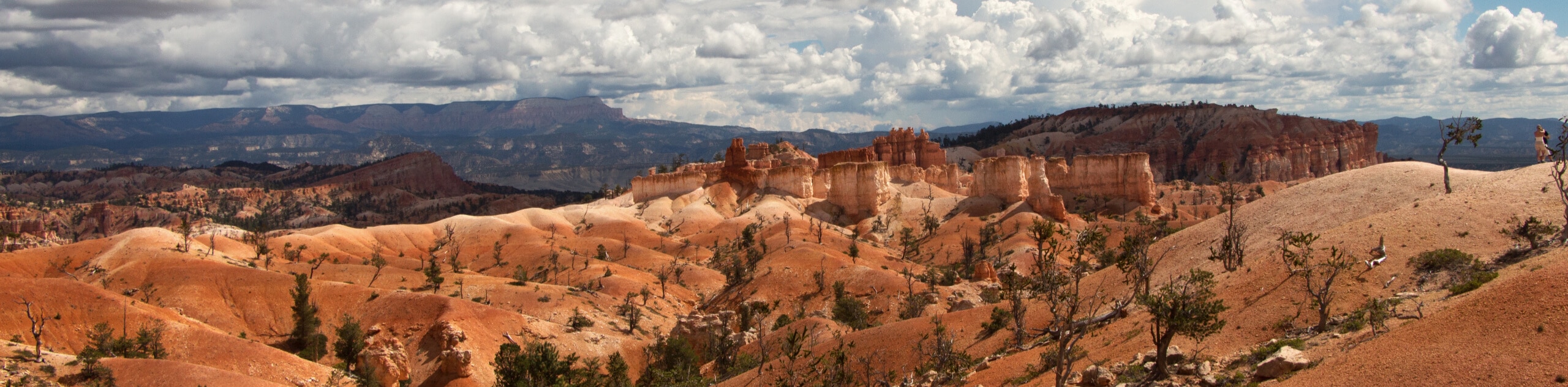
The trail continues north past Losee Canyon, undulating up and down but never getting too steep. Soon you will enter the startlingly white ‘Little Desert’ section. Traversing this short phase of bright white rock with scattered short trees is sure to amaze you!
After this break from reality you will have another short climb to another ridge. After travelling this ridge for a ways you will reach the second washroom and viewpoint, signposted as a left turnoff from the main trail. After enjoying the scenery and the facilities return to the trail and head north.
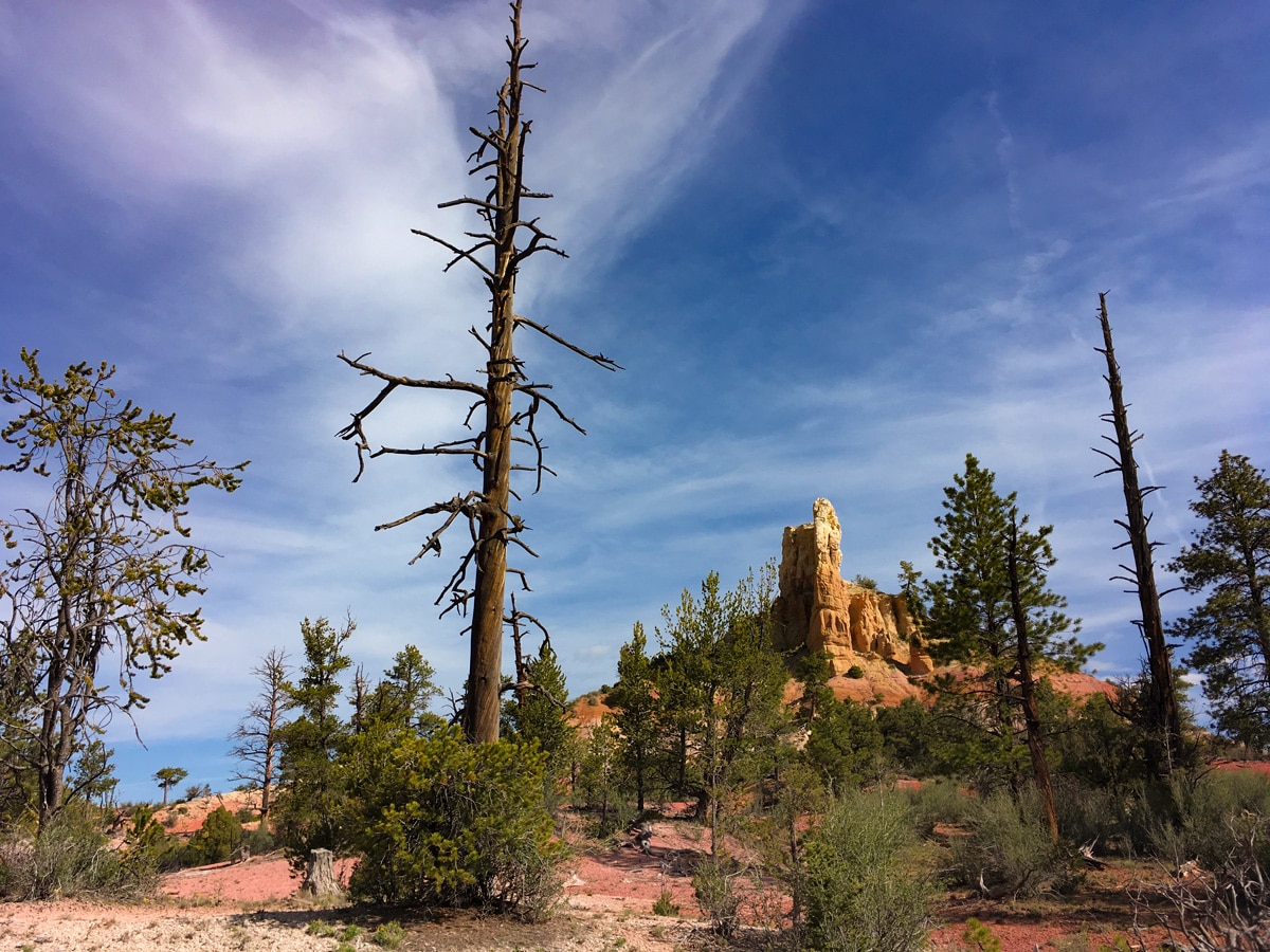
Soon, Mexican Hat Peak will come into view. This startling rock formation juts out of the ridgeline like a shark fin or a pop can. The trail doesn’t go awfully close to the formation, however you are granted stunning views up to its craggy peak. Finally the trail will descend slightly to meet the wet and lush Castro Canyon. From here return the way you came.
Insider Hints
If you wish to shorten this hike, only do the 2.5mi out to Brayton Point. Here you will find the best views, and not too much elevation gain! This hike would be rated a 2/5. Another option is to go to Losee Canyon and back, which is 5.0mi one way, a 3/5 hike.
The Red Canyon area gets way less traffic than Bryce Canyon. Come here to escape the crowds and seek solitude in nature.

Similar hikes to the Cassidy Trail hike
Piracy Point
The Piracy Point Trail is a short and sweet hike to an incredible viewpoint in Bryce Canyon National Park. This…
Rim Trail, Navajo Loop, and Peekaboo Circuit
The Rim Trail, Navajo Loop, and Peekaboo Loop Hiking Circuit is a fantastic trail in Bryce Canyon National Park. This…
Bryce Horse Trail
The Bryce Horse Trail is a great circuit in Bryce Canyon National Park. This trail is used by horseback riders…
Tiffany Swift 4 years ago
Taking the Ledges spur is a must...fantastic valley & range views with a helpful breeze during the warmer weather. Beautiful landscape, good for panoramic views.
Stevie M 4 years ago
Short and pretty easy with a few climbs when I did the Brayton Point. Beautiful scenery all around.
TwoBoots 4 years ago
The hike to the top offers an amazing vantage point.
Anabelle Clyde 4 years ago
Good for panoramic views. wonderful trail! well marked.
Frank M. 4 years ago
Beautiful landscape, good for panoramic views. great for short but slightly technical, you have to pay attention to the markers.
Gregory F 5 years ago
Cassidy Trail is a tougher longer hike. But the terrain it opens up is amazing. Loved it.
Jarvie P. 5 years ago
This hike consists of several loops and taking you in different directions with beautiful views. Easy and relaxing hike. Great hike away from crowds.
applepanda 5 years ago
Nice challenging hike. Beautiful but strenuous at times with pretty steep inclines. Totally worth it.
subterry 5 years ago
Fun out-and-back with good views of the Red Canyon the whole way
Isaiah L. 5 years ago
Great workout. It was hard and quite challenging. This place offers great views and interesting wildlife.