Riggs Spring Loop Trail hike
View Photos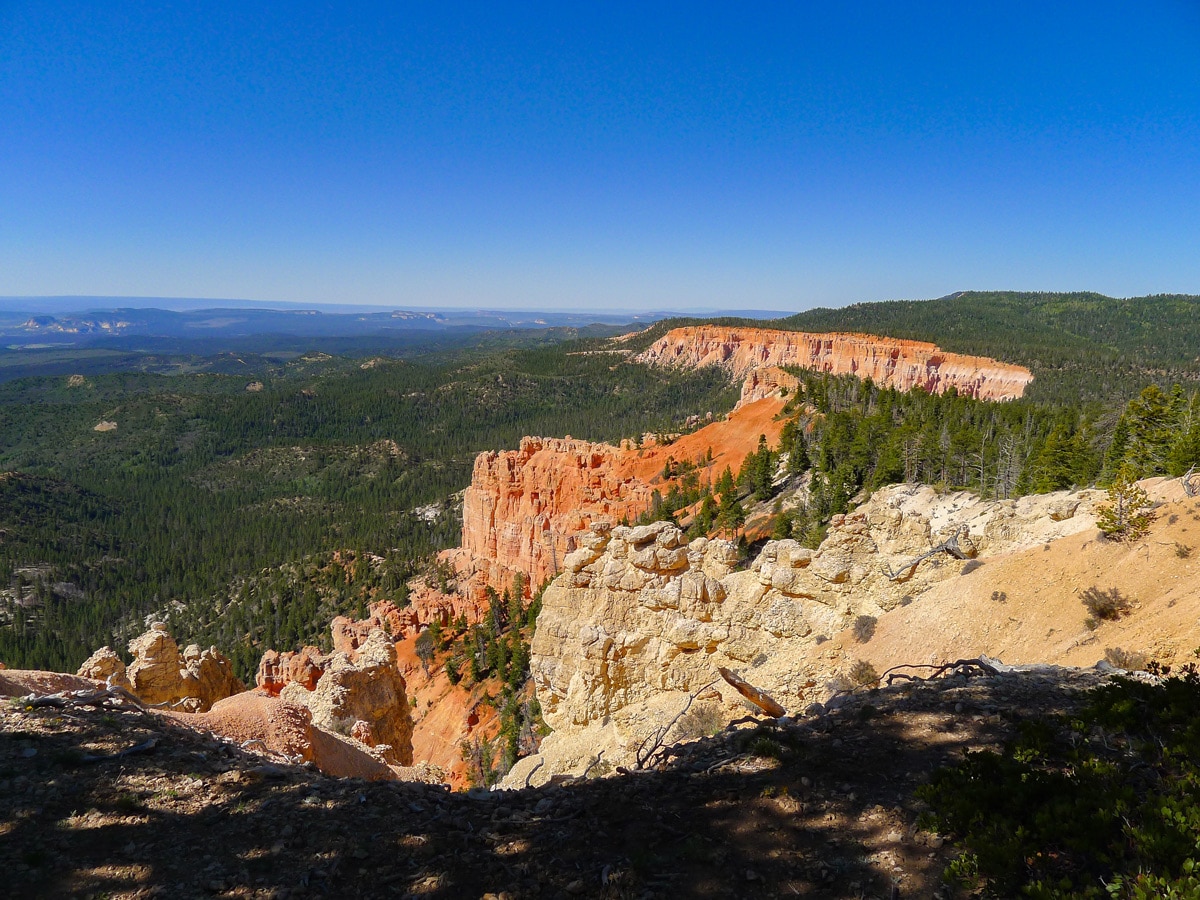

Riggs Spring Loop Trail hike
Difficulty Rating:
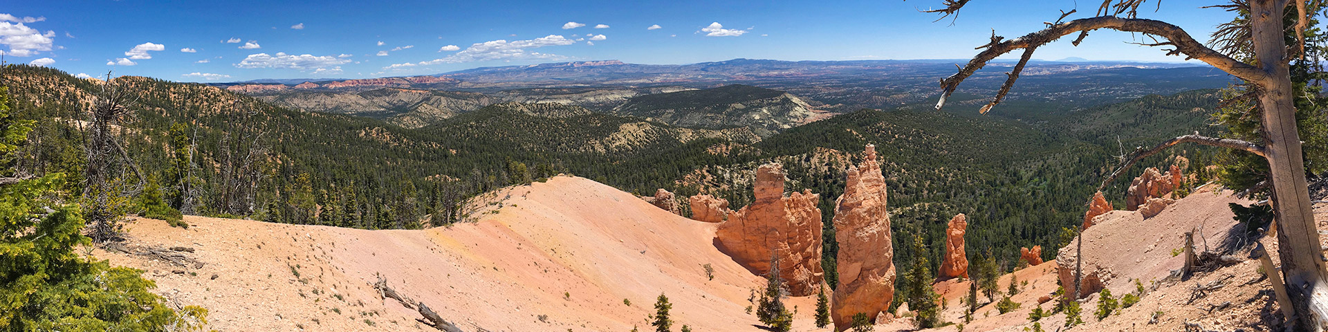
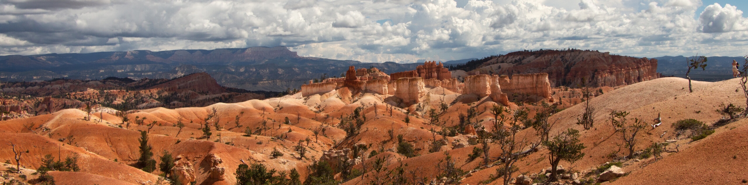
Though it has far fewer hoodoo views than other more popular trails in the park, this loop route gives you something the other trails simply can't – peace and solitude. Hiking through a stunning pine tree forest, this half day hike definitely separates you from the bustling view points along Bryce Canyon's main road.
Getting there
Enter Bryce Canyon National Park just south of the town of Bryce. Pay your dues at the park gate, then drive along the main road until its very end at Rainbow Point. Park here, but be advised – the lot fills quickly.

About
| When to do | Spring, early summer and fall, avoid summer heat and winter snow. |
| Backcountry Campsites | Several along trail, go to Visitors Centre for permit |
| Toilets | At trailhead |
| Family friendly | No |
| Route Signage | Average |
| Crowd Levels | Low |
| Route Type | Circuit |
Riggs Spring Loop Trail
Elevation Graph
Weather
Route Description for Riggs Spring Loop Trail
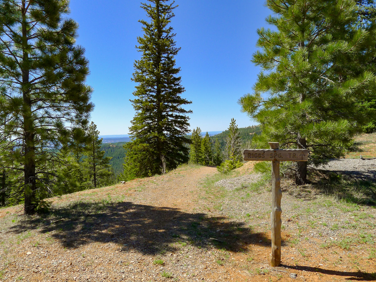
The description for completing the route counter clockwise is outlined here. Find the trailhead near the signs for Yovimpa Point. Continue along the trail as it heads towards this point, then quickly find a junction. Turn right here to head towards Yovimpa Pass Campground as well as the Riggs Spring Trail.
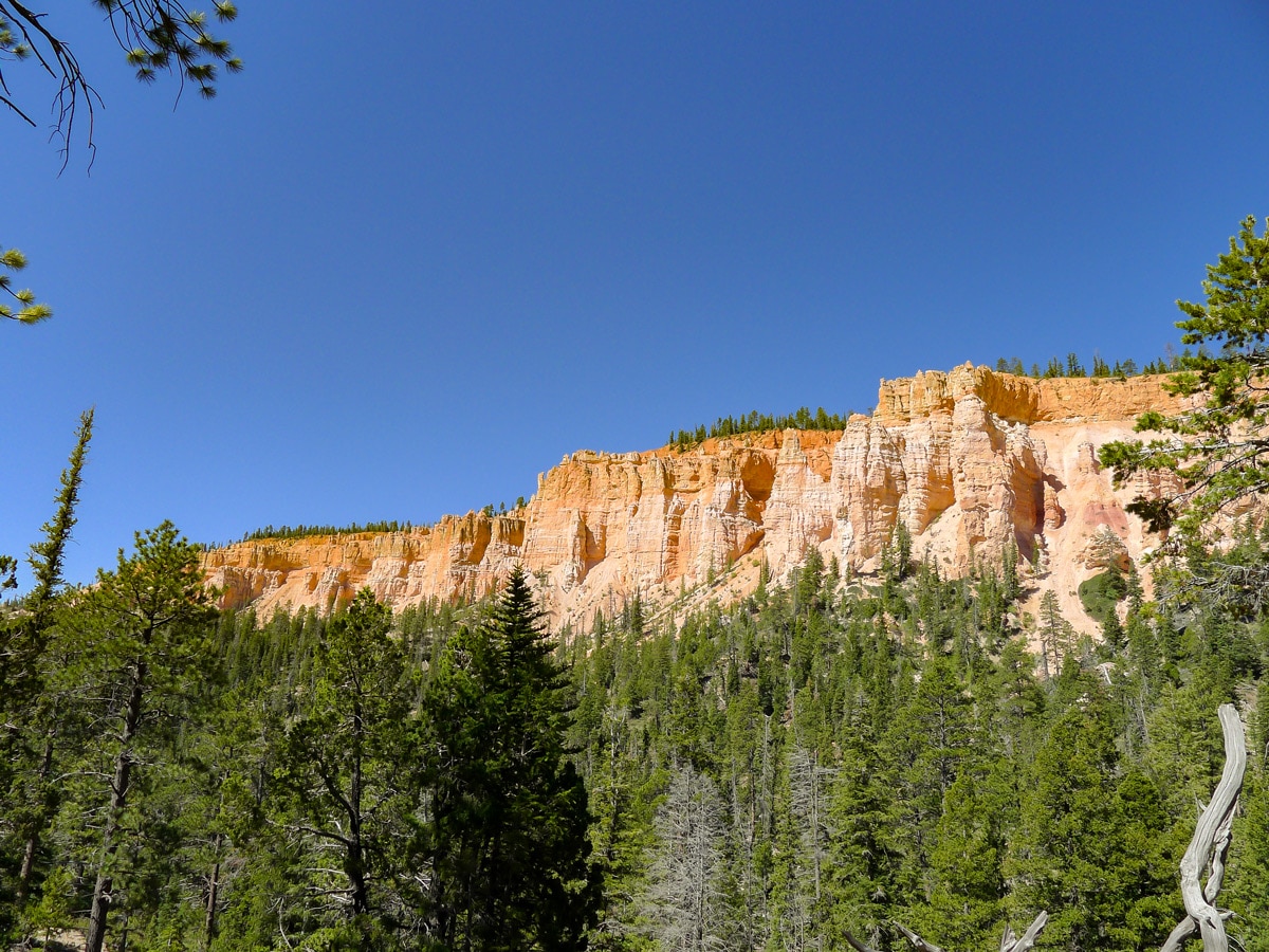
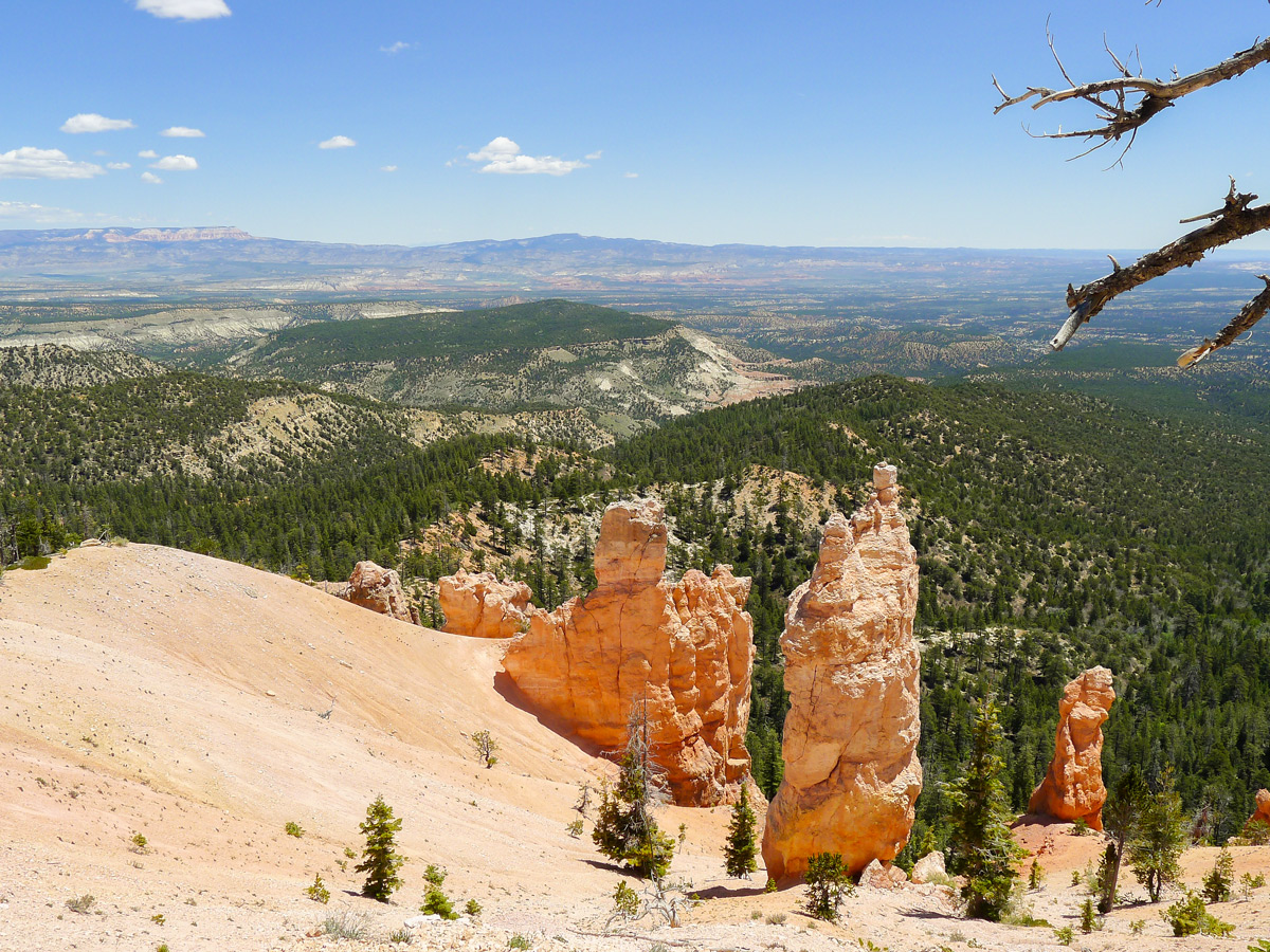
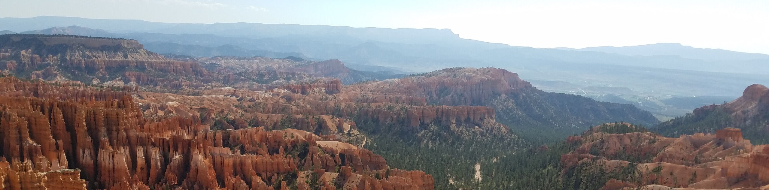
The trail will steeply descend and switchback down towards the obvious Yovimpa Pass. Around Yovimpa Pass the Paunsaugunt Plateau steepens as it approaches the rim, then drops completely off the vertical red cliffs. This impressive view is unlike most others in the park.
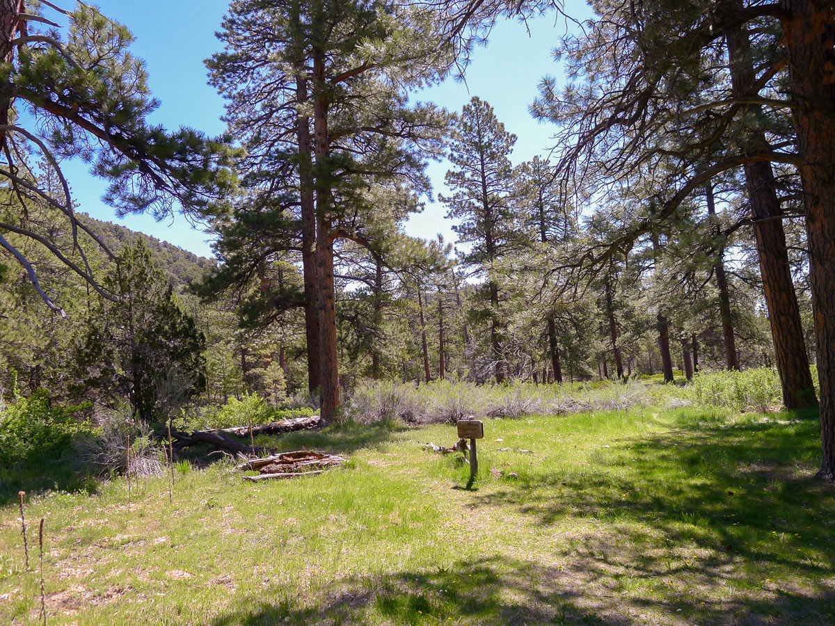
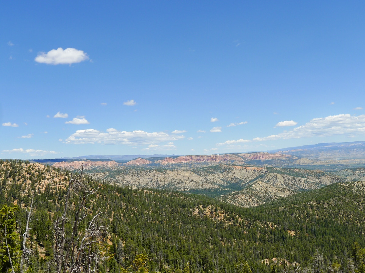
After reaching the pass the trail will veer left and continue descending down below the rim. Here you will enter a beautiful ponderosa pine forest and continue your descent. The sounds of traffic on the road are long gone, and the only things that fill your ears are the chirps of birds and buzzing of bees.
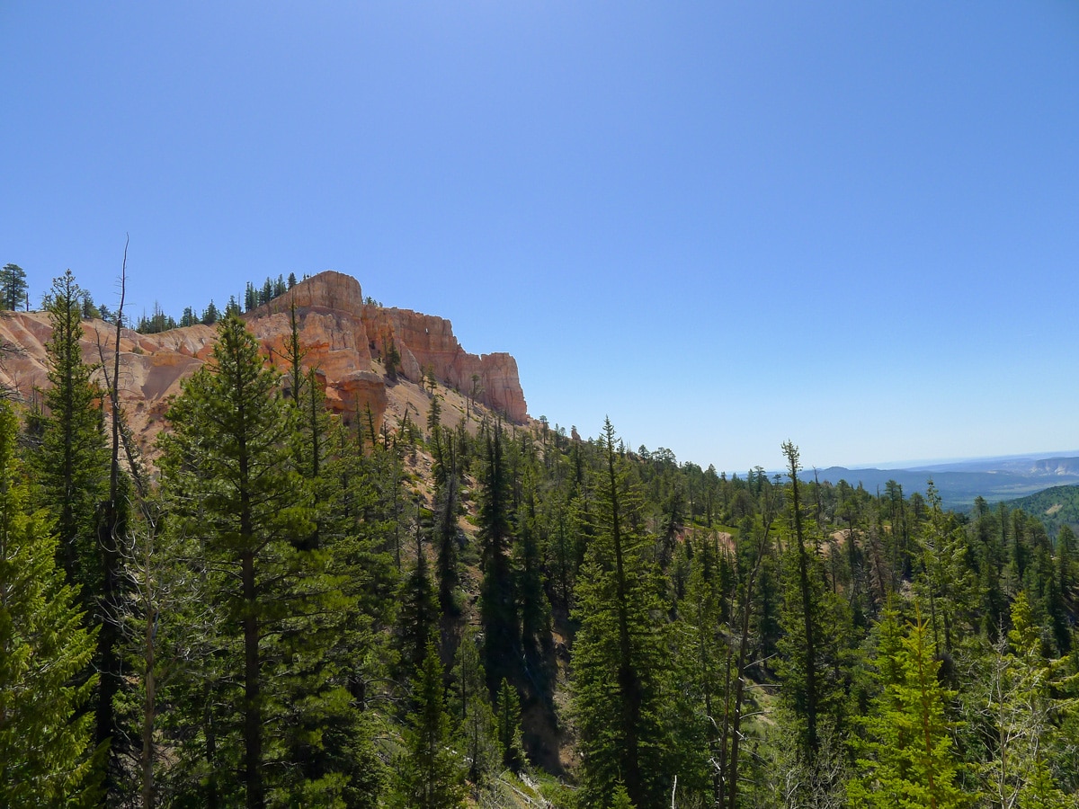
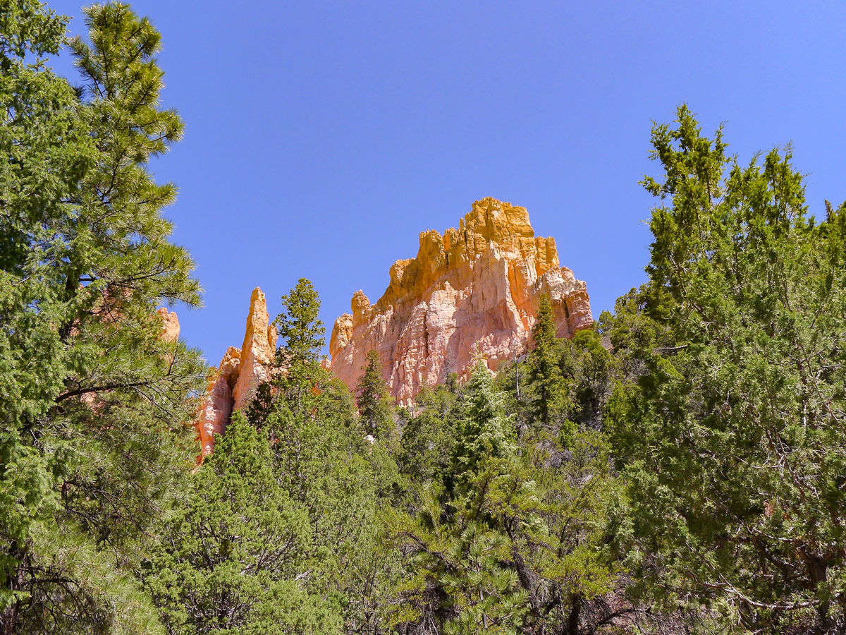
The trail will continue veering left and then descend towards Riggs Spring Campground. Here there is a seasonal stream – but do not drink the water. After the spring, turn sharply to the left and start ascending gradually. You will begin to have sporadic views of red cliffs through the trees. These views get better as you gain elevation.
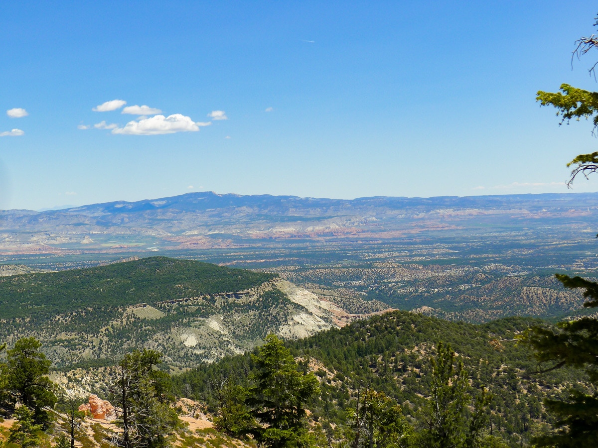
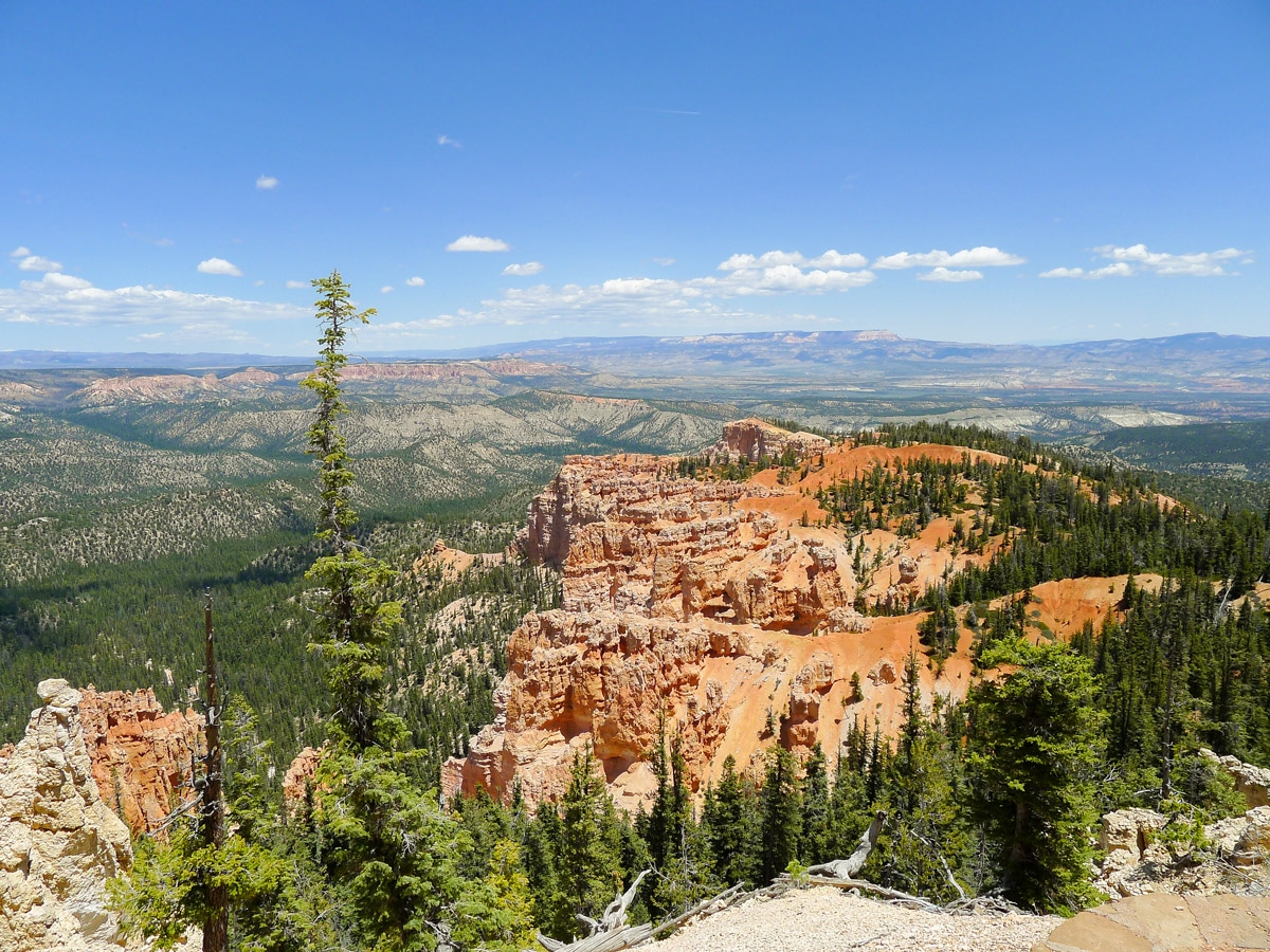
After passing Coral Hollow Campground you will gain a ridgeline with more visibility, granting fantastic views down to the staircase plateau below. Your next climb is up to Promontory Mesa. From here you will get sweeping views out towards the plane, as well as up towards to pink cliffs lining Rainbow Point. Looking north you will also be able to see the greenish tin in many hills, giving Rainbow Point its name.
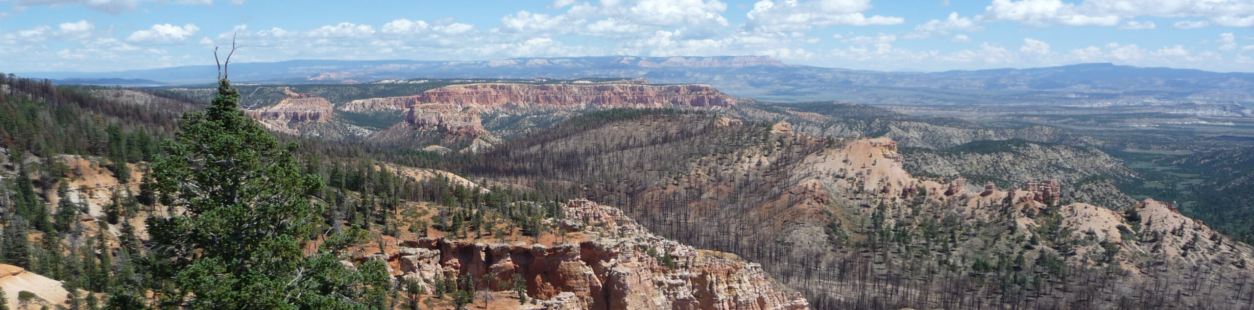
Finally you will make your way up a few more switchbacks to find yourself once again surrounded by people who make the quick jaunt from Rainbow Point in search of better photos. Pass by the junction for the Bristlecone Loop Trail and continue towards the parking lot. You will exit the trail at the opposite side of the parking lot than you started.
Insider Hints
We recommend completing the route counter clockwise as it makes the ascent less steep.

Similar hikes to the Riggs Spring Loop Trail hike
Piracy Point
The Piracy Point Trail is a short and sweet hike to an incredible viewpoint in Bryce Canyon National Park. This…
Bryce Horse Trail
The Bryce Horse Trail is a great circuit in Bryce Canyon National Park. This trail is used by horseback riders…
Inspiration Point to Queen’s Garden
The hike from Inspiration Point to Queen’s Garden is a fantastic route in Bryce Canyon National Park. This trail brings…
leo_Martini 4 years ago
The topography of the hike was amazing and the colors were out of this world.
Tiffany Swift 4 years ago
Amazing hike! Great workout!! I highly suggest counter clockwise. It's easy to follow and you'll see some beautiful fall foliage.
Stevie M 4 years ago
It's easy to navigate to since it was a pretty straight forward hike. Amazing views.
TwoBoots 4 years ago
This trail is great. Very nice views
Anabelle Clyde 4 years ago
Bryce is a really lovely place, super memorable. Amazing!
Frank M. 4 years ago
Nice trail. Lots of elevation But the climbs aren't bad. The trail follows the rim of the mesa and the views over the surrounding country are excellent. The hike is at 9000 ft. so you will want to have water, sunscreen and a hat. The sun can get pretty intense at that altitude.
Zuzu T. 5 years ago
There are more greeneries compared to other hikes in the park. It was very refreshing!
Gregory F 5 years ago
I loved this hike and almost all areas of the Bryce Canyon NP I have been in. The colors are just fantastic, a constant mix of green pine trees and red mountains. Just something completely different from the Northern parts of the US I am used to spending my weekends.
Jarvie P. 5 years ago
Nice and easy to follow. It was a memorable hike for me. Also, this trail was not very crowded, so I enjoyed my time here.
Meadow M. 5 years ago
Awe-inspiring views from the top. Nice loop and great views of the forest and canyon. Nice contrasting colors.