Nihahi Ridge hike
View Photos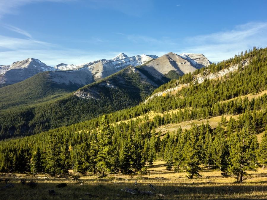
Nihahi Ridge hike
Difficulty Rating:
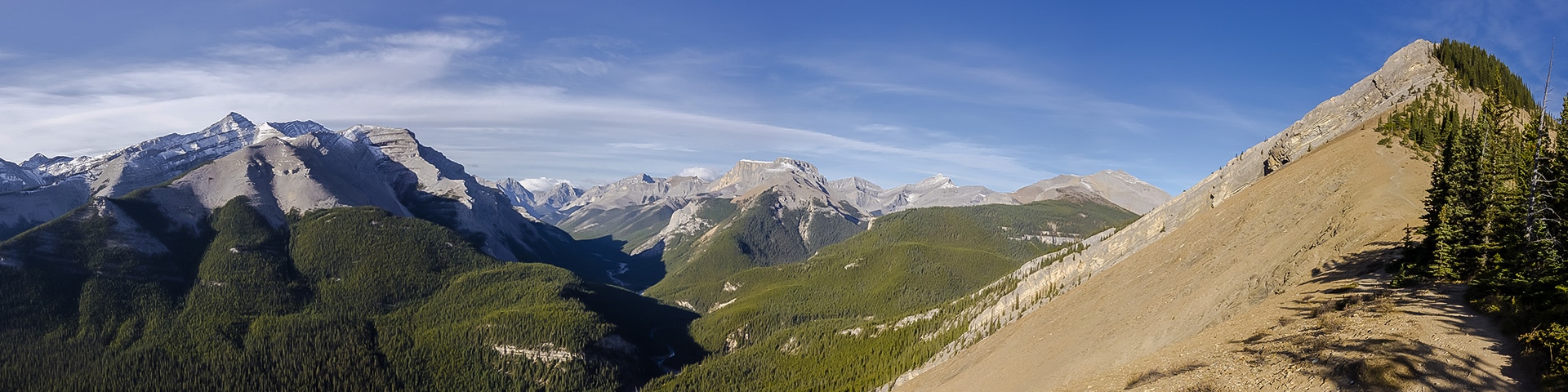
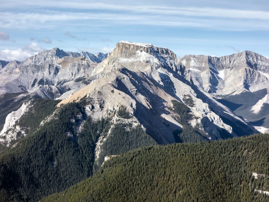
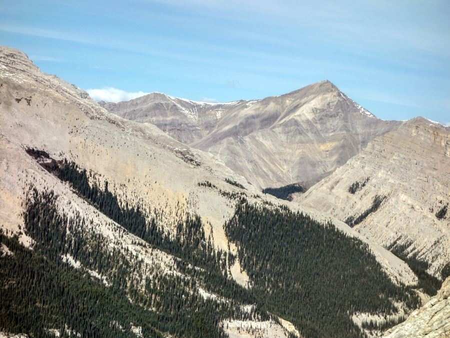
This hike has it all, starting in the forest before traversing a beautiful grassy meadow then gaining elevation in the alpine as climb the ridge. The views are spectacular throughout the hike.
Getting there
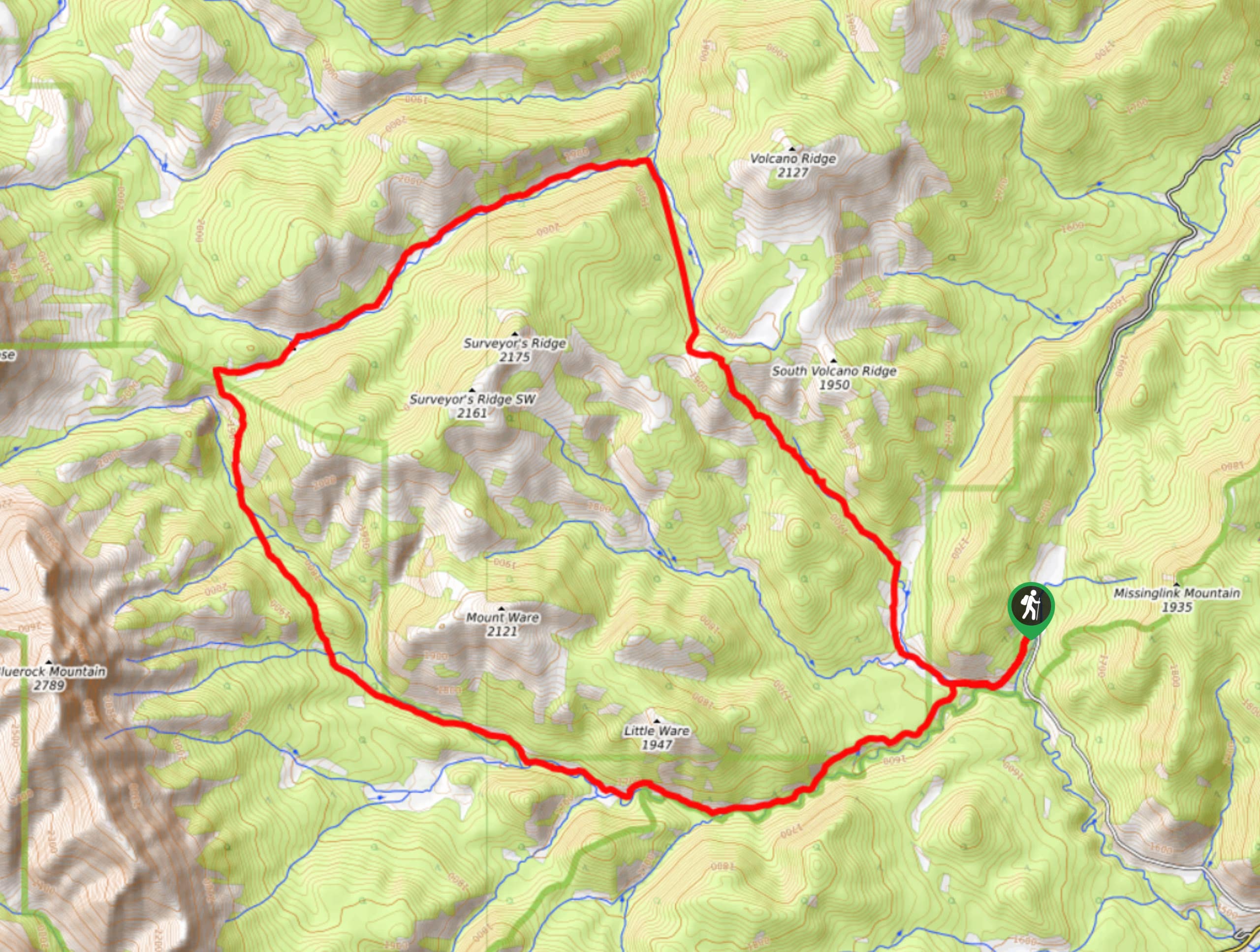
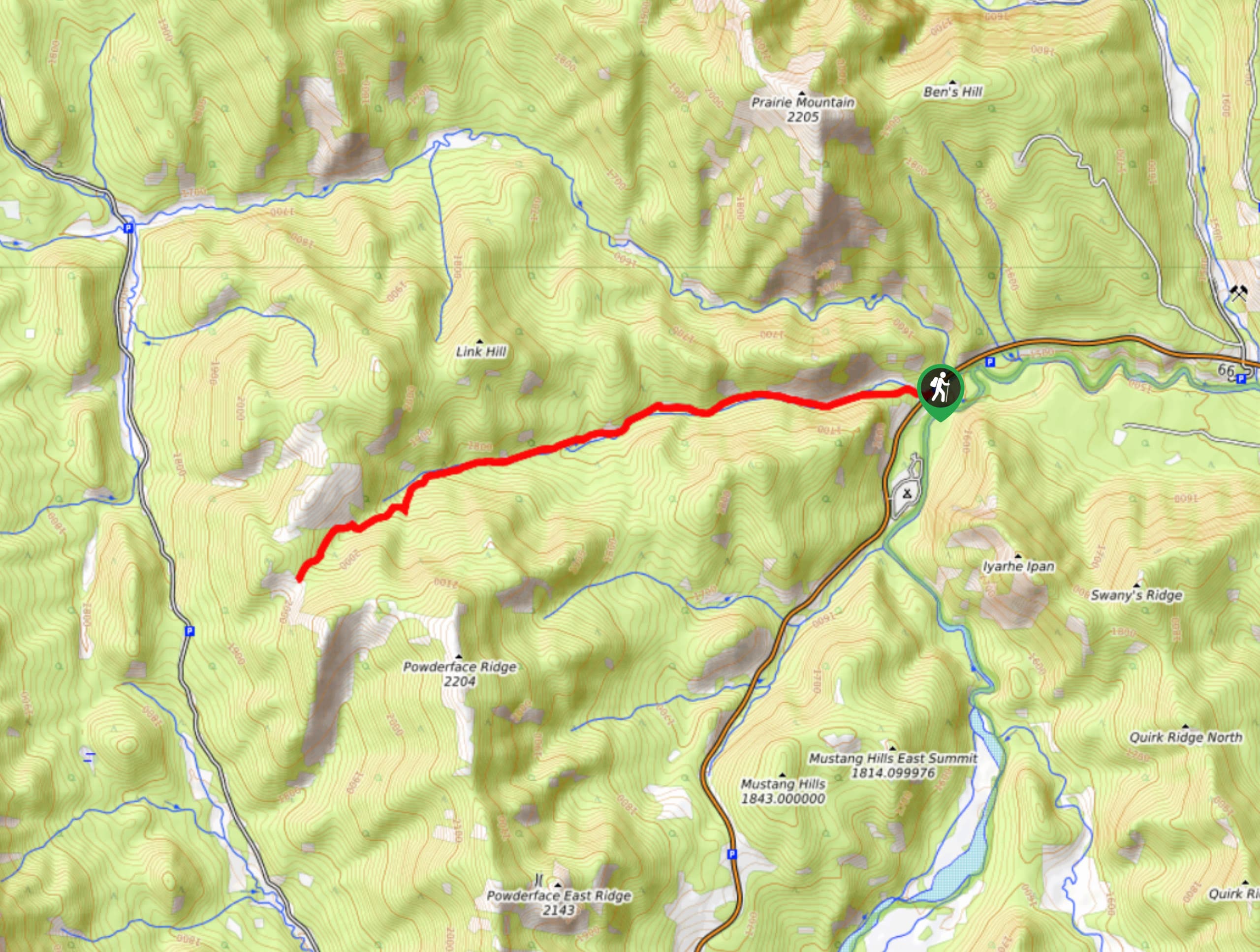
Take Highway 66 until it terminates (about 40 minutes from Calgary). Be aware that this road is closed from Dec. 1 to May 15. Park at the Little Elbow Campground.

About
| When to do | May 15 - October |
| Backcountry Campsites | Yes |
| Toilets | Yes |
| Family friendly | No |
| Route Signage | Average |
| Crowd Levels | Moderate to High |
| Route Type | Out and back |
Nihahi Ridge
Elevation Graph
Weather
Route Description for Nihahi Ridge
From the car, take the gravel road that follows the Elbow River until you exit the campground. You should now see signage marking the trail to the right. The start of the hike will take you through beautiful forest full of spruce and fir before exposing a grassy meadow with its gorgeous wild flowers after about 45 minutes.
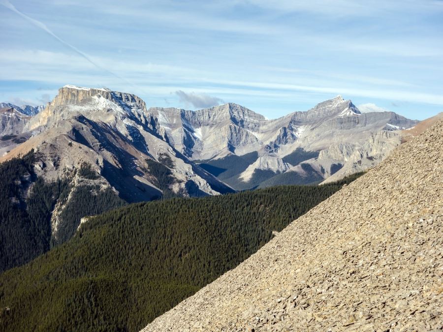
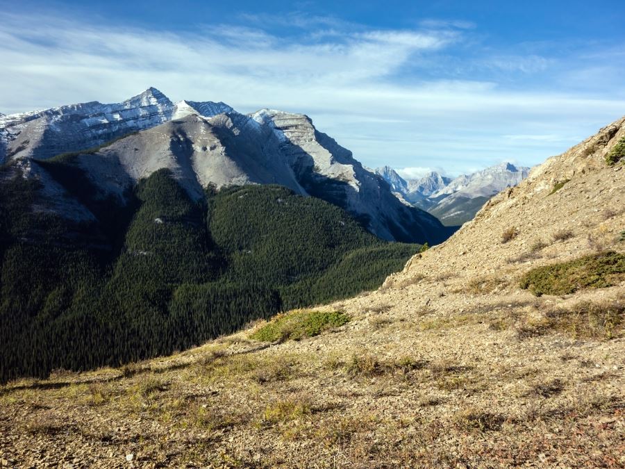
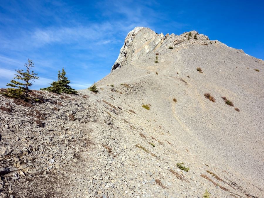
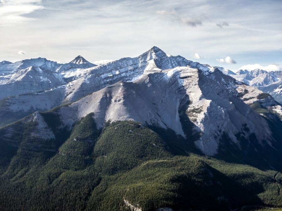
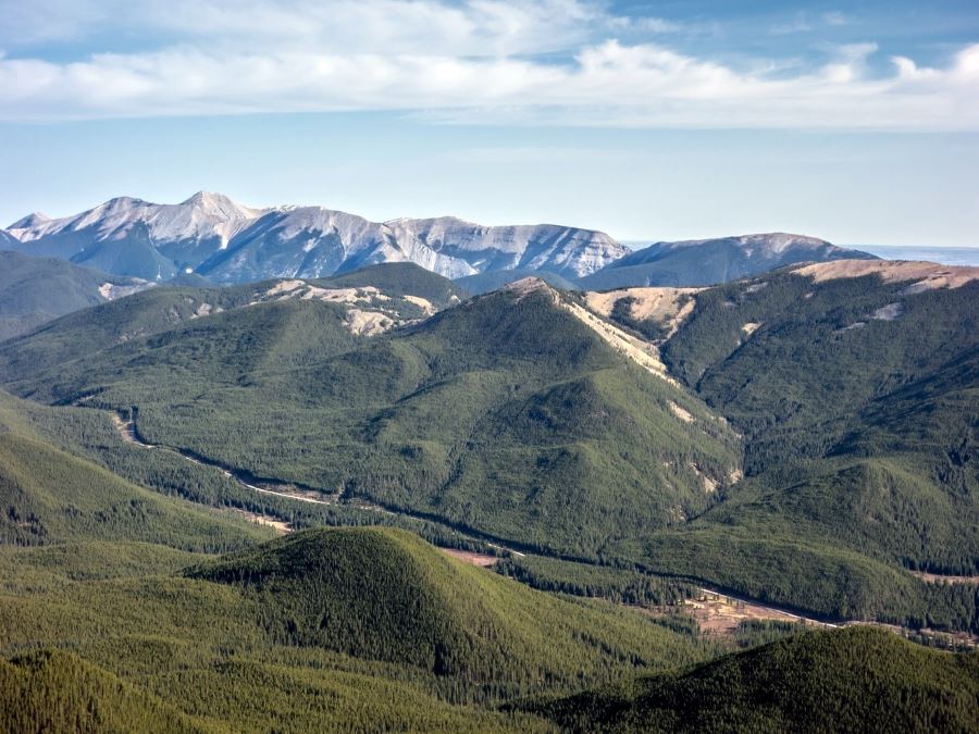
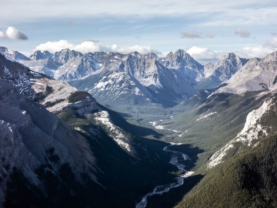
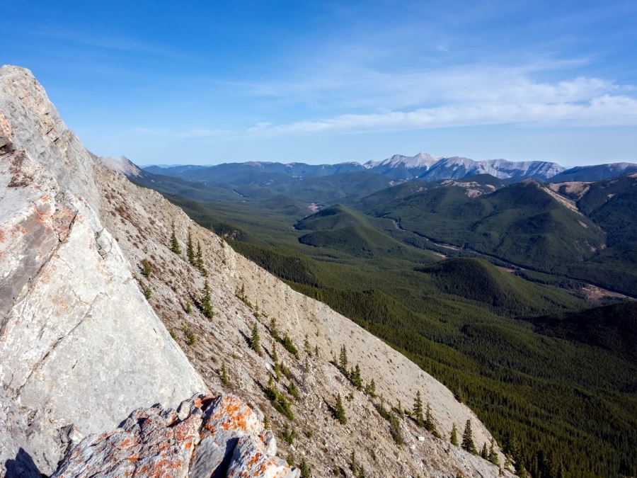
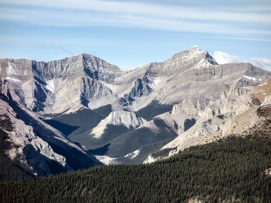
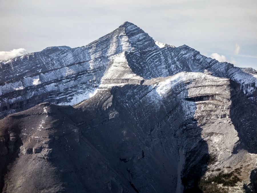
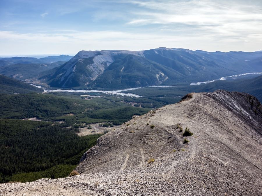
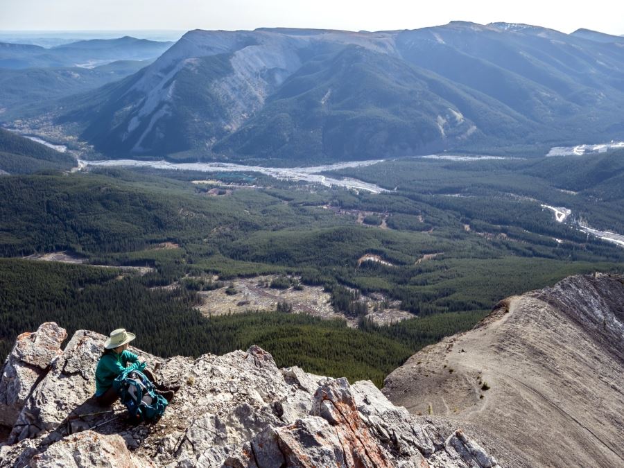
Looking west across the meadow we can see the ridge, follow the established trail as it loops through the trees as you begin to gain elevation. Don’t forget to look down as trail turns to the rock of the ridge, as the views down of the Little Elbow River Valley are spectacular.
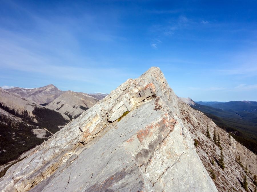
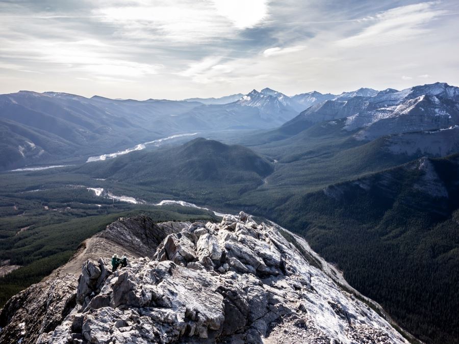
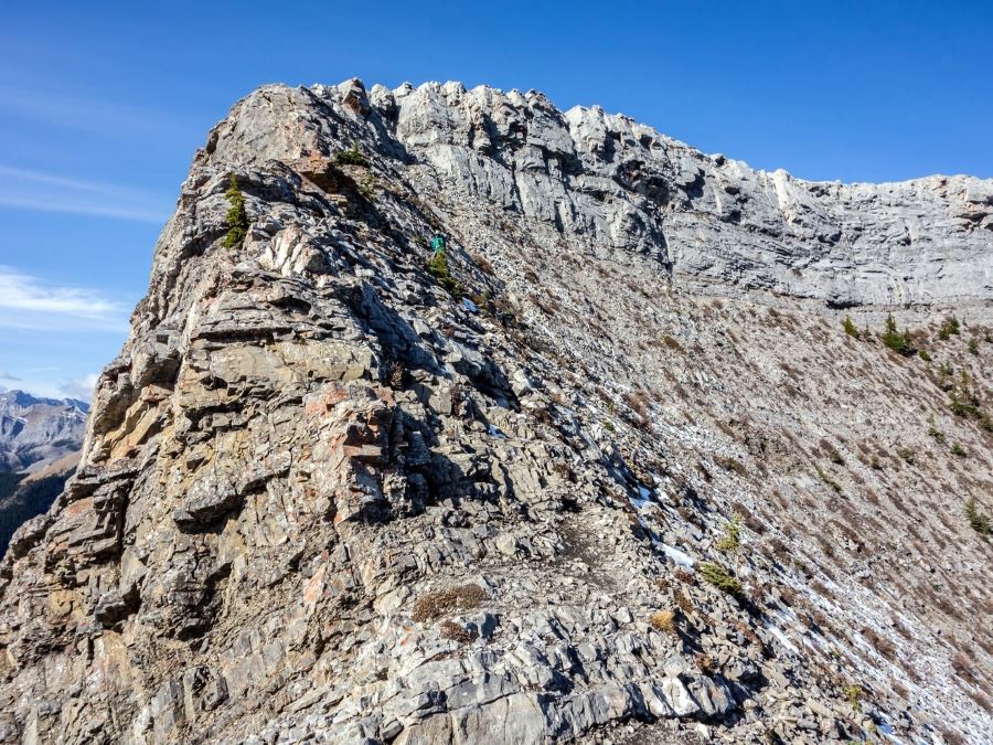
As you work your way up the ridge, the trail will become more steep and more dangerous. There is a brief section of guard fencing to ensure you stay on the trail. Before long as you quickly gain altitude, you will reach a large buttress which marks the end of the official trail. At this point we recommend you take it all in, savor the views and head back using the same trail.
Insider Hints
For those expert hikers, there is the opportunity to summit the ridge, in which you will face two short but technical scrambles, this part of the hike is technically beyond most hikers.
This is a very popular hike, we recommend starting early to beat the crowds.

Similar hikes to the Nihahi Ridge hike
Gorge Creek Loop
Hiking the Gorge Creek Loop requires some route knowledge and a bit of extra effort as it is not as…
Powderface Creek Trail
The Powderface Creek trail in Kananaskis is a popular hiking, biking, and horseback trail, so be aware of traffic when…
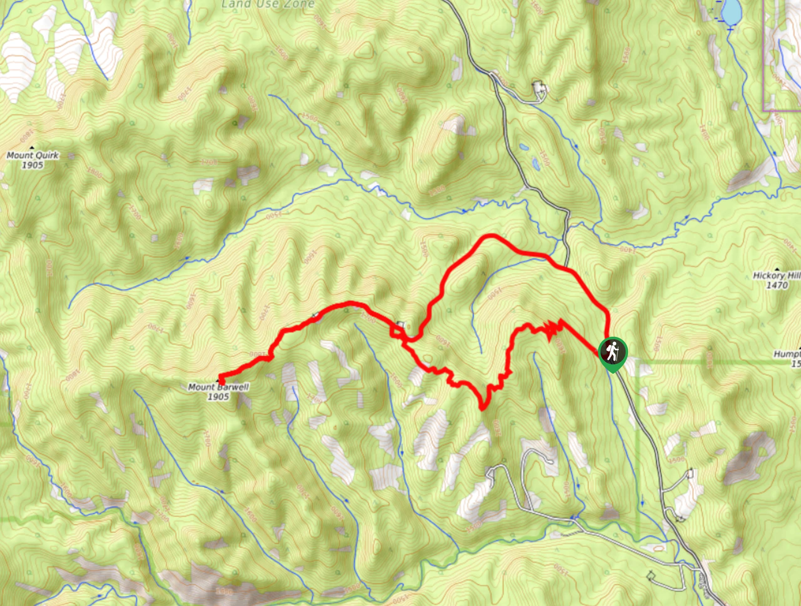
Barwell Trail
Hiking the Mount Barwell Trail is a half to full day effort that is very rewarding. With minimal crowds and…
chloehikes 4 years ago
Gorgeous hike but I'm glad I got an early start. The way down was the busiest trail I've ever experienced. If you're going on a weekend go early and you'll be fine
zero2ultra 5 years ago
Beautiful Hike. Feels very secluded, we only saw a couple of people on our way down. Plenty of great photo opportunities as well as some steep sections to challenge your hiking skill. Easy to miss the path back on your descent, make a note when ascending of where you come from after the railing section (We missed it on the way down and found another group who had as well).
alexjensen 5 years ago
I'd say bring your bikes to cruise through the campground faster and lock em to a tree, but my girlfriend and I had a great time out here. You can kind of choose how far along the ridge you climb. The views are awesome the whole way. She's not a big scrambler so we didn't summit the somewhat intimidating-looking buttress, but still a great one.
MayP 5 years ago
Sensational scenery of wildflowers and green meadows.
PeterHopkins 5 years ago
The grassy meadow looks spectacular. It was a great experience.
Emma Tree 5 years ago
Very scenic but heavily trafficked. Easy access to restrooms and lots of nice spots to rest and enjoy some picnic.
Grant Ko. 5 years ago
It's fun to do this hike, you will experience beautiful Canadian nature, adventure and endless spectacular views.
Rebekah L. 5 years ago
Great little walk along the grassy meadow. Went there a few months ago and there were very few people. Enjoyed taking pictures of the river valley.
Diana C. 5 years ago
The valley was gorgeous with its flowering trees, lush green meadows, and staggeringly gorgeous views.
LyleM 5 years ago
The trail is flat until the last 150 meters. It can be quite challenging but knowing the views at the top makes it worth it!