
Nugget Hill Trail
View Photos
Nugget Hill Trail
Difficulty Rating:
Hike in solitude as you trek the Nugget Hill Trail. This hidden gem guides adventurers along rocky terrain weaving through ponderosa pine forests and meadowlands up to the stunning overlook at the summit. We fear this incredibly scenic hike is not going to remain hidden for much longer, so get out there before the crowds begin to flock!
Getting there
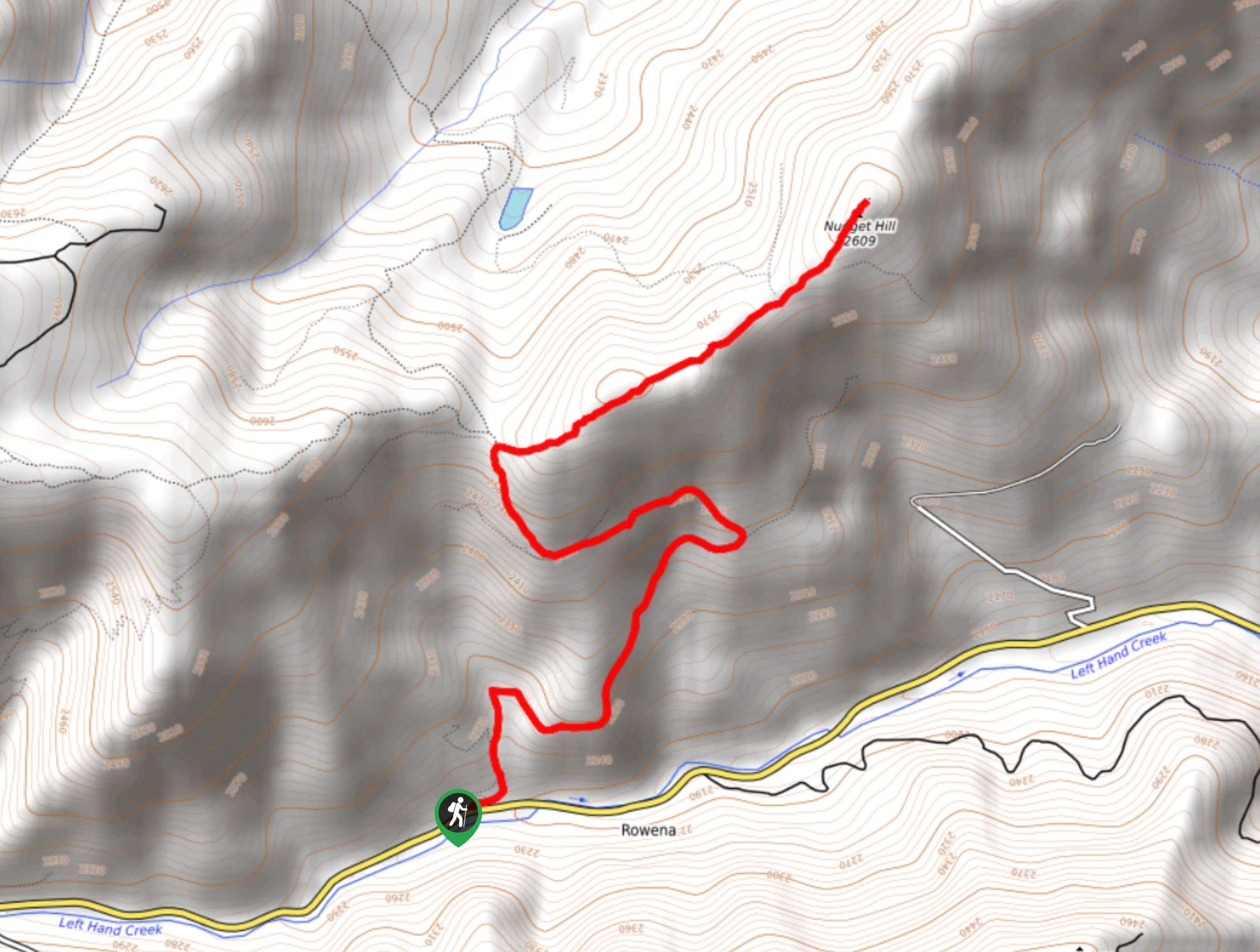
The Nugget Hill Trail departs from the trailhead (marked by a gate) off the Lefthand Canyon Drive.

About
| Backcountry Campground | No |
| When to do | Year-round |
| Pets allowed | Yes - On Leash |
| Family friendly | Older Children only |
| Route Signage | Average |
| Crowd Levels | Moderate |
| Route Type | Out and back |
Nugget Hill Trail
Elevation Graph
Weather
Nugget Hill Trail Description
The charm of a primitive trail is unparalleled, and the Nugget Hill Hike delivers just that. The undisturbed nature flourishes in the summer, rewarding the few adventurers with sights of vibrant wildflowers. As you hike through the lush vegetation be sure to keep an eye out for moose and grazing deer. As you venture into the wilderness it is important to be mindful of wildlife, so many hikers choose to wear a bear bell to help mitigate the chances of an unwelcome encounter. Note that there is no parking lot for this hike, so adventurers are required to park along the shoulder of the road.
Embark on your journey along the Nugget Hill Trail from the gate on the north side of Lefthand Canyon Drive. From here, track FS 509.1 northeast. Immediately climbing from the trailhead, the path will gradually ascend weaving through the coverage of towering pines and exposed meadows. The terrain is quite rocky in sections, so mind your footing—you wouldn’t want to roll an ankle! Continue along the path, and eventually, you will encounter an intersection. Here, keep right and you will be diverted onto the FS 509.3 D, heading east. This route will pass the Tippecanoe Mine to the summit of Nugget Hill.
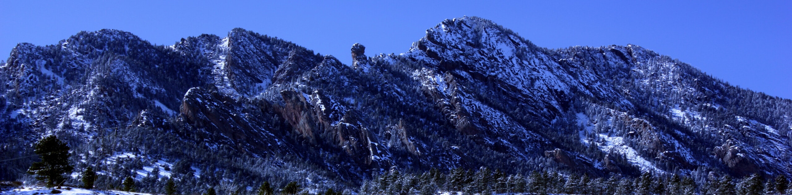
From here, revel in the sights of the Front Range snow-capped peaks that line the horizon. Appreciate the views of Colorado’s mountainous wilderness and when you are ready, retrace your footing along the route back to the trailhead.
Similar hikes to the Nugget Hill Trail hike

NCAR to Fern Canyon Hike
The NCAR to Fern Canyon Hike is an awesome but challenging adventure up to the summit of Nebel Horn. Put…
Bear and South Boulder Peaks Loop
Looking for a demanding but rewarding hike near Boulder? We’ve got you covered. The Bear and South Boulder Peaks Hike…

Rattlesnake Gulch Trail
The Rattlesnake Gulch Trail is an epic adventure through the Eldorado Canyon State Park. Ascend the steep cliffs of Eldorado…
Comments