Mount Sanitas Peak Trail
View Photos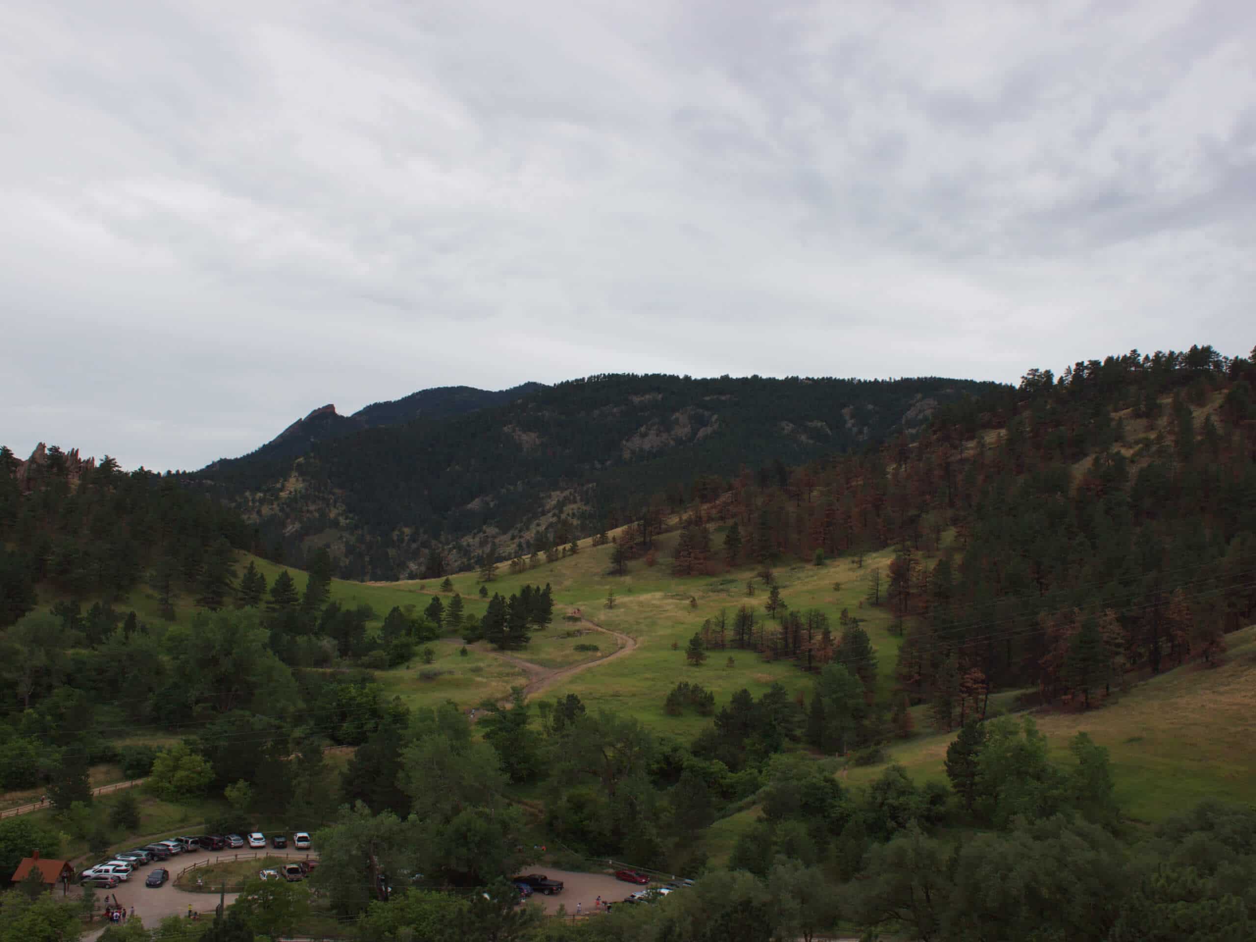
Mount Sanitas Peak Trail
Difficulty Rating:
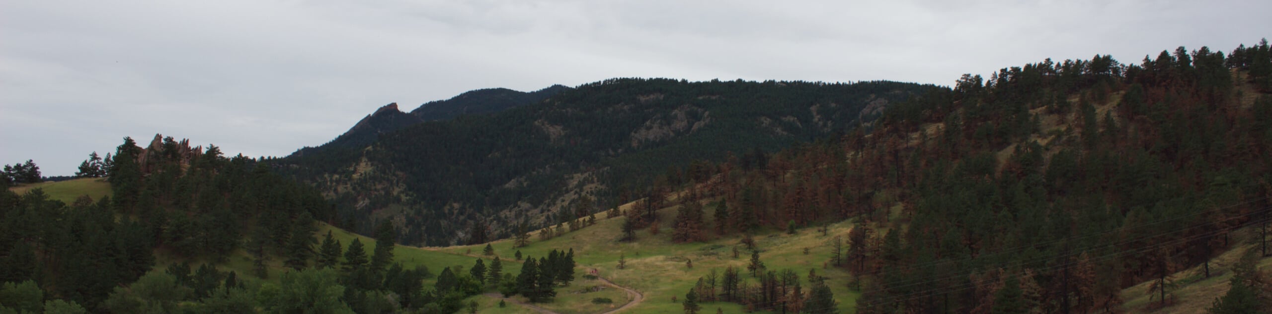
Rich in history, the Mount Sanitas Peak Trail is a beloved hiking adventure near Boulder, Colorado. Conveniently located near the city’s center, this popular excursion attracts locals and intrepid tourists alike. Laden with verdant vegetation and unique outcroppings, this mountain ascent promises a spectacular experience.
Getting there
The Mount Sanitas Peak Trail departs from the Centennial Trailhead Parking Lot off Sunshine Canyon Drive.

About
| Backcountry Campground | No |
| When to do | Year-round |
| Pets allowed | Yes - On Leash |
| Family friendly | Older Children only |
| Route Signage | Good |
| Crowd Levels | Extreme |
| Route Type | Out and back |
Mount Sanitas Peak Trail
Elevation Graph
Weather
Mount Sanitas Peak Trail Description
Whether it’s the stunning scenery or steep terrain, the Mount Sanitas Peak Trail is sure to take your breath away. Hike amongst fellow like-minded enthusiasts as you trek up the rocky terrain to the stunning overlook. If you are seeking a secluded summit hike, then we would suggest another adventure or an early morning trek. An early morning hike promises thinner crowds and will mitigate the possibility of not having a parking spot in the limited trailhead lot. Delivering expansive vistas of the cityscape and surrounding mountains, the excursion up to the summit warrants technical terrain. Wear sturdy shoes and consider trekking poles if you have joint pain. If you hike in the late fall or the winter months, we highly recommend microspikes to help navigate the likely icy route. As this path travels through the quintessential arid foothill terrain, it is important to be mindful of rattlesnakes, keeping an eye and ear out for them as you hike.
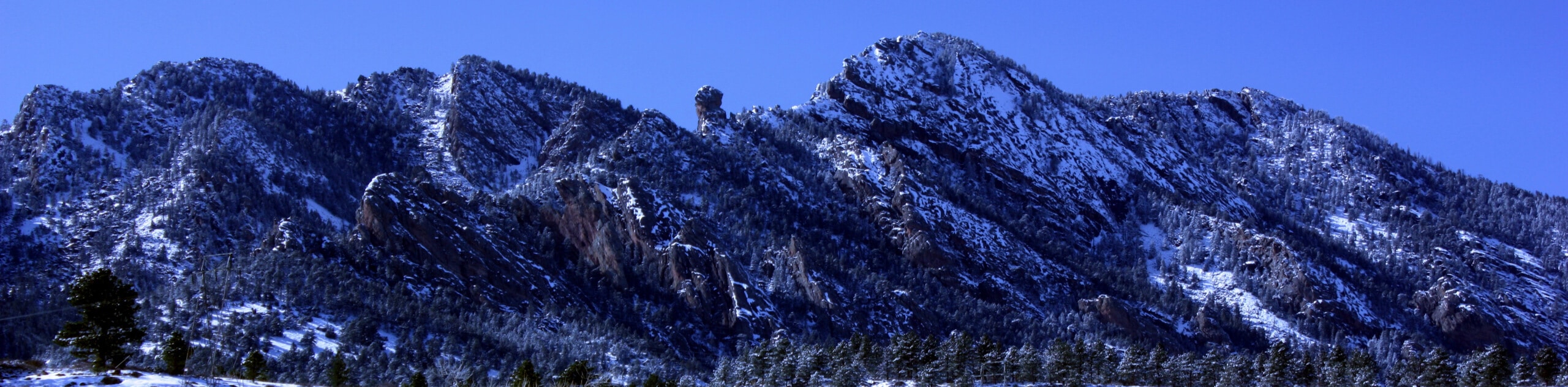
Whether you’ve never hiked the Mount Sanitas Peak Trail or trekked it a hundred times, it never gets old. The exposed terrain reveals expansive views of the Boulder cityscape, the Flatirons, Sunshine Canyon, and the encompassing foothills. Let the wonderful vistas motivate you as you scramble up the steep terrain. Rocky and technical in places, this hike is well worth the sweat. Get in your daily movement and appreciate the feeling of the fresh air filling your lungs. If you’ve done this hike before, why not trek it in the late evening? A moonlight walk will deliver a unique perspective of Boulder as it is all lit up with twinkling lights. Like so many others, we love this hike, and we know you will too. So, what are you waiting for? Lace up those hiking boots and get going!
Embark on your journey along the Mount Sanitas Peak Hike from the Centennial Trailhead and Parking Lot. From here, track over the Sunshine Canyon Drive. From here, track the Sanitas Connector Trail over the road before merging onto the Mount Sanitas Trail. This path will guide adventurers northwest over a creek. Ignore intersecting routes, keeping left on the trail. Immediately ascending the steep terrain, you will be guided through sparse tree coverage of towering pines. There will be several large boulders along the path so be mindful of your footing on loose terrain—especially if there is someone hiking behind you!
Take breaks as necessary as you hike up the butt burner of a trail. Let the stunning scenery motivate you as you ascend the path, and keep an eye out for eagles soaring above. As you get your heart rate up, imagine tuberculosis patients climbing up this steep terrain—no thanks! Eventually, the route will deliver you to the craggy summit of Mount Sanitas. From here enjoy expansive views of the Boulder cityscape in the east and the impressive Flatirons in the south. On a clear day, you should be able to see some Front Range snow-capped peaks lining the horizon in the west. Revel in the 360-degree views and when you are ready, simply retrace your footing down the path to the trailhead.
Trail Highlights
Mount Sanitas
Mount Sanitas is a charming peak that sits on Boulder’s city limits. Sitting at 6863ft in elevation. Ranked 4,846th on the list of Colorado summits, the peak is nothing to write home about, but the wonderful scenery and epic overlooks are. A popular hiking excursion for locals and tourists alike, this popular mountain has become a Boulder rite of passage.
The history of Mount Sanitas is like no other. In 1895 a sanatorium was built just east of the mountain. From the late 19th century to the early 20th, most of the patients in the sanitorium were tuberculosis patients. The mountains’ name was inspired by the word sanitorium, as the patients and staff blazed the now popular hiking route up to the summit. The perfect backyard hiking regiment, many of the first pioneers up the mountain were patients. In 1905, the tuberculosis patients were transferred to another facility and the sanitarium rebranded as a health and wellness retreat, advertising the hike as a part of the experience.
Since the 20th century, the Mount Sanitas Hike has been a hiking destination for people near and far. Immerse yourself in the verdant wilderness and travel back in time as you trek the Mount Sanitas Peak Trail.
Frequently Asked Questions
How long does it take to hike Mount Sanitas?
The hike up to Mount Sanitas takes approximately 2-3 hours.
Is the Mount Sanitas Hike difficult?
The Mount Sanitas Peak Trail is often regarded as a moderate to hard hike. The trail steeply climbs all the way to the summit and the terrain is rocky, so the path demands experience and stamina.
How tall is Mount Sanitas?
Mount Sanitas sits at an elevation of 6843ft.
Insider Hints
If you have a headlamp, consider a moonlight hike up to the summit where you will be granted amazing views of the city lights
The terrain is rocky and uneven in areas, so wear sturdy footwear
Keep an eye and ear out for rattlesnakes as you climb
If you are staying in Boulder, simply walk from the town to the trailhead to avoid the annoyances of trying to find parking in the little parking lot
Similar hikes to the Mount Sanitas Peak Trail hike

NCAR to Fern Canyon Hike
The NCAR to Fern Canyon Hike is an awesome but challenging adventure up to the summit of Nebel Horn. Put…
Bear and South Boulder Peaks Loop
Looking for a demanding but rewarding hike near Boulder? We’ve got you covered. The Bear and South Boulder Peaks Hike…

Rattlesnake Gulch Trail
The Rattlesnake Gulch Trail is an epic adventure through the Eldorado Canyon State Park. Ascend the steep cliffs of Eldorado…
Comments