
Miller Rock Hike
View Photos
Miller Rock Hike
Difficulty Rating:
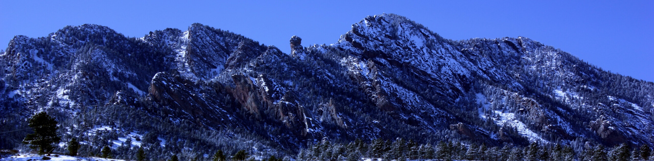
The Miller Rock Hike is a lovely excursion that travels through an enchanting forest and along a picturesque creek. Travel beneath the shade of towering evergreens interspersed with pines before ascending Miller Rock, which rewards hikers with awe-inspiring views of the Front Range snow-capped peaks.
Getting there
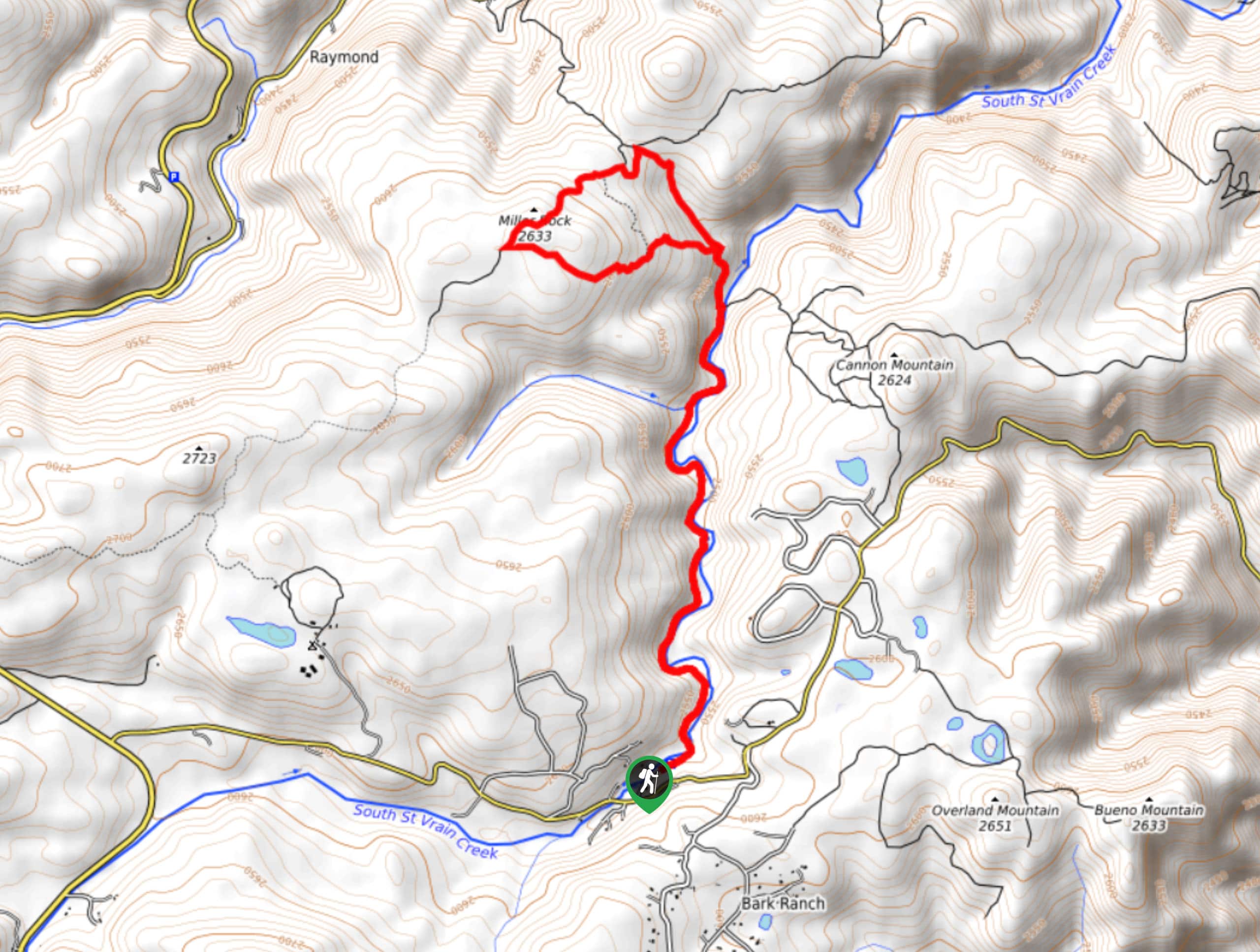
The Miller Rock Trail departs from the Ceran Saint Vrain Trailhead off Overland Road.

About
| Backcountry Campground | No |
| When to do | Year-round |
| Pets allowed | Yes - On Leash |
| Family friendly | Older Children only |
| Route Signage | Average |
| Crowd Levels | Moderate |
| Route Type | Lollipop |
Miller Rock Hike
Elevation Graph
Weather
Miller Rock Hike Description
Who doesn’t love a charming woodland hike? This lovely adventure exhibits the beauty of the Colorado wilderness as it guides adventurers along the forested cliffs that flank the running waters of the Saint Vrain Creek below. Reward yourself with the best of both worlds and hike above the timberline to summit Miller Rock which reveals epic views of the encompassing wilderness. Traveling deep into the woodlands, be mindful of wildlife and consider wearing a bear bell to deter uninvited encounters. If you are planning to venture this trail in the late fall and winter months, we highly recommend wearing microspikes to safely navigate the likely icy terrain.
Embark on your adventure along the Miller Rock Trail from the Ceran Saint Vrain Trailhead. From here, head north along the Ceran Saint Vrain Trail. This path will gently descend as you hike further into the wilderness. Enjoy the shade and sights of the lush evergreens and aspens towering above, letting the ambiance of the running waters of Saint Vrain Creek lull you into a state of relaxation. Eventually, you will cross a small footbridge over an intersecting stream. From here, revel in the wonderful sights of the creek below flanked by craggy walls dotted with verdant vegetation.
The trail will then guide you to an intersection, keep left here, and you will be diverted onto the Miller Rock Trail. Scramble up the rocky terrain to the next junction– keep left here and hike along the exposed route. Merge onto the Miller Rock Spur Trail at the next intersection and track northeast. Enjoy the sights of the Front Range peaks that line the horizon and reconnect with the Miller Rock Trail. Wander south, eventually reconnecting with the Ceran Saint Vrain Trail. From here, simply retrace your footing along the path back to the trailhead.
Similar hikes to the Miller Rock Hike hike

NCAR to Fern Canyon Hike
The NCAR to Fern Canyon Hike is an awesome but challenging adventure up to the summit of Nebel Horn. Put…
Bear and South Boulder Peaks Loop
Looking for a demanding but rewarding hike near Boulder? We’ve got you covered. The Bear and South Boulder Peaks Hike…

Rattlesnake Gulch Trail
The Rattlesnake Gulch Trail is an epic adventure through the Eldorado Canyon State Park. Ascend the steep cliffs of Eldorado…
Comments