First and Second Flatirons Loop
View Photos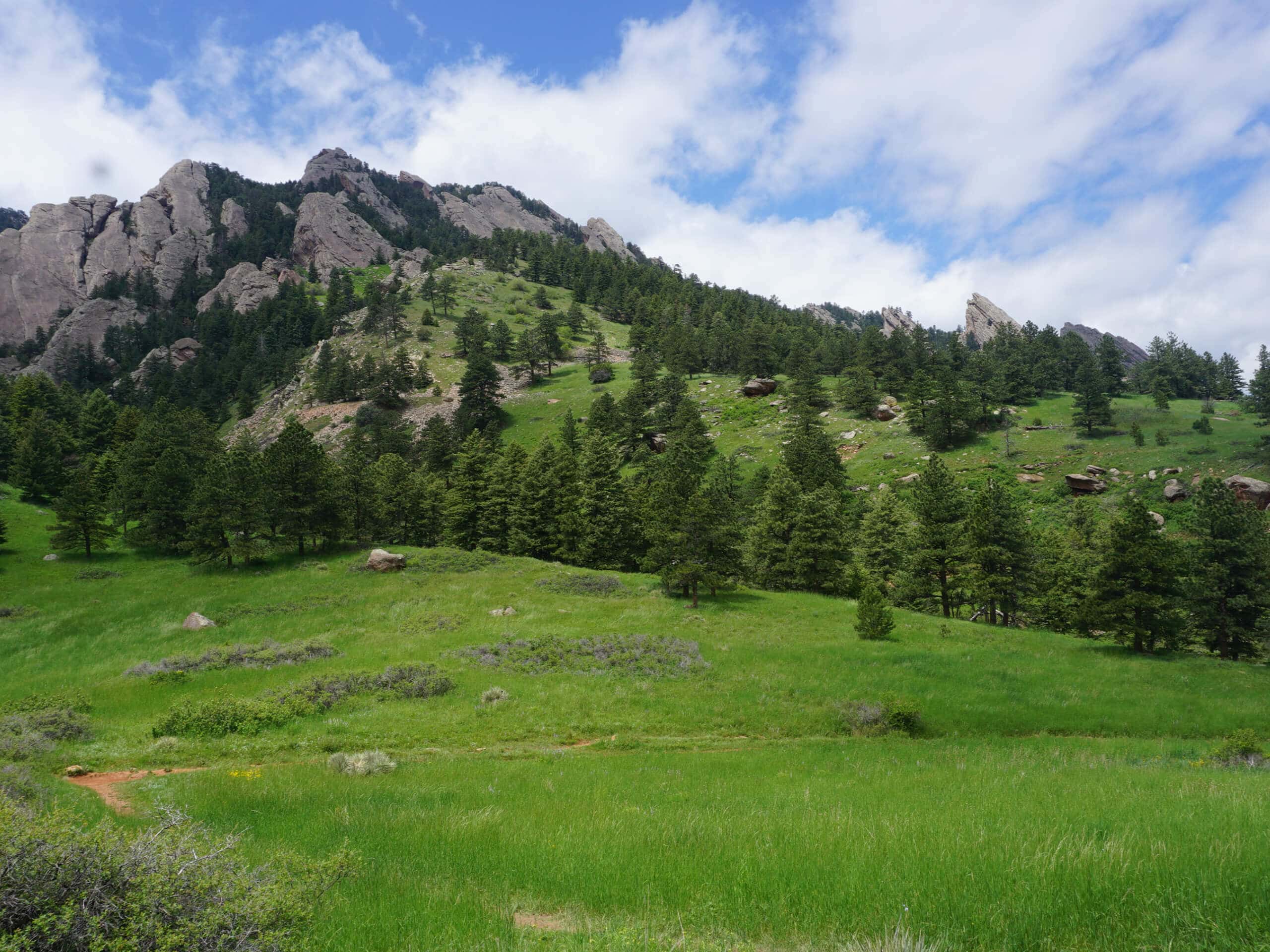
First and Second Flatirons Loop
Difficulty Rating:
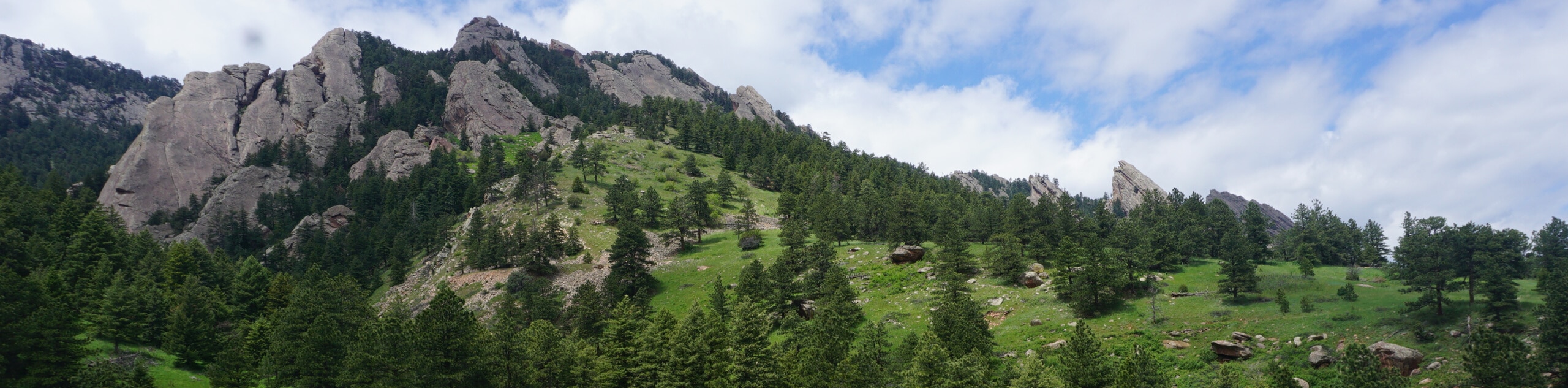
The First and Second Flatirons Loop is a quintessential adventure near Boulder, Colorado. Ascend the sandstone slabs that so famously protrude from the countryside and enjoy epic views of the Indian Peaks Wilderness in the west and the cityscape in the east. This excursion is a must-add to your Boulder adventure bucket list.
Getting there
The First and Second Flatirons Loop departs from the Chautauqua Trailhead off Kinnikinnick Road.

About
| Backcountry Campground | No |
| When to do | Year-round |
| Pets allowed | Yes - On Leash |
| Family friendly | Older Children only |
| Route Signage | Good |
| Crowd Levels | Extreme |
| Route Type | Lollipop |
First and Second Flatirons Loop
Elevation Graph
Weather
First and Second Flatirons Loop Description
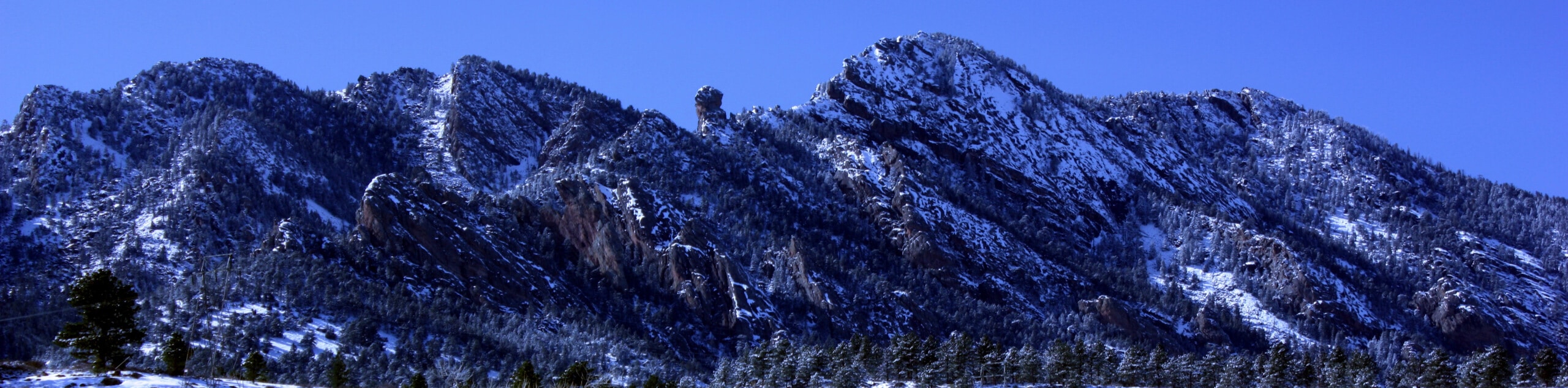
The First and Second Flatirons Loop is an amazing adventure through the impressive landmark. Reserved for intrepid adventurers, this trek demands stamina. Scrambling up scree fields, ping-ponging between craggy cliffs, and ascending a notable summit, this route will exhaust you. Due to the fame of the Flatirons, you will surely be sharing the trail with like-minded explorers. If you were seeking a more secluded adventure, then you best find another trek! Parking at the trailhead can be a nightmare, so we suggest parking along Baseline Road or walking from the city center! Be sure to wear sturdy footwear, and if you venture this path in the winter months, crampons are a must! Pack plenty of water and wear layers as insurance against windy conditions near the summit.
Though the First and Second Flatirons Loop Trail is a busy trek, it is well worth the crowds. Not only are the Flatirons impressively scenic from the base, but the vistas they deliver from the summit are unparalleled. Get the best of both worlds—enjoying sights of the Indian Peaks Wilderness and Longs Peak from one overlook and views of the cityscape from the other. Unfortunately, the frequented paths of this area are having detriments on the fragile environment. Respect the signage and make sure to always stay on the maintained trail to safeguard this beautiful adventure. Last but not least, you must bring your camera because you will want to snap pictures along this epic and impressive hike.
Embark on your adventure along the First and Second Flatirons Loop from the Chautauqua Trailhead. From here, track the Chautauqua Trail southwest along a gravel path through the grasslands, enjoying the towering rock slabs vistas. As you track closer to the base of the Flatirons, the terrain will become increasingly forested. Hike amongst the sparse shade of towering pine trees, and you will eventually meet a junction with the Bluebell Baird Trail. Here, stay straight and hike along the Flatirons Loop Trail. Shortly after the last intersection, you will meet another. At this point, veer right, and you will be diverted onto the 1st/2nd Flatirons Trail.
The terrain will become incredibly steep, narrow, and rocky as you begin your ascent up the Flatirons. Climb up a scree field, minding loose rocks and hikers behind you. There will be an off-shooting path; ignore this as it is for climbers. Continue along the 1st/2nd Flatirons Trail, scrambling up the rocky path. Soon you will meet a set of steep switchbacks. Navigate the seemingly never-ending switchbacks that will ping pong you between the First and Second Flatirons. Eventually, you will summit the saddle between the two: notice rock climbers below, the Boulder cityscape, and sights of the Third Flatiron from here.
Follow the route all the way to the backside of the First Flatiron. Revel in the stunning views of the snow-capped peaks that line the horizons and rehydrate. Snap some photos and retrace your footing along the 1st/2nd Flatirons Trail. At the first intersection after your descent, keep right and at the next junction, turn right again onto the Bluebell Baird Trail. From here, merge onto the Bluebell Road Trail before rerouting along the Bluebell Hiking Trail. Hike this path through the grasslands and along a gurgling creek back to the trailhead, marking the end of your adventure.
Trail Highlights
The Flatirons
The Flatirons are impressive sandstone rock formations that make up the foothills in the west of Boulder, Colorado. There are five named Flatirons that sit along the eastern edge of Green Mountain. These impressive slabs are a quintessential Boulder landmark that can be seen on logos, artwork, and buildings throughout the city. A popular hiking destination, the Flatirons are ideal for rock climbing too. Many intrepid adventurers flock to the areas to boulder the craggy blades.
Frequently Asked Questions
Can you see the Flatirons without hiking?
Yes, the Flatirons are prominent rock blades that protrude from the landscape.
Are there bears on the Flatirons?
Though the possibility of seeing bears on the Flatirons is slim due to the busyness of the area, there have been sightings atop the Flatirons.
What are the Flatirons?
The Flatirons are sandstone rock formations that make up a portion of Boulder’s foothills.
Insider Hints
In the winter the terrain is often slippery and snow-cloaked, so we highly recommend microspikes and trekking poles!
After your trek have a picnic in Chautauqua Park, revelling in the feat you just accomplished.
Pack plenty of water because the scramble up the Flatirons will surely tire you.
Similar hikes to the First and Second Flatirons Loop hike

NCAR to Fern Canyon Hike
The NCAR to Fern Canyon Hike is an awesome but challenging adventure up to the summit of Nebel Horn. Put…
Bear and South Boulder Peaks Loop
Looking for a demanding but rewarding hike near Boulder? We’ve got you covered. The Bear and South Boulder Peaks Hike…

Rattlesnake Gulch Trail
The Rattlesnake Gulch Trail is an epic adventure through the Eldorado Canyon State Park. Ascend the steep cliffs of Eldorado…
Comments