Taylor Pass Hike
View Photos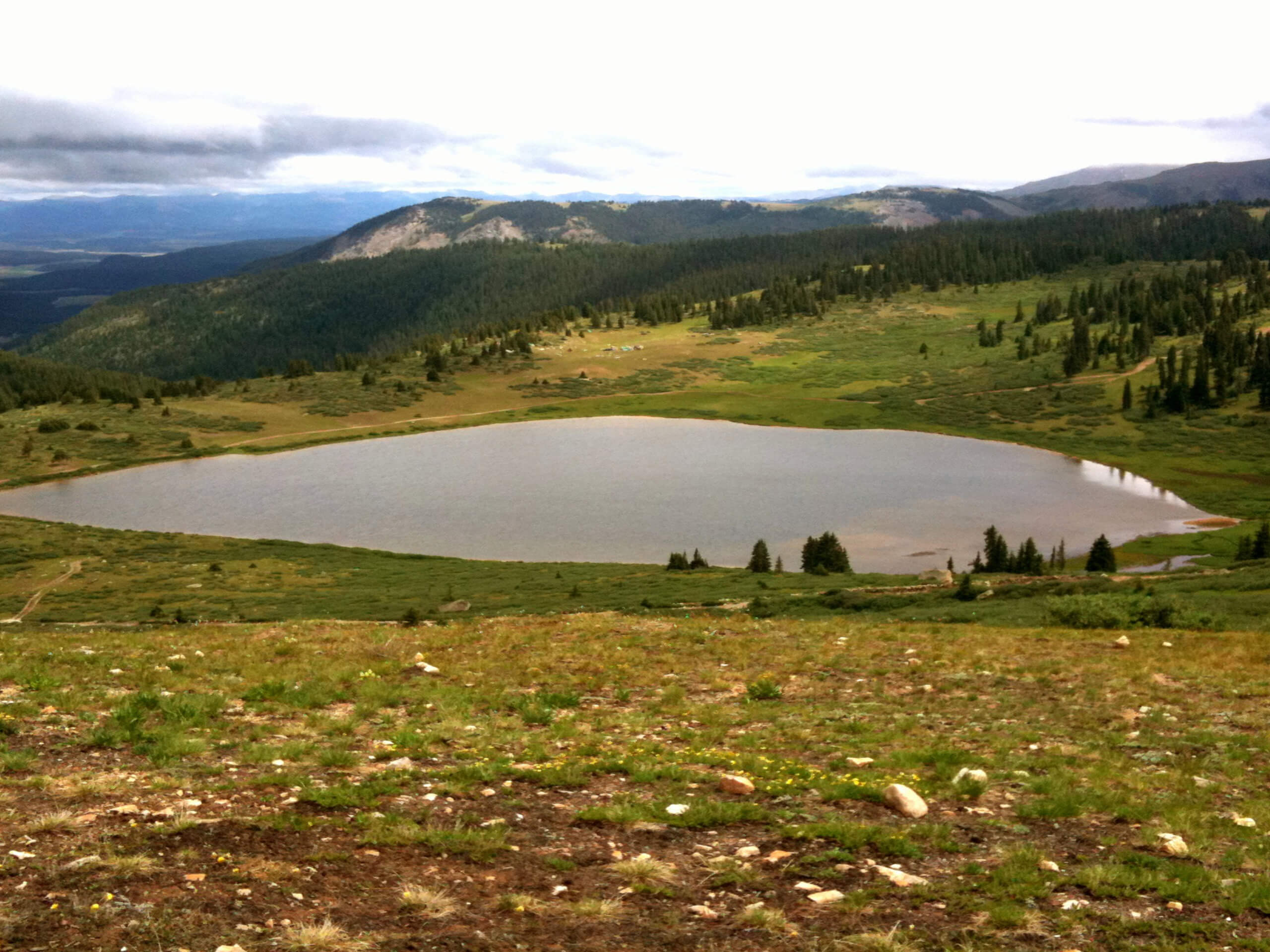
Taylor Pass Hike
Difficulty Rating:
The Taylor Pass Hike is an incredibly scenic adventure in Colorado’s high country. This trek is an outdoor enthusiast’s haven, attracting intrepid adventurers of all sorts from hikers, bikers, and even fearless off-roaders. Take in the natural beauty of the rugged wilderness here.
Getting there
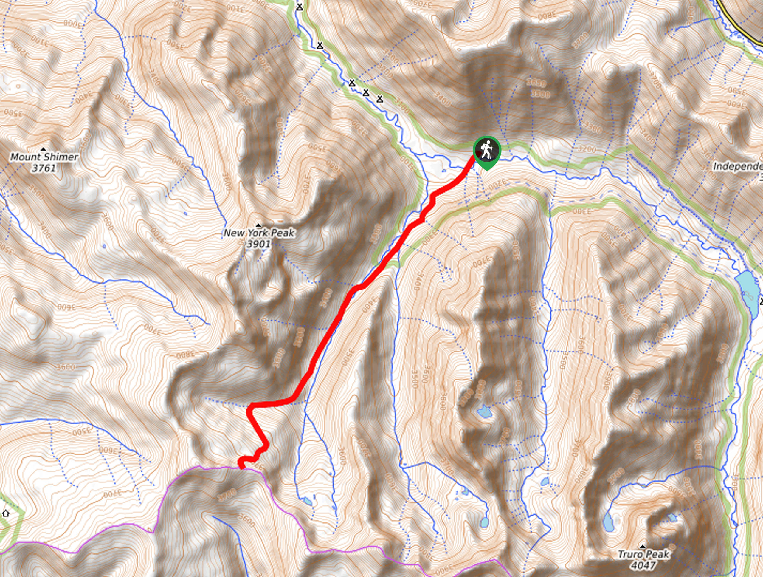
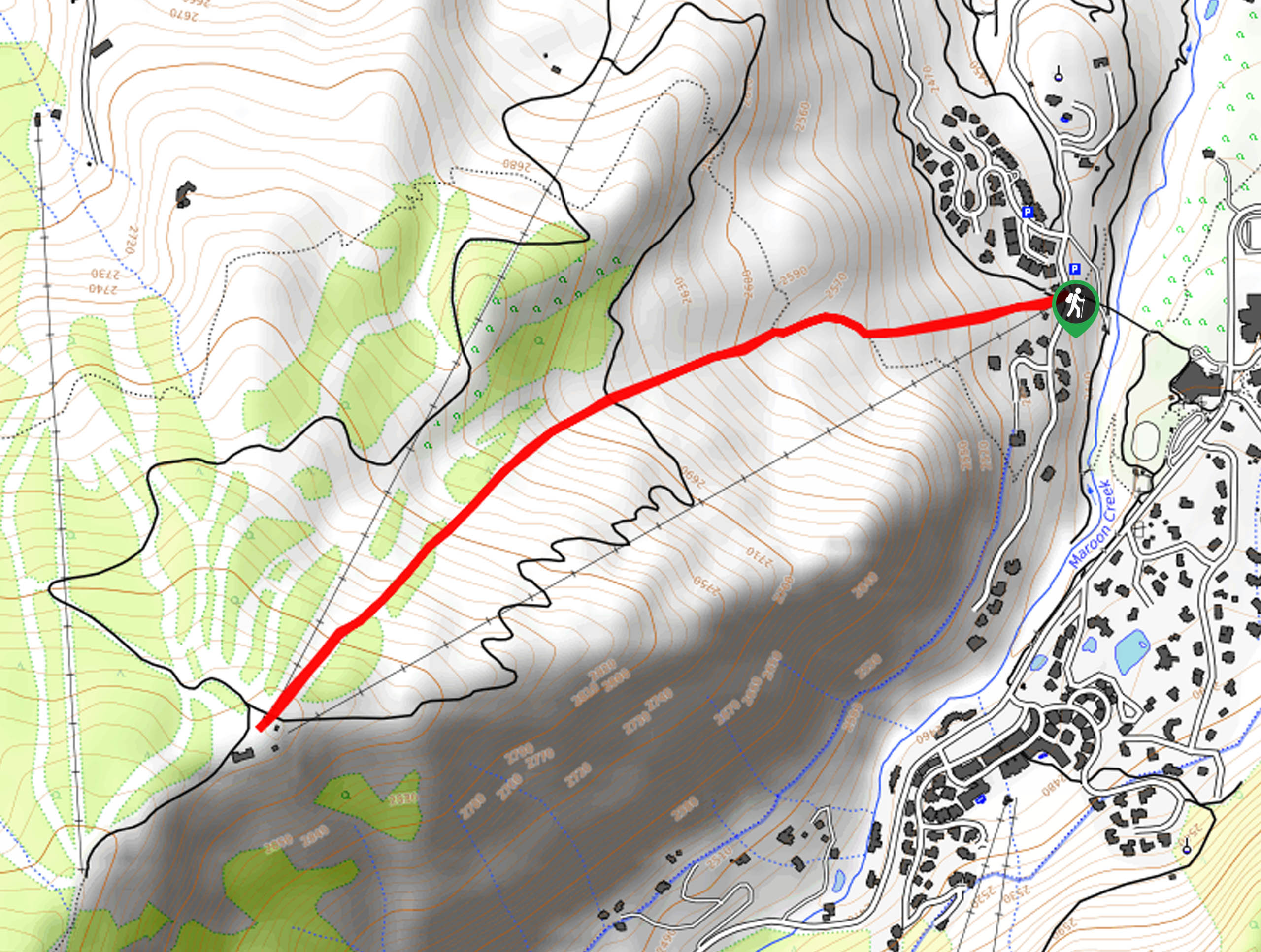
The Taylor Pass Hike departs from the Taylor Pass Trailhead off Express Creek Road.

About
| Backcountry Campground | Dispersed Backcountry Camping |
| When to do | June-October |
| Pets allowed | Yes - On Leash |
| Family friendly | No |
| Route Signage | Average |
| Crowd Levels | Low |
| Route Type | Lollipop |
Taylor Pass Hike
Elevation Graph
Weather
Taylor Pass Hike Description
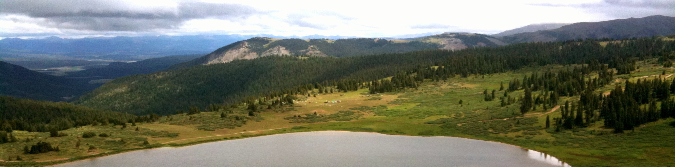
The Taylor Pass Trail exhibits diverse panoramas ranging from mountain scenery to views of alpine lakes, aspen groves, and pine forestlands. With ample landscapes to explore and admire, it proves well worth the effort. With mountain bikers and off-roaders also enjoying the terrain, it is important to be mindful of passers-by! Keep an ear out for bells or engines that signal an approaching adventurer. Located at a high elevation, it is also important to be acclimatized to the area’s altitude, and it is always a safe bet to bring plenty of water– you may need it.
Embark on your journey along the Taylor Pass Hike from the trailhead on Express Creek Road. From here, head southwest along the Taylor Pass Road through exposed meadowlands. Soon you will encounter an intersection, keep left here. Now passing Taylor Lake, you will be guided through some woodlands along the gurgling waters of Taylor Creek. At the route’s end, take a sharp right and you will be diverted onto Taylor River Road 740, where you will enjoy the sights of Taylor River as you climb up the river valley.
Eventually you will confront another junction, where you will again veer right and hook onto the Taylor Divide Road. As you ascend this path, you will be granted breathtaking vistas of the mountainous wilderness that encompasses you. Continue hiking until you reconnect with the Taylor Pass Road. From here, head left and retrace your footing down the route back to the trailhead.
Similar hikes to the Taylor Pass Hike hike
New York Creek Trail
The New York Creek Hike is a stunning adventure through Colorado’s high country. Featuring lush woodlands, expansive meadows, and mountain…
Montezuma Basin Trail
The Montezuma Basin Trail is an epic hike that attracts outdoor enthusiasts of all sorts. Hike, bike, or drive the…
Tiehack Hike
Seeking a killer workout? The Tiehack Hike is a butt-burner of a trek in the Buttermilk Ski Resort, a bustling…
Comments