Montezuma Basin Trail
View Photos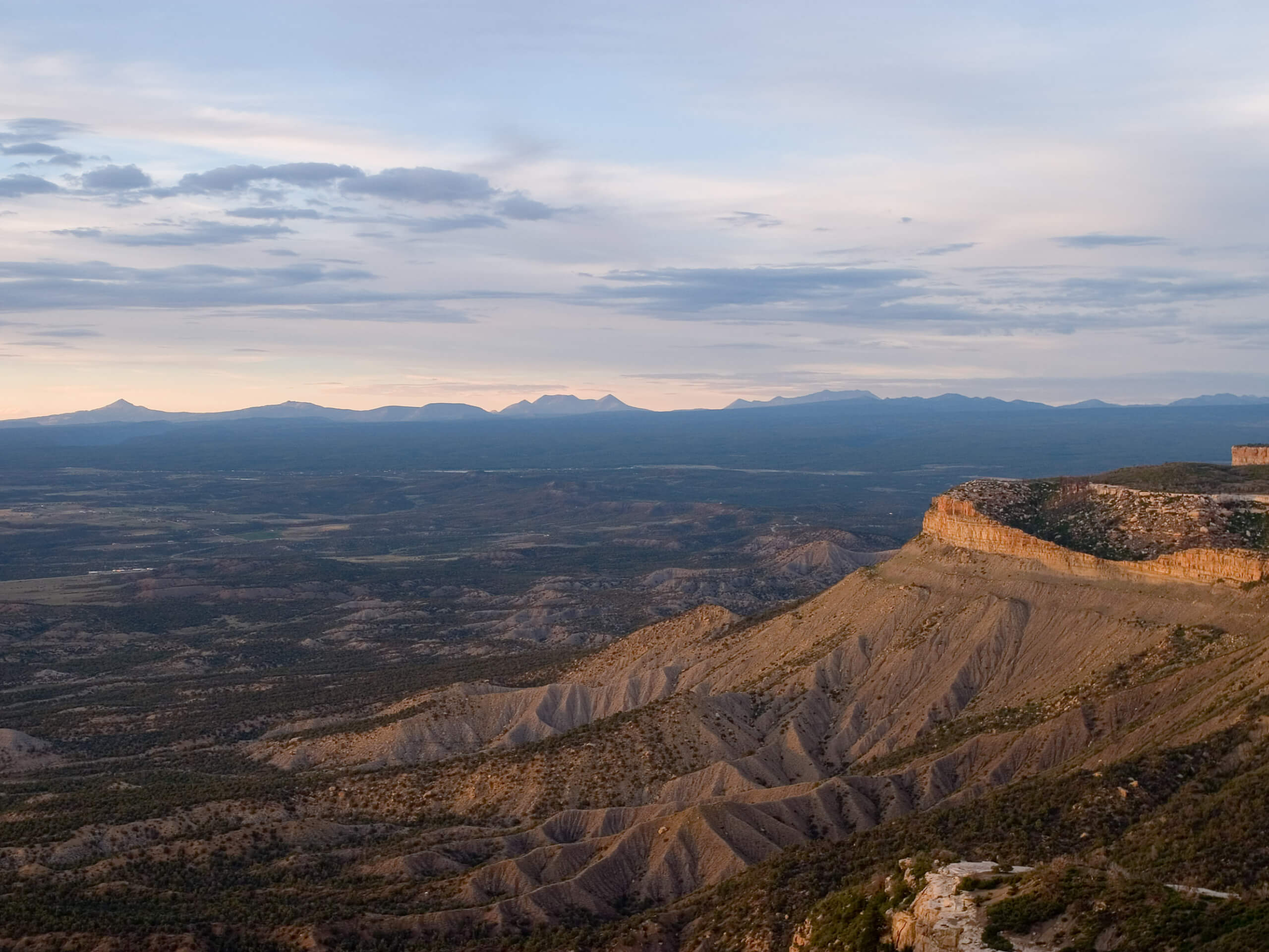
Montezuma Basin Trail
Difficulty Rating:
The Montezuma Basin Trail is an epic hike that attracts outdoor enthusiasts of all sorts. Hike, bike, or drive the high-country road through scenic forests and alpine tundras up to the mountain basin. This amazing excursion is a high demand, high reward type of experience, and we cannot recommend it enough.
Getting there
The Montezuma Basin Trail departs from the Pearl Pass Road Trailhead off Cooper Creek Road.

About
| Backcountry Campground | Dispersed Backcountry Campsites |
| When to do | May-November |
| Pets allowed | Yes - On Leash |
| Family friendly | No |
| Route Signage | Average |
| Crowd Levels | Moderate |
| Route Type | Out and back |
Montezuma Basin Trail
Elevation Graph
Weather
Montezuma Basin Trail Description
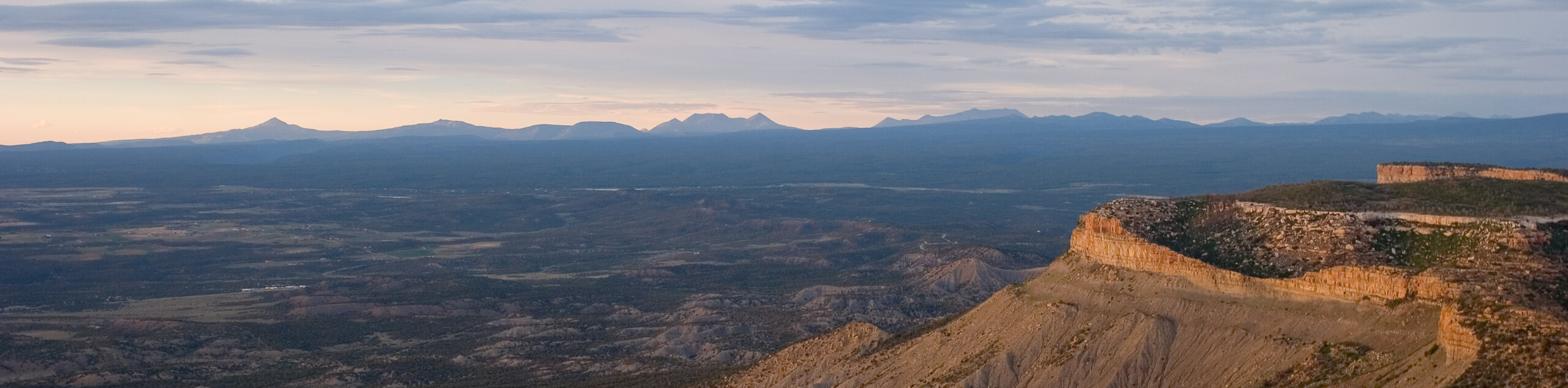
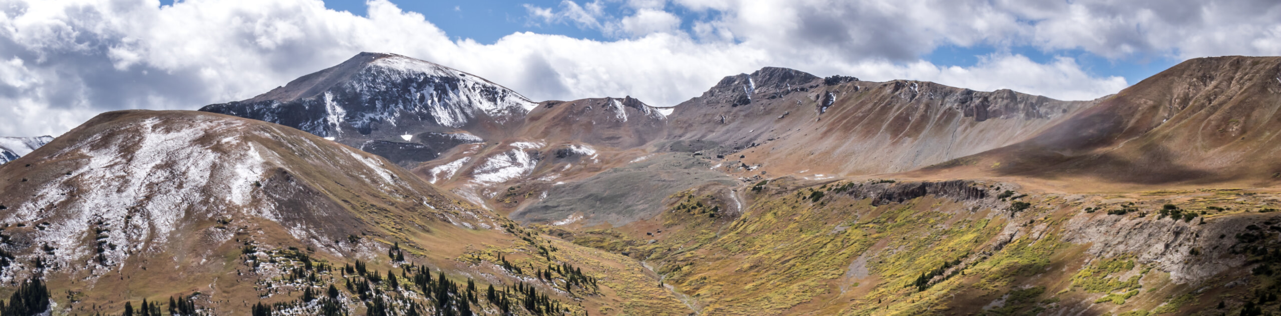
There is no shortage of jaw-dropping scenery along the Montezuma Basin Trail, as it exhibits sights of mesmerizing cascades, vibrant alpine tundras, and epic mountain views. This awesome adventure is great for those conditioning for a more technical ascent up a Colorado 14er, as it will tire you without over-exhausting you. Traveling at such high altitudes it is important to be acclimatized to the area before attempting this trek. Furthermore, when hiking in the summer months, be sure to check the forecast to mitigate the chances of getting caught in a nasty storm in the exposed basin. Note: off-roading vehicles are permitted along this route seasonally, so be mindful of passers-by.
Embark on your adventure along the Montezuma Basin Trail from the trailhead off Cooper Creek Road. From here, track the Pearl Pass Road south along Castle Creek. Intersecting with several streams, you will eventually encounter an intersection. Here, keep right and you will be diverted up Forest Road 129.1-Montezuma. This section of the trek will become more intense as you ascend the increasingly rocky terrain through the tundra to the mountain basin.
Let the sights of Malemute Peak motivate you to persist as you climb. Soon, you will reach the Montezuma Basin just southwest of Malemute Peak. From here, you will be rewarded with epic views of Conundrum and Castle Peaks in the west, and several old mine shafts along the slopes of Malemute. If you still have some gas left in the tank, continue along the route up to Conundrum Peak. If not, simply retrace your footing along the path back to the trailhead.
Similar hikes to the Montezuma Basin Trail hike
New York Creek Trail
The New York Creek Hike is a stunning adventure through Colorado’s high country. Featuring lush woodlands, expansive meadows, and mountain…
Tiehack Hike
Seeking a killer workout? The Tiehack Hike is a butt-burner of a trek in the Buttermilk Ski Resort, a bustling…
Independence Pass Ridgeline Trail
The Independence Pass Ridgeline Trail is a stunning high-country expedition that exhibits sweeping mountain views. Delivering unbeatable panoramas from a…
Comments