
Plateau des Glieres: Three Têtes Hike
View Photos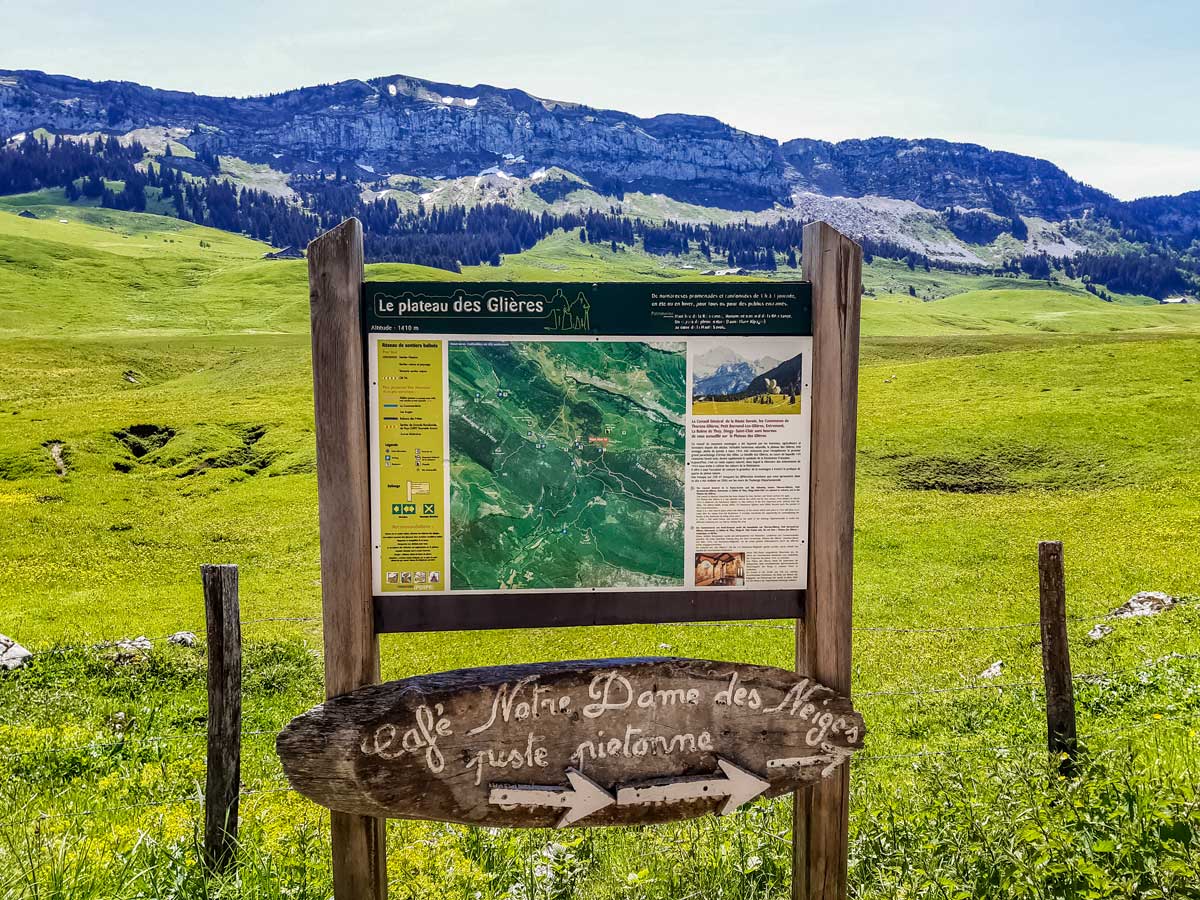
Plateau des Glieres: Three Têtes Hike
Difficulty Rating:
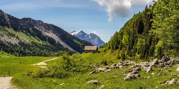
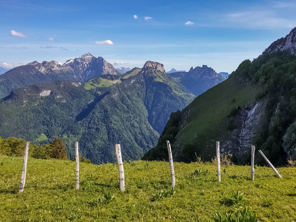
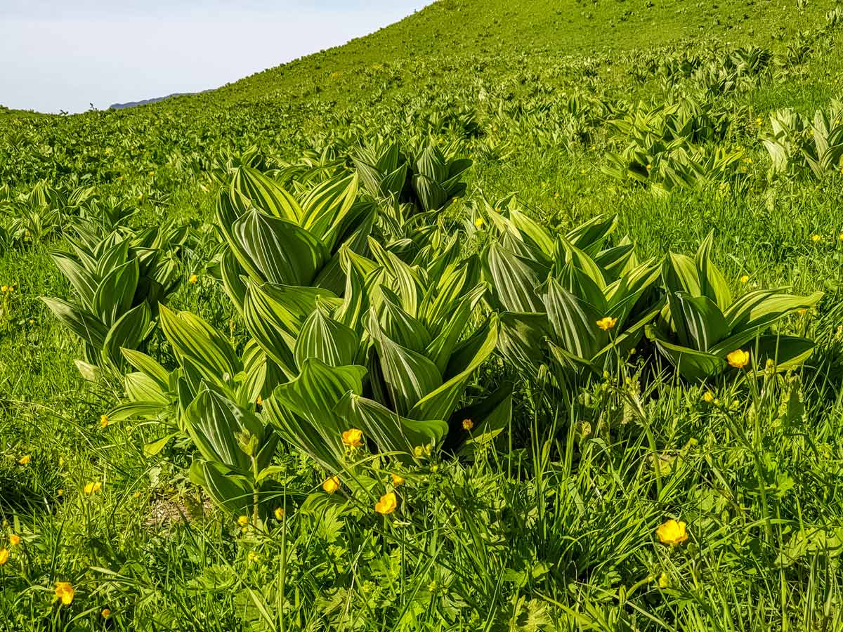
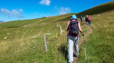
With jetting mountain peaks covered in a carpet of green and unforgettable valley and lake views, the Plateau des Glières Hike doesn’t disappoint! This hike gives you a chance to marvel at the three têtes: Tête Noire, Tête Rond, and Tête de l’Arpattaz. The area is rich in nature and history. You’ll find a monument to the French Resistance fighters who died in battle here, and in summer, wildflowers, blueberries and gentian herbs are abundant in the rolling fields and between the rocky mounts. This loop hike will have you reminiscing on the outstanding views and enchanting scenery for days!
Getting there
The Plateau des Glières is accessible from two directions by car — the D12 between Entremont and Le Petit Bornand, and from the east side, closer to Annecy, via the village of Thorens-Glières. The main road from one side of the other, which is partly a loose gravel road, hit the headlines when it was included in the 2018 Tour de France. This hike begins on the east side of the gravel road, so it’s best to approach from that side.
Be prepared to pay for parking (around 2€ per hour) at Gautard restaurant, or grab a drink or a meal before or after your hike for free parking. The hiking trail starts from the far end of this car park.

About
| When to do | Mid-April – end of September |
| Backcountry Campsites | Various refuges, and car parks for campervans (via Thorens-Glières only) |
| Toilets | No |
| Family friendly | No |
| Route Signage | Poor |
| Crowd Levels | Low |
| Route Type | Lollipop |
Plateau des Glieres: Three Têtes Hike
Elevation Graph
Weather
Route Description for Plateau des Glieres: Three Têtes Hike
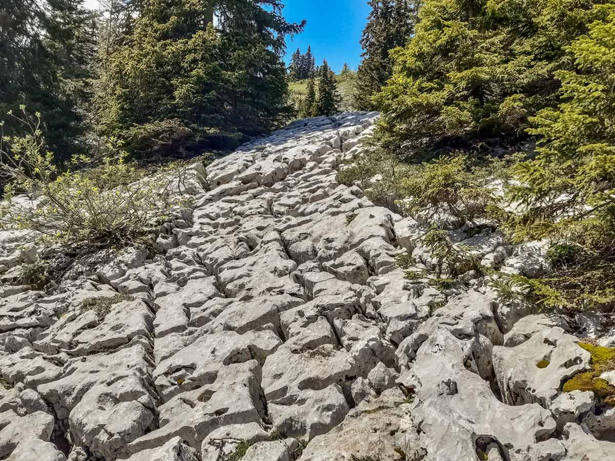
This hike can be completed in either direction. Half the hike is on craggy, challenging terrain and the other half meanders through relatively flat fields on dirt tracks and wide gravel access tracks. Clockwise, the hike starts with inclining difficult terrain and a similar gradient decline before an easy walk out. If you choose the anti-clockwise route, prepare to descend some difficult limestone pavement sections where trekking poles can only do so much. These instructions are for the clockwise hike.
This hike isn’t recommended for children or dogs as there is a vertical section of rock they need to be lifted down and many cliffs with no safety barriers.
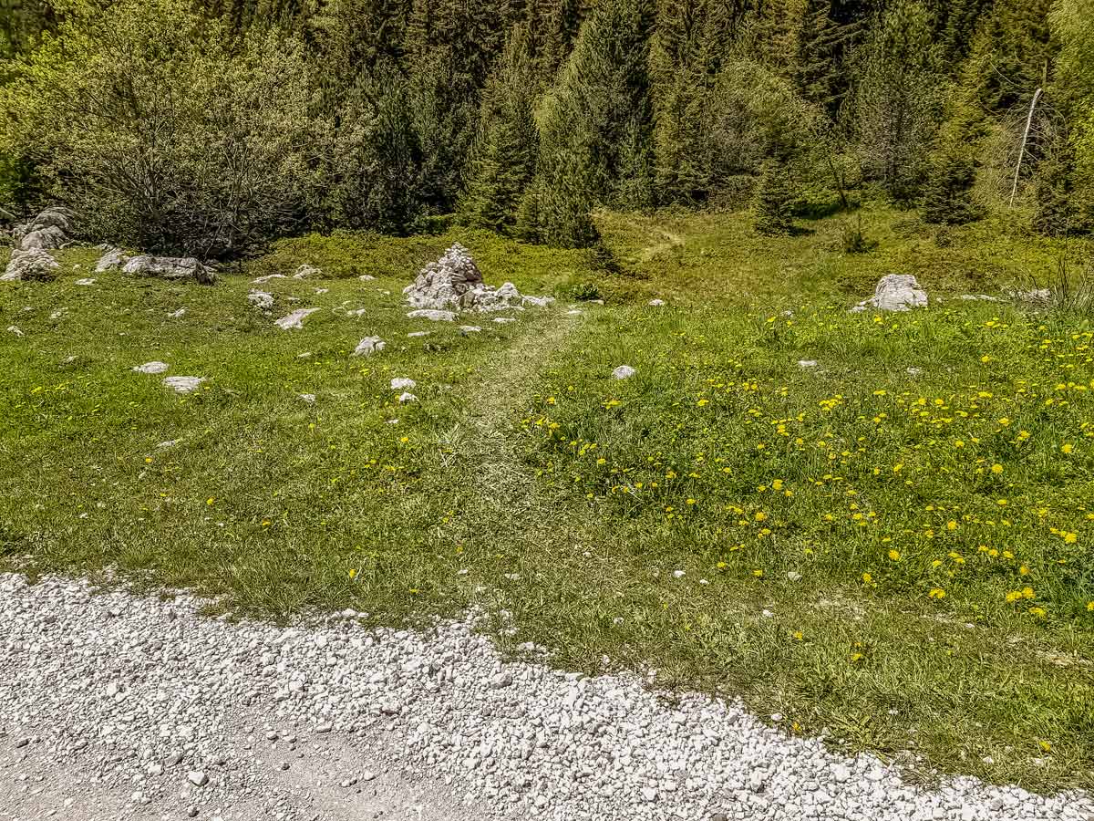
From the Gautard car park, walk away from the restaurant and follow the road to the far end of the car park, where there’s a large wooden info board. Pass the sign, then turn right and go down the wide gravel track, over the bridge with a trickling stream below, crossing fields and going through a cattle gate where there’s a small car park on the right and another wooden info board on the left. This is the beginning of the circuit.
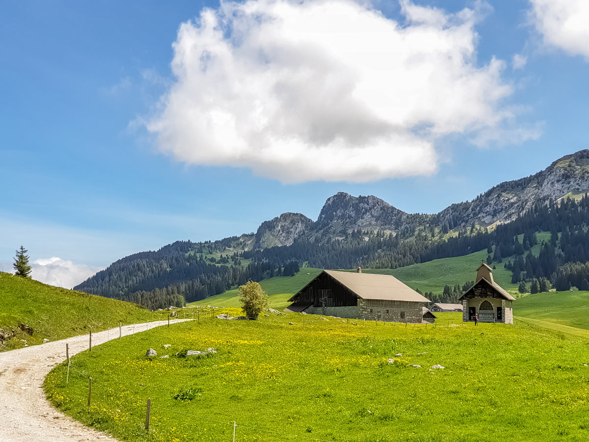
Bear left for the clockwise circuit. About 262ft after the pretty Notre Dame des Neiges chapel on the left, watch for a narrow, grassy unmarked trail on the right. The chapel should still be visible behind you.
Take the unmarked trail, which winds up through some bushes. A few rocks with faded red and yellow paint marks indicate it’s an official route. The trail winds through a sun-dappled forest to an open field, so don’t forget to look back for the first wide mountain views.
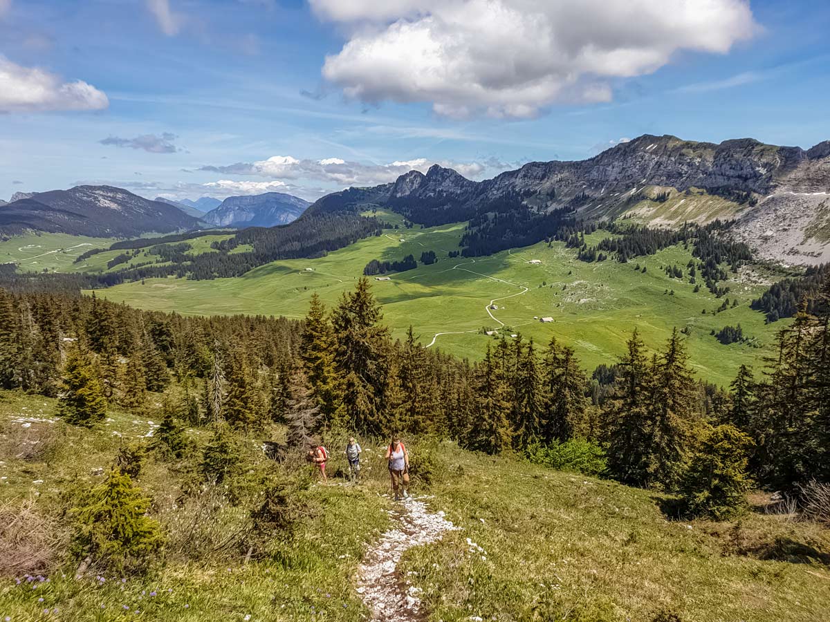
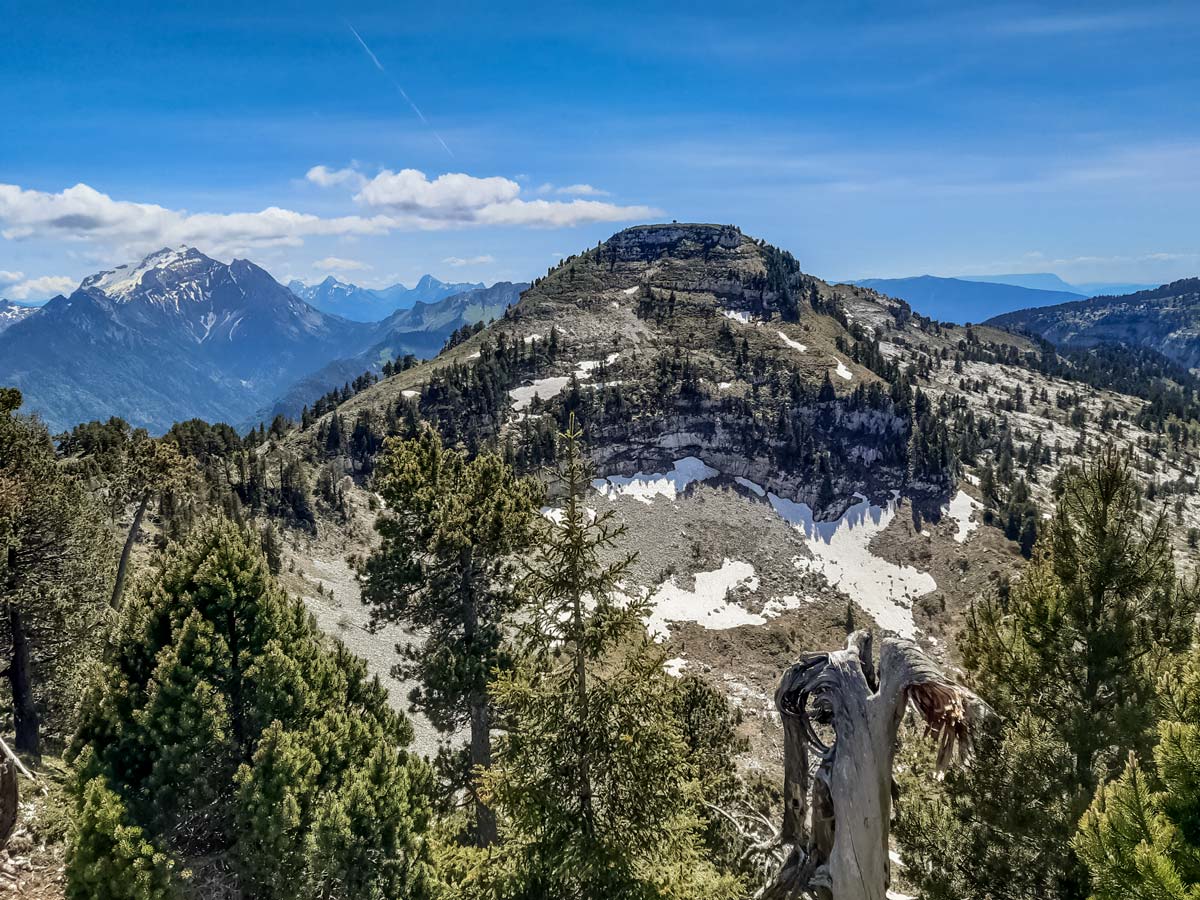
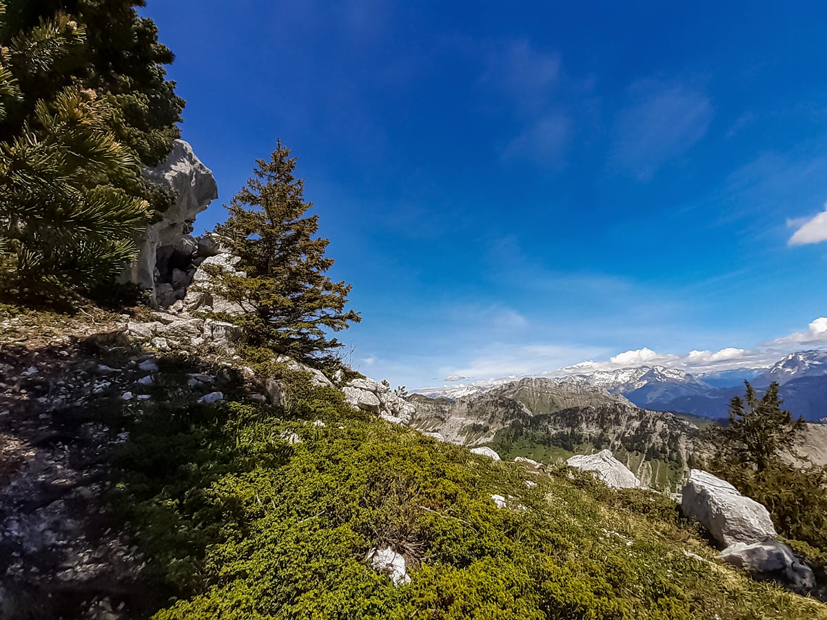
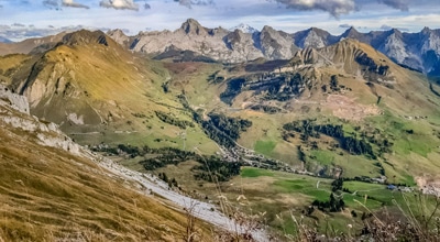
Follow the trail over sections of eroded limestone rock pavement and grass, and through woods, looking for any yellow and red paint marks on rocks and trees to indicate the way. The trail leads to the first of three têtes (heads). From the top of the first one, Tête Noire, you can see the next rounded head, called Tête Rond, and the Aravis chain of mountains further left. To the right is Lake Geneva.
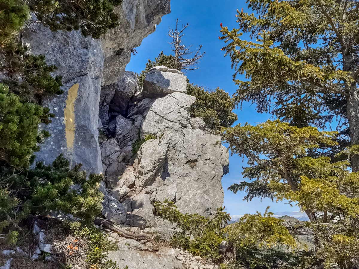
The trail continues not far from the cliff edge, leading to the sketchiest part of the hike. With a cliff ridge in front, turn right to see a four-metre section of steep rock to climb down. Two small rocks at the top are perfect for gripping and there is a ledge for feet about a metre below. After that, the rocks are angled enough to walk down.
Follow the single trail, which provides a view of the village of Thônes in the green valley below. The trail leads to the second head, Tête Rond, where the other two heads are visible.
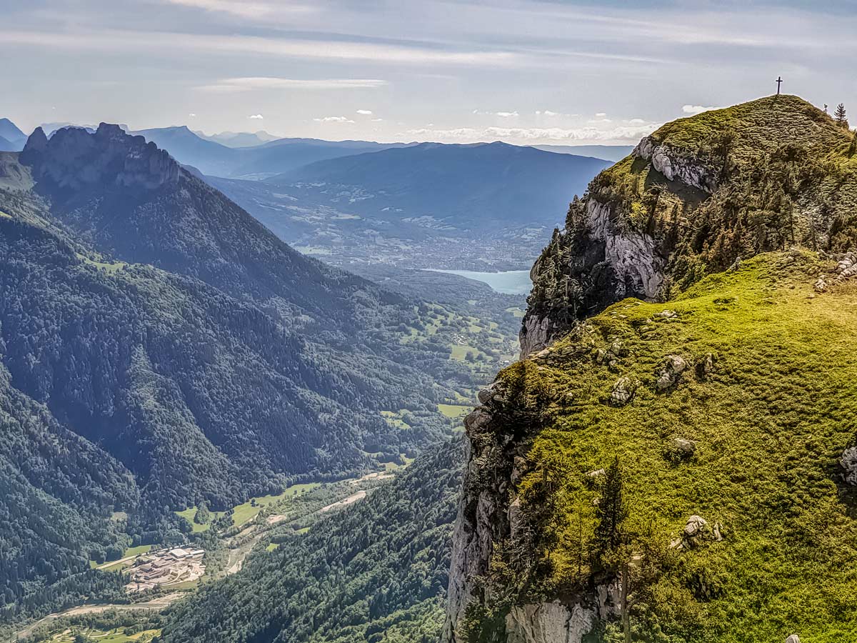
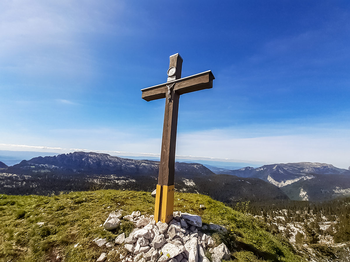
When you’re ready to continue, follow the trail towards the third head, the Tête de l’Arpattaz, with a cross at the top. From the left of the cross, there’s a glimpse of the south end of Lake Annecy.
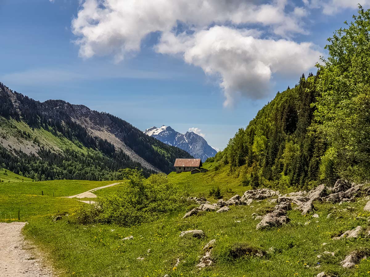
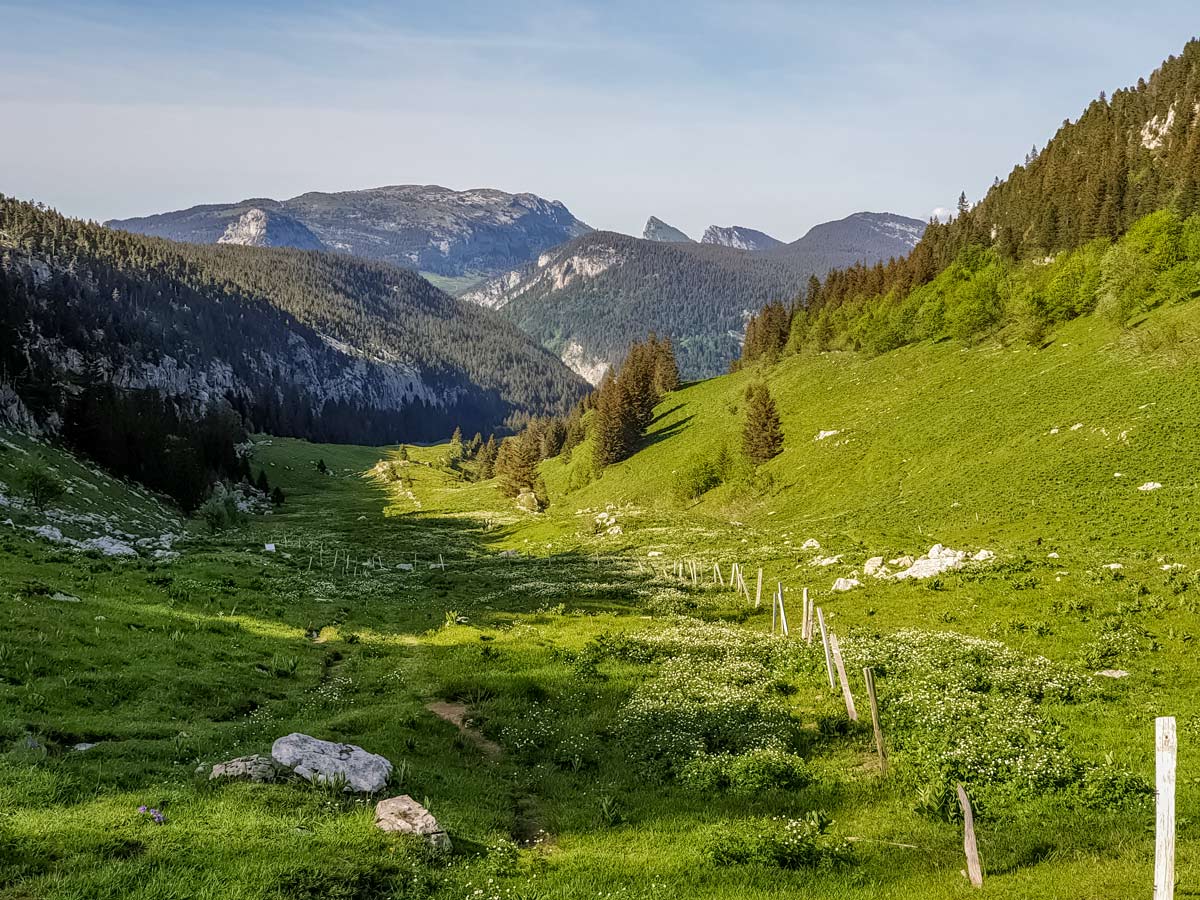
To continue, backtrack down the same trail to the base of the third head, then turn left where the trail descends towards the green valley below. The trail zig-zags down through fields and a few small sections of limestone, then traverses some woods before clearing to open green fields in the valley. Here, the hike is physically half way, but won’t take as long as the first half to complete.
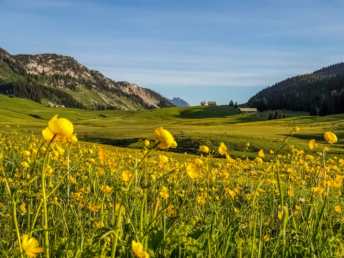
In the valley, there’s a crossroad. To the left, walk for around ten minutes for a final viewpoint that shows more of the valley of Thônes below. The path continues to La Balme de Thuy but it’s very steep and dangerous, indicated by warning signs that declare the trail as a ‘passage delicat’. Instead, walk back to the crossroad. The other trail option leads through the valley, eventually widening to an easy gravel track. Along the way, you will see signs. Follow the directions for Dran (Parking).
The gravel track winds through a forest up a gradual incline, leading to an open area and a T-intersection. Turn right up the road, following the sign towards Maison du Plateau par Dran. This road leads back to the start of the circuit. From here, turn left and follow the path you took at the start of this hike to return to the restaurant car park.
Insider Hints
There are free car parks dotted around the plateau, like the one where the circuit starts, but don’t expect public toilets or anywhere to buy a drink.
With plenty of light woods along the way, it’s easy to find a ‘wild’ toilet stop if required.
Hiking poles are highly recommended for this trail.
The Plateau des Glières is vast and provides hundreds of kilometres of hiking and biking tracks for all levels and interests, with chapels, monuments, farms that sell fresh butter and cheese, restaurants and of course the Tour de France every now and again.
The gravel track that connects the two roads up is usually open for easy access, but always check before leaving to avoid a long detour.
There are no public toilets on the trail; private toilets for restaurant patrons only
Similar hikes to the Plateau des Glieres: Three Têtes Hike hike
Lac du Mont Charvin
It would be easy to overlook this hike on face value: the lake is small and green; the starting point…
Lac de Lessy
Lac de Lessy is a classic place for wildlife spotting, and it’s well known for the loud calls of stags…
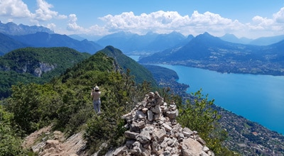
Mont Baron
Mont Baron offers a sweeping 360° vista, with Lake Annecy to the west and the foot of the Alps to…
Comments