Castle Towers Backpacking Trail
View Photos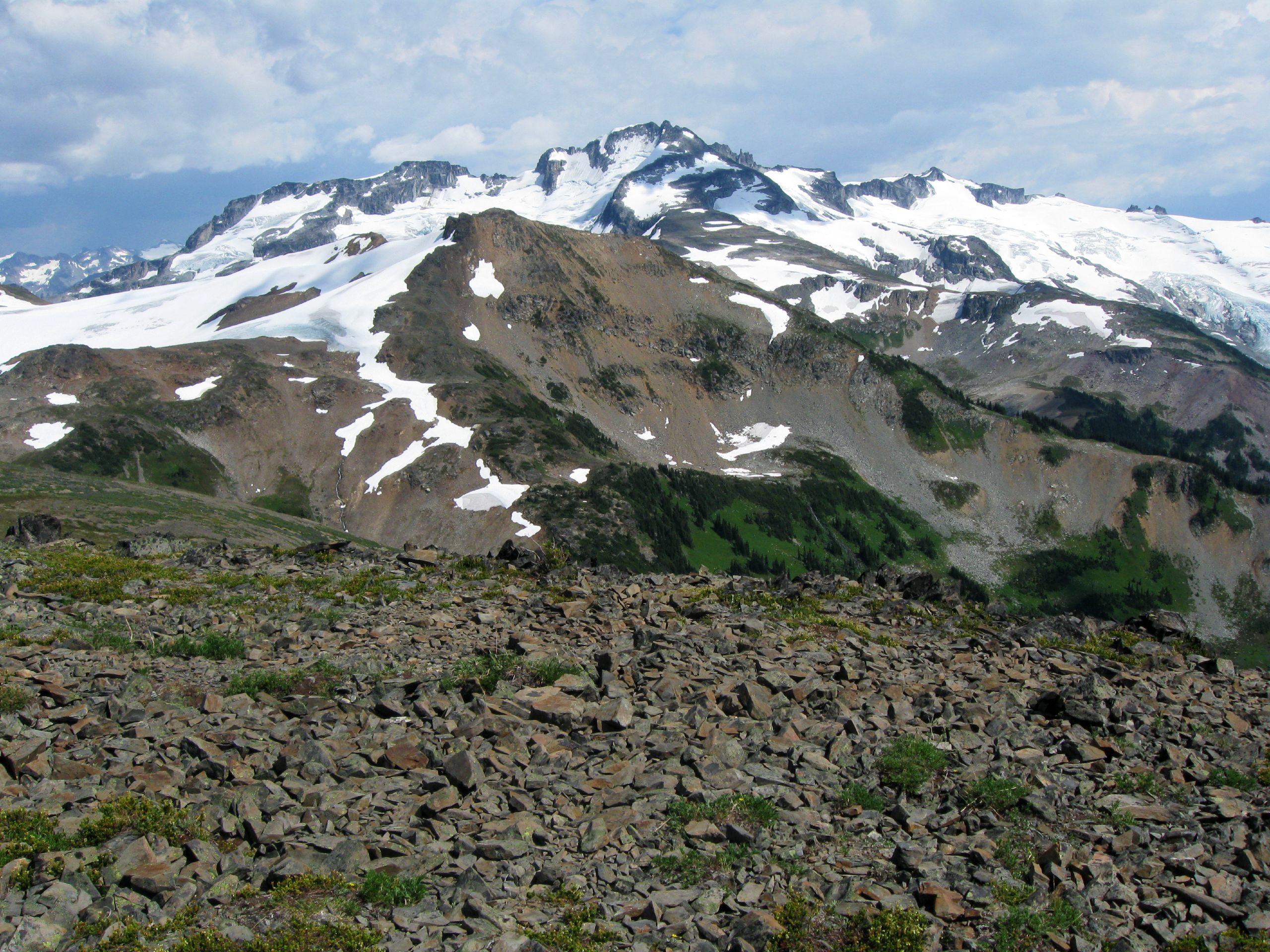
Castle Towers Backpacking Trail
Difficulty Rating:
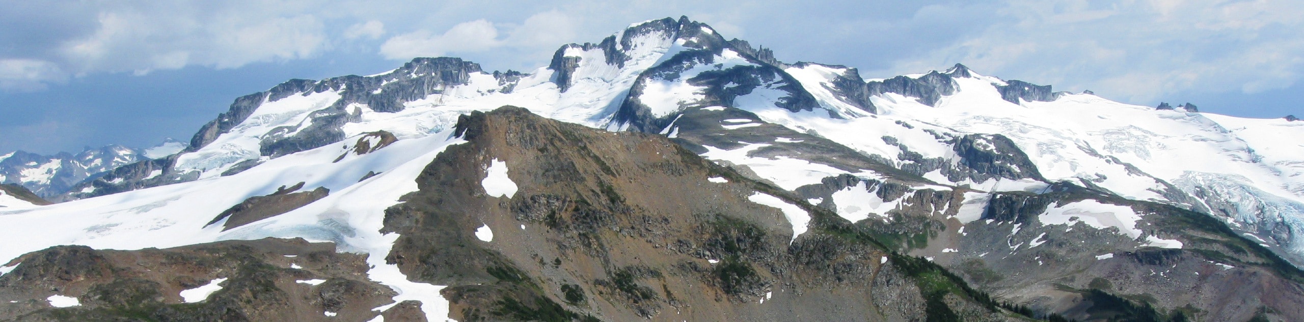
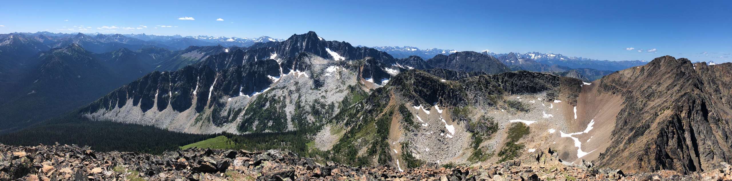
The Castle Towers Backpacking Trail is a difficult 21.5mi out-and-back hiking route that climbs through the rugged landscape of Garibaldi Provincial Park on the way to summit Castle Towers. This trail is best completed in a multi-day format, with an overnight stay at the Helm Creek Campground. Along the trail you will hike through scenic alpine meadows and experience the amazing sights within the park, such as the iconic Black Tusk and numerous glaciers. This is a challenging route that should only be attempted by experienced and confident hikers, but it does offer fantastic views that will allow you to witness the natural beauty of the Whistler area.
Getting there
To reach the trailhead for the Castle Towers Backpacking Trail from Whistler, drive west on BC-99 S and make a left turn onto Cheakamus Lake Road. After 1476ft, turn left to stay on Cheakamus Lake Road and follow it for another 4.3mi to reach the parking area.

About
| When to do | June-September |
| Backcountry Campsites | Helm Creek Campground |
| Pets allowed | No |
| Family friendly | No |
| Route Signage | Average |
| Crowd Levels | Low |
| Route Type | Out and back |
Castle Towers Backpacking Trail
Elevation Graph
Weather
Castle Towers Backpacking Trail Description
The Castle Towers Backpacking Trail is a difficult multi-day hiking route that requires hikers to have a good level of fitness, experience, and confidence to complete the summit of Castle Towers. Portions of the route are unmarked and will require navigation using a GPS if you are unfamiliar with the route. Additionally, the upper part of the trail along Polemonium Ridge and the final ascent of Castle Towers will require a good deal of scrambling in order to traverse the rocky terrain. Make sure to wear sturdy hiking footwear and bring any necessary gear, such as crampons or microspikes in order to traverse this technical terrain.
Although the route is a difficult one, it also provides the opportunity to witness some of the most amazing landscapes in the Whistler area. From stunning views of Black Tusk and Mount Garibaldi to beautiful alpine meadows and chilly glaciers; this hiking route has a truly diverse landscape that will leave you in awe.
Day 1: From Trailhead to Helm Creek Campground
Setting out from the trailhead, follow the trail as it heads east through the forest for 1.7km, where you will come to a junction in the trail. Take the path to the right to cross over the rushing waters of the Cheakamus River and follow along a series of switchbacks that climb uphill. The trail will continue on through the dense forests of Garibaldi Provincial Park for 6km, at which point you will enter into beautiful alpine meadows at the Helm Creek Campground. After setting up camp, take the opportunity to explore the area and take in the spectacular views of the alpine landscape and nearby Black Tusk before settling in to rest overnight for the ascent of Castle Towers the following day.
Helm Creek Campground
The Helm Creek Campground is a perfect spot to set up camp if you are looking to hike the many trails that can be found in this part of Garibaldi Provincial Park, including Panorama Ridge, Black Tusk and Garibaldi Lake. The campsite offers 30 tent pads that require a pre-booked reservation to utilize, and also contains outhouses and bear caches to safely store your food. The scenery around the campsite is spectacular, providing views over the rugged landscape in all directions.
Campground details
- Tent pads: 30 tent pads available.
- It costs $6 per tent pad/night
- Site Fee: $10 per person/night
- Fire pit: No
- Dogs allowed: No
- Campfire allowed: No
- Outhouses on site: Yes
Day 2: From Helm Creek Campground to Castle Towers and return journey
After breaking camp, leave the beauty of the meadow behind you and set out on a path to the south that will pass through the forest and cross over several streams. After roughly 1km, you will need to break off from the trail on an unmarked route that will take you around the edge of Helm Glacier. You will need a GPS to tackle this part of the trail, so keep an eye on the route in order to stay on the correct course towards Castle Towers.
Eventually, the route will bring you to an east-west moraine that you will need to work around to continue along the trail. Climb up onto the ridge of the moraine and follow the GPS as it leads you along the ridgeline. This route will lead you around the edge of Helm Glacier in a southeast direction toward your final destination of Castle Towers. Although the glacier is accessible, do not attempt to climb across it unless you are familiar with glacier hiking and have a wealth of experience. Melt holes and crevasses represent a real danger to amateur hikers and should be taken seriously.
Working along the Polemonium Ridge, continue on in a southeastern direction as you scramble across the rocky terrain towards the summit of Castle Towers. This portion of the trail is littered with fields of small boulders, making the terrain a technical and slow-going affair. After making the final climb up to the summit, hikers will be rewarded with amazingly scenic views that stretch out in all directions over Garibaldi Provincial Park. Countless mountain peaks and icy glaciers can be seen from this vantage point, including Mount Garibaldi, The Sphinx and even Mount Tantalus to the southwest. After taking in the gorgeous views, carefully work your way back down along the same trail to either return to the campsite or push on to the parking lot having completed the Castle Towers Backpacking Trail.
Sample Itinerary:
The Castle Towers Backpacking Trail passes right through the Helm Creek Campground and offers a bit of flexibility with route planning. This sample itinerary accounts for a fairly short and leisurely hike on day one, with an overnight stay at the camp. This is followed up on day two with a summit of Castle Towers and a longer return trip back to the trailhead. Hikers that would like to extend the length of this hike by another day could easily stay two nights at the campground, with the middle day serving as an opportunity to summit the peak.
- Day 1
Trailhead to Helm Creek Campground
Distance: 4.8mi
Elevation gain: 2533ft
Campground: Helm Creek Campground - Day 2
Helm Creek Campground to Castle Towers summit and return to Trailhead
Distance: 16.7mi
Elevation gain: 5883ft
Campground: None
Backpacking Trail Highlights
Black Tusk
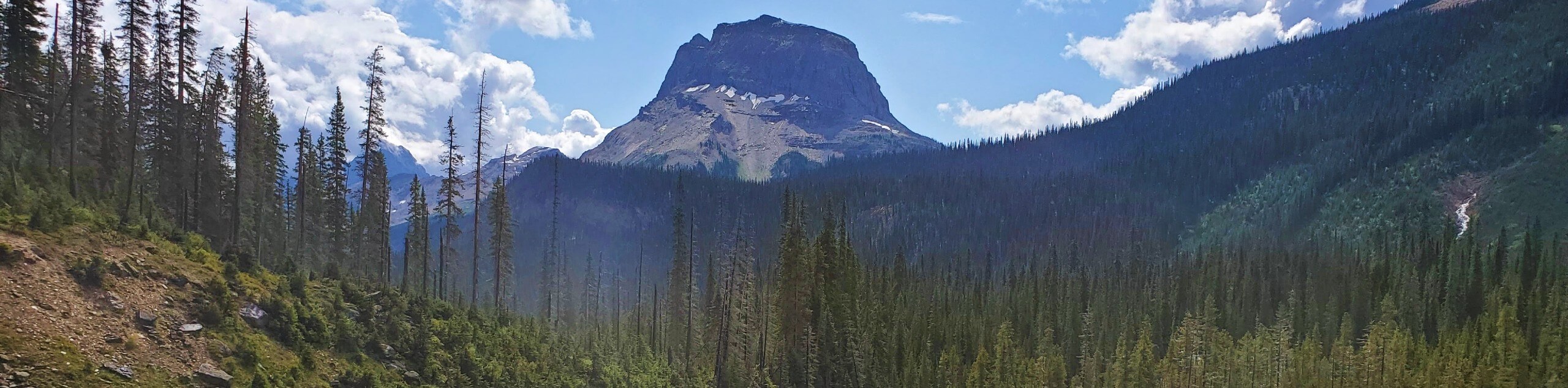
Arguably the most iconic and recognizable peak in the Whistler area, the Black Tusk stands at 7608ft and is the remnants of an extinct stratovolcano. This prominent black pinnacle is instantly recognizable and can be seen from all directions. Climbing to the top of Black Tusk requires an adventurous scramble on the final ascent.
Garibaldi Provincial Park
Located 43.5mi north of Vancouver, Garibaldi Provincial Park is a wilderness area that spans over 1950 square kilometres of territory and is a popular destination for outdoor enthusiasts, with over 100,000 day users per season.
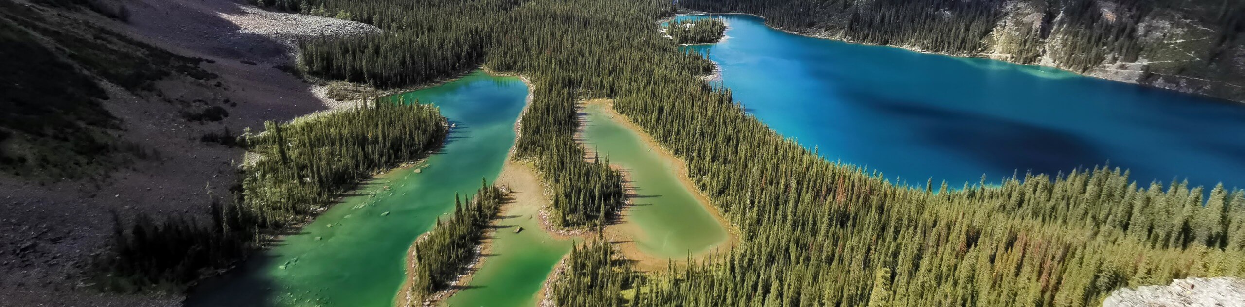
With a landscape made up of rugged mountains, dense forests, and over 150 glaciers; Garibaldi Provincial Park is a beautiful area that also houses a number of alpine lakes, such as Garibaldi Lake, Cheakamus Lake, Mamquam Lake, and Elfin Lakes. The highest point of the park is Wedge Mountain at 2891m, with other notable peaks that include the iconic Black Tusk and Mount Garibaldi.
Insider Hints
Depending on the desired length of your trip, this trail can be completed over a 1, 2, or 3-day span.
Remember to book your reservation for the campsite in advance.
Bring bear spray to avoid any dangerous encounters.
The campground also has bear caches for safely storing your food.
Wear proper hiking footwear and bring additional gear such as crampons or microspikes.
A GPS is required to navigate portions of this route.
Similar backpacking trails to the Castle Towers Backpacking Trail backpacking trail
Lake O’Hara Backcountry
Explore the incomparable Lake O'Hara area of Yoho National Park on this backcountry trek that totally immerses you in western…
Yoho Valley Backpacking Route
With waterfalls, mountain lakes, and stunning views in all directions, this Yoho Valley backpacking tour is both challenging and rewarding.…
Frosty Mountain Loop Backpacking Trail
The Frosty Mountain Loop Backpacking Trail is a 16.8mi loop through E.C. Manning Provincial Park that takes hikers…
Comments