
Nigel, Cataract and Cline Pass backpacking trail
View Photos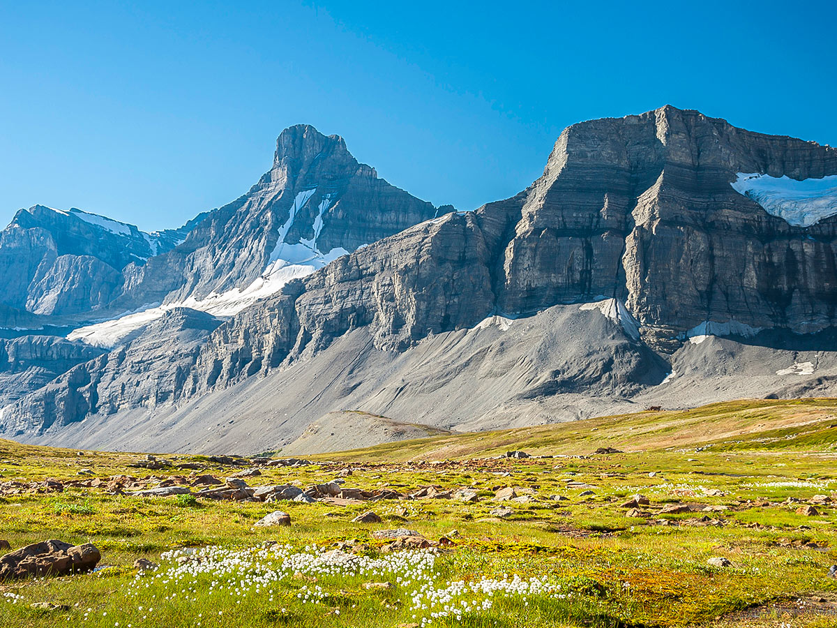
Nigel, Cataract and Cline Pass backpacking trail
Difficulty Rating:
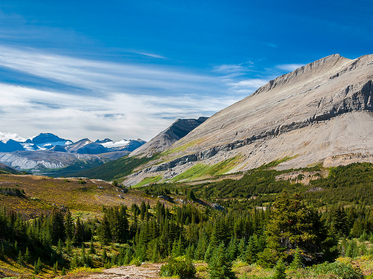
The trip to Nigel, Cataract and Cline Pass covers vast meadows, uniquely-coloured rock, glacial streams, and the glaciers of Cataract Pass, making it a truly unique backpacking destination. This trip takes you into the White Goat Wilderness Area, and you will be random backcountry camping, a unique opportunity for backpackers in the Canadian Rockies.
Getting there
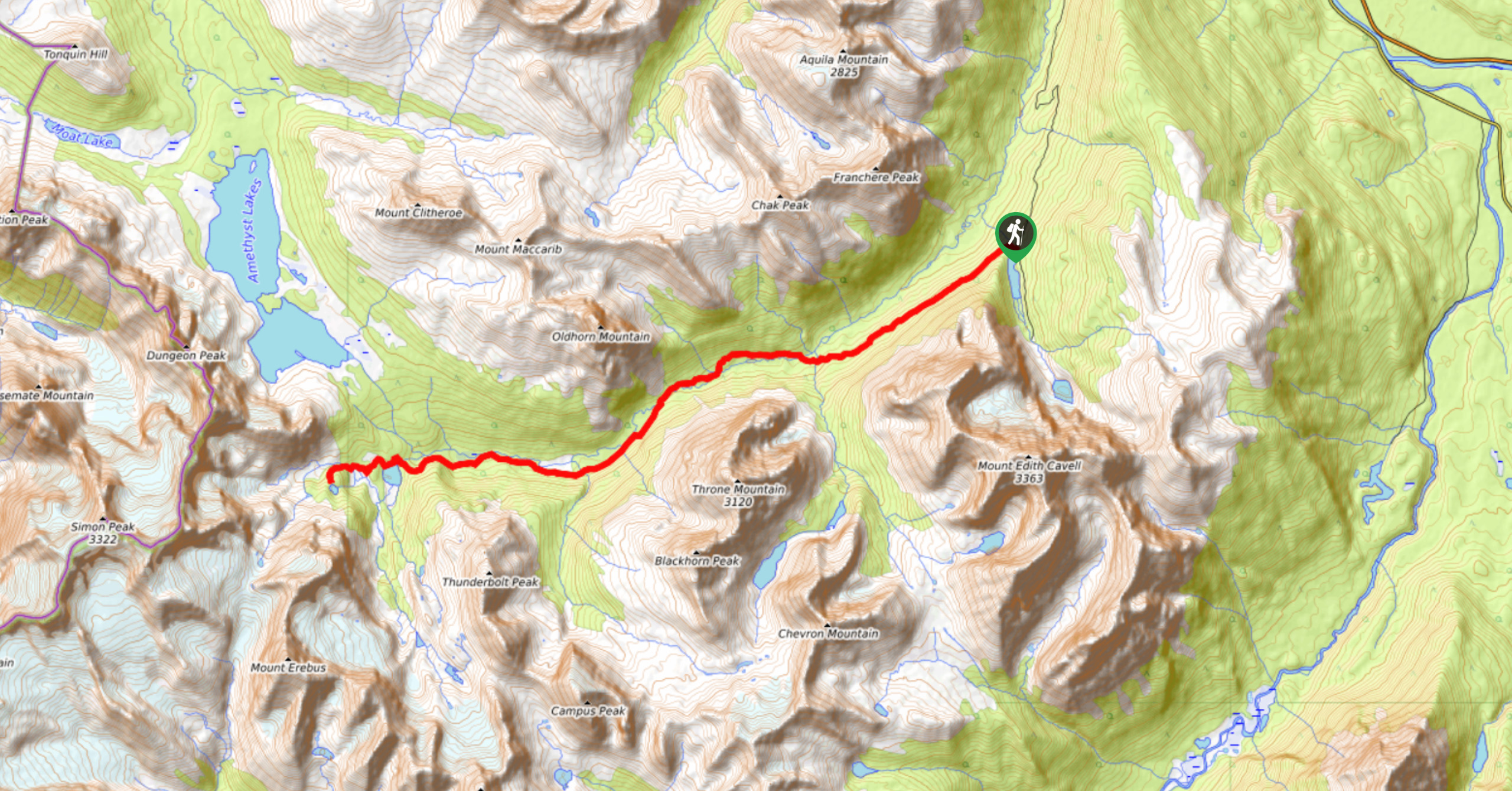
The Nigel Pass (and Brazeau Loop) trailhead is close to the middle of the Icefields parkway, practically equally distant from Lake Louise and Jasper. From Jasper, head south for 72.1mi, pull into the Nigel Creek parking lot on the left, 8.1mi south of the Icefields Centre. From Lake Louise head north for 70.8mi and turn right into the Nigel Creek Parking Lot.

About
| Re-supply points | None |
| When to do | Mid July - Spetember |
| Mountain Huts | No |
| Backcountry Campsites | Yes |
| Toilets | Trailhead |
| Pets allowed | No |
| Accommodation Type | Tent |
| Family friendly | No |
| Route Signage | Poor |
| Crowd Levels | Low to Moderate |
| Route Type | Out and back |
Nigel, Cataract and Cline Pass
Elevation Graph
Weather
Route Description for Nigel, Cataract and Cline Pass
This is a wonderful backpacking trip that takes you through Jasper National Park and into the White Goat Wilderness Area. You go through the scenic Nigel, Cataract and Cline Passes. There are no need for backcountry camping reservations, as you will be random camping in the White Goat Wilderness Area.
Day 1
Today the trip will be 9.1mi, over Nigel and Cataract Pass to a random camping spot of your choosing near Cataract Creek. The route will gain 2346ft while dropping 1056ft along the way.
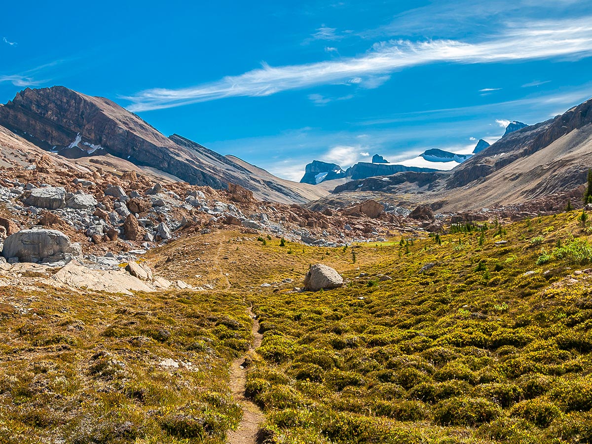
The trip starts at the popular Nigel Pass and Brazeau Loop trailhead along the Icefields Parkway. It is just north of the “big bend”.
Currently the initial 1.2mi of the trail to Nigel Pass is along a dirt road due to a washed-out bridge along the usual trail, but this is of little consequence and actually speeds up the most boring part of the trip. The only confusion with the detour may be immediately after crossing Nigel Creek where the trail splits into hiking and equestrian trails. It’s signed, and the hikers trail stays to the south, but if you somehow end up on the equestrian trail, you’ll have to cross the creek a few hours later and that might be difficult.
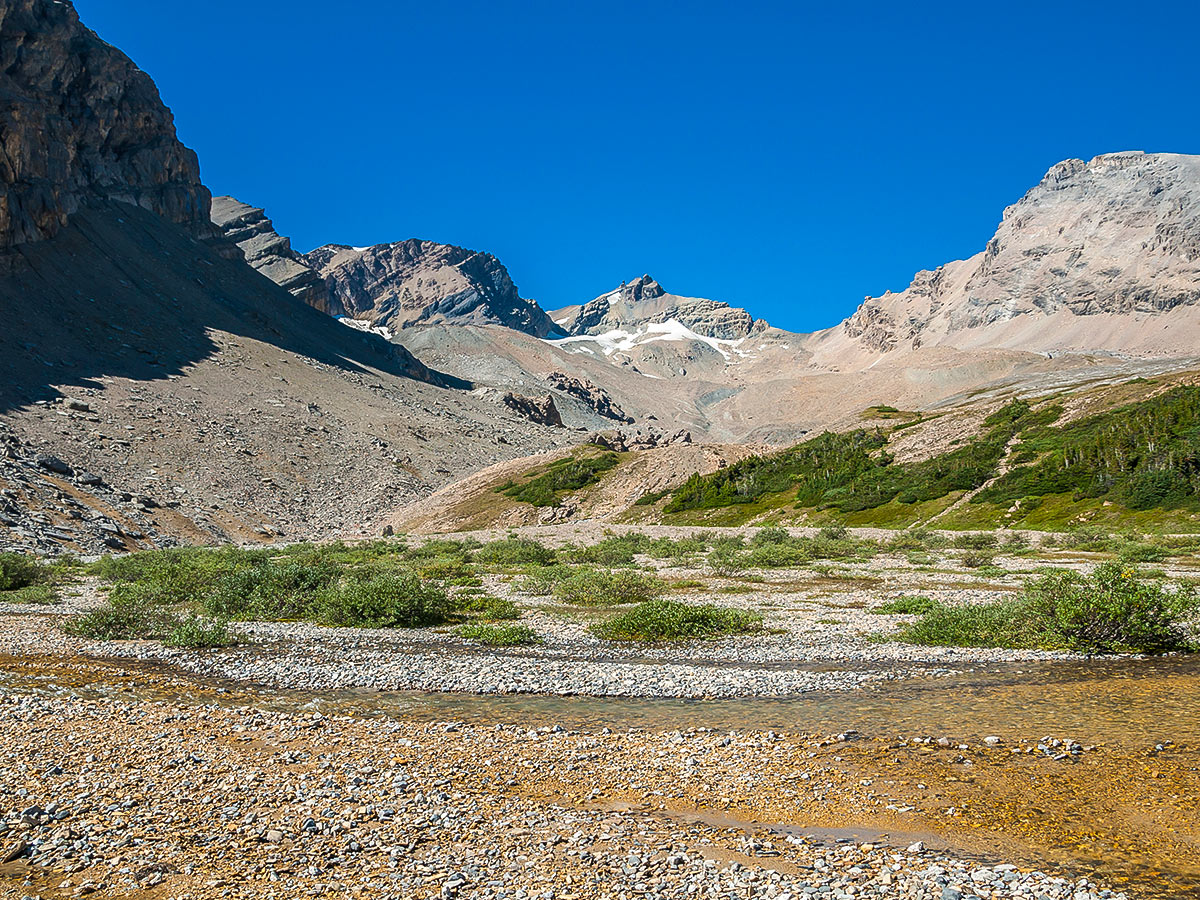
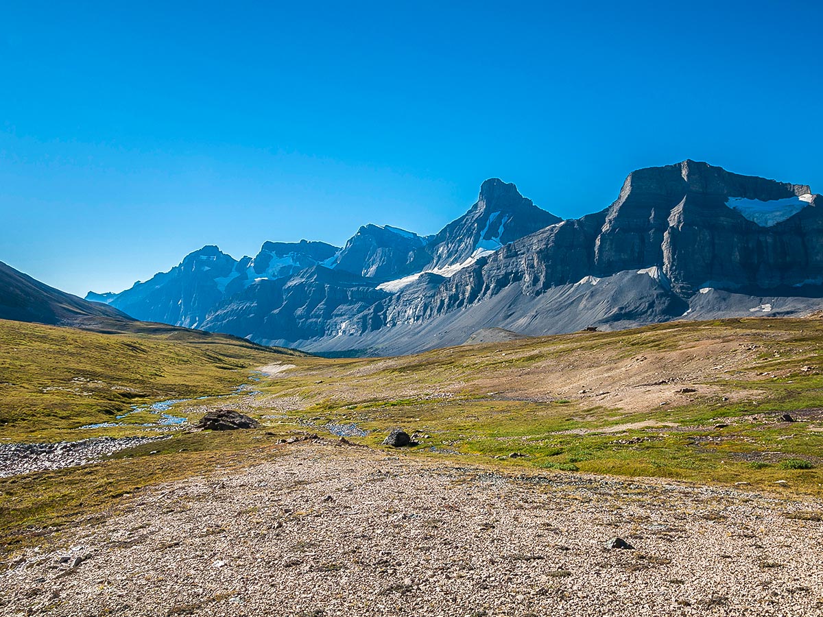
After about 5.0mi (and 1214ft of elevation gain) you come to a junction with the Great Divide Trail at Nigel Pass. Here you will need to rock-hop (easy) across the Brazeau River and then head upstream (east; to the right) towards Cataract Pass.
From Nigel Pass, it is useful to have good maps and a route plan before heading out, to ensure you’re going in the right direction.
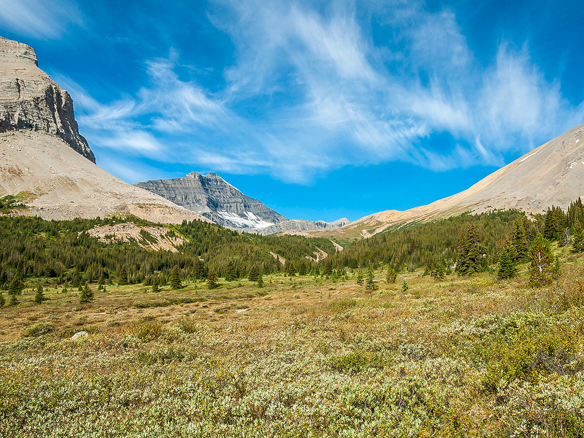
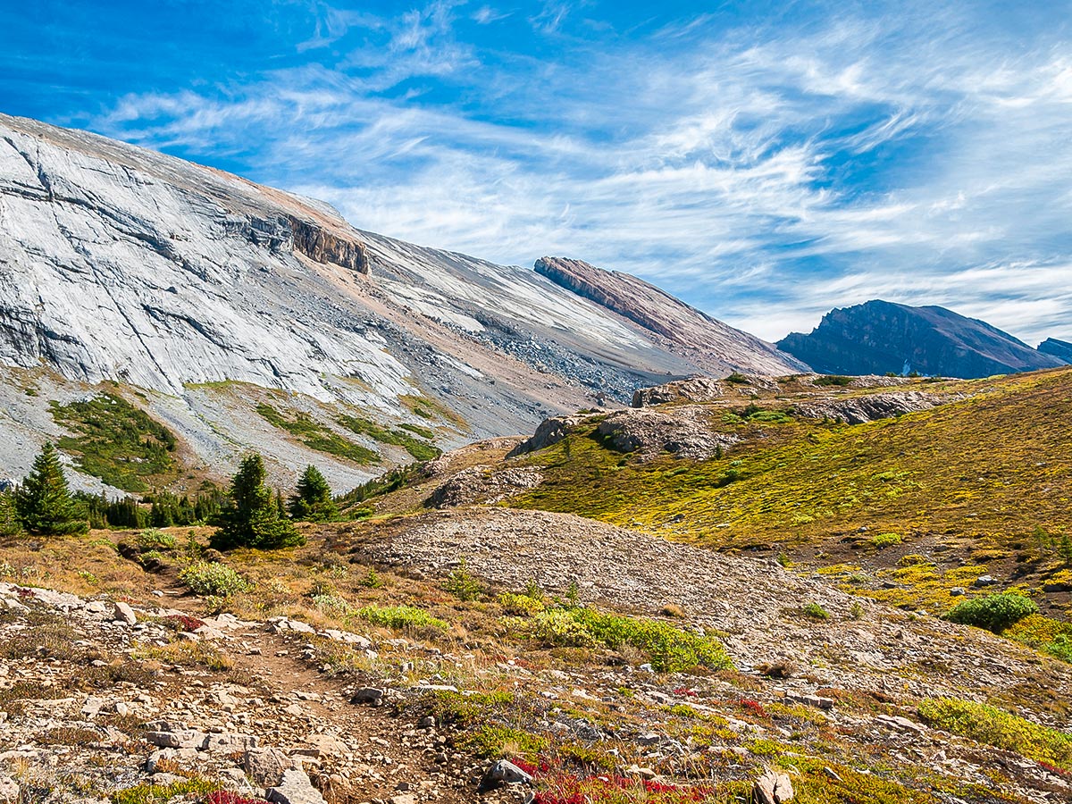
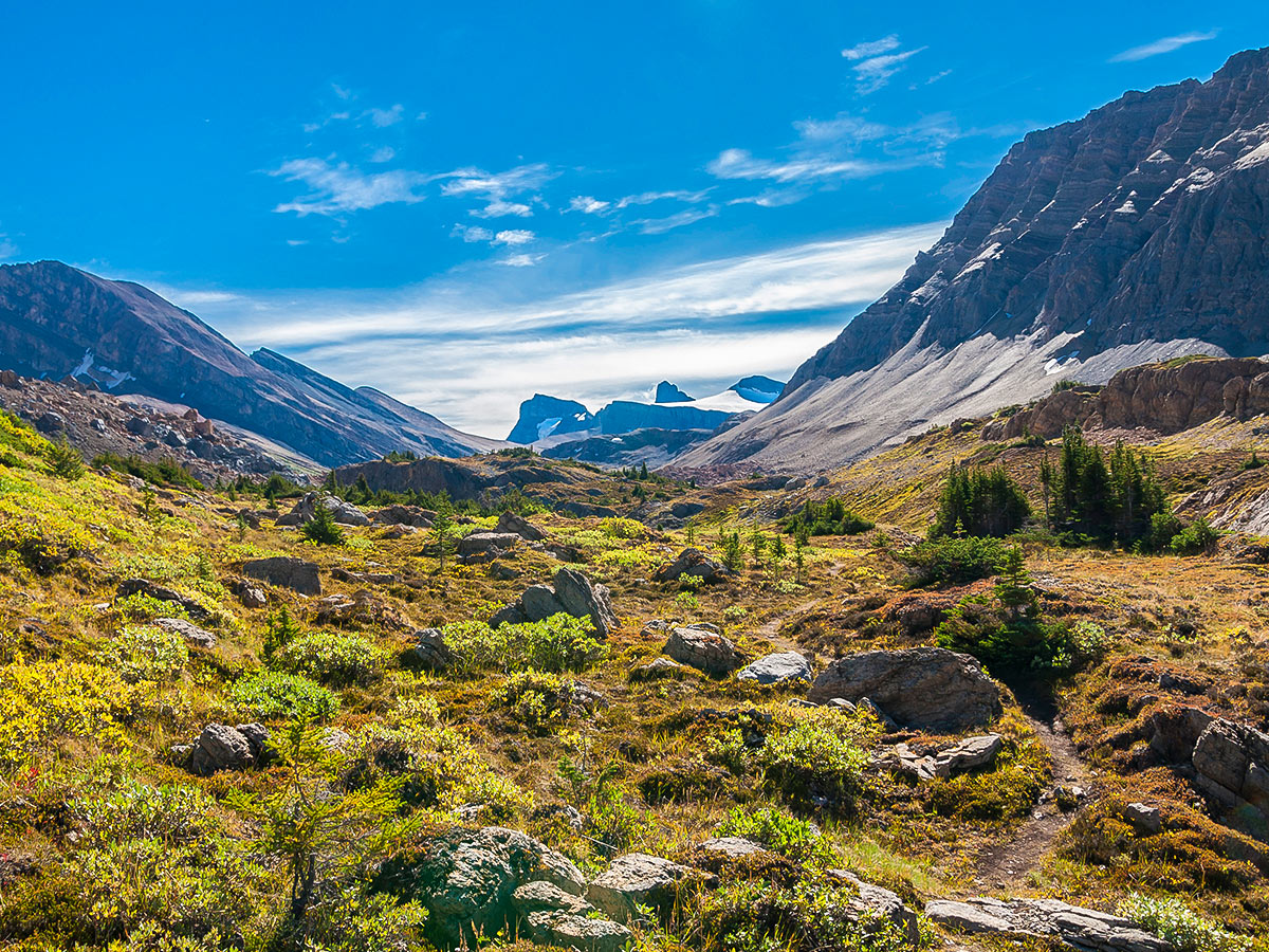
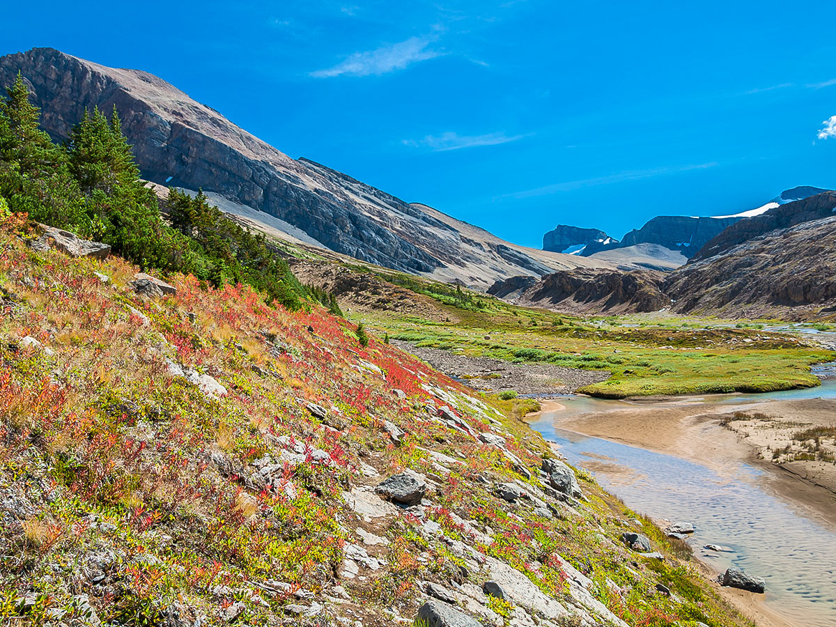
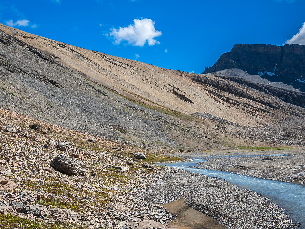
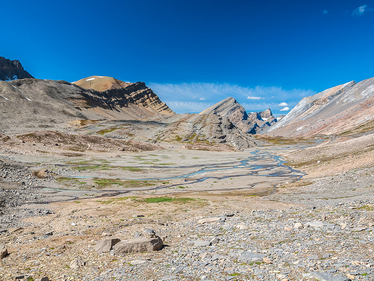
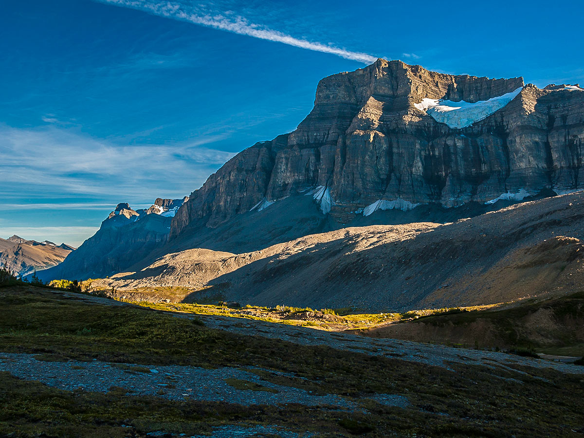
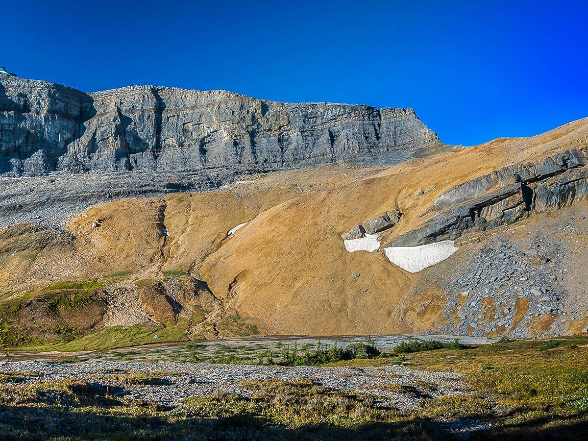
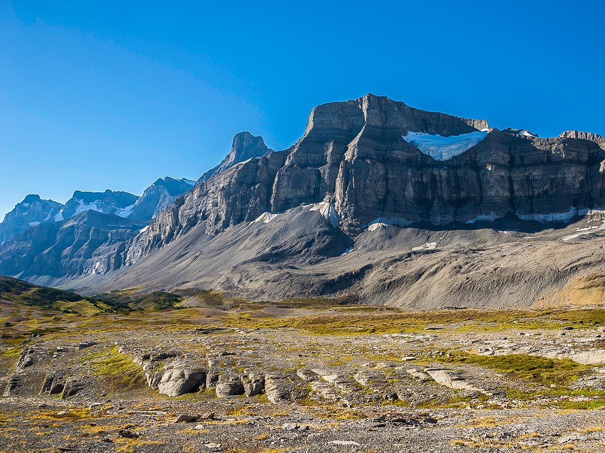
Cataract pass is about 3.1mi from Nigel Pass. There is a good trail most of the way, but when the trail splits or heads up through boulder fields, take your time to choose the best route. There will be cairns, and paths through the boulders, however spend time reading the terrain and choosing a route, as cairns can be placed by anyone, and may not be the safest or correct trail to follow.
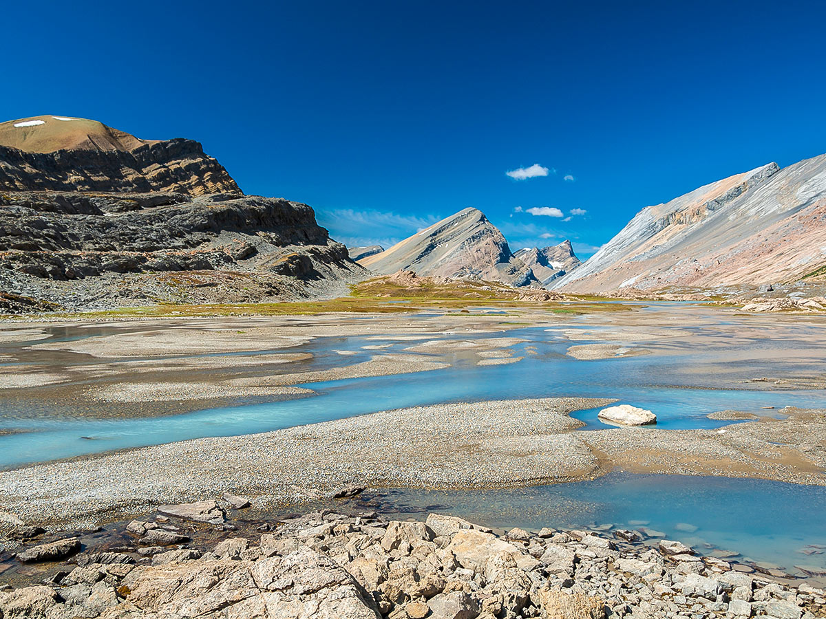
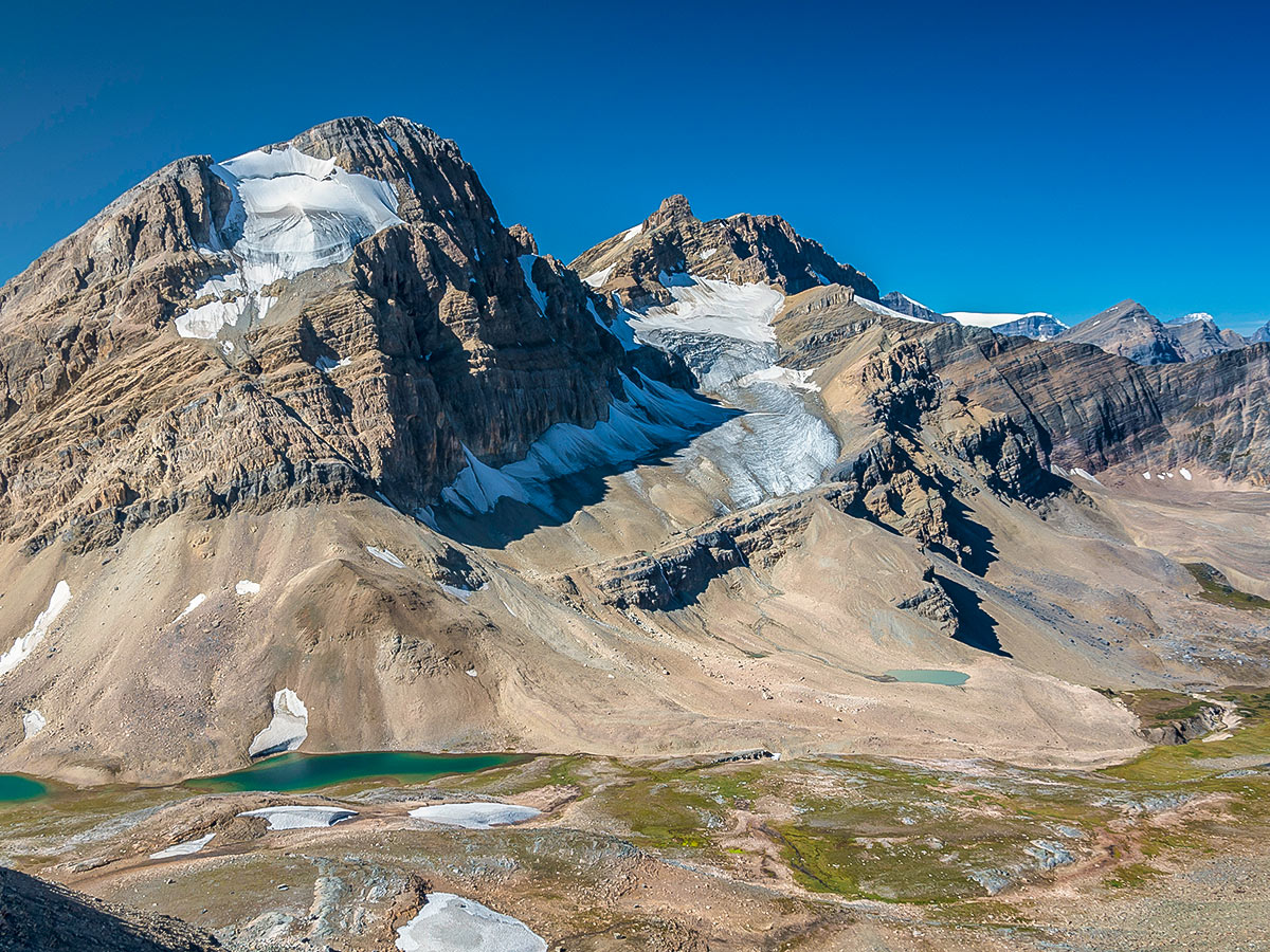
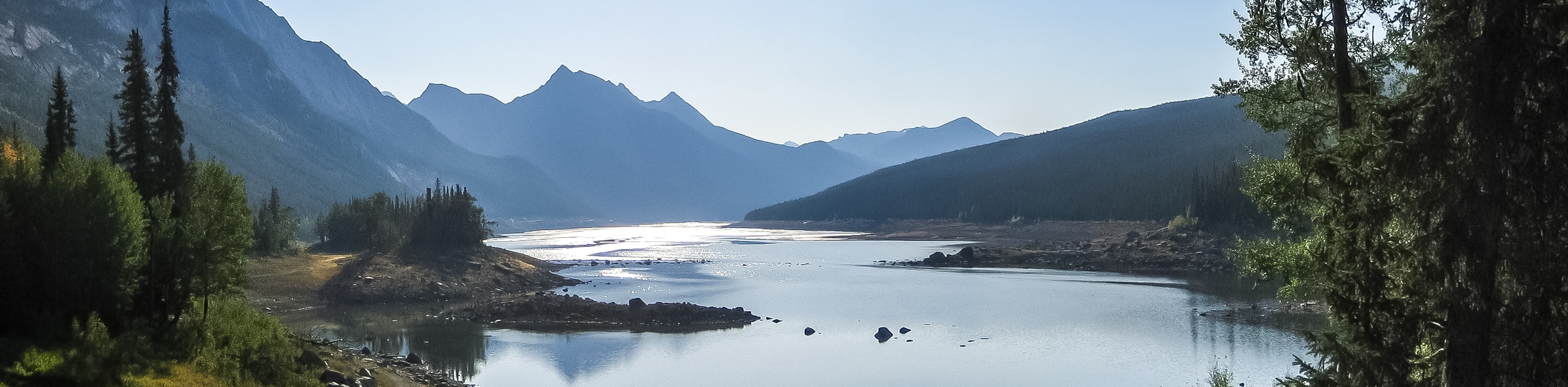
Once walking towards Cataract Pass, the terrain is spectacular and quite different than most other areas in the Rockies. There are plenty of pikas in the valley as well as other game.
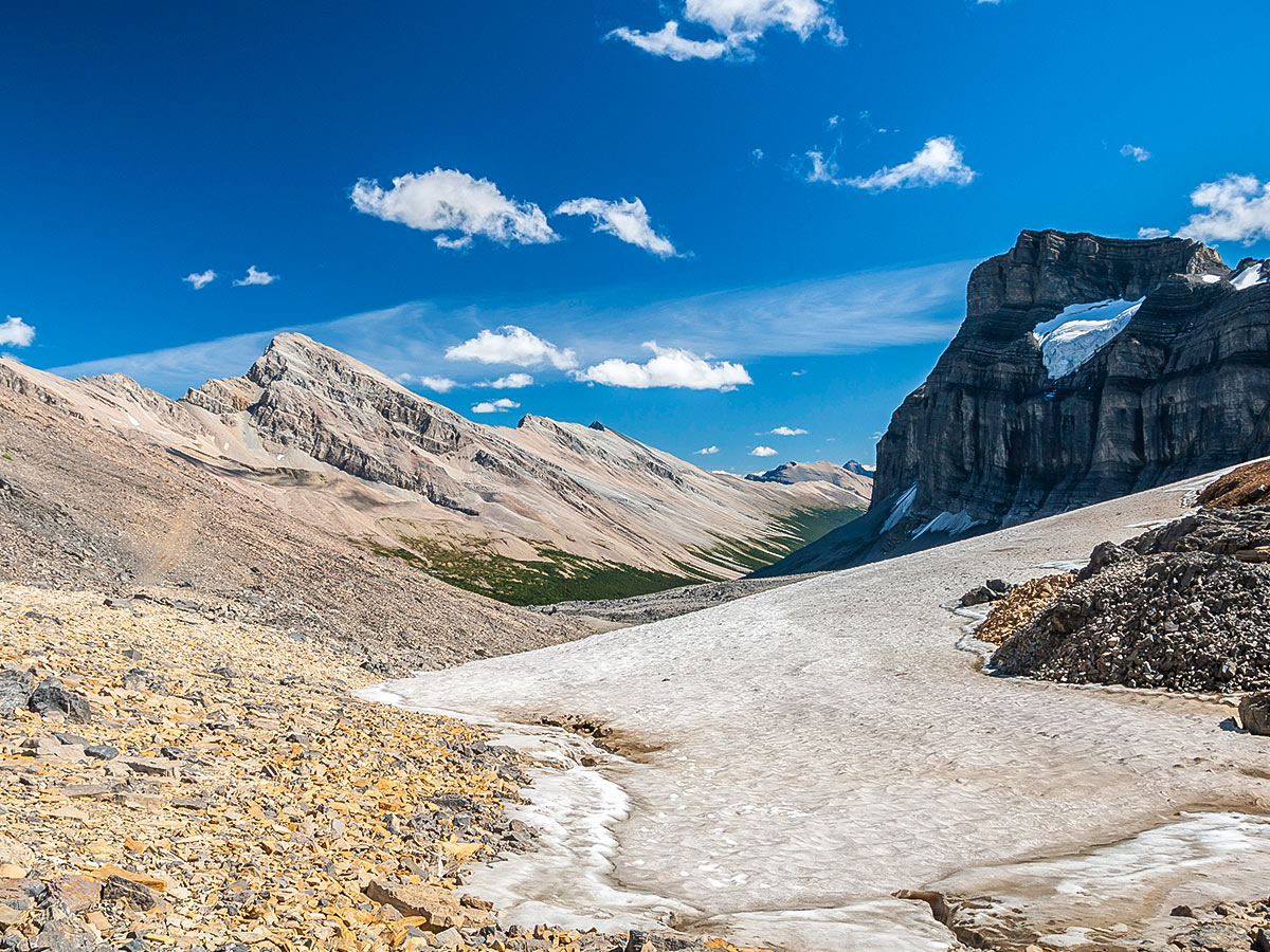
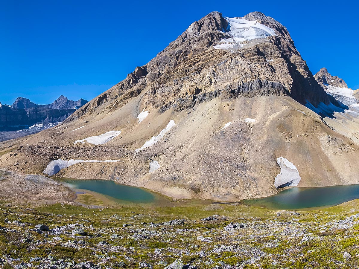
From a distance, Cataract Pass looks quite formidable, but there is a good trail that is visible. The ascent is shorter than it looks and takes the average hiker roughly twenty minutes once you are at the base.
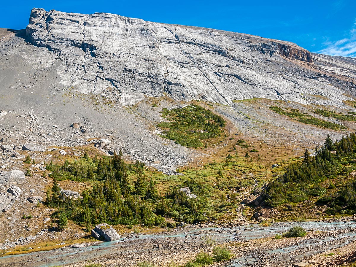
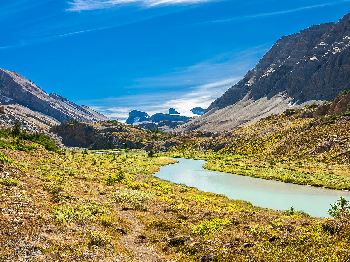
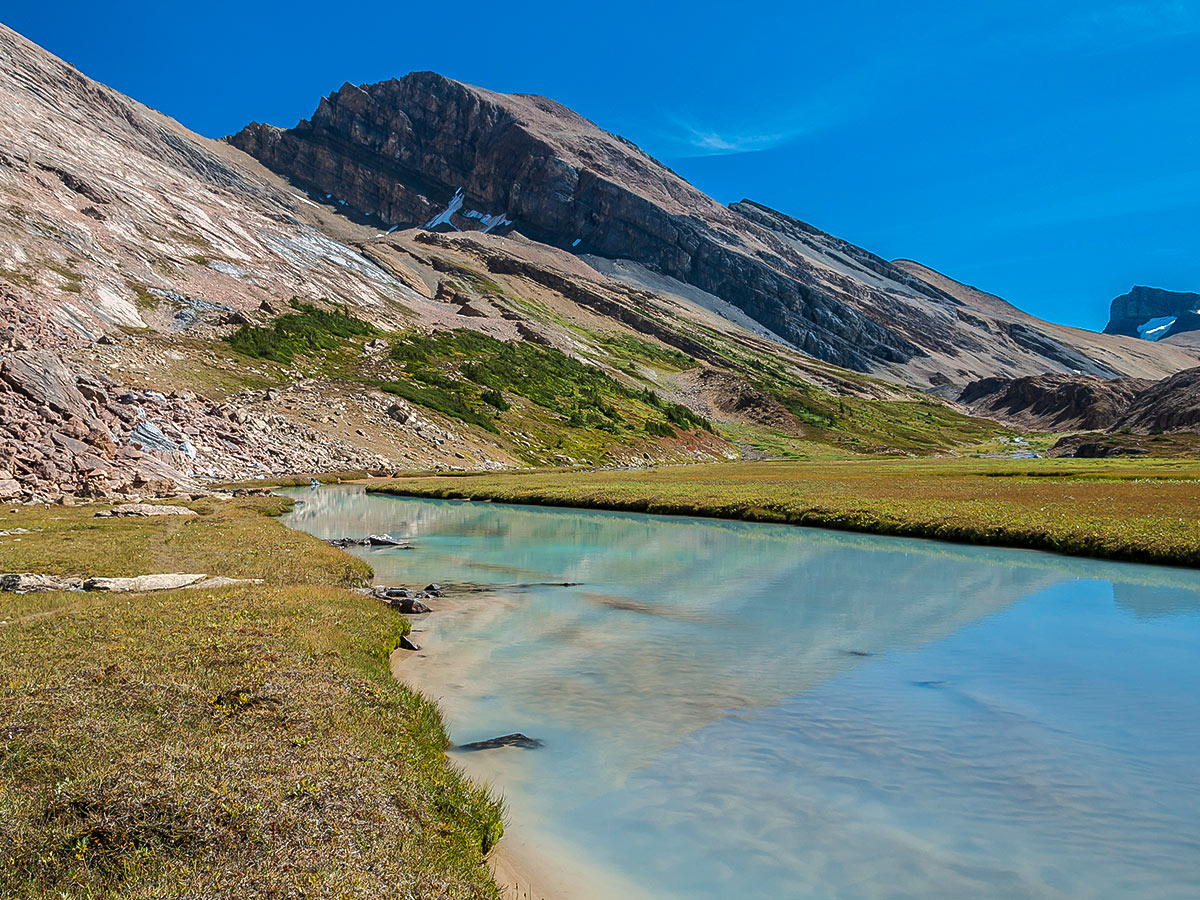
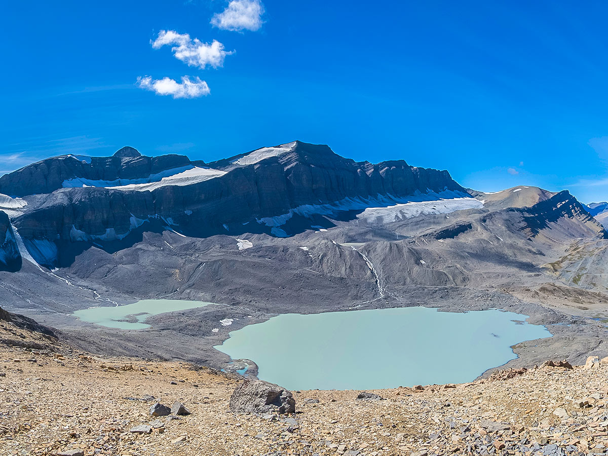
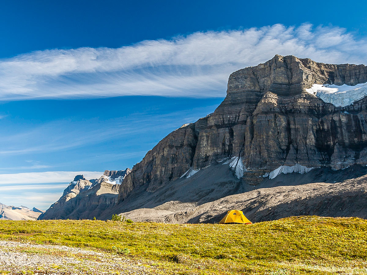
Cataract Pass marks the Jasper National Park boundary and beyond this point random camping is permitted. The logical place to camp is about 820ft below the pass at the headwaters of Cataract Creek. To get there, follow bits of trail and infrequent cairns through the pass. The descent is slow at first, then becomes much steeper for the final descent into the valley. Take your time route-finding just before the steep part starts, it’s not a straightforward descent and it’s worth it to find an easier route down. There is also a trail, if you’re able to find it.
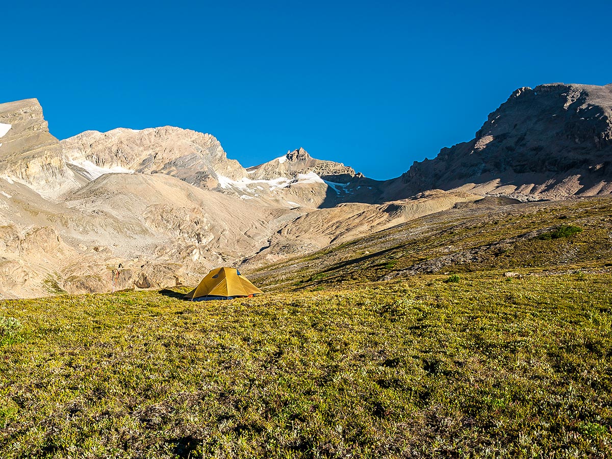
Once at the headwaters of Cataract Creek there are many potential camping areas. We surveyed the area from the pass and chose to camp above the creek on a bit of a terrace, but others in the same area chose to camp lower down near the creek. As there is no campground there are no outhouses or bear-proof storage containers, so come prepared – yes you’ll need to dig some pits so bring a trowel!
There appear to be boulders large enough to hang food from and plenty of smaller trees for bathroom shelter. Follow leave-no-trace practices here, and consult your trip with Parks Canada Visitor Centres before departure.
Day 2
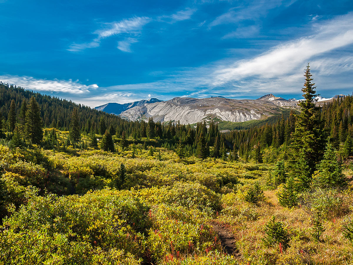
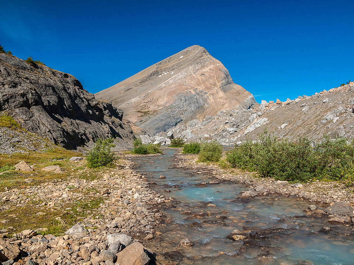
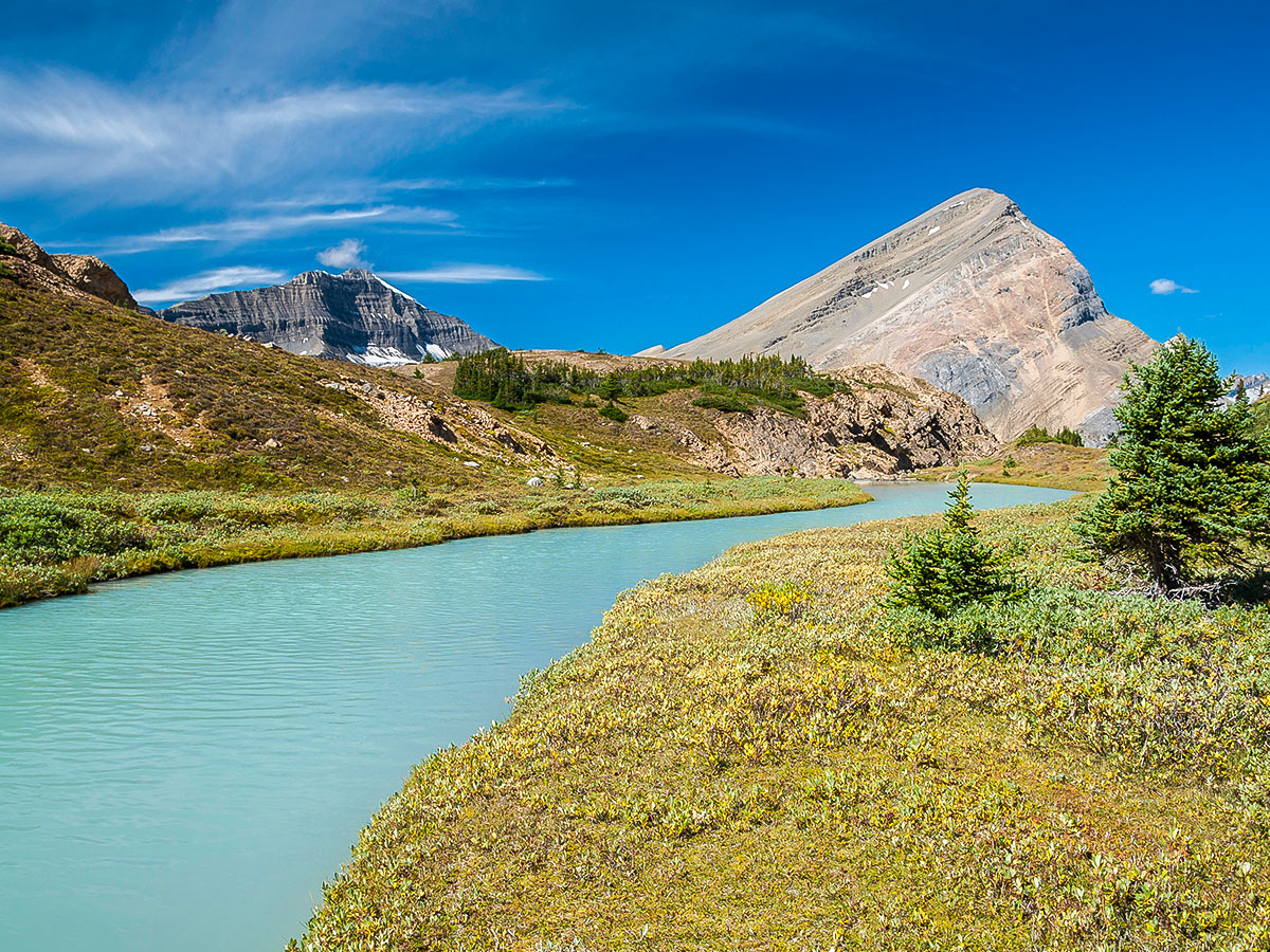
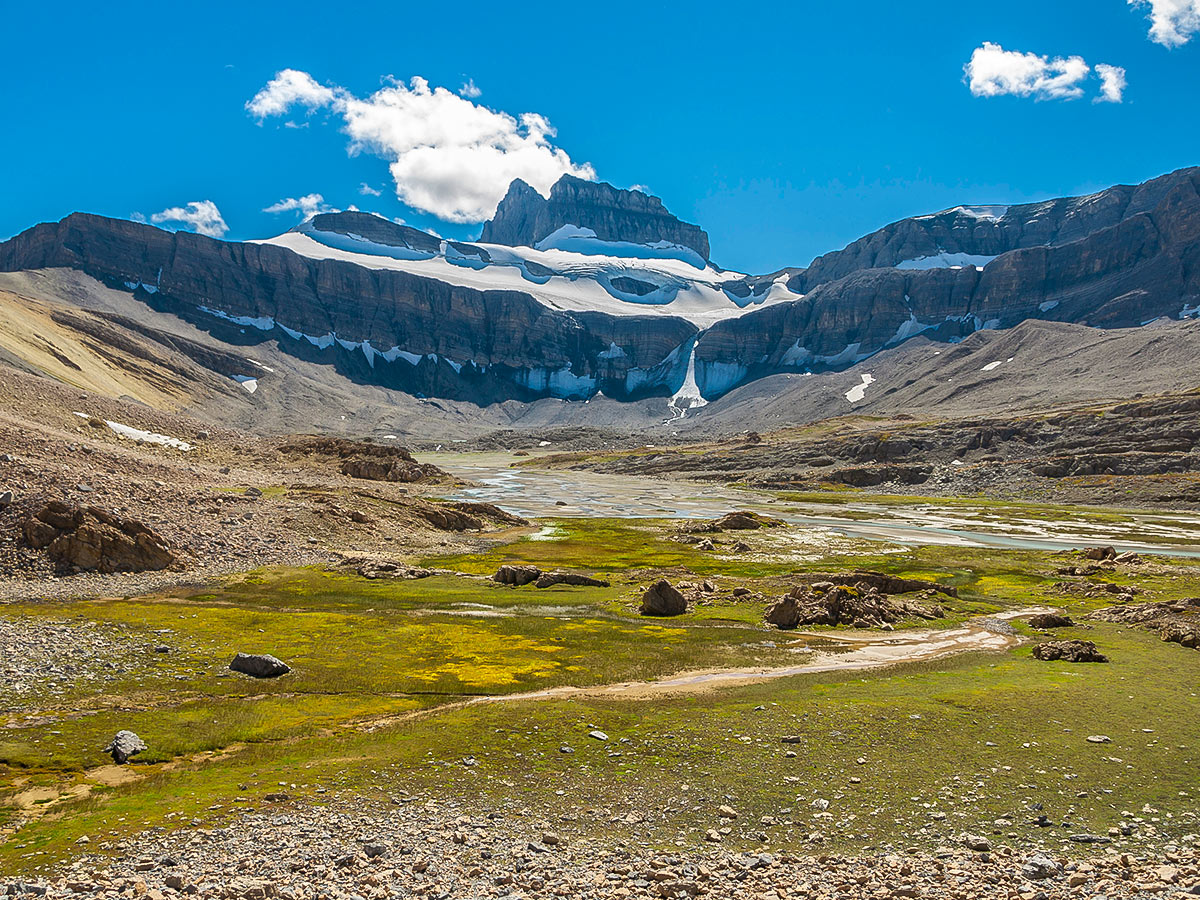
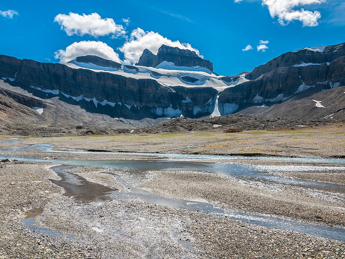
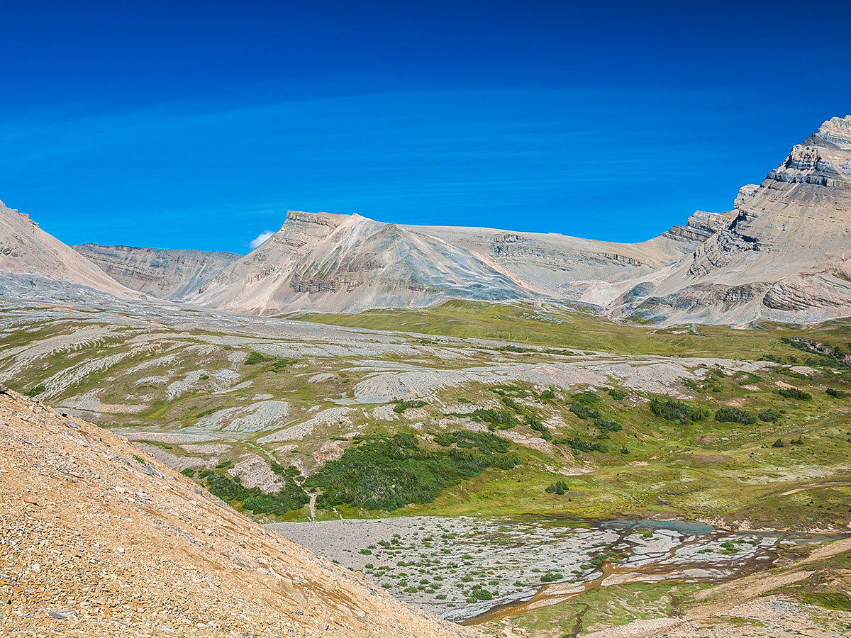
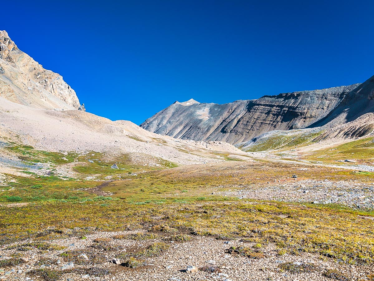
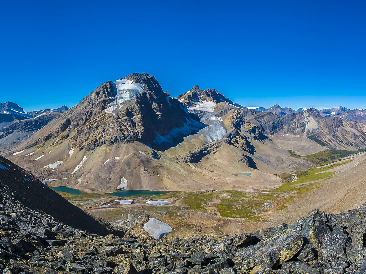
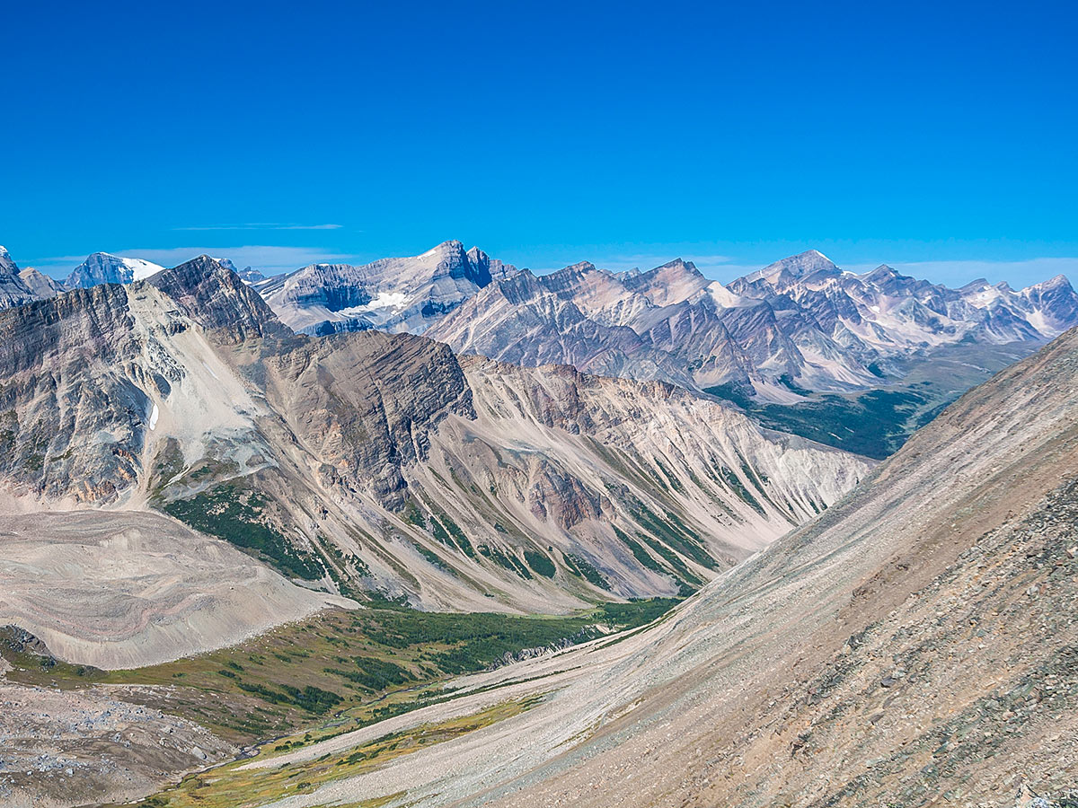
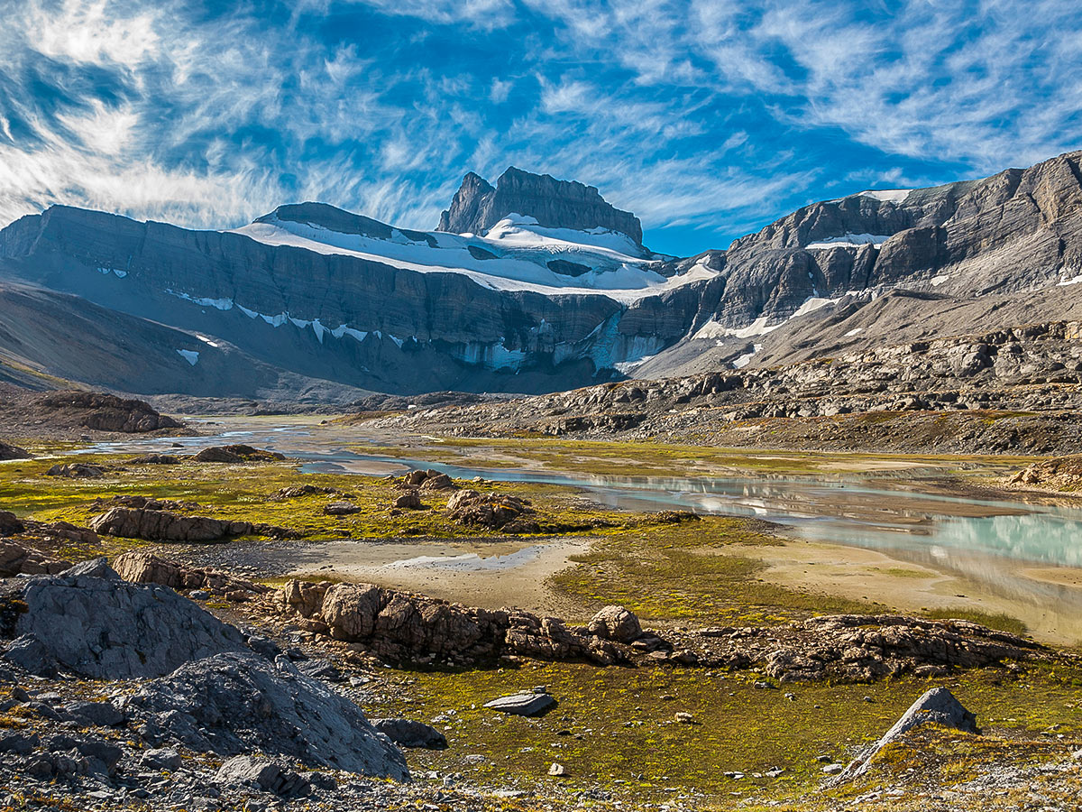
Leave your tent set-up, but take your food (to avoid coming back to a bear having destroyed your tent), and head out on a dayhike to Cline Pass. Head north-northeast to Cline Pass. The pass is between 1.9mi–2.5mi from your camp area (depending on where you setup camp). The route is above treeline, offering incredible views.
Take your time route-finding and explore the area. It is difficult to get lost here, but there are easy routes through meadows and challenging, undulating routes over rock that are a bit more taxing.
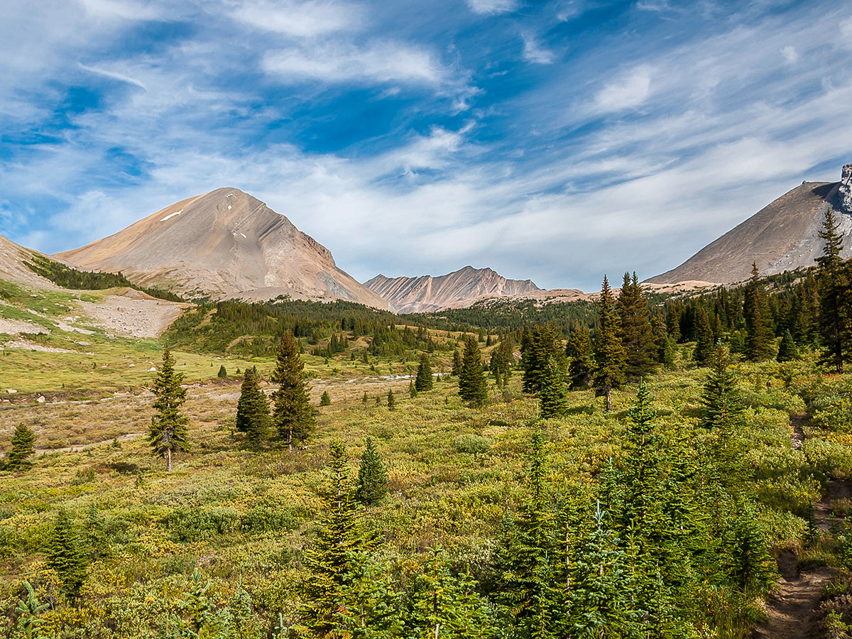
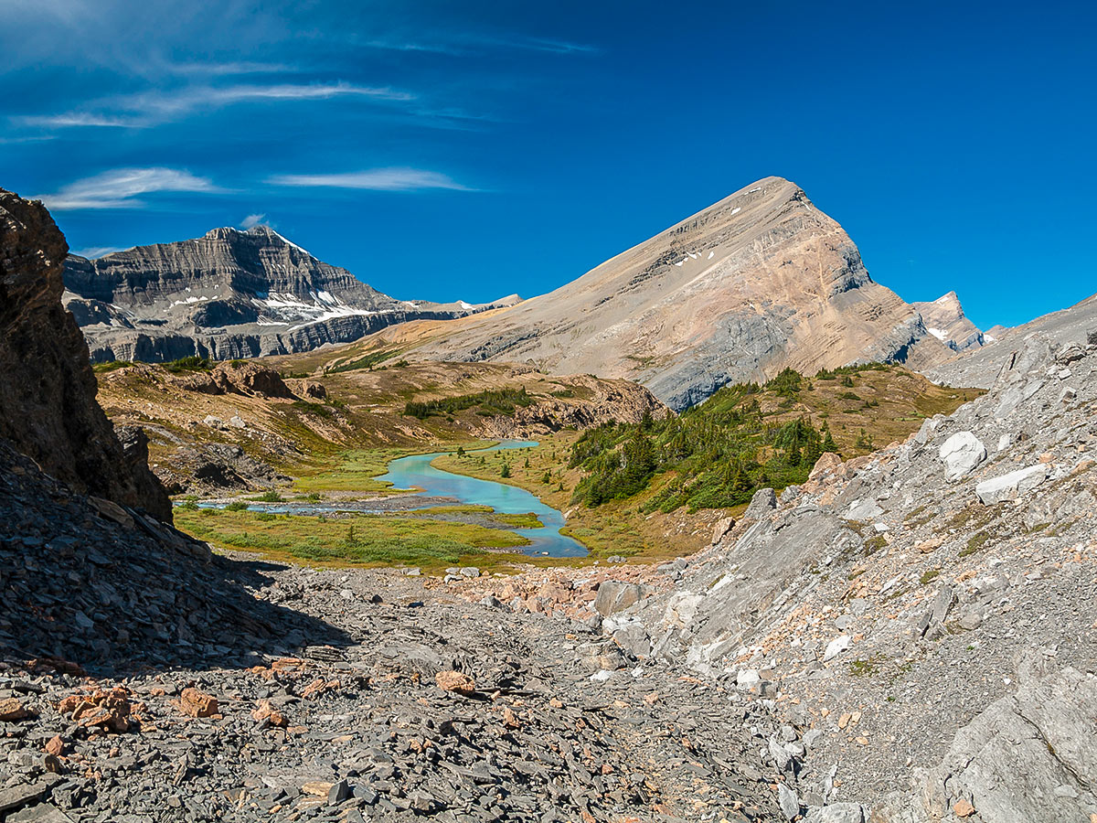
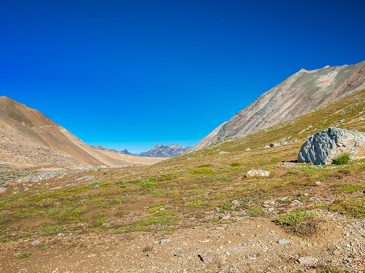
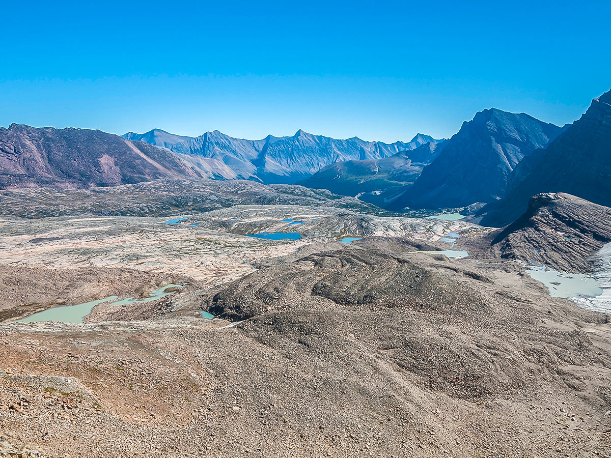
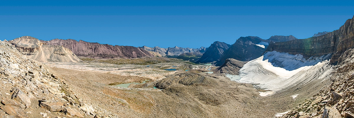
While many hikers are happy to stop at Cline Pass, there is an additional scrambly route you can tackle as well if you have the skills. From Cline Pass, near the lakes, the adventurous can also ascend a steep, boulder filled col for a view into the out-of-this-world Valley of the Lakes. The ascent is more difficult than it looks, however, and the large boulders are loose. Be extremely careful if more than one person is ascending and don’t trust the stability of any boulder. For a scrambler this is a moderate route and fun terrain, but if you are new to scrambling it is not recommended. As fantastic as the views are, it is important to know your skill level and know when you need to stop, as there are no designated trails such as ones found in the National Parks. Also, help is a couple of days away, and you don’t want to risk an injury.
The view into the Valley of the Lakes is spectacular though. The entire landscape—a very large area—has been scoured down to bedrock by glaciers, and the resulting moonscape is dotted with at least a dozen visible lakes of varying shades of blue. It’s quite the sight! It is also possible to descend into the valley (and camp, if you choose), but the descent is initially steeper than the ascent you just completed.
Once done at Cline Pass, return to your tent and enjoy a lazy afternoon in the sun.
Day 3
Return from Cataract Pass to your car at the Nigel Pass Trailhead.
Sample Itinerary:
Note: Total GPS distance varies from each days distance due to side trips and slight route variations each day.
Day 1: Trailhead to Cataract Pass meadows (9.1mi, 2346ft)
Day 2: Cataract Pass meadows to Valley of the Lakes lookout (round trip) (5.0mi, 1476ft)
Day 3: Return Cataract Pass meadows to Trailhead (9.1mi, 1066ft)
Insider Hints
Once leaving the Jasper Park boundary you are permitted to camp anywhere without registering with Parks Canada, however, as standard backcountry safety measures be sure to leave a general trip itinerary with someone not on the trip. Also, follow leave-no-trace while random camping.
If you want to tag on a shorter day hike at the end of your trip, try Parker Ridge which is found a little farther north once back on the Icefields Parkway.
Depending on the direction you are coming from, Jasper or Lake Louise having many great options for accommodation to extend your trip.

Similar backpacking trails to the Nigel, Cataract and Cline Pass backpacking trail
Saturday Night Lake Loop Backpacking Trail
The Saturday Night Lake Loop is accessible from the town of Jasper and a great trip for beginners and families.…
Wates-Gibson Hut Backpacking Trail
The route to the Wates-Gibson hut covers the gorgeous southern section of the Tonquin Valley in Jasper. There is an…
Jacques Lake Backpacking Trail
Backpacking to Jacques Lake is a great way to find solitude without a lengthy mission. It is a short and…
MartiniC 4 years ago
I love the marvelous views of glaciers.
TrixyT 5 years ago
A great backpacking trip. I recommend it to everyone.
Lisa B 5 years ago
Love the opportunity for random camping on the trip to Nigel Cataract and Cline Pass!