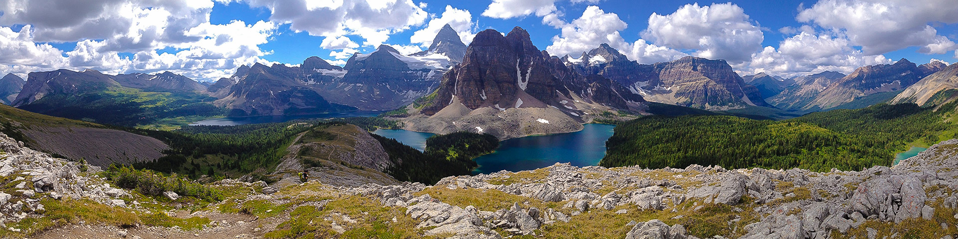
Sunshine to Assiniboine backpacking trail
View Photos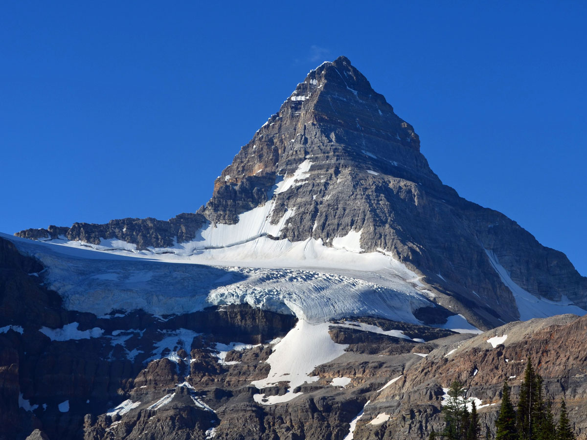
Sunshine to Assiniboine backpacking trail
Difficulty Rating:
Hiking from Sunshine Ski resort to Assiniboine Provincial Park is a bucket list trek. This backpack is incredible, and the scenery in Assiniboine is absolutely jaw-dropping. Hike from Sunshine Ski resort past wonderful Rock Isle Lake, over Citadel Pass and then down to Assiniboine Park. Once at Assiniboine make Lake Magog your base and explore this exquisite location. Hike out via Wonder Pass and Bryan Creek to the Mount Shark trailhead.
Getting there
Drive 4.8mi west of Banff on Trans-Canada Highway and take the Sunshine Village exit. Drive 5.1mi on this lovely road to Sunshine Village ski resort. Pick up your bus or gondola ticket from the main building.

About
| Re-supply points | Assiniboine Lodge |
| When to do | July - September |
| Mountain Huts | Naiset Huts, Bryant Creek Shelter, Assiniboine Lodge |
| Backcountry Campsites | Numerous |
| Toilets | Trailhead, backcountry campgrounds |
| Pets allowed | No |
| Accommodation Type | Tent, hut, lodge |
| Family friendly | No |
| Route Signage | Average |
| Crowd Levels | High |
| Route Type | One Way |
Sunshine to Assiniboine
Elevation Graph
Weather
Route Description for Sunshine to Assiniboine
Day 1
Now that there is the Mount Assiniboine Shuttle, you no longer need to drive one car to Mount Shark and another to Sunshine. The Mount Assiniboine Shuttle takes you from Mount Shark back to Canmore or Sunshine Village at 4:30pm each day. Definitely book this in advance to ensure it’s running and there’s space for you!
With the shuttle, your first day is as easy as driving to Sunshine Village Ski Resort and taking the Gondola or bus up to the base. Book your trip well in advance to ensure you get a seat on the gondola or bus. For a great experience consider staying at Sunshine Mountain Lodge the night before. It’s an unforgettable experience to have the entire mountain to yourself, and a dusk or dawn trip to Rock Isle Lake is spectacular. Staying at Sunshine Mountain Lodge also allows you to get an early start the next day.
Also note that the total distance quoted is simply the backpacking route from Sunshine to Mount Shark. You’ll need to add on distance depending on how many days you spend exploring around Assiniboine.
This first day gives you four options.
- Speed demons can do the entire 18.6mi route to Lake Magog in one-day. This is a long day, and tiring.
- Go slower, and camp at Og Lake Campground, a 13.7mi hike with 2461ft up and 2904ft descent. Still a big day, but achievable if you’re in good shape. Og Lake has 10 campsites and can be booked on the BC Park Camping Website. This is our preferred option, but it’s still a long hike.
- Do a half-day hike and stay at Porcupine Campground (7.8mi). As of 2018 this is a first-come, first served basis, with no reservation fee.
- If you can’t start until after work, consider getting the last gondola or bus up Sunshine (6pm) and stay at Howard Douglas Lake. This campground is only 3.5mi from Sunshine ski resort, however it gets you another night in the backcountry and shortens the next day.
From Sunshine, head out on the Citadel Pass / Rock Isle Lake trail uphill to the Southeast, where you soon pass the meadows of the Great Divide. At this point you are on the popular path to Rock Isle Lake, which has one of the most spectacular views in the Canadian Rockies.
After hiking about 20 minutes you come to a junction. If you have time, go right first and head for a look at Rock Isle Lake. It will only take you an extra 10 minutes to get there and it’s beautiful. If you don’t have time, then go left and head out to Citadel Pass.
The route is clear as you pass below Quartz Hill and then down to Howard Douglas Lake (3.5mi). Howard Douglas Lake Campground (SU8) has 5 sites and is worth a visit for an easy backpacking trip. We sometimes stay here if we start late. You can also fill your bottles here as it’s dry for the next 9.3mi.
From Howard Douglas Lake it’s 2.2mi to Citadel Pass. The view from Citadel Pass is stunning and is a fine day hike in itself. From Citadel Pass, the path continues for roughly 8.1mi to Og Lake Campground.
Continue on the trail from Citadel Pass. It starts with a steep descent down to the base of Citadel Pass, which is also the border between Banff National Park and Assiniboine Provincial Park. There’s a turn-off here for Porcupine campground, which is 7.8mi from Sunshine. The turn-off is to your right and the campground is about 0.6mi from the main path. Consider Porcupine if you don’t want a long first day. We prefer to push a long-day to Og Lake or start late and stay at Howard Douglas Lake.
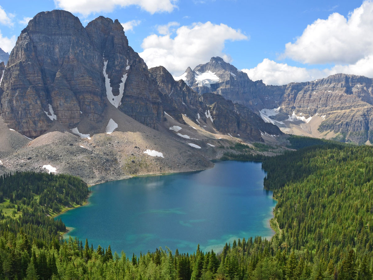
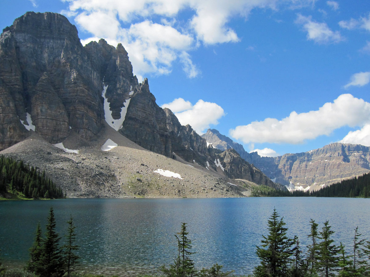
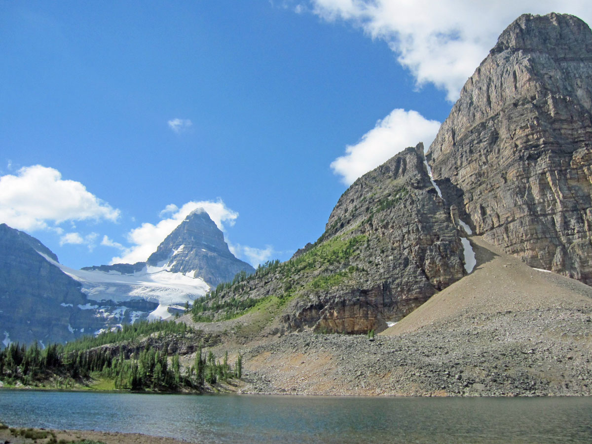
From the base of Citadel Pass, where you have entered Assiniboine Provincial Park, follow the main path across a steep open hillside. Over the next 6.2mi you will pass some interesting rock formations before arriving at Og Lake Campground. You book your Og Lake campsite online, and it gets booked out early. The campground is located at the North End of Og Lake, and has 7 tent pads, an outhouse, a central cooking area and food storage lockers. Take your water from Og Lake and treat it before drinking it.
Day 2
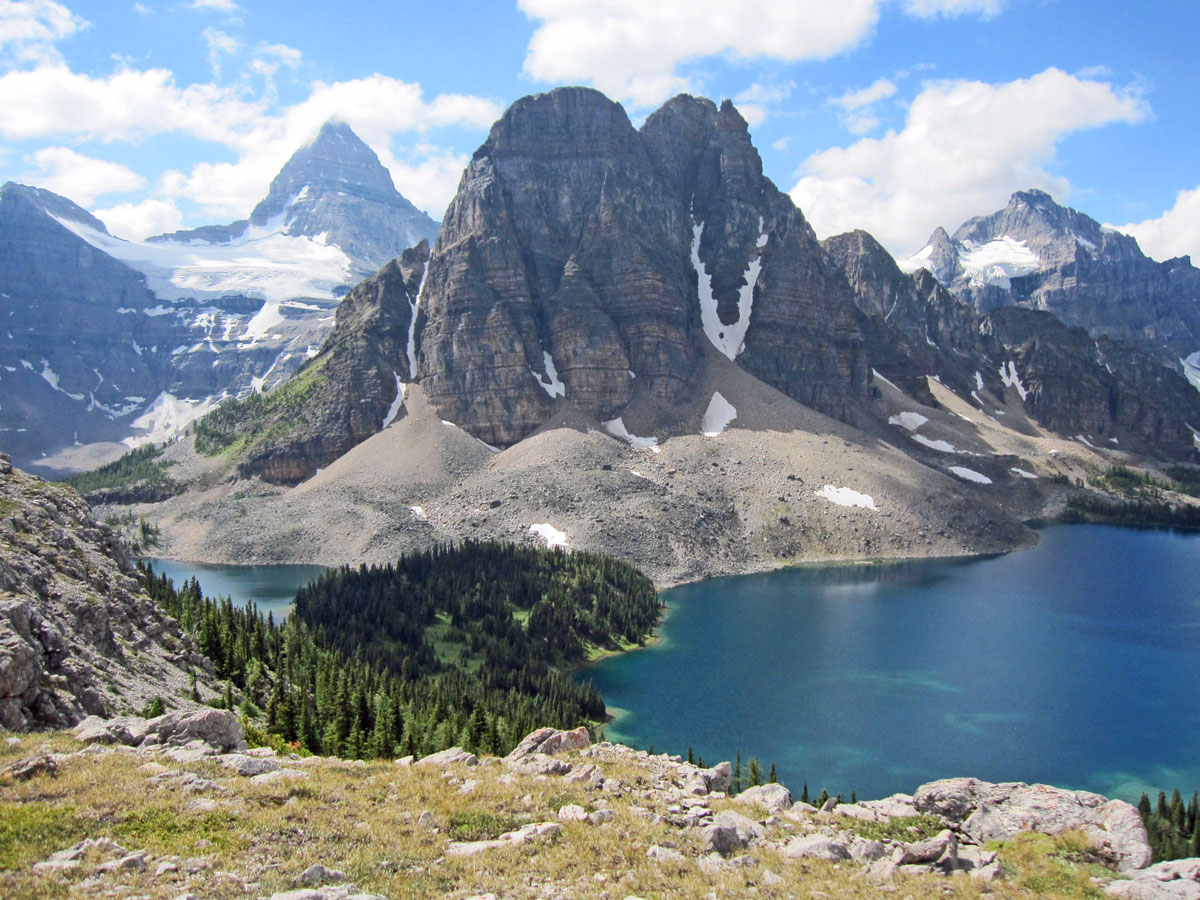
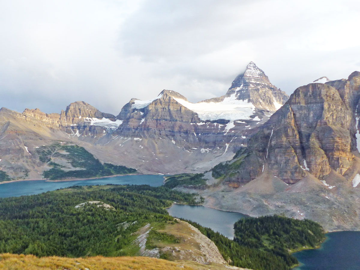
From Og Lake, the walk to Magog Lake is a short one, only 4.0mi, with 492ft of elevation gain. We like to get to Magog Lake early as it gives us the best choice of campsites. Magog Lake is a well-appointed campground which is very popular. You can book your Magog Lake campsite online, and it gets booked out early. Magog Lake has 40 tent pads, a semi-enclosed cooking shelter, food storage lockers, water taps and outhouses. We highly recommend heading over to Assiniboine Lodge between 4-5pm for afternoon tea.
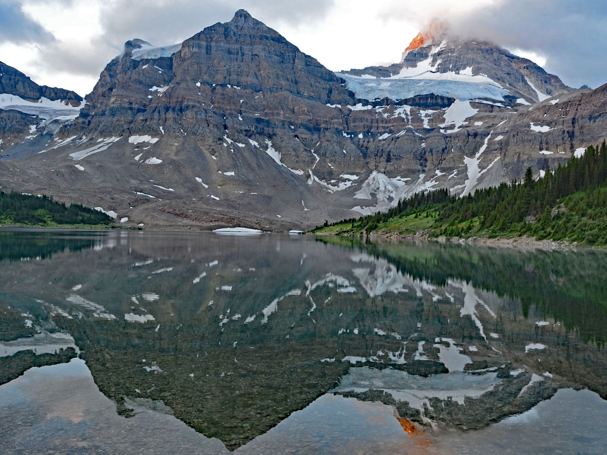
Once you’ve settled into your campsite, you have the afternoon to explore the stunning hikes in the area. We like to take the trip up to Niblet (or Nub Peak if we are feeling strong) once we get our camp setup. The trip to Niblet takes about 2 hours return and provides an iconic view of the area. If you have the energy, the hike all the way up to the summit of the Nub is incredible! This 6.8mi hike takes about 4 hours return, and gains 1886ft along the way. Leaving from the campsite you also go past Sunburst and Cerulean Lakes
Day 3 and 4 (Optional)
You could spend a week exploring the Assiniboine region. There are many incredible hikes. Our favourites are:
- Nub Peak (mentioned above): The hike up Nub Peak is about 6.8mi, gaining 1886ft along the way.
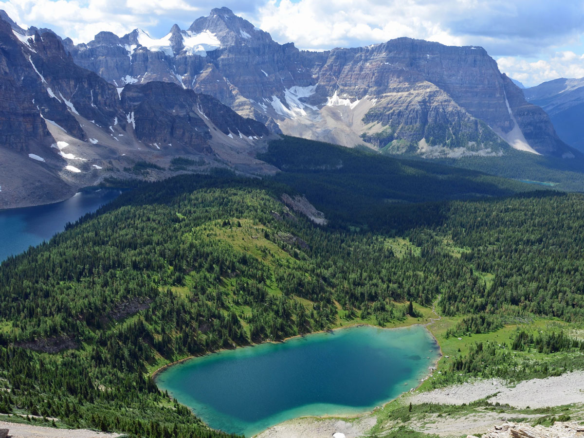
- Sunburst, Cerulean & Elizabeth Lakes: This 2.8mi loop is an easy day trip, and spending time lounging by the lakes can be very pleasant.
- Wonder Pass: This is another sublime hike, and though you’ll likely backpack out via Wonder Pass, it’s great to hike up here and spend a few hours relaxing in the sunshine. It’s about 3.4mi each way, with only 755ft of elevation gain.
- There are also numerous scrambles in the area, all of which get to incredible views.
Day 5
Whether you only spent a day in Assiniboine or a week, when it’s time to leave you can either hike out or chopper out. Taking a helicopter is a wonderful experience, with great views and a relief for tired legs. You’ll need to book your helicopter in advance with Assiniboine Lodge.
Most people hike out, especially if they are taking the shuttle bus back to Sunshine Village at 4:30pm. So, if you’re hiking out you can either hike out via Assiniboine Pass and Bryant Creek, or take one more exceptional trip and hike out via the challenging Wonder Pass and Bryant Creek. Heading out via Wonder Pass is a real treat, and highly recommended.
To hike out via Wonder pass, head to Assiniboine Lodge and then hike past the Naiset Huts and along Gog Creek. You’ll reach Wonder Pass approximately 1.9mi after Assiniboine Lodge, passing by Gog Lake and going through pretty larch forests along the way. The final stretch up Wonder Pass is spectacular in early summer, filled with wildflowers and expansive views looking back. In fact, on clear days you can see the route you hiked in a few days ago along the Og Valley and even Citadel Pass.
At Wonder Pass continue on the path as it curves, and you pass into Banff National Park. You soon see Marvel Lake as you descend on a series of switchbacks. As you come to the Marvel Pass Junction (roughly 3.7mi) keep left as the trail passes through forest and avalanche paths above the stunning Marvel Lake.
Continue on the trail as it re-enters the forest at the end of Marvel Lake and continue straight when the path splits, crossing Bryant Creek and then reaching the main Assiniboine Pass / Bryant Creek Trail (9km from Wonder Pass). Turn right here, and you’ll soon pass the beautiful Bryant Creek Warden’s Cabin.
For those that don’t want a 16.2mi+ hike out in one day, there are three sleeping options near the Warden’s Cabin. McBride’s Camp (BR14) is the closest campground to the Warden’s Cabin. Further along is the Bryant Creek Shelter. This is a spartan shelter, with nothing but a wood stove, wood and a building. It’s wonderful if it rains and during the winter, but on nice days it’s probably better to camp. Finally, Marvel Lake Campground (BR13) is also nearby. All can be reserved on the Parks Canada Website.
Now that you’re on the main Bryant Creek Trail the route back to Mount Shark is clear, on a well-maintained, broad path. The path from here on is unfortunately pretty bland, with only a few views as you go through the forest. Along the way you will see trails fork off, however keep going straight towards Mount Shark trailhead.
Eventually you reach trails that may be familiar to you if you do a lot of skiing in the Mount Shark area. You cross over a bridge and reach an arm of the Spray Lakes Reservoir. While you’re only 3.7mi from the parking lot, you now have a long uphill on a broad path to finish off your day. Pass Watridge Lake turnoff after 30-45 minutes and follow the logging roads and the abundant signing to Mount Shark Trailhead. Once you get there you’ll probably be pretty tired.
One last thing, if you took the helicopter in and need to go to your car at the heliport, then you have an extra 20-30 minute uphill hike from here. This can be very painful!
Sample Itinerary
- Day 1: Sunshine Village to Og Lake (12.9mi, 2461ft up, 2904ft down)
- Day 2: Og Lake to Magog Lake + Explore Assiniboine (4.0mi, 492ft up, 33ft)
- Day 3: Explore Assiniboine
- Day 4: Optional day to Explore Assiniboine
- Day 5: Magog Lake to Mount Shark via Wonder Pass (16.5mi, 1608ft gain, 3035ft loss)
Insider Hints
If you haven’t been to Sunshine in summer before, take the chairlift up Mount Standish and walk down to Rock Isle Lake and then come back to meet the trail onwards to Assiniboine. The views on the hike down from Mount Standish are spectacular. Better yet, book a night at Sunshine Mountain Lodge the night before and explore the area without a heavy pack.
Book your gondola ticket and shuttle from Shark to Sunshine well in advance.
If you’re using the shuttle at Mount Shark Trailhead, you’ll want to leave very early in the morning. Depending on your fitness you may want to be on the trail by 7am as it’s a 7-9 hour hike.
You can also helicopter in and out of Assiniboine from Mount Shark. The cost is $175 each way + $3 / pound for excess gear and the helicopter only runs on select days. This is useful if you only want to explore Assiniboine. Book your tickets through Assiniboine Lodge.
There are two other accommodation types at Assiniboine. The historic and incredible Assiniboine Lodge is a bucket-list place to stay. It is truly spectacular in summer, but highly in demand, so you usually need to reserve the year before. Reservations for next year start in August the prior year. The nearby Naiset Huts are also good options, and much cheaper. They can feel a bit cramped, but the common cooking facility is incredible. You book them through Assiniboine Lodge as well.

Similar backpacking trails to the Sunshine to Assiniboine backpacking trail
Pharaoh Creek Backpacking Trail
The Pharaoh Creek backpacking trail follows the same route that many take to reach Egypt Lake and it’s cascading counterparts.…
Og Lake Backpacking Trail
The Og Lake backpacking trail is a great option for those who can’t make a reservation at the busy Lake…
Merlin Lake Backpacking Trail
The backpacking route to the Merlin Lake Trail follows the main Skoki route and covers all the popular landmarks in…
FellWalker 4 years ago
Incredible trail that offers a stunning view
Rob Silvermann 4 years ago
No wonder why this is a popular hike. Exciting trail and really beautiful place.
AmandaT 5 years ago
This hike is just wonderful. I cannot describe how beautiful it is. It is also hard, but you forget about that.
Richard Campbell 5 years ago
I love backpacking to Assiniboine, and the shuttle from Mt Shark makes it so easy to do this one-way hike without a complex car shuttle.
Gordie 5 years ago
Backpacking to Assiniboine is incredible. Definitely one of the best backpacking trips in the Canadian Rockies. Just hard to get a reservation for a campsite now