Wasootch Ridge hike
View Photos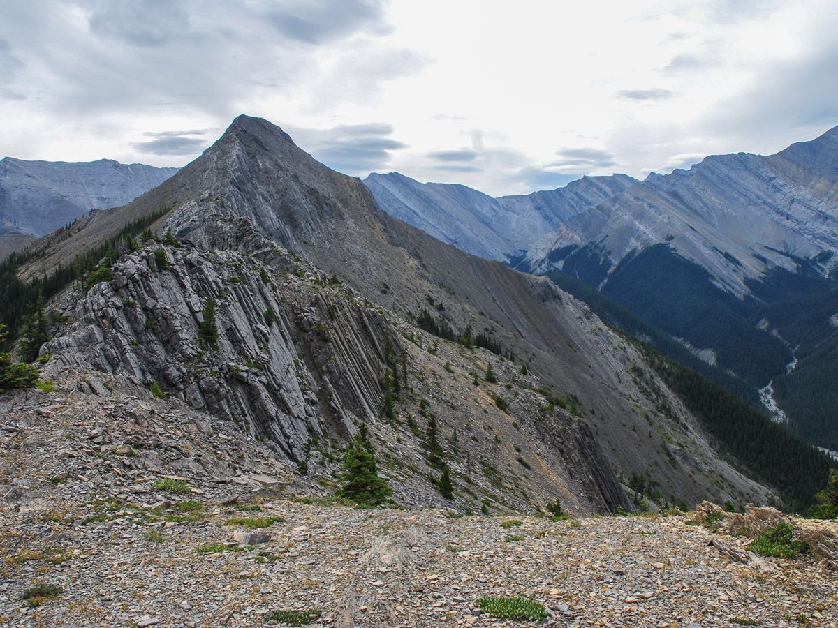
Wasootch Ridge hike
Difficulty Rating:
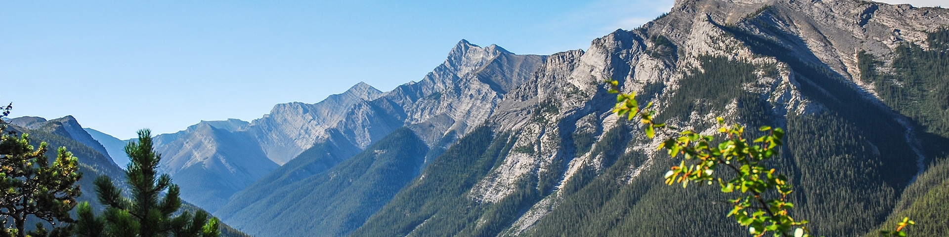
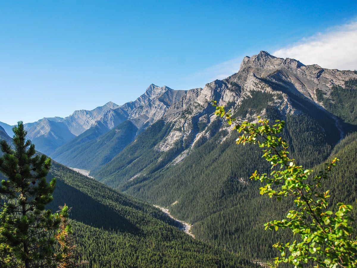
Wasootch Ridge is an easy choice as one of the best hikes near Canmore. Once you are up on the ridgeline, the valley feels isolated, with no other sounds or trails visible. This is a great day out!
Getting there
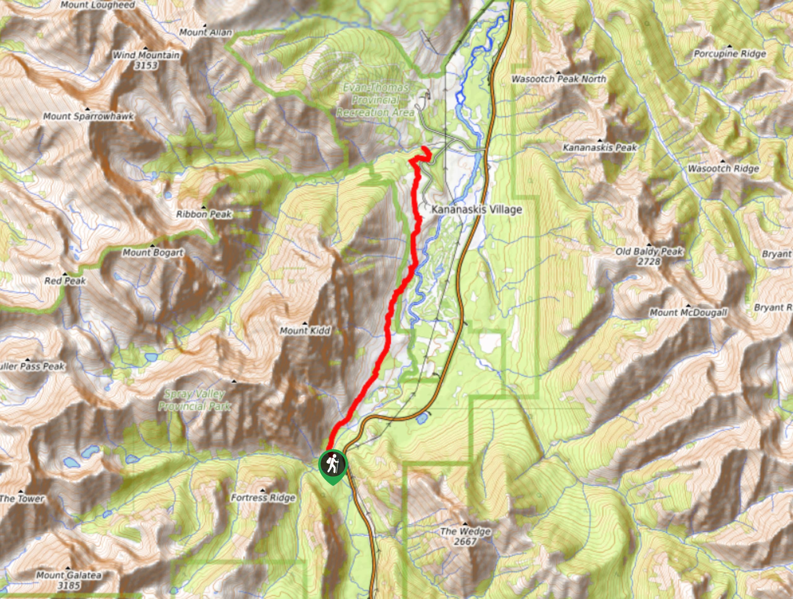
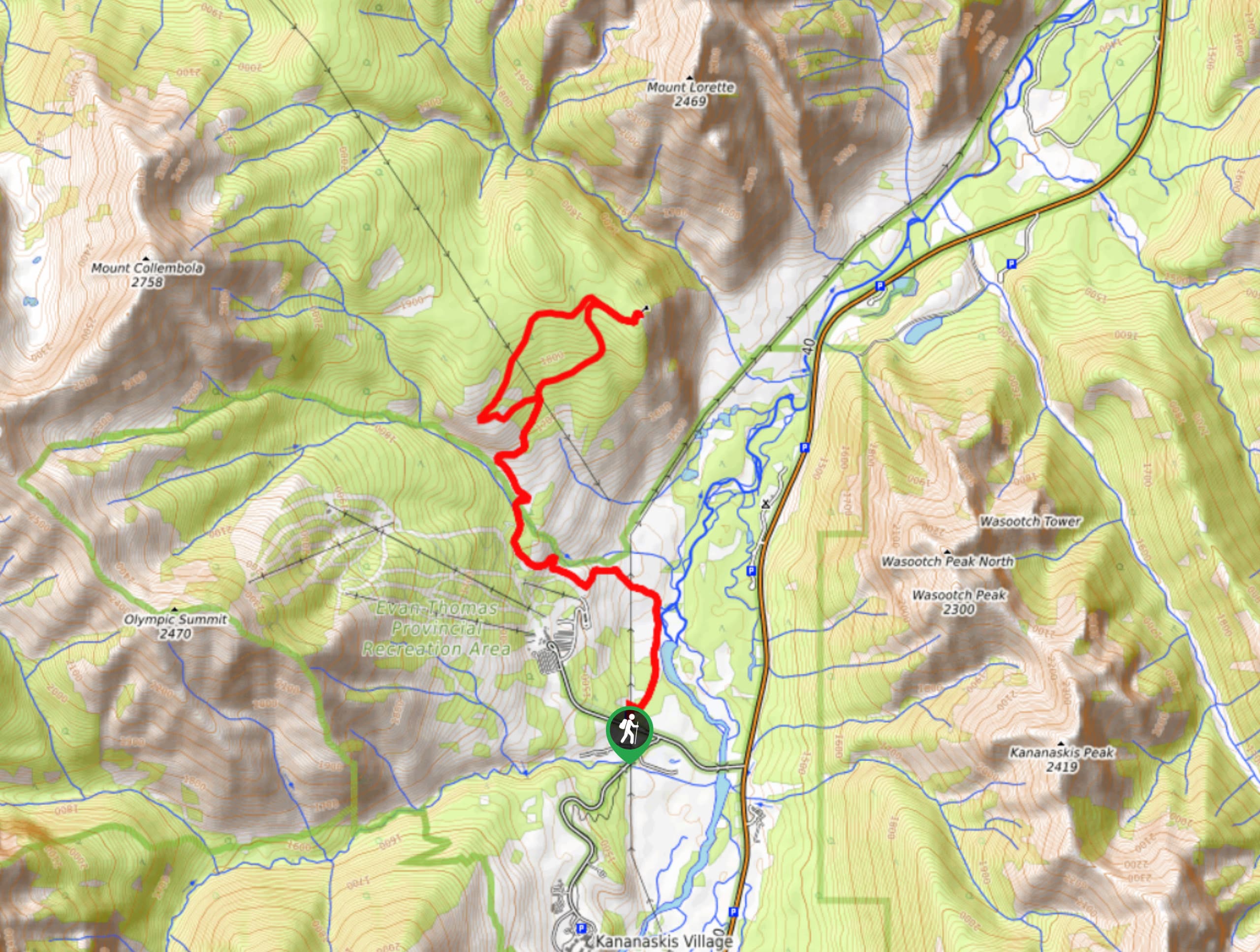
Take Highway 40 West off of the Trans-Canada Highway towards Nakiska and Kananaskis Lakes. Follow Highway 40 for roughly 10.6mi, passing Barrier Lake and then turn left into Wasootch Day Area. Follow the short drive for roughly 2461ft to the parking lot.

About
| When to do | June through October |
| Backcountry Campsites | No |
| Toilets | Trailhead |
| Family friendly | No |
| Route Signage | None |
| Crowd Levels | Moderate |
| Route Type | Out and back |
Wasootch Ridge
Elevation Graph
Weather
Route Description for Wasootch Ridge
From the very beginning, this is not a hike that you ease into. As you leave the parking lot, head southeast. There are several trails leaving the parking lot that are quite steep. With the creek to your right, the route rises quickly through trees – a great test for your hiking fitness. As you come through the forest, take a moment to look back at your car and see how far you’ve gone!
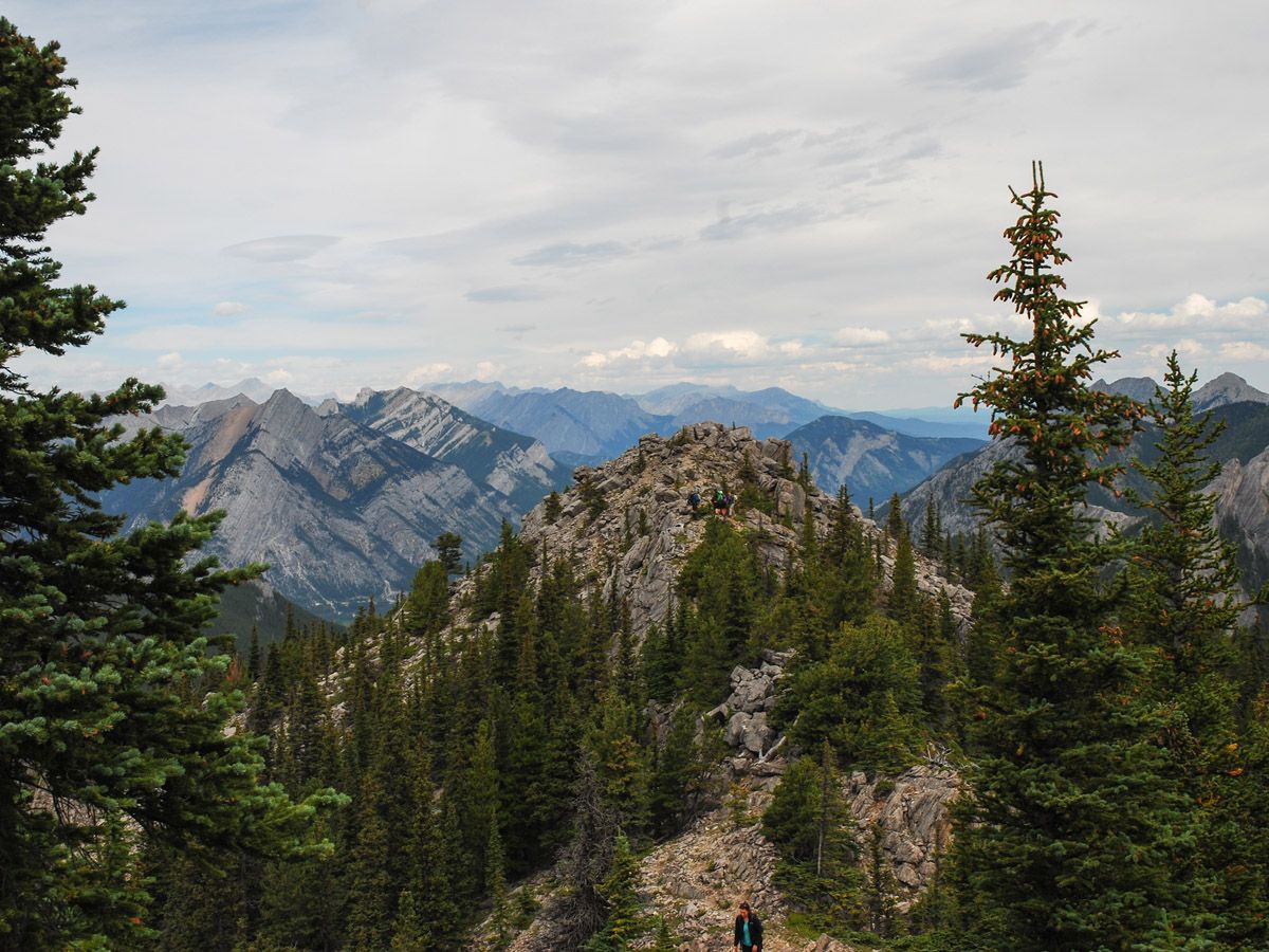
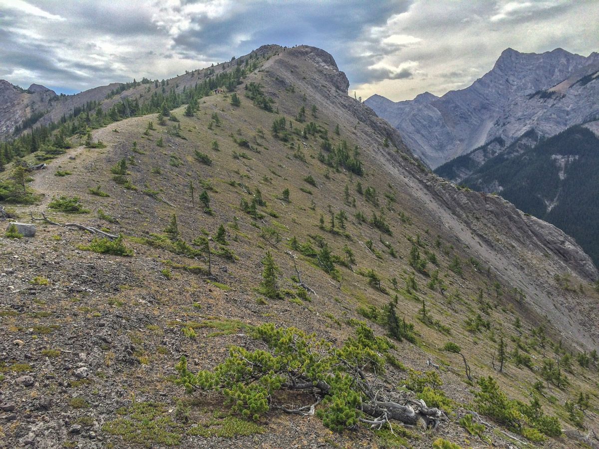
As you rise to the first of the bumps along the ridge, you’ll quickly notice there are still more to come. Hiking along the bumps is pleasant, as the path is wide with several braids of trail meandering throughout. Unfortunately, what goes up must come down, and each bump has a drop down before the next bump rises.
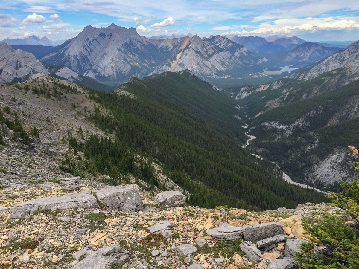
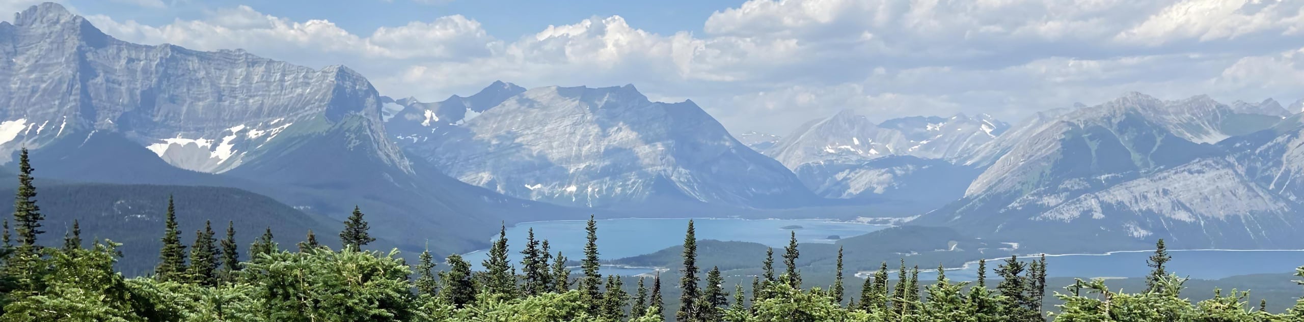
As you get farther along the ridge you get views down into Wasootch Creek on your right. You also can look back on the ski hill Nakiska. Looking ahead there is a dead-end valley. The views are truly magical, and if the trail isn’t busy, you’ll feel like you have the whole world to yourself.
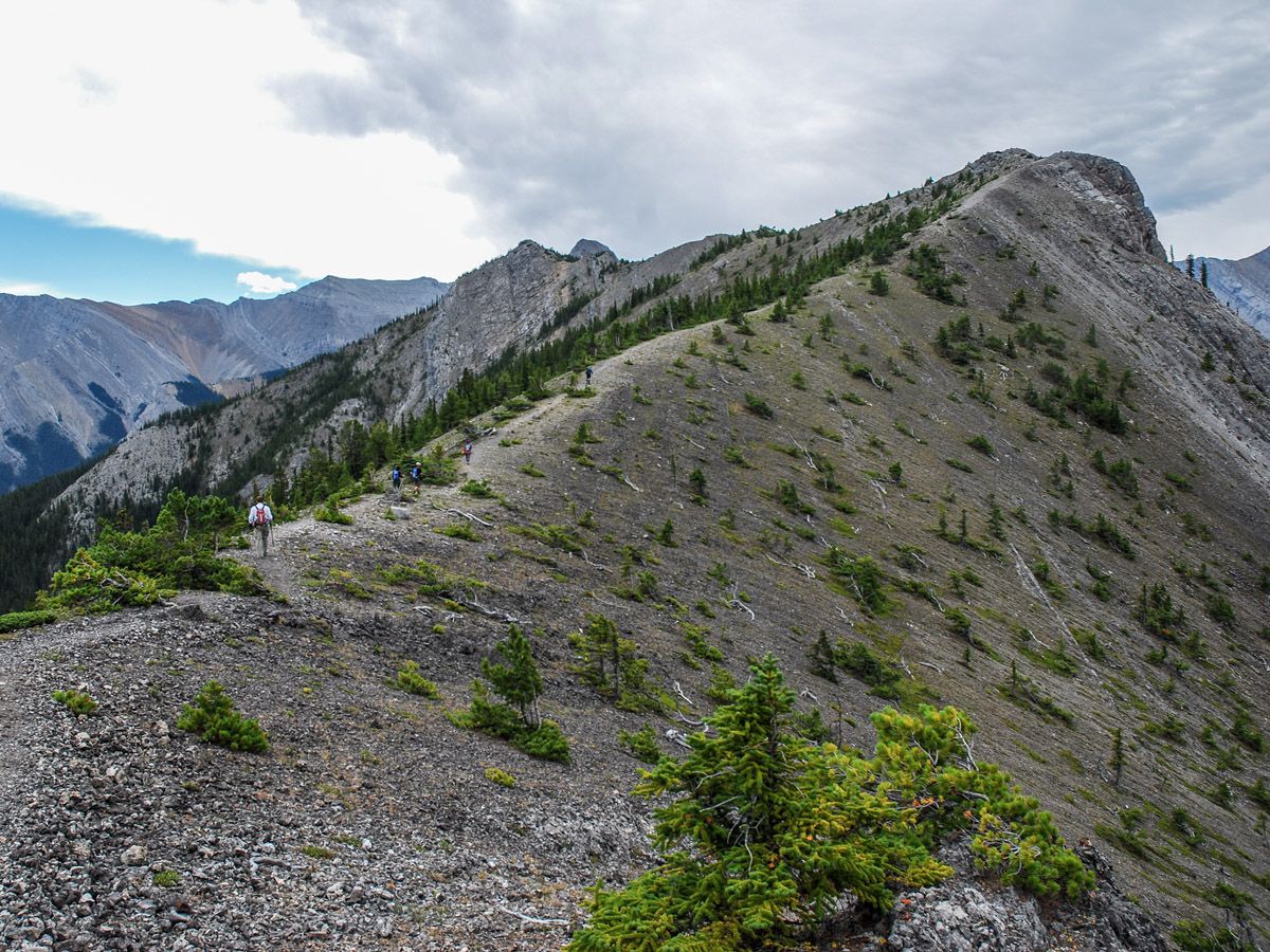
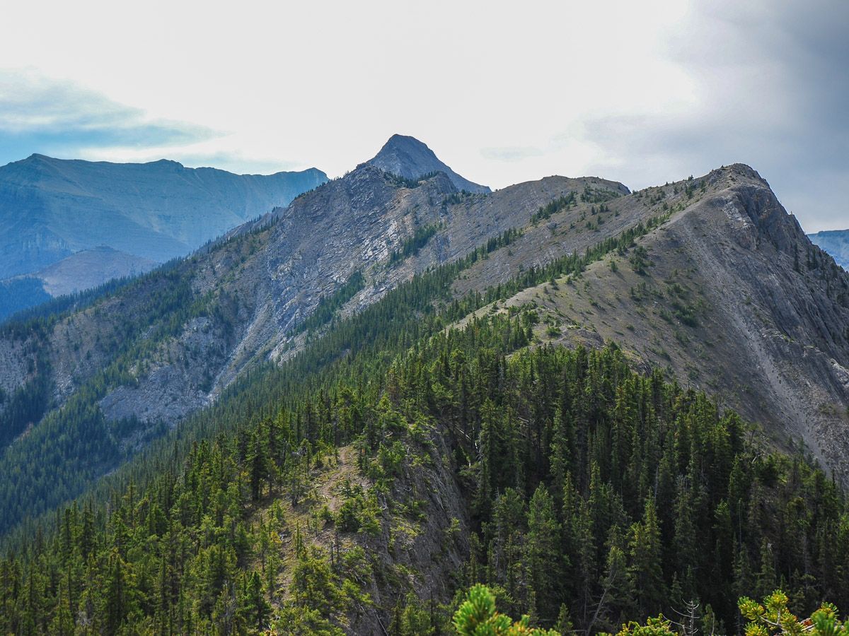
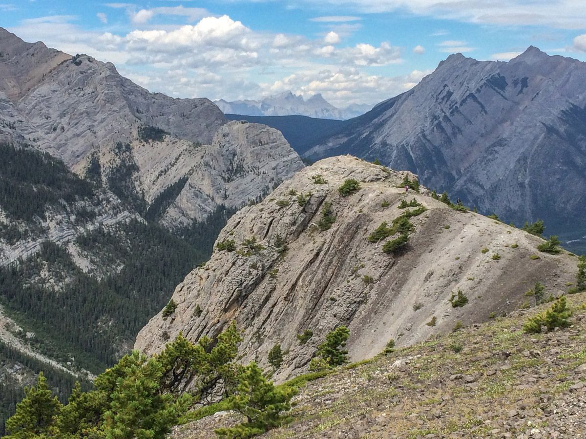
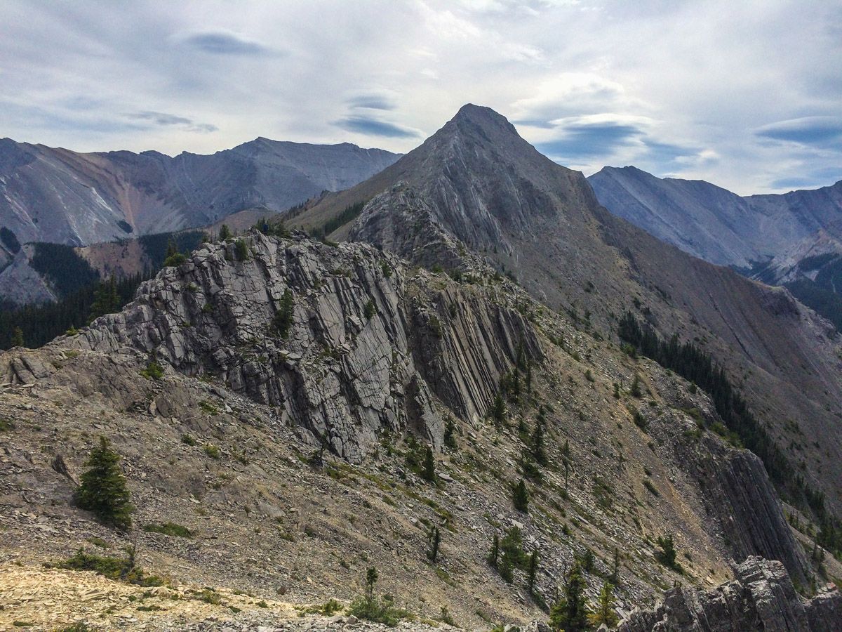
The path ahead will be clear, so continue to stay on the ridge top following the well-defined trail. There are occasional sections that require some care, but hiking poles can overcome the need to use your hands. As the trees clear the views become exceptional – just remember to keep looking down so you don’t trip.
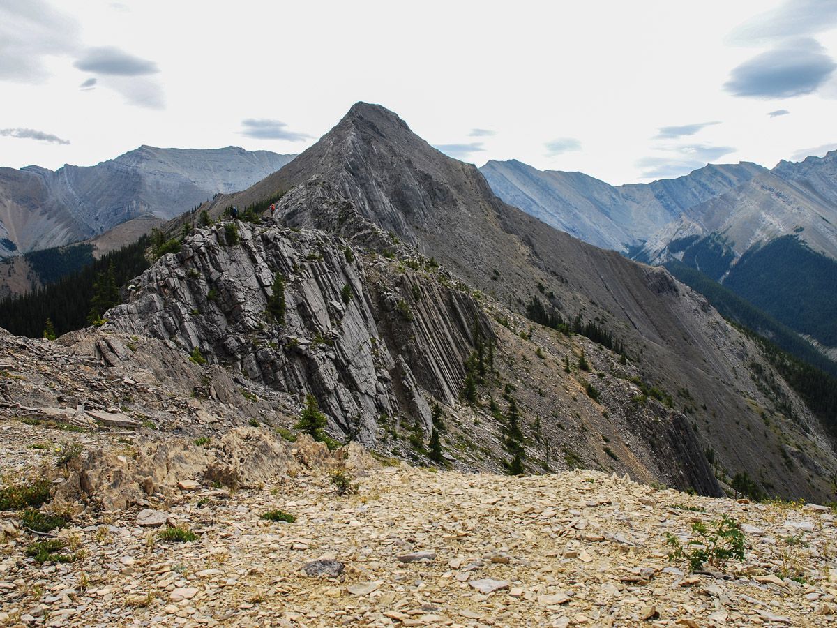
Eventually, around 3.4mi, you’ll meet your first real test of scrambling. This section requires you to scramble up a rocky area through some trees to continue on the ridge. There appear to be routes branching off to both sides, though we recommend taking the route over the little hump. This is not a major scramble, however as you progress, the technical nature of the trip gets more pronounced with the trail narrowing and a descent of some big boulders.
At approximately 3.6mi there will be a point where proceeding further becomes more exposed and requires more scrambling. There is a nice rock windbreak here (in 2015) to sit and admire the views before turning around. It’s recommended that only experienced scramblers proceed with tackling the scramble to the summit, which actually descends off the ridge and up on scree farther along the trail.
The route down is the same as the route up. Unfortunately, what is steep and hard to ascend can also be tricky to descend!
Insider Hints
Bring poles, this is a steep one and they help greatly on the descent.
If you are a big eater, consider stopping at the Stoney Casino on the way back home. The food is good value, and they have a buffet in the evenings on weekends.
Watch out for ticks, they love it here. Check your hair and body before getting back into your car.

Similar hikes to the Wasootch Ridge hike
Terrace Trail
The Terrace Trail South is a great connecting trail that links Ribbon Creek with Galatea Creek. You can choose to…
Hummingbird Plume Lookout
The Hummingbird Plume Lookout trail is a beautiful half to full-day hike that has many options to extend and visit…
Kananaskis Fire Lookout Trail
The trail to the Kananaskis Fire Lookout follows the Mount Tyrwhitt trail up an old decommissioned fire road to the…
mallorykirzinger 5 years ago
This is a real grind from the start, you gain wicked elevation in just 2km. Bring poles if you have them and just apologize to your knees in advance. Push through because the view from the top is sublime! There's a hidden valley right next to you with Alps-like peaks and then the Opal range right on the other side. Beautiful! We ran into a giant her of bighorn sheep on the way down.
coreyg23 5 years ago
To start this hike you go to the Wasootch ridge day area, once you reach the parking lot the washroom is on the right and to the left is a small sign. Thats the trail head, its not marked for the trail name. From there its straight up literally, the first 1.5 km is pure elevation its not the best views but it gets you up there. If you're not planning on going the full way I wouldn't reccomend starting this hike. After theres a bit of a scramble with some open drop offs that may worry some, then its up and down for while until finally you get out in the open, thats where I found the views started to get really worth the effort. You follow the top of the ridge for a while until you reach a steep incline of loose rock which is a challenge. At the top is a few Inukshuk which seemed to be a turn around point for some. You can continue, you can see the peak and its worth it. The trail is easy to see throughout this hike but from here it does start getting a little more difficult theres some scrambling where the only option is to use your hands, then to the "top" where there is a rocky lookout with 360 views, thats where I stopped. Great place to munch a sandwich. You could go further to the final peak but I was solo and it looked to be pure scrambling and all rock to the top, starts to get very windy near the top as well. Next time. Then follow the path back same way, that last 1.5 down sucks its steep your feet are tired but this hike is very worth it, but its a commitment to make it to the top.
Linby SK. 5 years ago
Some sections were quite steep. Be wary of those paths. This hike is a great test for your hiking fitness.
Mike Kowalcyzk 5 years ago
Few climbing sections and then a bit of a tough, steep push to the top. We stopped a bit short because of intense wind but still enjoyed a great view.
ItsAccrualWorld 5 years ago
First of all, I signed up almost exclusively to warn everyone that this is not a "beginner" hike. Grassi Lake and Chester Lake are "beginner hikes" and it does no one any benefit to rate the technical difficulty of this as 'beginner'. I've been hiking consistently for 20 years and still found parts of the ridge a bit narrow and sketchy, and if you are afraid of heights you likely will have problems in some spots. Please don't attempt this if you're brand new to hiking- it's this kind of overreach that ends up with people dying on Yamnuska this past weekend. Anyways, the views on this one are quite nice the whole way. The beginning is very steep and the scree slopes near the top will give you a solid workout. Finally, my friend and I rushed through this in under 4 hours partly because there was a bit of a rainstorm and a tonne of wind near the top. Definitely bring a windbreaker and raincoat. I would recommend taking more time than we did because by the time I had reached the bottom, my knees were pretty shot and I would have wanted more time to enjoy the view at the top given better conditions.
SebClyde 5 years ago
It was a wonderful hike filled with fun and adventure. I do not recommend it to people with knee problems, but in general, it is a safe and enjoyable hike!
Chichi Uyi 5 years ago
moderate hike. i like it a lot.
WendyMag. 5 years ago
Fantastic view! It was a steep hike up and as you got to the ridge it was super windy. Be sure to go earlier if you want to complete the full hike.
Heidon 5 years ago
The first part of the trail is a good climb, well worth it. I love ridge walks and this one did not disappoint. Look forward to doing this one again.
Lukas Saville 5 years ago
a beautiful trail. we've done it during the winter, and it was fantastic. the snow was packed. only at the final section, the snow got high so we had to turn back, but the ridge walk opens so many great views, there isn't a point where the trail has to end. so you can turn back whenever