
Pine Woods Loop
View Photos
Pine Woods Loop
Difficulty Rating:
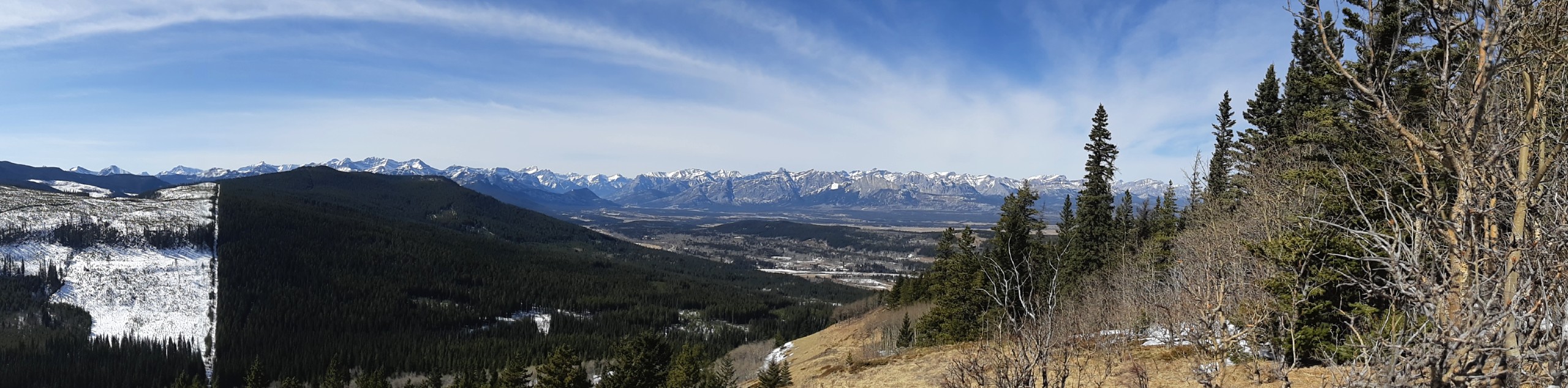
Hiking the Pine Woods Interpretive Loop Trail doesn’t take long, but is an excellent way to find solitude in the woods. The less frequented area along AB-68 is free from the crowds that Highway 40 sees. Take the family on an educational outing along this easy forested trail.
Getting there
From the Junction with the Trans Canada Highway, travel 4.7mi along Highway 40 before turning left onto AB-68 towards Sibbald Creek. Follow Highway 68 for 11.2mi and turn right. In 1.2mi, you will come to the Pine Woods trailhead.

About
| When to do | May-October |
| Backcountry Campsites | No |
| Pets allowed | Yes - On Leash |
| Family friendly | Yes |
| Route Signage | Average |
| Crowd Levels | Moderate |
| Route Type | Lollipop |
Pine Woods Loop
Elevation Graph
Weather
Pine Woods Loop Hike Description
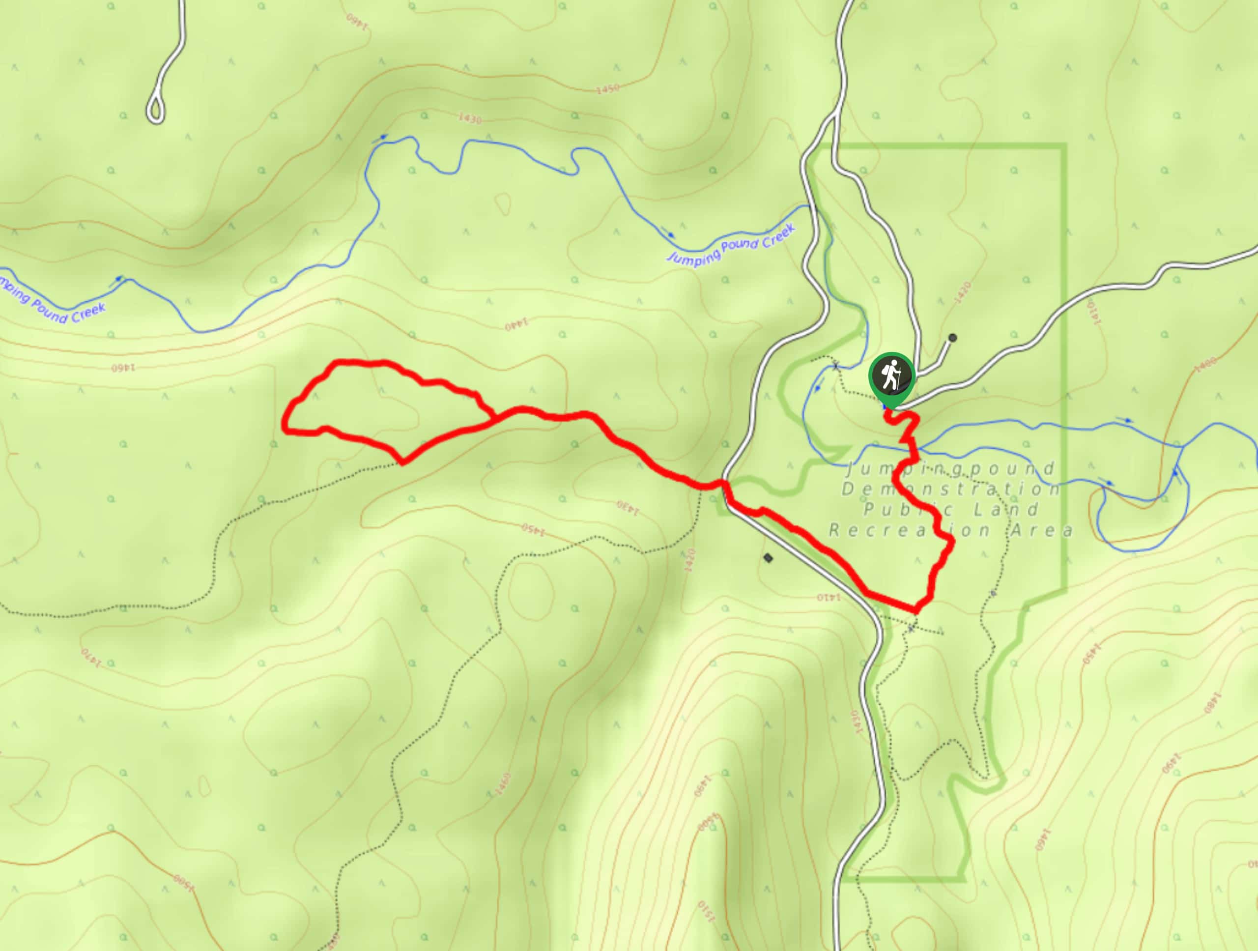
From the Pine Woods Loop trailhead, find the trail sign at the end of the parking lot and begin your hike. This is an easy-to-follow trail through the woods that intersects with other multi-use trails. You won’t have any trouble following your route due to the well-signed junctions. Watch for interpretive signs along the way to make this an educational excursion. The trail makes a lollipop along the Tom Snow route before heading back to the trailhead.
Similar hikes to the Pine Woods Loop hike
Eagle Hill Trail
The Eagle Hill trail climbs the foothills of Kananaskis Country to reach a ridge that looks out into the Prairies.…
Sugar Momma Trail
Hiking the Sugar Momma trail near Bragg Creek is a great way to spend a half day. The multi-use trail…
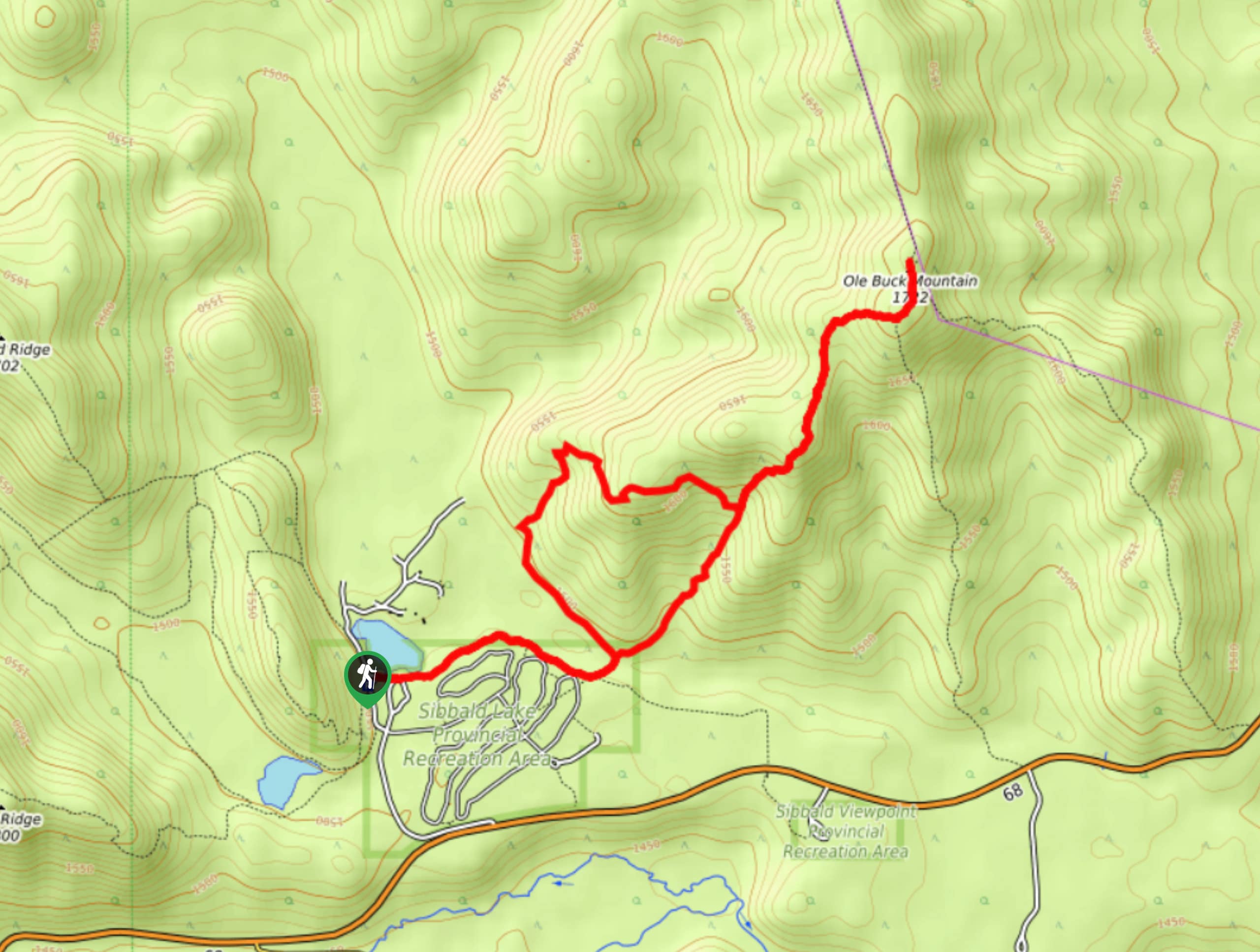
Buck Mountain Trail
Ole Buck Mountain is a great trail to tackle when exploring the Sibbald Flats area. Whether you are staying at…
Comments