
Foran Grade Trail
View Photos
Foran Grade Trail
Difficulty Rating:
The Foran Grade trail is a great running and walking trail near Turner Valley, Alberta. It follows a semi-forested path with excellent clearings for sightseeing. This trail travels counter-clockwise through a birch forest and other beautiful groves between viewpoints.
Getting there
From Turner Valley, AB, travel 14.6mi west to the Foran Grade Trailhead on the right side of the highway.

About
| When to do | June-September |
| Backcountry Campsites | No |
| Pets allowed | Yes - On Leash |
| Family friendly | Yes |
| Route Signage | Average |
| Crowd Levels | Moderate |
| Route Type | Out and back |
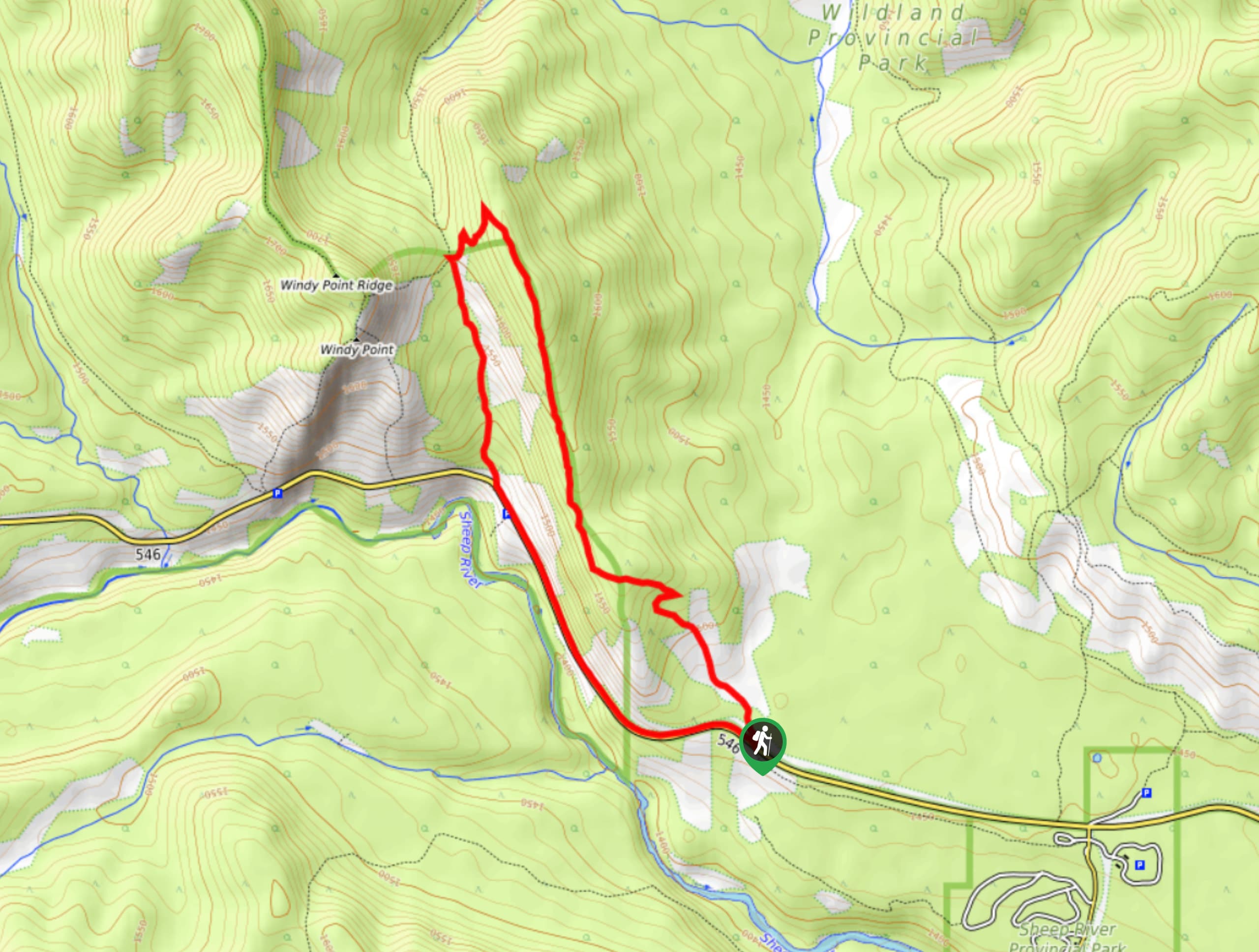
Foran Grade Trail
Elevation Graph
Weather
Foran Grade Trail Description
The Foran Grade trail starts in the parking area off of Highway 546. Begin hiking along the trail on the right when you start. You’ll hike the loop counterclockwise, beginning in a wide open area. After 0.7mi, you’ll reach a birch grove. The views begin roughly 1640ft after the birch grove and continue as you travel along the bench before descending to the highway. At 2.2mi, you will reach a junction and take the Windy Point Trail to descend. This will take you down to the highway, where you will cross and hike along the Sheep River. Continue hiking eastbound along the river until you reach your starting point, where you will cross the highway to your vehicle.
Find other amazing hikes in Kananaskis Country
- Kananaskis – Smith Dorrien Trail: Chester Lake, Tent Ridge, Burstall Pass, West Wind Pass and Rummel Lake.
- Bragg Creek and Sheep River Provincial Park: Prairie Mountain, Powderface Ridge, Nihahi Ridge and ForgetMeNot Ridge.
- Kananaskis Trail: Troll Falls, Rawson Lake, Wasootch Ridge, Sarrail Ridge and Pocaterra Ridge.
Similar hikes to the Foran Grade Trail hike
Gorge Creek Loop
Hiking the Gorge Creek Loop requires some route knowledge and a bit of extra effort as it is not as…
Powderface Creek Trail
The Powderface Creek trail in Kananaskis is a popular hiking, biking, and horseback trail, so be aware of traffic when…
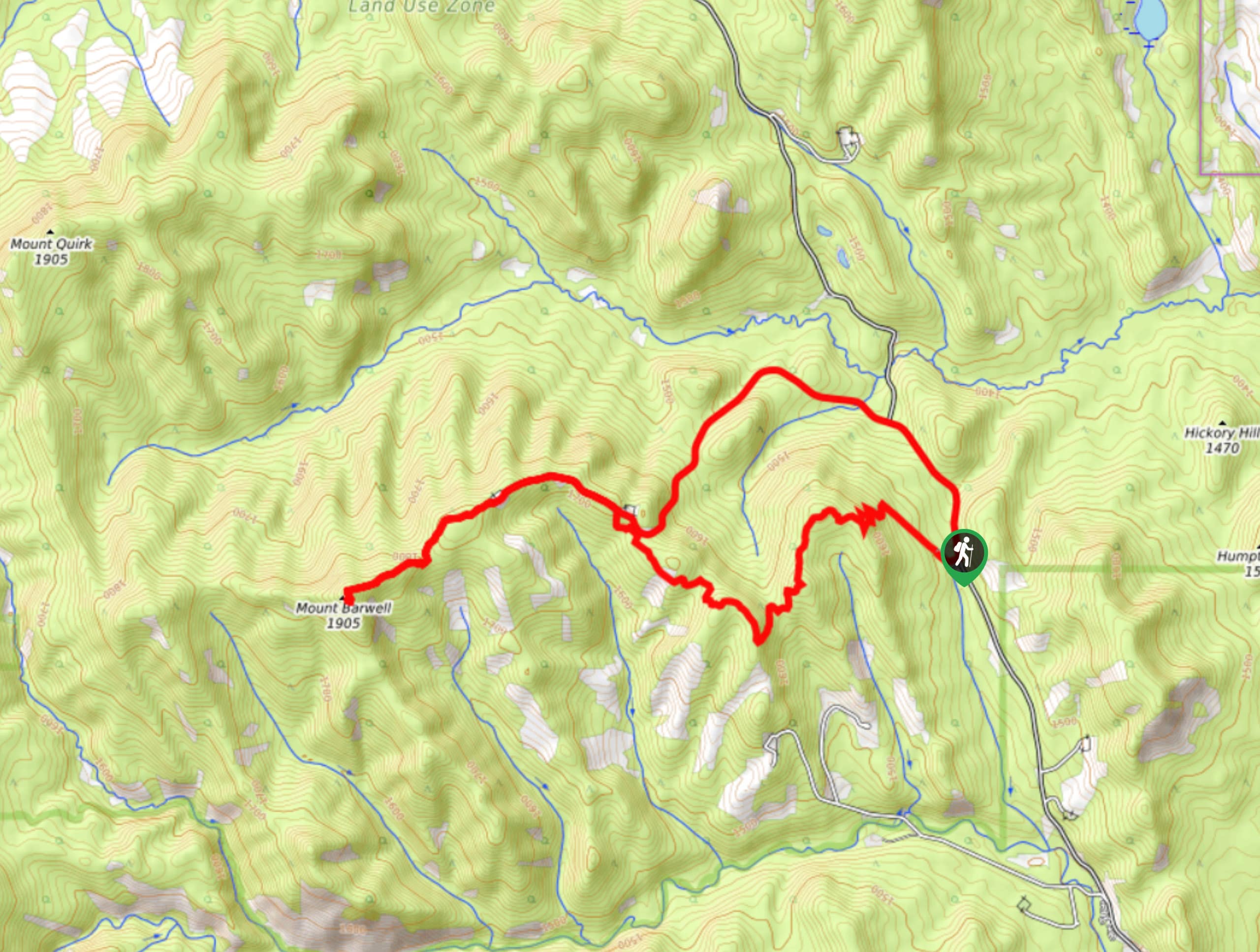
Barwell Trail
Hiking the Mount Barwell Trail is a half to full day effort that is very rewarding. With minimal crowds and…
Comments