Mount Ernest Ross Scramble
View Photos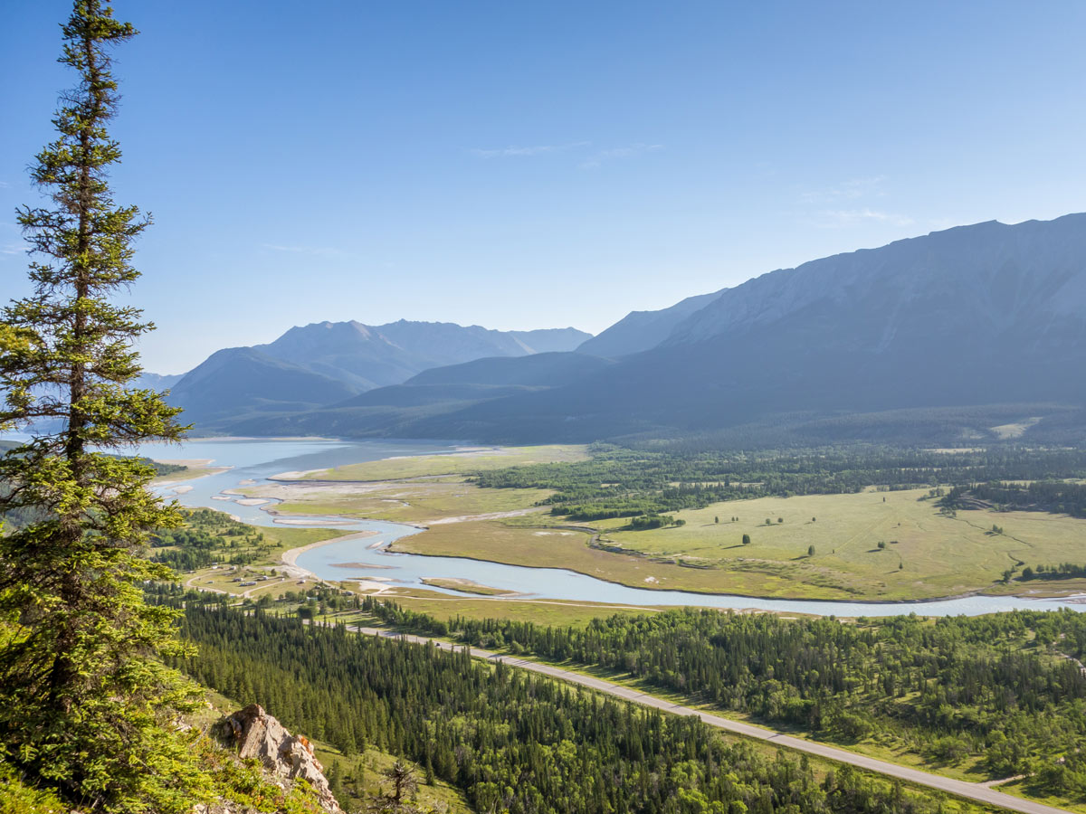
Mount Ernest Ross Scramble
Difficulty Rating:
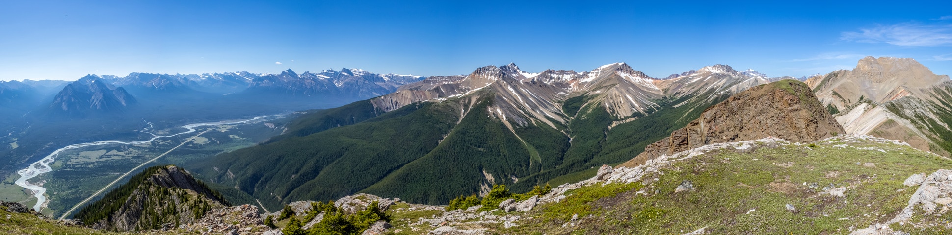
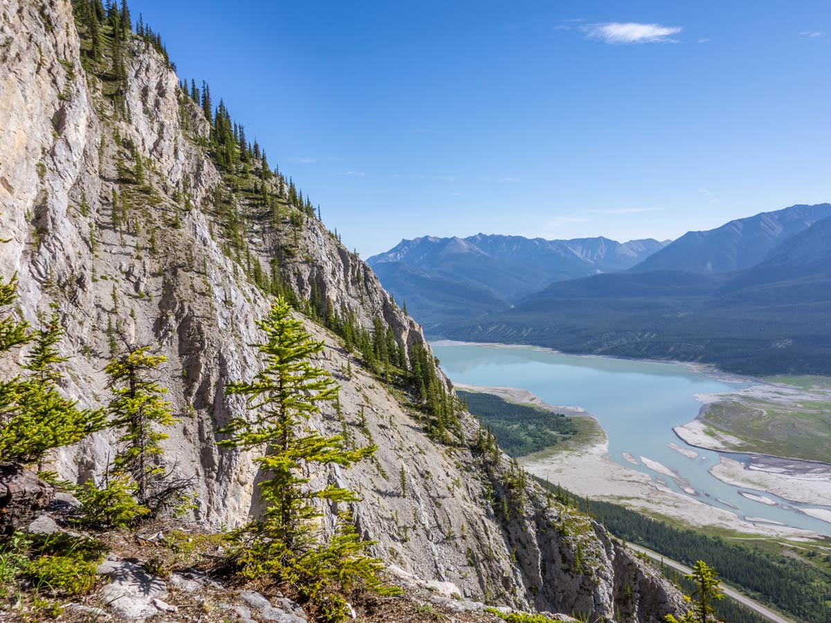
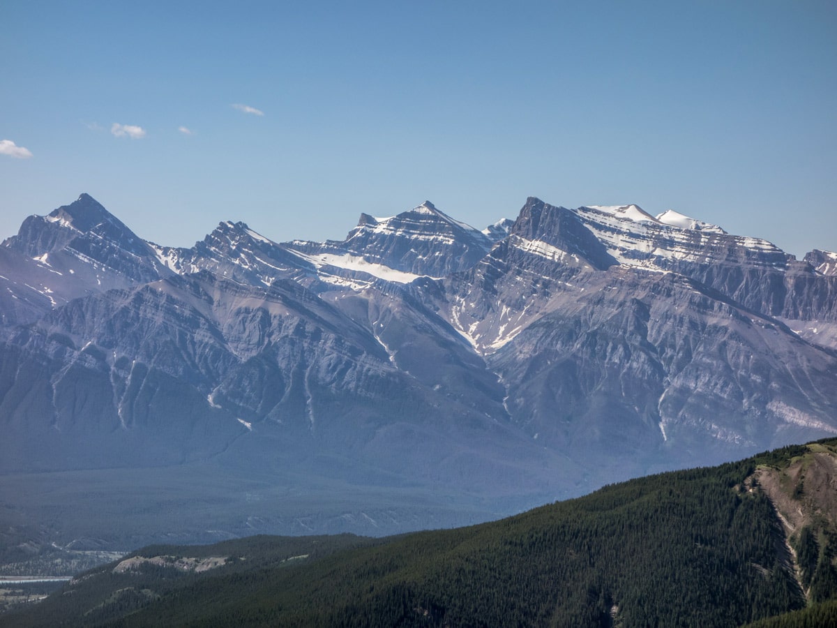
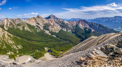
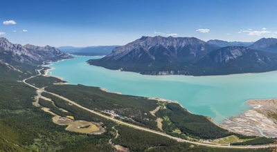
The trail to the top of Ernest Ross Mount is a little challenging, but a fun scramble. You will find yourself on a quiet path with constantly changing surroundings: from bushes, trees, scree to almost vertical rock boulders. Although most of the trail is not too hard, one section will make you sweat a little: the scrambly part is a little steep and you will have to use some of your rock-climbing skills. But it’s worth all the effort, as the views from the top will take your breath away. From the surrounding peaks, to Kootenay Plains, and Abraham Lake – the panorama here is stunning!
Getting there
You can leave your car near the ditch on the north side of an unmarked creek that is right at the bottom of the Ernest Ross Ridge. You can also walk from Preachers Point Staging Area, but that would add 0.9mi one-way to your hike.

About
| When to do | June-October |
| Backcountry Campsites | No |
| Pets allowed | Yes - On Leash |
| Family friendly | No |
| Route Signage | None |
| Crowd Levels | Low |
| Route Type | Out and back |
Mount Ernest Ross
Elevation Graph
Weather
Route Description for Mount Ernest Ross
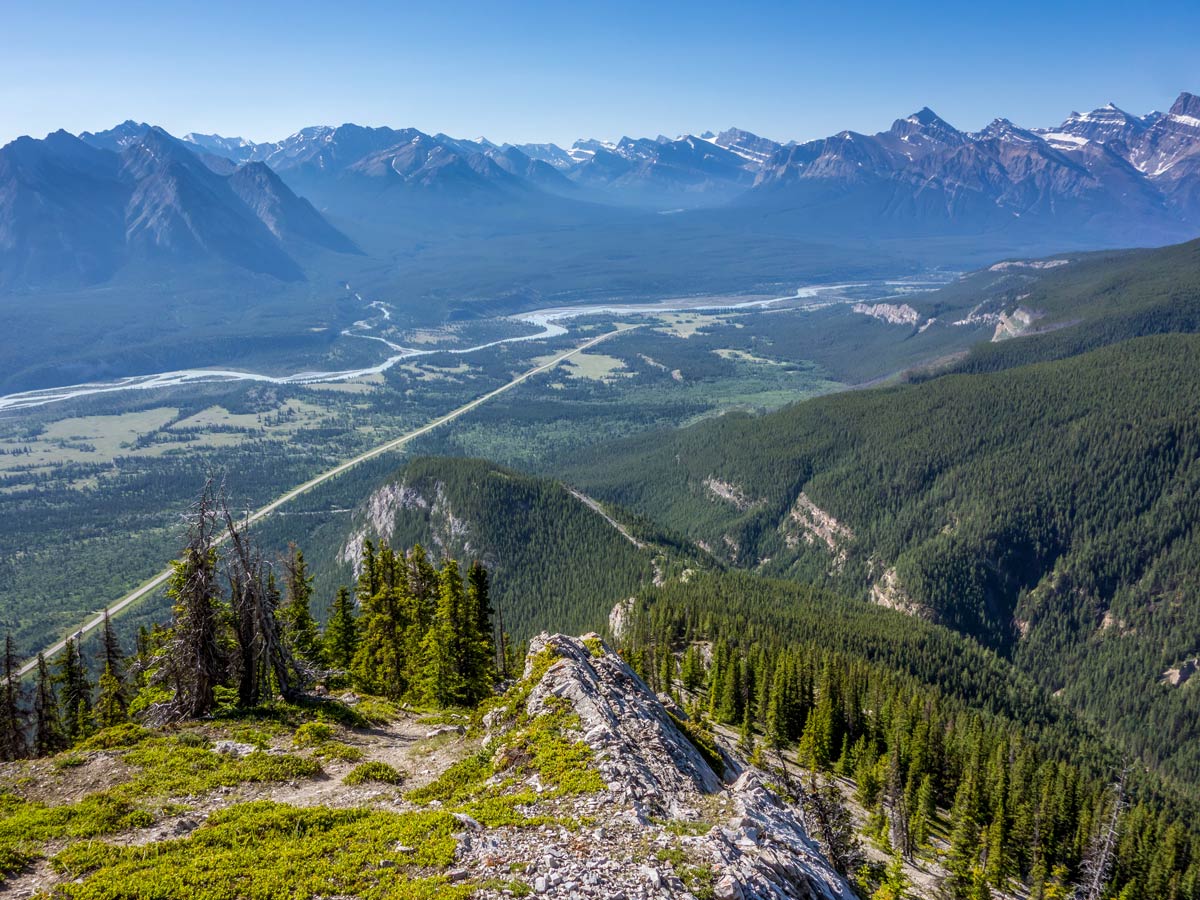
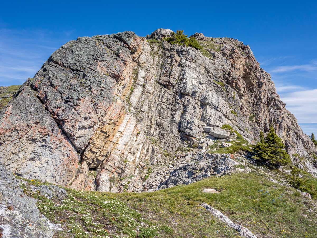
Mount Ernest Ross scramble is a great trail. The trail ascends quite steeply, but evenly throughout the route with an exception of the last bit to reach the summit, where you will find yourself climbing up on rather steep rocks. This part is rather short and exposure here is minimal, but turn back if it’s too much for you.
The trail starts at the northern bank of the creek near the bottom of the ridge. Don’t look for any signs marking the trailhead, as there aren’t any, just approach the mountain on the path in front of you!
The path leading through the forest shortly will start ascending quite steeply.
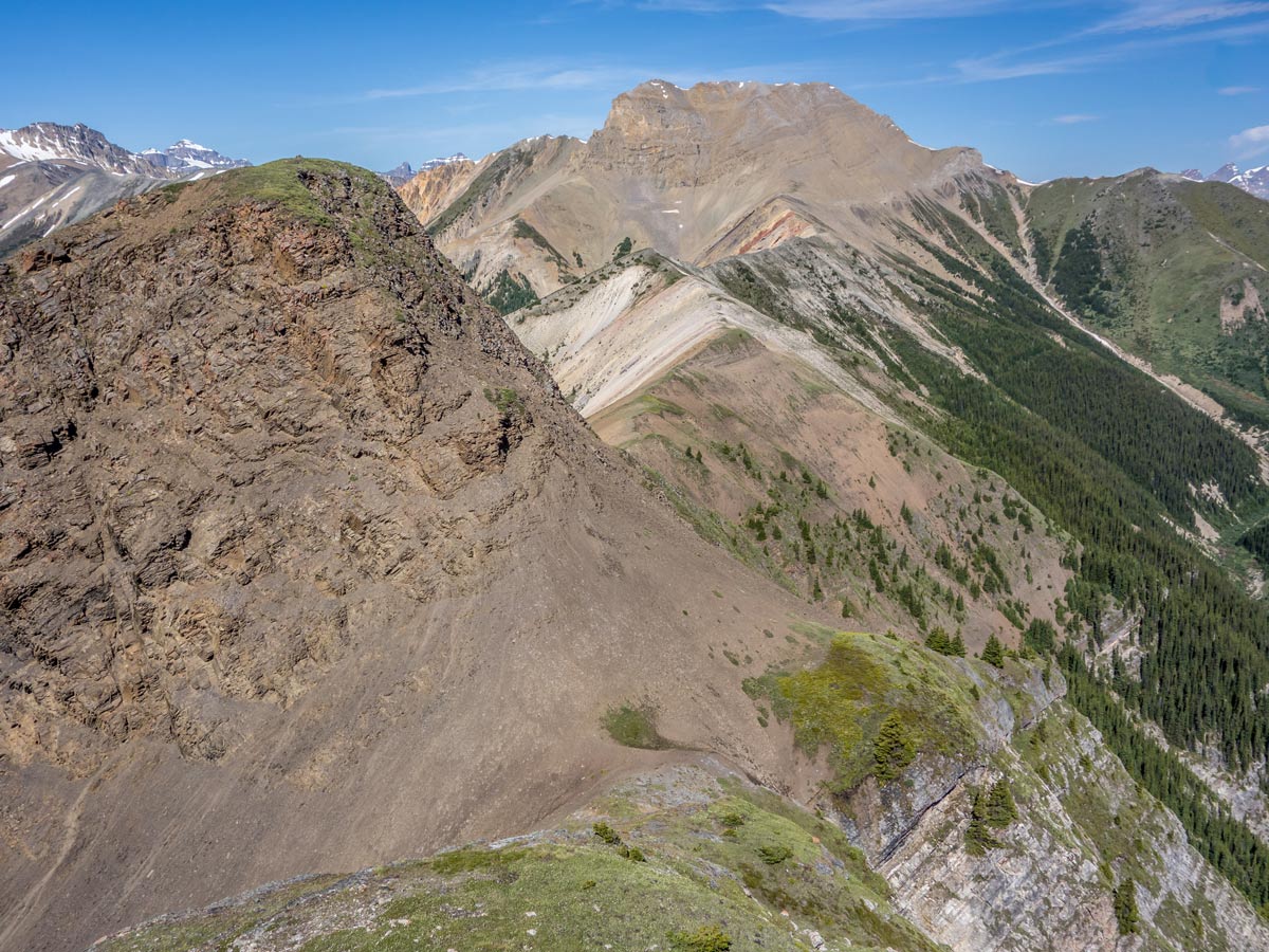
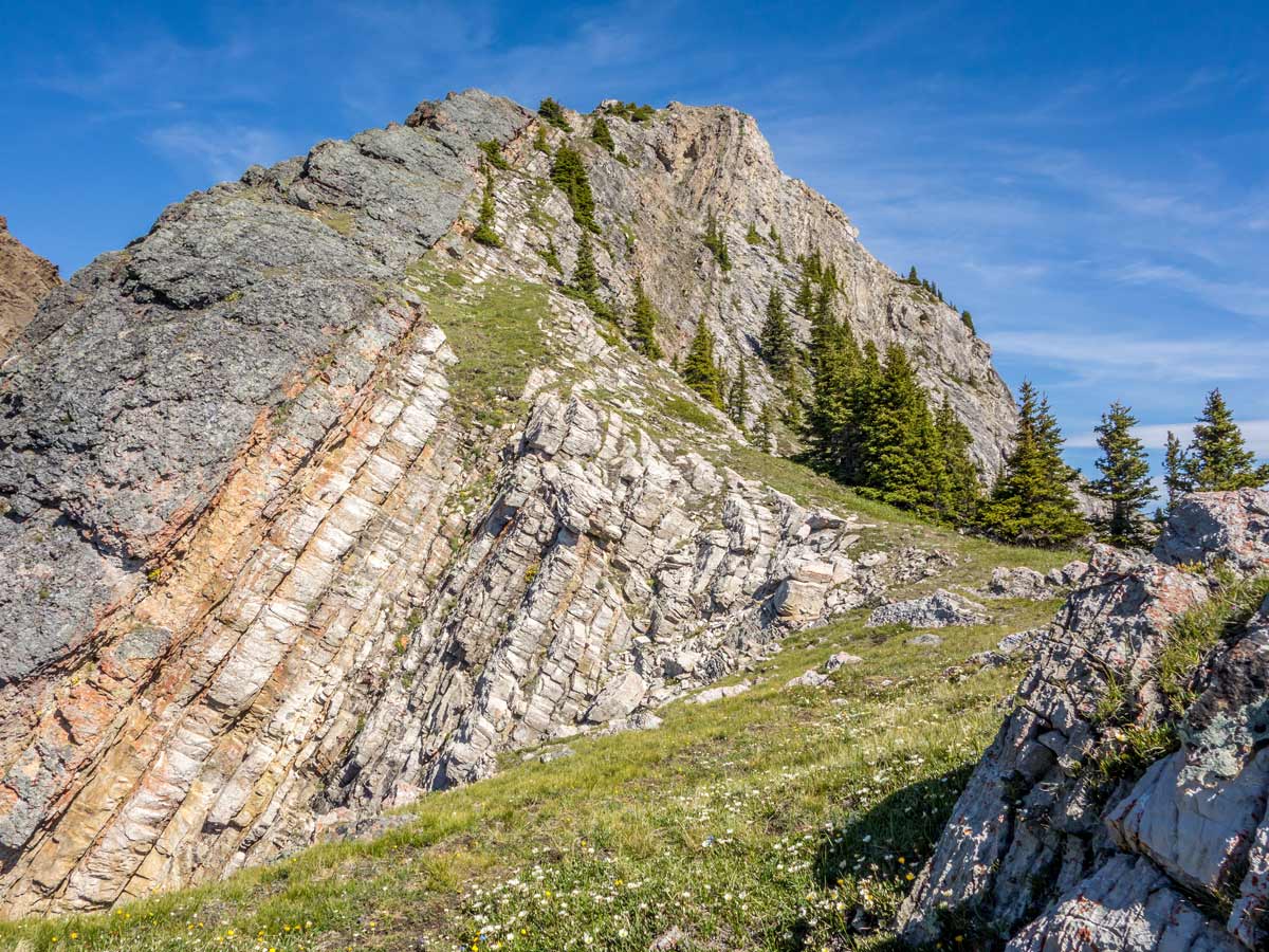
Soon, you will reach the ridge crest. Continue towards the top. Sometimes the path will get closer to steep cliffs – some people find these stretches to be quite exposed. If you are afraid of heights, you can walk a bit further from the edge, but you will have to bush-walk then.
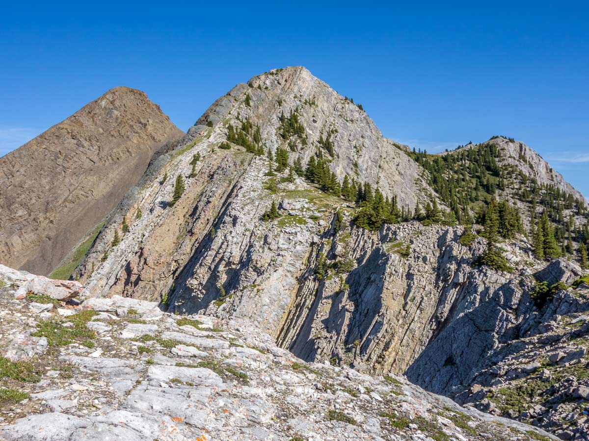
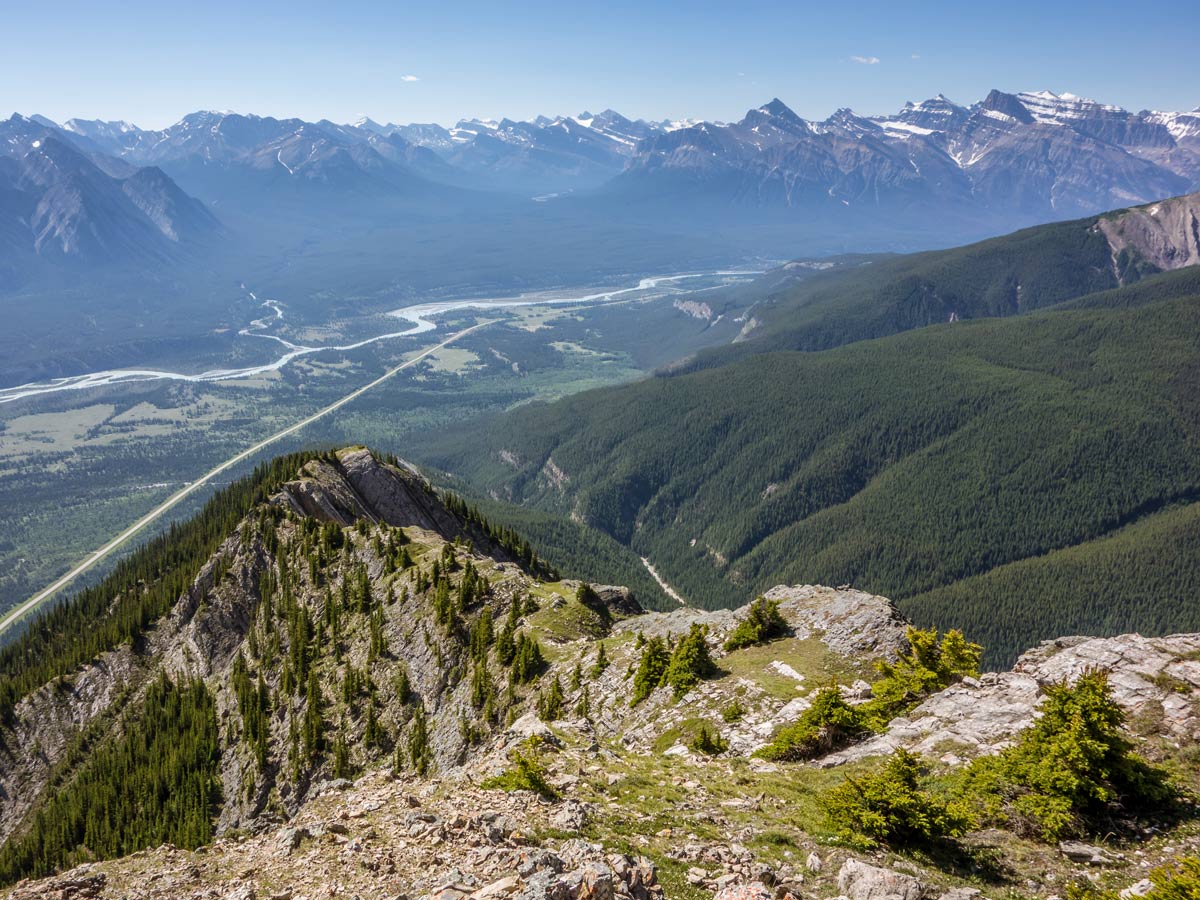
Continue hiking and you will find yourself in an open area with beautiful views rising around you. From here you will notice that the last bit to the top is quite steep, but don’t give up before checking it out.
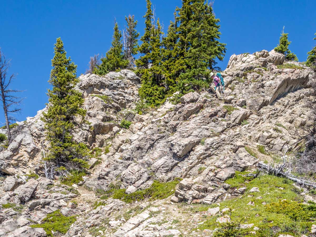
Soon the path will get slightly steeper, as you will be ascending to the peak. There will be some exposure on your left side.
For the last bit, follow the path of the least resistance to reach the top. Rocks here are of good grip and you will find lots of options to place your foot and hands. And it’s not too exposed!
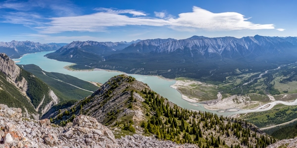
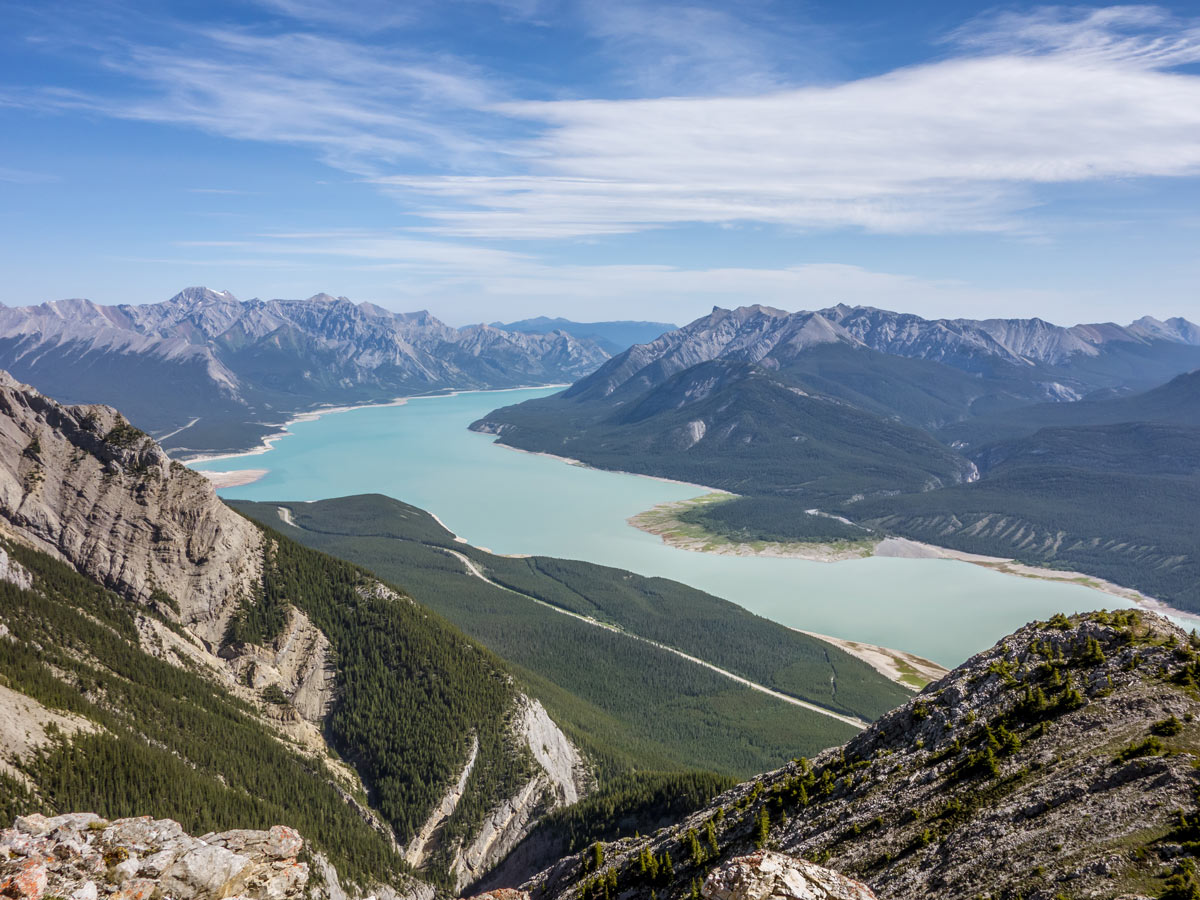
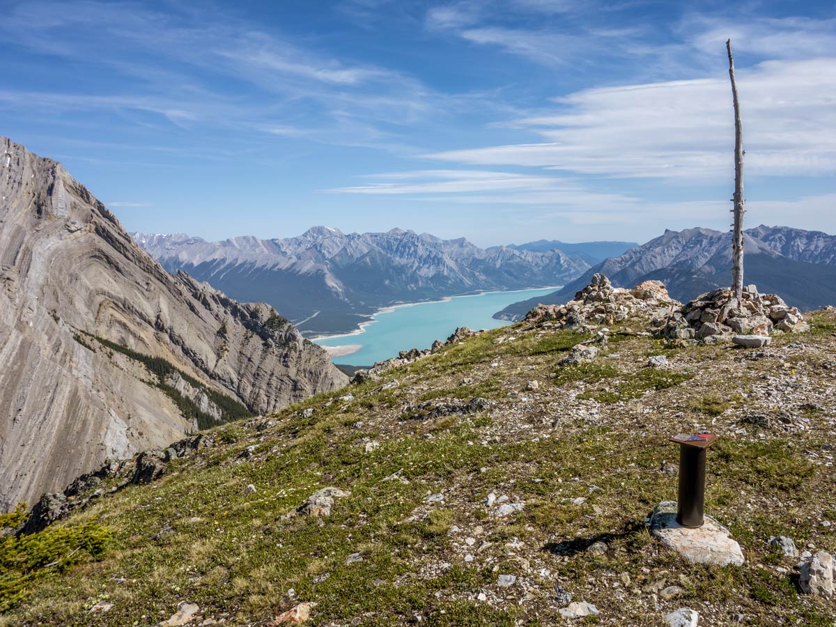
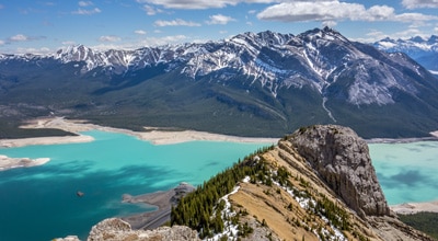
You will find the views around you breathtaking: Elliot Peak, Kootenay Plains, Abraham Lake, beautiful Two O-Clock Ridge and plenty of others – make sure to take plenty of pictures. Spend some time here, as the Mount Ernest Ross has a comfortable summit plateau.
You will notice another summit just next to you – it’s a second peak of the Ernest Ross Mountain. Quite a lot of hikers choose to ascend it too, but a path to it is steeper, a little loose and considered to be quite a challenging scramble. However, we haven’t heard anybody who would complain after reaching the second summit!
Return the same way you came.
Insider Hints
Have a picnic at Preachers Point Staging Area – it’s only 0.9mi north to the trailhead.
Although dogs on leash are allowed on the Mount Earnest Ross trail, we think that the terrain of this hike is too challenging for pets. Even if the dog is capable of steep ascents, exposed sections along the ridge might be dangerous.
Similar Scrambles to the Mount Ernest Ross Scramble
Windy Point Ridge, The Buckle, and Talus Peak
This beautiful scramble to Windy Ridge with an extension to Talus Peak and the Buckle can be called a gem…
Two O-Clock Ridge
The Two O-Clock Ridge Trail is a wonderful scramble near David Thompson Highway. After a short, but steep scramble you…
Coral Ridge
The Coral Ridge scramble is a treat for adventure lovers, as this path is not very well known and very…
Comments