
Observation Peak Scramble
View Photos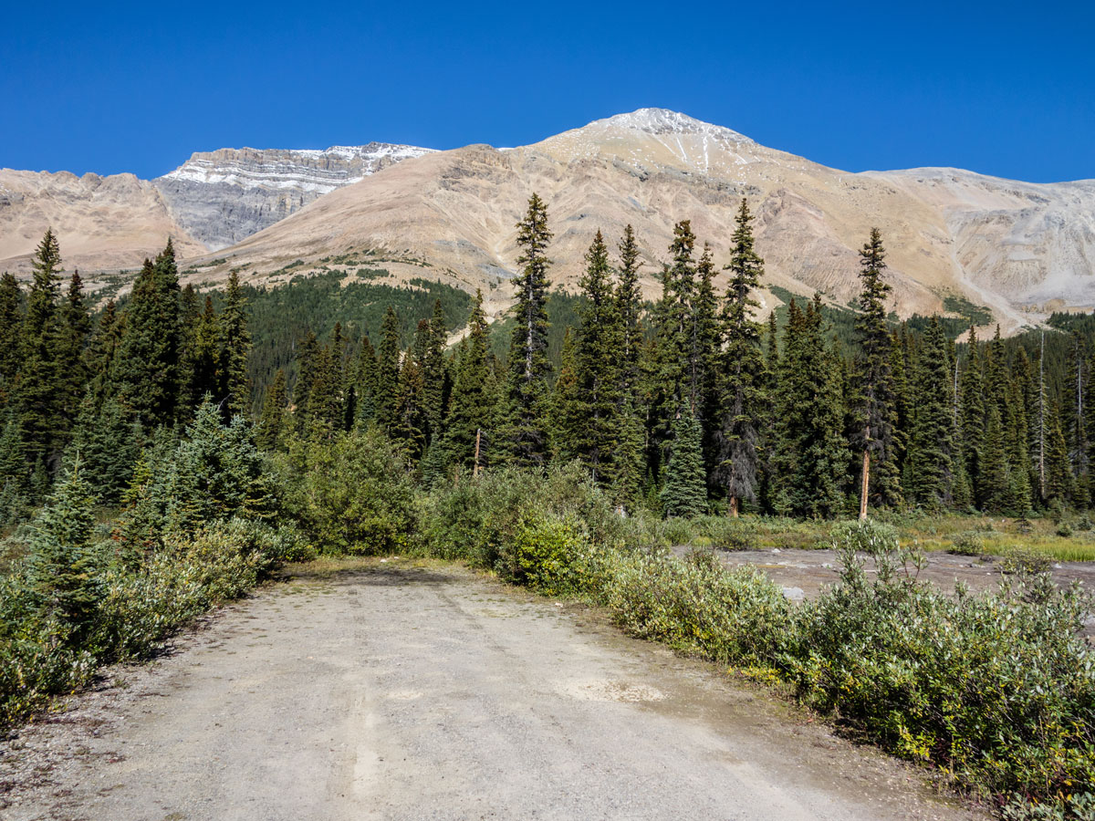

Observation Peak Scramble
Difficulty Rating:
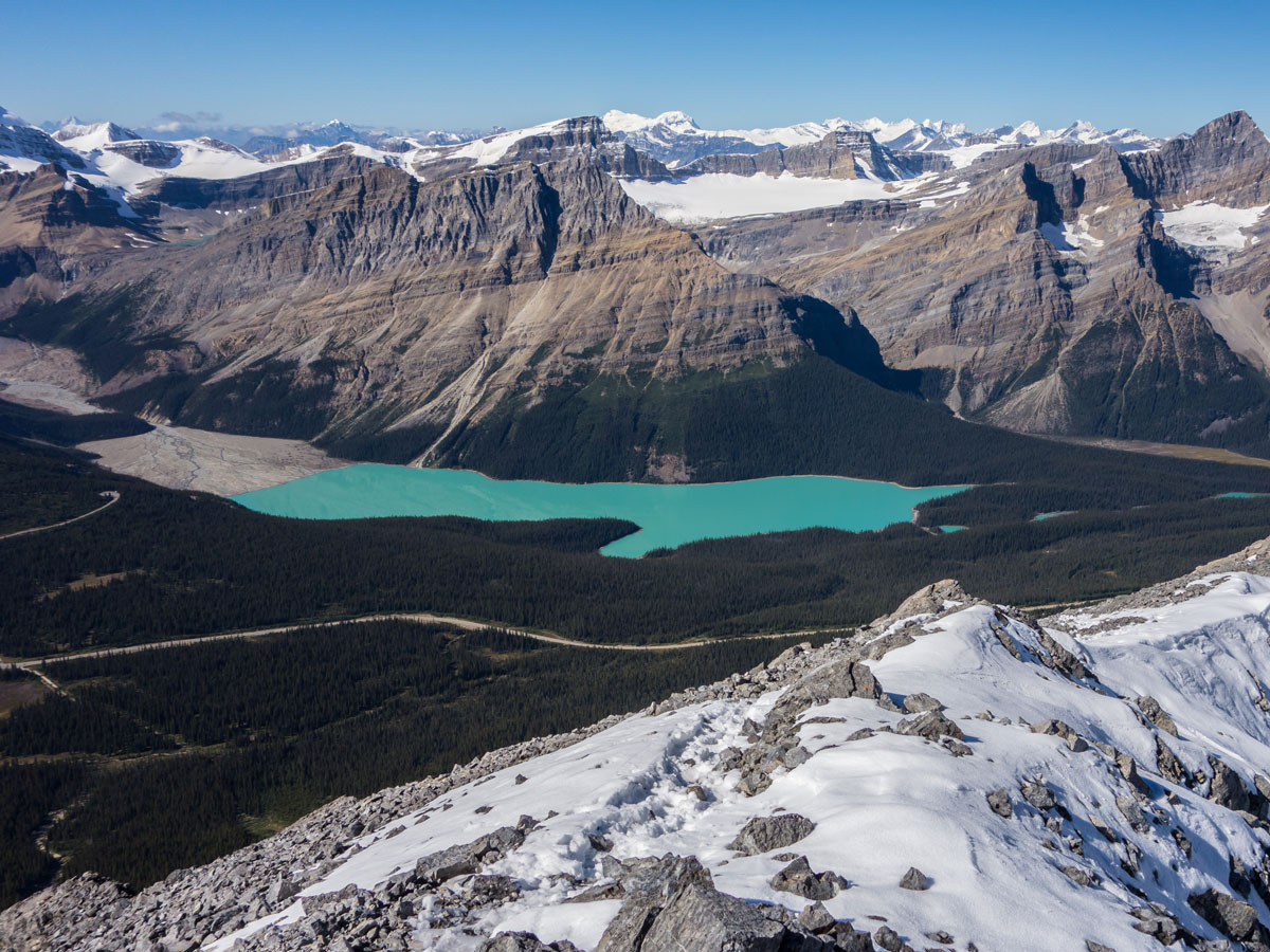
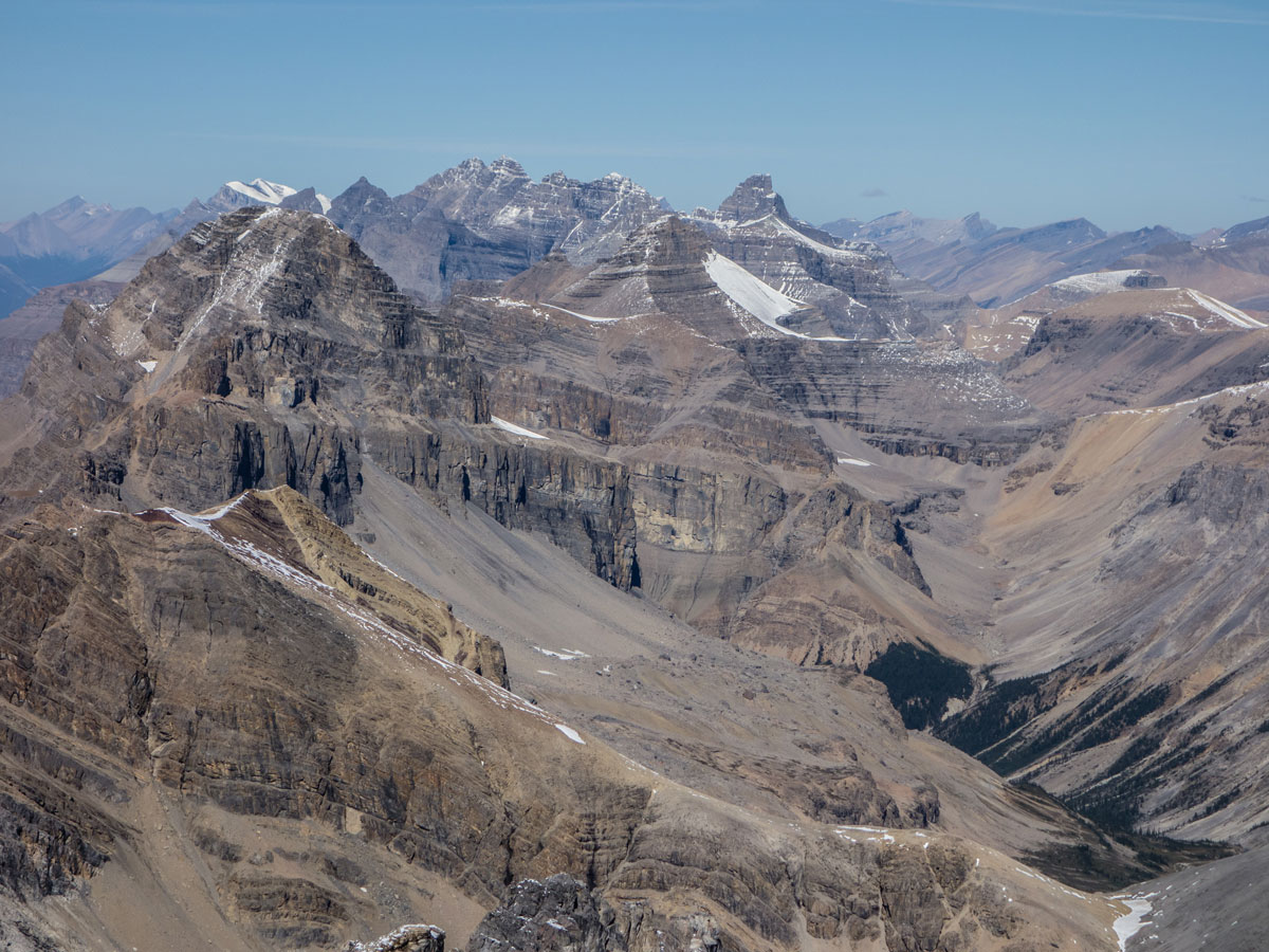
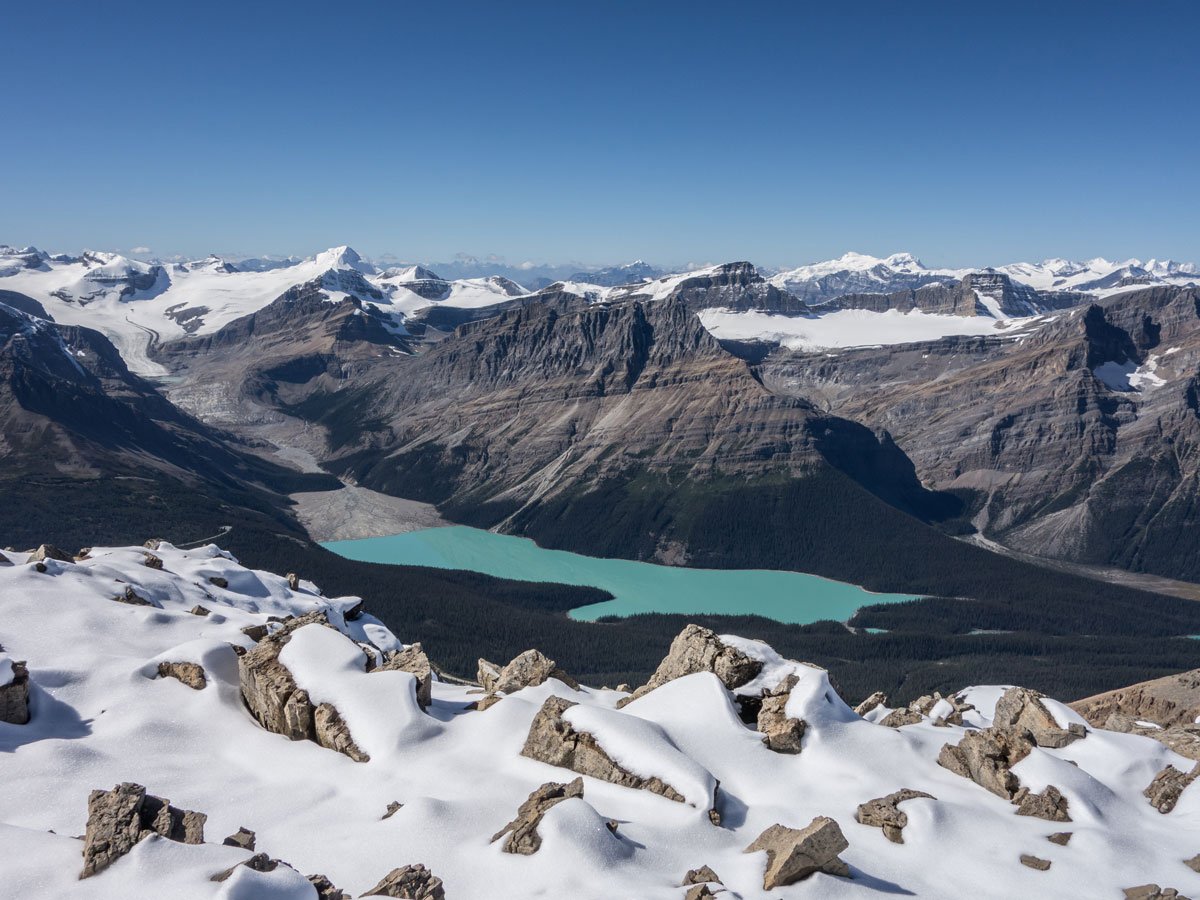
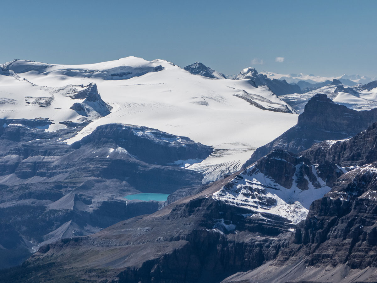
Aptly named, the scramble up Observation Peak gives a bird’s eye view of turquoise Peyto Lake and Bow Lake at the base of glaciated giants on the continental divide. Observation Peak is a stunning scramble on the Icefields Parkway.
Getting there
From Lake Louise take the Trans-Canada Highway west. Turn onto the Icefields Parkway and head towards Jasper for 25.5mi. When you get to Bow Summit, turn right on a small road instead of turning left into the parking lot. Drive to the end of this short access road.

About
| When to do | July - September |
| Backcountry Campsites | No |
| Toilets | Peyto Lake Viewpoint; Across the parkway from trailhead. |
| Pets allowed | Yes - On Leash |
| Scarmbling Rating | Grade 1 |
| Exposure | Mild |
| Family friendly | No |
| Route Signage | None |
| Crowd Levels | Low |
| Route Type | Out and back |
Observation Peak
Elevation Graph
Weather
Route Description for Observation Peak
Observation Peak was named by Charles Noyes, who in 1899 noted that the view from the summit was one of the finest he’d ever taken in.
While this is a stunning route, we would not recommend this scramble if it’s wet, snowy or outside of the summer season.
Instead of turning left and parking at Bow Summit Parking Lot, go right, shortly after and drive to the end of the short access road, making sure you’ll be able to get your car out at the end of the day and that you aren’t boxing any other cars in.
Follow this road as it continues along into the bushes for a few hundred meters. Shortly after it turns left and fills in with willows, look out for a cairn on the right side that marks the start of the trail.
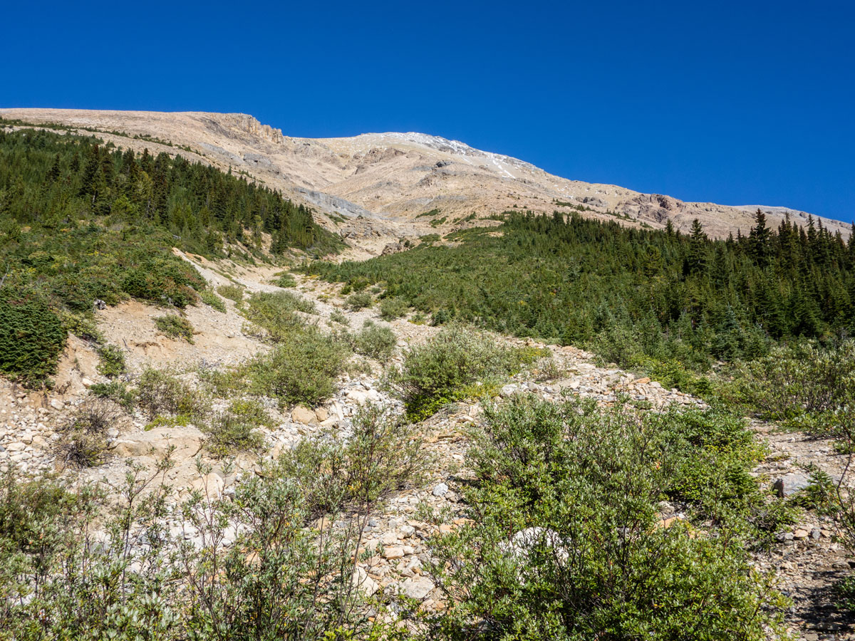
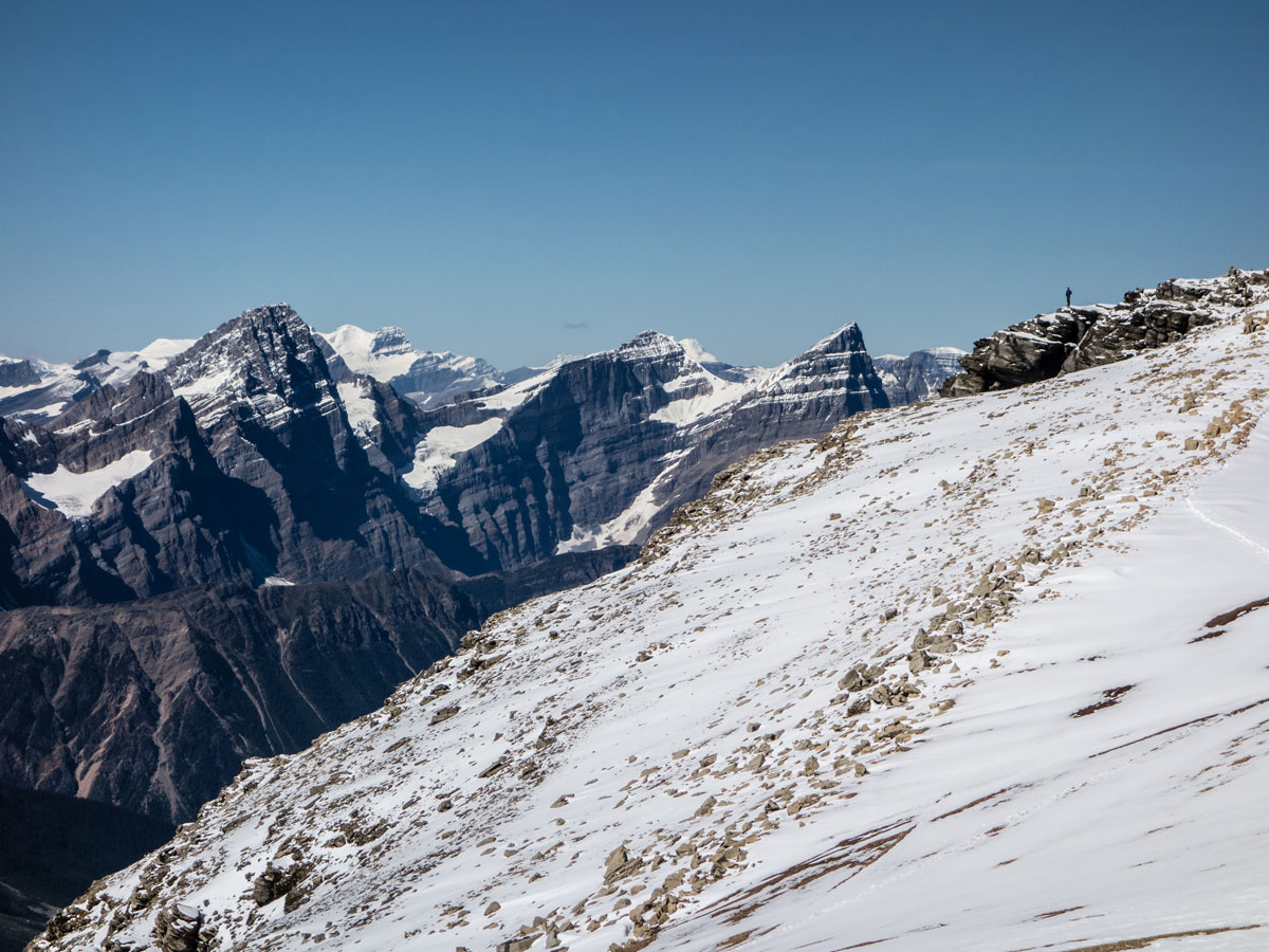
While there are many possible routes up the mountain, we recommend following the main route that was made popular by Alan Kane’s ‘Scrambles in the Canadian Rockies’. There is now an acceptable trail from the parking area to the top via this route. One note though: many guides speak of north and south gully approaches, recommending one or the other. The obvious trail we took initially follows the north gully, but just past the treeline moves onto the broad ridge between the two gullies.
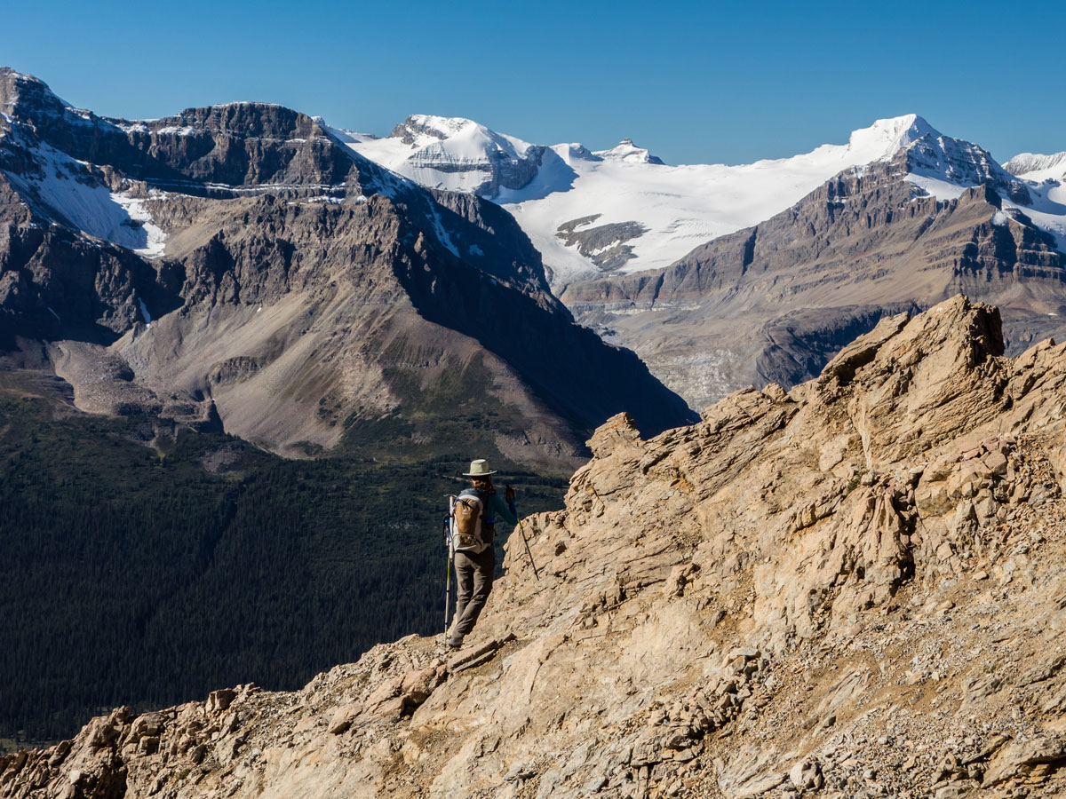
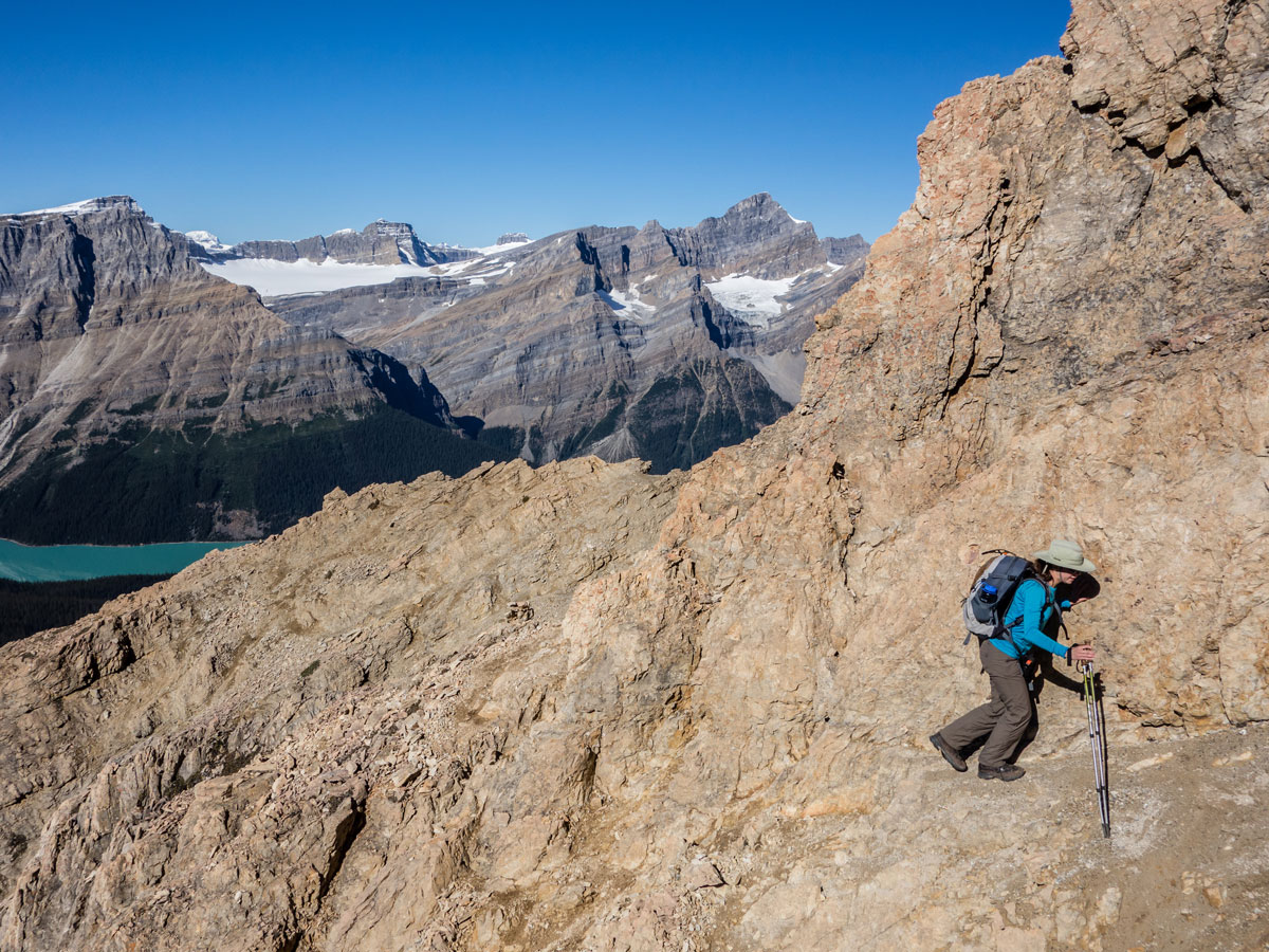
If the route is dry, there are still two potentially very difficult sections on this scramble. The first difficult section was the rocky cliff bands about 2/3rd’s of the way up. We did expect to encounter these cliff bands, but did not realize that traversing through here would involve moderate scrambling, with a small section just a little more difficult than the Grade 1 rating for the rest of the route. The cairned route through this section involves first a short traverse on a ledge (easy), an awkward maneuver over a rocky rib (hard), followed by several moderately difficult steps over a variety of loose scree and bits of bedrock. Although not too challenging, it does add some time, and did put one of our contributors, a regular scrambler, outside of their comfort zone.
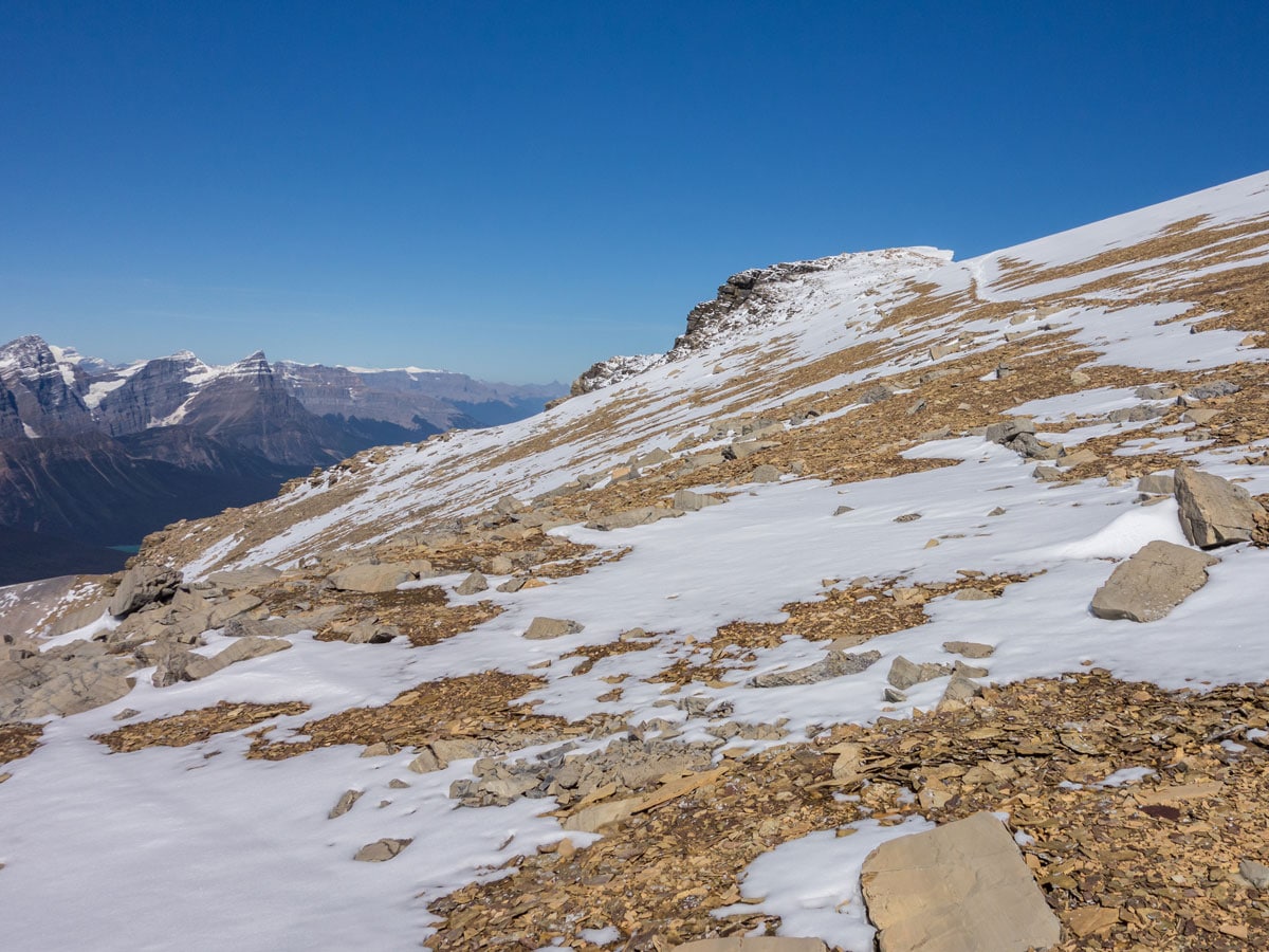
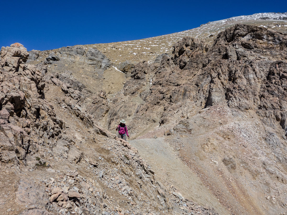
The second difficult section is especially problematic when this route is attempted late in the season with a very challenging last vertical 492ft of loose scree just before the false summit. The ground is prone to freezing, leaving loose rock on top that slides and rolls with alarming ease. We have been on loose scree before, but this was completely different and ridiculously more difficult (by comparison, it made the stuff in the scree chute of Noseeum Peak look like pavement). When these conditions prevail, it is essentially impossible to move up.
To continue past this scree, it is recommended to take an alternate route. Options include following a snow-filled trail up and although it will likely be slippery, it does offer the possibility for elevation gain. On the plus side the scree does make for a fun descent, if approached with careful consideration and caution. Again, it was much different than other scree we’ve descended. It really did feel like marbles on a sheet of ice and it took quite a bit of effort to not fall. It would be safe to assume that in the summer this section is nothing more than your typical run of the mill loose scree, but it definitely isn’t late in the season.
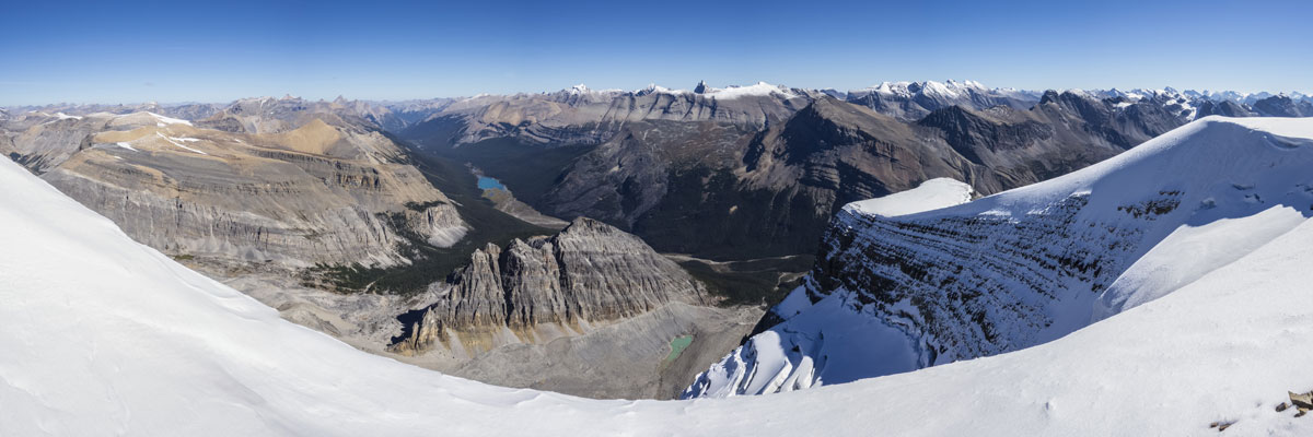
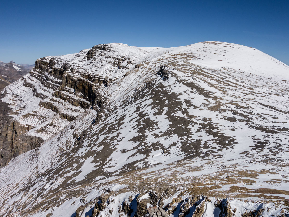
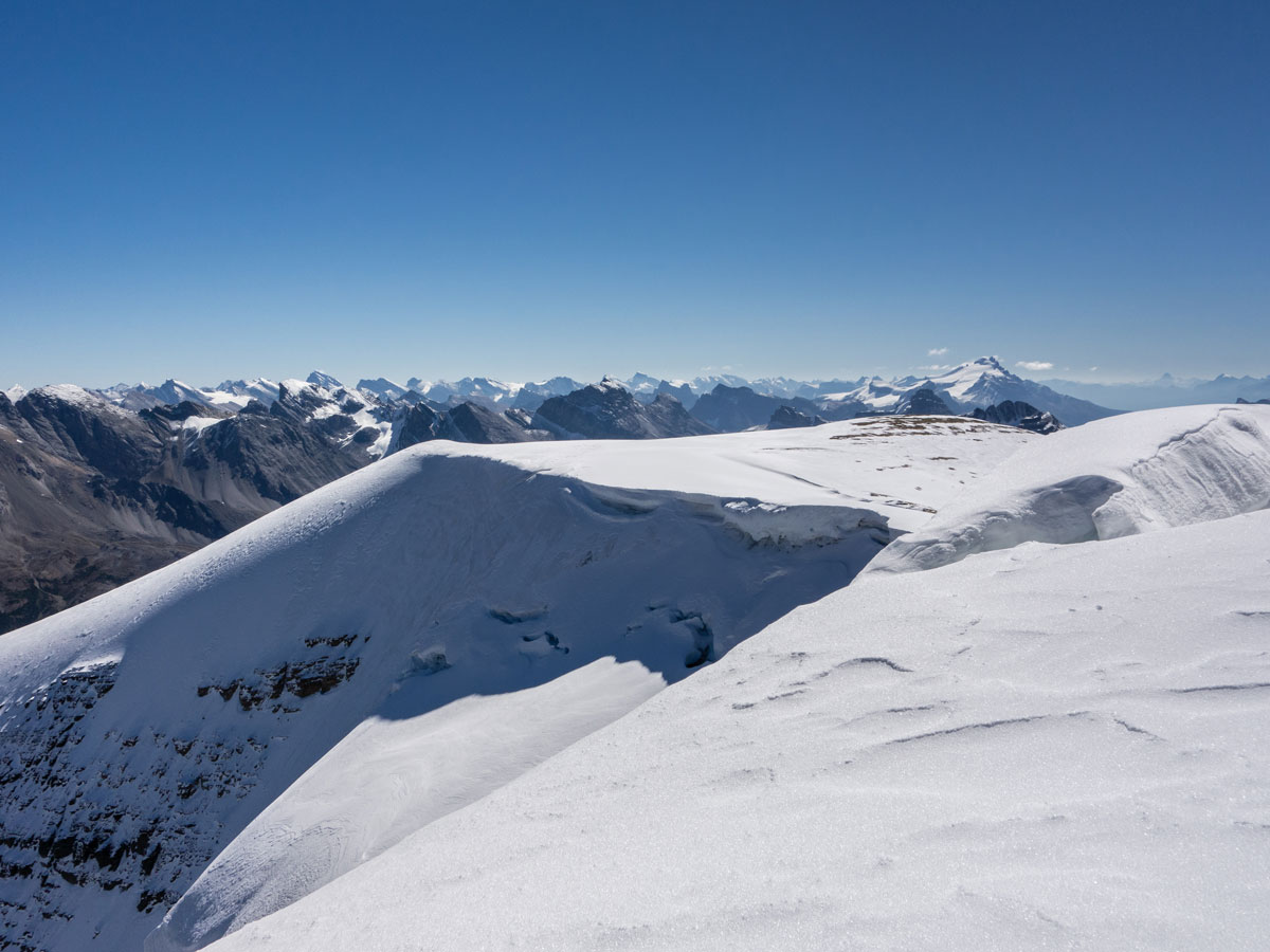
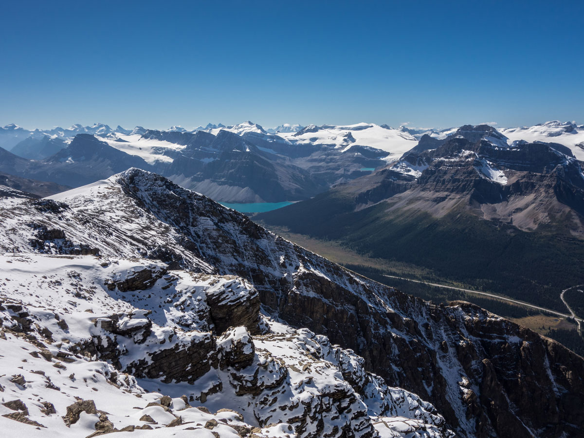
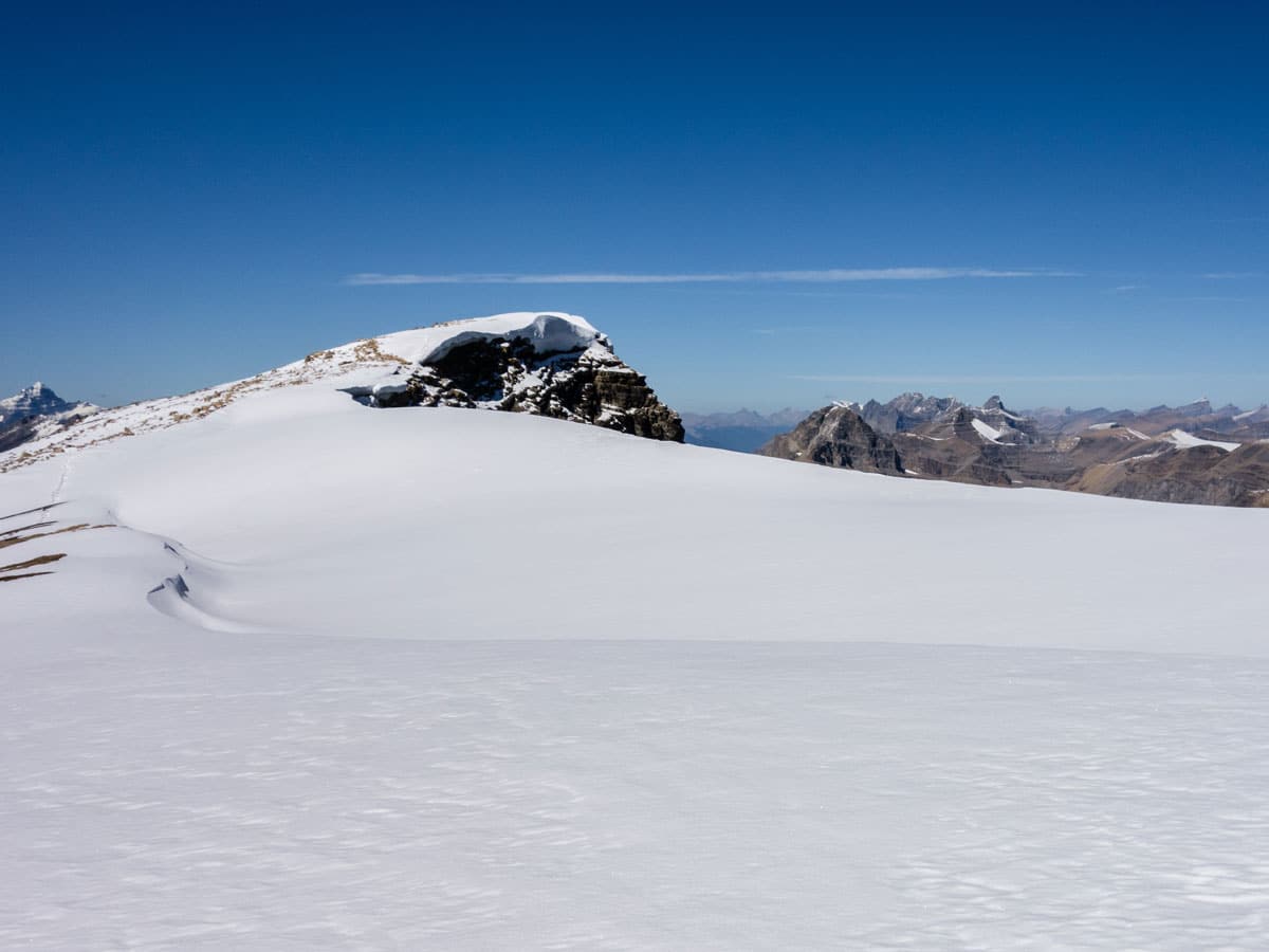
Once the false summit is reached, the remainder of the traverse is easy. There will likely be a fair amount of snow along the summit ridge, but it will still be possible to distinguish snow on rock from the enormous cornice that overhangs the eastern side. Even after a hot summer it’s remarkable how much snow survives through to autumn!
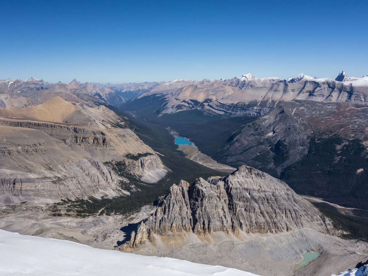
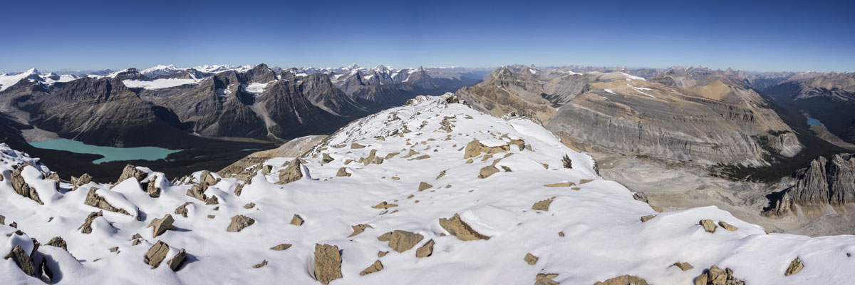
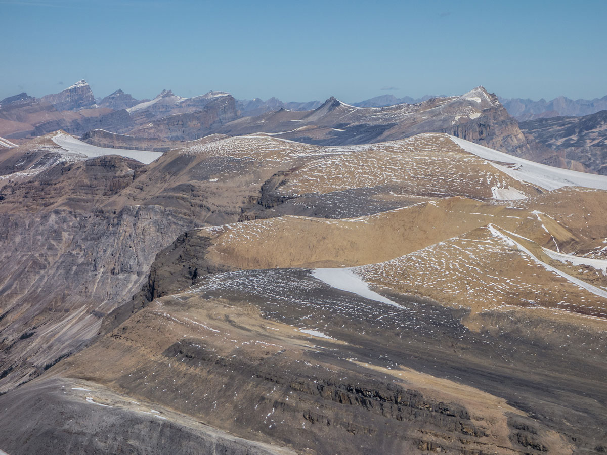
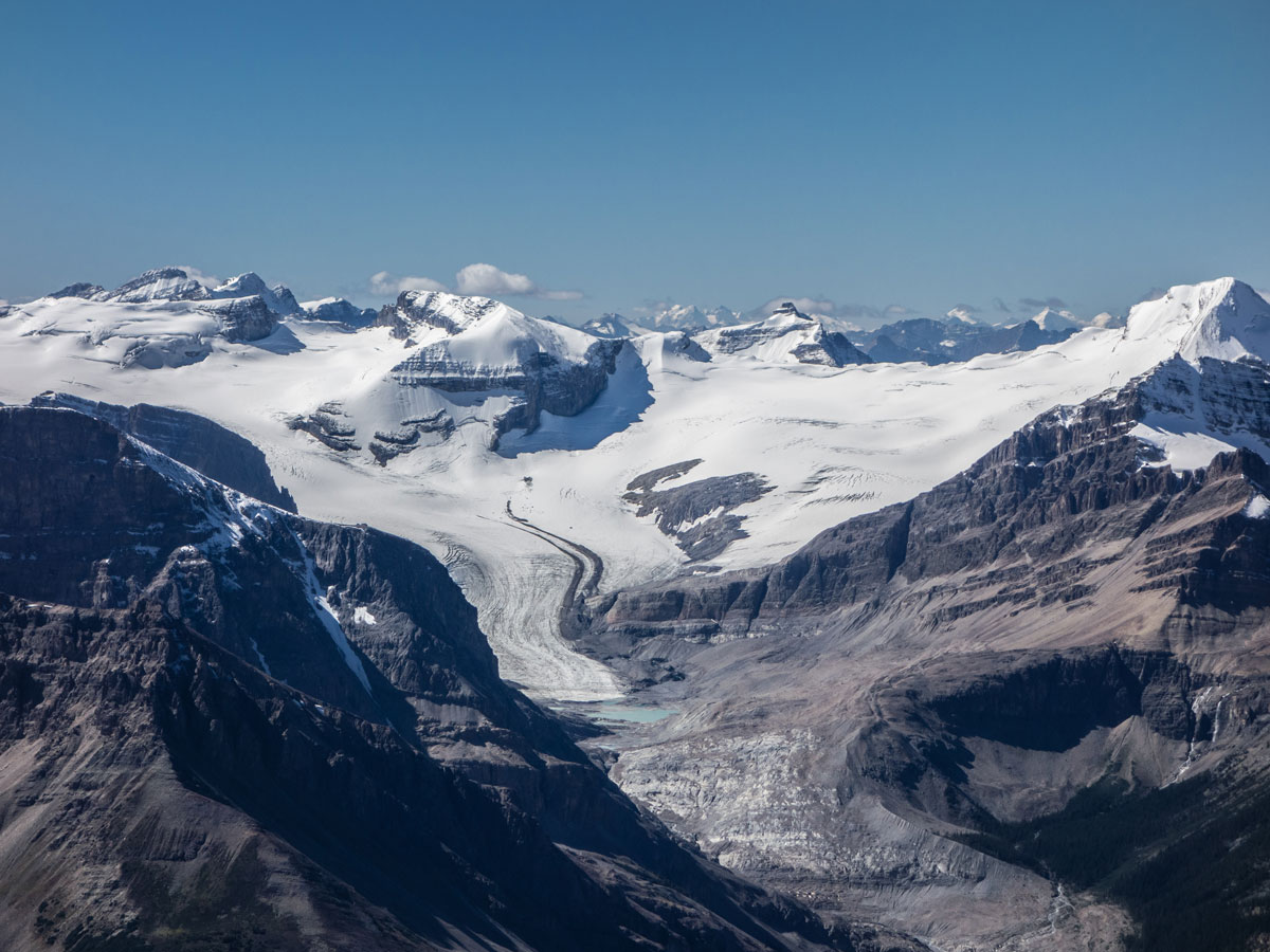
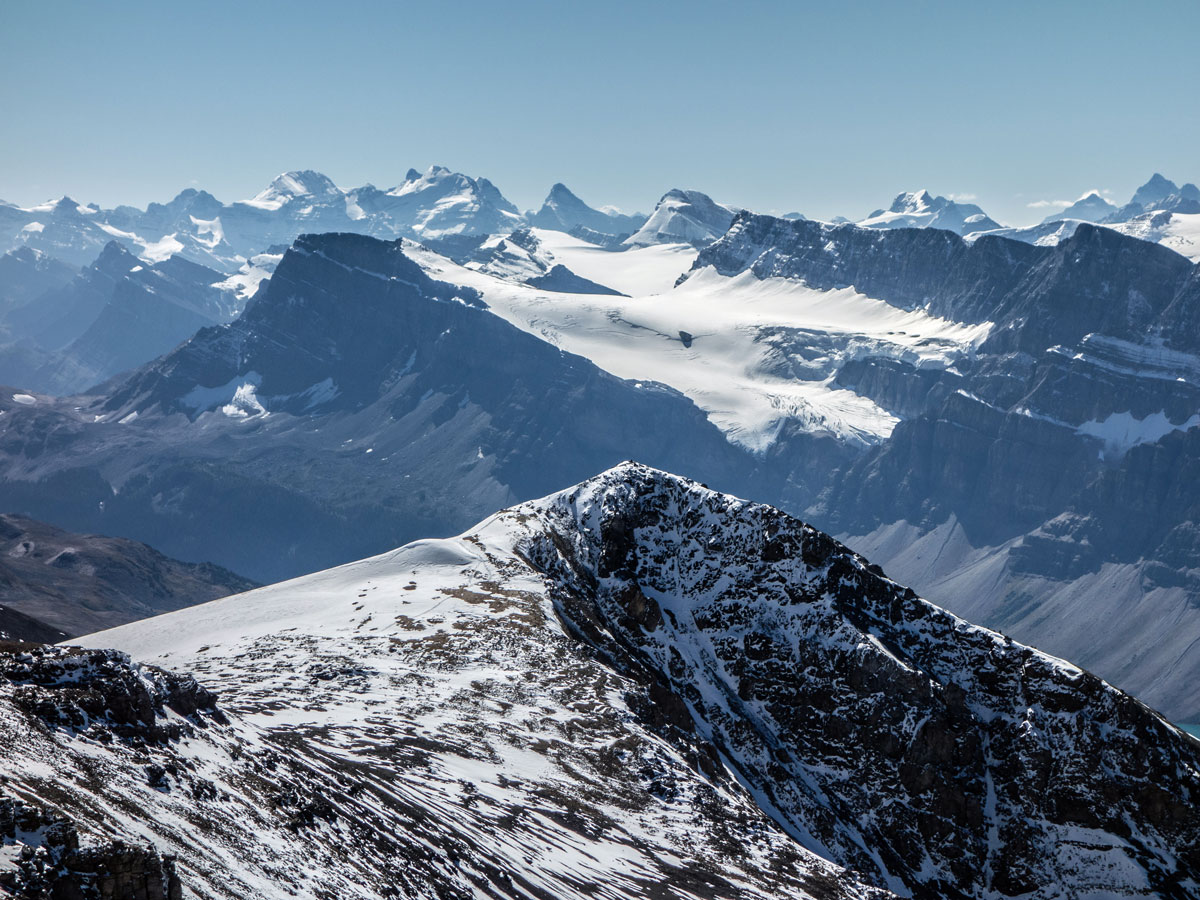
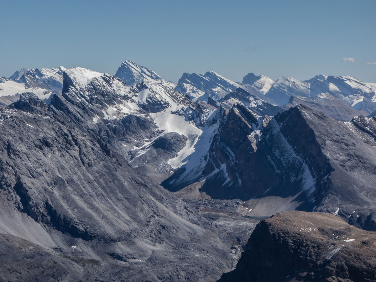
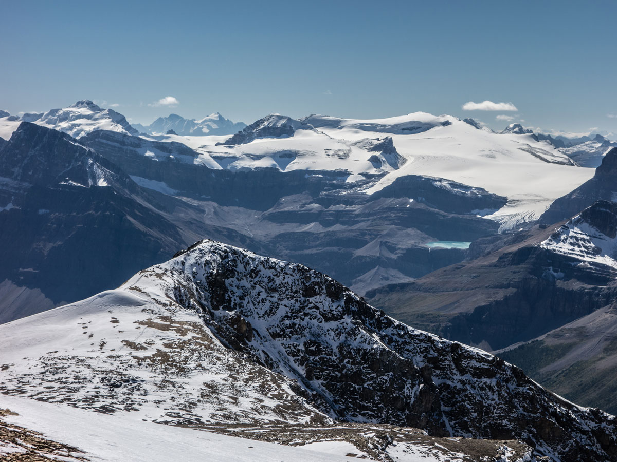
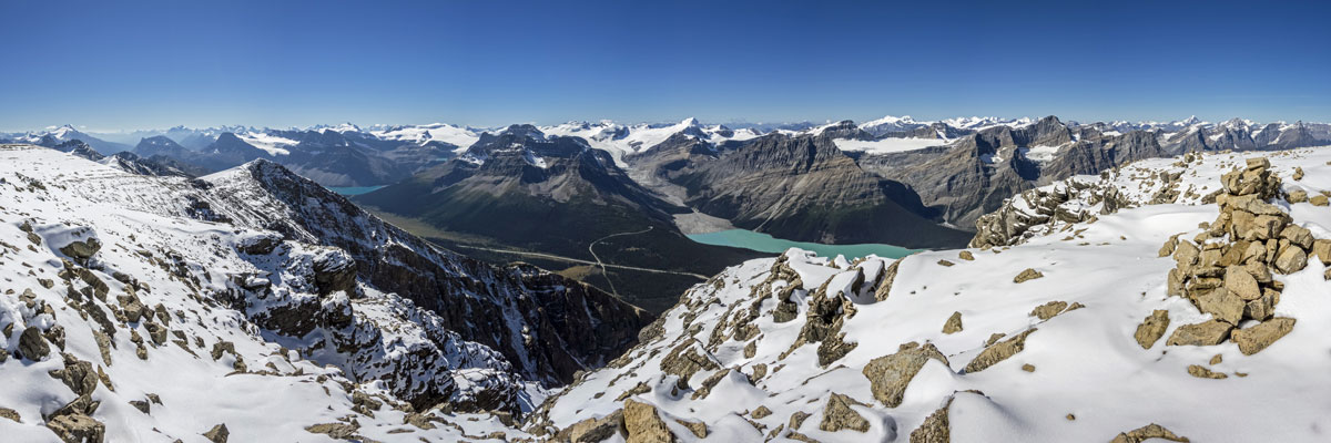
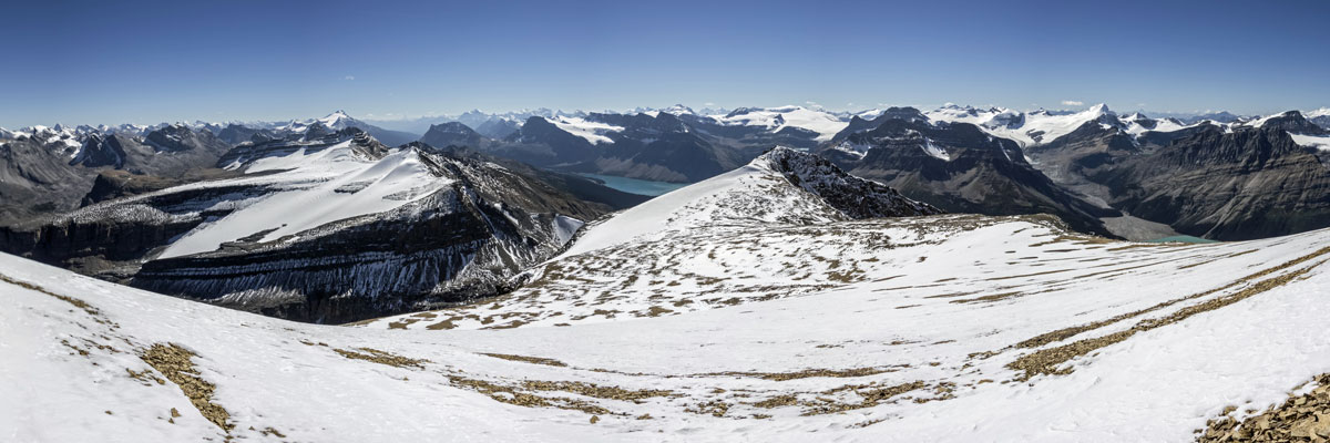
Views from the top are, as expected, expansive! On a clear day, look out for Mt. Assiniboine, nearly visible from 68.4mi away! Spectacular sights include a large portion of the Wapta Icefield, Peyto Lake and Bow Lake (well over a kilometer below), as well as glaciated Mt. Hector, and a sea of other peaks in all directions.
Return the way you came up, taking care on the two challenging bits form the way up.
Insider Hints
Just across the road is another great viewpoint, the Peyto Lake Viewpoint. Consider stopping for a quick look if you start early or finish late, as the softer light makes the view from the Peyto Lake Viewpoint spectacular.
The Icefields Parkway is remote, so make sure you fill up with gas and snacks in Lake Louise ( Laggans and Trailhead Cafe are ideal for this) before the drive. Lake Louise’s Bill Peyto’s Cafe is great place for breakfasts or a well-earned post-hike meal, epecially if you’re staying at the adjacent (and excellent) HI-Lake Louise Alpine Centre.

Similar Scrambles to the Observation Peak Scramble
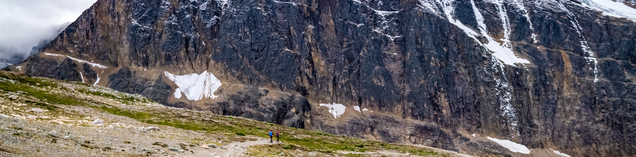
Eiffel Peak
Eiffel Peak isn’t frequented by many who make their way to Moraine Lake. It is a difficult scramble with less…
Mount Edith
Mount Edith scramble begins with the unsuspecting Cory Pass hike before branching off to the right to begin gaining Mount…
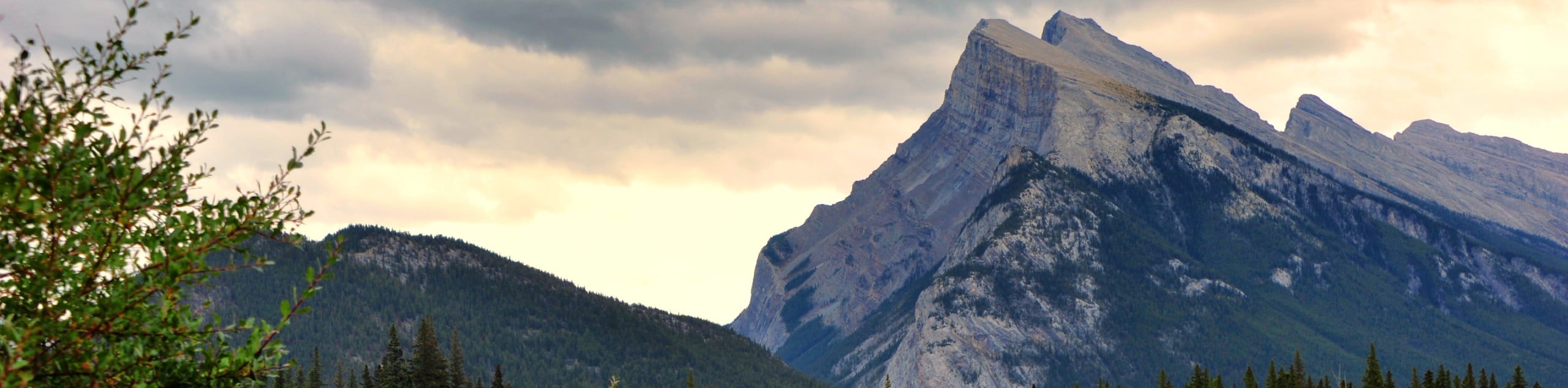
Mount Rundle
Locals stare at Mount Rundle day in and day out, enough to acquire a personal relationship with the impressive feature.…
9stepsM8 5 years ago
It's a great but tough scramble.
Wicked T 5 years ago
Observation peak opens up some amazing views of the lakes around. It's a really astonishing area.