Taft Point via Glacier Point Hike
View Photos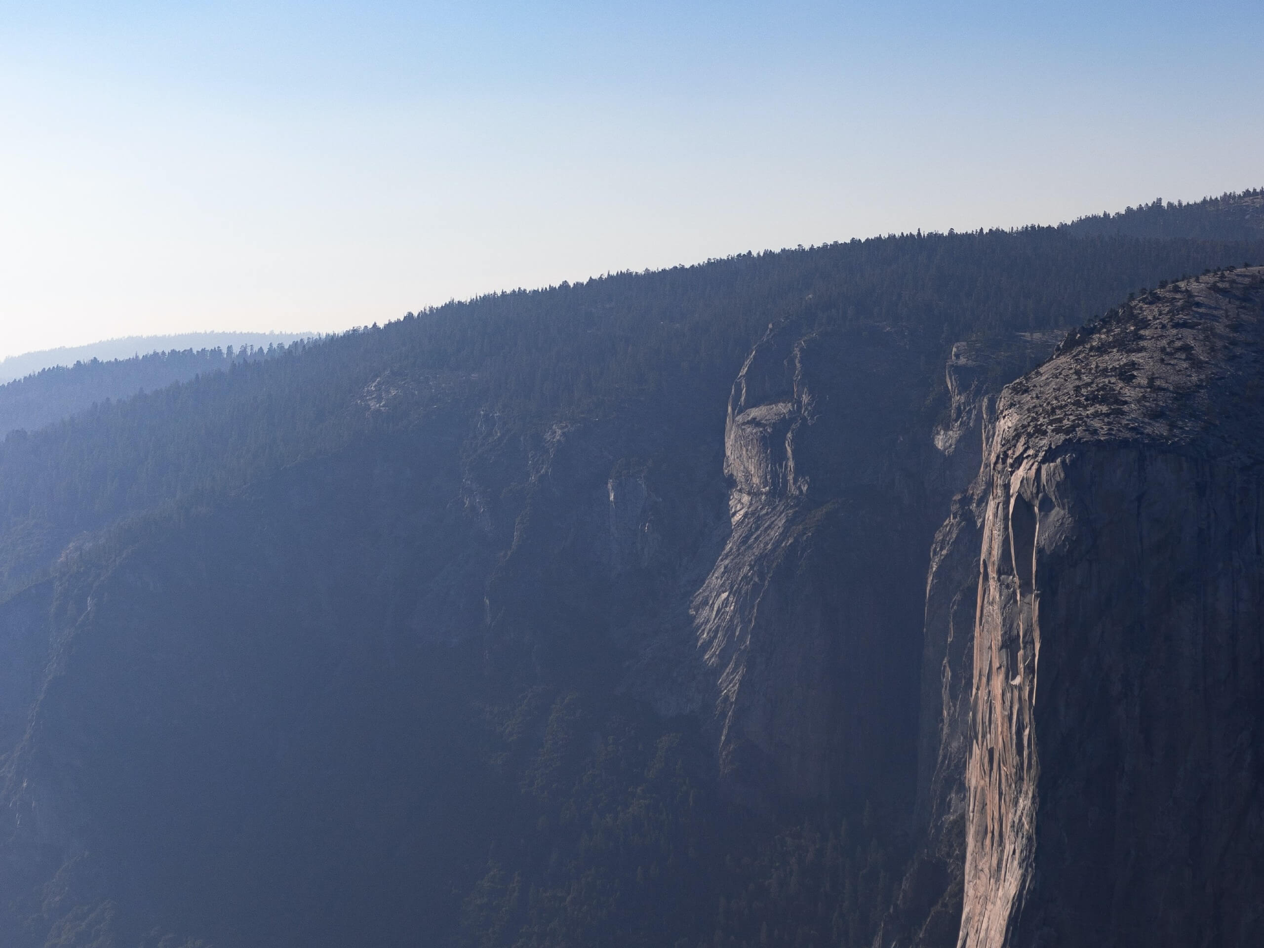
Taft Point via Glacier Point Hike
Difficulty Rating:
The Taft Point via Glacier Point Hike is an epic excursion that boasts knee-buckling views of Yosemite Valley and the famous granite features that adorn the landscape. Wander through mixed pine forests and get a workout in as you follow along the southern rim of the canyon.
Getting there
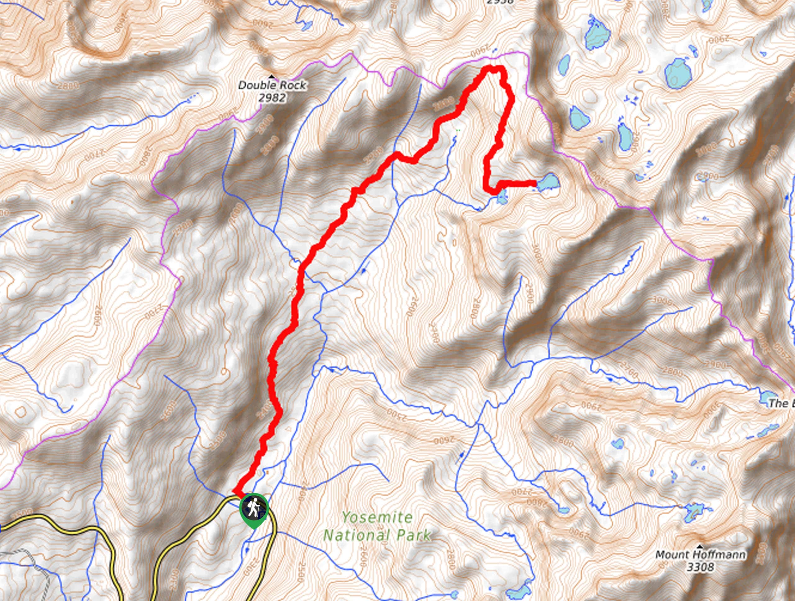
The Taft Point via Glacier Point Hike is accessed via the Glacier Point Trailhead off Glacier Point Road.

About
| Backcountry Campground | No |
| When to do | May-September |
| Pets allowed | No |
| Family friendly | Older Children only |
| Route Signage | Average |
| Crowd Levels | High |
| Route Type | Out and back |
Taft Point via Glacier Point Hike
Elevation Graph
Weather
Taft Point via Glacier Point Hike Description
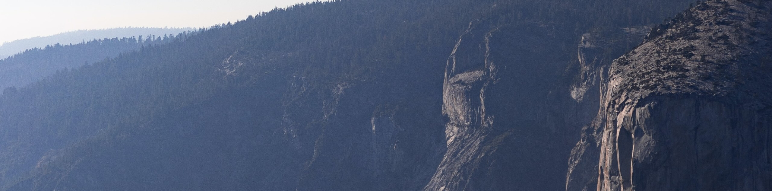
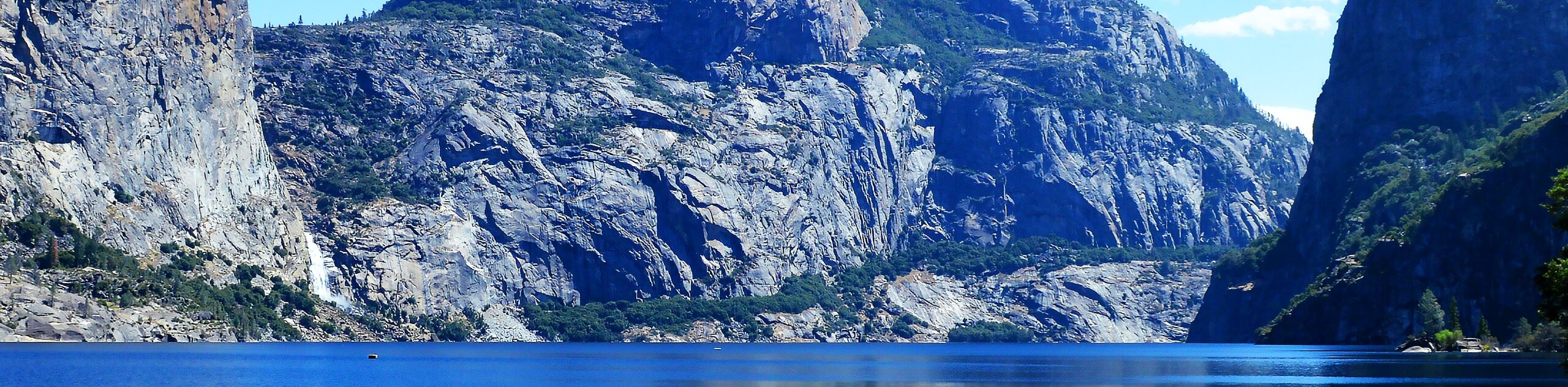
Overwhelm yourself with dramatic panoramas of Yosemite Valley, including views of Half Dome, Yosemite Falls, El Capitan, and more. As the trail is adorned with Jeffrey trees and ponderosa pines, be sure to stick your nose to a tree to get a whiff of the butterscotch and vanilla-smelling conifers. Make sure to wear sturdy footwear, as sections of the path are rough and uneven, most notably at Taft Point. When visiting Taft Point after a good rainfall, be sure to keep your distance from the cliff’s edge as the granite overlook can be incredibly slippery. Note: visitors are subject to a fee charged by the National Park; refer to the NPS website for additional information.
Embark on your adventure from the Glacier Point Trailhead. Setting out along the Panorama Trail, you will be guided west up to Sentinel Point. Revel in the expansive views of the dramatic landscape, then retrace your footing back down the dome to the intersection. Take a sharp left and wander southwest through the mixed pines in order to make your way along the southern rim of Yosemite Valley. Soon the path will intersect with Sentinel Creek, before climbing gently up to Taft Point and The Fissures.
Take some time to revel in the scenery of El Capitan and the bustling valley below. After admiring the grandeur of the landscape, retrace your footing along the path back to the trailhead.
Similar hikes to the Taft Point via Glacier Point Hike hike
Beehive Meadow Trail
The Beehive Meadow Trail is an amazing adventure in Hetch Hetchy that travels through diverse terrains. Cross the O’Shaughnessy Dam,…

Chain Lakes Hike
Explore one of the more secluded trails in Yosemite National Park along the Chain Lakes Hike. This wonderful trail exposes…
Grant Lakes Hike
Immerse yourself in Yosemite’s high country along the Grant Lakes Trail. This epic hike exhibits the grandeur and diversity of…
Comments