Mono Pass Trail
View Photos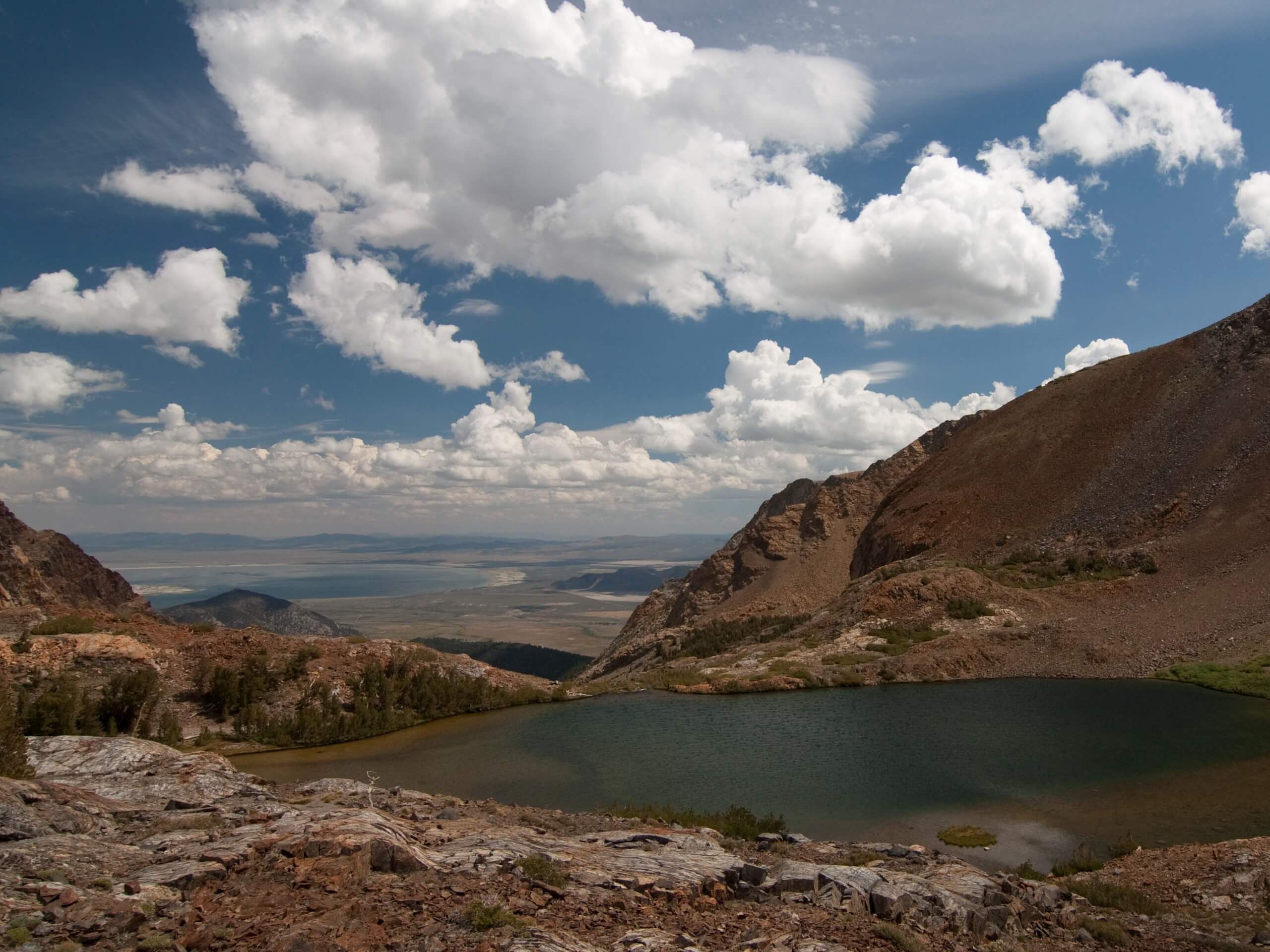
Mono Pass Trail
Difficulty Rating:
The Mono Pass Trail is a lovely excursion in Yosemite that guides adventurers to a high mountain pass overlooking Mono Lake and Bloody Canyon. Get your steps in as you wander into the high country and reward yourself with the area’s breathtaking scenery.
Getting there
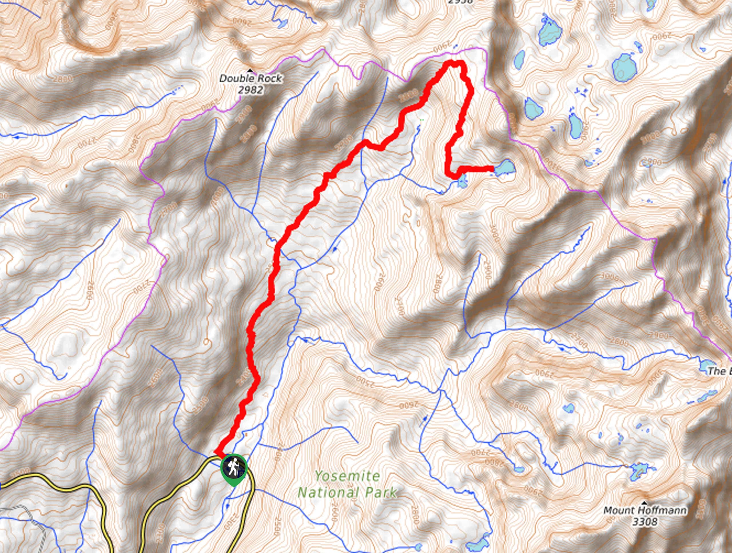
The Mono Pass Trail departs from the trailhead off Tioga Pass Road.

About
| Backcountry Campground | Dispersed Backcountry Camping, Wilderness Permit Required. |
| When to do | March-November |
| Pets allowed | No |
| Family friendly | Older Children only |
| Route Signage | Average |
| Crowd Levels | Moderate |
| Route Type | Out and back |
Mono Pass Trail
Elevation Graph
Weather
Mono Pass Trail Description
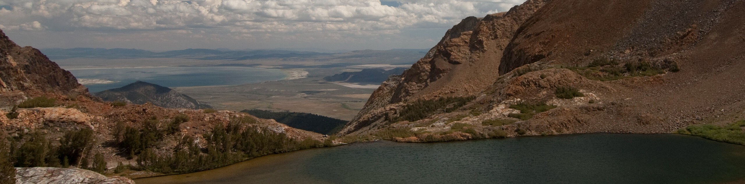
Immerse yourself in Yosemite’s high country along the Mono Pass Trail. This epic adventure travels through lush meadowlands and mixed pine forests before summiting the infamous mountain pass. This excursion boasts the perfect opportunity for a more tranquil, relaxing experience in Yosemite. Appreciate the seclusion as you travel up to the pass and the Sardine Lakes. As most of the trail is exposed, you will want to wear sun protection to beat the effects of overexposure. Additionally, make sure to wear a pair of sturdy footwear, as the terrain is uneven and rocky in sections. Note: Yosemite National Park charges an entrance fee; refer to the NPS website for more information.
Setting out from the trailhead, the Mono Pass Trail travels southeast through meadowlands intersected with several snowmelt streams. As you wander through the exposed meadow, you will be granted views of the granite summits that line the horizon. The path will soon increase in intensity, climbing into the mountain cirque between Mount Gibs, Mount Lewis and Mammoth Peak. Eventually, you will pass Summit Lake before reaching Mono Pass. Revel in the vistas of Mono Lake and continue hiking down to the Sardine Lakes.
Explore the shores of the quaint, shimmering alpine lakes and dip your tired feet in the frigid waters. When you are ready to head back, retrace your footing along the path back to the trailhead.
Similar hikes to the Mono Pass Trail hike
Beehive Meadow Trail
The Beehive Meadow Trail is an amazing adventure in Hetch Hetchy that travels through diverse terrains. Cross the O’Shaughnessy Dam,…

Chain Lakes Hike
Explore one of the more secluded trails in Yosemite National Park along the Chain Lakes Hike. This wonderful trail exposes…
Grant Lakes Hike
Immerse yourself in Yosemite’s high country along the Grant Lakes Trail. This epic hike exhibits the grandeur and diversity of…
Comments