
Laurel Lake Trail
View Photos
Laurel Lake Trail
Difficulty Rating:
The Laurel Lake Trail is an amazing adventure in Yosemite National Park that exhibits the beauty and diversity of the high country. Wander over the O’Shaughnessy Dam and through an eerie tunnel to make your way up to the shimmering alpine lake. This trek is a must add to your Yosemite itinerary!
Getting there
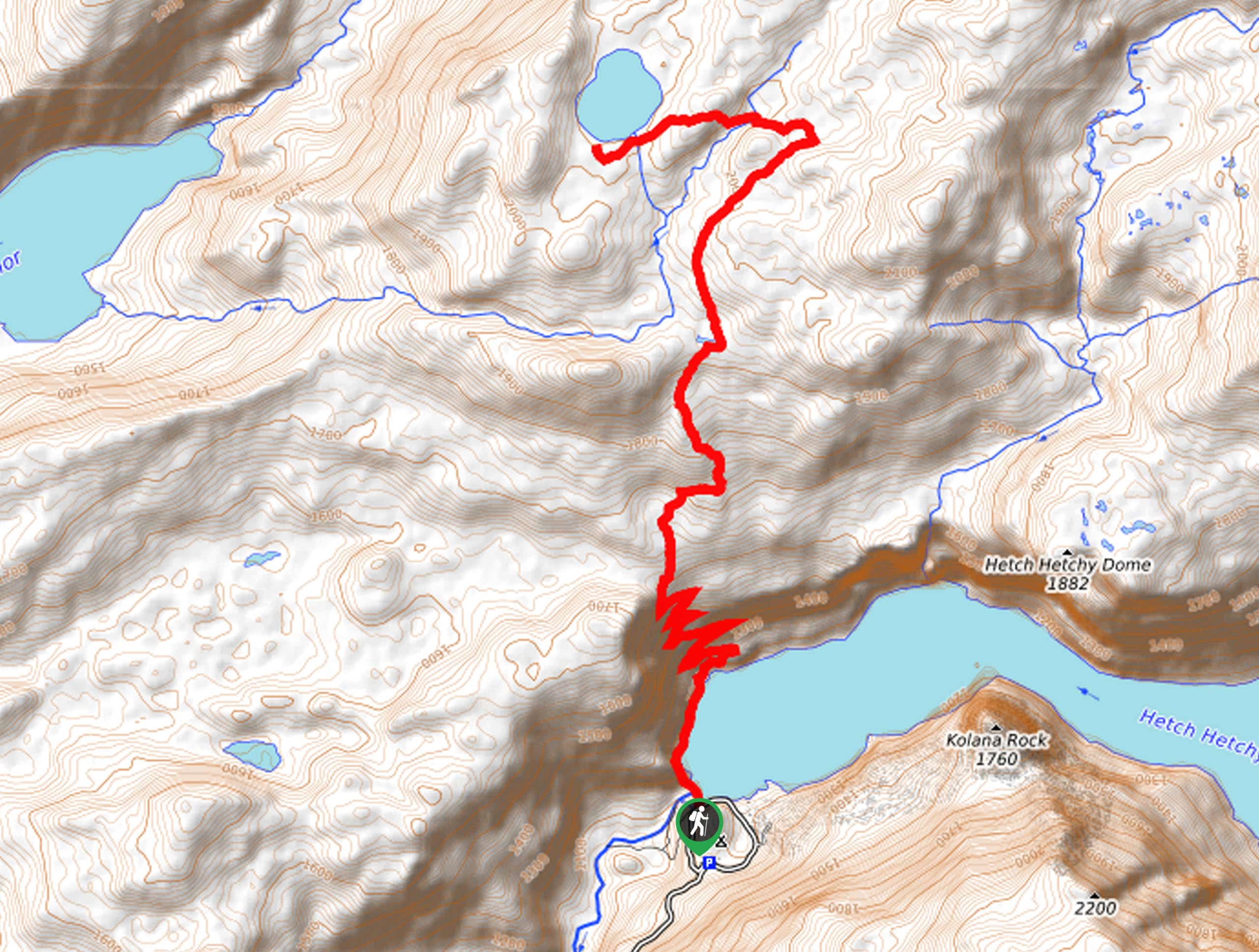
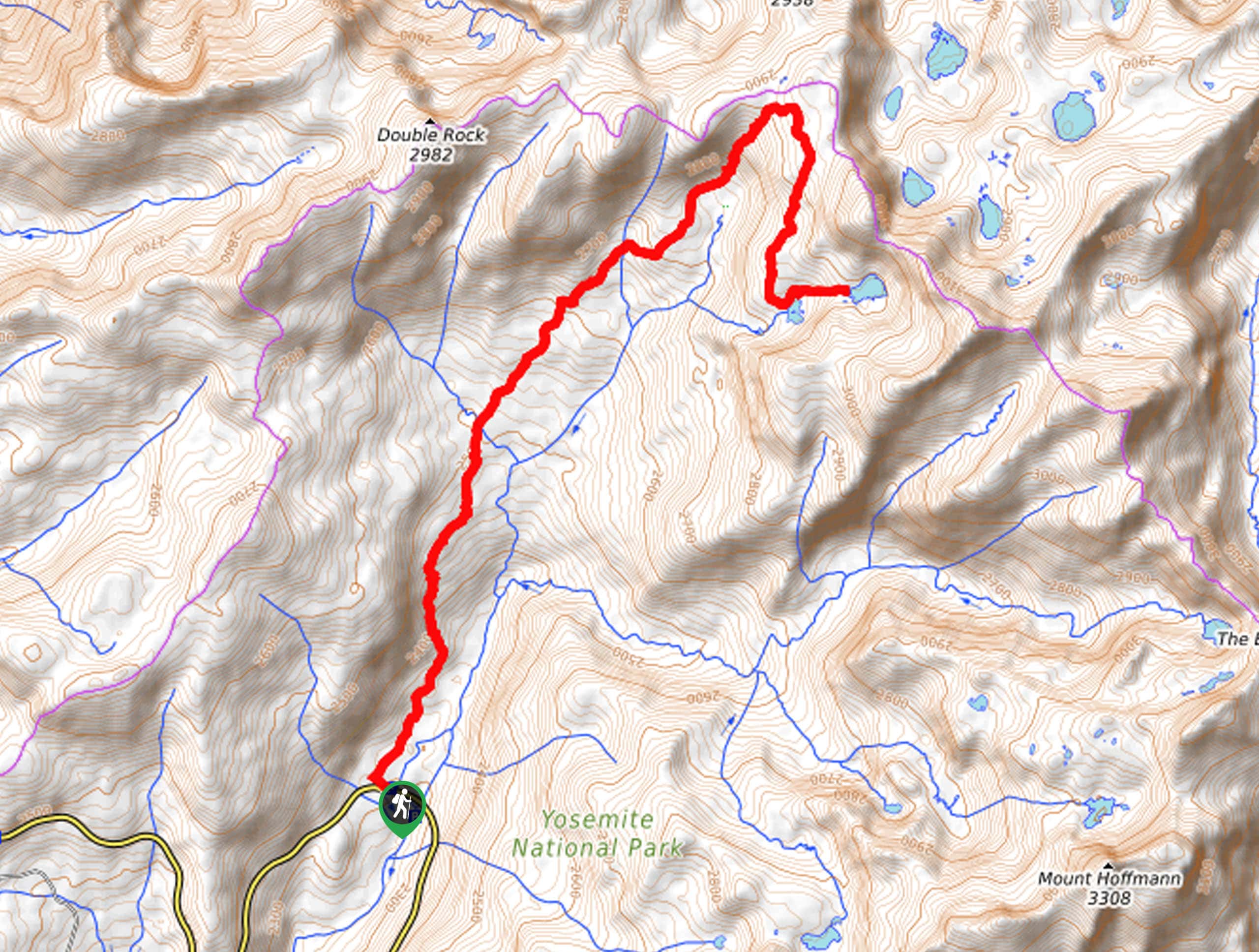
The Laurel Lake Trail departs from the O’Shaughnessy Dam Trailhead off Hetch Hetchy Road.

About
| Backcountry Campground | Backcountry Camping, Wilderness Permit Required. |
| When to do | April-October |
| Pets allowed | No |
| Family friendly | No |
| Route Signage | Average |
| Crowd Levels | Moderate |
| Route Type | Out and back |
Laurel Lake Trail
Elevation Graph
Weather
Laurel Lake Trail Description
The Laurel Lake Hike is an epic excursion that we can’t recommend enough! Impressively scenic and strenuous, you get the best of both worlds along this hike. Be sure to pack plenty of water, as this route will surely get your heart pumping! A sturdy pair of footwear, bear spray, and a bear bell are also a good idea. As this trek is long, we strongly encourage you to head out early to avoid having to walk back to the trailhead in the dark. The National Park charges an entrance fee; check out the NPS website for additional information.
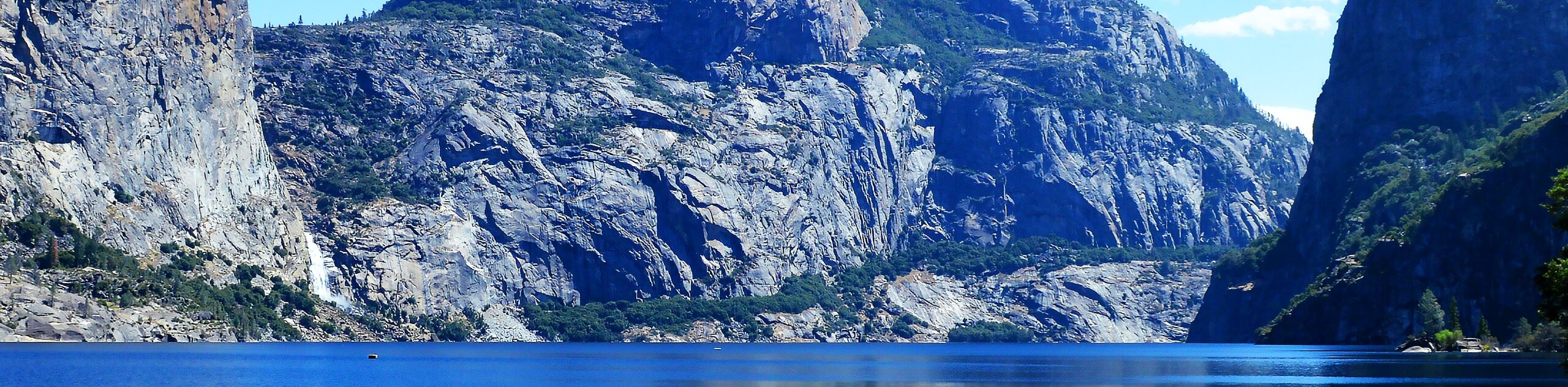
Setting out from the O’Shaughnessy Dam Trailhead, follow the Laurel Lake Trail over the dam which bounds Tuolumne River. Revel in the view of the shimmering waters hemmed by granite domes, before continuing along the path through the tunnel and along a forest-lined path. Soon you will reach an intersection and veer left onto the Miguel Meadow Fire Road. Here, you will navigate several wide switchbacks up to another junction. Keep right and trek the unnamed path northeast through the woodlands. At the next fork in the road, take another right, followed by a left at the next junction. You will soon reach the shore of Laurel Lake.
Admire the postcard-perfect scene of the shimmering lake encircled by mixed conifers and granite bluffs. Take some time to rest and rehydrate, before retracing your steps along the route back to the trailhead.
Similar hikes to the Laurel Lake Trail hike
Beehive Meadow Trail
The Beehive Meadow Trail is an amazing adventure in Hetch Hetchy that travels through diverse terrains. Cross the O’Shaughnessy Dam,…

Chain Lakes Hike
Explore one of the more secluded trails in Yosemite National Park along the Chain Lakes Hike. This wonderful trail exposes…
Grant Lakes Hike
Immerse yourself in Yosemite’s high country along the Grant Lakes Trail. This epic hike exhibits the grandeur and diversity of…
Comments