Four Mile Trail to Mist Trail
View Photos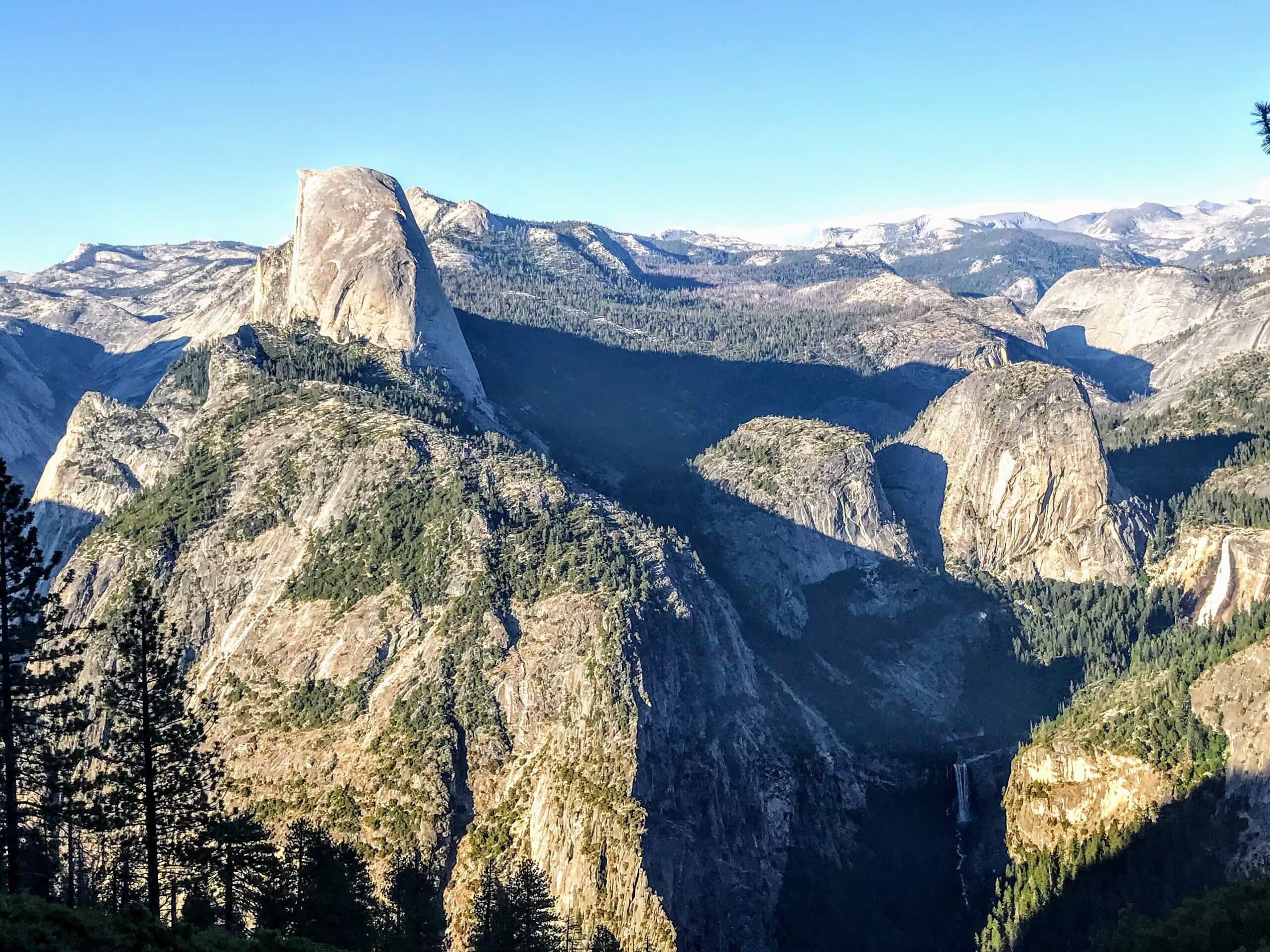
Four Mile Trail to Mist Trail
Difficulty Rating:
Hiking the Four Mile Trail to Mist Trail is a demanding experience in Yosemite National Park. Start from the Yosemite Canyon Floor, summit the southern rim, then climb back down into the canyon. Passing several famous lookout points and waterfalls along the way, there is no shortage of scenery to keep you motivated.
Getting there
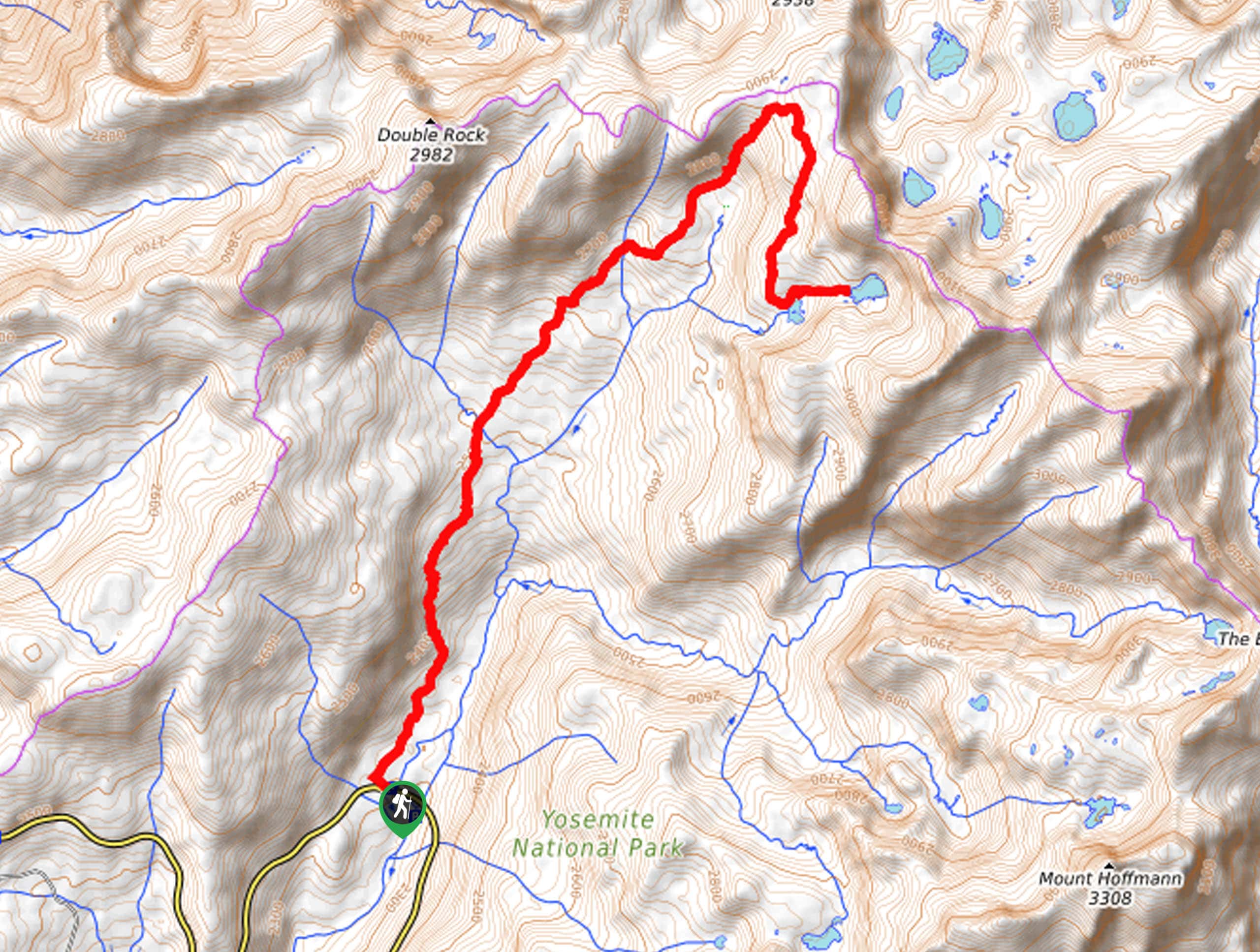
The Four Mile Trail to Mist Trail departs from the Four Mile Trailhead off Southside Drive.

About
| Backcountry Campground | Backcountry Camping, Wilderness Permit Required. |
| When to do | May-October |
| Pets allowed | No |
| Family friendly | Older Children only |
| Route Signage | Average |
| Crowd Levels | Moderate |
| Route Type | One Way |
Four Mile Trail to Mist Trail
Elevation Graph
Weather
Four Mile Trail to Mist Trail Description
The Four Mile Trail to Mist Trail is an epic one-way adventure from the Yosemite Valley floor up to the top of the southern rim. Put your stamina to the test as you navigate 4426ft of elevation along this trek. Reserved for intrepid spirits and experienced hikers, proper preparation and equipment is necessary. Additionally, don’t forget to leave a car at the Mist Trailhead or arrange for pickup—the last thing you will want to be doing after this exhausting hike is figuring out transportation! The National Park charges an entrance fee; refer to the NPS website for additional information.
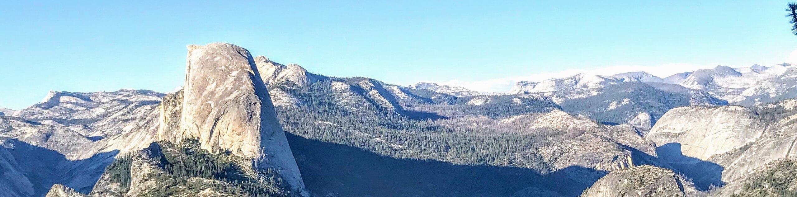
Setting out from the Four Mile Trailhead, the Four Mile Trail to Mist Trail will begin to climb almost immediately. Navigate several sets of switchbacks up to Union Point, where you can take a break to revel in the epic views of Yosemite Falls. Continue up the trail and mind your footing on the steep and rocky terrain. Here, you will maneuver yet another set of switchbacks to eventually reach Glacier Point, a famous overlook of Yosemite Valley and the Sierra Nevada Peaks. Enjoy views of the Half Dome, Clouds Rest, Yosemite Falls, and Tenaya Canyon. At this point, hook onto the Panorama Trail and head down to Illilouette Fall.
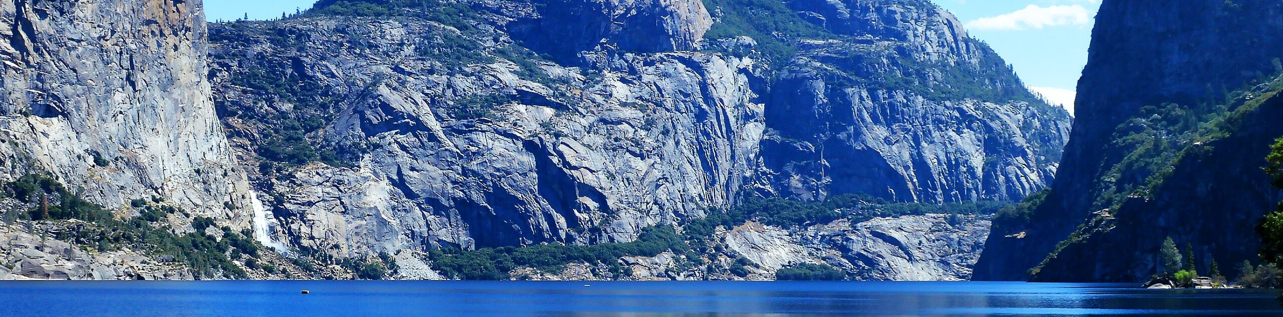
Follow the Panorama Trail to the route’s end, where you will merge onto the rightmost John Muir Trail. Hike this path down and over Nevada Falls, diverting left onto the Mist Trail. From here, wander the Mist Trail west down Nevada Falls and Vernal Falls all the way to the Mist Trailhead, which marks the end of your adventure.
Similar hikes to the Four Mile Trail to Mist Trail hike
Beehive Meadow Trail
The Beehive Meadow Trail is an amazing adventure in Hetch Hetchy that travels through diverse terrains. Cross the O’Shaughnessy Dam,…

Chain Lakes Hike
Explore one of the more secluded trails in Yosemite National Park along the Chain Lakes Hike. This wonderful trail exposes…
Grant Lakes Hike
Immerse yourself in Yosemite’s high country along the Grant Lakes Trail. This epic hike exhibits the grandeur and diversity of…
Comments