Back Basin Trail
View Photos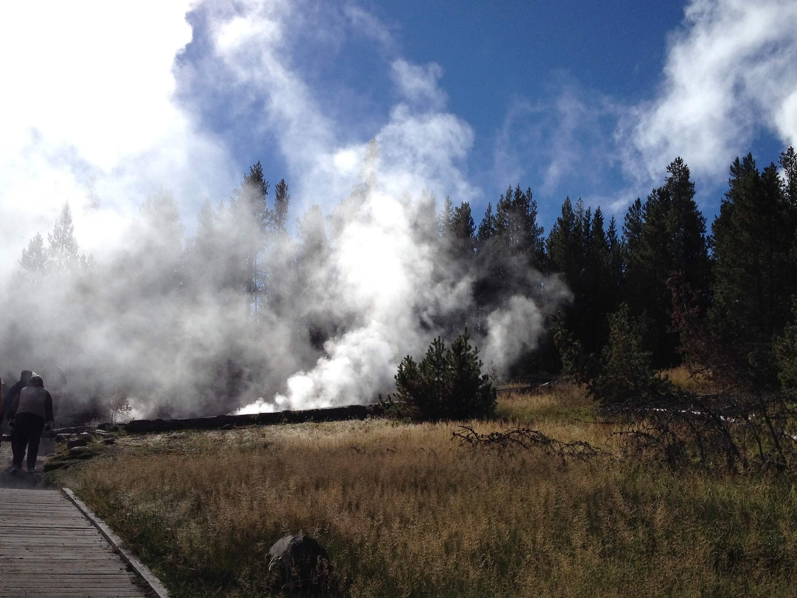
Back Basin Trail
Difficulty Rating:
The Back Basin Trail is a fantastic hike through an active geothermal basin. This trail features the World’s tallest active geyser: The Steamboat Geyser. This trail is family-friendly and appropriate for hikers of all ages and skill levels.
Getting there
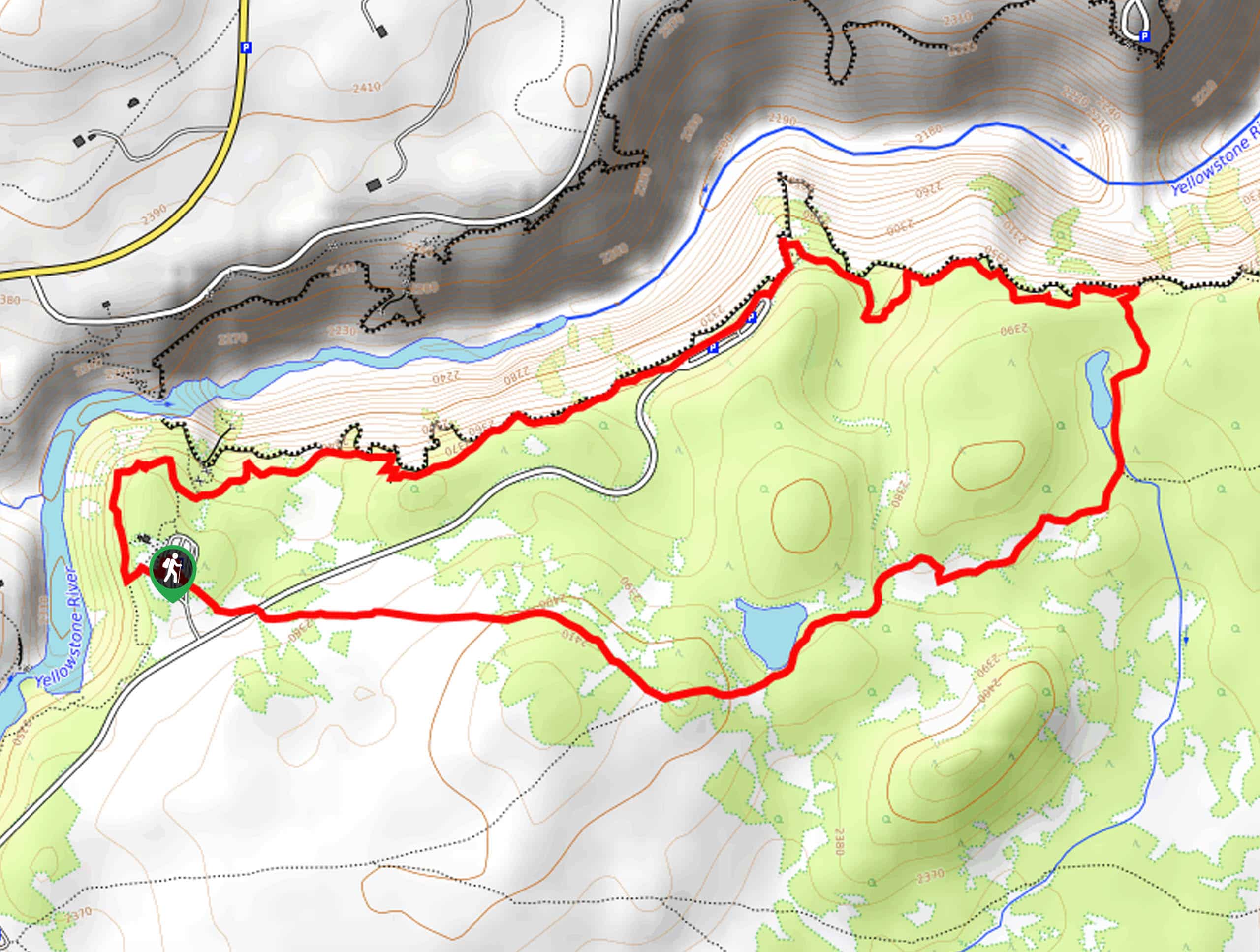
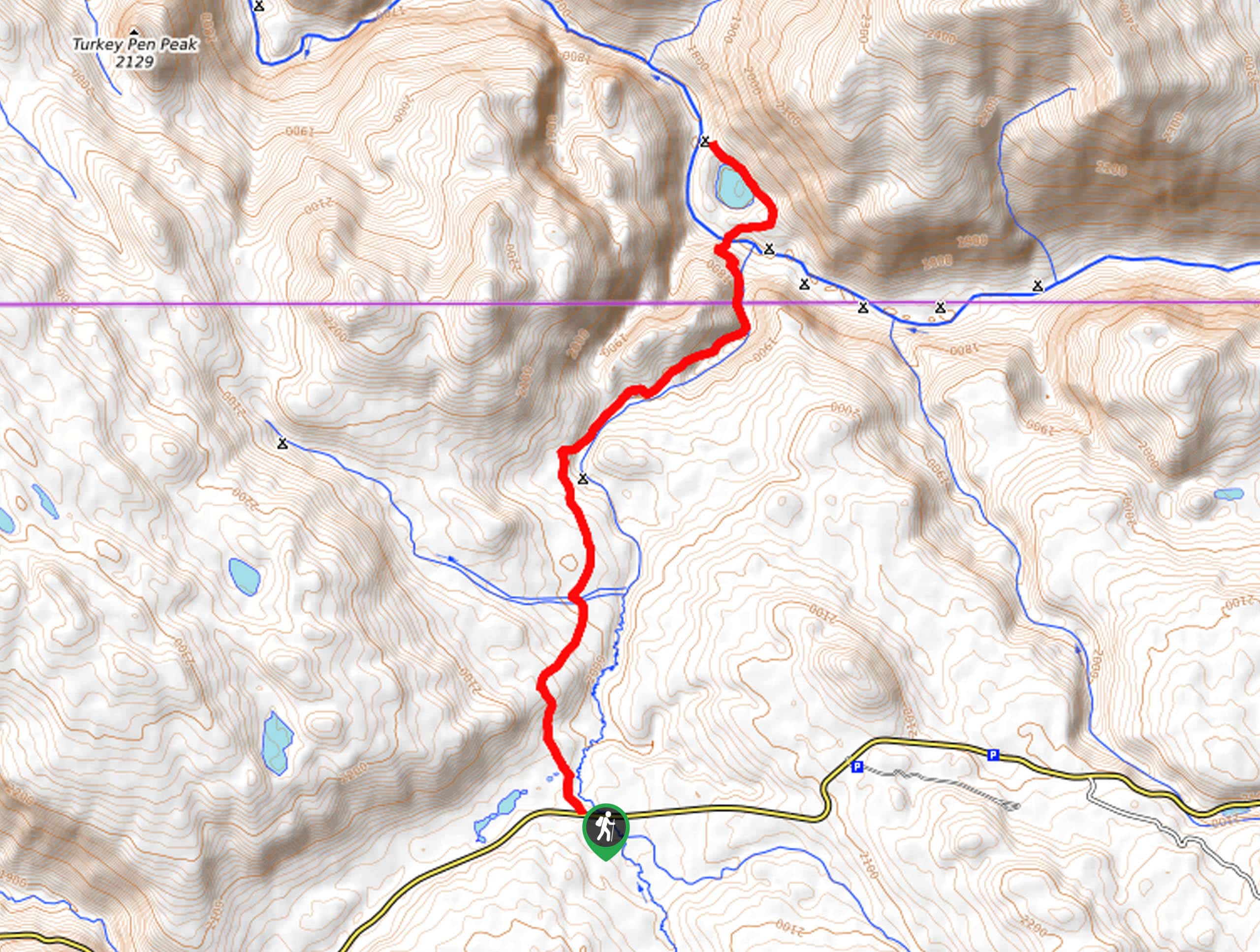
This hike begins at the Norris Geyser Basin Museum off of Grand Loop Road.

About
| Backcountry Campground | No |
| When to do | May to October |
| Pets allowed | No |
| Family friendly | Yes |
| Route Signage | Average |
| Crowd Levels | Moderate |
| Route Type | Circuit |
Back Basin Trail
Elevation Graph
Weather
Back Basin Trail Description
The Back Basin Trail is an easy hike past some incredible geothermal features in Yellowstone National Park. There is not a ton of shade along this trail, so wear sunscreen, a sunhat, and bring lots of water for everyone in your hiking party. The Back Basin Trail is not as popular as other basin hikes in the area, but it can still get crowded. If you are hiking this route during tourist season, we suggest heading out early in the day to beat the crowds.
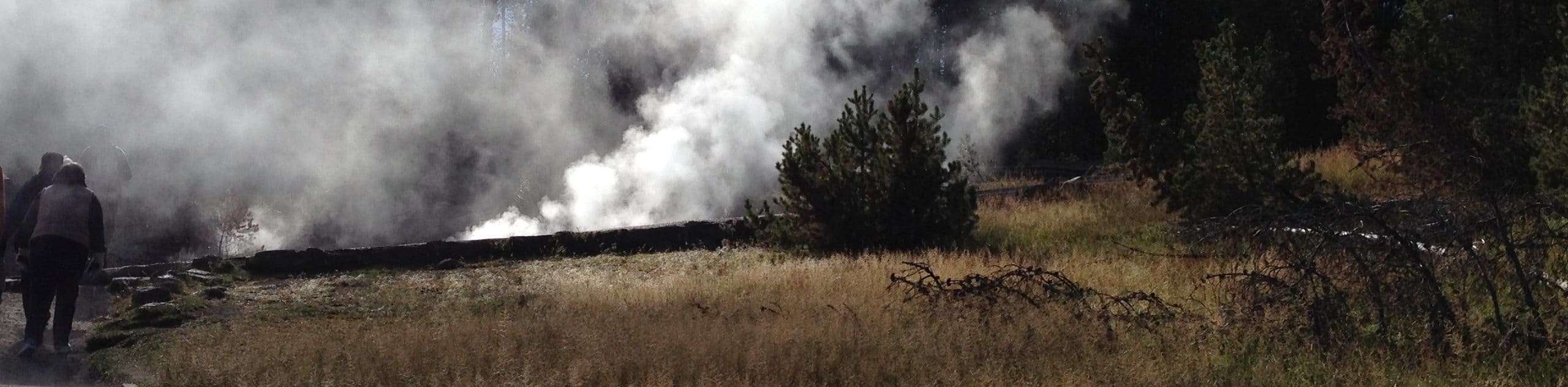
With a myriad of geothermal features and spectacular views, the Back Basin Trail is a great way to sample Yellowstone National Park. This trail follows a well-maintained boardwalk, but, unfortunately, it is not wheelchair accessible or stroller-friendly. The Back Basin Trail features the World’s largest active geyser: The Steamboat Geyser. This geyser is unpredictable, although small eruptions of 6ft–40ft do happen quite frequently. When this geyser really goes, it goes big, shooting scalding water over 300ft in the air.
To hike the Back Basin Trail, begin at the Norris Geyser Basin Museum and follow the boardwalk south to hike clockwise around the basin. Going south, you will pass the Emerald Spring and Dr. Allen’s Paintpot on the way to the Steamboat Geyser. Stop at the Steamboat geyser and see if you can catch it erupting, then continue down to a divide at the Cistern Spring. At this divide, take the path on your left to hike past a series of mud vents and geysers, including the Vixen Geyser and the Porkchop Geyser. Just past the Vixen Geyser, the trail will divide once more; stay left at this divide to make your way back around to the Trailhead where you began.
Before heading home, check out the Norris Geyser Museum or hike around the Porcelain Basin Trail for even more incredible geothermal wonders.
Trail Highlights
Steamboat Geyser
Located in the Back Basin, the Steamboat Geyser is the tallest active geyser globally. This geyser has both minor and major eruptions. Minor eruptions are quite frequent and range from 6ft–40ft in height. Major eruptions are highly unpredictable but can reach more than 300ft in height. The significant eruptions of the Steamboat Geyser shoot silica, water, and debris into the air in a dramatic and volcanic display. Visitors have reported hearing the major eruptions of the Steamboat Geyser from more than a mile away.
Porkchop Geyser
The Porkchop Geyser used to be a small porkchop-shaped pool with minor eruptions that delighted the visitors of Yellowstone National Park. In 1985, the activity of the Porkchop geyser increased markedly with a perpetual spout shooting water 20ft–30ft in the air. This was the status quo for the geyser until September 5th, 1989, when the Porkchop geyser exploded, shooting rocks as large as 3ft in size out of the ground. The result of this explosion, a 30ft crater, is now all that is left of this once charming little geyser.
Frequently Asked Questions
How long is the Back Basin Trail in Yellowstone?
The Back Basin Trail is a 2.6mi long hike in Yellowstone National Park.
Insider Hints
Geothermal features in the Back Basin and elsewhere in Yellowstone National Park are hot and dangerous, so do not leave the designated trail.
Parking at this trailhead can be tricky. Go early in the day or after 6pm in the summer to beat the crowds and snag a parking spot.
Similar hikes to the Back Basin Trail hike
Clear Lake and Artist’s Point Loop
The Clear Lake and Artist’s Point Loop is an easy, scenic hiking circuit in Yellowstone. This trail features incredible views…
Turbid Lake Trail
The Turbid Lake Trail is an adventurous hike in Yellowstone. This trail is not well maintained and requires navigation and…
The Crevice Lake Trail
The Crevice Lake Trail is a gorgeous hike in Yellowstone. This trail can be done as a day hike or…
Comments