The Sinks Canyon Trail
View Photos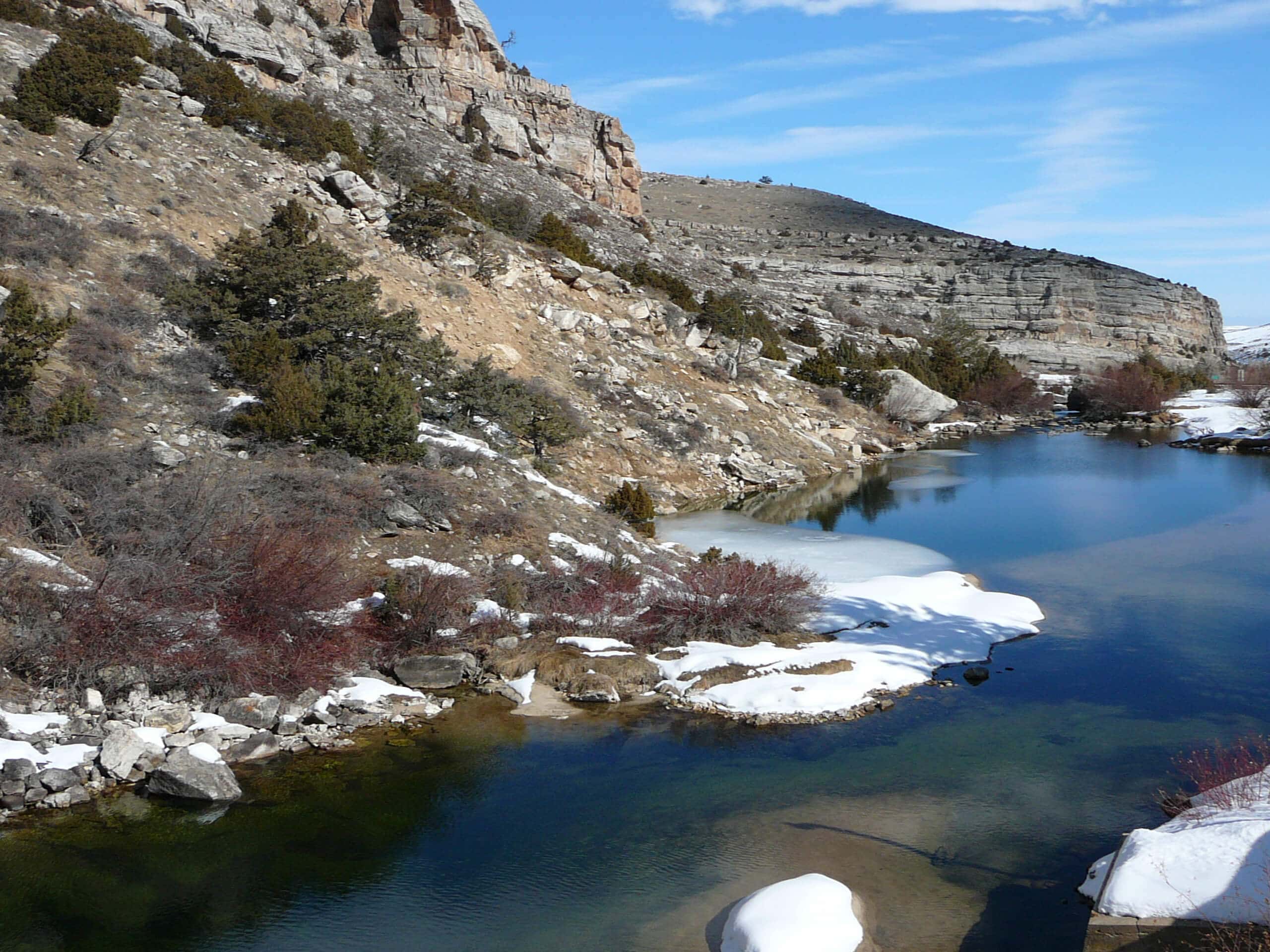
The Sinks Canyon Trail
Difficulty Rating:
The Sinks Canyon Trail is a family-friendly adventure through a picturesque Canyon south of Lander, bisected by the Popo Agie River. Surprisingly, the beautiful scenery isn’t the main attraction, instead, it's the geological mystery of the Popo Agie River vanishing into a limestone cave beneath the ground only to reappear a half-mile away at ‘the Rise’. A magnet for outdoor explorers and geologists alike, a trip to The Sinks is worth adding to your itinerary.
Getting there
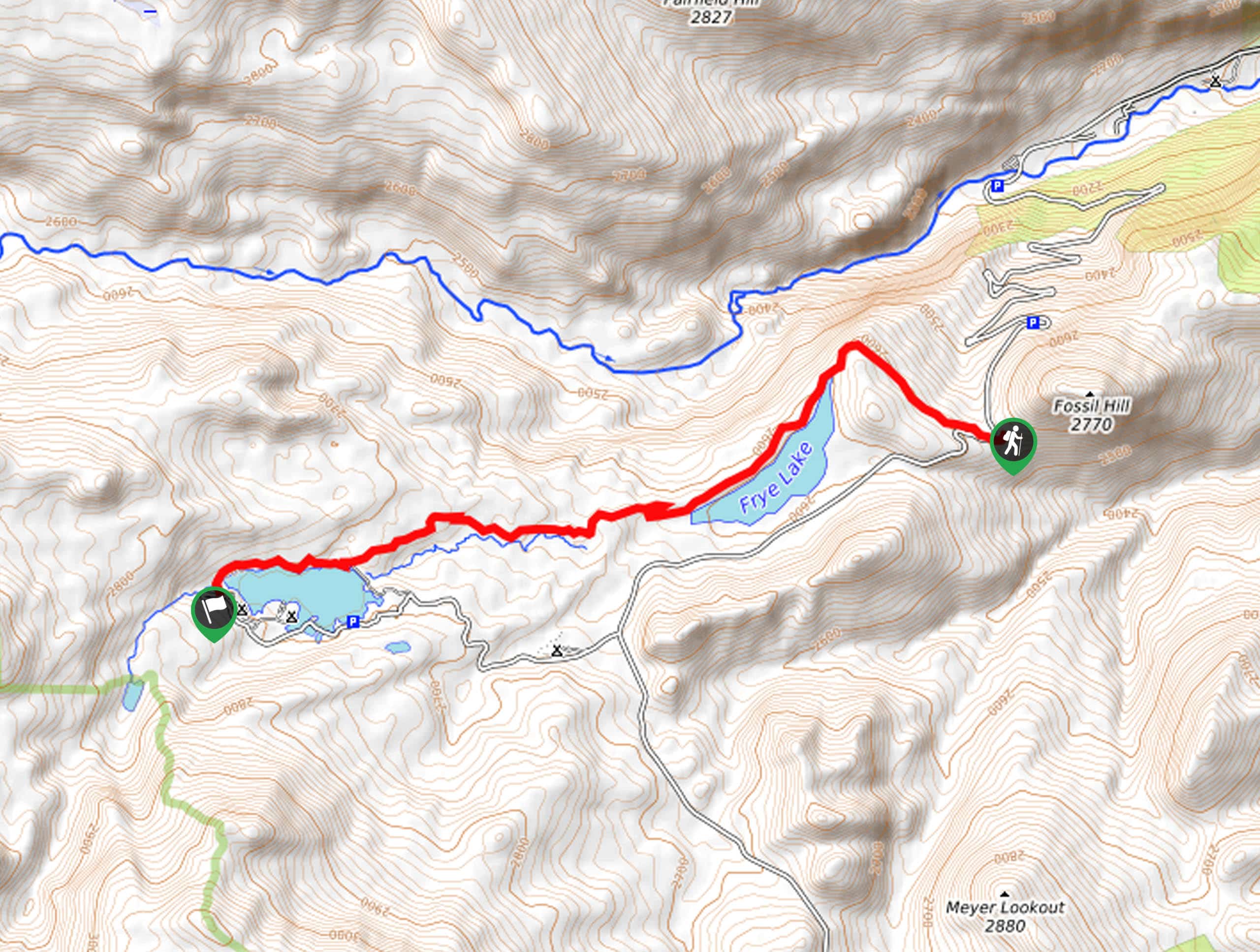
The Sinks Canyon Trail is accessed via the Sinks and the Rise Trailhead off the Sinks Canyon Road.

About
| Backcountry Campground | |
| When to do | Year-round |
| Pets allowed | Yes - On Leash |
| Family friendly | Yes |
| Route Signage | Average |
| Crowd Levels | High |
| Route Type | Out and back |
The Sinks Canyon Trail
Elevation Graph
Weather
The Sinks Canyon Trail Description
The Sinks Canyon Trail is a short and sweet adventure to a unique geological site sure to mystify. While the route is open year-round, the park and the road are unmaintained in the off-season. Winter exploration also presents inherent challenges, the main being slippery conditions, notably around the cavern and on the rocky river banks! Though not the busiest trail in the state, this route sees plenty of curious day-trippers, so we encourage early morning exploration for a more tranquil experience. As with all hikes and adventures in the area, make sure you or someone you are with carries bear spray!
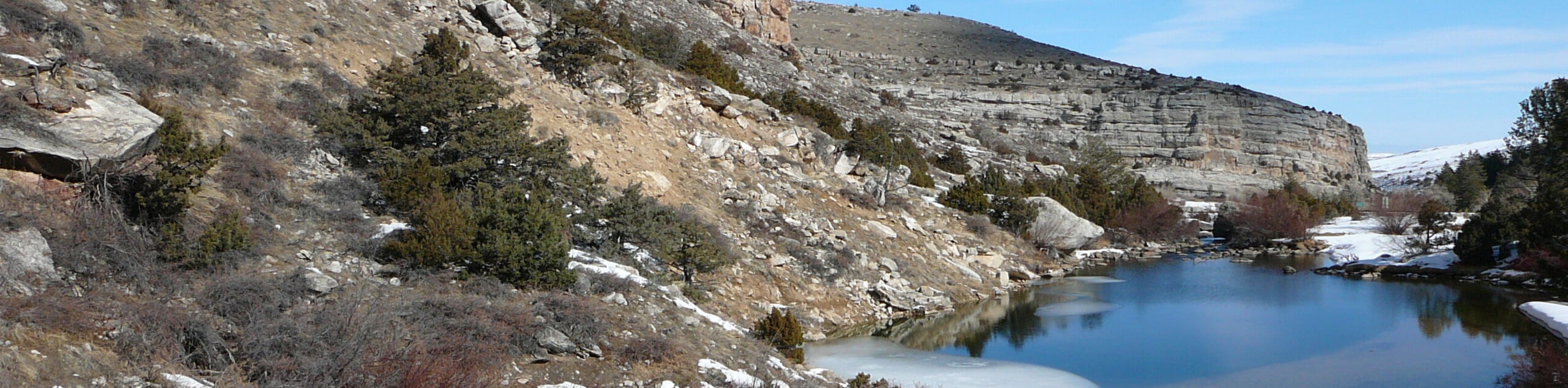
Beckoning curious tourists, geologists, and history buffs alike, this natural anomaly will never cease to amaze. Though there is a small network of routes in the area, the Sinks Canyon Trail is the most direct and family-friendly option. Wander along the meandering river and notice the water bubbling up from the Rise before reaching the impressive cavern where the river flows into the cracks and crevices, disappearing underground. While impressive year-round, springtime exploration offers impressive views of blooming wildflowers and water surging through the Overflow Channel. Don’t forget to take your camera; the scenery is quite photogenic.
Your journey along the Rise Canyon Trail begins from the Sinks and the Rise Trailhead off the Sinks Canyon Road. At this point, you will explore the Rise. Admire the anomaly of the bubbling water. Marvel at the sights, then track the Sinks and the Rise Trail southwest parallel to the Sinks Canyon Road. As you wander this route, wonderful views of the Sinks Canyon and the foothills of the Wind River Range will unfold before you. After some hiking, the route will cross over the Sinks Canyon Road—exercise caution as you cross this route.
Reconnecting with the Sinks and the Rise Trail, you will be led south through abundant wildflower meadowlands, and sparse tree stands. Nearing the Popo Agie River, you will likely notice a stretch of smoothed rocks which is usually barren, but in the spring, this channel is surging with overflow snowmelt that missed the mark of the Sink Cavern. Continue trekking this route, and you will likely notice the company of more explorers heading to the Cavern.
After passing the visitors center, you will reach the Sink. Take the time to explore this geological site. Revel in the scene of the water vanishing into the limestone cavern floor. While you will likely notice intrepid adventurers exploring the cave up close, this is not recommended as the terrain is extremely slippery, and humans can negatively affect the fragile environment. Admire the intricacy of the cavern and take the time to realize how far it travels underground before resurfacing at the Rise. Snap a few photos, then head back the way you came to the trailhead.
Trail Highlights
The Sinks and the Rise
Located on the Popo Agie River in the Sinks Canyon are the geological mysteries known as the Sinks and the Rise. Nestled between the towering limestone walls, the Popo Agie River mysteriously disappears beneath the ground, appearing again hundreds of yards away. What is known as the Sinks is the limestone cavern where the river vanishes, and the Rise is just north where the water reappears. It is likely that the glaciers created the Sinks and Rise in the Ice Age.
Frequently Asked Questions
Why is it called Sinks Canyon?
The Sinks Canyon is named for the Popo Agie River that disappears into a limestone cavern and appears again at the Rise hundreds of yards away.
Where are the Sinks?
The Sinks and the Rise are located in the Sinks Canyon State Park just southwest of Lander, Wyoming.
Insider Hints
Head out in the spring when the wildflowers are blooming
Be mindful of your footing as roots and rocks obstruct the path
Bring bear spray and make sure you know how to properly use it need be
When exploring in the late summer the cave becomes visible and ideal for exploration
Though tempting, this area is not a place for swimming
Wear SPF in the summer months as there is limited tree shade
The trout here go crazy for fish food—bring a quarter and see for yourself!
Similar hikes to the The Sinks Canyon Trail hike
Upper Brewers Trail
The charm of a one-way trek is unrivaled. Enjoy new scenery every step of the way as you hike the…
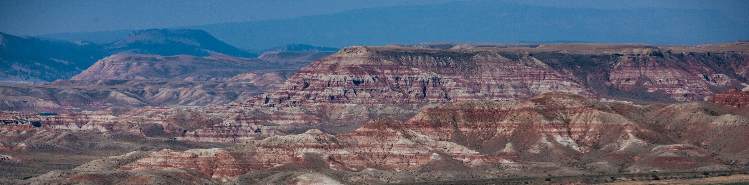
Dubois Recreation Area Scenic Overlook Hike
The Dubois Recreation Area Scenic Overlook Hike is an epic adventure that explores the painted hills. Located just outside the…
Downtown Dubois Walk
While not technically a hiking route, the Downtown Dubois Walk is a great adventure. Many people visiting the Winds or…
Comments