Goat Lake Trail
View Photos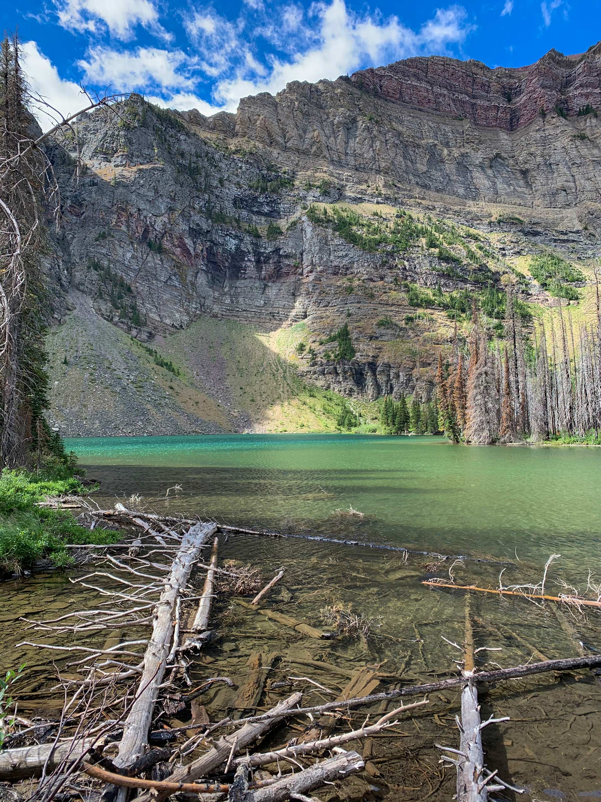
Goat Lake Trail
Difficulty Rating:
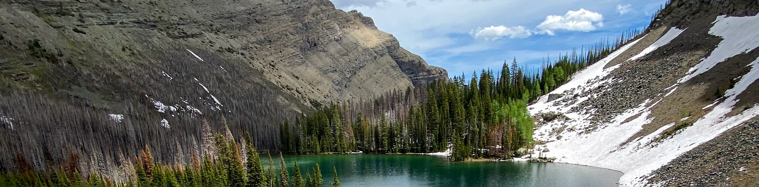
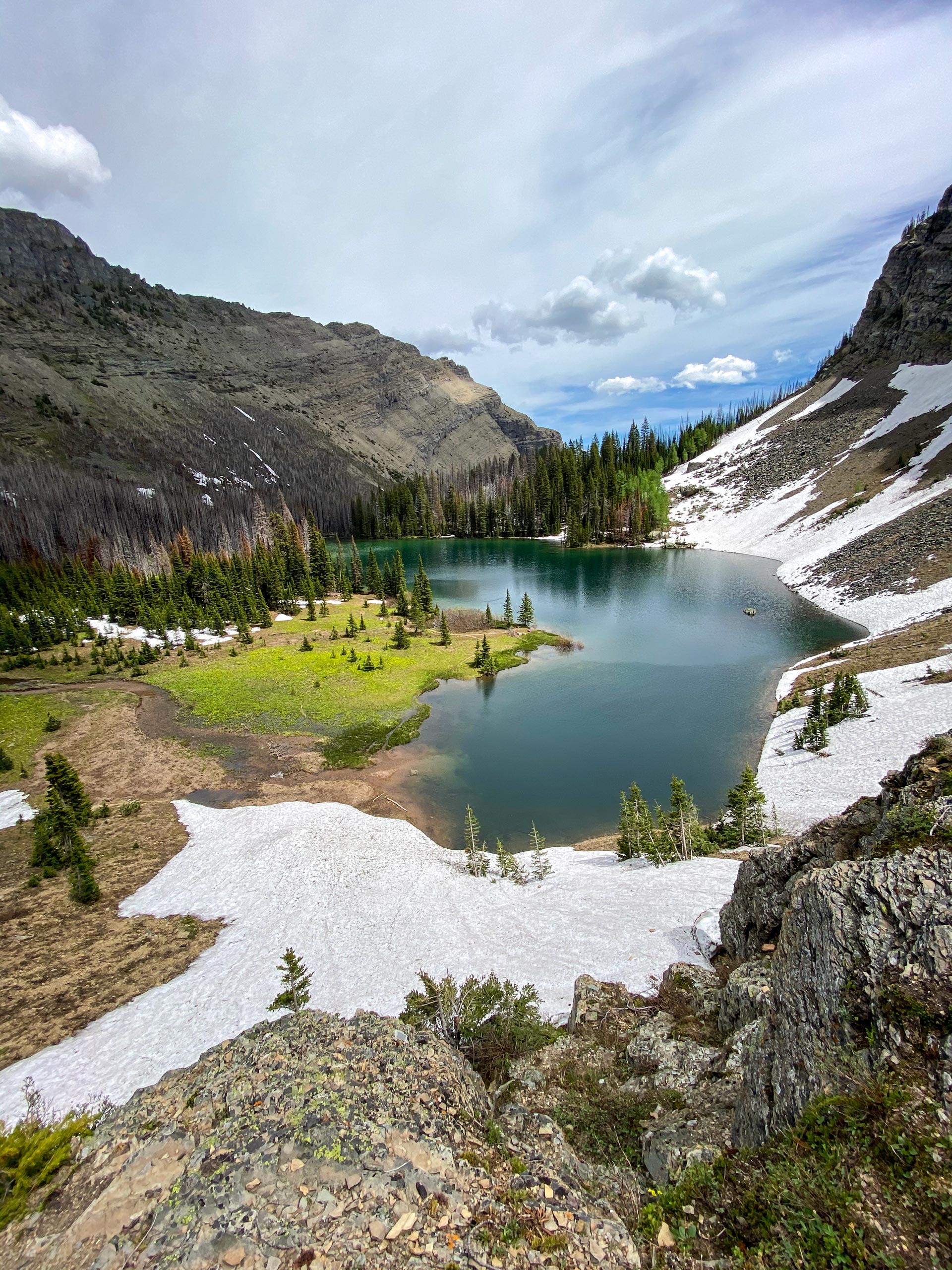
The Goat Lake trail in Waterton Lakes National Park leaves from the Red Rock Parkway and makes its way up through the forest. You’ll be able to catch some views between switchbacks as you make your way up to Goat Lake. From the lake, enjoy your time here, taking in the incredible panoramic views.
Getting there
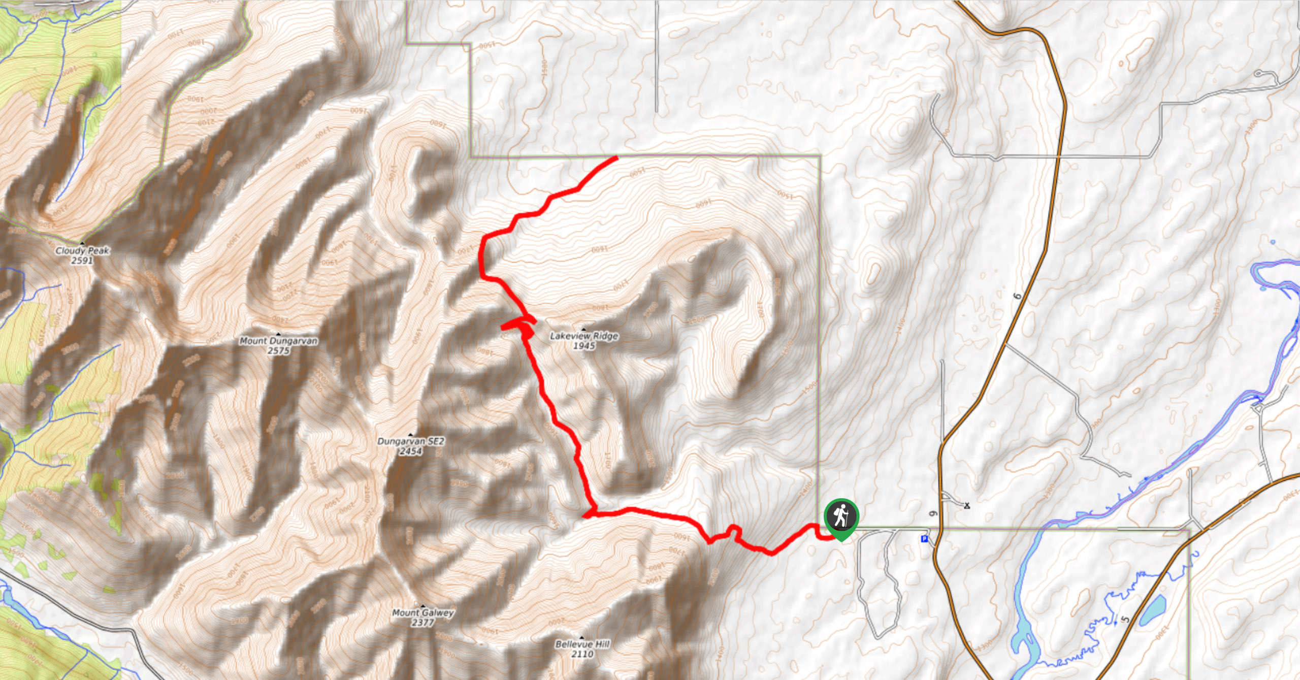
To get to Goat Lake, start in the Waterton Townsite and take the Red Rock Parkway to the very end. The parking lot for the Goat Lake trail is here and well signed.

About
| When to do | May–September |
| Backcountry Campsites | Goat Lake (closed due to fire damage) |
| Pets allowed | Yes - On Leash |
| Family friendly | Older Children only |
| Route Signage | Average |
| Crowd Levels | Moderate |
| Route Type | Out and back |
Goat Lake Trail
Elevation Graph
Weather
Goat Lake Hike Trail Description
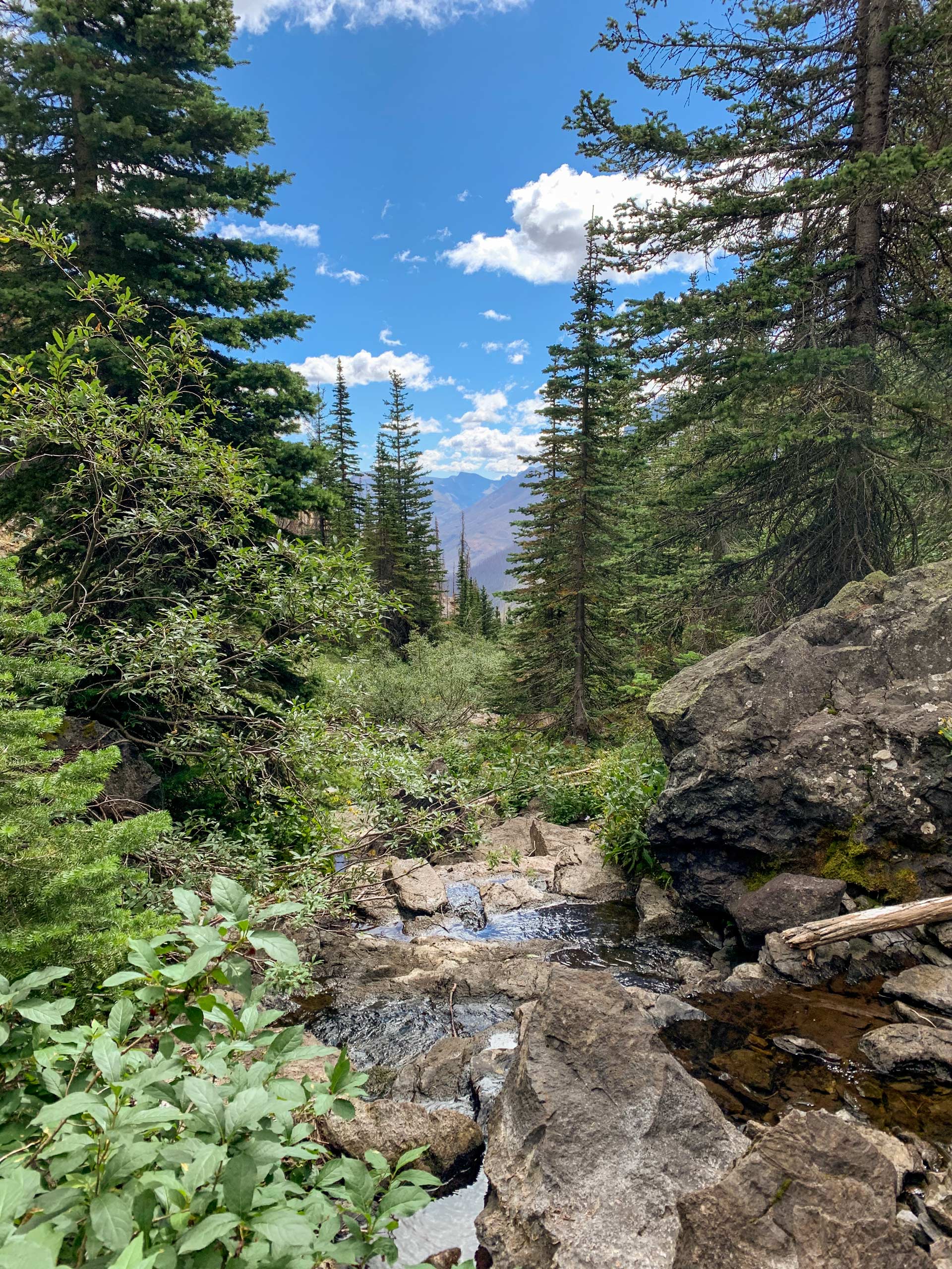
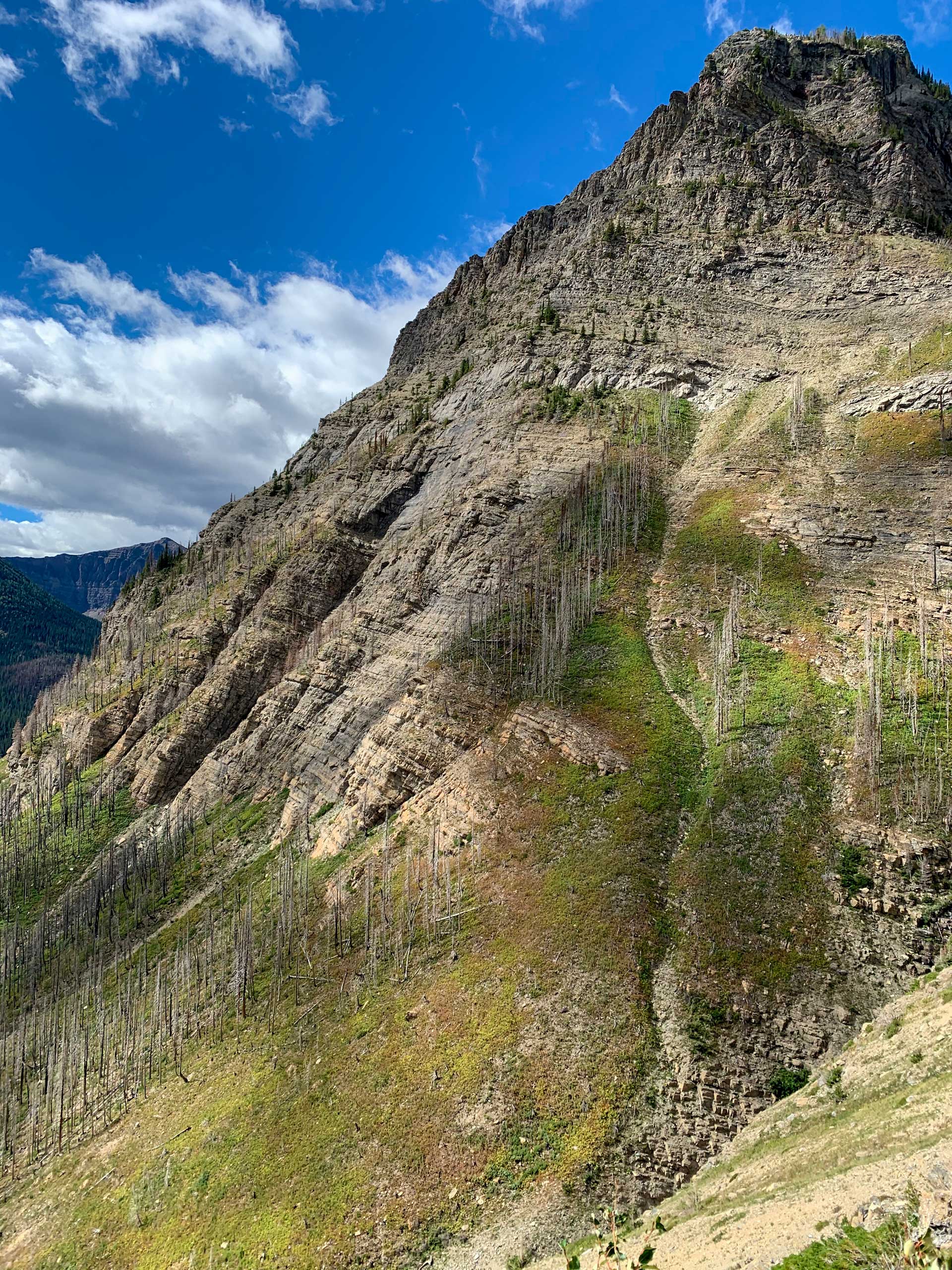
From the Red Rock parking lot, begin your journey to Goat Lake on the obvious path. Cross the bridge over Red Rock Creek and continue along the trail through the forest. Begin gaining elevation on the steep forested section along the mountainside. You’ll be able to catch some views on the way up between the switchbacks. Continue through the forest to reach Goat Lake.
There are no junctions or detours on this route, so making your way to Goat Lake is simple and straightforward. A backcountry campground was once in use at the lake; however, it has been closed due to damage from the Kenow forest fire.
Other amazing walks in Waterton Lakes National Park
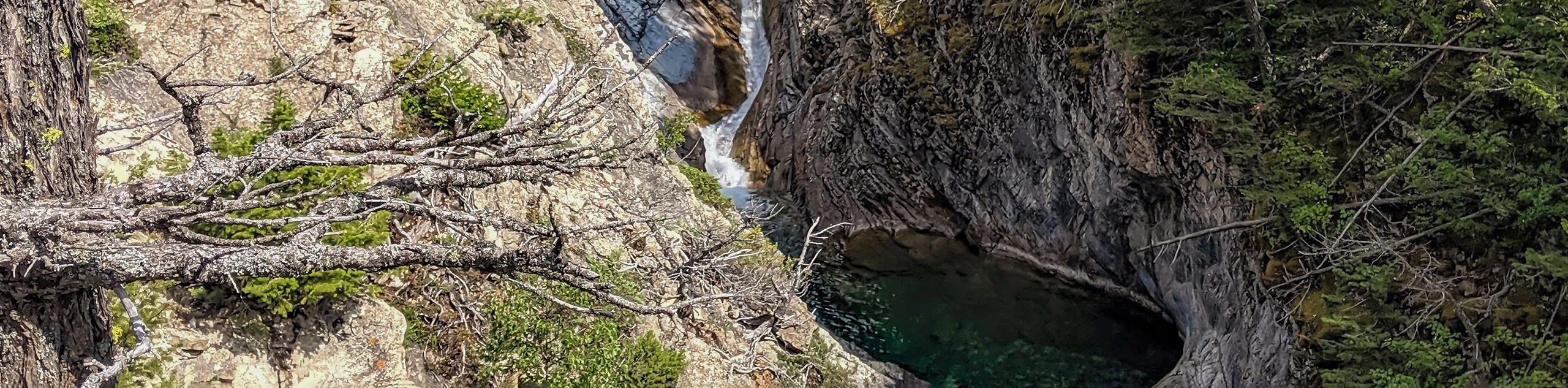
Check out our guides to Bertha Lake, Cameron Lake, Red Rock Canyon or Crypt Lake Hike. Or see all our hikes in Waterton Lakes National Park on 10Adventures.
Similar hikes to the Goat Lake Trail hike
Horseshoe Basin Hike
The incredible Horseshoe Basin Hike in Waterton Lakes National Park climbs from the Bison Paddock area towards the saddle below…
Hell Roaring Falls Hike
The hike to Hell Roaring Falls in Waterton Lakes National Park can be approached by bike, boat, or on foot.…
Bellevue Prairie Trail
The Bellevue Prairie Trail is shaped like a reverse lollipop route that gives hikers the option to take a small…
Comments