
Carthew - Alderson hike
View Photos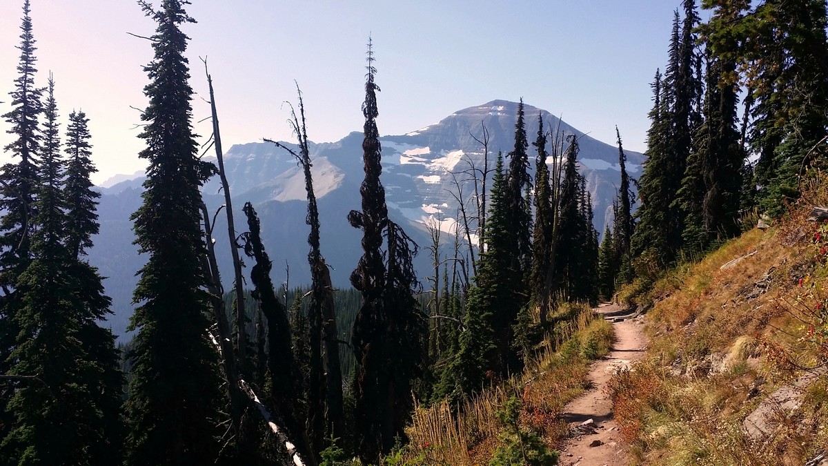

Carthew - Alderson hike
Difficulty Rating:
The Carthew-Alderson hike is a beautiful one-way hike providing epic and vastly varied views. You’ll see mountain peaks, rocky red slopes, and alpine lakes. Carthew-Alderson is one of Waterton’s Triple Crown hikes. You’ll need a shuttle to the trail-head for this hike.
Getting there
Take Akamina Parkway all the way to its end at Cameron Lake. You can book a shuttle with Hike Waterton. From the parking lot facing the lake, turn left. Continue on the path 246ft to the signed trailhead.

About
| When to do | July to early October |
| Backcountry Campsites | Yes, at Alderson Lake |
| Toilets | At trailhead and at Alderson Lake |
| Family friendly | No |
| Route Signage | Average |
| Crowd Levels | High |
| Route Type | One Way |
Carthew - Alderson
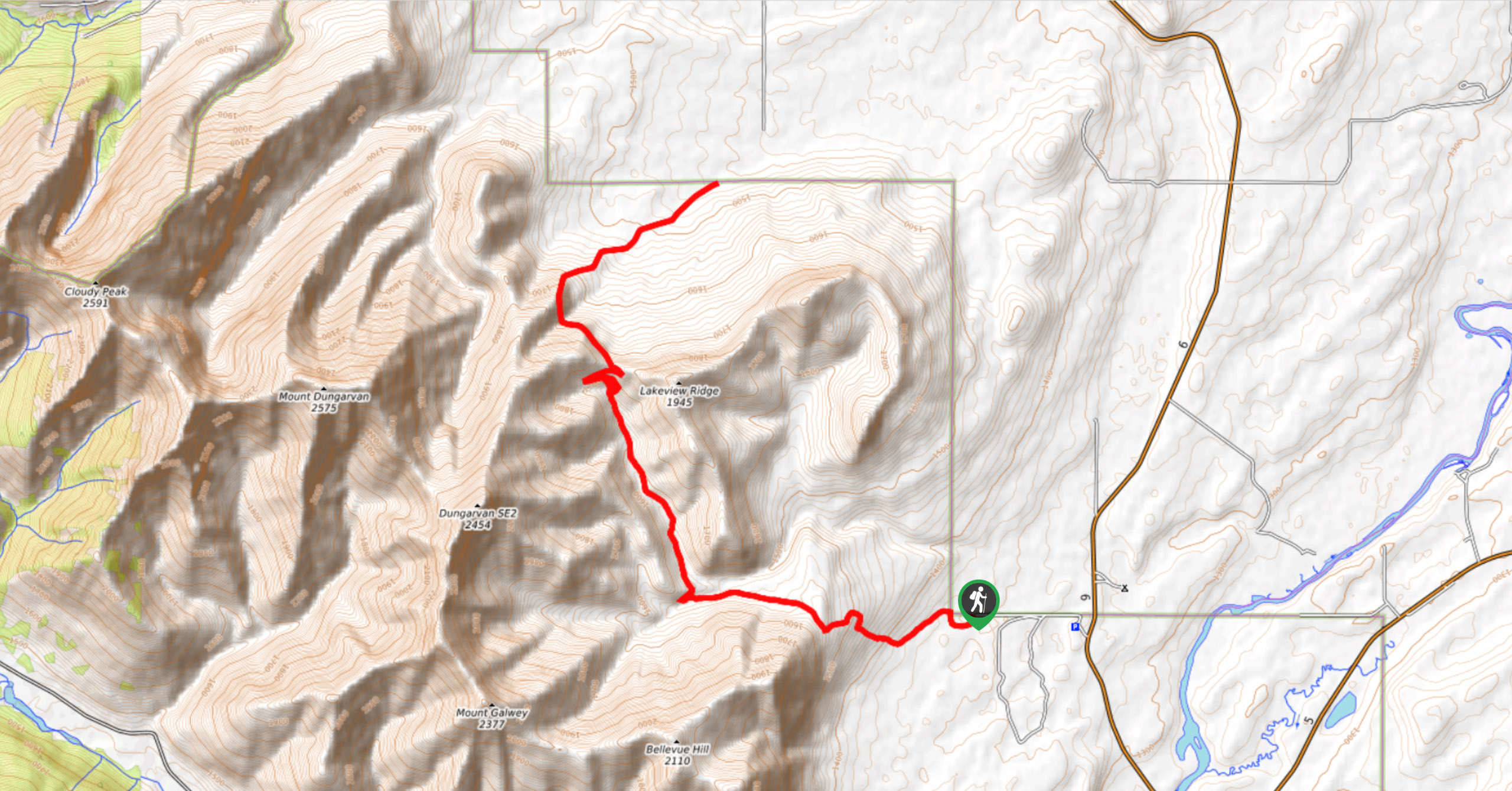
Elevation Graph
Weather
Route Description for Carthew - Alderson
Note that much of Waterton National Park was severely impacted by the 2017 Kenow Wildfire. To find out what trails are open, please check the Parks Canada website.
This one-way hike begins along the lakeshore. You’ll walk on a level path with a long section of boardwalk before beginning to climb.
The trail climbs through the forest on a series of very long switchbacks over a gradual, but steady, ascent for the first 1.9mi. You’ll get views of Cameron Lake and Mount Custer.
The trail then levels. You’ll travel through meadows and open, subalpine forests as you approach Summit Lake. There are regular stepping-stones for when wet conditions arise along the rocky path.
You’ll reach the junction to Summit Lake at 2.7mi. The lake provides a scenic spot for a snack break, with distant views of Chapman Peak and Mount Custer to the south in Glacier National Park in Montana.
From the signed Summit Lake junction, take the left fork to continue to Carthew ridge. Travel in a northeasterly direction through fairly open trees and lush undergrowth as the rocky trail steadily climbs.
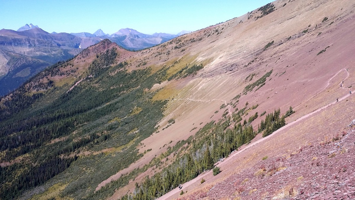
At nearly 3.1mi, you’ll get fantastic views ahead of the red talus slopes you will eventually cross to attain the ridge. If you look south you’ll see impressive views of Mount Custer and Chapman Peak.
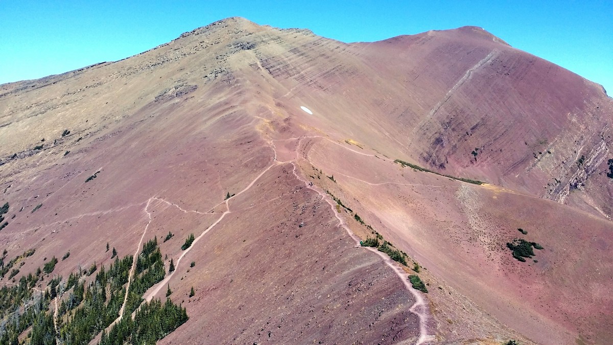
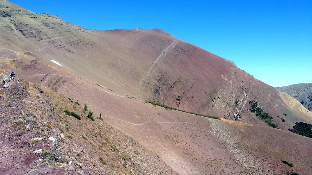
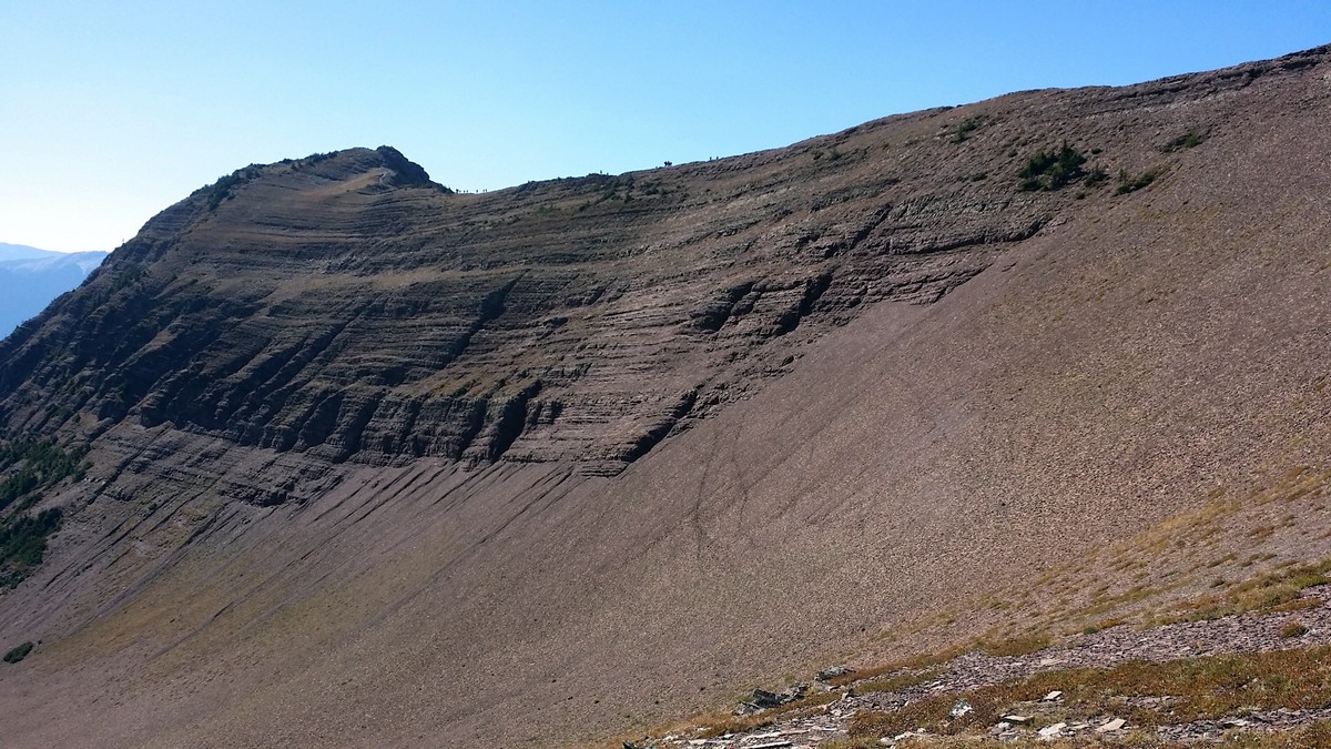
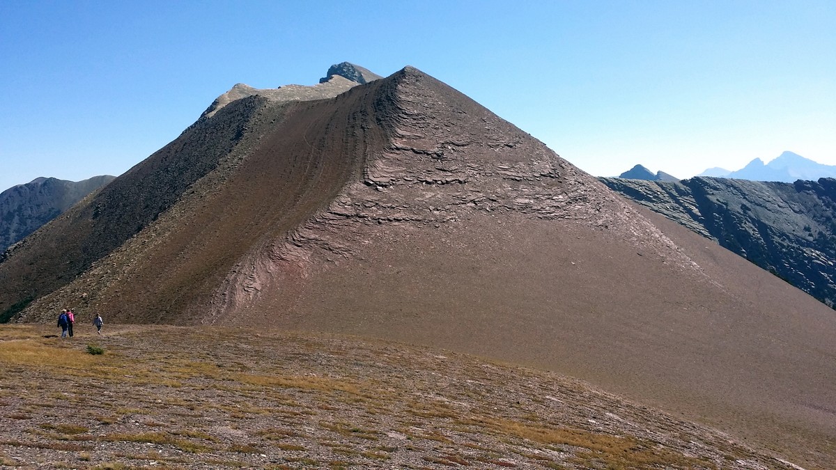
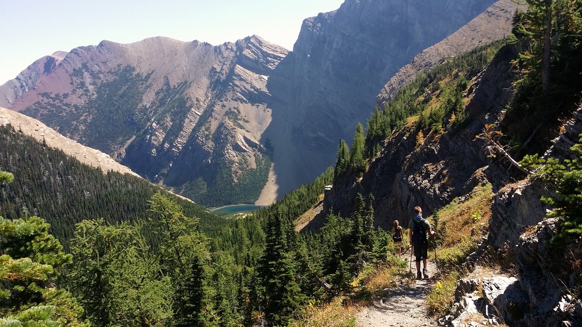
The view ahead continues to open up until you exit the tree line at 3.9mi, with impressive wide-open views all around. Ahead you can see the trail crossing the barren red slopes. The rocky, dirt trail becomes more of a loose scree as you continue to climb, at times the rocks fall several hundred feet to the basin below: a stern reminder to watch your footing.
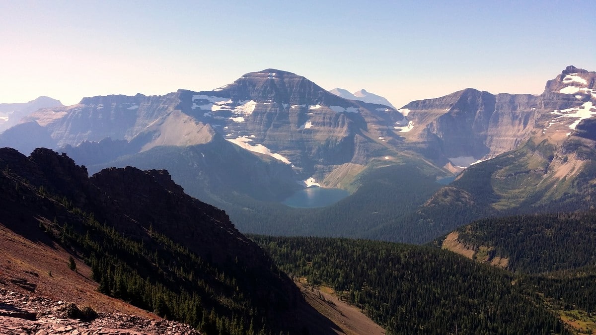
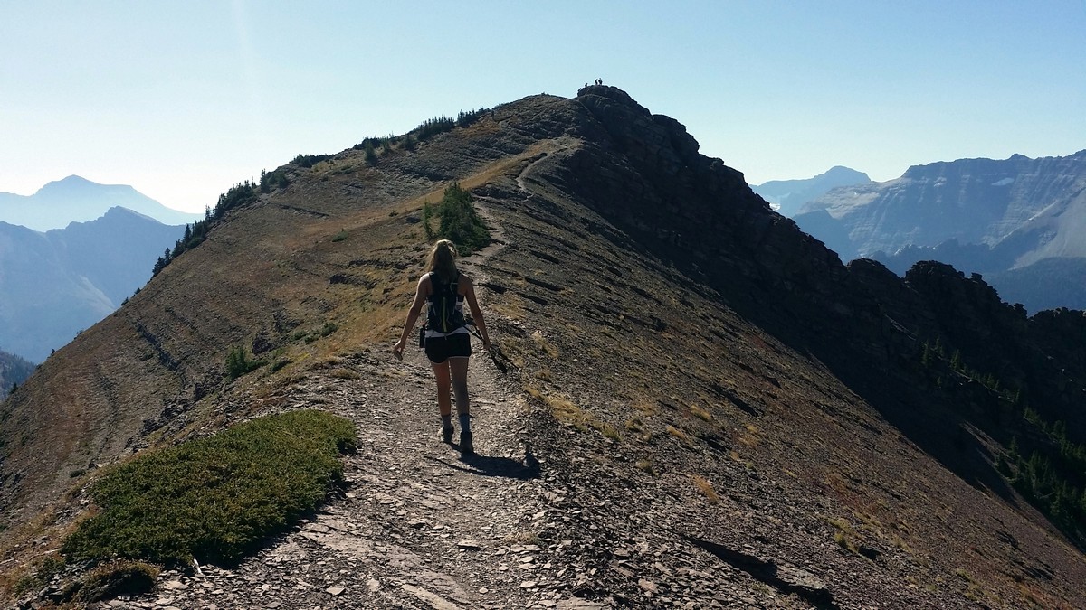
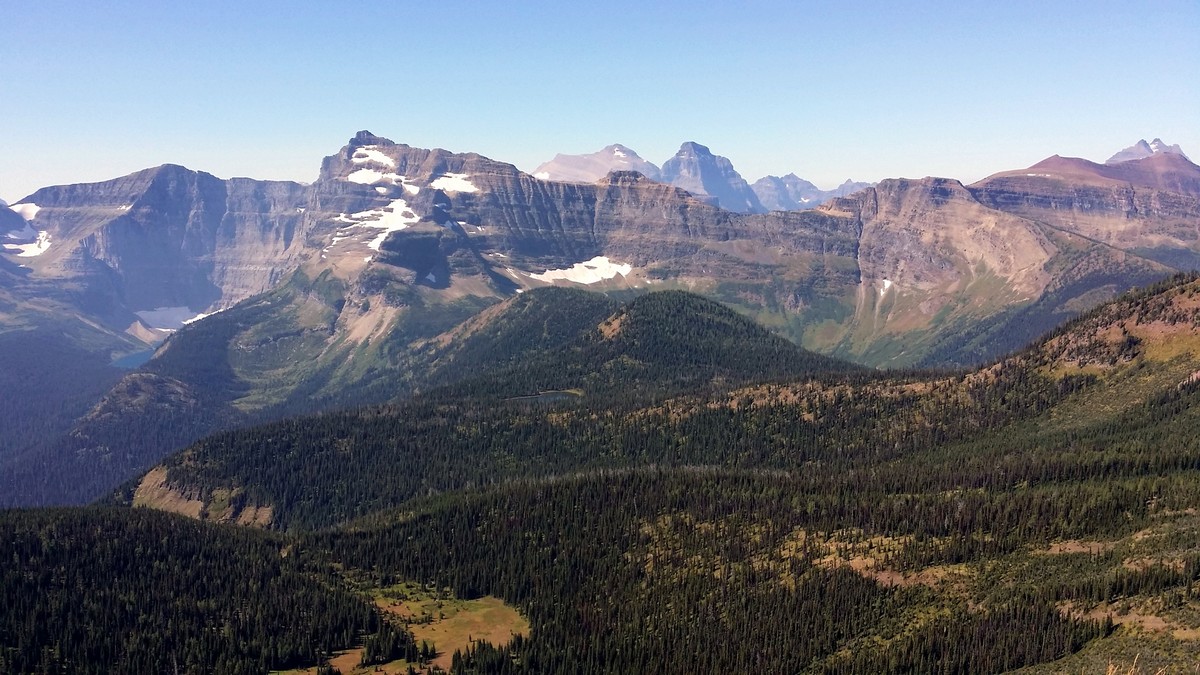
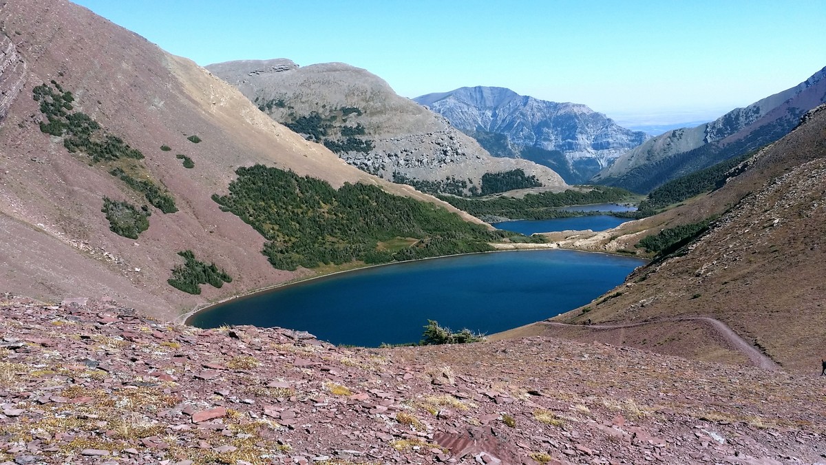
At 5.0mi the trail crests at Carthew Summit (actually a false summit; the true Carthew Summit lies further to the north off trail). Looking east to west you can see Lakes Carcajou, Wurdeman and Nooney in Glacier National Park. Chapman Peak rises above Lake Wurdeman, and Mount Custer is still visible above the Cameron Lake basin. Turning to the east, the view is wildly different, with barren, red talus slopes. Mount Alderson can also be seen in the east, along with other peaks spreading out into the horizon as the mountains slide down into the Alberta prairie.
Although the views are stunning, this can be an unpleasantly windy place to linger. Gusts coming over the ridge often feel strong enough to blow you over; however, take a moment to travel south (right) along the ridge just a short distance to the visible false summit to take in even broader views. It is an easy climb onto the pinnacle and, if the weather allows, this is a wonderful place to eat lunch and soak in the views.
Back on the ridge, head north, following orange markers. These markers are valuable when snow remains along the ridge. Follow the markers to either of two descent options: a short scramble down, or a longer gradual switchback. The route is easily visible in the scree slope as you continue travelling east, losing elevation.
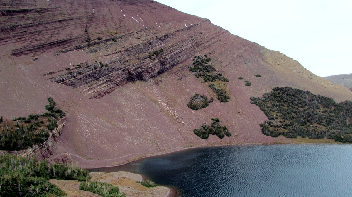
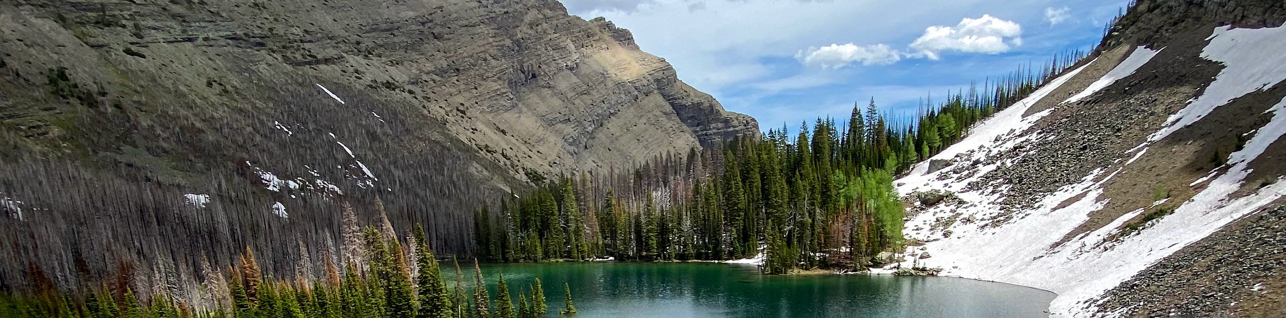
The chain of the three Carthew Lakes becomes visible down the valley. As you descend to the first of the lakes on the south shore, the trail turns left sharply, passing along the western shore to skirt the entire lake along the northern shore. Lots of wildflowers can be seen in season, and snow patches remain late into August. It is more sheltered here, and there are several spots that offer a tempting sit-down.
The area around the Carthew lakes is stunning: it is very lush and wet, with large mossy areas, wildflowers, and trickling streams. The path courses along the west and north bank of the second Carthew Lake, with steep cliffs bordering the left side of the trail and the lake lapping up against the right edge of the path. Everything about this area is spectacular.
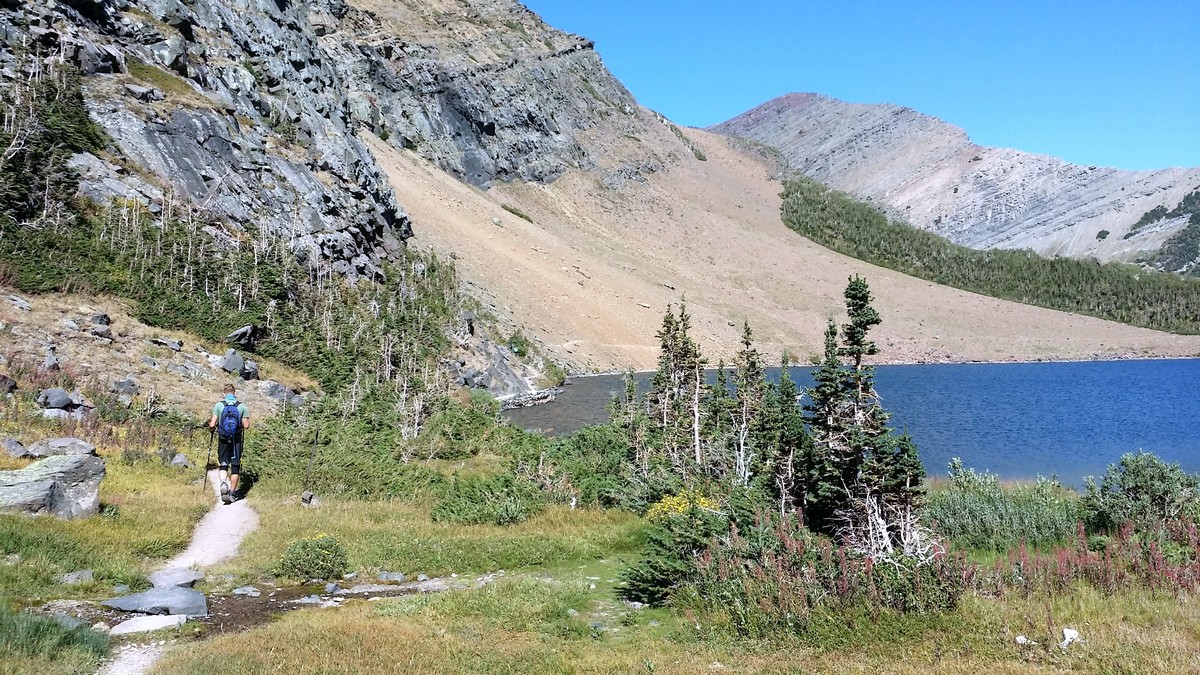
Continue to follow the trail around the north bank of the third Lake. From here, the path travels north towards Buchanan peak and bowl. Views of Alderson Lake open up ahead on the trail, with the impressive headwalls of Mount Alderson towering over it. Descend steeply to the lake, being careful not to lose your footing on the loose scree.
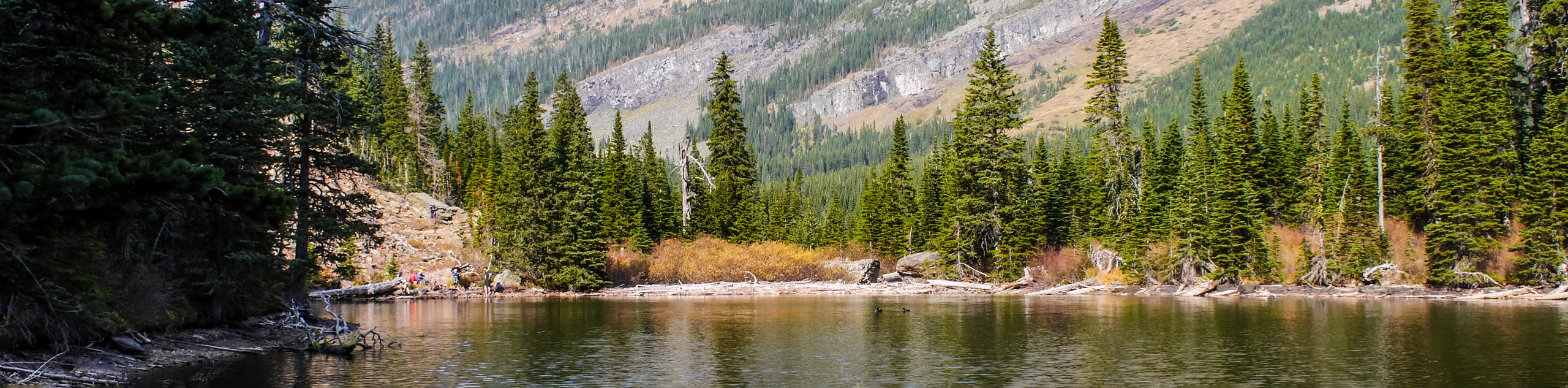
At 8.3mi, you’ll reach a junction with Alderson Lake. From here, turn right for a worthwhile 656ft jaunt to the lake. There’s a pit toilet near the lake and lake water provides an opportunity to refill water bottles (make sure to bring a purification solution).
To continue to Cameron Falls and the trail’s end, stay straight at the junction with Alderson Lake. From here it is still 4.2mi to the townsite. The final section of the trail travels through forests with views opening up to the north of Buchanan Ridge and Crandell Mountain. Regular stepping-stones appear again to keep feet dry in muddy situations.
The descent is generally gradual, with occasional sets of switchbacks. At 9.3mi, the sound of Carthew Creek below adds to the ambience. At 11.8mi, views of Bear’s Hump, Waterton townsite and Akamina Parkway are visible. Shortly after, the trail descends along Cameron Creek, until the trail’s end at Cameron Falls in Waterton townsite.
Insider Hints
The recommended route is from Cameron Lake to Carthew Falls (west to east), as the elevation gain is a significant 1148ft less than travelling the route east to west. You can also take a shuttle to start your day and end in town, which is always welcome.
On hot sunny days, take lots of water. Be sure to fill water bottles at Summit Lake and treat the water. There is no water between Summit Lake and Carthew Lakes, and the route and ridge are exposed and barren.
Zum's in Waterton townsite claims the world’s best fried chicken and a casual atmosphere. Enjoy a meal here after the hike to replenish some calories.
The trail ends at Cameron Falls in the Waterton townsite, so if using two vehicles, park one here before driving up to the trailhead at Cameron Lake. To book a shuttle, call Tamarack Outfitters in Waterton, a family owned business that provides shuttle service to Cameron Lake at 7:30 and 9:00AM in summer, and 8:30AM in the fall. Call 1.403.859.2378 to book a shuttle time or visit this website.

Similar hikes to the Carthew - Alderson hike
Horseshoe Basin Hike
The incredible Horseshoe Basin Hike in Waterton Lakes National Park climbs from the Bison Paddock area towards the saddle below…
Rowe Lakes Trail
Hiking to Rowe Lakes is an excellent way to spend a few hours in Waterton National Park. It’s a pleasant…
Goat Lake Trail
The Goat Lake trail in Waterton Lakes National Park leaves from the Red Rock Parkway and makes its way up…
CamilaP. 4 years ago
My favourite hike in Waterton lakes national park. The hike up had variety and nice views. The peak was beautiful. Would love to visit again.
LyleM 4 years ago
It was one of the most beautiful hikes I have been on. The first 7 miles is hands down the most consistently beautiful hike of my life.
Parker L. 4 years ago
Beautiful hike that offers stunning views. Amazing views of mountains and lakes. You just need a shuttle to go to the trail-head of this hike.
Calel P. 4 years ago
The trail ascends through the forest with a gradual but steady incline. The meadow and vistas look so awe-inspiring. The lake provides a scenic spot for a snack break.
Alexander Ivanov 4 years ago
It was a little demanding moderate hike. I sweat a little. After the hike, we treat ourselves to a delicious chicken from Zum.
Mildred G. 4 years ago
Extraordinary views. I take a lot of photos of the impressive lakes and mountain peaks. It was truly one of a kind hiking experience.
John Savage 4 years ago
This trail really stands out. I have to say one of the nicest hikes I've ever had the privilege of completing(also part of the Triple Crown in Waterton). The hike up is so beautiful through all the trees and a lake half way up before you get past the tree line where you can sit down and take a snack and just enjoy the amazing views!
Aaron P. 4 years ago
This hike goes up to the saddle, passing by Summit Lake, with views of other glacial lakes. A great place to escape the bustling city.
Heidon 4 years ago
The views will take your breath away. I will definitely do this hike again sometime next year.
Rebekah L. 4 years ago
Nice hike with amazing views.If you want a hike to challenge you and offer amazing views, this one is for you.